


Geology of the Pointe Le Droit Region, Southeastern Churchill Province, Nunavik, Quebec, Canada
Project for NTS sheets 24I, 24P and 25A
Guillaume Mathieu, Isabelle Lafrance and Marc-Antoine Vanier
BG 2018-07
Translated on 20 November 2018


The summer 2017 geological survey of the Point Le Droit area closes the 1:250,000 mapping project in the Southeastern Churchill Province (SECP) initiated in 2011 by the ministère de l’Énergie et des Ressources naturelles (MERN). A harmonized map of this entire Churchill portion will be published shortly. Mapping of this area helped to clarify the boundary between the Falcoz and Burwell lithotectonic domains. Fifteen showings were discovered, highlighting the region’s potential for Ni-Cr magmatic mineralization associated with mafic and ultramafic intrusions, rare earth element mineralization associated with potassic intrusions, iron ± titanium ± vanadium mineralization associated with mafic intrusions, and paragneiss-associated polymetallic and graphitic mineralization.
Methodology
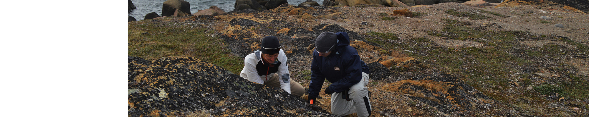
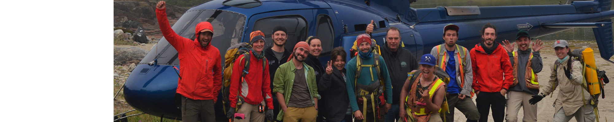
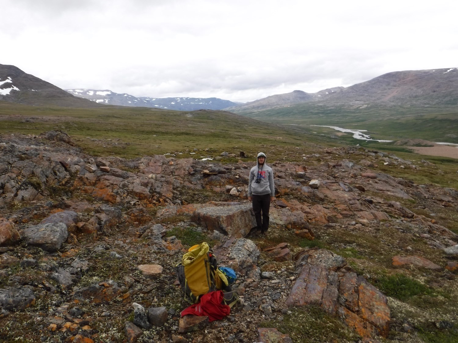
The region was mapped using the established methodology for surveys conducted in isolated areas. Geological mapping was conducted by a team of seven geologists and seven students between June 15 and August 23, 2017.
Mapping of the area produced and updated the information presented in the table below:
| Elements | Number |
|---|---|
| Described outcrops (“geofiches”) | 1054 |
| Total lithogeochemical analyses | 249 |
| Lithogeochemical analyses of metals of economic interest | 75 |
| Geochronological analyses | 1 |
| Covered thin sections | 452 |
| Polished thin sections | 0 |
| Sodium cobaltinitrite stains | 452 |
| Stratigraphic units | 17 |
| Metallic mineralization records | 99 |
| Non-metallic mineralization records | 11 |
Previous Work
The table below provides a summary list of the work done since 1982 in the study area. It also includes references cited in the report.
| Author(s) | Type of work | Contribution |
|---|---|---|
| Low, 1896 | Geological reconnaissance | First geological survey work on Labrador Peninsula and Ungava Bay Coast |
| Taylor, 1979 | Large-scale regional geological mapping | Early systematic geological mapping of the Churchill Province |
| Compilation, geological synthesis and geodynamic implications |
Synthesis and geodynamic model of the Burwell Domain First synthesis of the entire Southeastern Churchill Province |
|
| U-Pb and Sm-Nd dating work in the Burwell Domain | Determination of the ages of emplacement of Burwell lithologies | |
| Compilation and geological mapping | Geology of sheets 14E, 25A and northern 24P | |
| Regional geological mapping | Geology of sheets 24I and 14L, and U-Pb datings | |
| Master’s theses, scientific papers | Study of lamprophyre dykes in the Abloviak Fjord area | |
|
Genest et al., 2007; Joly, 2008; Joly, 2009; Diagana, 2008a; Diagana, 2009; Lalande, 2009; Joly et al., 2010; Joly et Diagana, 2010; Bérubé, 2009 |
Detailed mapping, airborne and ground-based magnetic and spectrometric surveys, prospecting, grooving, drilling, potential assessment | Discovery and exploration of U-Th mineralization from the Cage project |
| D’Amours et Paul, 2007; Diagana, 2008b; Charlton, 2009a; Charlton, 2009b; Charlton 2010; Généreux, 2000; Girard, 2007a; Girard, 2007b; Girard et al., 2010; Girard et Desbiens, 2010; Moreau, 2010; Desbiens et Girard, 2009a; Desbiens et Girard, 2009b; Paul, 2008; Paul et Letourneau, 2008; Smith et al., 2007; St-Hilaire, 2007; St-Hilaire, 2008 | Prospecting, detailed mapping, airborne and ground-based spectrometric and magnetic surveys, bottom lake sediment geochemistry in Davis Inlet and Kangiqsualujjuaq areas | Discovery of U-Th mineralization in felsic potassic intrusions cutting marbles of the Lake Harbour Group |
| Barnett et Dillman, 2001a; Barnett et Dillman, 2001b; Besserer, 2000; Besserer, 2001; Besserer, 2002; Connell et al, 2004; Dillman, 2001; Dillman, 2002a; Dillman, 2002b; Dillman, 2003; Dillman, 2004; Gauthier et Tremblay, 2001a; Gauthier et Tremblay, 2001b; Jago, 2001; Jago, 2003; Jago, 2004; King, 2004; Mazerolle, 2001a; Mazerolle, 2001b; Mazerolle, 2002a; Mazerolle, 2002b; Mazerolle, 2002c; Mazerolle, 2002d; Mazerolle, 2002e; Mazerolle, 2002f; Mazerolle, 2002g; Mazerolle, 2002h; Mazerolle et King, 2003; Mazerolle et Grant, 2006; Plante, 2000; Rennick, 1999; Roy, 2000a; Roy, 2000b; Roy 2000c; Scott, 2001; Généreux, 2000a, Généreux, 2000b | Prospecting, detailed mapping, magnetic and gravimetric surveys, diamond sampling, creek sediment geochemical surveys and heavy mineral analyses in the Abloviak Fjord and Alluviaq Creek area | Discovery of lamprophyre and studies of diamond potential in the centre of the mapped area |
| Besserer et al., 2000; Cuerrier, 1998a, Cuerrier, 1998b; Gaudreault, 1997; Noyes et Besserer, 2000a, Noyes et Besserer, 2000b; St-Hilaire, 2000 | Prospection, airborne and ground-based geophysical surveys, detailed mapping and sampling for base metals in the Abloviak Fjord and Alluviaq Creek area | Discovery of base metal and tungsten mineralization in graphitic metatexites of the Tasiuyak Complex and Ni-Cu mineralization in the associated mafic horizons |
| Fournier, 2008; Gaudreault, 2008; Lessard, 1998; Magnan, 1999; Roger et Boucher, 1998; St-Hilaire, 1998 | Detailed mapping, geophysical surveys, lake bottom sediment geochemistry and exploration in the Kangiqsualujjuaq area | Discovery of Ni-Cu mineralization in mafic and ultramafic lithologies and semi-massive to massive sulphide base metal mineralization in the Lake Harbour Group |
Lithostratigraphy
The study area is characterized by a complex, polyphase tectonic evolution that is marked by intense deformation and metamorphism of lithological units. A draft stratigraphic diagram based primarily on lithological attributes, but also taking into account major structures and metamorphism, is proposed in this bulletin. The definition of the different lithostratigraphic domains is closely linked to the structural evolution of the region.
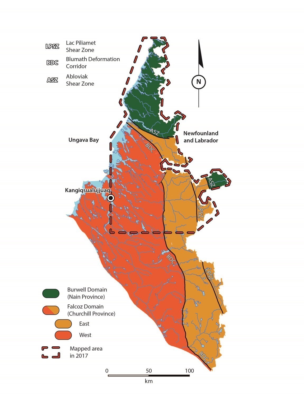
The area mapped is on the edge of two geological provinces separated by the Abloviak Shear Zone (ASZ); the Southeastern Churchill Province (SECP) to the west and south; and the Nain Province to the east and north. As a result, the ASZ, which had sinistral movement and was active between 1845 and 1820 Ma (Bertrand et al., 1993; Scott, 1998), is interpreted as the suture zone between these two provinces. The SECP is represented in this area by the Falcoz Domain, a lithotectonic division established as a result of work carried out by the Ministère and its academic and institutional partners since 2011. The Quebec portion of the Nain Province is represented by the Burwell Domain.
The Burwell Domain is interpreted as part of the Nain Province since some intrusive phases of this domain have intruded into lithologies of the Nain Archean craton and in the Tasiuyak Complex (Van Kranendonk et al., 1993 b; Van Kranendonk and Wardle, 1996). However, it could be considered an independent domain as:
- recent tectonometamorphic studies have shown that the emplacement of Burwell intrusions is concurrent with the Nain-Superior collision (Charette, 2016);
- studies of Sm-Nd isotopes and detrital zircons of the Tasiuyak Complex indicated that the origin of this complex, currently interpreted as an accretion prism, is exotic to the Nain Province and the Core Zone (Scott and Machado, 1995; Connely, 2001).
The sinistral Komaktorvic Shear Zone (KSZ) in Labrador is associated with a post Churchill-Nain collision deformation phase between 1.80 and 1.74 Ga (Bertrand et al., 1993; Scott, 1998). It is also interpreted as a post-collision isostatic rebound structure (Scott, 1998).
Geological units in the Point Le Droit region are presented according to their respective domain according to their relative chronology with respect to regional deformation.
Falcoz Domain – Churchill Province
The Falcoz Domain consists of two subdomains (Falcoz West and Falcoz East) separated by the Blumath Deformation Corridor (BDC), which marks the boundary between the lithologies mainly characterized by the presence of orthopyroxene (Sukaliuk and Lomier complexes, Courdon and Inuluttalik suites), in the east, and those lacking it (Siimitalik, Baudan, Qarliik and Abrat suites, Kangiqsualujjuaq and Fougeraye complexes, Lake Harbour Group), in the west.
Falcoz West Subdomain
Gneissic Rocks
The Kangiqsualujjuaq Complex (Verpaelst et al., 2000) represents the Archean basement recognized throughout the Falcoz Domain. It consists of a package of tonalitic (ApPkan1) and granitic (ApPkan2) gneiss. The tonalitic gneiss unit includes the oldest rocks in the area (2.6-2.9 Ga; Davis et al., 2014, 2018; David et al., 2009).
Supracrustal Rocks
The Lake Harbour Group (Jackson and Taylor, 1972; Verpaelst et al., 2000) represents the supracrustal cover of the Falcoz Domain. It consists of a sequence of metamorphosed volcano-sedimentary rocks of Paleoproterozoic age. It consists of four units, a variably migmatitized paragneiss unit (pPhb1), a quartzite unit (pPhb2), a marble and calcosilicate rock unit (pPhb3), and an amphibolite unit (pPhb4). These units are typically interstratifed at the outcrop scale.
Intrusive Rocks
The Siimitalik Suite (ApPsik, Lafrance et al., 2015) is composed mostly of granodiorite, monzogranite, and foliated and magnetic tonalite. The Archean ages of rocks of the Siimitalik Suite (2739-2840 Ma; Davis et al., 2018; Corrigan et al., 2018) imply near synchronous emplacement with gneiss of the Kangiqsualujjuaq Complex.
The Baudan Suite (Aban, Verpaelst et al., 2000) consists of porphyroclastic monzogranite dated 2623 Ma (David et al., 2009). It is therefore contemporary to granitic gneiss of the Kangiqsualujjuaq Complex.
The Nuvulialuk Suite (Verpaelst et al., 2000) includes mafic (pPnuv1) and ultramafic (pPnuv2) intrusions interpreted as Paleoproterozoic dykes and sills intruded into metasedimentary rocks of the Lake Harbour Group and surrounding basement.
The Abrat Suite (pPaba), introduced in this bulletin, consists of ultrametamorphic granite and tonalite, considered to be the most evolved products of partial melting of paragneiss from the Lake Harbour Group. It is spatially associated with this latter unit.
The Fougeraye Complex (pPfog) is a new unit of migmatites interpreted as derived from partial melting of gneiss of the Kangiqsualujjuaq Complex. Contact between these two complexes is gradual and poorly defined. Kangiqsualujjuaq gneiss outcrops include migmatitized horizons and ultrametamorphic granite in varying proportions, while Fougeraye migmatites show many gneiss enclaves and horizons. The crystallization age of the leucosome is 1829 Ma and that of the protolith is 2788 Ma (Jean David, personal communication).
The Qarliik Suite (pPqik) is a new unit that groups late-tectonic granitic intrusions of Paleoproterozoic age (1828-1832 Ma; David et al., 2009). These intrusive rocks also occur as dykes that cut most of the older units.
Falcoz East Subdomain
This subdomain is divided into two portions; a western area (Sukaliuk Complex and Inuluttalik Suite) bounded by the BDC in the west and the Lac Pilliamet Shear Zone (LPSZ) in the east, and an eastern area (Lomier Complex, Courdon Intrusive Suite and Koroc River Group) bordered by the LPSZ in the west and the ASZ in the east (Figure 1).
Gneissic Rocks
The Sukaliuk Complex (Verpaelst et al., 2000) groups a package of orthogneiss, metasedimentary rocks and mafic rocks metamorphosed to the granulite facies. It consists of five units: a hypersthene tonalitic orthogneiss unit (ApPSuk1), a hypersthene granitic orthogneiss unit (ApPSuk2), a mafic-ultramafic rock unit (ApPsuk4), a metasedimentary unit (ApPSuk4), and a garnet felsic intrusion unit interpreted as ultrametamorphic granites derived from partial melting of paragneiss (ApPSuk5). Gneiss are Archean (2659-2897 Ma; Davis et al., 2018; Corrigan et al., 2018), while paragneiss migmatitization is Paleoproterozoic (1812 Ma; Davis et al., 2018).
The Lomier Complex (pPlom; Girard, 1990) refers to Paleoproterozoic gneiss that outcrops east of the LPSZ. These rocks are interpreted as deformation zones consisting of alternating millimetric to decametric horizons of rocks of the Koroc River Group and Courdon Intrusive Suite (Girard, 1990). They regularly contain decimetric horizons that are better preserved and are in gradual contact with these units.
Supracrustal Rocks
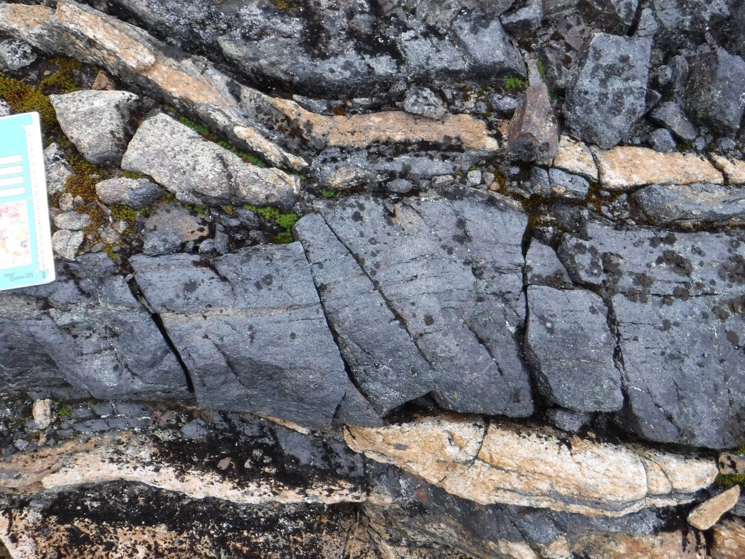
The Koroc River Group (Girard, 1990) groups volcano-sedimentary lithologies located between the LPSZ and the ASZ. It consists of hypersthene amphibolite (pPko1), paragneiss and leucogneiss (pPko2), marble and calcosilicate rocks (pPko3), and sulphide facies iron formations (pPko4). Metasedimentary bands are interbedded with gneiss of the Lomier Complex, in places at the outcrop scale. Only unit pPko2 has been identified in the mapped area.
Intrusive Rocks
The Inuluttalik Suite (Lafrance et al., 2015) includes intrusions dated between 1.86 and 1.78 Ga (Davis et al., 2018; Corrigan et al., 2018; Jean David, personal communication). It mostly consists of enderbite (pPina1) and charnockite (pPina2). Rocks of the Inuluttalik Suite intrude into gneiss of the Sukaliuk Complex with which they share transposed contact.
The Courdon Intrusive Suite (Girard, 1990) groups intrusions interbedded with gneiss of the Lomier Complex. It incorporates ultramafic (pPcou1) and mafic (pPcou2 and pPcou3) intrusive lithologies, enderbite (pPcou4), charnockite (pPcou5), and orthopyroxene quartz syenite (pPcou6).
Burwell Domain – Nain Province
The Burwell Domain consists of klippes of Archean bedrock (Noodleook Complex) cut by an intrusive unit (Killinek Suite) interpreted as a batholith emplaced during collision between the Burwell and Falcoz domains. The Tasiuyak Complex is a large sedimentary unit, possibly derived from a turbidity sequence, which would have developed independently of the Nain craton (Van Kranendonk and Wardle, 1996).
Gneissic Rocks
The Noodleook Complex (Van Kranendonk and Wardle, 1996) groups Archean to Paleoproterozoic grey gneiss with a composition varying from tonalitic to granodioritic (ApPnoo). These gneiss contain orthopyroxene in the western portion of the mapped area. The hypersthene isograde is globally oriented along an N-S line parallel to the Komaktorvik Shear Zone (KSZ). These gneiss represent an Archean basement (2802 Ma; Scott 1995b) north of the suture zone (ASZ) and thus constitute the Nain craton.
The Tasiuyak Complex is composed of sedimentary lithologies metamorphosed to the granulite facies and variably affected by partial melting (Van Kranendonk and Ermanovics, 1990). It is currently divided into four units: a unit composed of paragneiss, metatexite and diatexite with garnet, rutile, sillimanite and some biotite (pPtas1), a quartzite unit (pPtas2), a marble and calcosilicate rock unit (pPtas3), and a garnet ultrametamorphic granite unit (pPtas4). This complex wraps the geometry of the ASZ and is heavily affected by the deformation associated with this structure. It is known as far as Baffin Island.
Intrusive Rocks
The Killinek Suite (Wardle et al., 1993) is predominantly composed of very homogeneous hypersthene granitoids that outcrop in large kilometric masses at the north end of the area of interest. It is the largest unit in the Burwell Domain. In the eastern portion, orthopyroxene is disappearing in favour of green hornblende. This Paleoproterozoic suite (Scott and Machado, 1995; Scott, 1995a) is interpreted as an inclined batholith caught between the SECP and Nain Province. It consists of mafic intrusive rocks (pPkil1), a dominant unit of hypersthene quartz diorite and enderbite (pPkil2), opdalite to charnockite (pPkil3), speckled orthopyroxene quartz monzodiorite (pPkil4), and coarse-grained orthopyroxene quartz syenite (pPkil5). The Killinek Suite intrudes into gneiss of the Noodleook Complex and the northern part of metatexites of the Tasiuyak Complex. Ultrametamorphic granite of the Tasiuyak Complex (pPtas4) intrudes into the Kilinek Suite, involving a post-batholith partial melting event.
The Hutton Suite (Wardle et al., 1993) groups mafic klippes of kilometric dimensions that outcrop in the ASZ area of influence. This suite consists of a main unit of anorthosite (ApPhut1) and a secondary unit of garnet norite (ApPhut2).
The Lepers Suite (pPler) is a new ultramafic unit composed mostly of olivine websterite. It usually outcrops near the contact between the Tasiuyak Complex and the Killinek Suite.
Late Mafic-Ultramafic Dykes
The study area is cut by three dyke swarms of Mesoproterozoic to Neoproterozoic age: the Falcoz Swarm, Avayalik Dykes and Torngat Dykes.
The Falcoz Swarm (mPfal; Girard, 1990) groups NNW-SSE-oriented olivine gabbro dykes with subvertical dip.
The Avayalik Dykes (mPava; Wardle et al., 1992) cut all units in the Burwell Domain. They were also identified in the northern part of the Falcoz Domain. These gabbronorite and gabbro dykes are oriented approximately NE-SW with generally subvertical to locally moderate dip (~30°) towards the SE in the Torngat Mountains (Van Kranendonk and Wardle, 1996).
The Torngat Dykes (mPtor) are a swarm of subvertical diamond ultramafic lamprophyre dykes oriented 070°, mapped by Digonnet (1997) in the Abloviak Fjord area. The dyke composition varies from a phlogopite melnoite to a carbonate matrix aillikite (Marchand, 2005). Despite the fact that these dykes extend over several kilometres, their thickness never exceeds 3 m. Intrusion of these dykes was dated to 550 Ma and would therefore be synchronous to opening of the Iapetus Ocean (Digonnet et al., 2000).
Structural Geology
The structural geology of the region is complex and marked by several ductile deformation events associated with folds and major shear zones. The possible Archean deformation of gneiss of the Nain craton (Noodleook Complex) is not addressed here, therefore the first phase of Paleoproterozoic deformation is identified as Dn+1. In addition, fabrics associated with Dn+1 deformation phases recognized on either side of the AZS cannot be connected since this deformation zone represents a suture zone and the juxtaposition of these two blocks occurred during the Dn+2 phase. Sixteen structural subdomains were identified in four main domains (Figure 2).
Structural Domain A

In the northern portion of the map, domain A corresponds to the Burwell Domain. It has a main structural grain oriented NNW (Figure 2). This area is characterized by the development of a type 2 or 3 interference pattern of Ramsay and Huber (1987) due to the formation of Pn+1 folds followed by Pn+2 folds. Folding Pn+1 correspond to deformation phase Dn+2 defined by Van Kranendonk and Wardle (1996) and is associated with crustal thickening of the Burwell Domain through thrust faults and recumbent folds. However, these structural characteristics were not observed directly in the field. Deformation Dn+3 is more pronounced and is primarily expressed by the presence of quartz rods and, more rarely, by stretching of mafic minerals. Metric folds with hinges strongly tilted to the NNW are also present in the northern portion. The calculated dip of fold axes gradually decreases in the southern portion of domain A.
This domain is also characterized by variations in the expression of deformation which varies from elongation to flattening on the decametric scale. The attitude of mineral stretch lineations is subparallel to regional fold axes (Figure 2; Subdomain A1). At the south end of subdomain A3, planar fabrics are more abrupt and the distribution of measurements suggests isoclinal folding. The latter generated a dome and basin geometry. Dextral shear zones, metre to decametre wide are also recognized, characterized by protomylonitic to ultramylonitic textures. The formation of these structures is favoured by the presence of late granitic intrusions compared to Dn+3. Finally, a deformation episode Dn+4 identified by Van Kranendonk and Wardle (1996) is mainly associated with the dextral shear zones of Katherine River and Komaktorvik Lake, both located in Labrador. This episode took place between 1.80 and 1.74 Ga (Bertrand et al., 1993; Scott, 1998).
Structural Domain B
Domain B (Figure 2) groups the Falcoz East Subdomain and a small part of the Burwell Domain. It is a broad strip of heavily deformed rocks that correspond to zones of influence of the ASZ and LPSZ. All fabrics of this domain are highly transposed and straight-lined. The ASZ represents a sinistral structure whose formation is synchronous to the development of dip right and tight folds observed on either side of the shear zone. This zone is oriented N-S in the southern part of the region and then turns towards the WNW in its northern part. This deformation event is correlated with Pn+2 folds recognized in the Burwell Domain, to the north, and Falcoz Domain, to the south. The ASZ is associated with the sinistral transpression regime of the Torngat Orogen (Wardle et al., 2002) and represents a deformation event that began before 1844 Ma and ended after 1824 Ma (Scott and Machado, 1995; Van Kranendonk and Wardle, 1996). The LPSZ extension that was identified further south (Lafrance et al., 2015) has the same structural characteristics as the ASZ.
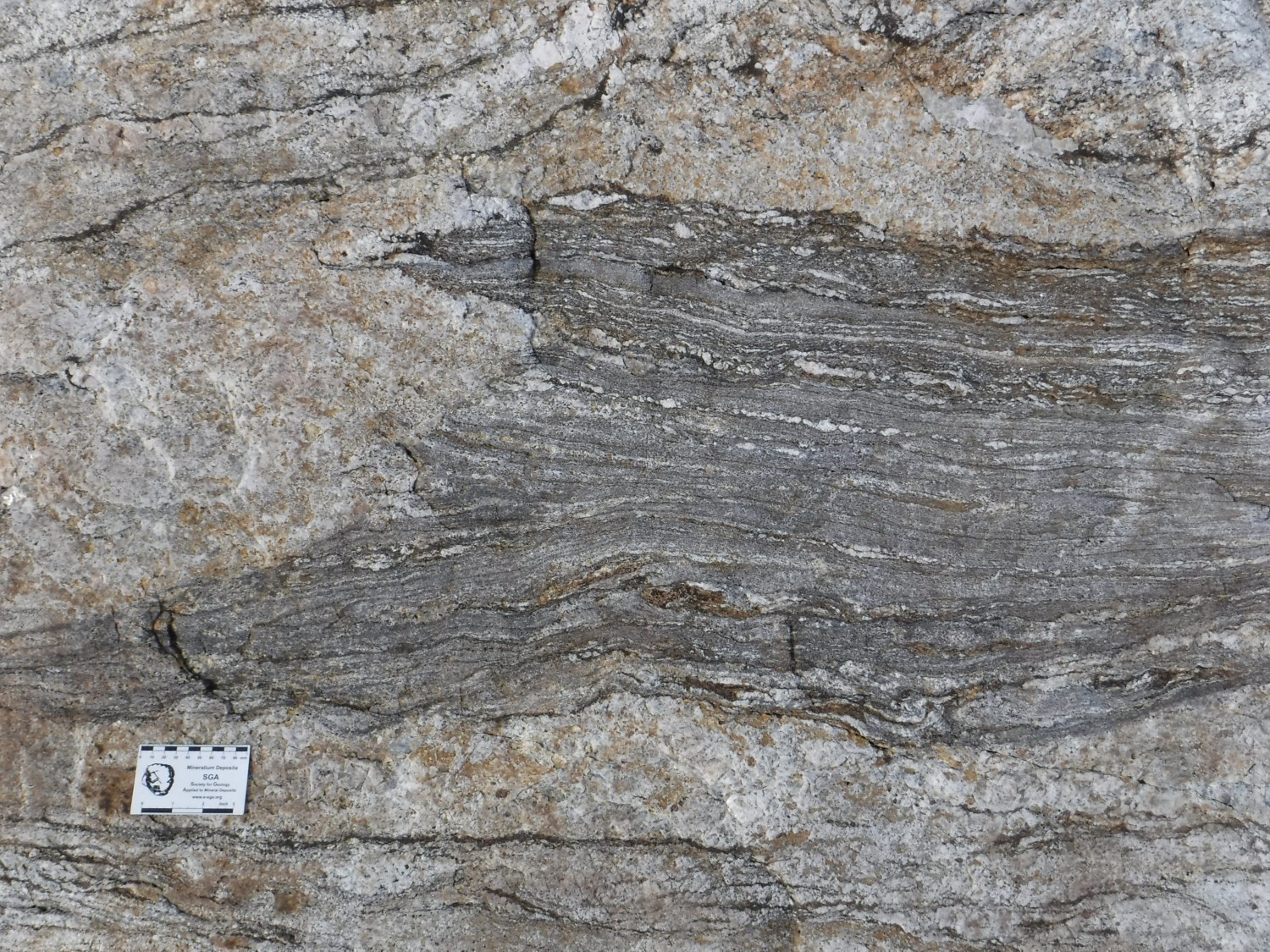
The maximum deformation intensity is located in a right dip gneiss observed on contact with the Tasiuyak and Sukaliuk complexes in subdomain B1 (Figure 2). This tectonite has feldspar porphyroclasts and banding marked by the segregation of feldspars and quartz. The euhedral habit of garnet and sillimanite demonstrates syn-kinematic to late-kinematic formation and contrasts strongly with pre-kinematic minerals. The ASZ is also characterized by variations in the deformation style. While at the regional scale the L/S fabric is the most common, L or S tectonites are commonly observed, locally even on the same outcrop. In this case, there are metric folds with moderate dip axes of 40° to 65°, parallel to the most intense lineation. These observations are consistent with the dispersion of linear measurements within the ASZ (Figure 2; subdomain B1).
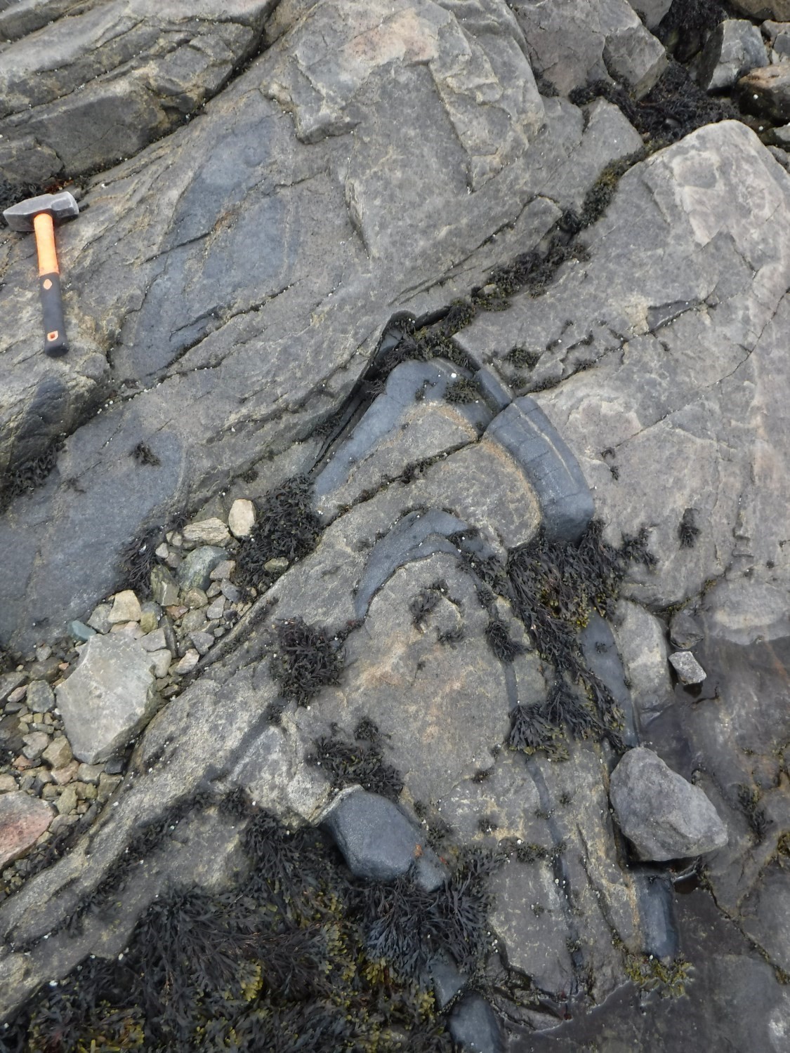
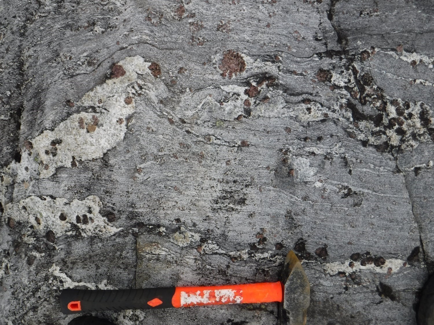
In subdomains B2 and B3, the planar fabric is N-S oriented. Lineations and tight fold hinges are subhorizontal and also N-S oriented. Lithological contacts visible on satellite images allow identification of isoclinal folds and elliptical forms whose long axis is parallel to regional foliation. These features, which are specific to sheath folds (Cobbold and Quinquis, 1980), demonstrate elongation consistent with the main stretch direction in the ASZ. These structures can form by active folding in rocks with rheological contrast (Reber et al., 2012).
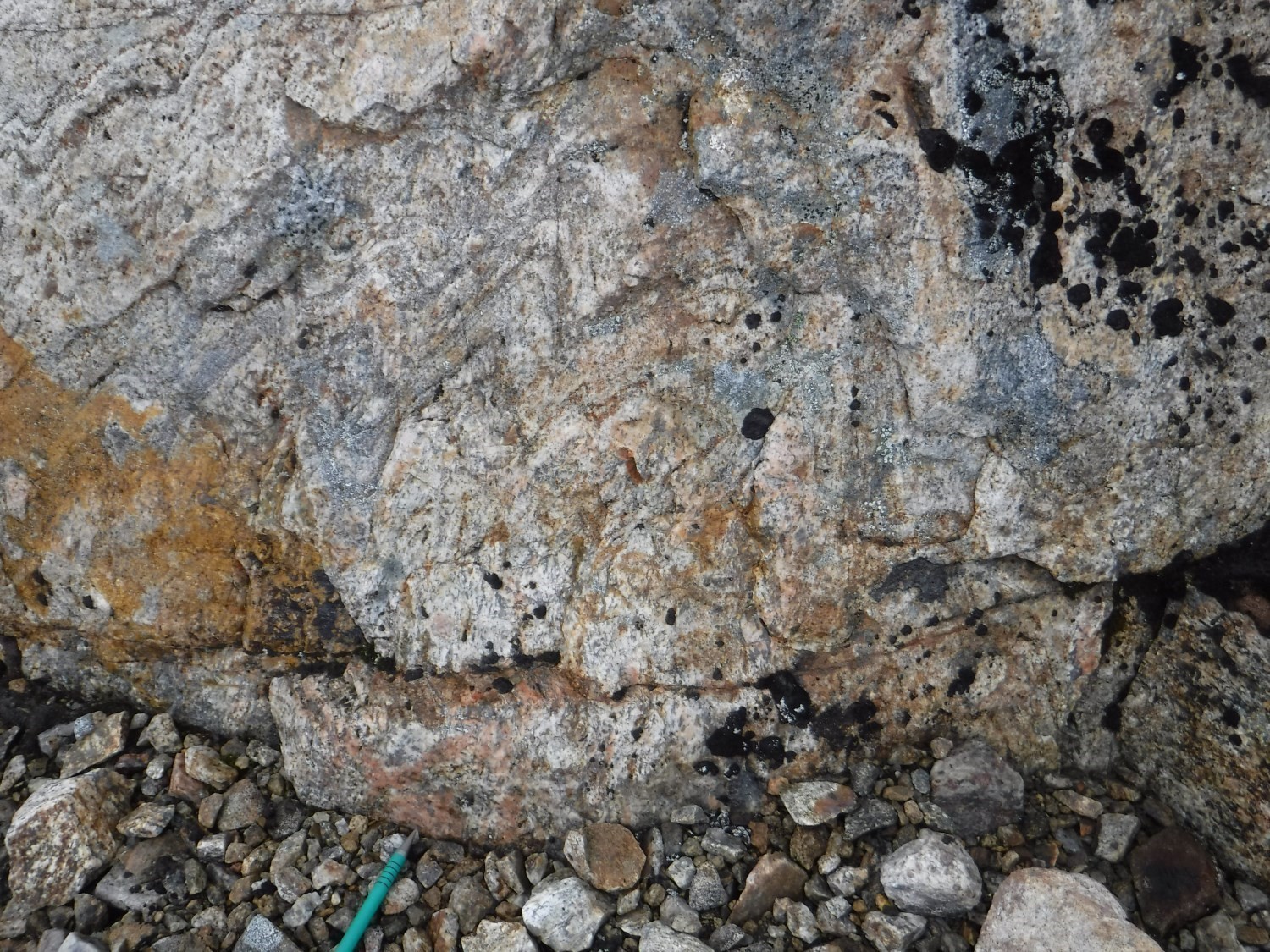
At the microscopic scale, quartz shows dynamic recrystallization by migration of grain edges. It is also partially affected by late static recrystallization. Feldspars are heavily crushed and the remaining porphyroclasts give the rock a mortar texture. Decimetric intrusions of transposed late granite with protomylonitic texture locally cut gneiss and show greater abundance of kinematic indicators. Textures observed in quartz, i.e., recrystallization by grain edge migration and chessboard extinction, indicate high temperature deformation (600-700°C; Stipp et al., 2002). Added to this is the late-kinematic nature of garnet and sillimanite, which indicates that deformation in the ASZ is globally synchronous with metamorphic peak. Static recrystallization, also evidence of high temperatures, is common, implying that the heat flow continued after the stress was reduced. The low number of kinematic indicators is also explained by very high temperature deformation, which is not conducive to the formation of this type of structure (Trouw et al., 2010). Among those observed were mainly sigma or delta-type porphyroclasts and shear bands, all sinistral.

Structural Domain C
Structural domain C is associated with the Falcoz West Subdomain. The passage between structural domains B and C is marked by significantly less abrupt and more dispersed regional foliation (Figure 2; subdomains C1 and C2), by more open folds with a curved axial trace parallel to the main foliation of domain B, as well as by the presence of the BDC. The latter represents a series of N-S shear zones characterized by sub-horizontal lineations and sinistral kinematic indicators (Verpaelst et al., 2000).
Within domain C, Lake Harbour Group rocks show an interference pattern in domes and basins, particularly in subdomain C6. It is also possible to locally locate Pn+2 folds showing an E-W to NE-SW axial trace. The main planar fabric is affected by folds whose calculated axis dip 16 to 24° SE or south according to domains (Figure 2). The asymmetrical and less inclined distribution of planar fabrics in the southern part of domain C (Figure 2; subdomains C4-C6) suggests that WSW-verging recumbent folds are present, as proposed by Verpaelst et al. (2000).
Structural Domain D
Domain D, which corresponds to the Falcoz Shear Zone (FSZ), was not visited during the summer 2017 fieldwork. This large sinistral strike-slip structure is 5 to 7 km wide (Verpaelst et al., 2000). Interpretation of regional lineaments allows validation of the sinistral dominant component and identification of a synform fold, two elements associated with the Dn+4 phase affecting paragneiss of the Lake Harbour Group (Figure 2). This synform fold is kinematically compatible with a sinistral movement of the FSZ.
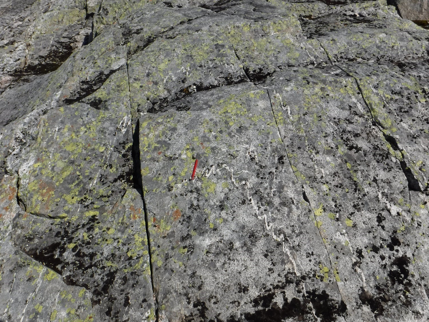
Late Brittle Deformation
The spot presence of pseudo-tachylite veinlets was noted throughout the eastern half of the mapped area. These veins were observed cutting most units, including mafic dykes assigned to the Falcoz Swarm (mPfal). These veinlets do not have a spatial association with ductile fabrics. They are evidence of a post-Mesoproterozoic late tectonic phase, a brittle regime, and could be linked to uplift of the Nain and Churchill provinces during the opening of the Atlantic Ocean 150 Ma ago.
Metamorphism
The Falcoz Domain major metamorphic event is associated with the Paleoproterozoic Torngat Orogen. Verpaelst et al. (2000), however, described an Archean metamorphic event affecting migmatitized gneiss of the western portion of the mapped area (Kangiqsualujjuaq Complex). Paleoproterozoic metamorphism is characterized by an E-W gradient that moves from the mid amphibolite facies to the granulite facies. In the centre of the area, this results in an abundance of metatexite and a small proportion of diatexite associated with Lake Harbour Group lithologies. Further east and north, the presence of orthopyroxene and, locally, garnet indicates metamorphism to the granulite facies in rocks of the Sukaliuk Complex. The lithologies most affected by partial melting give Paleoproterozoic ages (ultrametamorphic granite ApPsuk4a at 1812 Ma and 1825 Ma; Davis et al., 2018), synchronous to the end of ASZ activity. The metamorphic grade increases east of the LPSZ, as evidenced by the relative rarity of hydrated phases in gneiss of the Lomier Complex and metasedimentary rocks of the Koroc River Group. The disappearance of sphene (paragneiss of the Koroc River Group) in favour of rutile (Tasiuyak Complex) indicates intensification of metamorphism immediately east of the ASZ.

The entire Burwell Domain was metamorphosed to the granulite facies, such that sedimentary protoliths of paragneiss of the Tasiuyak Complex were transformed into garnet-sillimanite ± biotite diatexites. One noteworthy observation is the occasional presence of retrograde cordierite rimming garnet. As for igneous protoliths, cluster metatexites are more common; they usually contain pyroxene, amphibole and commonly garnet. The intensity of metamorphism increases towards the east and north of the domain before abruptly retrograding to the upper amphibolite facies in the eastern Torngat Mountains along a globally N-S-oriented isograde.
Economic Geology
The Point Le Droit region is conducive to the development of seven (7) mineralization types:
- Ni-Cr magmatic mineralization associated with mafic-ultramafic intrusions;
- rare earth mineralization associated with potassic intrusions;
- iron ± titanium ± vanadium mineralization associated with mafic intrusions;
- crystalline graphite mineralization associated with paragneiss;
- polymetallic mineralization associated with rusty paragneiss;
- diamond mineralization in lamprophyres;
- polymetallic mineralization associated with granitic pegmatites or skarns.
The table below presents the results of analyses for the 137 mineralized zones in the area, including 15 new showings discovered during the summer 2017 work.
(E): selected sample; (R): channel; (F): drillhole
The table of lithochemical analyses of metals of economic interest provides the location, description and results of 75 samples selected for assessing the economic potential of the region.
New Iron ± Titanium ± Vanadium Showing Associated with a Mafic Intrusion
Iron ± titanium ± vanadium mineralization associated with massive oxide horizons are relatively uncommon within the SECP and none were reported in the study area. The Marcus showing was discovered during the summer 2017 mapping campaign. There are several decimetric to metric rusty horizons of massive oxides hosted in a felsic lithology that intrude into hypersthene diorite. Mineralization is boudinaged and hosted in a secondary shear zone. The rock is heavily deformed, suggesting remobilization of oxide horizons during deformation. Mineralization is associated with hypersthene diorite assigned to the Killinek Suite. This lithology forms a series of oblong-shaped intrusions, decimetre to hectometre wide that outcrop over several tens of kilometres in diatexites of the Tasiuyak Complex, on the periphery of the main Killinek mass further north. Geochemistry of the mineralized sample indicates the presence of vanadium titanomagnetite and ilmenite.
New Rare Earth Showing in a Potassic Intrusion
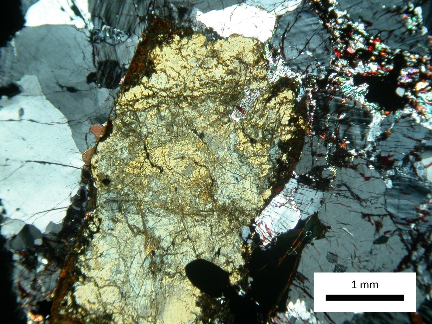
The Rivière Abrat showing was discovered when sampling a medium to coarse-grained and relatively homogeneous and massive granitic intrusion of the Qarliik Suite (pPqik2). Syenogranite is magnetic and has mineralization consisting of approximately 3% coarse-grained allanite. The sample 17AO4074-A1 yielded a value of 2689 ppm REE.
Potential of Sedimentary Metatexites of the Tasiuyak Complex
Migmatitized paragneiss of the Tasiuyak Complex have an undervalued potential for polymetallic and graphitic mineralizations. Indeed, the rust zones observed in metatexites and diatexites of this unit were not worked on. The Tasiuyak Complex outcrops over 400 km long and has an apparent thickness exceeding 20 km in the northern part of the Abloviak Fjord. Many rust zones associated with disseminated graphite and sulphide lenses were sampled in the summer of 2017; however, many rust zones remain to be explored. Lenticular-shaped and metre to decametre thick mineralized zones are mainly located around Alluviaq and Vent d’Ouest creeks. A total of eight graphite showings were discovered. Mineralization consists of fine-grained graphite or millimetric flakes associated with pyrrhotite and pyrite.
| Authors |
Guillaume Mathieu, Eng., guillaume.mathieu@mern.gouv.qc.ca Isabelle Lafrance, P.Geo., M.Sc., isabelle.lafrance@mern.gouv.qc.ca Marc-Antoine Vanier, Jr. Eng., marc-antoine.vanier.1@ulaval.ca |
| Geochemistry | Fabien Solgadi, P.Geo., Ph.D. |
| Geophysics | Rachid Intissar, P.Geo., M.Sc. |
| Potential assessment | |
| Logistics |
Clotilde Duvergier, GIT, B.Sc. Isabelle Lafrance, P.Geo., M.Sc. |
| Geomatics |
Julie Sauvageau Kathleen O’Brien |
| Editing | Claude Dion, Eng. |
| Critical review | Benoit Charette, P.Geo., M.Sc. |
| English version | Céline Dupuis, P.Geo., Ph.D. |
| Organism | General direction of Géologie Québec, Ministère de l’Énergie et des Ressources naturelles, Government of Québec |
Acknowledgements:
This Geological Bulletin was made possible through the cooperation of many people who have been actively involved in the various stages of the project. We would like to thank geologists Julie Vallières, Antoine Rhéaume-Ouellette, Samuël Simard, Rémi Germain and Antoine godet; students Caroline Courchesne, Vincent Bilodeau-Gagnon, Samuel Desmarais, Olivier Gauthier, Marie-Andrée Fortin and William Bergeron, and the wonderful Tivi Unatweenuk in Kangiqsualujjuaq. We would like to acknowledge the excellent work of cook Vicky Pelletier and camp man Guy Malette. Pilots Richard Brunet, Damien Calichon and Patrice Tremblay, as well as mechanic Maude Labrosse-Legris of Peak Aviation, performed their work with efficiency, professionalism and good humour. The collaboration of the Northern Village of Kangiqsualujjuaq and the support of the Nunavik Mineral Exploration Fund are also noteworthy.
References
Publications available through Sigeom Examine
BARNETT, R. L., DILLMAN, R. J., 2001a. ELECTRON MICROPROBE RESULTS, HEAVY MINERAL ANALYSES, TORNGAT PROJECT. DIAMOND DISCOVERIES INTERNATIONAL CORPORATION, CLAIMS FERDERBER, assessment work submitted to the Government of Québec. GM 59139, 69 pages.
BARNETT, R. L., DILLMAN, R. J., 2001b. PETROLOGICAL RESULTS, HEAVY MINERAL CONCENTRATES, TORNGAT PROJECT. DIAMOND DISCOVERIES INTERNATIONAL CORPORATION, CLAIMS FERDERBER, assessment work submitted to the Government of Québec. GM 59140, 64 pages.
BERUBE, P., 2009. RAPPORT D’INTERPRETATION, LEVE DE RESISTIVITE / POLARISATION PROVOQUEE, PROJET CAGE. URANOR INC, assessment work submitted to the Government of Québec. GM 64725, 25 pages, 16 maps.
BESSERER, D. J., 2000. REPORT, ABLOVIAK FJORD PROPERTIES, UNGAVA BAY AREA. DUMONT NICKEL INC, assessment work submitted to the Government of Québec. GM 59271, 26 pages.
BESSERER, D. J., 2001. ASSESSMENT REPORT FOR PERMIT 1467, ABLOVIAK FJORD. INTERNATIONAL TOWER HILL MINES LTD, assessment work submitted to the Government of Québec. GM 59174, 16 pages, 2 maps.
BESSERER, D. J., 2002. ASSESSMENT REPORT FOR PERMIT 1467, ABLOVIAK FJORD. INTERNATIONAL TOWER HILL MINES LTD, assessment work submitted to the Government of Québec. GM 60980, 21 pages, 2 maps.
BESSERER, D. J., NOYES, A. K., MITTON, B., 2000. ASSESSMENT REPORT, PERMITS 1469, 1492 AND 1522, ABLOVIAK FJORD. DUMONT NICKEL INC, assessment work submitted to the Government of Québec. GM 58270, 65 pages, 3 maps.
CHARLTON, J. D., 2009a. WORK REPORT ON THE DANIEL LAKE PROJECT. EXPLORATION AZIMUT INC, assessment work submitted to the Government of Québec. GM 65394, 241 pages.
CHARLTON, J. D., 2009b. WORK REPORT ON THE DANIEL LAKE PROJECT. EXPLORATION AZIMUT INC, assessment work submitted to the Government of Québec. GM 65968, 168 pages.
CHARLTON, J. D., 2010. WORK REPORT ON THE NORTH RAE PROJECT. EXPLORATION AZIMUT INC, assessment work submitted to the Government of Québec. GM 65967, 270 pages.
CONNELL, M. D., WATTERS, S. E., LISTER, D. G., 2004. ASSESMENT REPORT, DDI – 7 PROPERTY, TORNGAT MOUNTAINS. DIAMOND DISCOVERIES (CANADA) INC, CLAIMS FERDERBER, assessment work submitted to the Government of Québec. GM 61616, 80 pages, 16 maps.
CUERRIER, G., 1998a. PROJETS LE DROIT (1235), BAUDONCOURT (1236), KOROC (1237) ET TORNICK (1238) RAPPORT DES TRAVAUX D’EXPLORATIONS. CAMBIOR INC, SOQUEM, MINES D’OR VIRGINIA INC, assessment work submitted to the Government of Québec. GM 58346, 48 pages, 6 maps.
CUERRIER, G., 1998b. RAPPORT DES TRAVAUX D’EXPLORATIONS, ETE 1998, PROJETS LE DROIT ( 1235 ), KOROC ( 1237 ). CAMBIOR INC, SOQUEM INC, MINES D’OR VIRGINIA INC, assessment work submitted to the Government of Québec. GM 56597, 40 pages, 2 maps.
D’AMOURS, I., PAUL, R., 2007. HELICOPTER-BORNE MAGNETIC, GAMMA-RAY SPECTROMETRY AND VLF GEOPHYSICAL SURVEY, DATA ACQUISITION REPORT, KANGIQ PROJECT. EXPLORATION AZIMUT INC, assessment work submitted to the Government of Québec. GM 64508, 42 pages, 27 maps.
DAVID, J., MAURICE, C., SIMARD, M., 2009. DATATIONS ISOTOPIQUES EFFECTUEES DANS LE NORD-EST DE LA PROVINCE DU SUPERIEUR – TRAVAUX DE 1998, 1999 ET 2000. MRNF; DV 2008-05, 92 pages.
DAVIS, D. W., LAFRANCE, I., GOUTIER, J., BANDYAYERA, D., TALLA TAKAM, F., GIGON, J., 2018. Datations U-Pb dans les provinces de Churchill et du Supérieur effectuées au JSGL en 2013-2014. MERN; RP 2017-01, 63 pages.
DAVIS, D.W., SIMARD, M., HAMMOUCHE, H., BANDYAYERA, D., GOUTIER, J., PILOTE, P., LECLERC, F., DION, C., 2014. Datations U-Pb effectuées dans les provinces du Supérieur et de Churchill en 2011-2012. MERN, GEOCHRONOLOGICAL LABORATORY; RP 2014-05, 62 pages.
DESBIENS, S., GIRARD, R., 2009a. TRAVAUX GEOLOGIQUES DE RECONNAISSANCE POUR L’URANIUM, CAMPAGNE 2008, PROJET NORTH RAE. EXPLORATION AZIMUT INC, assessment work submitted to the Government of Québec. GM 65167, 367 pages, 4 maps.
DESBIENS, S., GIRARD, R., 2009b. TRAVAUX GEOLOGIQUES DE RECONNAISSANCE POUR L’URANIUM, PROJET DANIEL LAKE. EXPLORATION AZIMUT INC, assessment work submitted to the Government of Québec. GM 65041, 379 pages, 4 maps.
DIAGANA, B., 2008a. EVALUATION DU POTENTIEL URANIFERE DES PROPRIETES AMAUJAQ ET BRUMATH. URANOR INC, assessment work submitted to the Government of Québec. GM 64724, 89 pages, 13 maps.
DIAGANA, B., 2008b. EVALUATION REGIONALE DU POTENTIEL URANIFERE DU DISTRICT DE CAGE 2007. URANOR INC, assessment work submitted to the Government of Québec. GM 64914, 199 pages, 22 maps.
DIAGANA, B., 2009. RESULTATS DU LEVE SPECTROMETRIQUE EFFECTUE SUR LA PROPRIETE D’AMAUJAQ. URANOR INC, assessment work submitted to the Government of Québec. GM 64841, 38 pages, 5 maps.
DIGONNET, S., 1997. ETUDE PETROGEOCHIMIQUE DE KIMBERLITES DANS LES MONTS TORNGAT, NOUVEAU QUEBEC. TH 1723, 82 pages.
DILLMAN, R. J., 2001. PETROLOGICAL RESULTS, HEAVY MINERAL CONCENTRATES, TORNGAT PROJECT. DIAMOND DISCOVERIES INTERNATIONAL CORPORATION, CLAIMS FERDERBER, assessment work submitted to the Government of Québec. GM 60873, 72 pages.
DILLMAN, R. J., 2002a. REPORT ON HEAVY MINERAL EXAMINATION AND ANALYSIS, TORNGAT DIAMOND PROJECT. DIAMOND DISCOVERIES (CANADA) INC, assessment work submitted to the Government of Québec. GM 59661, 380 pages.
DILLMAN, R. J., 2002b. REPORT ON HEAVY MINERAL EXAMINATION AND ANALYSIS, TORNGAT DIAMOND PROJECT. DIAMOND DISCOVERIES INTERNATIONAL CORPORATION, CLAIMS FERDERBER, assessment work submitted to the Government of Québec. GM 60877, 227 pages.
DILLMAN, R., 2003. RESULTS OF HEAVY MINERAL CONCENTRATE EXAMINATIONS, DDI-7 SERIES CONCENTRATES, TORNGAT DIAMOND PROJECT. DIAMOND DISCOVERIES INTERNATIONAL CORPORATION, CLAIMS FERDERBER, assessment work submitted to the Government of Québec. GM 60876, 145 pages.
DILLMAN, R., 2004. RESULTS OF HEAVY MINERAL CONCENTRATE EXAMINATION, TORNGAT DIAMOND PROJECT. DIAMOND DISCOVERIES (CANADA) INC, CLAIMS FERDERBER, assessment work submitted to the Government of Québec. GM 61618, 47 pages.
FOURNIER, N., 2008. CAMPAGNE D’ECHANTILLONNAGE DE SEDIMENTS LACUSTRES, PROJET KANGIQ. EXPLORATION AZIMUT INC, assessment work submitted to the Government of Québec. GM 64507, 190 pages, 21 maps.
GAUDREAULT, D., 2008. RAPPORT TECHNIQUE D’EVALUATION DE LA PROPRIETE UNGAVA. 170364 CANADA INC, assessment work submitted to the Government of Québec. GM 63678, 55 pages.
GAUTHIER, R., TREMBLAY, L., 2001a. LEVE GEOCHIMIQUE PEM 1489. FONDS D’EXPLORATION MINIERE DU NUNAVIK, assessment work submitted to the Government of Québec. GM 58451, 59 pages, 2 maps.
GAUTHIER, R., TREMBLAY, L., 2001b. LEVE GEOCHIMIQUE PEM 1491, PARTIE 1 DE 2 ET PARTIE 2 DE 2. FONDS D’EXPLORATION MINIERE DU NUNAVIK, assessment work submitted to the Government of Québec. GM 58452, 217 pages, 4 maps.
GENEREUX, J., 2000a. HIGH RESOLUTION AEROMAG SURVEYS, TORNGAT. BAND-ORE RESOURCES LTD, assessment work submitted to the Government of Québec. GM 58437, 43 pages, 1 map.
GENEREUX, J., 2000b. OPERATIONS REPORT, HIGH RESOLUTION AEROMAG SURVEYS, PROJECT 0003, 0004, 0005. DIAMOND DISCOVERIES INTERNATIONAL CORP., CLAIMS FEDERBER, assessment work submitted to the Government of Québec. GM 58931, 47 pages, 2 maps.
GENEREUX, J., 2000c. OPERATIONS REPORT, TORNGAT PROJECT, HIGH RESOLUTION AEROMAG SURVEYS. 737142 ALBERTA LTD, MARUM RESOURCES INC, INTERNATIONAL TOWER HILL LTD, assessment work submitted to the Government of Québec. GM 59273, 47 pages, 29 maps.
GENEST, S., JOLY, M., BEAUDIN, J., RICHARD, Y., FLOTTE, N., GRAND, T., 2007. EVALUATION PRELIMINAIRE DU POTENTIEL URANIFERE, PROPRIETE CAGE, PROJET 114024. URANOR INC, assessment work submitted to the Government of Québec. GM 63422, 829 pages, 38 maps.
GIRARD, R., 2007a. LAKE-BOTTOM SEDIMENT SAMPLING PROGRAM IN THE KANGIQSUALUJJUAQ GEORGE RIVER AREA, NORTH RAE PROJECT. EXPLORATION AZIMUT INC, assessment work submitted to the Government of Québec. GM 63353, 150 pages, 4 maps.
GIRARD, R., 2007b. URANIUM EXPLORATION CAMPAIGN IN THE KANGIQSUALUJJUAQ GEORGE RIVER AREA, NORTH RAE PROJECT. EXPLORATION AZIMUT INC, assessment work submitted to the Government of Québec. GM 63354, 180 pages, 5 maps.
GIRARD, R., DESBIENS, S., 2010. TRAVAUX GEOLOGIQUES DE RECONNAISSANCE POUR L’URANIUM, PROJET KANGIQ. EXPLORATION AZIMUT INC, assessment work submitted to the Government of Québec. GM 65027, 234 pages, 2 maps.
GIRARD, R., TREMBLAY, L., TREMBLAY, P., 2010. URANIUM EXPLORATION CAMPAIGN, SUMMER 2007, NORTH RAE PROJECT. EXPLORATION AZIMUT INC, assessment work submitted to the Government of Québec. GM 65084, 1058 pages, 25 maps.
JAGO, B. C., 2001. MICRODIAMOND EXTRACTION, SELECTION AND DESCRIPTION. DIAMOND DISCOVERIES INTERNATIONAL CORPORATION, CLAIMS FERDERBER, assessment work submitted to the Government of Québec. GM 59141, 49 pages.
JAGO, B. C., 2003. MICRODIAMOND EXTRACTION, SELECTION AND DESCRIPTION. DIAMOND DISCOVERIES INTERNATIONAL CORPORATION, CLAIMS FERDERBER, assessment work submitted to the Government of Québec. GM 60875, 68 pages.
JAGO, B. C., 2004. MICRODIAMOND EXTRACTION, SELECTION AND DESCRIPTION. DIAMOND DISCOVERIES (CANADA) INC, CLAIMS FERDERBER, assessment work submitted to the Government of Québec. GM 61617, 68 pages.
JOLY, M., 2008. GEOPHYSIQUE HELIPORTEE MAGNETOMETRIE ET SPECTROMETRIE. URANOR INC, assessment work submitted to the Government of Québec. GM 64639, 87 pages.
JOLY, M., 2009. GEOPHYSIQUE HELIPORTEE, MAGNETOMETRIE ET SPECTROMETRIE, PROJET CAGE. URANOR INC, assessment work submitted to the Government of Québec. GM 64510, 114 pages, 7 maps.
JOLY, M., DIAGANA, B., 2010. EVALUATION DU POTENTIEL URANIFERE, PROJET CAGE 2009. URANOR INC, assessment work submitted to the Government of Québec. GM 65042, 860 pages, 1 map.
JOLY, M., DIAGANA, B., LACHANCE, N., 2010. EVALUATION DU POTENTIEL URANIFERE, PROJET CAGE 2008. URANOR INC, assessment work submitted to the Government of Québec. GM 64913, 319 pages, 23 maps.
KING, M. S., 2004. SUMMARY REPORT ON MAGNETOMETER SURVEYS (FALL 2003) OVER THE TORNGAT PROPERTIES AND SUBSEQUENT DATA PROCESSING. DIAMOND DISCOVERIES (CANADA) INC, CLAIMS FERDERBER, assessment work submitted to the Government of Québec. GM 61615, 9 pages, 12 maps.
LAFRANCE, I., BANDYAYERA, D., BILODEAU, C., 2015. Géologie de la région du lac Henrietta (SNRC 24H). MERN; RG 2015-01, 62 pages, 1 map.
LALANCETTE, J., GIRARD, R., 2007. LAKE-BOTTOM SEDIMENT, SAMPLING PROGRAM, GRENVILLE PROJECT, CHEVERY PROPERTY. EXPLORATION AZIMUT INC, assessment work submitted to the Government of Québec. GM 63360, 154 pages, 4 maps.
LESSARD, P., 1998. REPORT ON THE 1998 SUMMER FIELD EXPLORATION PROGRAM PROJECT GRAND NORD. FALCONBRIDGE LTEE, assessment work submitted to the Government of Québec. GM 58329, 60 pages, 15 maps.
MAGNAN, M., 1999. RAPPORT SUR LES TRAVAUX DE TERRAIN, ETE 1999, PROJET UNGAVA J/V (#245). FONDS D’EXPLORATION MINIERE DU NUNAVIK, CAMBIOR INC, assessment work submitted to the Government of Québec. GM 60310, 37 pages.
MALO LALANDE, C., 2009. LEVE INFINITEM DE SURFACE, RAPPORT D’INTERPRETATION, PROJET CAGE. URANOR INC, assessment work submitted to the Government of Québec. GM 64638, 24 pages, 79 maps.
MARCHAND, P., 2005. CARACTERISATION DE DEUX INTRUSIONS KIMBERLITIQUES AU TEMISCAMINGUE, NOTRE-DAME-DU-NORD 1 ET BELLETERRE (BT 44) ET DE DEUX DYKES ULTRAMAFIQUES DES MONTS TORNGAT, ETUDES PETROGRAHIQUE, MINERALOGIQUE, GEOCHIMIQUE ET POTENTIEL DIAMANTIFERE. TH 1854, 324 pages.
MAZEROLLE, G. J., 2001a. INTERIM REPORT OF ACTIVITIES ON THE LEVELLAND PROPERTY IN THE TORNGAT MOUNTAINS OF NORTH-EASTERN QUEBEC. CLAIMS FERDERBER, assessment work submitted to the Government of Québec. GM 59416, 34 pages, 3 maps.
MAZEROLLE, G. J., 2001b. NOTES ON RECENT DEVELOPMENTS IN THE TORNGAT MOUNTAINS OF NORTHEASTERN QUEBEC. DIAMOND DISCOVERIES (CANADA) INC, assessment work submitted to the Government of Québec. GM 59486, 88 pages, 5 maps.
MAZEROLLE, G. J., 2002a. REPORT OF ACTIVITIES ON AYREX RESOURCES LIMITED PROPERTY IN THE TORNGAT MOUNTAINS (PEM 1463). AYREX RESOURCES LTD, assessment work submitted to the Government of Québec. GM 59663, 16 pages.
MAZEROLLE, G. J., 2002b. REPORT OF ACTIVITIES ON DIAMOND DISCOVERIES INTERNATIONAL PROPERTY DDI 3 IN THE TORNGAT MOUNTAINS. DIAMOND DISCOVERIES (CANADA) INC, assessment work submitted to the Government of Québec. GM 59665, 29 pages.
MAZEROLLE, G. J., 2002c. REPORT OF ACTIVITIES ON DIAMOND DISCOVERIES INTERNATIONAL PROPERTY DDI 3 IN THE TORNGAT MOUNTAINS. DIAMOND DISCOVERIES INTERNATIONAL CORPORATION, CLAIMS FERDERBER, assessment work submitted to the Government of Québec. GM 60872, 33 pages, 4 maps.
MAZEROLLE, G. J., 2002d. REPORT OF ACTIVITIES ON DIAMOND DISCOVERIES INTERNATIONAL PROPERTY DDI 4 IN THE TORNGAT MOUNTAINS. DIAMOND DISCOVERIES (CANADA) INC, assessment work submitted to the Government of Québec. GM 59666, 16 pages.
MAZEROLLE, G. J., 2002e. REPORT OF ACTIVITIES ON DIAMOND DISCOVERIES INTERNATIONAL PROPERTY DDI 5 IN THE TORNGAT MOUNTAINS. DIAMOND DISCOVERIES (CANADA) INC, assessment work submitted to the Government of Québec. GM 59664, 17 pages.
MAZEROLLE, G. J., 2002f. REPORT OF ACTIVITIES ON DIAMOND DISCOVERIES INTERNATIONAL PROPERTY DDI 6 IN THE TORNGAT MOUNTAINS OF NORTH-EASTERN QUEBEC. DIAMOND DISCOVERIES (CANADA) INC, assessment work submitted to the Government of Québec. GM 59485, 93 pages, 2 maps.
MAZEROLLE, G. J., 2002g. REPORT OF ACTIVITIES ON DIAMOND DISCOVERIES INTERNATIONAL PROPERTY DDI-1 & 2 IN THE TORNGAT MOUNTAINS. DIAMOND DISCOVERIES INTERNATIONAL CORPORATION, CLAIMS FERDERBER, assessment work submitted to the Government of Québec. GM 60871, 30 pages, 5 maps.
MAZEROLLE, G. J., 2002h. REPORT OF ACTIVITIES ON DIAMOND DISCOVERIES INTERNATIONAL PROPERTY, DDI 6 IN THE TORNGAT MOUNTAINS (PEM 1472). DIAMOND DISCOVERIES (CANADA) INC, assessment work submitted to the Government of Québec. GM 59662, 16 pages, 3 maps.
MAZEROLLE, G. J., GRANT, S., 2006. ASSESSMENT REPORT, TORNGAT PROJECT. CLAIMS MACNAUGHTON, CLAIMS SCOTT, CLAIMS MAZEROLLE, assessment work submitted to the Government of Québec. GM 62612, 50 pages.
MAZEROLLE, G. J., KING, S., 2003. ASSESSMENT REPORT, DIAMOND DISCOVERIES INTERNATIONAL, DDI-7 PROPERTY, ABLOVIAK REGION. DIAMOND DISCOVERIES INTERNATIONAL CORPORATION, CLAIMS FERDERBER, assessment work submitted to the Government of Québec. GM 60874, 98 pages, 19 maps.
MOREAU, A., 2010. INTERPRETATION STRUCTURALE, PROJET UNGAVA. 170364 CANADA INC, assessment work submitted to the Government of Québec. GM 65222, 12 pages, 1 map.
NOYES, A. K., BESSERER, D. J., 2000a. ASSESSMENT REPORT FOR CLAIM PROPERTIES 1480 AND 1484 ABLOVIAK FJORD. CLAIMS CLOUTIER, CARIBGOLD RESOURCES INC, assessment work submitted to the Government of Québec. GM 58252, 31 pages, 4 maps.
NOYES, A. K., BESSERER, D. J., 2000b. ASSESSMENT REPORT FOR PERMITS 1466, 1467, 1478, 1487 AND 1500, ABLOVIAK FJORD. 737142 ALBERTA LTD, MARUM RESOURCES INC, INTERNATIONAL TOWER HILL LTD, assessment work submitted to the Government of Québec. GM 58349, 48 pages, 3 maps.
PAUL, R., 2008. HELICOPTER-BORNE MAGNETIC AND GAMMA-RAY SPECTROMETRIC GEOPHYSICAL SURVEY, DATA ACQUISITION REPORT, NORTH RAE PROJECT. EXPLORATION AZIMUT INC, assessment work submitted to the Government of Québec. GM 63962, 37 pages, 18 maps.
PAUL, R., LETOURNEAU, O., 2008. HELICOPTER-BORNE MAGNETIC AND GAMMA-RAY SPECTROMETRY GEOPHYSICAL SURVEY, DATA ACQUISITION REPORT, KANGIQ PROJECT. EXPLORATION AZIMUT INC, assessment work submitted to the Government of Québec. GM 64509, 36 pages, 9 maps.
PLANTE, L., 2000. MAGNETIC SURVEY, TORNGAT PROJECT, ALLUVIAQ FJORD AREA. TWIN MINING CORPORATION, assessment work submitted to the Government of Québec. GM 58750, 12 pages, 10 maps.
RENNICK, M. W., 1999. PRELIMINARY REPORT ON THE ABLOVIAK FIORD DIAMOND PROSPECT. DIAMOND DISCOVERIES INTERNATIONAL CORPORATION, CLAIMS FERDERBER, assessment work submitted to the Government of Québec. GM 59138, 14 pages, 7 maps.
ROGER, G., BOUCHER, R., 1998. RAPPORT SUR LES TRAVAUX D’EXPLORATION, PROPRIETES RIVIERE GEORGES, LAC IJURVIK, COLLINE MISURTUK. MINES ET EXPLORATION NORANDA INC, assessment work submitted to the Government of Québec. GM 58331, 53 pages, 3 maps.
ROY, R., 2000a. ABLOVIAQ REPORT. BAND-ORE RESOURCES LTD, assessment work submitted to the Government of Québec. GM 59272, 12 pages.
ROY, R., 2000b. GEOLOGICAL REPORT ON THE SPRING 2000 SAMPLING PROGRAM, TORNGAT PROJECT, ALLUVIAQ FJORD AREA. TWIN GOLD CORPORATION, assessment work submitted to the Government of Québec. GM 59209, 17 pages, 1 map.
ROY, R., 2000c. REPORT ON THE 2000 EXPLORATION PROGRAM, TORNGAT PROJECT. TWIN MINING CORPORATION, assessment work submitted to the Government of Québec. GM 58749, 149 pages, 12 maps.
SMITH, G., ST-HILAIRE, C., BRETT, J. S., 2007. REPORT ON A HELICOPTER-BORNE IMPULSE SYSTEM ELECTROMAGNETIC, RADIOMETRIC AND MAGNETIC SURVEY, NORTH RAE PROJECT. EXPLORATION AZIMUT INC, assessment work submitted to the Government of Québec. GM 63352, 42 pages, 20 maps.
ST-HILAIRE, C., 1998. LEVE ELECTROMAGNETIQUE, MAGNETIQUE ET SPECTROMETRIQUE HELIPORTE, REGION DU GRAND NORD. CAMBIOR INC, SOQUEM INC, MINES D’OR VIRGINIA INC, assessment work submitted to the Government of Québec. GM 56596, 65 pages, 12 maps.
ST-HILAIRE, C., 2000. HIGH SENSITIVITY AEROMAGNETIC, GRADIOMETRIC AND VLF SURVEY, TORNGAT MOUNTAINS, SURVEY REPORT, PROJECT REF. 99A08-20. TWIN GOLD CORPORATION, assessment work submitted to the Government of Québec. GM 58115, 25 pages, 15 maps.
ST-HILAIRE, C., 2007. HIGH RESOLUTION AEROMAGNETIC AND GAMMA-FAY SPECTROMETRIC SURVEY, FINAL TECHNICAL REPORT, LAC DANIEL PROJECT. EXPLORATION AZIMUT INC, assessment work submitted to the Government of Québec. GM 63660, 36 pages, 49 maps.
ST-HILAIRE, C., 2008. INTERPRETATION REPORT, HIGH RESOLUTION AEROMAGNETIC AND GAMMA-RAY SPECTROMETRIC SURVEY, LAC DANIEL PROJECT. EXPLORATION AZIMUT INC, assessment work submitted to the Government of Québec. GM 63963, 82 pages.
VERPAELST, P., BRISEBOIS, D., PERREAULT, S., SHARMA, K. N. M., DAVID, J., 2000. Géologie de la région de la rivière Koroc et d’une partie de la région de Hébron, 24I et 14L. MRN; RG 99-08, 62 pages, 10 maps.
Other publications
BERTRAND, J.M., RODDICK, J.C., VAN KRANENDONK, J.M., ERMANOVICS, I., 1993. U-Pb geochronology of deformation and metamorphism across a central transect of the Early Proterozoic Torngat Orogen, North River map area, Labrador. Canadian Journal of Earth Sciences; volume 30, pages 1470-1489 doi.org/10.1139/e93-127
CHARETTE, B., 2016. Long-lived Anatexis in the Exhumed Middle Crust from the Torngat Orogen and Eastern Core Zone: Constraints from Geochronology, Petrochronology, and Phase Equilibria Modeling. University of Waterloo; mémoire de maîtrise, 427 pages. Source
COBBOLD, P.R., QUINQUIS, H., 1980. Development of sheath folds in shear regimes. Journal of Structural Geology; volume 2, pages 119–126. doi.org/10.1016/0191-8141(80)90041-3
CONNELLY, J.N., 2001. Constraining the Timing of Metamorphism: U-Pb and Sm-Nd Ages from a Transect across the Northern Torngat Orogen, Labrador, Canada. The Journal of Geology, volume 109, numéro 1, pages 57-77. doi.org/10.1086/317965
CORRIGAN, D., WODICKA, N., McFARLANE, C., LAFRANCE, I., VAN ROOYEN, D., BANDYAYERA, D., BILODEAU, C., 2018. Lithotectonic framework of the Core Zone, Southeastern Churchill Province. Geoscience; volume 45, pages 1-24. Source
DIGONNET, S., GOULET, N., BOURNE, J.H., STEVENSON, R., ARCHIBALD, D., 2000. Petrology of the Abloviak Aillikite dyke, New Quebec: evidence for a Cambrian diamantiferous alkaline province in northeastern North America. Canadian Journal of Earth Sciences; volume 37, pages 517-533. doi.org/10.1139/e00-008
ERMANOVICS, I., VAN KRANENDONK, J.M., 1998. Geology of the Archean Nain Province and Paleoproterozoic Torngat Orogen in a transect of the North River-Nutak map areas, Newfoundland (Labrador) and Quebec. Geological Survey of Canada; Bulletin 497, 156 pages, 7 plans. doi.org/10.4095/209574
GIRARD, R., 1990. Les cisaillements latéraux dans l’arrière-pays des orogènes du Nouveau-Québec et de Torngat : une revue. Geoscience Canada; volume 17, pages 301-304. Source
JACKSON, G.G., TAYLOR, F.C., 1972. Correlation of major Aphebian rock units in the northeastern Canadian Shield. Canadian Journal of Earth Sciences; volume 33, pages 216-230. doi.org/10.1139/e72-146
LOW, A.P., 1896. Report on exploration in the Labrador peninsula along the East Main, Koksoak, Hamilton, Manicouagan and portions of other rivers in 1892-93-94-95. Geological Survey of Canada; Annual Report 1895, volume VIII. Source
RAMSAY, J. G., HUBER, M. I., 1987. The Technics of Modern Structural Geology Volume 2: Folds and fractures. Academic Press; 700 pages.
REBER, J.E., GALLAND, O., COBBOLD, P.R., LE CARLIER DE VESLUD, C., 2012. Experimental study of sheath fold development around a weak inclusion in a mechanically layered matrix. Tectonophysics; volume 586, pages 130-144. doi.org/10.1016/j.tecto.2012.11.013
SCOTT, D.J., 1995a. An overview of the U-Pb geochronology of the Paleoproterozoic Torngat Orogen, Northeastern Canada. Precambrian Research; volume 91, pages 91-107. doi.org/10.1139/e95-143
SCOTT, D.J., 1995b. U-Pb geochronology of the Nain craton on the eastern margin of the Torngat Orogen, Labrador. Canadian Journal of Earth Science; volume 32, pages 1859-1869. doi.org/10.1139/e95-144
SCOTT, D.J., 1998. An overview of the U-Pb geochronology of the Paleoproterozoic Torngat Orogen, Northeastern Canada. Precambrian Research; volume 91, pages 91-107. doi.org/10.1016/S0301-9268(98)00040-0
SCOTT, D.J., MACHADO, N., 1995. U-Pb geochronology of the northern Torngat Orogen, Labrador, Canada: a record of Palaeoproterozoic magmatism and deformation. Precambrian Research; volume 70, pages 169-190. doi.org/10.1016/0301-9268(94)00038-S
STIPP, M., STUNITZ, H., HEILBRONNER, R., SCHMID, S. M., 2002. The eastern Tonale fault zone: a ‘natural laboratory’ for crystal plastic deformation of quartz over a temperature range from 250 to 700 °C. Journal of Structural Geology; volume 24, pages 1861-1884. doi.org/10.1016/S0191-8141(02)00035-4
TAYLOR, F.C., 1979. Reconnaissance geology of a part of the Precambrian Shield, northeastern Quebec, northern Labrador and northwest Territories. Geological Survey of Canada ; Memoir 393, 99 pages and 19 maps. doi.org/10.4095/124930
TROUW, R.A.J., PASSCHIER, C.W., WIERSMA, D.J., 2010. Atlas of Mylonites and related microstructures. Springer; 322 pages. Source
VAN KRANENDONK, M.J., ERMANOVICS, I., 1990. Structural evolution of the Hudsonian Torngat Orogen in the North River map area, Labrador: evidence for east- west transpressive collision of Nain and Rae continental blocks. Geoscience Canada; volume 17, pages 283-288. Source
VAN KRANENDONK, M.J., WARDLE, R.J., 1996. Burwell domain of the Palaeproterozoic Torngat Orogen, northeastern Canada: tilted cross-section of a magmatic arc caught between a rock and a hard place. In: Precambrian Crustal Evolution in the North Atlantic Region (Brewer, T.S., editor). The Geological Society London; Geological Society Special Publication No. 112, pages 91-115.
VAN KRANENDONK, M.J., ST-ONGE, M.R., HENDERSON, J.R., 1993. Paleoproterozoic tectonic assembly of Northeast Laurentia through multiple indentations. Precambrian Research, volume 63, pages 325-347 doi.org/10.1016/0301-9268(93)90039-5
WARDLE, R.J., VAN KRANENDONK, M.J., MENGEL, F., SCOTT, D. 1992. Geological mapping in the Torngat Orogen, northernmost Labrador: Preliminary results. In: Current Research. Newfoundland Department of Mines and Energy, Geological Survey Branch; Report 92-1, pages 413-429. Source
WARDLE, R.J., VAN KRANENDONK, M.J., MENGEL, F., SCOTT, D., SCHWARZ, S., RYAN, B., BRIDGWATER, D., 1993. Geological mapping in the Torngat Orogen, northernmost Labrador: report 2. In: Current Research. Newfoundland Department of Mines and Energy, Geological Survey Branch; Report 93-1, pages 77-89. Source
WARDLE, R.J., JAMES, D.T., SCOTT, D.J., HALL, J., 2002. The southeastern Churchill Province: synthesis of a Paleoproterozoic transpressional orogen. Canadian Journal of Earth Science; volume 39, pages 639-663. doi.org/10.1139/e02-004