


Geology of The Lake Ewart Region, La Grande and Opinaca Subprovinces, East of Radisson, Eeyou Istchee James Bay, Quebec, Canada
Project for NTS sheets 33G04 and 33G05
Jean Goutier
BG 2018-10
Translated on 20 November 2018


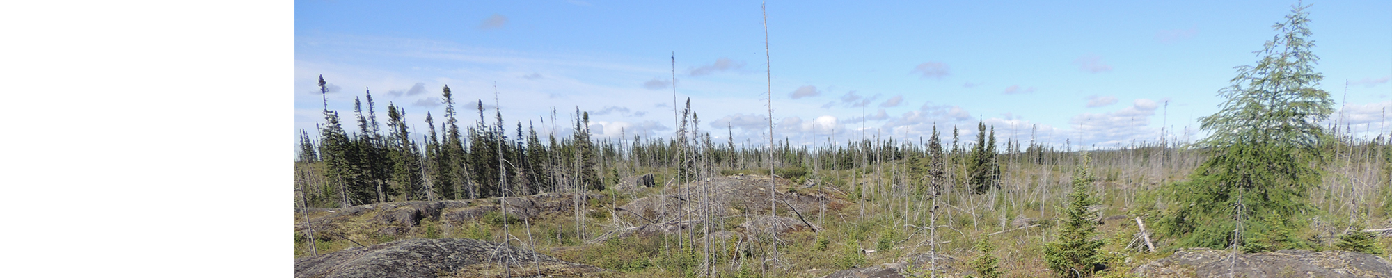
A new geological map of the Lake Ewart Lake (NTS sheets 33G04 and 33G05) was produced at a 1:50,000 scale following a survey conducted in the summer of 2016. The mapping of this area, located in the La Grande and Opinaca subprovinces, revealed a new strip of metabasalt, a polygenetic conglomerate horizon and an anomalous gold content in a paragneiss of the Laguiche Complex. A new beryllium index was found in sheet 33G04, in a banded granitic pegmatite located on the edge of a granitic pluton. Our work has also led to new shear zones, one of which is associated with ultramafic intrusions showing anomalous gold levels.
Methodology
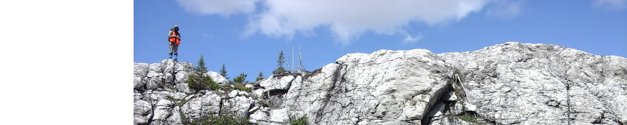
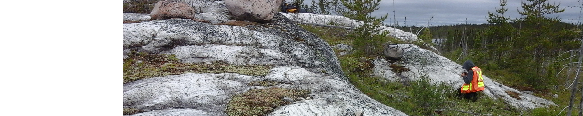
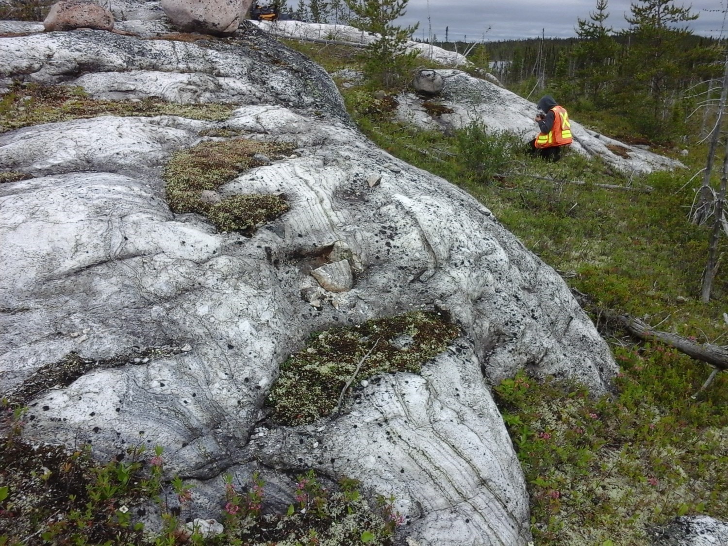
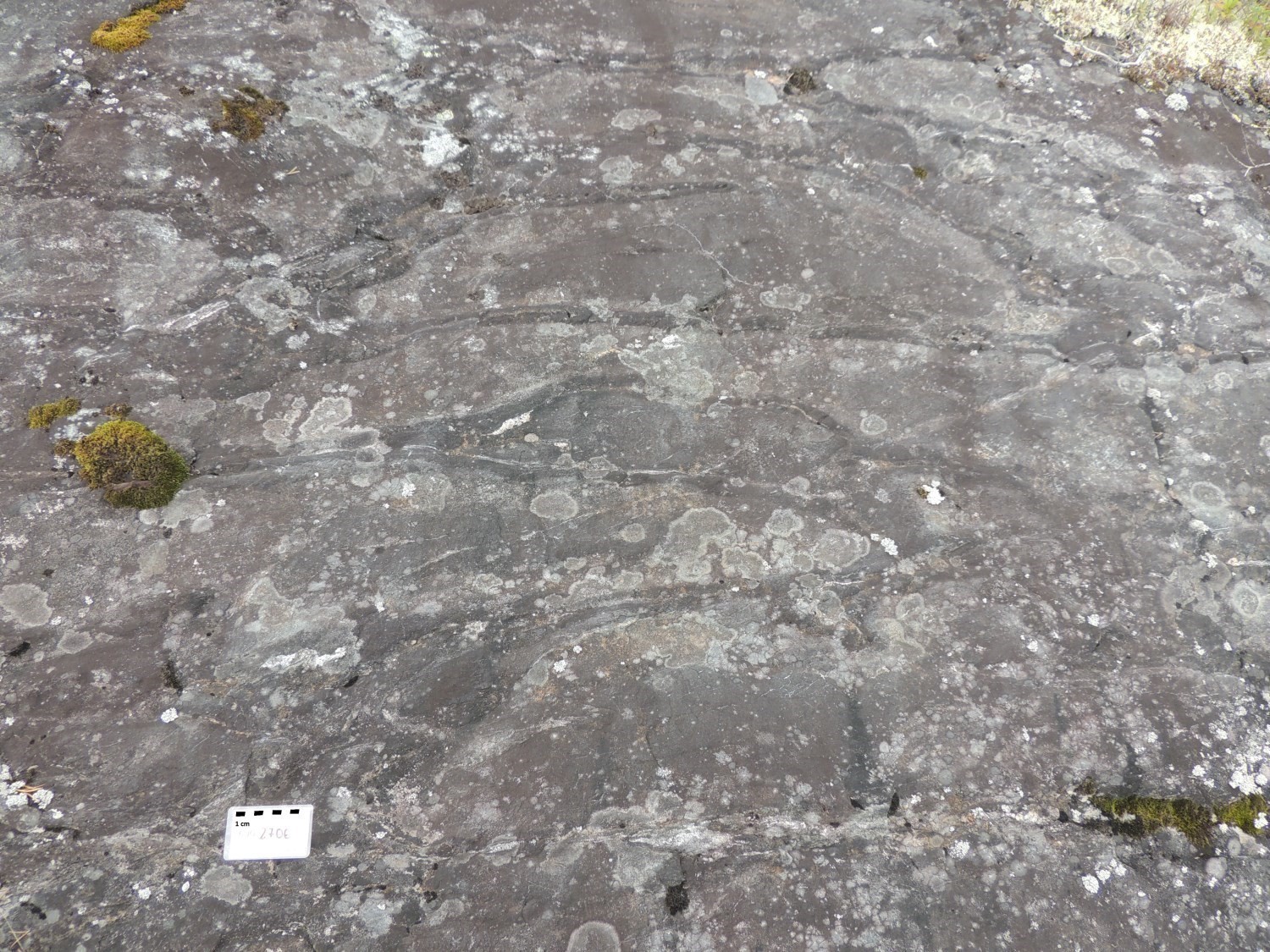
The region was mapped using the established method for surveys in isolated areas with some road access. Geological mapping was conducted by a team of six geologists and six students between June 13 and August 19, 2016. Outcrops along and around the Transtaïga Road, as well as along a road near the transmission line, were revisited by truck. Mapping was also done on NTS sheets 33F02 and 33F07, in addition to spot checks on other sheets.
It should be noted that in 1997, a team from the Ministère had mapped sheets 33G03, 33G04, 33G05 and 33G06 at a scale of 1:250,000 (Simard and Gosselin, 1999). "Geofiches" were added in SIGÉOM, but maps were produced later and were not included in the Simard and Gosselin (1999) report. In 2000, sheets 33G05, 33G06 and 33G11 were mapped to a 1:50,000 scale by a team from the Ministère (Goutier et al., 2002). The major differences between the 1997 and 2000 work and the 2016 work are the use of high-resolution aeromagnetic survey (Goldak Airborne Surveys, 2008; D'Amours, 2011), as well as a new approach to mapping the Laguiche Complex based on assessing the mobilisate percentage. In 2014, a sample was taken near the Transtaiga Road to date the main pluton of the Bezier Suite.
Geological mapping of the study area has produced and updated information presented in the table below:
| Elements | Number | Link |
|---|---|---|
|
Outcrops described (“geofiches”) in 2014 (2) and 2016 |
- | |
|
Outcrops described (“geofiches”) in 1997 and 2000 |
876 | - |
| Total lithogeochemical analyses, including 2014 re-analyses | 114 | 116 samples |
| Total lithogeochemical analyses re-analyzed in 2014 | 15 | - |
| Lithogeochemical analyses of metals of economic interest of 2016 | 37 | 37 samples |
|
Lithogeochemical analyses of metals of economic interest in 1997 and 2000 |
17 | - |
| Geochronological analyses | 1 | 1 sample |
| Covered thin sections (2000, 2014 and 2016) | 92 | - |
| Polished thin sections (2000, 2014 and 2016) | 20 | - |
| Sodium cobaltinitrite stains | 78 | - |
| Stratigraphic units | 12 | - |
| Mineralization records | 24 | 24 showings |
Previous work
The table below presents a selection of work done in the study area since 1957 that has had an impact on the geological understanding of the area. Interested readers can obtain a complete list of the region’s exploration work from the EXAMINE documentary base.
| Author(s) | Type of work | Contribution |
|---|---|---|
|
Eade et al., 1957 |
Regional mapping |
First geological survey of the region (1:508,880) |
|
Regional mapping |
First geological report and geological map (1:1,000,000) |
|
|
Geological compilation |
First regional geological compilation and interpretation of aeromagnetic data |
|
|
Heliborne prospection |
U-Th showing discovery (Delphine and anomalous U-Th areas) |
|
|
Geological compilation, mapping and prospection |
More detailed regional geological map, petrography, first stratigraphic diagram and structural cross-section, 1975 prospecting work synthesis. |
|
|
Regional mapping, geological and metallogenetic compilation |
First geological mapping by the Ministère of sheets 33F and 33G (northern part of 33G05) at 1:100,000. Presentation of the first "geofiche". Iron showing found on sheet 33G05 (JP-392, Isabeau showing). Identification of Cu-Mo-Ba anomalies on the edge of the La Grande 3 Resevoir (sheet 33G05). |
|
|
Surface prospection, geochemistry and heliborne electromagnetic survey |
Geochemical analyses of several units in the NE sector of sheet 33G05. Identification of anomalous gold areas. |
|
|
Gauthier, 2000 |
Geological and metallogenetic compilation |
Updating the geology of sheets 33F and 33G, structural lineament map, metallogenetic models, regional stratigraphic diagram, magnetism and lake-bottom sediment geochemistry maps. |
|
Gosselin et al., 2002 In: MRNF, 2010 |
Regional mapping |
First geological mapping by the Ministère of sheets 33B and 33G SW at 1:250,000. "Geofiches" in 1997 and geochemical analyses in 1998. Publication in 2002 of colour maps of sheets 33G in SIGÉOM. |
|
Regional mapping |
Geological report, 1:50,000 maps (sheets 33G05, 33G06 and 33G11), "geofiche" outcrops, compilation outcrops, geochemical analyses |
|
|
Prospecting, detailed mapping, geochemistry and geophysics |
Detailed mapping of ultramafic intrusions in sheet 33G04 and discovery of anomalous gold levels |
|
|
Geological compilation |
First map of Eeyou Istchee James Bay’s regional metamorphism in relation to gold mineralization |
|
|
Geological compilation and structural analysis |
Structural analysis of much of Opinaca Subprovince, tectonic model proposal |
|
|
Uranium surface prospection, geophysics (magnetism and spectrometry) |
Outcrop description on sheet 33G04. An anomalous area in U and Th was found in sheet 33G05 and uranium showings in the southern portion of sheets 33G04, 33G03 and 33B14. |
|
|
Airborne geophysics |
High resolution regional magnetic survey |
|
|
Mineral potential assessment |
Identification of high prospective zones for gold in the north of sheet 33G05, confirmation of the anomalous area in gold near an ultramafic intrusion in sheet 33G04. Identification of high prospective zones for Cu-Au-Mo in the north of sheet 33G05. |
|
|
Detailed geological mapping, prospecting, stripping, drilling, geochemistry (soil, till, rocks) |
Discovery of numerous gold showings (e.g. Edy) and Mo showings in the north of sheet 33G05 and near contact between the La Grande and Opinaca subprovinces eastward. Silver and copper anomalous content found in sheet 33G05. Detailed mapping of the showings. |
Lithostratigraphy
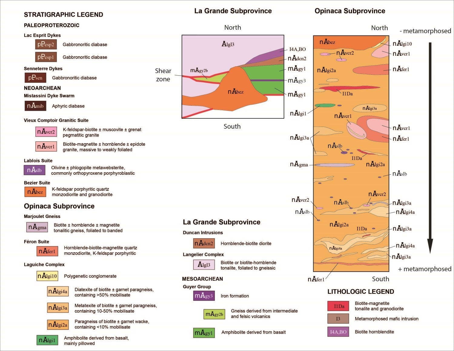
 The study area is located in the northwestern part of the Opinaca Subprovince and touches part of the La Grande Subprovince. These large units are part of the Superior Province (Card and Ciesielski, 1986). Rocks of the La Grande Subprovince are of Mesoarchean and Neoarchean ages, while rocks of the Opinaca Subprovince are of Neoarchean age. Rocks in these two subprovinces are cut by Neoarchean and Paleoproterozoic intrusions that form sills parallel to the main foliation, egg-shaped pluton or unconformable straight-line dykes.
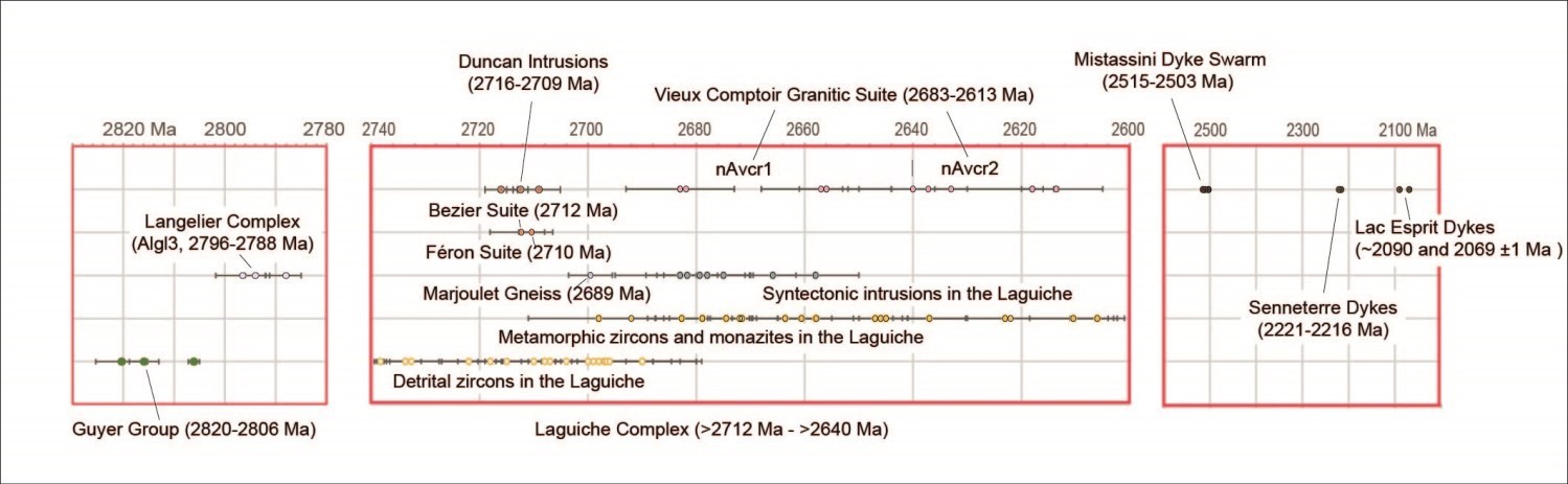
The relative timing of emplacement of these units is shown in the Ewart Lake time scale and stratigraphic diagram that takes into account crosscutting relationships observed in the field and data from adjacent sheets. This pattern also highlights the higher metamorphism of the units at the base of the Laguiche Complex, located in the southern part of the mapped area. Much of the units in the Opinaca Subprovince are conformable with the main foliation. The various units in the area are described in more detail in the Québec Stratigraphic Lexicon. References associated with unit U-Pb datings can be found in the map legend of Ewart Lake and in the Québec Stratigraphic Lexicon records.
LA GRANDE SUBPROVINCE
Mesoarchean
Rocks of the Guyer Group (mAgy, 2820-2806 Ma) are only exposed in the NE portion of sheet 33G05 where it forms two strips. The western strip consists of the highly deformed unit mAgy2b. It consists of a gneiss and a banded amphibolite after basalt. Gneiss is interpreted as the result of deformation and metamorphism of intermediate and felsic volcanics. The eastern strip represents the western end of the main strip of the Guyer Group as shown in sheets 33G06, 33G07, 33G10 and 33G11. This strip is important because it bears most of gold mineralization. The units are mAgy1 (amphibolite after basalt), mAgy2 (felsic and intermediate tuffs) and mAgy3 (iron formation). Unit mAgy2 was removed from the 33G05 sheet following work by Cayer (2010, 2011) which indicates that the proportion of deformed felsic intrusions exceeds that of felsic volcanics. Unit mAgy3 trace was modified from the more detailed aeromagnetic map.
Neoarchean
The Langelier Complex (Algl, 3452-2788 Ma) is a widespread unit in the La Grande Subprovince. In several places, this unit represents the basement on which the volcano-sedimentary units have deposited. In the Ewart Lake area, rocks of this complex are present in the northern portion of sheet 33G05. They belong to unit Algl3 composed mainly of biotite or biotite-hornblend tonalite, foliated and locally gneissic. In detail, tonalite is locally gneissic and a few horizons of diorite are present. This unit’s contact with rocks of the Guyer Group is tectonic in nature. However, an unpublished date of the Langelier Complex from further west (sheet 33F08) indicates a Neoarchea age (2796.5 ±5.3 Ma), suggesting that this unit was intrusive into the rocks of the Guyer Group.
A hornblende-biotite diorite, in intrusive contact with rocks of the upper part of the Guyer Group, was associated with the Duncan Intrusion unit nAdcn2 (nAdcn, 2716-2709 Ma) by Goutier et al. (2002). This diorite is weakly deformed. Its main feature is that it is the host unit of gold mineralization. Cayer’s work (2009, 2010) revealed the presence of several gold anomalous levels (>500 ppb) and gold showings within this intrusion and along its extension to the NE where the percentage of tonalite increases.
OPINACA SUBPROVINCE
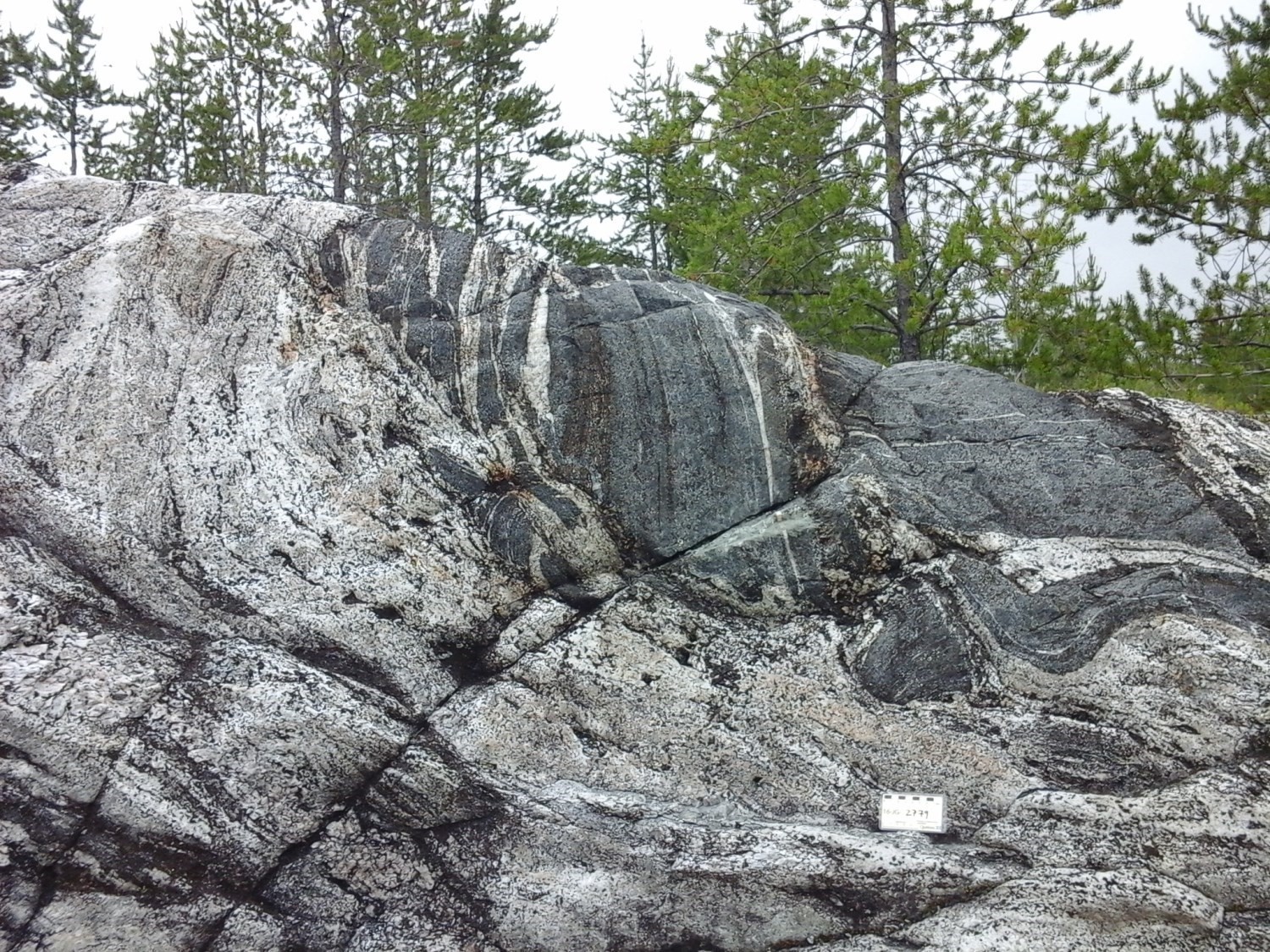
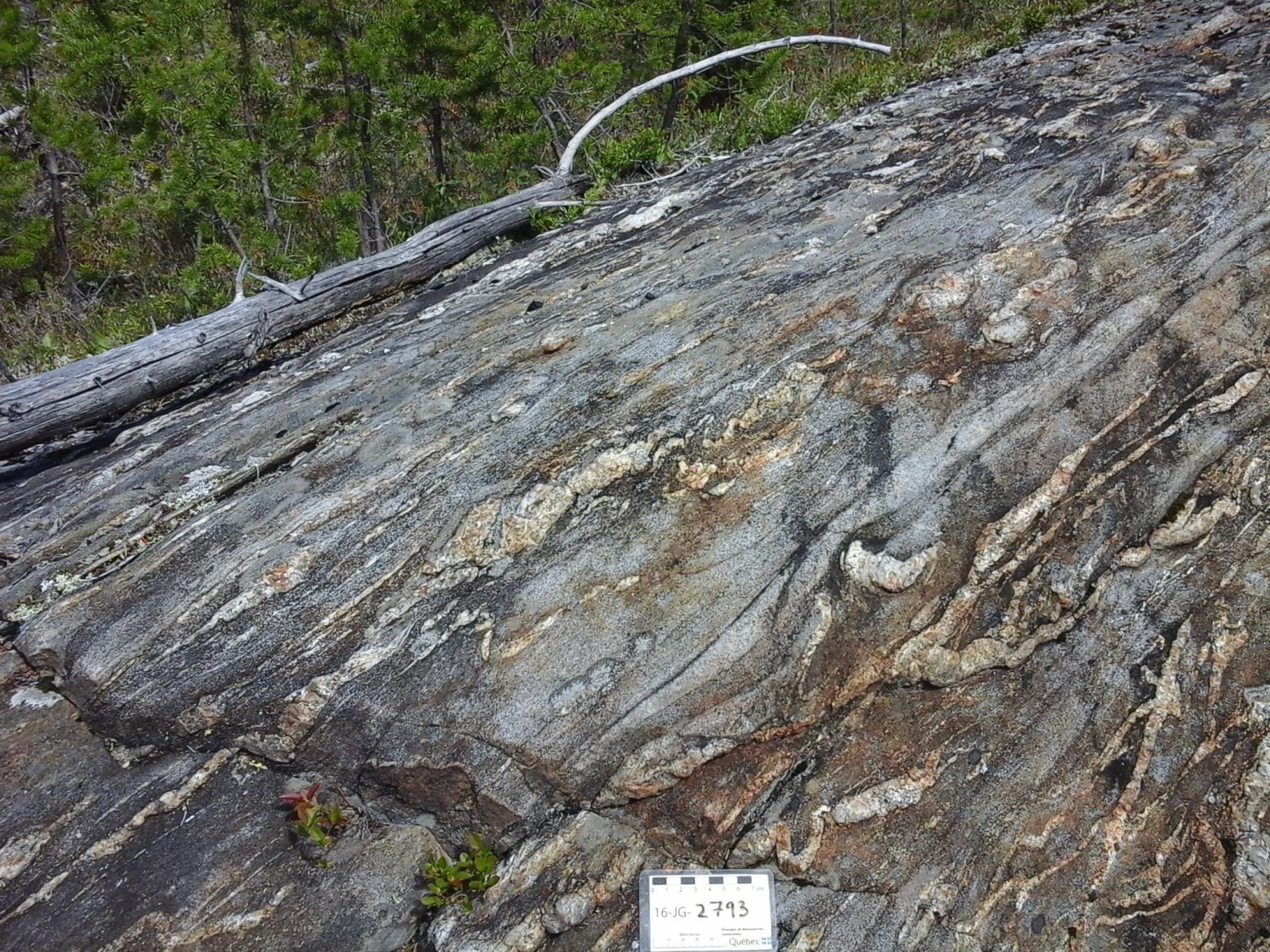
The Laguiche Complex (nAlgi, >2712 to 2640 Ma) is the main unit of the Opinaca Subprovince and covers 85% of the area mapped in the Lake Ewart region. As illustrated in the stratigraphic diagram, there is an increase in metamorphism and mobilisate from north to south, resulting in the appearance and increasing importance of metatexite and diatxite units (nAlgi3a and nAlgi4a). The boundary between paragneiss and migmatized facies is gradual. For example, on the same outcrop of the southern part of the region, the proportion of mobilisate can vary significantly from the metric to the decametric scale. The same is true for the number of centimetric intrusions of granodioritic to granitic composition.
One of the major contributions of the summer 2016 work was the discovery of a horizon of amphibolite after a mostly pillow basalt (unit nAlgi1) in the NW corner of the 33G04 sheet. It was traced 2.57 km long and approximately 300 m thick from outcrops and the vertical magnetic gradient map. The pillow facies is particularly well preserved and dominant. Garnet is present in the edges of the pillows, suggesting metamorphosed volcanogenic alteration. Contact with adjacent paragneiss appears stratigraphic.
Similarly, the 2016 work identified a strip (3.2 km by 160 m) of polygenetic conglomerate in the northern portion of sheet 33G05. This highly deformed conglomerate was associated with unit nAlgi10, which is a very minor part of the Laguiche Complex. Contact with monzodiorites of the Bezier Suite is tectonic in nature, but some monzodiorite dykes cut the conglomerate, suggesting that the Bezier Suite intruded into the sedimentary rocks and that the two units were subsequently deformed. This unit also includes minor horizons of paragneiss, iron formation and amphibolite. It could be thrust slices from the La Grande Subprovince.
Intrusive Rocks
The Marjoulet gneiss (nAgma) is a unit composed of biotite ± hornblende ± magnetite tonalitic gneiss, foliated and banded. It forms two kilometric horizons in sheet 33G04, inside rocks of the Laguiche Complex. This unit is interpreted as syntectonic intrusions emplaced parallel to the main foliation and which have been progressively deformed into gneiss. An unpublished age indicates intrusion around 2689 ±4 Ma.
The Féron Suite (nAfer1) includes intrusions of hornblende-biotite-magnetite quartz monzodiorite, porphyritic with K-feldspar phenocrystals. These rocks intrude rocks of the Laguiche Complex. They range in shape from egg-shaped plutons to sills parallel to the main foliation. They have a clear signature on aeromagnetic maps due to their high magnetic susceptibility. U-Pb dating dates intrusion of these rocks to 2710.4 ±2.4 Ma.
The main intrusion of the Bezier Suite (nAbez) occupies a significant portion of the northern portion of sheet 33G05. This intrusion is composed of quartz monzodiorite and granodiorite, with a K-feldspar porphyritic texture. These rocks intrude rocks of the La Grande and Opinaca subprovinces. Locally, the contact is sheared off. The unpublished dating of 2712.3 ±5.8 Ma from a sample taken in 2014 (2014-JG-2088A) in sheet 33G05 yielded an older age than previously proposed by Goutier et al. (2002) at 2674 ±12 Ma.
The Lablois Suite (nAslb, 2620 Ma) consists of a series of ultramafic intrusions (~0:32 km2) located near large shear zones that pass through the Laguiche Complex in the southern part of sheet 33G04. The dominant lithology of this unit is an olivine ± phlogopite metawebsterite, usually porphyroblastic with orthopyroxene. The low degree of deformation compared to the host rocks suggests intrusive contact. The interest in these intrusions lies in their proximity to shear zones and gold mineralization, as well as their anomalous gold content.
Rocks of the Vieux Comptoir Granitic Suite (nAvcr) come in two forms, kilometric egg-shaped plutons and metric to kilometric pegmatitic dykes or intrusions. In the Lake Ewart area, these granite intrusions cut all the rocks in the Opinaca Subprovince, with the exception of diabase dykes.
Large plutons (nAvcr1 unit) consist of biotite-magnetite ± hornblende ± epidote granite, massive to slightly foliated. Pegmatitic intrusions (nAvcr2 unit) are composed mainly of K-feldspar-biotite ± muscovite ± garnet ± tourmaline granite. Published and unpublished datings indicate that the nAvcr1 unit is older (2683-2656 Ma) than unit nAvcr2 (2640-2613 Ma).
Neoarchean and Paleoproterozoic Diabase Dykes
Archaean rocks in the region are cut by diabase dykes, brown in surafce and green grey in fresh exposure. These diabases are gabbronoritic, medium grained and undeformed to fractured. These dykes are grouped according to their orientation and geochemical composition. Here, the NE-SW diabase dykes belong to the Senneterre dykes (pPsen). NW-SE oriented dykes may belong to the Mistassini Dyke Swarm (nAmib1) or the Lac Esprit Dykes (pPesp). Dykes of unitnAmib1 are richer in TiO2, K2O and P2O5 than diabase of the Lac Esprit Dykes. The distinction between pPesp1 and pPesp2 dykes is based on geochemistry and U-Pb isotopic dating. The pPesp2 dykes have a flat profile of incompatible elements (see Buchan et al., 2007, Figure 11) and are older (~2090 Ma), compared to the pPesp1 dykes that have a slope profile and are younger (2069 ±1 Ma).
Neoarchean Lithological Units
Biotite-MagnetiteTonalite and Granodiorite
Three intrusions that vary in composition from tonalite to granodiorite cut rocks of the Laguiche Complex (Neoarchean, I1Da). They contain biotite and magnetite, and are massive to locally gneissic. They mainly follow structural grain and have a high magnetic susceptibility, which allows them to be recognized on aeromagnetic maps. At present, these intrusions have not been associated with a particular lithodemic unit.
Mafic Intrusion
A lithological unit representing metamorphosed mafic intrusion was plotted from the work of Laflèche et al. (2004). It is located just north of the centre of sheet 33G04. There is insufficient data to associate this intrusion with a known lithodemic unit.
Biotite Hornblendite
The lithological unit of biotite hornblendite is located in the NE corner of the 33G05 sheet and continues in the 33G12 sheet. It was plotted and described during the work of Goutier et al. (2002). It is weakly deformed. The exploration work of Cayer (2010) revealed several showings of Mo-Ag-Cu-Re, an unusual metallic association in an ultramafic intrusion.
Structural Geology
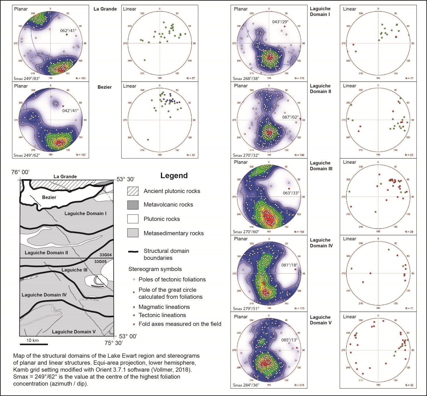
Few primary structures in volcanic and sedimentary rocks were observed as the rocks in the Lake Ewart region were heavily deformed and at least two episodes of high regional metamorphism were observed. Grouped planar elements include: primary foliation defined by elongation of minerals such as biotite and hornblende; gneissossity and migmatitic banding defined by alternating leucocratic neosome bands and messocratic paleosome bands richer in biotite and intrusions. Stereograms of lineations are constructed with tectonometamorphic mineral lineations, magmatic lineations and megascopic fold axes.
Archaean shear zones in the region form foliated, banded or mylonitic zones that are several metres thick. In some cases, in the north, they correspond to gneissic horizons several hundred metres thick, developed in metamorphosed volcanic rocks. They were drawn from the outcrops, structural style changes and vertical gradient map of the total residual high-resolution magnetic field. Traces of the shear zones in the adjacent west sheets (33F01 and 33F08) were taken into account. East sheets (33G03 and 33G06) will be mapped in 2018.
Major folds were drawn from variations in the attitude of foliation and gneissossity, as well as the vertical gradient map, aerial photos and portions of satellite images. Folding and gneissossity are associated with a first phase affecting the rocks of the Laguiche Complex, while regional folds are associated with a subsequent phase.
Structural Arrangement and Structural Domains
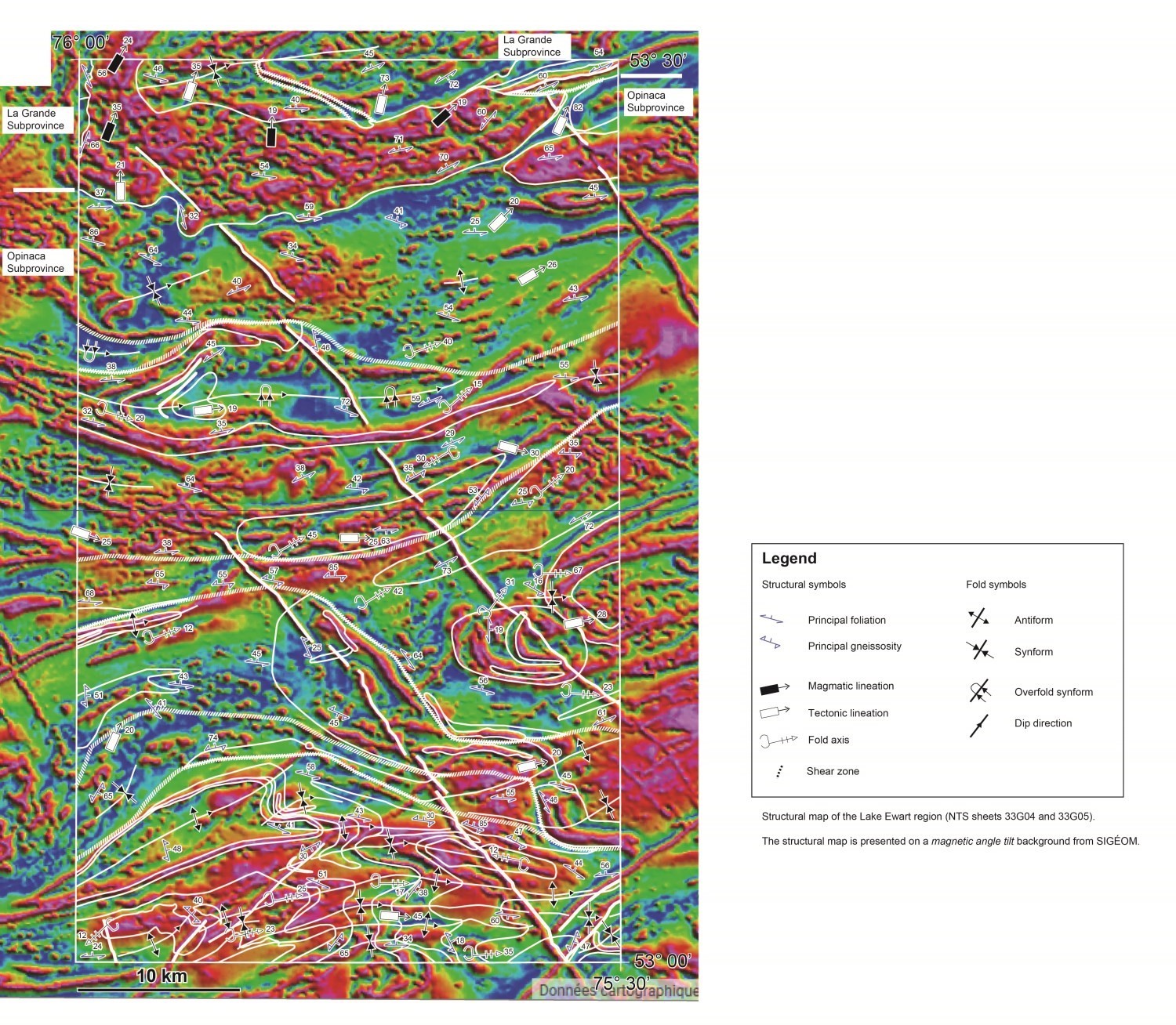
The region was divided into seven structural domains based on the attitude of the measured structures (structural map). There are changes in structural attitudes on stereograms and on the structural map. In the north, the first domain, La Grande, corresponds in large part to the southern flank of a synform belonging to an ovoid structure affecting Mesoarchean and Neoarchean rocks in the La Grande Subprovince. This structure dips moderately towards the ENE. The antiform portion, located to the north in sheet 33G11, dips similarly (065°/32°). This is a new interpretation from Goutier et al. (2002). The plan form is clearly visible by the image of the magnetic angle tilt in SIGÉOM.
The second domain is the main pluton of the Bezier Suite, intruded in the contact zone between the La Grande and Opinaca subprovinces and in the ovoid structure of the La Grande domain. There is a northward dipping foliation and northward dipping lineations (magmatic and tectonic) indicating that rocks of the Opinaca Subprovince extend beneath rocks of the La Grande Subprovince.
The following domains are all in the Opinaca Subprovince. They reflect an increase in deformation and metamorphism from north to south. In outcrop, the gneissossity becomes more pronounced southward. Regional folds are more abundant and denser in the southernmost area and show some variability in orientation and dip. These variations could be attributed to a later deformation phase.
Interpretation and Structural Model
With U-Pb isotopic dating, it is possible to establish a chronology of the structural and metamorphic events that have affected the Lake Ewart region.
First Episode
Rocks of the Guyer Group were deformed by a first compression event that arrived after their formation (<2806 Ma) and before or during intrusion of a tonalite of the Langelier Complex nAlgl3 unit, newly dated at 2796.5 ±5.3 Ma. This event is important as the rocks at the base of the Guyer Group have been transformed into mylonite and gneiss zones.
Second Episode
The second event is related to an N-S compression carrying the rocks of the La Grande Subprovince over the rocks of the Opinaca Subprovince. The age of this event is constrained by the age of the Bezier main pluton, present in the Lake Ewart area and dated 2712.3 ±5.8 Ma. This pluton intruded at the interface between the two subprovinces. It is less deformed, intrusive into adjacent rocks and contains magmatic mineral lineations.
Third Episode
The most important event is associated with another N-S compression and regional metamorphism that has reached the granulite facies just south of the region. It could have started around 2698 Ma with formation of the first migmatites (Jean David, personal communication, 2016) and ended around 2600 Ma since the youngest phases of the Vieux Comptoir Granitic Suite are locally affected by mylonite zones (e.g., Orfée gold showing; Bogatu and Huot, 2016). This compression event was followed or ended with uplift or extension, exposing the more metamorphosed rocks to the south. This is supported by observations of normal movement in some mylonite zones between the two subprovinces.
Fourth Episode
This episode is associated with a phase perpendicular to the third episode. This causes undulation of large regional folds and changes in the orientation of the folding axes.
Late Deformation
Subsequent deformation phases are brittle in nature and related to the intrusion of different Neoarchean and Paleoproterozoic diabase swarms (see Goutier et al., 2002).
Metamorphism
The region has been affected by at least two episodes of metamorphism to the amphibolite facies. The first episode arrived at around 2800 Ma with significant deformation affecting metavolcanics of the Guyer Group mAgy2b unit in sheet 33G05, transforming them into gneiss, while the adjacent Langelier tonalite (nAlgl3) is not as deformed. This relationship is observed on the shores of the La Grande 3 Reservoir. The second episode (2689-2606 Ma) is the one that affects the entire region, particularly rocks of the Opinaca Subprovince at the amphibolite facies. In detail, there is an important peak between 2683 and 2670 Ma, and a peak around 2645 Ma. There is a growth in metamorphism from north to south, characterized by an increase in the percentage of mobilisate in paragneiss units. The metamorphism reached the granulite facies in sheets 33B located just south with the appearance of orthopyroxene in paragneiss and migmatites (Sawyer, 1998; Morfin et al., 2013).
Economic Geology
(E): selected sample; (R): channel; (F): drillhole
The table of lithogeochemical analyses of metals of economic interest provides the location, description and results of the 37 samples selected to assess the economic potential of the region in 2016. Five samples were collected in 1997 and twelve in 2000 by the teams at Géologie Québec. It should be noted that the sectors targeted by Lamothe’s potential assessment studies (2008, 2009) have been heavily prospected by industry.
New pillow metabasalt and polygenetic conglomerate strips southeast of Radisson
 Following fieldwork in the summer of 2016, two mapping targets were identified. The first, identified in sheet 33G04, is associated with a pillow metabasalt horizon, partially altered, which may represent a prospective zone for base and precious metal mineralization. The second, located in sheet 33G05, is a strip of paragneiss containing anomalous gold content and a deformed polygenetic conglomerate lens. This target represents a prospective zone for orogenic-type gold mineralization.
New prospective zones southeast of Radisson
 Two new prospective zones in the Lake Ewart area are identified in this bulletin. The first prospective zone is a 2 to 3 km thick aureole located on the edge of an intrusion of the Vieux Comptoir Granitic Suite. This area is characterized by the presence of banded pegmatitic intrusions enriched with beryllium (Blacksmith showing) cutting paragneiss of the Laguiche Complex. The Sinclair model (1996, Figure 21-4) suggests that pegmatites are zoned with a gradual enrichment of the following elements as they move away from the pluton: Be; Be, Nb, Ta; Li, Be, Ta, Nb; and Li, cs, Be, Ta, Nb.
The Lac Ewart-2 prospective zone is a grouping of a point area of gold high-favorability (Lamothe, 2008, 2009; Allard et al., 2015) and ultramafic intrusions near a shear zone. Gold anomalous levels (~300 ppb) were obtained during exploration in this sector (Laflèche et al., 2004, 2006; Bussières and Richard, 2010).
Lamothe (2008, 2009) and Allard et al. (2015) identified several high-favorability zones in their potential assessment for orogenic-type gold mineralization and porphyry-type copper-gold ± molybdenite mineralization. These zones are concentrated in the northern portion of sheet 33G05.
MINERALIZATION ASSOCIATED WITH GRANITIC PEGMATITES
Granitic intrusions are very abundant in rocks of the Laguiche Complex. In the Ewart Lake area, the presence of a beryllium showing in an alkali feldspar banded granite on the edge of a granitic egg-shaped pluton suggests potential for rare earth metal mineralization.
GOLD MINERALIZATION
Gold mineralization contains the largest number of showings in the Ewart Lake region. They are found in the form of orogenic quartz and quartz-tourmaline veins, gold-bearing disseminated sulphides (pyrite and pyrrhotite) in amphibolites after basalt and gold-bearing sulphides in iron formations. These showings are mainly concentrated in the Guyer Group volcanic band in the northern part of sheet 33G05.
The presence of a polygenetic conglomerate unit, a disseminated mineralization (<1% PY, 666 ppb Au) in a paragneiss and anomalous gold levels in an ultramafic intrusion show that rocks of the Laguiche Complex also have some potential for gold mineralization.
MINERALIZATION ASSOCIATED WITH PORPHYRITIC INTRUSIONS
Updating the showings on sheet 33G05 indicates the presence of a large number of molybdenite mineralization on or around a biotite hornblendite intrusion. This ultramafic intrusion is most likely not the source of metals, but the intrusion associated with this mineralization has not been identified. In addition to the Mo content, it is interesting to note the showing levels of silver, copper, gold and rhenium. This type of mineralization is found in the adjacent sheets 33G12 and 33G11. Work is underway (R. Hanes, Ph.D. currently underway at Laval University) in the adjacent sheets to better understand this type of mineralization and its link to the orogenic-type vein systems.
The presence of this type of ultramafic mineralized intrusion, near a major deformation zone, at the boundary between the La Grande and Opinaca subprovinces, increases the mineral potential of the Lake Ewart region. From a more regional perspective, the association of these mineralized intrusions with tectonic areas represents an important metallotect for the exploration of both base and precious metals.
UNKNOWN TYPE DEPOSITS
Three showings were classified as undetermined deposits due to the lack of information in the statutory work reports (GM). The first two are gold mineralization, while the third may be related to mineralization associated with porphyry intrusions.
This bulletin was made possible through the cooperation of many people who have been actively involved in the various stages of the project.
| Authors |
Jean Goutier, P.Geo., M.Sc., jean.goutier@mern.gouv.qc.ca |
| Organism | General direction of Géologie Québec, Ministère de l'Énergie et des Ressources naturelles, Government of Québec |
| Cooperation - Fieldwork | |
| Mapping in 2016 |
Jean Goutier, Joséphine Gigon, Myriam Côté-Roberge, Jean-Philippe-Fleury, Roman Hanes and Nathan Cleven; Students : Rachel Laplante, Marc-Antoine Lévesque, Maëva Payet, Sara Pedneault, Jean-Marc Rolland and Myriam Roy |
| Cook | Frédéric Tremblay |
| Camp representative | David Lalancette |
| Logistics | Marie-France Beaulieu, GIT, B.Sc. |
| Camp set-up | Jean Goutier, MERN supervisor and CIVILCO company team |
| Transport | Hélicoptères Canadiens Ltd. (Whapchiwem); pilots : David Mimin, André Daneau, Kim Roux |
| Cooperation - Bulletin GéologiQUE | |
| Consultation and discussion |
Joséphine Gigon, Jr. Eng., Myriam Côté-Roberge, GIT |
| Coordination | James Moorhead, P.Geo., M.Sc. |
| Editing | Céline Dupuis, P.Geo., Ph.D. |
| Deposit records | Pierre Lacoste, P.Geo., M.Sc. Alban Duvernois |
| Geochemistry | Fabien Solgadi, P.Geo., Ph.D. |
| Geomatics | Karine Allard, Kathleen O’Brien et Julie Sauvageau |
| Geophysics | |
| Critical review | Hanafi Hammouche, P.Geo., M.Sc. |
| English version | Céline Dupuis, P.Geo., Ph.D |
References
Publications of the Government of Québec
ALLARD, G., GOUTIER, J., LAMOTHE, D., 2015. Évaluation du potentiel en minéralisations d'or de type orogénique, Municipalite d'Eeyou Istchee Baie-James (version 2014)Évaluation du potentiel en minéralisations d'or de type orogénique, Municipalite d'Eeyou Istchee Baie-James (version 2014). MERN; EP 2015-01, 42 pages, 1 map.
ALLARD, P., 2008. RAPPORT DU PROGRAMME D'UNE RECONNAISSANCE GEOLOGIQUE SUR LA PROPRIETE UGO, SECTEUR SUD DU RESERVOIR LAGRANDE-3. EXPLORATION DIOS INC, assessment work submitted to the Government of Québec. GM 64342, 23 pages, 2 maps.
AUGLAND, L.E., DAVID, J., PILOTE, P., LECLERC, F., GOUTIER, J., HAMMOUCHE, H., LAFRANCE, I., TALLA TAKAM, F., DESCHENES, P.-L., GUEMACHE, M.A., 2016. Datations U-Pb dans les provinces de Churchill et du Supérieur effectuées au GEOTOP en 2012-2013. MERN, GEOTOP; RP 2015-01, 43 pages.
BOGATU, A., HUOT, F., 2016. MINERALISATION AURIFERE DU GITE ORFEE, EEYOU ISTCHEE BAIE-JAMES, QUEBEC. MERN, UNIVERSITE LAVAL; MB 2016-10, 47 pages.
BOUCHARD, R. A., GIRARD, T., 2016. REPORT AND RECOMMENDATIONS, EXPLORATION PROGRAM SUMMER 2015, POSTE LEMOYNE EXTENSION. EXPLORATION OSISKO-BAIE JAMES INC, assessment work submitted to the Government of Québec. GM 69865, 110 pages, 7 maps.
BUSSIERES, Y., RICHARD, L.-P., 2010. RAPPORT TECHNIQUE, CARTOGRAPHIE ET PROSPECTION 2009, PROPRIETE EWART. RESSOURCES MINIERES PRO-OR INC, assessment work submitted to the Government of Québec. GM 65506, 95 pages.
CAYER, A., 2010. TECHNICAL REPORT AND RECOMMENDATIONS, SUMMER 2009 GEOLOGICAL RECONNAISSANCE PROGRAM AND FALL 2009 DRILLING PROGRAM, POSTE LEMOYNE EXTENSION PROPERTY. MINES VIRGINIA INC, assessment work submitted to the Government of Québec. GM 65401, 1162 pages, 45 maps.
CAYER, A., 2011. TECHNICAL REPORT AND RECOMMENDATIONS, SUMMER 2010 GEOLOGICAL RECONNAISSANCE PROGRAM, POSTE LEMOYNE EXTENSION PROPERTY. MINES VIRGINIA INC, assessment work submitted to the Government of Québec. GM 66018, 742 pages, 34 maps.
COCKBURN, G. H., 1977. ATLAS GEOCHIMIQUE DES SEDIMENTS DE RUISSEAU: LA GRANDE RIVIERE. MRN; DPV 455, 272 pages.
D'AMOURS, I., 2011. Synthèse des levés magnétiques de la Baie-James. MRNF; DP 2011-08, 5 pages, 2 maps.
DUBÉ, C., FRANCONI, A., HOCQ, M., REMICK, J.H., SHARMA, K.N.M., AVRAMTCHEV, L., DUCROT, L., 1976. Compilation géologique du territoire de la baie de James. MRN; DP 358, 8 pages, 18 maps.
DUPUIS, J. C., 1975. ANALYSE TECTONIQUE. S D B J, GROUPE MINIER S E S, assessment work submitted to the Government of Québec. GM 34097, 14 pages.
FAURE, S., 2010. RECONNAISSANCE DE STRUCTURES SYNVOLCANIQUES MAJEURES DANS LES ENVIRONNEMENTS DE SULFURES MASSIFS VOLCANOGENES, NORD-OUEST DE LA SOUS-PROVINCES D'ABITIBI, CONSOREM, PROJET 2009-04. CONSOREM; MB 2014-14, 43 pages.
GAUTHIER, M., 1996. GEOLOGIE DE LA REGION DU LAC DE LA FREGATE. MRN; MB 96-04, 1 map.
GAUTHIER, M., LAROCQUE, M., CHARTRAND, F., 1997. Cadre géologique, style et répartition des minéralisations métalliques de la Grande Rivière, Territoire de la Baie James. MRN; MB 97-30, 73 pages.
GIROUX, M., 1975. RAPPORT PROSPECTION CHIEN DE CHASSE. S D B J, GROUPE MINIER S E S, assessment work submitted to the Government of Québec. GM 34117, 30 pages, 32 maps.
GIROUX, M., OAKES, B. W., 1975. RELEVES AEROPORTES. S D B J, GROUPE MINIER S E S, assessment work submitted to the Government of Québec. GM 34107, 38 pages, 5 maps.
GOLDAK AIRBORNE SURVEYS, 2008. LEVE AEROMAGNETIQUE SUR LE TERRITOIRE DE LA BAIE-JAMES - OPINACA, SUD DE LG-3 ET SUD DE LG-4. DP 2008-01, 50 pages, 58 maps.
GOUTIER, J., DION, C., OUELLET, M. C., DAVIS, D. W., DAVID, J., PARENT, M., 2002. Géologie de la région du lac Guyer, 33G/05, 33G/06 et 33G/11. MRN; RG 2001-15, 55 pages, 3 maps.
GOSSELIN, C., GOUTIER, J., SIMARD, M., 2002. Lac Ewart In: CARTE(S) GÉOLOGIQUE(S) DU SIGEOM - feuillet 33G. MRNF; CG SIGEOM33G, 17 maps.
JOHNSON, M., 1996. SUMMARY REPORT 1996, SAKAMI PROJECT, LAC GUYER AND LAC DE LA CORVETTE AREAS, BAIE-JAMES REGION. PHELPS DODGE CORP OF CAN LTD, assessment work submitted to the Government of Québec. GM 56869, 54 pages, 6 maps.
LAFLECHE, M. R., BERGERON, M., BOUSSICAULT, B., 2004. GEOLOGIE, GEOCHIMIE ET GEOPHYSIQUE DE LA PROPRIETE LAC EWART. RESSOURCES MINIERES PRO-OR INC, assessment work submitted to the Government of Québec. GM 61670, 99 pages.
LAFLECHE, M. R., BERGERON, M., BUSSIERES, Y., 2006. ETUDE GEOPHYSIQUE ET GEOCHIMIQUE D'UNE PERIDOTITE AURIFERE DE LA PROPRIETE LAC EWART. RESSOURCES MINIERES PRO OR INC, assessment work submitted to the Government of Québec. GM 62933, 66 pages.
LALANCETTE, J., TREMBLAY, P., GIRARD, R., 2008. TRAVAUX GEOLOGIQUES DE RECONNAISSANCE POUR L'URANIUM DANS LA SOUS-PROVINCE D'OPINACA, PROJET U2. EXPLORATION DIOS INC, assessment work submitted to the Government of Québec. GM 64463, 63 pages, 3 maps.
LAMOTHE, D., 2008. Évaluation du potentiel en minéralisations de type or orogénique de la Baie James. MRNF; EP 2008-01, 54 pages, 33 maps.
LAMOTHE, D., 2009. Évaluation du potentiel minéral pour les gîtes porphyriques de Cu-Au ± Mo de la Baie-James. MRNF; EP 2009-01, 54 pages, 1 map.
LAPOINTE, I., 2008. Environnements sédimentaires aurifère en Environnements sédimentaires aurifère en terrain de haut grade métamorphique : le cas des bassins sédimentaires d'Opinaca-Nemiscau, Baie-James. CONSOREM; MB 2008-10, 41 pages.
LAROSE, P. Y., 1975. PETROGRAPHIE, STRATIGRAPHIE. S D B J, GROUPE MINIER S E S, assessment work submitted to the Government of Québec. GM 34096, 8 pages.
LAVOIE, L., LAROSE, P. Y., DUPUIS, J. C., GIROUX, M., 1976. RAPPORT DE SYNTHESE DES TRAVAUX 1975. S D B J, GROUPE MINIER S E S, assessment work submitted to the Government of Québec. GM 34118, 49 pages, 7 maps.
MEILLON, J. J., 1975. PHOTOGEOLOGIE MAGNETISME. S D B J, GROUPE MINIER S E S, assessment work submitted to the Government of Québec. GM 34099, 5 pages.
OAKES, B. W., 1975. DESCRIPTION OF THE GEOLOGICAL UNIT, TAKEN FROM THE PRELIMINARY GEOLOGY REPORTS. S D B J, GROUPE MINIER S E S, assessment work submitted to the Government of Québec. GM 34087, 14 pages, 1 map.
OAKES, B. W., 1975. HISTOIRE GEOLOGIQUE. S D B J, GROUPE MINIER S E S, assessment work submitted to the Government of Québec. GM 34098, 10 pages.
OSBORNE, B. S., 1995. A REPORT ON A RECONNAISSANCE PROGRAMME IN THE LA GRANDE REGION, SUMMER 1995. PHELPS DODGE CORP OF CAN LTD, assessment work submitted to the Government of Québec. GM 55392, 75 pages, 2 maps.
OSWALD, R., 2012. TECHNICAL REPORT AND RECOMMENDATIONS, TECHNICAL REPORT ON SUMMER 2011 GEOLOGICAL EXPLORATION, POSTE LEMOYNE EXTENSION PROPERTY. MINES VIRGINIA INC, assessment work submitted to the Government of Québec. GM 66855, 317 pages, 12 maps.
OSWALD, R., 2013. TECHNICAL REPORT AND RECOMMENDATIONS SPRING 2012 DRILLING PROGRAM AND SUMMER 2012 GEOLOGICAL EXPLORATION PROGRAM, POSTE LEMOYNE EXTENSION PROPERTY. MINES VIRGINIA INC, assessment work submitted to the Government of Québec. GM 67696, 589 pages, 13 maps.
RENARD, J. P., 1975. ETUDE PETROGRAPHIQUE, PROJET SES. S D B J, GROUPE MINIER S E S, assessment work submitted to the Government of Québec. GM 34100, 43 pages.
SAWYER, E. W., 1998. PETROGRAPHIE ET GEOCHIMIE DES MIGMATITES DE LAGUICHE. assessment work submitted to the Government of Québec. GM 61392, 38 pages.
SHARMA, K. N. M., 1975. LA GRANDE RIVER AREA ( 1973-1974 PROJECT ) NEW-QUEBEC TERRITORY - GEOLOGICAL REPORT. MRN; DP 311, 80 pages.
SIMARD, M., GOSSELIN, C., 1999. Géologie de la région du lac Lichteneger (SNRC 33B). MRN; RG 98-15, 27 pages, 1 map.
ST-HILAIRE, C., 2008. HIGH RESOLUTION AEROMAGNETIC AND GAMMA-RAY SPECTROMETRIC SURVEY, FINAL TECHNICAL REPORT, UPINOR PROJECT. EXPLORATION DIOS INC, assessment work submitted to the Government of Québec. GM 64066, 33 pages, 24 maps.
TREMBLAY, M., MARLEAU, R. A., 1973. ETUDE DE LA GEOLOGIE ET DU POTENTIEL MINERAL DU TERRITOIRE DE LA BAIE-JAMES. S D B J, assessment work submitted to the Government of Québec. GM 34001, 1146 pages, 102 maps.
TREMBLAY, P., LALANCETTE, J., GIRARD, R., 2009. TRAVAUX D'EXPLORATION ET DE CARTOGRAPHIE GEOLOGIQUE POUR L'URANIUM DANS LE SECTEUR D'OPINACA, PROJET UPINOR. EXPLORATION DIOS INC, assessment work submitted to the Government of Québec. GM 64464, 244 pages, 5 maps.
Other Publications
BUCHAN, K.L., GOUTIER, J., HAMILTON, M.A., ERNST, R.E., MATTHEWS, W.A", Paleomagnetism, U-PB geochronology, and geochemistry of Lac Esprit and other dyke swarms, James Bay area, Quebec, and implications for Paleoproterozoic deformation of the Superior Province. Canadian Journal of Earth Sciences; volume 44, pages 643-664. doi.org/10.1139/e06-124
CARD, K.D., CIESIELSKI, A., Subdivisions of the Superior Province of the Canadian Shield. Geoscience Canada; volume 13, page 5-13. Source
EADE, K.E., HEYWOOD, W.W., LEE, H.A., 1957. Sakami Lake area, New Quebec. Geological Survey of Canada; map 23-1957. doi.org/10.4095/108545
GAUTHIER, M., 2000. Styles et répartition des gîtes métallifères du territoire de la Baie-James (Québec). Chronique de la recherche minière; numéro 539, pages 17-61.
GAUTHIER, M., TRÉPANIER, S., GARDOLL, S., 2007. Metamorphic Gradient: A Regional-Scale Area Selection Criterion for Gold in the Northeastern Superior Province, Eastern Canadian Shield. SEG Newsletter; volume 69, pages 1-15. doi.org/10.5382/SEGnews.2007-69.fea
MORFIN, S. – SAWYER, E.W. – BANDYAYERA, D., 2013. Large volumes of anatectic melt retained in granulite facies migmatites: an injection complex in northern Quebec. Lithos, volume 168-169; pages 200-218. doi.org/10.1016/j.lithos.2013.02.007
SINCLAIR, W.D., 1996. Pegmatites granitiques. Dans : Géologie des types de gîtes minéraux du Canada (Eckstrand, O.R., Sinclair, W.D., Thorpe, R.I., editeurs). Commission géologique du Canada; Géologie du Canada nº 8 pages 559-568. doi.org/10.4095/208027
VOLLMER, F.W., 2018. Orient: Spherical projection and orientation data analysis software. Mai 2018. www.frederickvollmer.com (page consultée le 28 mai 2018)
GOUTIER, J., 2018. Geology of The Lake Ewart Region, La Grande and Opinaca Subprovinces, East of Radisson, Eeyou Istchee James Bay, Quebec, Canada. MRNF; BG 2018-10, 2 plans.