Geology of the Barraute Area, Abitibi Subprovince, Abitibi-Témiscamingue Region, Quebec, Canada
Project for NTS sheet 32C05-200-0202
Pierre Pilote, Jonathan Marleau and Jean David
BG 2019-06
Translated on 3 March 2020
Featured
In Essence
The 2018 field campaign consisted of 1:20 000 scale mapping and compilation of the Barraute area (sheet 32C05-200-0202). The geology of this area consists of Neoarchean rocks: 1) mafic to felsic volcanic rocks (Landrienne and Deguisier formations, Upper Figuery Group), 2) sedimentary rocks (Fiedmont Formation), and 3) intrusive rocks (Barraute, Carpentier and Mogador plutons, Mont-Vidéo Suite, late-tectonic to post-tectonic La Corne Batholith emplaced between 2681 Ma and 2642 Ma).
The dominant structural feature of this area is the Manneville Thrust Zone (Daigneault et al., 2002; Pilote et al., 2017, 2018). This regional-scale thrust zone can be interpreted as a large, folded sequence materialized in the area east of Barraute by a series of ESE-WNW-oriented synclinal (Barraute and Figuery synclines) and anticlinal folds overturned southward. This zone has a N-S width of to -8 km (see aeromagnetic map below) and extends several tens of kilometres westward (Pilote et al., 2009, 2017, 2018) affecting the entire Kinojévis Group, Landrienne Formation and Fiedmont Formation sedimentary rocks. Stratification is reversed and polarities are commonly facing south, which is confirmed by the observed pattern of pillows in mafic lava. This thrust zone was subsequently cut by faults associated with the development of the “Destor-Porcupine Fault Zone” (Daigneault et al., 2002; Legault et al., 2005; Pilote et al., 2009, 2017, 2018). The latter includes several longitudinal faults such as the Aiguebelle, Abcourt and Lyndhurst faults, which are oriented E-W to ESE-WNW, have a moderate to steep dip northward, and tend to imbricate together towards the ESE. Some of these faults, or specific segments of these faults, are associated with orogenic gold mineralization.
Methodology
The Barraute area was mapped using the established method for surveys in forest areas served by a network of secondary roads. Geological mapping was conducted by a team of one geologist accompanied by a geologist in training from late May to late August 2018. This area has an extremely low density and a very uneven distribution of outcrops, and a considerable Quaternary cover. Compilation of some of the drill cores and aeromagnetic surveys greatly contributed to enhancing the geological map.
Mapping of the study area produced and updated the information presented in the following table:
| Element | Number |
|---|---|
| Described outcrop (“geofiche”) | 157 outcrops |
| Total lithogeochemical analysis | 189 samples |
| Lithogeochemical analysis of metals of economic interest | 6 samples |
| Geochronological analysis | 4 samples |
| Covered thin section | 144 |
| Polished thin section | 5 |
| Sodium cobaltinitrite stain | 12 |
| Stratigraphic unit | 7 |
| Mineralization record | 22 |
Previous Work
The table below lists the work that has been done in the study area since 1910. It also includes references cited in the report.
| Author(s) | Type of Work | Contribution |
|---|---|---|
| Bell, 1931 | Description of gold mineralized zones | Venus gold mine, Barraute Township |
| Beullac, 1983 | Geological mapping | Geology of the Barraute-Fiedmont area |
| Boily et al., 1989 | Description of mineralized zones | Metallogeny of high-tech metals in Abitibi-Témiscamingue |
| Brown, 1957, 1958 | Geological mapping | Preliminary report on the geology of the NE quarter of Fiedmont Township |
| Daigneault, 1996 | Description of fault and shear zones in Abitibi | Deformation corridors of the Abitibi Subprovince |
| Dawson, 1966 | Geological mapping and description of mineralized zones | Studies of the various intrusive phases of the Preissac–La Corne Batholith |
| Doig, 1963 | Geological mapping | Geology of the SE quarter of Landrienne Township and SW quarter of Barraute Township |
| Imreh, 1979 | Geological Association of Canada, Québec Congress 1979, field trip guidebook | Lithostratigraphy and ultramafic rocks of the Val-d’Or–Amos Area |
| Imreh, 1984 | Geological mapping | Synthesis of the La motte-Vassan trough and its southern foreland |
| Imreh, 1991 | Geological mapping | Preliminary 1:15 840 geological maps of the southern portion of East Abitibi (NW quarter of sheet 32C05) |
| James and Mawdsley, 1929 | Geological mapping | Geology of the Fiedmont area, Abitibi Township, Quebec |
| Jones, 1964 | Geological mapping | Geology of the NW quarter of Fiedmont Township |
| Keating, 1979 | Geophysical surveys | Compilation of Input-type electromagnetic anomalies |
| Lacoste, 1984 | Geological mapping | Geology of the Fiedmont area |
| Latulippe and Ingham, 1955 | Description of mineralized zones | Lithium mineralization in the La Corne area |
| Leuner, 1959 | Geological mapping | Preliminary geological report on the western half of La Motte Township |
| MER, 1984 | Geological mapping | Geoscience compilation map of sheet 32C05 (GC 032C/05) |
| Geological Survey of Canada, Virginia Gold Mines, Noranda Exploration, 2009 | Geophysical surveys | MEGATEM colour geophysical maps (sheet 32C05) |
| Pilote, 2015 | Geological mapping | Geology of the La Corne area (CG-32C05A-2015-01) |
| Sharpe, 1961 | Geological mapping | Preliminary geological report on the southern half of Figuery Township and the SW quarter of Landrienne Township |
| Tremblay, 1946, 1947, 1950a, 1950b | Geological mapping | Geology of the La Corne and Fiedmont areas |
| Wilson and Prud’homme,1910 | Geological mapping | Reconnaissance mapping along projected transcontinental railway route |
Lithostratigraphy
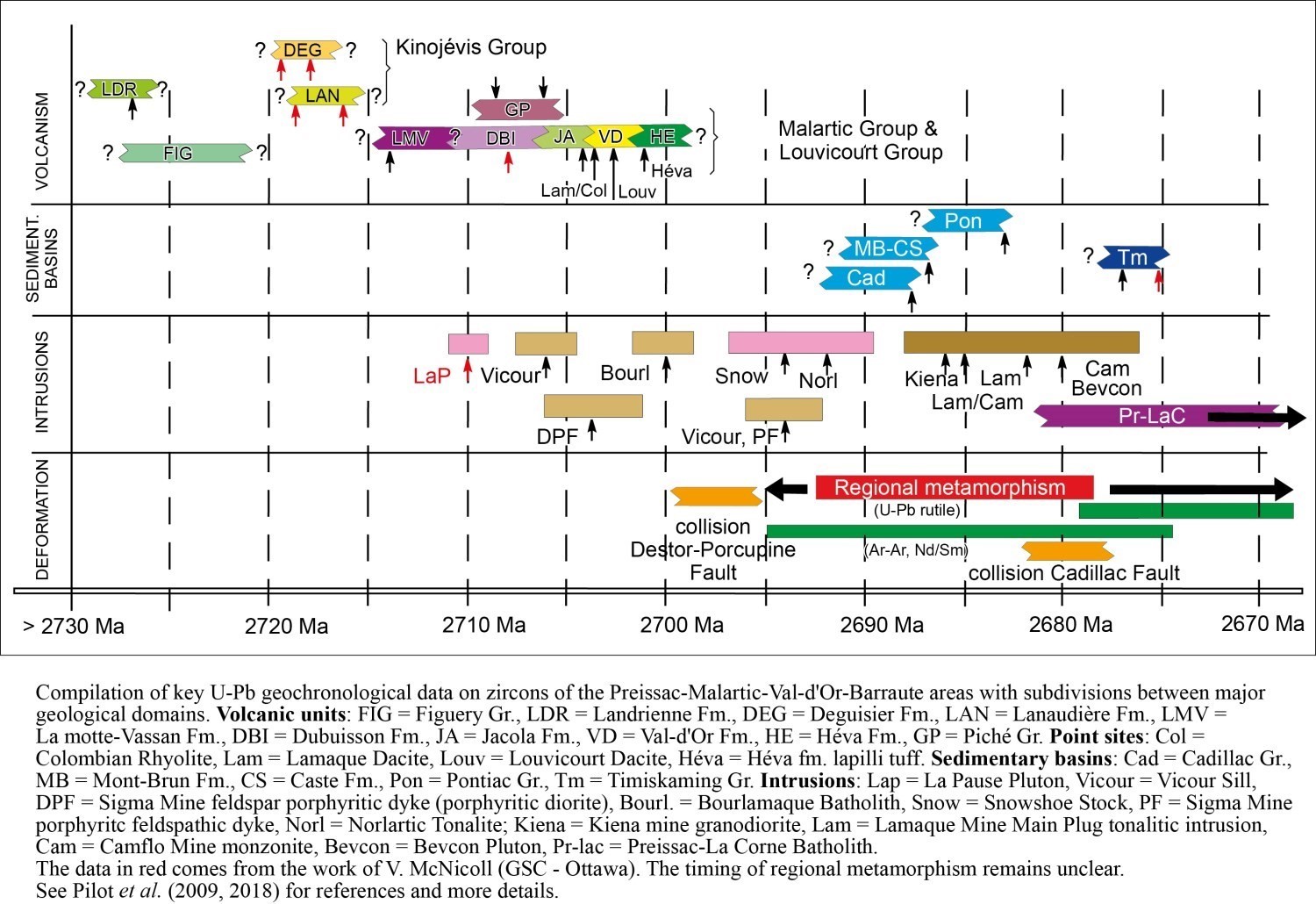 The Barraute area is located in the southern part of the Abitibi Subprovince of the Superior Province (Dimroth et al., 1982; Card and Ciesielski, 1986; Calvert and Ludden, 1999; Thurston et al., 2008; Percival et al., 2012). Rocks in this area form an Archean volcano-sedimentary pile consisting of mafic, intermediate and felsic volcanic and volcaniclastic rocks (2727 ±2 Ma to 2716 ±2 Ma; Pilote et al., 2009) along a narrow strip of sedimentary rocks (Fiedmont Formation). A compilation of the main zircon U-Pb data is shown in the opposite figure.
These are units found in the Barraute area, from north to south: 1) the Figuery Group (nAfg); 2) the Deguisier Formation (nAdg), included in the Kinojévis Group (nAki); 3) the Landrienne Formation (nAla); 4) the Lanaudière Formation (nAln), also included in the Kinojévis Group; and 4) the Fiedmont Formation (nAfd). Numerous pre-tectonic and post-tectonic dioritic-tonalitic to monzonitic and monzogranitic intrusions cut the volcanic sequence (e.g., the La Corne Batholith and Mogador Pluton).
VOLCANOSEDIMENTARY UNITS
Volcanic Rocks
 The geological and stratigraphic settings of the Barraute area are well defined due to the work of Sharpe (1961), Beullac (1983), Imreh (1979, 1984, 1991) and Pilote et al. (2018). Stratigraphic units of the Barraute area are described below from the oldest to the youngest.
The Landrienne Formation (nAla) consists of basalt, gabbro sills, and felsic volcaniclastics and volcanics. The significant apparent thickness of this formation can be explained by the fact that these units are repeated several times by a series of overfolds, including at least two synclines (Barraute and Figuery synclines, well visible in the NW quarter of sheet 32C05) and anticlines (NE and NW quarters of sheet 32C05). This formation is not assigned to any group. It is bordered by the longitudinal Abcourt (north flank) and Aiguebelle (south flank) faults. The Landrienne Formation includes a rhyolitic unit (2727 +/-2 Ma; Labbé, 1999) significantly older than adjacent volcanic rocks located north (Deguisier Formation) and south (Lanaudière Formation) and belonging to the Kinojévis Group (age range of 2716-2720 Ma; Pilote et al., 2009). This layout can likely be explained by the presence of a large anticlinorium, the Manneville Thrust Zone, whose central part is occupied by the Landrienne Formation and which is truncated by many faults, including the Aiguebelle and Landome faults, and the Uniacke Deformation Corridor (Moorhead, 1988; 1989).
The Figuery Group (nAfg) consists of plagioclase porphyritic andesitic flows, intermediate to felsic volcaniclastics and felsic volcanics. The Figuery Group is bordered to the north by the Amos Group (Imreh, 1979; Labbé, 1999) and the Beauchamp Fault (Labbé, 1995; sheet 32C12), to the south by the Lyndhurst Fault and the Deguisier Formation. The mean age of Figuery Group volcanics should be comparable to or slightly older than that of the Taschereau Batholith (2718.3 +2.3/-2.2 Ma; Frarey and Krogh, 1986), a tonalitic to granodioritic intrusion interpreted as synvolcanic by Doucet (2001).
The Kinojévis Group (nAki) was subdivided into two formations by Goutier (1997), the Deguisier Formation (nAdg) at the base and the Lanaudière Formation (nAln) at the top. The Deguisier Formation (nAdg) consists of tholeiitic basalt, thin chert horizons between flows, tholeiitic rhyolite (2719.4 ±1 Ma and 2718.1 ±1.3 Ma; McNicoll, cited in Pilote et al., 2009) and intermediate to felsic volcaniclastics. It is in fault contact with the Figuery Group to the north and the Landrienne Formation to the south. The Lanaudière Formation (nAln) consists of mafic to felsic volcanics. The close spatial association observed between ultramafic lava and rhyolitic complexes of this formation, dated 2718.7 ±0.7 Ma and 2716.2 ±0.8 Ma (McNicoll, cited in Pilote et al., 2009), suggests several similarities with the Kidd-Munro Assemblage (Bleeker, 1999; Berger, 2002; Ayer et al., 2002). On the other hand, the Lanaudière Formation is bounded to the south by the La Corne Batholith and to the north by the Aiguebelle Fault. This northward low-dipping fault (Mueller et al., 1996; Daigneault et al., 2002) may represent one of the subsidiary faults of the Destor-Porcupine Fault Zone further west (Goutier, 1997; Legault et al., 2005). Goutier (1997) and Pilote et al. (2009) proposed that the Deguisier and Lanaudière formations were originally joint and that they were subsequently separated by faults.
Sedimentary Rocks
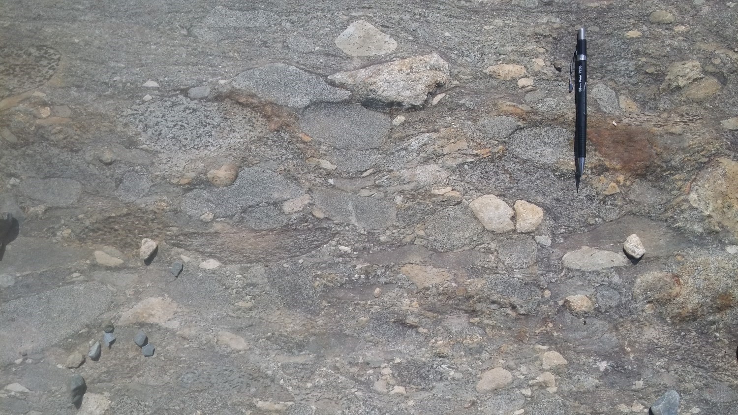
The Fiedmont Formation (nAfd) consists of grauwacke, biotite schist and siliceous to ferruginous exhalite. Numerous cross-bedded sequences representing river deposition environments, similar to Timiskaming-type sedimentary units, are interstratified in conglomerate (Rocheleau, 1980; Pyke, 1982; Corfu et al., 1991; Mueller et al., 1994; Goutier, 1997; Ayer et al., 2002; Legault et al., 2005). The Fiedmont Formation is bordered to the north by the Aiguebelle Fault. This sedimentary rock strip extends southward where it is truncated by the La Corne Batholith.
Intrusive Units
The Mont-Vidéo Intrusive Suite (nAvid) includes ultramafic intrusions (peridotite and pyroxenite), amphibolite, gabbro and diorite (Jones, 1964). These lithologies are masked by a thick overburden cover and have only been recognized by drilling. These intrusive rocks are interpreted as winding dykes and sills cutting host volcanic rocks. These intrusions are likely contemporary to volcanism (Jones, 1964). Late dykes and intrusions of quartz monzonite and granodiorite (I2Ea), possibly comparable to some adjacent phases associated with the La Corne Batholith, cut ultramafic and mafic lithologies (Jones, 1964).
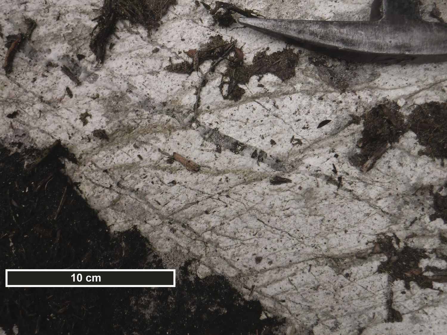
The Carpentier Pluton (nAcrp) consists of pinkish white porphyritic tonalite, massive and intensively fractured in places. It contains enclaves of felsic volcanic rock distributed mainly along its edge and in its eastern half. The work of Pilote et al. (2019) indicates that this tonalite is of calc-alkaline affinity, comparable to the Barraute Pluton, and is synvolcanic.
The Barraute Pluton (nAbrt) consists of porphyritic tonalite of calc-alkaline affinity. Mafic to felsic dykes cut this pluton in a few places. This pluton is interpreted as synvolcanic, based on the presence of a significant regional S1 fabric and the absence of a significant contact metamorphism aureole in host volcanics.
The Mogador Pluton (nAmog) has a composition that ranges from quartz monzonite to granodiorite. This pluton does not outcrop and is covered by more than 30 m of surface deposits. Based on its shape and location, the Mogador Pluton appears to be partially conformable with host volcanics of the Lanaudière Formation. This pluton also contains dioritic, gabbroic and amphibolitic marginal phases. Mafic dykes cutting it have been recognized in drilling (Geoffroy and Koulomzine, 1960). By its composition and calc-alkaline geochemistry, granodiorite is reminiscent of the La Corne Batholith nAlac3 unit. This suggests that the Mogador Pluton is late-tectonic, and this interpretation is also supported by the absence of a penetrative fabric in this unit.
The Barraute area includes the NE portion of the La Corne Batholith (nAlac) in the SW corner (Dawson, 1966; Danis, 1985; Bourne and Danis, 1987; Boily et al., 1989, 1990; Rive et al., 1990; Boily, 1992, 1995; Mulja et al., 1995a and 1995b). This batholith consists of several early intrusive phases, but only the nAlac1 (quartz monzonite, granodiorite and pegmatite) and nAlac3 (hornblende monzonite) phases are found in this area. The nAlac3 facies also form large dykes and elongated intrusions of hornblende monzonite intruding into Lanaudière Formation volcanics in the south-central part of the Barraute area. The La Corne Batholith is part of the Preissac–La Corne Plutonic Suite (nAplc).
Proterozoic Diabase Dykes
Only one dyke outcrop was observed on the western shore of Fiedmont Lake, outside and further south of the mapped area (SE quarter of sheet 32C05). It consists of a N-S to NNE-SSW oriented subophitic gabbro sill. Proterozoic diabase dykes can be traced from their high magnetic signature (Geological Survey of Canada et al., 2009). Those observed in the Barraute area are not assigned to any particular family.
Structural Geology
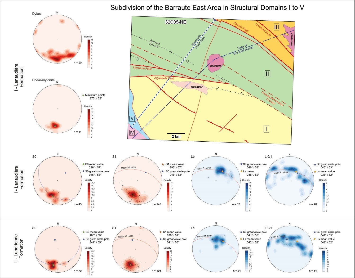
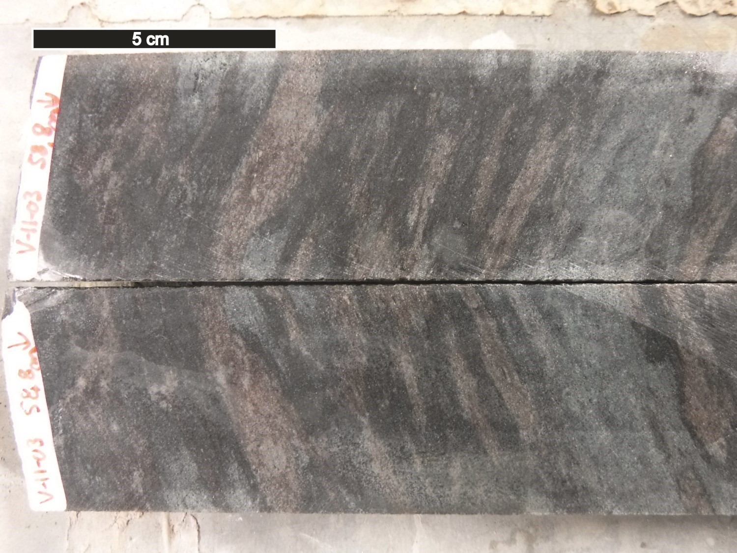
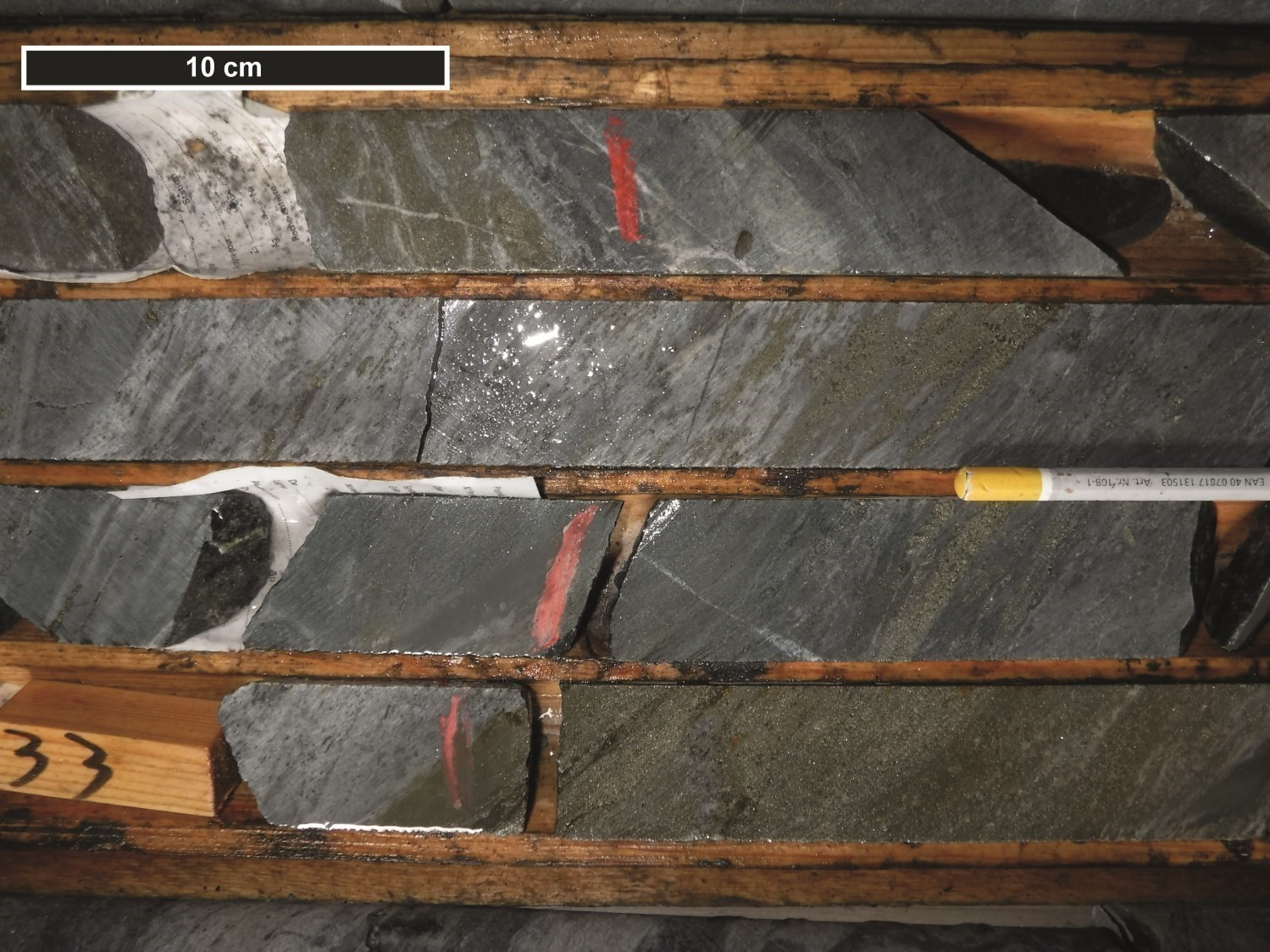
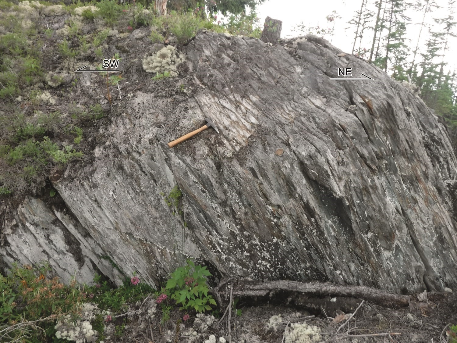
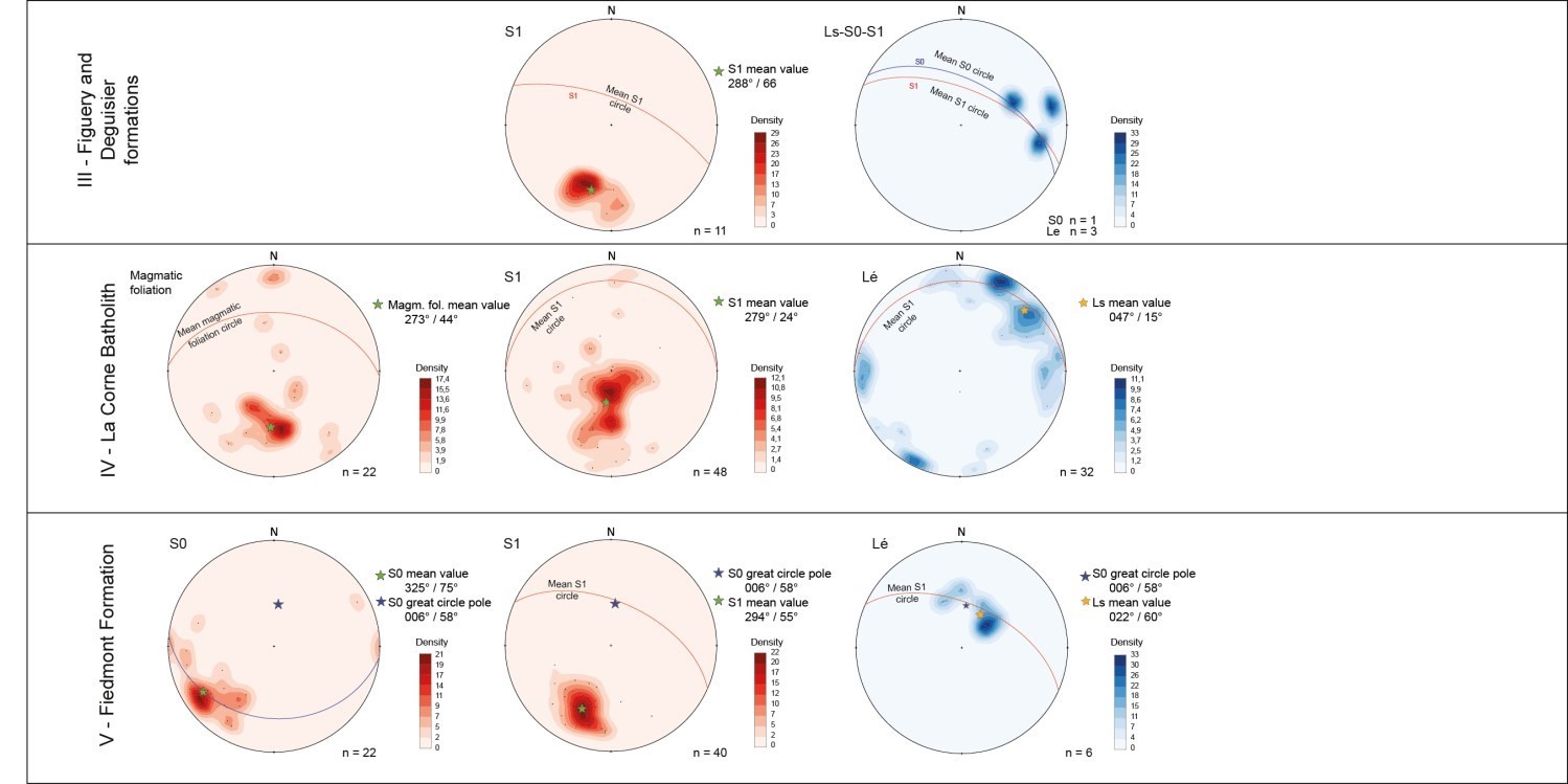 The following nomenclature was applied to the description of major structural elements of the study area. The schistosity hosting stretch lineation has been designated as S1. This regional fabric is the oldest schistosity. The S0 stratification and S1 schistosity are oriented WNW and have a moderate 45 to 60° northward dip. The S0 stratification is almost subparallel to the S1 fabric, except near the hinges of large synclinal and anticlinal P1 folds, which are well-known in the central part of the Landrienne Formation (see the aeromagnetic map, schematic N-S composite section and stereonet equal-area projections below). On the one hand, the intensity of the S1 fabric is further accentuated in the vicinity of major regional faults. On the other hand, the S1 fabric becomes mylonitic at the edge of the La Corne Batholith.
MANNEVILLE THRUST ZONE AND DESTOR-PORCUPINE FAULT ZONE
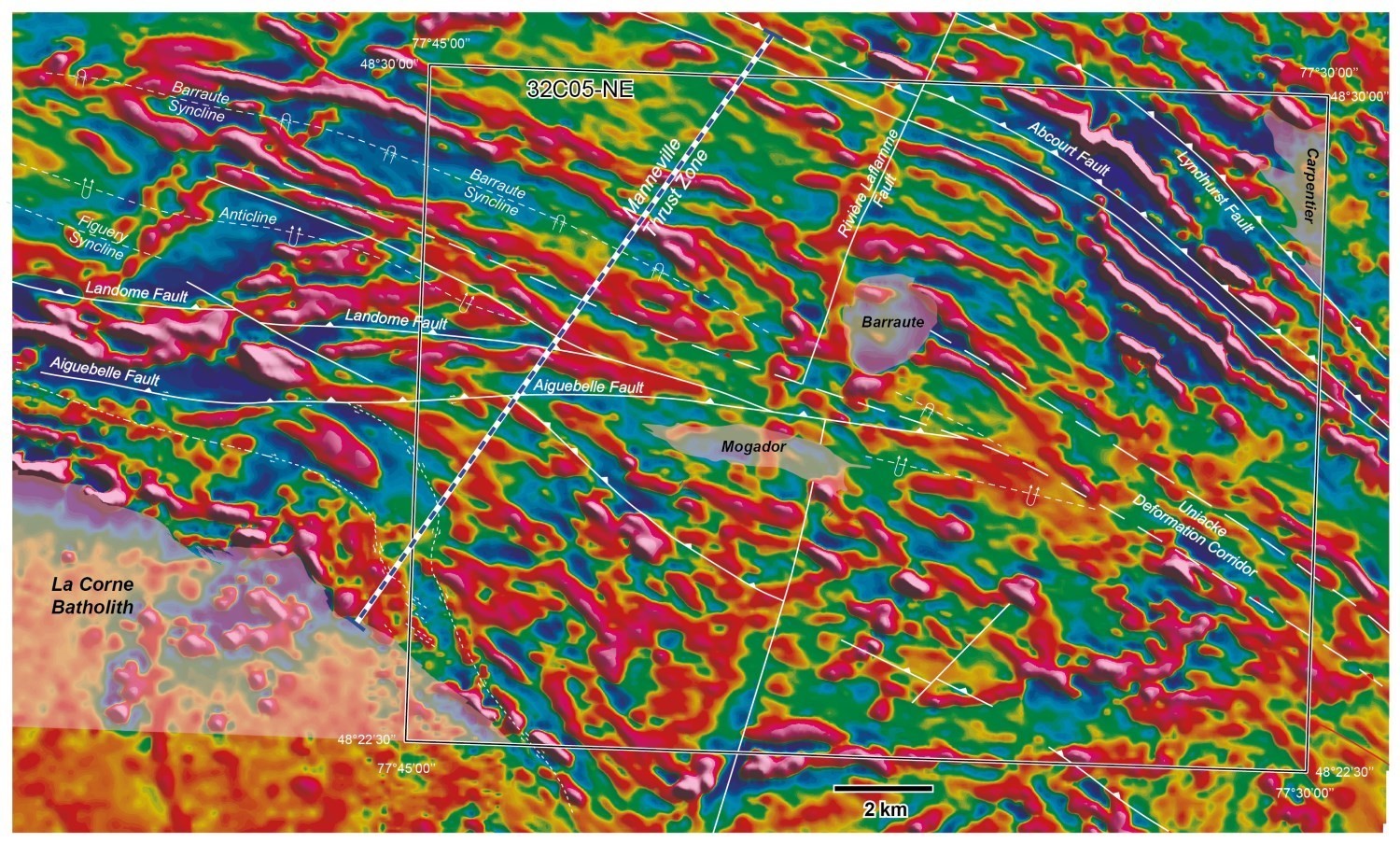 The largest structural component of this region is represented by the Manneville Thrust Zone (MTZ; Daigneault et al., 2002). This thrust affects the entire Kinojévis Group, Landrienne Formation and Fiedmont Formation sedimentary rocks, corresponding to a N-S width of 6 to 8 km (see aeromagnetic map). This regional-scale thrust can be interpreted as a large, folded sequence, materialized in the Barraute area by a series of synclinal (Barraute and Figuery synclines) and anticlinal folds, all of which were overturned southward and cut by faults. Stratification is reversed and polarities commonly face south, which is corroborated by the pillow layout observed in mafic lava.
In the Barraute area, fold axial plane traces were defined by combining our field observations, regional aeromagnetic surveys and the various geological maps available. For the Lanaudière, Landrienne, Figuery, Deguisier and Fiedmont formations (domains I, II, III and V), S0 surface poles are distributed over a great circle whose theoretical fold axis is more or less close to the maximum concentration of Ls stretch lineations. The mean lineation has a moderate plunge (40-50°) towards the NE (see stereograms). Domains I, II, III and V have a similar deformation style. In domains I and II (Lanaudière and Landrienne formations), observations from S0 and S1 planes were used to calculate intersections defining fold axes (L0/L1). These axes are distributed over a great circle corresponding to the mean schistosity of each domain. This distribution indicates that rocks of these domains are affected by shallow to moderate double-dip folds (towards the WNW and ESE), although the maximum concentration of the axes corresponds to the orientation of Ls stretch lineations. The development of double-dip folds is likely consistent with regional deformation in the absence of regional S2 cleavage. All of these features point to an early origin of the MTZ (Daigneault et al., 2002). As observed by Daigneault et al. (2002) and Pilote et al. (2018), these geometric relationships are found along this structure over several tens of kilometres along an E-W orientation.
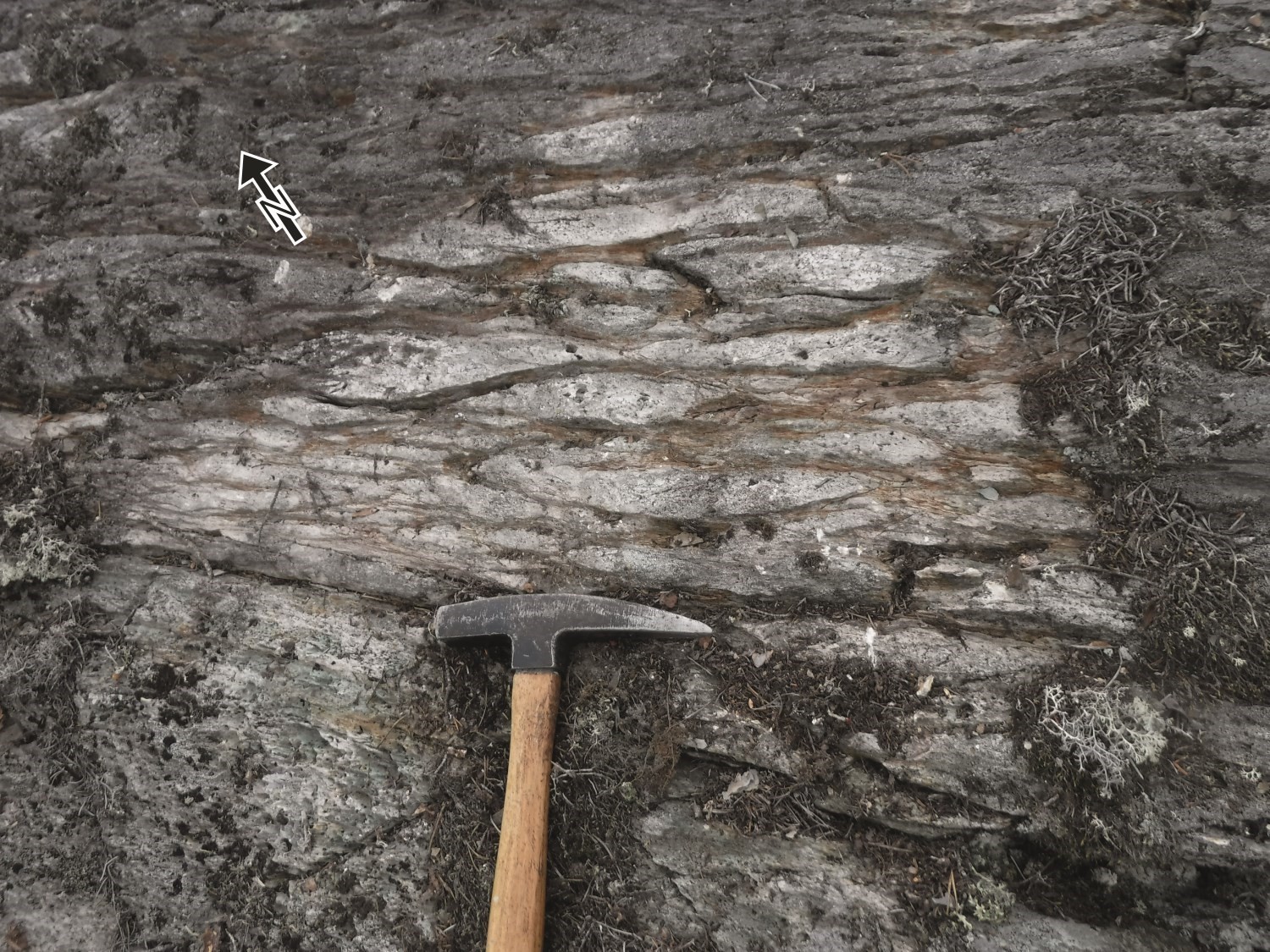 The Destor-Porcupine Fault Zone (DPZ) is a late structure compared to the development of the MTZ. The DPZ includes the following regional faults, from north to south: Lyndhurst, Abcourt, Landome and Aiguebelle faults. The Manneville Fault (observed further west in sheet 32D08 and NW quarter of sheet 32C05) may also be included in the DPZ (Pilote et al., 2018), as well as the Uniacke Deformation Corridor (Moorhead, 1988, 1989), the latter affecting the SE corner of the mapped area. All these E-W to NW-SE oriented structures play major roles as they: 1) affect the continuity of stratigraphic units; 2) form the edge of younger sedimentary units; 3) accommodate successive increments of regional deformation; and 4) materialize potential for specific orogenic gold mineralization, demonstrated for instance by a higher density of dykes and intrusions along or bordering their lines.
In a westerly direction towards the Preissac area, S0, S1 surfaces and E-W faults become subvertical, almost subparallel between them, and are obliterated in the Porcupine-Destor Deformation Zone (Goutier, 1997; Daigneault et al., 2002; Legault et al., 2005). Multiple faults converge or overlay, cutting this large thrust zone into several blocks. In the eastward direction, the Barraute Syncline’s trace and a series of anticlinal and synclinal folds converge towards the Aiguebelle Fault and Uniacke Deformation Corridor.
Structural data of the La Corne Batholith (domain IV) presented here come from sheet 32C05 NW quarter (Pilote et al., 2018) and NE quarter to obtain a sufficient number of measurements. Magmatic foliations are oriented E-W and have a NE dip (maximum concentration 273°/44°). The parallelism between this value and the average measure of the S1 fabric in the Lanaudière and Landrienne formations suggests that unit nAlac1 has been emplaced in a pre-existing structure, namely the Manneville Thrust Zone, which is characterized by its shallow northward dip (Daigneault et al., 2002). E-W oriented S1 foliations were also observed, but dip values vary widely. The attitude of Ls stretch lineations observed in this batholith is similar to that observed in the Lanaudière and Figuery formations.
SINISTRAL NE-SW AND DEXTRAL NW-SE FAULTS
Smaller and later faults, oriented NW and NE, cut large E-W faults described above. Apparent horizontal throws range in magnitude from ~100 m to a maximum of ~500 m. Despite an NNE orientation, the Rivière Laflamme Fault is a good example of these intersecting faults. They have been observed or interpreted during mapping, drilling, or by numerous, different-scale aeromagnetic and electromagnetic surveys in this region.
Metamorphism
The degree of regional metamorphism observed in the Barraute area has changed from the amphibolite facies in the half-south of the map to the upper greenschist facies in the northern half. The typical mineralogical assemblage of massive and pillow mafic volcanics consists of albite-chlorite-carbonate-actinolite (greenschist facies) or light green hornblende-chlorite-epidote-quartz-carbonate (lower amphibolite facies to upper greenschist facies; Beullac, 1983; Imreh, 1984; Daigneault et al., 2002; Pilote et al., 2009, 2017, 2018).
Economic Geology
The Barraute area has prospective zones for five (5) types of mineralization:
- disseminated and replacement gold;
- orogenic gold-bearing veins;
- magmatic Ni-Cu;
- base metal massive sulphides associated with volcanic rocks;
- gold-bearing massive sulphides associated with volcanic rocks.
The table of mineralized zones below presents analytical results for the twenty-one (21) known mineralized sites in the Barraute area.
| Name | Contents |
|---|---|
| Gold mineralization associated with orogenic-type veins | |
| Alta | Historical values (1979): 63.4 g/t Au (G); 30.5 g/t Au (G); 18.1 g/t Au over 1.8 m (R); 3.5 g/t Au over 3.0 m (R). Recent values (2008): 2.05 g/t Au over 0.5 m (R); 15.85 g/t Au over 0.3 m (R) |
| Barmat | 1.33 g/t Au over 1.46 m (R) |
| Chevalier | 11.13 g/t Au (G) |
| D-4 | 1 g/t Au over 1 m (D) |
| Héva-Cadillac | 10.95 g/t Au over 5.5 m (R); 2.13 g/t Au over 5.0 m; 11.05 g/t Au over 0.6 m; 2.05 g/t Au over 1.01 m |
| Lac Vendôme | 10.40 g/t Au over 0.52 m (D); 11.60 g/t Au over 0.30 m (D) |
| Oregon | 3.8 g/t Au over 0.6 m (R); 41.5 g/t Au over 1.0 m (R) (GM 42404); 20.4 g/t Au (G) |
| Ruisseau Blin-Nord | 3.2 g/t Au over 0.79 m (D); 2.3 g/t Au over 1 m (D) |
| Tri-Cor | 36.7 g/t Au over 0.30 m (D); 103.6 g/t Au over 1.83 m (D); 17.0 g/t Au over 0.60 m (D) |
| Vallée (Currie-Mills) | 22.46 g/t Au (G); 2.47% Cu (G) (GM 52154); 45.3 g/t Au over 0.15 m (D) |
| Vénus (Barexor) | Reserves (not compliant with NI 43-101) of 29 700 t at an average grade of 10.12 g/t Au |
| Vénus-Nord | 37.45 g/t Au (G); 4.2 g/t Au over 1.6 m (R) (GM 55636); 23.45 g/t Au over 0.3 m (D) |
| Zone Ouest | 1.06 g/t Au over 1.0 m (R); 2.93 g/t Au (G) |
| Magmatic Ni-Cu mineralization | |
| Vendôme No 2 (Mogador) | Reserves (not compliant with NI 43-101) of 317 518 t at 0.82% Ni and 0.68% Cu |
| Base metal massive sulphide mineralization associated with volcanic rocks | |
| Absam | 14.76 g/t Ag over 5.5 m (D); 17 g/t Ag over 3.6 m (D); 9.4 g/t Ag over 1 m (D); 5.9 g/t Ag over 1.4 m (D); 1.5 g/t Au over 1 m (D); 17.3% Zn over 2.3 m (D); 0.75% Zn over 1.4 m (D) |
| Barvallée | Reserves: 275 923 t at 1.31 g/t Au, 48.06 g/t Ag, 4.38% Zn and 0.87% Cu. Another recent estimate (Canadian Mines Handbook 1998-99) shows potential reserves of 181 000 t at 44.23 g/t Ag, 1.23% Cu and 5.71% Zn |
| Belfort (Roymont) | Reserves: 66 625 t at 1.05 g/t Au, 19.22 g/t Ag, 5.71% Zn and 0.18% Cu |
| Projet Laflamme | 7.5 g/t Ag and 4397 ppm Zn over 0.78 m (D) |
| Ruisseau Blin | 0.86% Zn over 2.2 m (GM 47960) |
| Vendôme No 1 (Mogador) | Reserves: 675 554 t at 1.10 g/t Au, 58.50 g/t Ag, 7.50% Zn and 0.51% Cu; drilling yielded 117.65 ppm Ag over 12 m (D), 12.748 g/t Au over 1.5 m (D), 1.46% Cu over 0.6 m (D) and 29.7% Zn over 0.9 m (D) |
| Canadian Shield | 1.37 g/t Au over 0.91 m (D); 1.20 g/t Au over 1.52 m (D) |
(D): diamond drilling; (G): selected sample; (R): channel–chip sample
The table of lithochemical analyses of metals of economic interest provides the location, description and results of six (6) samples selected for assessing the economic potential of the region.
Prospective Zones for Volcanogenic Massive Sulphide Mineralization Distributed in Three Areas, Namely the Lanaudière, Landrienne and Deguisier Formations
In the north-central part of the Barraute area, the Blin prospective zone includes andesitic and dacitic units of the Landrienne Formation. This zone contains the volcanogenic massive sulphide (VMS)-type Ruisseau Blin zinc mineralized zone which consists of sphalerite veinlets hosted in NNW-oriented shear zones. Regional deformation is intense along the northern edge of this prospective zone.
In the NE portion of the mapped area, the Blin-Nord prospective zone consists of volcanics belonging to the Deguisier Formation. This formation continues to the NW in sheet 32C06-200-0102 and is the host unit of the Barvue (Abcourt) deposit, a VMS-type zinc-silver mineralization. This deposit is hosted in dacitic rocks in southern contact with a regional differentiated ultramafic-mafic intrusion. Mapping and compilation of recent work has revealed these volcanic and intrusive units’ extension in the Barraute area. The intensity of regional deformation is significant, with the presence of the Abcourt and Lyndhurst faults in the area. The outcrop density is very low, however, with quaternary cover >30 m. The Ruisseau Blin-Nord and Barmat gold mineralized zones are also located in this prospective zone, associated with intense deformation, and demonstrate the potential for orogenic-type lode gold mineralization.
In the south-central part of the Barraute area, the Mogador prospective zone consists of felsic to intermediate volcanic rocks of the Lanaudière Formation (unit nAln12). Deformation in this area is intense. This zone contains the Vendôme No. 1 (Mogador), Barvallée, Belfort, Absam and Projet Laflamme sites. Mineralization consists of lenticular clusters of massive to semi-massive sulphides, usually subconformable and discontinuous, containing mainly pyrite, sphalerite, chalcopyrite and galena. There are also economic contents of gold and silver. The lateral extension of zones can reach >300 m (Vendôme No. 1 site). Mineralized clusters are oriented 300° and have a steep northward dip. These mineralized sites are all located on the south side of a large, kilometre-wide intrusion of monzonite and granodiorite (Mogador Pluton). To varying degrees, these zones were affected by significant contact metamorphism (upper greenschist to amphibolite facies) that can be seen up to 500 m south of the pluton. Stretch lineations observed in this area plunge to the NE (see Domain I stereograms) and have possibly affected the geometry of mineralized bodies.
Prospective Zone for Ni-Cu and Potentially PGE Magmatic Mineralization Associated With Ultramafic Intrusions of the Mont-Vidéo Intrusive Suite
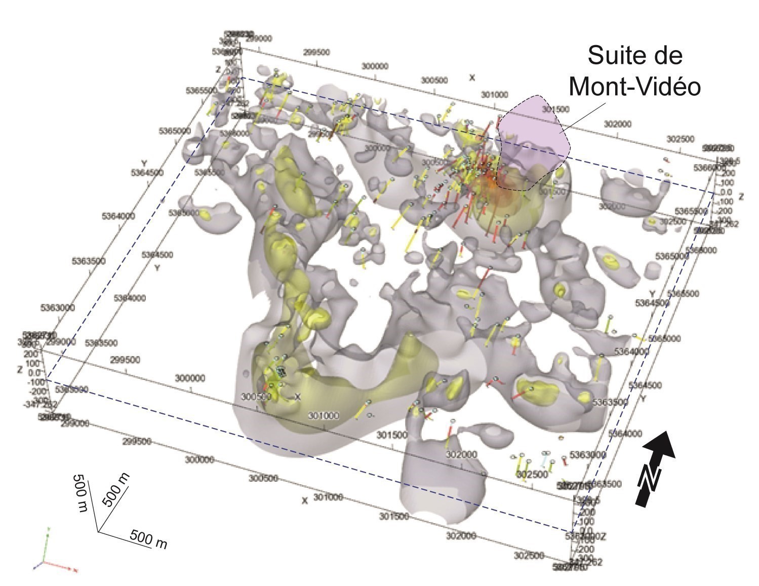
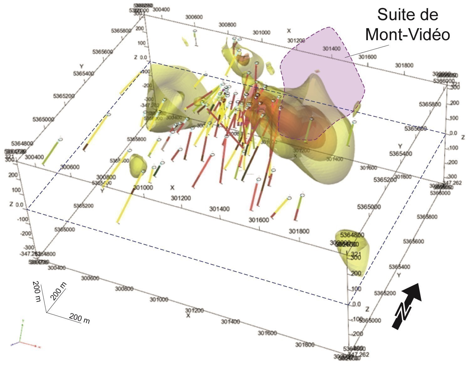
The Mont-Vidéo Intrusive Suite (nAvid) is a differentiated ultramafic intrusion located in the SW portion of the Barraute area. It hosts the Vendôme No. 2 (Mogador) nickel mineralization and corresponds to the Vidéo prospective zone. The mineralized zone, located in the SE portion of the Mont-Vidéo Intrusive Suite ultramafic intrusion, consists of massive and semi-massive sulphide veinlets and clusters composed of pyrrhotite, chalcopyrite and pentlandite. Mapping and compilation (Geoffroy, 1961; Jones, 1964; Farquharson, 1963; Munger, 1988; Théberge, 2014) and aeromagnetic (Dubé, 2016) works in the area have identified pyroxenitic to dioritic/gabbroic intrusions (I4-I3) that may be associated with this magmatic unit. Note that historical work describing this mineralization does not mention analysis of platinum group elements (PGE), which means that the potential for these metals has not been fully assessed.
Two Prospective Zones for Gold Mineralization Hosted in Shear Zones (Gold-Bearing Orogenic-Type Veins): 1) the Extension of the Manneville Thrust Zone, the Aiguebelle, Abcourt and Lyndhurst Faults, and the Uniacke Deformation Corridor; and 2) the Carpentier Pluton Area (NE Corner of the Map) in the Figuery Group
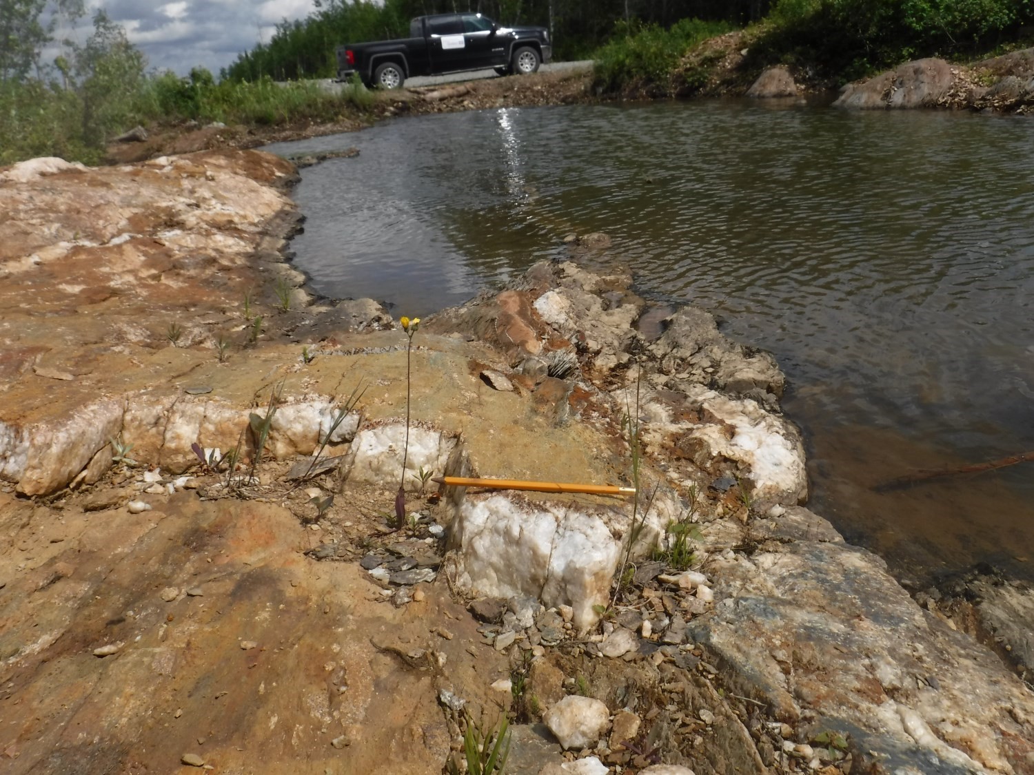
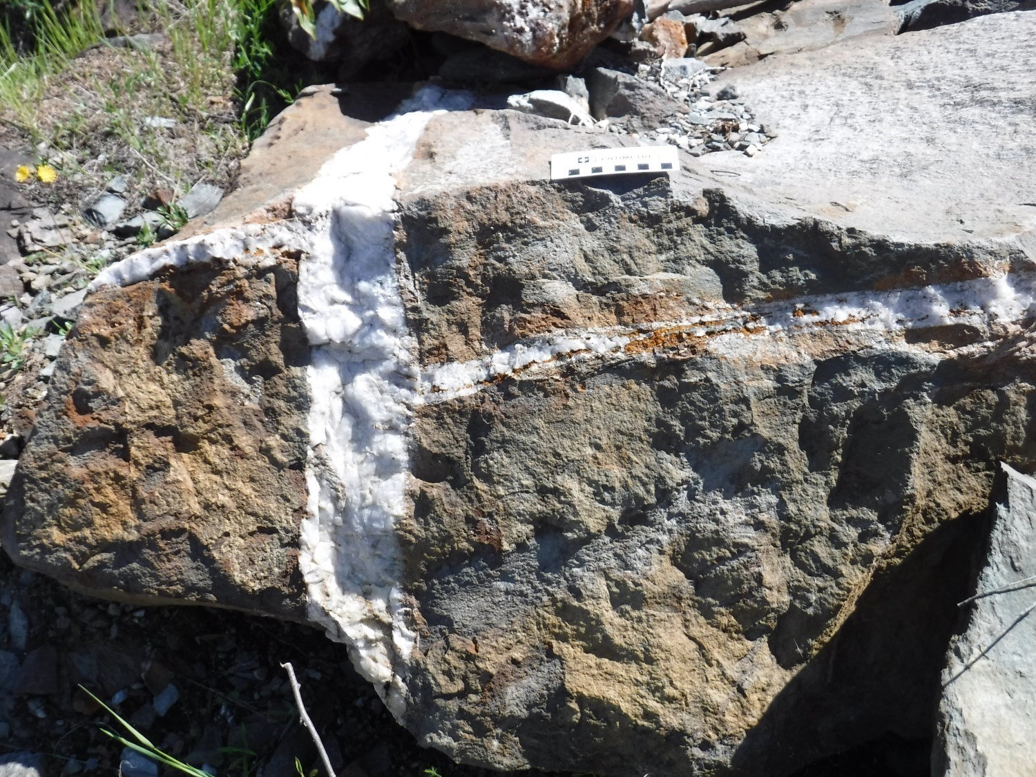
1) The extension of the Manneville Thrust Zone, the Aiguebelle, Abcourt and Lyndhurst faults along with the Uniacke Deformation Corridor constitute the MDP prospective zone. These faults cut or border rocks of the Landrienne Formation. This prospective zone contains several sites (Alta, Vénus Nord, Vénus [Barexor], Lac Vendôme and Héva-Cadillac) known for their gold-bearing quartz-tourmaline-pyrite orogenic-type veins. These veins are commonly oriented NW-SE and have a moderate dip towards the NE (shear veins), or are subhorizontal (stress veins) and have a shallow dip towards the SW. Walls are regularly mineralized in pyrite and highly altered to ankerite.
2) The Carpentier Pluton area (NE corner of the map), in the Figuery Group, makes the Carpentier prospective zone. This prospective zone contains gold mineralization associated with quartz veins hosted in shear zones cutting the Carpentier Pluton and the narrow strip of host volcanic rocks. Veins and mineralized zones are commonly oriented NW-SE and N-S and have moderate to steep dips towards the NE. Site D-4 is located in this zone. Many gold mineralized zones (e.g., Jolin – Zone Principale, 1694 and Savane) located in the adjacent sheet 32C06-200-0201 are hosted in the SE extension of this prospective zone.
Extension of a Sedimentary Basin Showing Orogenic-Type Gold Potential NE of the La Corne Batholith
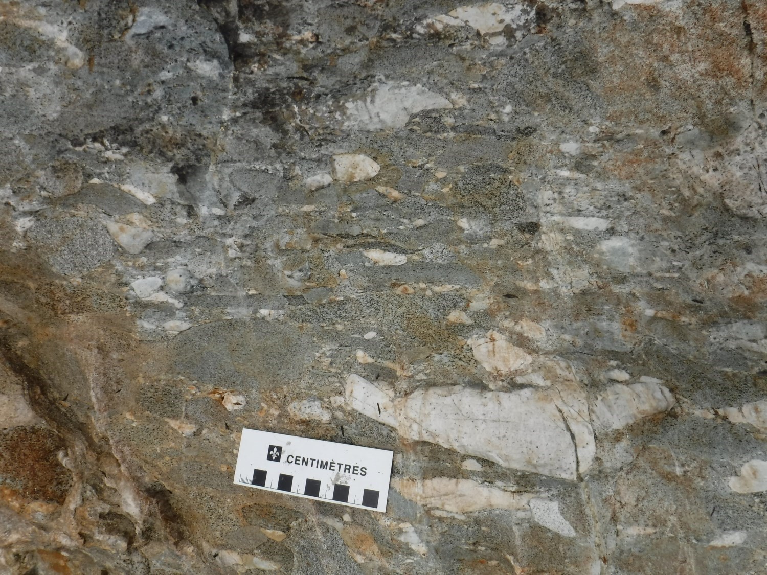
The Fiedmont 1 prospective zone, initially identified west of the study area in the NW quarter of sheet 32C05 (Pilote et al., 2018), continues eastward in the NE quarter of sheet 32C05. It is a sandstone, pebble sandstone and polymictic conglomerate unit of the Fiedmont Formation (nAfd3). Conglomerates commonly contain pebbles of mafic or felsic volcanic rocks and granitoids. These lithologies show typical structures of Timiskaming-age river environments (Pyke, 1982; Corfu et al., 1991; Mueller et al., 1994; Ayer et al., 2002). This sedimentary basin, similar to other Timiskaming-type basins observed elsewhere in Abitibi (Rocheleau, 1980; Goutier, 1997; Legault et al., 2005; Bleeker, 2012), is prospective for orogenic-type gold mineralization due to the presence of: 1) polymictic conglomerates; (2) significant faults in contact with the basin; and (3) numerous felsic dykes cutting these sedimentary units.
Another Zone of Interest
A few kilometres farther west of the mapped sheet, namely sheet 32C05-NW, the northern contact of the La Corne Batholith contains molybdenum and lithium mineralized zones (including the North American Lithium Mine, located on the historical site of the Lithium Amérique du Nord mineralized zone). Although there is no direct indication of spodumene pegmatite in the area mapped in the summer of 2018, the two La Corne Batholith units (nAlac1 and nAlac3) located in the SE corner of the map have the potential to contain such mineralization hosted in pegmatite (La Corne 1 prospective zone). It should be noted, however, that this area is particularly poor in outcrops.
Discussions and Conclusion
The revision of cartographic and geophysical data, combined with drilling observations, clarified the architecture of the area east of Barraute and highlighted the following points on geological units:
• the Deguisier and Lanaudière formations are similar in age to the lower Kidd-Munro Assemblage observed on the Ontario side, host of the Kidd Creek VMS deposit;
• the kilometric size of the Manneville Thrust Zone, a wide strip of volcano-sedimentary rocks affected by multiple synclines and anticlines (overfolded southward);
• the more or less severe obliteration and truncation of synclines and anticlines developed in the Manneville Thrust Zone by fractures associated with the Porcupine-Destor Fault Zone, accompanied by the development of a syntectonic to late-tectonic sedimentary basin (Fiedmont Formation). The Porcupine-Destor Fault Zone includes regional structures such as the Aiguebelle, Landome, Manneville and Lyndhurst faults, and the Uniacke Deformation Corridor. Some segments of these structures contain specific alkaline intrusive suites that are associated with a major orogenic-type gold event.
| Authors |
Pierre Pilote, Eng., M.A.Sc. pierre.pilote@mern.gouv.qc.ca Jonathan Marleau, GIT Jean David, P.Geo., Ph.D. |
| Geochemistry | Fabien Solgadi, P.Geo., Ph.D. |
| Geophysics | Rachid Intissar, P.Geo., M.Sc. |
| Potential assessment | Hanafi Hammouche, P.Geo., M.Sc. |
| Logistics | Clotilde Duvergier, GIT, B.Sc. |
| Geomatics |
Kathleen O’Brien Julie Sauvageau |
| Template and content compliance | François Leclerc, P.Geo., Ph.D. |
| Coaching/mentoring and critical review |
Patrice Roy, P.Geo., M.Sc. François Leclerc, P.Geo., Ph.D. |
| English version | Céline Dupuis, P.Geo., Ph.D. |
| Organization | General direction of Géologie Québec, Ministère de l’Énergie et des Ressources naturelles, Government of Québec |
Acknowledgements:
This Geological Bulletin was made possible through the cooperation of many people who actively took part in the various stages of the project. We would like to thank students Laurence Guyot-Messier, Pauline Nazareth, Carl-Philippe Folkesson and Ève Cloutier. James Moorhead (MERN) and Réal Daigneault (UQAC) are also thanked for their thorough reading of this document and the many comments made. The staff of the Abcourt Society (Mr. Renaud Hinse and Mr. Eugène Gauthier) were very helpful in compiling the Vendôme No. 1 (Mogador), Absam and Barvallée deposits area.
References
Publications available through Sigéom Examine
Other publications
PILOTE, P., MARLEAU, J., DAVID, J., 2019. Geology of the Barraute Area, Abitibi Subprovince, Abitibi-Témiscamingue Region, Quebec, Canada. MRNF; BG 2019-06, 2 plans.


