

Last modified: 14 June 2019
Translation of original French
| Author(s): | Dimroth et al., 1973 |
| Age: | Neoarchean |
| Stratotype: | None |
| Type area: | Various volcanic units belonging to this formation can be found on NTS sheets 32D07, 32D08, 32D09, 32D10, 32D11, 32C05 and 32C12 north of the Porcupine-Destor Fault Zone. However, the most representative outcrops are found on forest roads of sheets 32D07, 32D08 and 32D10 (Aiguebelle National Park). |
| Geological province: | Superior Province |
| Geological subdivision: | Abitibi Subprovince |
| Lithology: | Volcanic and volcano-sedimentary rocks |
| Category: | Lithostratigraphic |
| Rank: | Formation |
| Status: | Formal |
| Use: | Active |
- Kinojévis Group
-
- Lanaudière Formation
- Deguisier Formation
Background
The Deguisier Formation is part of the Kinojévis Group. This group was originally defined by Dimroth et al. (1973) who subdivided it into three formations: the Hunter Mine, Ruisseau Deguisier and Ruisseau Paré formations. More recently, Goutier (1997) redefined the Kinojévis Group to include the Deguisier Formation (nAdg) at the base and the Lanaudière Formation (nAln) at the top, according to its work in the Destor region (sheet 32D07-200-0201). The Deguisier Formation continue eastward in the La Motte Lake (sheet 32D08), La Corne (sheet 32C05) and Senneterre (sheet 32C06) area. The Deguisier Formation is the main unit of the Kinojévis Group and is one of the most important units in sheet 32D10. It occupies the central part of Aiguebelle National Park (Goutier and Melançon, 2003).
Description
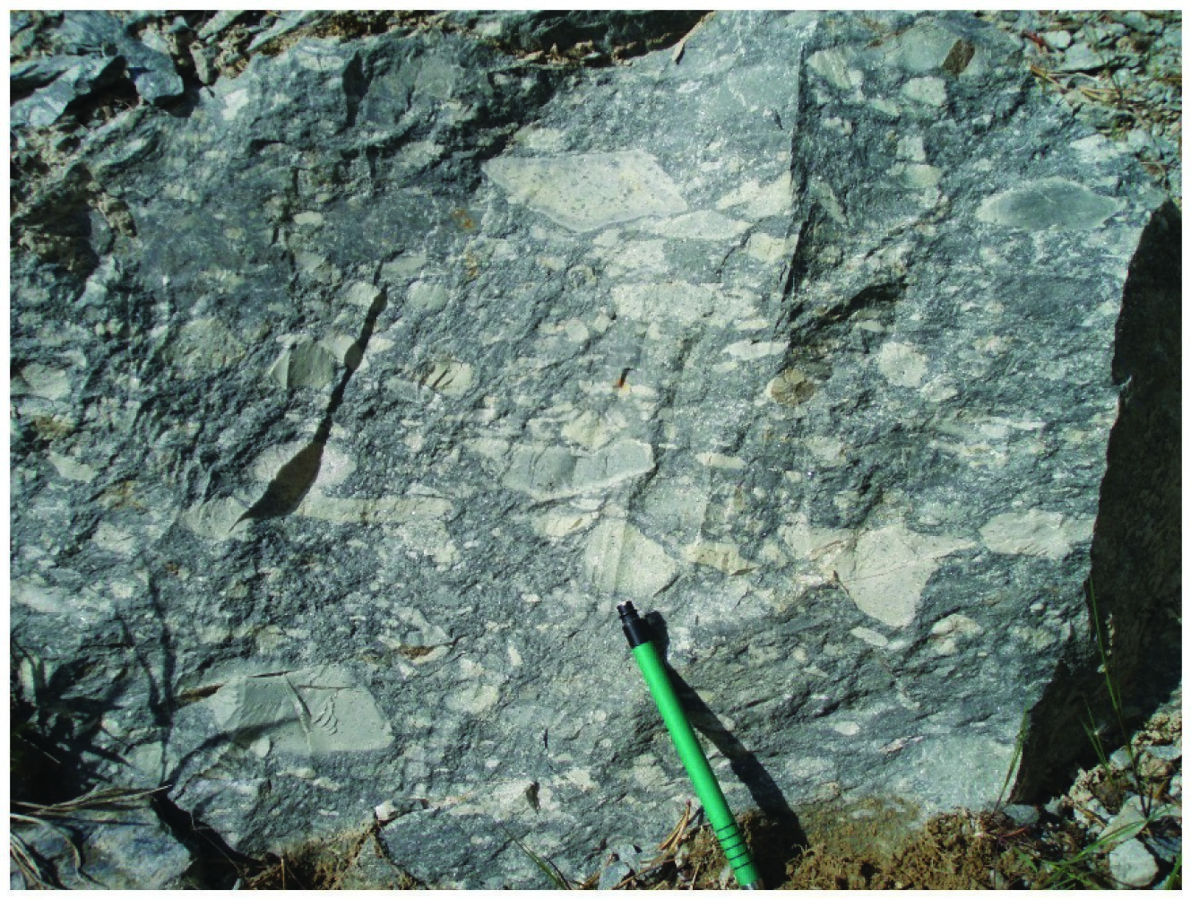
The Deguisier Formation consists of Fe-high and Mg-high massive and pillow tholeiitic basalts (nAdg1), thin chert horizons between flows (nAdg6 and nAdg7), lobed tholeiitic rhyolites and mafic to felsic volcaniclastics. Some of these felsic flows and volcaniclstics associated with unit nAdg3 were dated 2719.4 ±1 Ma and 2718.1 ±1.3 Ma (McNicoll, in Pilote et al., 2009). The abundance of gabbroic sills (nAdg5) is the most distinctive character of this formation, coupled with the absence of ultramafic flows and sills. Gabbro is more abundant in the upper (southern) part of the formation. This formation is also characterized by two marker horizons of glomerophyric basalt (nAdg2) in the Duparquet, Destor and Aiguebelle townships (sheet 32D10, Buffam, 1927; Bannerman, 1940; Graham, 1954; Hocq, 1979; Sanschagrin and Leduc, 1979; Goutier and Lacroix, 1992). These horizons make it possible to trace the Abijévis Synclinal’s hinge in the SE quarter of Aiguebelle Township (Sanschagrin and Leduc, 1979). Volcanic facies and petrography of lava were described in detail in the works of Sanschagrin and Leduc (1979), Leduc (1981) and Sanschagrin (1981).
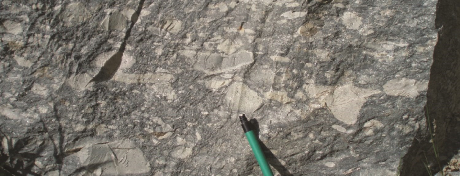
Deguisier Formation 1 (nAdg1): Basalt, Andesitic Basalt and Mafic Volcaniclastics
This unit is composed of tholeiitic basaltic flows that have all conventional morphofacies: massive, pillowed and brecciated. The thickness of massive flows is commonly between 5 and 10 m. The three morphofacies combined can reach a total thickness of 8 to 15 m (Dimroth et al., 1973; Sanschagrin and Leduc, 1979; Leduc, 1981; Sanschagrin, 1981). This unit is exceptionally well developed in Aiguebelle National Park (sheets 32D11 and 32D10; see Goutier and Melançon, 2003). The intensity of regional deformation there is very low and the basalt flow architecture is well documented (Dimroth et al., 1973; Sanschagrin and Leduc, 1979; Leduc, 1981; Sanschagrin, 1981). This unit continues in sheets 32D11, 32D10, 32D09, 32D08 and 32D07; to the east, it extends to sheets 32C05 and 32C12.
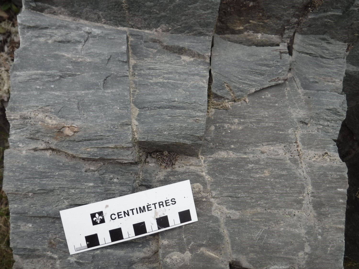
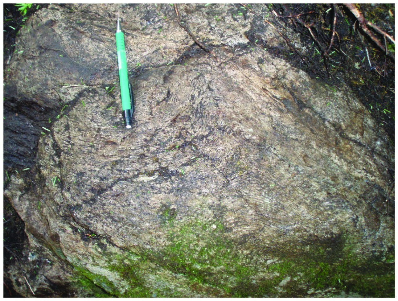
Deguisier Formation 2 (nAdg2): Basalt and Glomerophyric Volcaniclastics
Tholeiitic glomerophyric basalt is a special variety of massive to locally pillow basalt. It forms excellent marker horizons, extending from 500 m to 3 km with an average thickness rarely exceeding 100 m (Hocq, 1979). It is characterized by the presence of centimetric whitish clusters of feldspar crystals. This unit is particularly well displayed in Aiguebelle National Park (sheets 32D11 and 32D10; see Goutier and Melançon, 2003).
Deguisier Formation 3 (nAdg3): Felsic Volcanics and Volcaniclastics
This unit forms a large number of small felsic centres scattered throughout the Deguisier Formation (Dimroth et al., 1973; Hocq, 1979; Sanschagrin and Leduc, 1979; Leduc, 1981; Sanschagrin, 1981; Goutier, 1997; Pilote et al., 2009). These centres are 1 to 2 km long and do not exceed 500 m wide. The largest one intrudes at the junction of sheets 32D08, 32C05 and 32C12 (Pilote et al., 2009). The unit consists of massive to brecciated rhyolitic to dacitic flows, which belong to generally tholeiitic suites (Pilote et al., 2009). In addition, rhyolitic shell breccias are common at the eastern end of sheet 32D08.
Deguisier Formation 4 (nAdg4): Andesite and Intermediate to Mafic Volcaniclastics
This unit is located mainly in the southern and eastern parts of the Deguisier Formation (Dimroth et al., 1973; Hocq, 1979; Sanschagrin and Leduc, 1979; Leduc, 1981; Sanschagrin, 1981; Goutier, 1997; Pilote et al., 2009). It consists of massive to pillowed andesitic flows of thloeiitic affinity, the average thickness of which generally ranges from 7 to 10 m. The summital part of these flows is commonly brecciated along thicknesses ranging from 1 to 10 m. It should be noted that basaltic flows are uncommon in this unit.
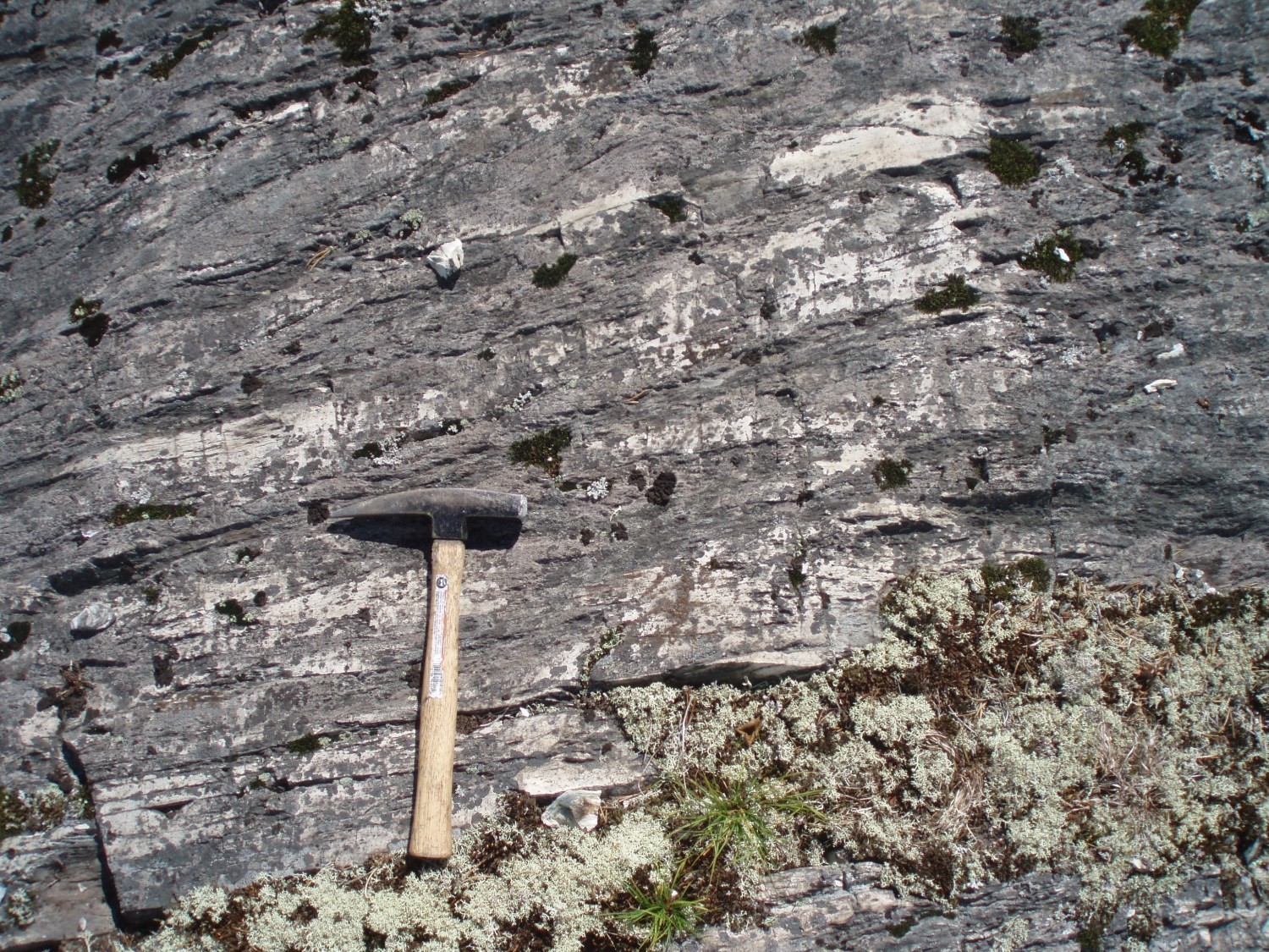
Deguisier Formation 5 (nAdg5): Gabbroic Sill, Magnetite Basalt and Mafic Volcaniclastics
Over 90% of unit nAdg5 is represented by bulky gabbro sills. These sills can reach lengths exceeding 5 km and thicknesses ranging from 800 to 1200 m (Dimroth et al., 1973; Hocq, 1979; Sanschagrin and Leduc, 1979; Leduc, 1981; Sanschagrin, 1981; Goutier, 1997; Pilote et al., 2009). Units nAdg1 and nAdg5 alone represent the majority of the lithologies encountered in the Aiguebelle National Park (sheets 32D11 and 32D10; see Goutier and Melançon, 2003). Gabbros of unit Adg5 likely represent feeder pipes of many basaltic flows (Dimroth et al., 1973; Hocq, 1979; Sanschagrin and Leduc, 1979). They are similar in composition, but are distinguished by coarser grain size. Magnetite basaltic flows and mafic volcaniclastics are marginal parts of the Deguisier Formation.
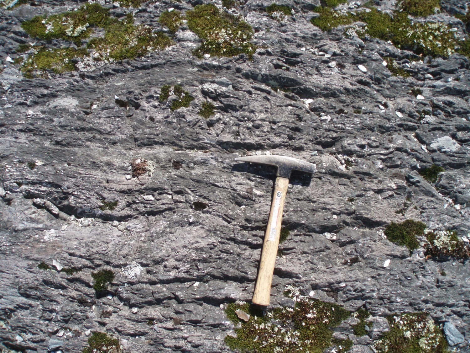
Deguisier Formation 6 (nAdg6): Felsic to Intermediate Volcaniclastics, Medium to Coarse-Grained Matrix
Unit nAdg6 is present only in the central part of the Deguisier Formation in Aiguebelle National Park (sheets 32D11 and 32D10; see Hocq, 1979; Goutier and Melançon, 2003). It consists of thin volcaniclastic horizons that vary in composition from felsic to intermediate. These horizons are discontinuous and moderately long (500-3000 m) with thickness ranging from 100 to 500 m (Hocq, 1979; Sanschagrin and Leduc, 1979).
Deguisier Formation 7 (nAdg7): Felsic to Intermediate Volcaniclastics, Fine-Grained Matrix
Unit nAdg7 is very small and occurs in the central-eastern part of the Deguisier Formation (sheets 32D07 and 32D10). It forms relatively continuous marker horizons up to 3 km long and approximately 100 to 300 m wide. This unit consists of felsic to locally intermediate volcaniclastics with a fine-grained matrix (Hocq, 1979; Sanschagrin and Leduc, 1979).
Deguisier Formation 8 (nAdg8): Semi-Massive Sulphides, Exhalite, Volcaniclastics
Unit nAdg8 is located in the eastern part of the Deguisier Formation (sheet 32D08) and consists of mineralized zone observed at the Newcomex (Figuery Zone) showing. Mineralized horizons were defined by drilling. These are metric horizons rich in semi-massive sulphides (mainly zinc), exhalites and highly silicified volcaniclastics. The lateral extension of these units, according to the numerous drills carried out, does not exceed 500 m.
Deguisier Formation 9 (nAdg9): Pyrrhotite-Pyrite Graphitic Claystone, Siltstone and Cherty Tuff
Unit nAdg9 was encountered in several drills located in the NE corner of sheet 32C05 and NW corner of sheet 32C06. It corresponds to important electromagnetic conductors (“INPUT” type anomalies) noted on geophysical surveys (GSC et al., 2009). This unit consists of graphitic mudstone, siltstone and cherty tuff for a total thickness of 2 to 30 m and a lateral extension of up to several kilometres. Sulphides (pyrrhotite and pyrite) are very common and vary in content (trace-5%). This unit is deformed and generally run by large longitudinal faults, giving it both a stratigraphic and structural marker (allowing position of some large faults to be clarified).
Thickness and Distribution
The Deguisier Formation is a package of generally E-W-oriented volcanic and intrusive lithologies with stratigraphic thicknesses ranging from 1 km to nearly 5 km, and affected by the Abijévis Synclinal (Dimroth et al., 1973; Hocq, 1979; Sanschagrin and Leduc, 1979; Leduc, 1981; Sanschagrin, 1981; Goutier, 1997). Various volcanic units belonging to this formation can be found in sheets 32D07, 32D08, 32D09, 32D10, 32D11, 32C05 and 32C12, north of the Porcupine-Destor Fault Zone.
Dating
Felsic flows and volcaniclastics (nAdg3) were dated 2719.4 ±1 Ma and 2718.1 ±1.3 Ma (McNicoll in Pilote et al., 2009; sheet 32D08). These ages indicate that the Deguisier Formation was emplaced in a relatively short period of time of ~2 Ma.
| Isotopic System | Mineral | Crystallization Age (Ma) | (+) | (-) | Reference(s) |
| U-Pb | Zircon | 2719.4 | 1 | 1 | McNicoll, in Pilote et al., 2009 |
| U-Pb | Zircon | 2718 | 1.3 | 1.3 | McNicoll, in Pilote et al., 2009 |
Stratigraphic Relationship(s)
This formation marks the base of the Kinojévis Group. The Deguisier and Lanaudière formations are in fault contact (Aiguebelle Fault) throughout sheets 32C05 to 32D11 over more than 70 km. To the east of the intersection of the Abijévis Synclinal axial plane with the Aiguebelle Fault, volcanics of these two formations show opposite polarities.
Paleontology
Does not apply.