
Geology of the Borgia Lake Region, Grenville Province, North of La Tuque, Mauricie and Saguenay – Lac-Saint-Jean Regions, Quebec, Canada
Project for sheets 31P09, 31P10, 31P15 and 31P16
Abdelali Moukhsil and Gabriel Côté
BG 2018-01
Translated on 20 November 2018


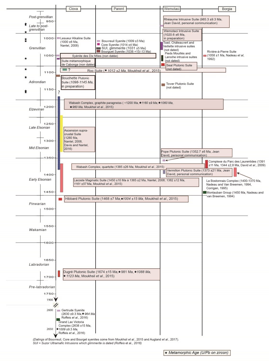
A new geological map of the Borgia Lake region (western Grenville Province) was produced at a 1:50,000 scale following a survey conducted in summer 2017. Identified lithologies are composed of metasedimentary and volcanic rocks cut by mafic to felsic intrusions. The ages of these rocks range from Pinwarian to Grenvillian (1.52-0.99 Ga).
The region displays volcano-sedimentary rocks of the Montauban Group (1450 Ma), recognized north of Trois-Rivières, which host Zn-Pb-Ag-Au mineralization mined at the Montauban and Tétrault mines. This supracrustal unit is cut by intrusive rocks of the La Bostonnais (1380 Ma) and Laurentian Park (1390-1345 Ma) complexes, and the Vermillon and Pope plutonic charnockitic suites. Grenvillian intrusions of the Rivière-à-Pierre Suite (1058 Ma) represent a large volume of intermediate to felsic rocks in the eastern part of the region. Mafic to ultramafic rocks also occur as dykes or major intrusions such as the Langelier Anorthosite, Étoile Suite and Édouard Gabbronorite, which is the host unit of the Lac-Édouard Mine Ni-Cu mineralization (historical resources of 34,259 t at 1.55% Ni and 0.5% Cu). In addition to known showings, several new prospective zones for exploration have been discovered in the region (rare earths, iron oxides, titanium, P-V, Cu-Ni, industrial minerals).
Methodology
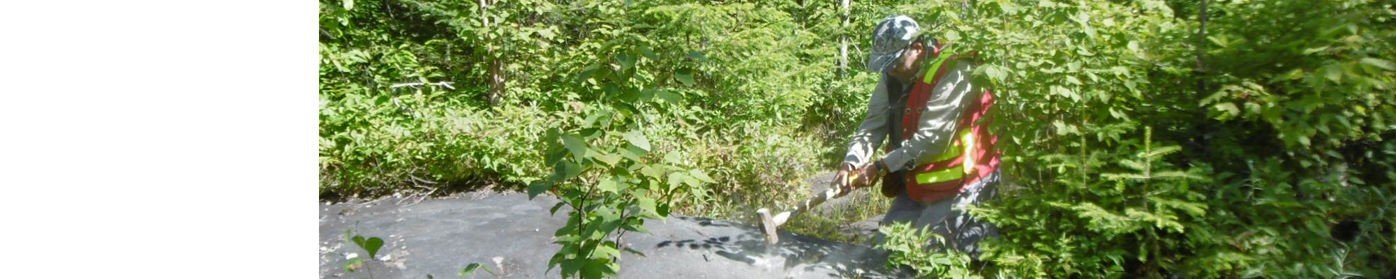
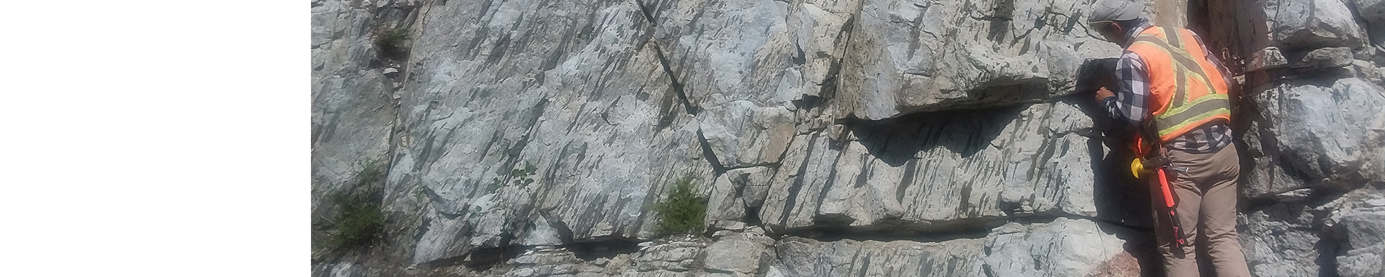
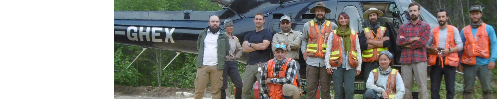
The area was mapped using the established method for surveys in forest areas served by a network of secondary roads. Geological mapping was conducted by a team of one geologist, five geologists-in-training and five students between June 2 and August 18, 2017.
Mapping of the study area produced and updated the information presented in the table below:
| Elements | Number |
|---|---|
| Described outcrops (“geofiches”) | 1270 |
| Total lithogeochemical analyses | 296 |
| Lithogeochemical analyses of metals of economic interest | 47 |
| Geochronological analyses | 5 |
| Covered thin sections | 178 |
| Polished thin sections | 125 |
| Sodium cobaltinitrite stains | 99 |
| Blue methylene stains | 2 |
| Micro-fluorescence X-ray analysis (M4 Tornado, U-Laval) | 63 |
| CAMECA SX-100 electronic microprobe analysis (U-Laval) | 3 |
| Stratigraphic units | 12 |
| Mineralization records | 10 |
Previous Work
The table below provides a list of previous work consulted in reparation of this report. A more comprehensive list can be found in the EXAMINE literature database.
| Author(s) | Type of Work | Contribution |
|---|---|---|
| Wilson, 1910 | Geological reconnaissance | Geological reconnaissance along the railway |
| Retty, 1934 | Geological reconnaissance | Geological reconnaissance |
| Osborne, 1935 | 1:250,000 mapping | Regional mapping |
| Newham, 1964 | 1:31,680 mapping | Regional mapping |
| Wynne-Edwards, 1966 | 1:250,000 mapping | Regional mapping |
| Laurin and Sharma, 1975 | 1:250,000 mapping | Regional mapping |
| Rondot, 1978 | Mapping | Regional mapping |
| Baer, 1976 | Paper | Study of the Langelier Anrthosite |
| Bissonnette, 1978 | M.Sc. thesis | Petrology and structure of the Langelier Anrthosite |
| Dion et al., 1981 | Mappinf ang drilling | Definition of the Chasseur mica deposit |
| Perreault, 1992 | 1:50,000 mapping | Mapping of NTS sheet 31P16 |
| Hébert and Nadeau, 1995 | 1:50,000 mapping | Mapping of NTS sheet 31P01 |
| Nadeau et al., 1997 | 1:50,000 mapping | Mapping of NTS sheet 31P09 |
| Ph.D. thesis | Mineralization study and dating of the Lac Édouard Mine |
Lithostratigraphy
The mapped area is located in the Grenville Province, specifically in the western part of the Allochton belt (Rivers et al., 1989, 2012). This province, the youngest geological province in the Canadian Shield, has developed along the eastern margin of the Laurentia continent, the continental core of North America. The Grenville represents the deep root of an ancient mountain range comparable to the present Himalayas (Dewey and Burke, 1973).
The region consists of volcano-sedimentary rocks intruded by plutonic suites metamorphosed to the amphibolite and granulite facies with ages between 1.4 and 1.09 Ga. This episode is contemporaneous with the formation of a sedimentary basin composed mainly of generally migmatitic Elzevirian (1230-1180 Ma; Elzevirian according to Moore and Thompson, 1980) metasediments. Grenvillian to Postgrenvillian gabbroic and syenitic intrusions then intrude this package between 1.09 and 0.99 Ga. All of these rocks are cut by granitic pegmatite dykes.
Geological Cross-Section
The structural cross-section below shows the relationships between units, faults and shear zones. It is accompanied by a diagram illustrating the chronological relationships between the different units.

| Rhéaume Intrusive Suite (1019 ±2 Ma, David, 2017) | |
|
|
Syenite, quartz ± hypersthene syenite, Fe-Ti-P-oxide gabbronorite, minor amounts of hypersthene syenite, foid monzonite, syenogranite, monzogranite and mangerite |
| Rivière-à-Pierre Suite (1058 ±1 Ma, Nadeau et al., 1992) | |
|
|
Porphyraceous granite and monzonite, leucocratic; monzodiorite; minor amounts of granodiorite, mangerite and syenite |
| Catherine Granite | |
|
|
Syenogranite, granite, quartz monzonite, mangerite, quartz monzodiorite, locally porphyritic, granitic pegmatite dykes |
| Roc Suite (>1012 ±1 Ma, Moukhsil et al., 2015) | |
|
|
Fe-Ti-P-oxide-sulphide gabbronorite, minor amounts of gabbro and leuconorite |
|
|
Foliated gabbronorite and gabbro, minor amounts of Fe-Ti-P-oxide mafic rocks |
|
|
Olivine websterite, pyroxenite, gabbronorite, gabbro |
| Borgia Suite (1072.1 ±5.4 Ma, Konstantinos Papapavlou, personal communication) | |
|
|
Syenite, hypersthene syenite, mangerite, syenogranite, charnockite, minor amounts of granite and monzonite |
|
|
Granite; mangerite, syenogranite; minor amounts of gabbronorite, charnockite and monzonite |
|
|
Monzonite, mangerite, syenite, alkali feldspar syenite, syenogranite |
| Étoile Suite | |
|
|
Granite with or without orthopyroxene, hypersthene syenite and syenite, minor amounts of mangerite |
|
|
Coarse-grained black anorthosite, gabbronorite, minor amounts of troctolite, orthopyroxenite and pyroxenite |
| Trenche Anothosite | |
|
|
Gabbronorite; porphyritic anorthosite, leuconorite, minor amounts of mangerite, paragneiss enclaves |
| Langelier Anorthosite | |
|
|
White anorthosite, minor amounts of gabbronorite |
| Édouard Gabbronorite (>1164.7 ±3.6 Ma; David et al., 2010) | |
|
|
Gabbrononorite, minor amounts of leuconorite, mangerite, gabbro and diorite |
| Wabash Complex (maximum age 1204 ±2 Ma, Moukhsil et al., 2015) | |
|
|
Calcitic to dolomitic marble, minor amounts of paragneiss, calcosilicate rocks and quartzite |
|
|
Rusty paragneiss, minor amounts of quartzite, pyrite-chalcopyrite-garnet quartzitic wacke, granite and granitic gneiss |
|
|
Migmatitized paragneiss, sedimentary migmatite and granite |
| Vermillon Plutonic Suite (1373 ±21 Ma, David, 2017) | |
|
|
Charnockite and granitic gneiss, minor amounts of enderbite, granite, alkali feldspar granite, quartz monzodiorite and jotunite |
| La Bostonnais Complex (1400-1370 Ma, Nadeau and van Breemen, 1994; Corrigan, 1995) | |
|
|
Granodiorite, gabbronorite, quartz monzodiorite, minor amounts of diorite, gabbro, monzogabbro, and mangerite |
|
|
Gabbronorite, gabbro, diorite, minor amounts of monzonite, monzogabbro, hypersthene monzodiorite and syenite |
|
|
Granodiorite, tonalite |
| Montauban Group (1450 Ma, Nadeau and van Breemen, 1994) | |
|
|
Granoblastic amphibolite probaly volcanic (basalt, andesite), lapilli tuff; variable amounts of biotite paragneiss, quartzofeldspathic gneiss and garnetite |
|
|
Light grey mesocratic paragneiss |
|
|
Rusty pyritic paragneiss, quartzite, amphibolite, aluminous pegmatite |
Simplified Description of Lithostratigraphic and Lithodemic Units
The following description is given in chronological order, from the oldest unit to the youngest unit.
The Montauban Group has undergone extensive mapping and geochemical studies since 1916 (Bancroft, 1916; Smith, 1956; Pyke, 1966; Rondot, 1978; Morin, 1984; Nadeau et al., 1999; Sappin, 2012, etc.). Rocks of this Goup consists of quartzofeldspathic gneiss, minor amounts of quartzite, and rare horizons of marble and calcosilicate rock. This metasedimentary package is associated with metavolcanic rocks including pillow metabasalt of tholeiitic affinity, amphibolitized andesite and lapilli metatuff (MacLean et al., 1982; Nadeau et al., 1992; Moukhsil and Côté, this report). One lapilli tuff was dated 1.45 Ga (Nadeau and van Breemen, 1994).
The La Bostonnais Complex was introduced by Rondot (1978) in the Saint-Maurice region. Zircon U/Pb dating on a diorite and granodiorite resulted in crystallization ages ranging from 1.4 to 1.37 Ga for this complex (Nadeau and van Breemen, 1994; Corrigan, 1995). In the mapped area, the La Bostonnais Complex consists of: 1) heterogeneous gneiss, usually banded, which shows tight alternating centimetric to decimetric horizons of paragneiss, impur quartzite, biotite or hornblende ± garnet ± sulphide ± anthophyllite ± cordierite gneiss (unit mPbos1); 2) granodioritic and tonalitic hornblende-biotite ± garnet gneiss (unit mPbos2); 3) granodiorite and tonalite (unit mPbos3); 4) gabbronorite, gabbro, quartz diorite, monzonite and minor amounts of monzonite, monzogabbro, hypersthene monzodiorite and K-feldspar-hypersthene syenite (unit mPbos4); and 5) granodiorite, gabbronorite, quartz monzodiorite, minor amounts of diorite with or without hypersthene, gabbro, monzogabbro and mangerite (unit mPbos5).
The Parc des Laurentides Complex was introduced by Hébert and Nadeau (1995) during mapping of the Talbot area (Portneuf, sheet 31P01). A granitic gneiss and an augen monzogranite of this complex gave respective ages of 1391 ±11 Ma and 1344 ±2.8 Ma (David et al., 2009). In the Borgia Lake region, the complex consists of: 1) metatexitic granitic gneiss (unit mPcpl1) occuring mainly in the SSE corner of sheet 31P09 and continuing in the NNE corner of sheet 31P08; 2) leucogranite (monzogranite and syenogranite) which occupies a small area (<2 km2) in the SSE corner of sheet 31P09 (unit mPcpl2); 3) augen granitic orthogneiss, containing amphibolite boudins, aplite dykes and some paragneiss screens (unit mPcpl4); and 4) foliated or augen quartz monzonite also containing some aplite dykes (unit mPcpl5) mapped here and there in this unit.
The Vermillon Plutonic Suite was introduced by Moukhsil and Côté (2017). A preliminary age of 1373 ±21 Ma (U/Pb on zircons) is proposed for this unit (David, 2017). This suite (mPver) was recognized in the western part of the study area in sheets 31P10 and 31P15. It consists of charnockite and granitic gneiss associated with minor amounts of enderbite, granite, alkali feldspar granite, quartz monzodiorite and jotunite.
The Pope Plutonic Suite was introduced by Moukhsil and Côté (2017). It outcrops on the NNW corner of sheet 31P15. A preliminary age of 1352 ±6 Ma (U/Pb on zircons) is proposed for this suite (David, 2017). In the study area, the Pope Plutonic Suite (mPpop2) consists of granite, charnockite, granitic gneiss, mangerite and minor amounts of quartz monzodiorite, monzonite, enderbite and alkali feldspar granite.
The Wabash Complex is a package of metasedimentary and metavolcanic rocks with a maximum age of 1204 ±2 Ma (U/Pb on zircons, Moukhsil et al., 2015, 2016, 2017). Lithologies composing it are: 1) migmatitized biotite paragneiss, sediment-derived migmatite and granite - all cut by granite and pegmatite dykes (unit mPwab1); 2) rusty biotite ± graphite ± garnet ± sillimanite ± pyrite ± pyrrhotite paragneiss associated with minor amounts of impure quartzite in millimetric beds and garnet-pyrite-chalcopyrite quartzitic wacke (unit mPwab2); 3) a horizon of dolomitic calcosilicate marble, mixed with minor amounts of rusty graphite-garnet paragneiss, and associated with calcosilicate rock boudins and centimetric to metric horizons of impure quartzite (unit mPwab3); 4) amphibolite, garnetite, quartzofeldspathic rocks and ultrametamorphic granitoids (unit mPwab4); and 5) volcano-sedimentary rocks containing silicate facies iron formation, oxide iron formation with chert bands, sulphide garnetite, amphibolite (mafic volcanic rock), quartzofeldspathic gneiss (felsic volcanic rock), fragmentary rock (lapilli tuff) and minor amounts of biotite paragneiss (unit mPwab5).
The Édouard Gabbronorite, host of a closed Ni-Cu mine, was introduced by Nadeau et al. (1997) during mapping of Édouard Lake (sheet 31P09). It was cut by a monzonitic intrusion at 1164.7 ±3.6 Ma (David et al., 2010), indicating that it was emplaced before 1164.7 Ma. Strongly magnetic and NNE-SSW oriented, it consists of: 1) pyroxenite, foliated to massive and locally containing chalcopyrite, olivine websterite and minor amounts of harzburgite, with local compositional bedding (websterite-orthopyroxenite-harzburgite, Sappin, 2012), lamprophyre and diabase (unit mPedo1); 2) massive gabbronorite, with local poikilitic hornblende phenocrystals and weak magmatic foliation and banding, minor amounts of leuconorite, mangerite, gabbro and diorite (unit mPedo2); and 3) hypersthene syenite, locally K-feldspar porphyritic, and minor amounts of monzonite and syenogranite (unit mPedo3).
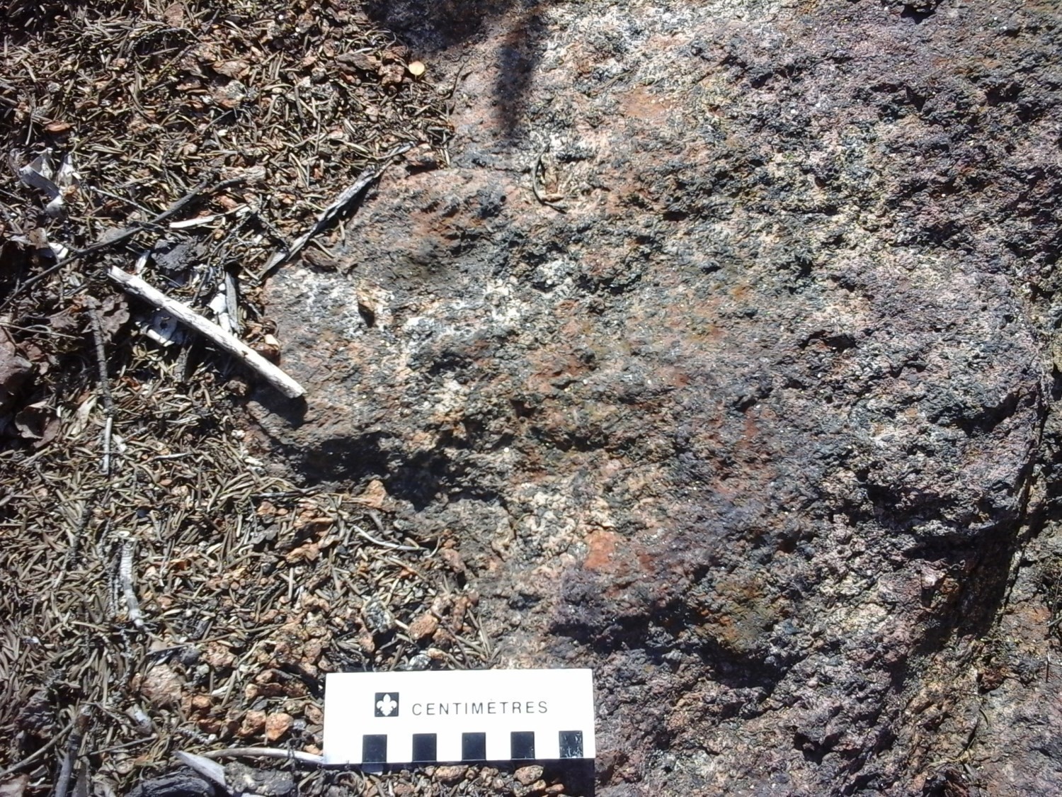
The Langelier Anorthosite, named by Rondot (1978), outcrops in the centre of the mapped area. It is a circular intrusion characterized by a low magnetic anomaly surrounded by a shear zone and, to the north, by a few thrust zones. It mainly consits of white andesine (uncommonly labrador)-hypersthene anorthosite with minor amounts of gabbronorite.
The La Tuque Anorthosite (mPtuq) was recognized by Klugman (1956). It forms a small 12 km2 N-S oriented mass that partially outcrops south of the mapped area (sheet 31P10). The remainder of the intrusion continues on sheet 31P07. It consists of white anorthosite, locally granoblastic, and minor amounts of phlogopite gabbronorite.
The Trenche Anorthosite (mPtec) is a new unit identified in the west of sheet 31P15 where it outcrops as small, sparse intrusions into the Vermillon Plutonic Suite of and the Wabash Complex. It consists of gabbronorite, plagioclase porphyritic anorthosite, leuconorite and paragneiss enclaves.
The Étoile Suite was introduced by Perreault (1992) in sheet 31P16. It consists of scattered intrusions into the La Bostonnais Complex. In the mapped area, this suite consists of: 1) black anorthosite, gabbronorite and minor amounts of troctolite and pyroxenite (mPeto1); and (2) syenogranite with or without orthopyroxene (charnockite), hypersthene syenite, massive syenite, locally augen and minor amounts of mangerite (mPeto2).
The Travers Suite (1076.2 ±8.4 Ma, U/Pb on Zircons, Konstantinos Papapavlou, personal communication) was introduced by Perreault (1992) in the NNE corner of sheet 31P16. It is bordered by significant shear zones. One of the typical outcrops (17-AM-101) in the edge area has mylonite showing sinistral movement. The suite consists of: 1) gabbronorite, hypersthene diorite, mangerite and minor amounts of K-feldspar-hypersthene granite (unit mPtra1); 2) mangerite, syenite, hypersthene syenite and minor amounts of syenogranite, granite and alkali feldspar granite (unit mPtra2); and 3) alkali feldspar porphyritic granite, syenogranite and minor amounts of gabbronorite, monzonite and quartz syenite, also containing paragneiss enclaves (unit mPtra3).
The Borgia Suite (1072.1 ±5.4 Ma, U/Pb on zircons, Konstantinos Papapavlou, personal communication) was introduced by Perreault (1992) during geological mapping of sheet 31P16. This suite intrudes into the La Bostonnais Complex and Montauban Group; it overthrusts the northern part of the Langelier Anorthosite. This suite consists of: 1) massive monzonite, locally K-feldspar-plagioclase porphyritic, and mangerite, syenite, alkali feldspar syenite and syenogranite (unit mPbor1); (2) massive granite, mangerite, syenogranite and minor amounts of gabbronorite, charnockite and monzonite (unit mPbor2); and 3) syenite, hypersthene syenite, mangerite, syenogranite, charnockite and minor amounts of granite and monzonite (unit mPbor3).
The Roc Suite, whose metamorphic age is 1012 ±1 Ma (U/Pb on zircons; Moukhsil et al., 2015) occurs as highly dispersed mafic to ultramafic intrusions and dykes. It consists of :1) olivine websterite, pyroxenite, gabbronorite and gabbro (unit mPsro1); 2) gabbronorite, foliated gabbro and minor amounts of Fe-Ti ± P oxide mafic rock (unit mPsro2); and 3) Fe-Ti ± P oxide gabbronorite (OAGN, Oxide-Apatite-Gabbronorite, acronym proposed elsewhere in the Grenville by Dymeck and Owens, 2001), locally garnet porphyroblastic, gabbro and leuconorite (unit mPsro3).
The Catherine Granite (mPcat) was introduced by Perreault (1992) to the south of sheet 31P16. It extends to the north of sheet 31P09 (Nadeau et al., 1997). This unit intrudes, among others, into rocks of the Étoile Suite and La Bostonnais Complex. It consists of syenogranite, granite, quartz monzonite, mangerite, quartz monzodiorite, locally porphyritic. It is cut by centimetric granitic pegmatite dykes, locally graphic.
The Rivière-à-Pierre Suite was introduced by Perreault (1993). An age of 1058 ±1 Ma was given by Nadeau et al. (1992). Only unit mPprr2 of this suite outcrops in the eastern part of the region (sheets 31P09 and 31P16) where it consists of porphyraceous and leucocratic granite and monzonite, monzogranite, monzodiorite and minor amounts of granodiorite, mangerite and syenite. Unit mPprr1 consists of porphyraceous granite and monzonite with or without hypersthene. In general, the suite has sheared contact with surrounding units (La Bostonnais Complex, Montauban Group, Parc des Laurentides Complex).
The Rhéaume Intrusive Suite was introduced by Moukhsil and Côté (2017) in the Wemotaci region. The age of this unit was estimated at 1019 ±2 Ma (David, 2017). In the mapped area, unit mPrhe2 consists of syenite, quartz ± nepheline syenite, Fe-Ti-P oxide gabbronorite and minor amounts of hypersthene syenite, foid monzonite, syenogranite, monzogranite and mangerite.
Structural Geology
Gneissosity and Folding
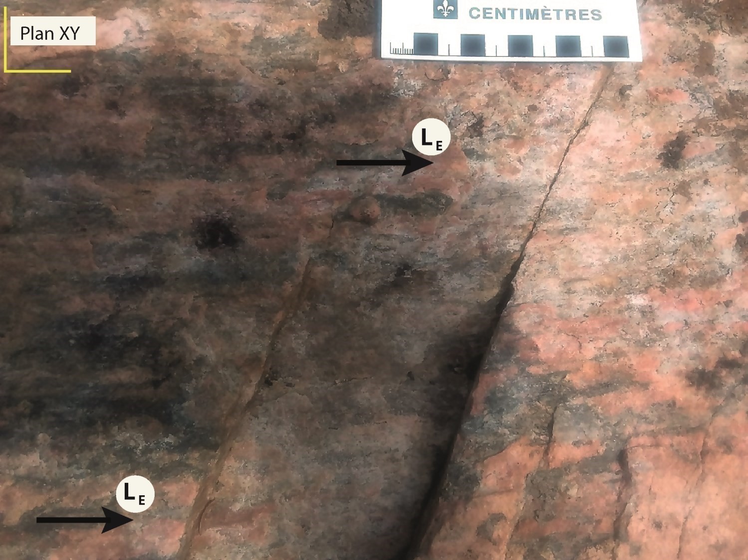
The oldest lithological units in the Borgia Lake area, Pinwarian to Adirondian (1520-1080 Ma), have been recrystallized, deformed and folded following multiple pre-grenvillian deformation events (>1080 Ma). These fabrics were transposed during deformation D1 to form a penetrative gneissosity, called G1, NW-SE oriented. As a result, all primary structures of these rocks were obliterated. These older units were subsequently affected by penetrative deformation D2/G2 during the Grenvillian Orogenesis. The final configuration of these units consists of dome and basin structures visible at different scales, and marked by dip inversions to the west or east.
Rocks emplaced during the Grenvillian Orogenesis are less deformed and have sub-magmatic planar fabrics. These structures are associated with the emplacement of post-tectonic intrusions of various composition (anorthosite, syenite, granite) which have thus disturbed all previous structures, especially their margins, thus forming deformation corridors. It is very difficult to link the different folding phases to tectonic events. Two types of folds are generally observed. First are isoclinal folds with an axial plane oriented more or less parallel to the dominant NE-SW to NNE-SSW structural grain of the region (G2). There are also some open folds of approximate N-S to NNW-SSE orientation corresponding to a non-penetrative planar fabric, G3. This orientation is taken by a few granitic pegmatite dykes.

Shear Zones
Several shear zones have been mapped here and there in the region. The largest ones are located in the east, centre and NNE corner of the region.
Eastern Part of the Region
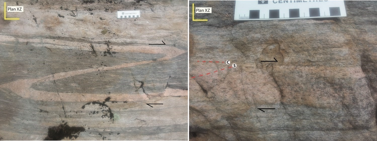
The Rivière-à-Pierre Suite is bordered by a shear zone. This unit is generally massive, but locally presents a non-penetrative tectono-metamorphic foliation. The shear zone roughly NNE-SSW is observed over a hundred metres wide at the edge of the intrusion. This zone is subvertical or steeply dipping to the east and is associated with NE directional-type mineral or stretch lineations. Several kinematic indicators (e.g., C/S fabrics) suggest a predominantly sinistral movement. It is possible that this shear zone played a role in the emplacement of the Rivière-à-Pierre Suite.
Central Part of the Region

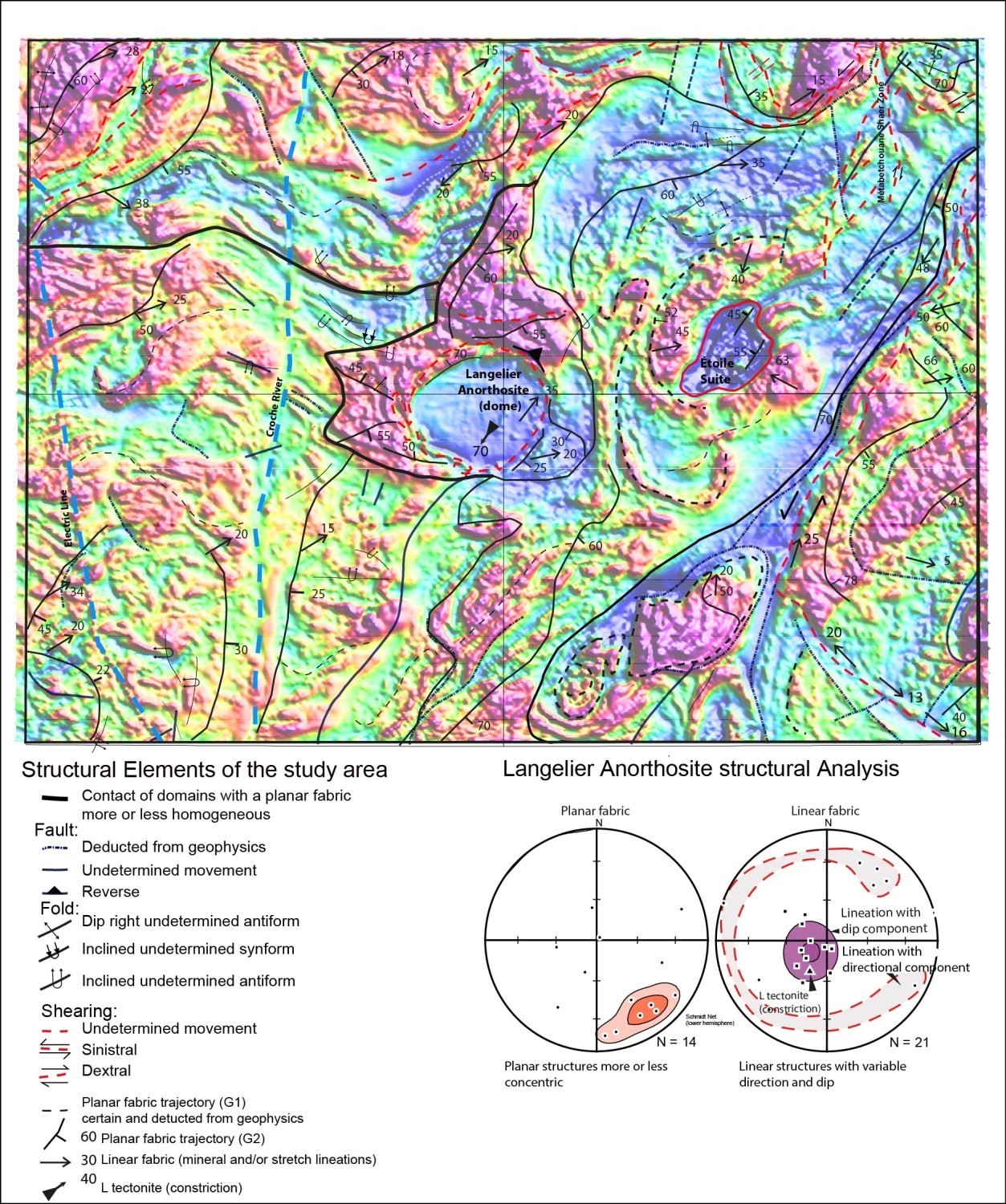
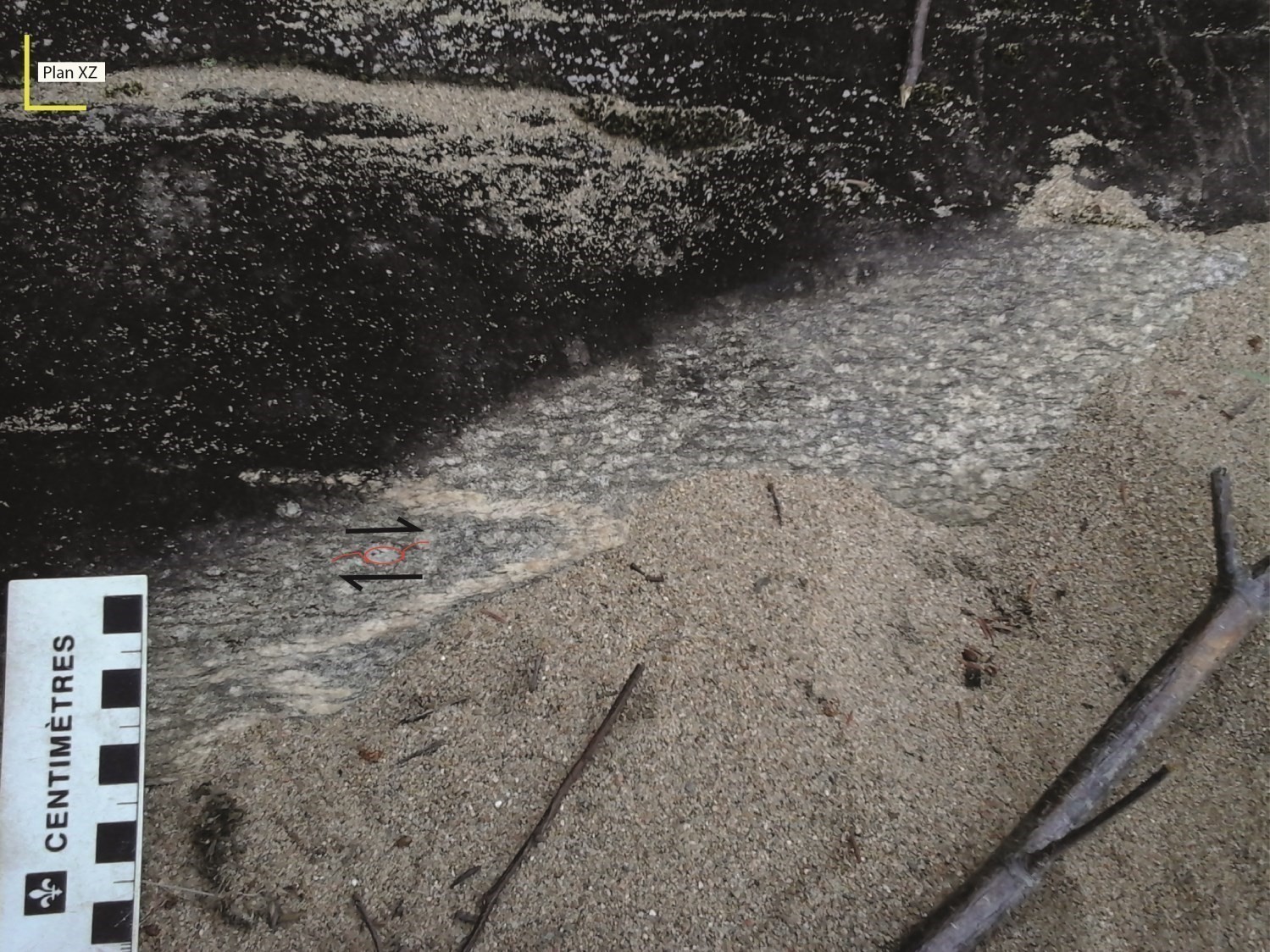
The Langelier Anorthosite is bordered by a ductile shear zone that may also be associated with its emplacement. Plagioclase of the anorthositic facies is completely recrystallized. Foliation has a varying dip between 52 and 65° to the SW and bears shallow-dip lineations to the east or NE. On the other hand, towards the centre of the intrusion, strong lineations (65-70° dip) oriented S to SW (L tectonite) likely result from a significant reduction in intrusion (typical outcrop 17-AM-174). To the north of the intrusion, shear and thrust zones are locally observed. These structures suggest that intrusion ceased to progress during its emplacement. L-tectonic probably indicates constriction during anorthosite deformation. These planar and linear structures, together with the rounded shape of the Langelier Anorthosite, demonstrate that this intrusion forms a tube or a diapir.
NNE Part of the Region
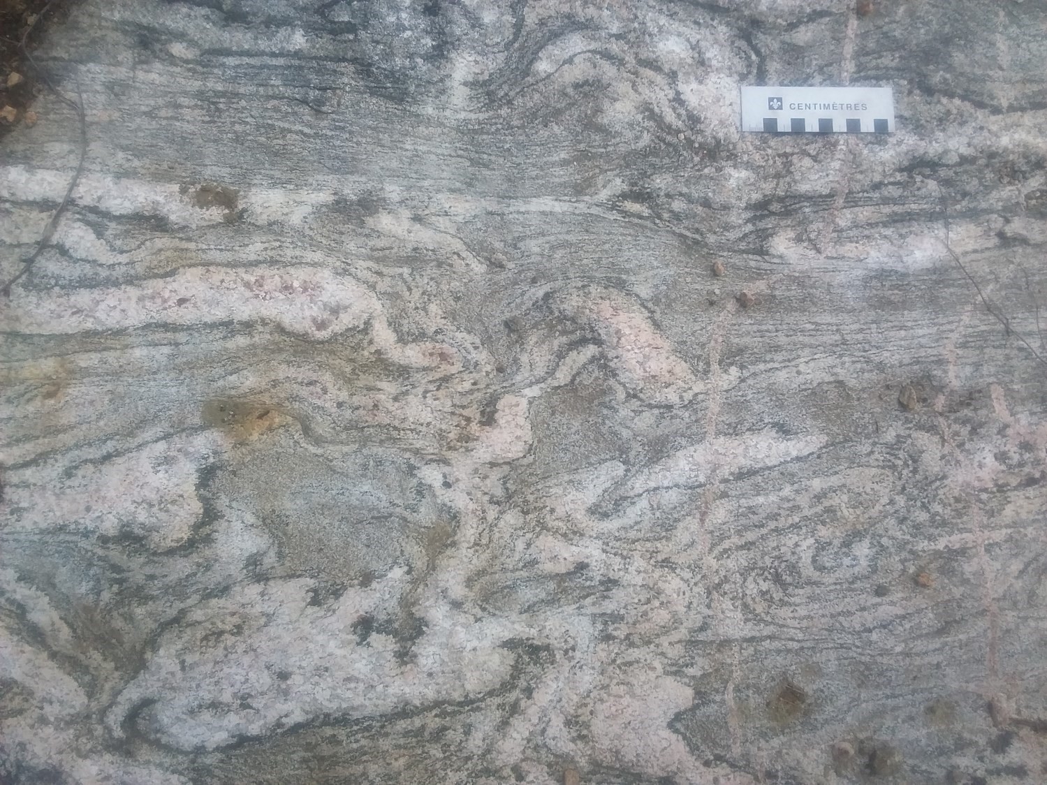
The Métabetchouane Shear Zone, oriented N-S, forms a ductile deformation corridor at least 300 m wide and approximately 12 km long. This shear zone passes through heavily deformed mylonitic rocks transformed into granitic gneiss in the deformation corridor (typical outcrop 17-MR-4140). The east side of the shear zone consists of mangeritic and gabbronoritic facies of the Trenche Anorthosite, while the west side consists of gabbros and diorites of the La Bostonnais Complex. The shear zone has mineral and stretch lineations with directional component and kinematic indicators (d-type porphyroblasts ) suggest dextral movement. This structure is cut by other less significant dextral shear zones (Z folds and C/S structures) that have a NE-SW orientation, moderate dip to the east and directional component lineations to the SW (typical outcrop 17-AM-102).
Metamorphism

The mapped area is characterized by either metamorphosed rocks or rocks emplaced at the granulite or amphibolite facies. The metamorphic domain interpretation figure plots the distribution of metamorphic domains dominated by orthopyroxene (granulite facies) or amphibole (amphibolite facies). Locally, granulite facies rocks have been retrograded to the amphibolite facies and have hornblende-plagioclase-garnet paragenesis.
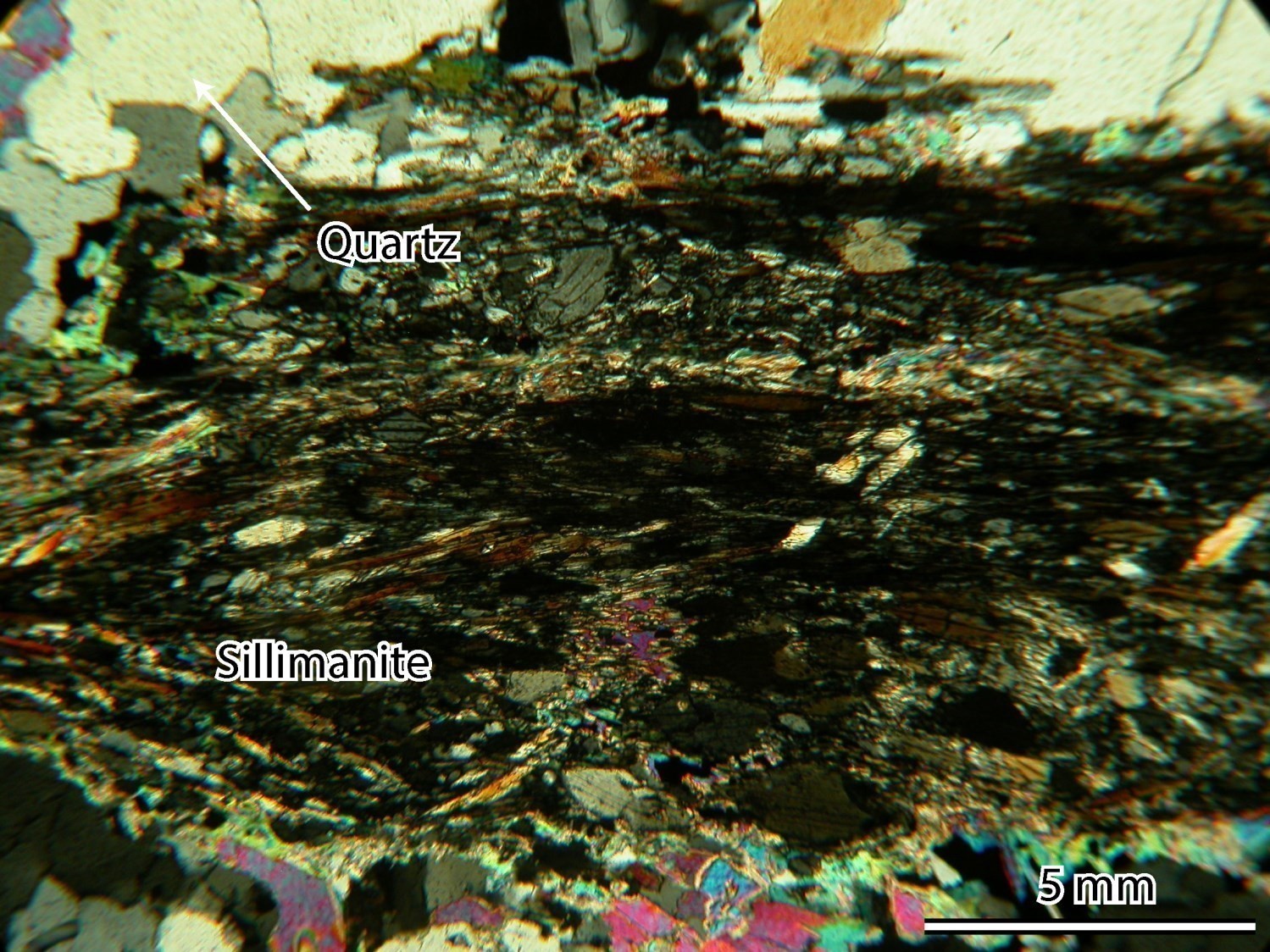
Primary muscovite was observed only in an undeformed white pegmatite intruding into paragneiss of the Montauban Group. Pelitic paragneiss of the Montauban Group and Wabash Complex contain diagnostic minerals of metamorphism such as garnet, sillimanite and trace cordinerite. The absence of muscovite and the presence of the quartz-K-feldspar-plagioclase-garnet-sillimanite-biotite assemblage in these paragneiss indicate that regional metamorphism P–T conditions have exceeded the muscovite stability field and reached the biotite melting reaction P–T field. These paragneiss are locally migmatitic and have undergone partial melting with granitic mobilisate formation (with orthopyroxene west of the region). This indicates that rocks have undergone high-temperature and medium-pressure metamorphism.
Gabbronorites of the region typically have plagioclase-orthopyroxene-clinopyroxene-hornblende assemblage, rarely garnet, with minor amounts of quartz; the latter is observed mainly at the edge of the mafic minerals. This assemblage is comparable to that observed in rocks reaching the medium-pressure granulite facies (Pattison, 2003).
The significant presence of perthitic, mesoperthitic to antiperthitic feldspar in orthopyroxene charnockites and syenites of the region also indicates that these rocks are metamorphosed or have intruded at the granulite facies.
The orthopyroxene-amphibole-biotite association is mainly observed in mafic rocks (leuconorite and gabbronorite) and in some mangerites. In such cases, orthopyroxene is uralitized (hornblende) and secondary biotite is locally present as inclusions or along cleavage planes. Brown-red mica (phlogopite?) is interpreted as a product of hydrothermal alteration.

Economic Geology
The Borgia Lake region has prospective zones for seven (7) mineralization types:
- magmatic Cu-Ni mineralization associated with mafic rocks
- industrial minerals
- architectural stones
- rare earth element (REE) mineralization
- V mineralization associated with anorthosites
- Fe mineralization with anomalous Ti and V contents
- Cu mineralization and anomalous Zn contents associated with volcanic rocks
The table of showings below presents the results of analyses for the ten known showings in the area, including three (3) new showings discovered in our work.
(E): selected sample; (R): channel; (F): drillhole
The table of lithochemical analyses of metals of economic interest provides the location, description and results of 47 samples selected for assessing the economic potential of the region.
New Zone to Explore for Copper Mineralization Associated with Volcanic Rocks
Rocks of the Trois-Rivières region, specifically volcanics of the Montauban Group, have long been known for their Zn-Pb-Au-Ag mineralization potential (Tétrault Mine: 1911-1965 production of 2.7 Mt at 4.5% Zn, 1.5% Pb, 0.56 g/t Au, 70 g/t Ag; Montauban Mine: historical resources of 440 Kt at 2.91% Zn, 0.88% Pb, 34.29 g/t Ag; Tomkins et al., 2007). Although these rocks are metamorphosed to the amphibolite facies (St. Seymour and MacLean, 1984), other examples such as the Broken Hill deposit in Australia show that this mineralization can be preserved at high metamorphic grade (granulite).
In the Borgia Lake area, the Ghislaine showing was discovered in units that are part of the Montauban Group rock continuity. It is a garnetite horizon in contact with a basalt and a paragneiss. Garnetite is composed of garnet, titanite, orthopyroxene, amphibole, plagioclase, biotite, gahnite, sphalerite and chalcopyrite. Unlike the Zn-Pb-type mineralization of the Montauban region, the latter is Cu-Zn, possibly explainable by a different depositional environment or by higher temperature during hydrothermal activity. This showing has mineralization at 0.17% Cu, 0.1% Zn and 2.4% S. Based on 100% sulphides (Kerr, 2003), the massive zone is expected to have 2.4% Cu and 1.32% Zn contents. Also, as with mineralization in Montauban, synmetamorphic deformation concentrates the lens without remobilizing mineralization (Tomkins et al., 2007). For these reasons, the Borgia region has economic potential equivalent to that of Montauban, although metamorphism is of higher grade.
New Zone to Explore for Magmatic Ni-Cu Mineralization Associated with Mafic Rocks

The emplacement of Ni-Cu ± GPE host intrusions in the La Tuque area is linked to intrusion of magmas from metasomatic mantellic sources (Sappin, 2012). These magmas would then partially remobilize and transport the sulphidic liquid to form mineralized intrusions of the Portneuf-Mauricie Domain located in the south-central part of the Grenville Province. An example of this deposit type is the Lac Édouard Mine (historical resources of 34,259 t at 1.55% Ni and 0.5% Cu, Poirier, 1988). Host rocks are folded websterite, orthopyroxenite and gabbronorite. Mineralization occurs as massive to semi-massive sulphide lenses located near the synclinal hinge (Poirier, 1988).
In the Borgia region, two showings associated with mafic-ultramafic intrusions have been uncovered in small intrusions of the La Bostonnais Complex: 1) the Kiskissink showing, composed of disseminated sulphides, hosted in pyroxenite boudins in gabbronorite; and (2) the Cabouron showing, corresponding to disseminated sulphides in gabbronorite. The Kiskissink showing is the most promising of both, since:
- copper and nickel contents are higher;
- Ni/Cu ratio of 1.37 indicates little remobilization;
- the 100% sulphide calculation (Kerr, 2003) indicates the presence of a probable massive zone with 6.53% Ni and 4.69% Cu contents, which is slightly higher than Lac Édouard contents (6.7% Ni and 1.7% Cu, Clark, 2000).
The 2017 fieldwork led to the discovery of a single small mineralized outcrop for the Kiskissink showing. Despite this, there is significant potential in this area and some characteristics comparable to the Lac Édouard mineralization. The area requires more exploration to determine the intrusion dimensions and to find massive or semi-massive sulphide zones.
New Zone to Explore for Fe-Ti-V-P Mineralization Associated with Mafic-Ultramafic Intrusions

For the past 100 years, vanadium has been used primarily as an additive to the iron process. Over the past several years, however, new uses of this metal have emerged with the growth of the battery market. According to some experts (Merchant Research & Consulting, 2016), demand for vanadium could double by 2025.
Three types of deposits may contain vanadium: 1) vanadium-bearing titanomagnetite (VTM) deposits; 2) phosphate rock deposits; and 3) uranium-bearing sandstones. In the Borgia Lake region, vanadium is located in VTMs. This type of deposit is the largest source of vanadium (85% of global production). High-quality iron producers have long tried to extract iron, titanium and vanadium from VTM. A Quebec company (Electrochem Technologie & Materials) has succeeded in extracting these metals and concentrating high-performance vanadium oxide for energy storage (Chemical Engineering, 2017).
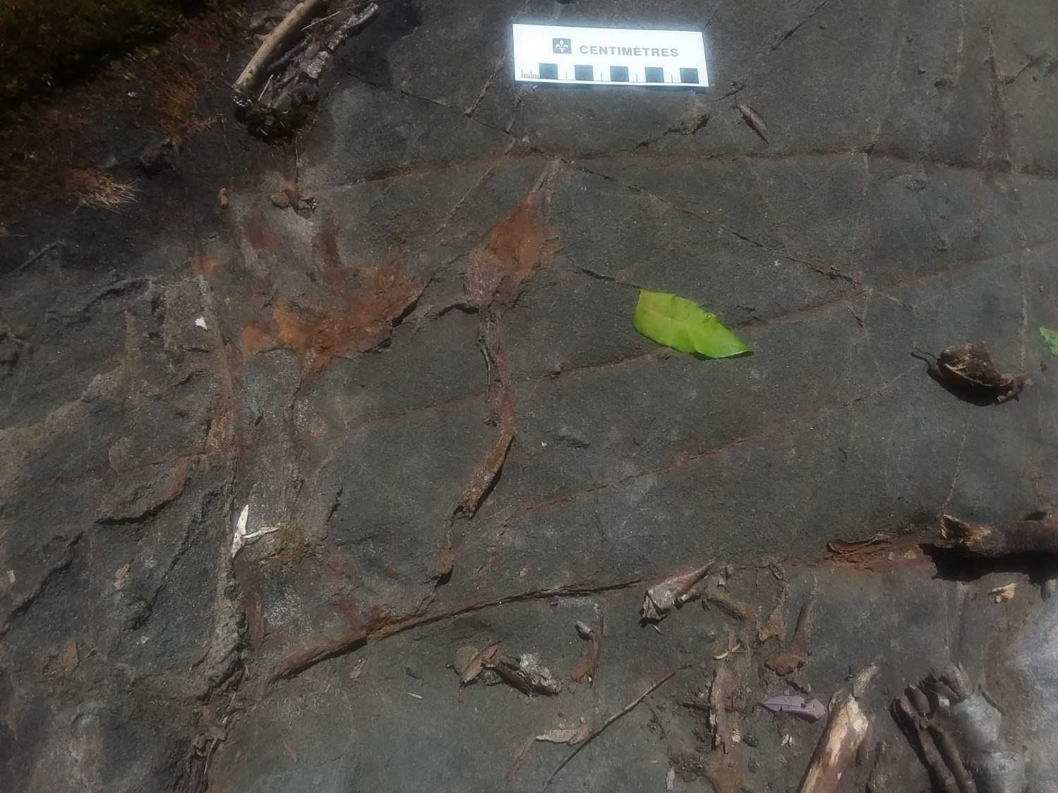
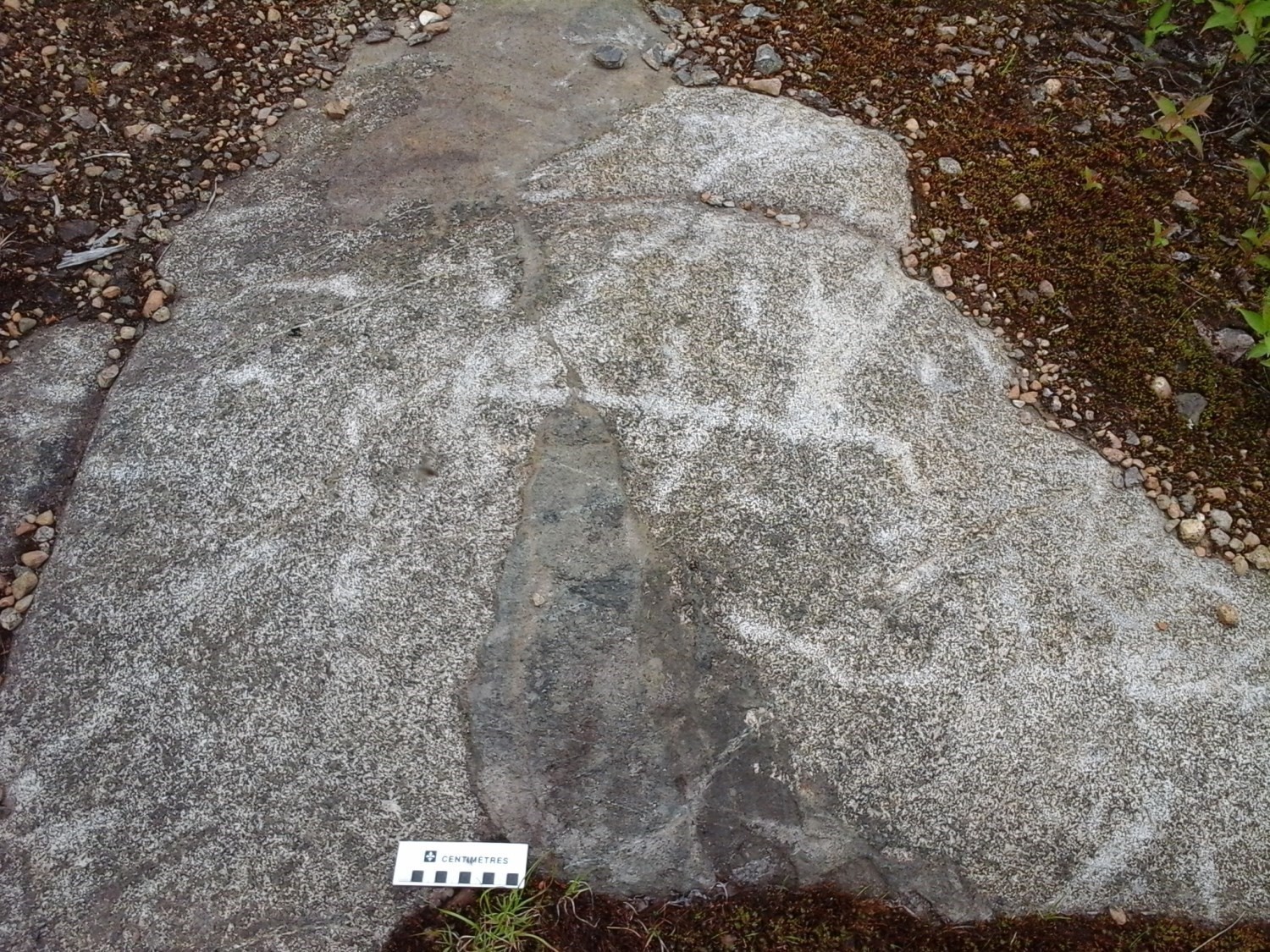
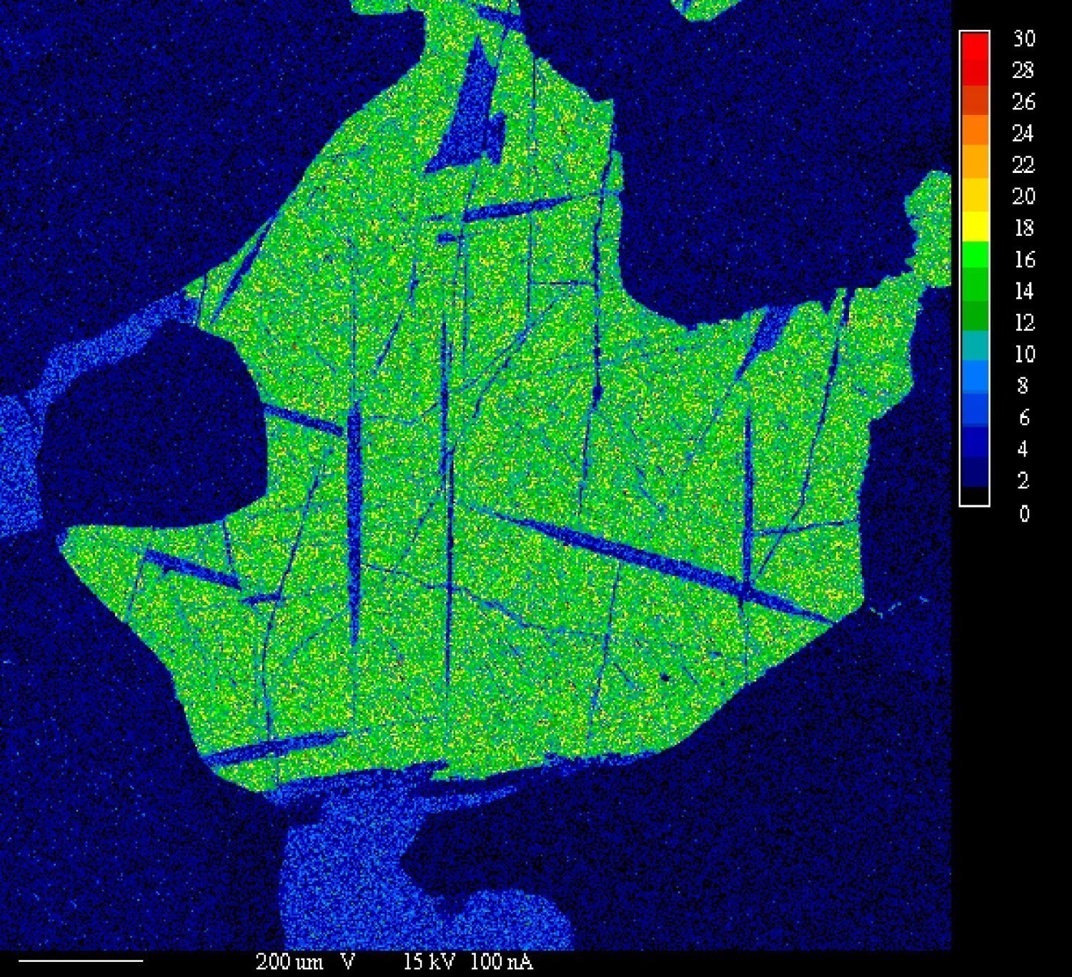
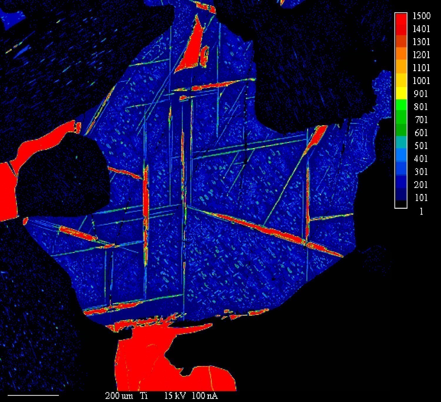
In the Borgia Lake area, several anomalies and one showing (Lac Fabien) contain this type of mineralization associated with mafic-ultramafic intrusions such as the La Tuque Anorthosite and the Étoile Suite. VTM occurs as approximately 1 mm grains and contains elongated titanite inclusions of approximately 200 µm. At the Lac Fabien showing, V2O5 contents in these MTVs are about 0.79%, slightly lower than those in Lac Doré (1.08% V2O5, Vanadiumcorp 2017). The Lac Fabien lens is easily identifiable on aeromagnetic surveys with its dimensions of approximately 800 m by 500 m. With new processes for vanadium extraction, and considering the lens size and good V2O5 content of VTM, the Lac Fabien mineralized zone has a high potential for this substance. In the region, more exploration is needed to identify other lenses of this size.
| Authors | Abdelali Moukhsil, P.Geo., Ph.D. Abelali.Moukhsil@mern.gouv.qc.ca Gabriel Côté, GIT, B.Sc. Gabriel.Cote@mern.gouv.qc.ca |
| Geochemistry | Fabien Solgadi, P.Geo., Ph.D. |
| Geophysics | Siham Benahmed, GIT, M.Sc. Rachid Intissar, P.Geo., M.Sc. |
| Potential assessment | Hanafi Hammouche, P.Geo., M.Sc. |
| Logistics | Clotilde Duvergier, GIT, B.Sc. |
| Geomatics | Julie Sauvageau Kathleen O'Brien |
| Editing | Simon Auclair, P.Geo., M.Sc. |
| Critical review |
Fabien Solgadi, P.Geo, Ph.D. James Moorhead, P.Geo., M.Sc. |
| English version | Céline Dupuis, P.Geo., Ph.D. |
| Organism | General direction of Géologie Québec, Ministère de l'Énergie et des Ressources naturelles, Government of Québec |
Acknowledgements:
This Geological Bulletin was made possible through the cooperation of many people who have been actively involved in the various stages of the project. We would like to thank geologists-in-training Antoine Archambault, Ahmed Boulahcen, Christopher Lambert, Manuelle Perron-Racine, as well as students Maxime Daniel-Tanguay, Maryse Desrocher, Philippe Pelletier, Évelyne Sunatori. We would like to acknowledge the excellent work of cook Daniel Crépeau, camp man Patrick Dubeau and Kostas Papapavlou for geochronology. Discussions with geologists Serge Perreault and Marc Constantin were very beneficial.
References
Publications available through Sigeom Examine
Other publications
MOUKHSIL, A., COTE, G., 2018. Geology of the Borgia Lake Region, Grenville Province, North of La Tuque, Mauricie and Saguenay – Lac-Saint-Jean Regions, Quebec, Canada. MRNF; BG 2018-01, 2 plans.