Last modified: 31 October 2022
DISCLAIMER: This English version is translated from the original French. In case of any discrepancy, the French version shall prevail.
| Author(s): | Bandyayera and Daoudene, 2018 |
| Age: | Neoarchean |
| Stratotype: | None |
| Type area: | The most representative outcrops are located NW of the Goulde Lake area (NTS sheet 32O11). |
| Geological province: | Superior Province |
| Geological subdivision: | La Grande Subprovince |
| Lithology: | Volcano-sedimentary rocks |
| Category: | Lithostratigraphic |
| Rank: | Group |
| Status: | Formal |
| Use: | Active |
None
Background
The Lac des Montagnes Group was introduced in the early 2000s during the compilation work for the Nemiscau and La Grande subprovinces. It was defined to describe a package of volcano-sedimentary rocks observed south of the Champion Complex between the Rupert and Nemiscau rivers (sheets 32N07, 32N08, 32N09, 32O11, 32O12 et 32O14). Valiquette (1963) was the first to describe these rocks in the Montagnes Lake area; the subdivisions and the descriptions of the unit are based on his work (Valiquette, 1963, 1975). Bandyayera and Daoudene (2018, 2019) and Bandyayera and Caron-Côté (2019) also contributed to the mapping of the Lac des Montagnes Group and later assigned it to the La Grande subprovince (Bandyayera et al, 2022). A volcano-sedimentary rock unit that extends ~60 km along an E-W axis (sheets 32N05, 32N06 and 32N07) in the Nemiscau Subprovince had originally been attributed to the Lac des Montagnes Group. These rocks are now reassigned to the Peat Formation (Bandyayera et al., 2022).
Description
The Lac des Montagnes Group consists mainly of volcano-sedimentary rocks. It is divided into five units:
- amphibolitized basalt; ultramafic volcanic rock layers (nAmo1);
- intermediate volcanic rocks (nAmo2);
- felsic volcaniclastic rocks (nAmo3);
- oxide facies iron formation and silicate facies iron formation (nAmo4);
- amphibolite derived from komatiitic basalt (nAmo5).
However, the stratigraphic succession of these units could not be accurately determined.
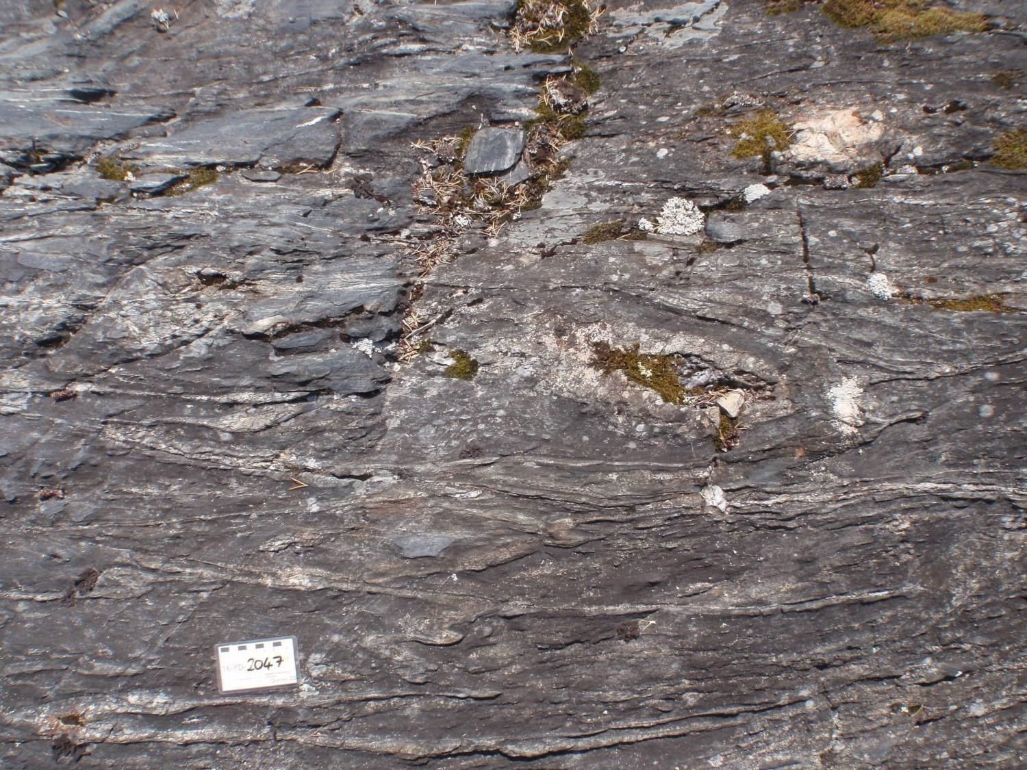
Lac des Montagnes Group 1 (nAmo1): Amphibolitized Basalt; Ultramafic Volcanic Rock Layers
This unit represents ~80% of the area of the Lac des Montagnes Group. The most representative outcrops are located NW and north of Senay Lake (sheet 32O11; Valiquette, 1975).
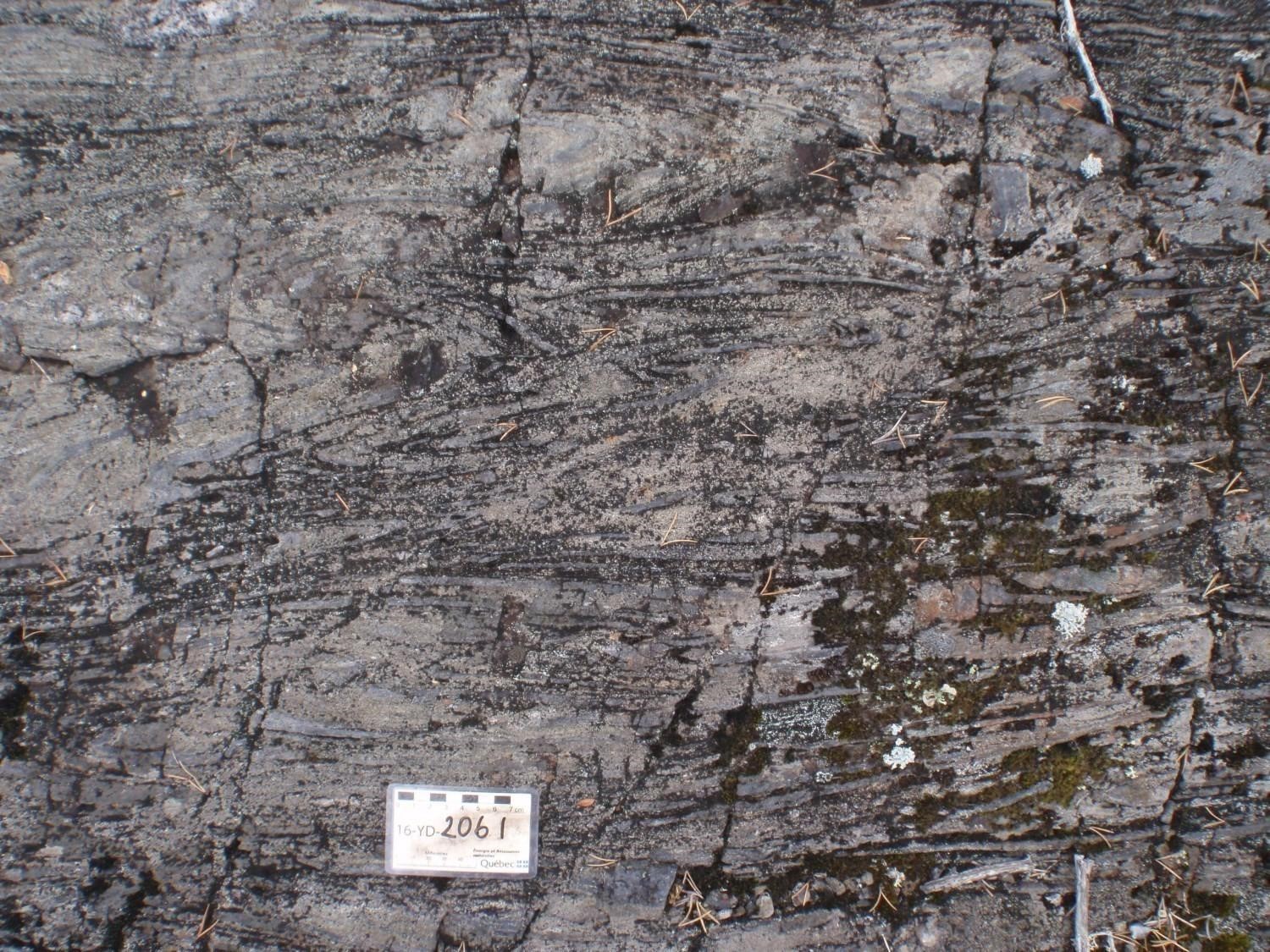
The basalt and amphibolite derived from basalt in the nAmo1 unit are fine to medium grained, greenish grey on a fresh surface and have a dark green to black, locally light grey, altered patina. These rocks form massive to pillow flows locally associated with flow breccias. Pillows are usually elongated, stretched and flattened and surrounded by well-recognizable hyaloclastic material. Locally, deformed quartz chambers appear to indicate stratigraphic polarity to the south. The margins of the pillows are generally richer in hornblende than the rest of the rock and show epidote, or locally, silica alteration. These areas may also contain 5-10% garnet, 5% biotite and up to 15% disseminated sulphides. The spaces between pillows, as well as the centre of pillows and the massive lava flows show in places a replacement with felsic material or saussuritized nuclei (“epidote balls”). These nuclei are widespread in these basaltic rocks.
In thin section, the metavolcanic rocks of the nAmo1 unit show a fine to very fine grain size and a generally granonematoblastic microtexture. They are mainly composed of >50% amphibole (hornblende, actinolite-tremolite) and 40% plagioclase associated with minor amounts of quartz and biotite. Hornblende is partially replaced by chlorite and epidote. These rocks are metamorphosed from the upper greenschist to the amphibolite facies and contain sphene, sulphides, calcite and sericite as accessory or alteration minerals.
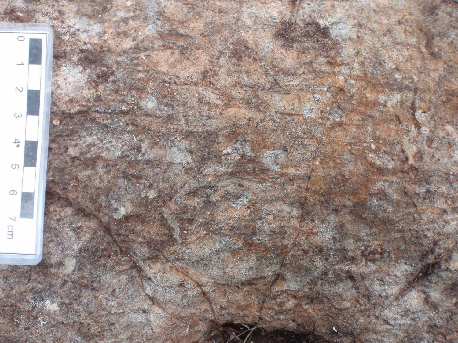
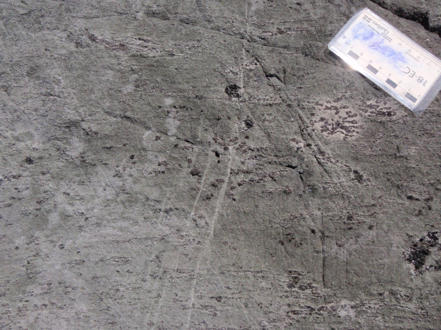
Unit nAmo1 contains in places decametric layers of massive to pillow ultramafic lava. The tremolite-rich foliated rock is magnetic, fine to medium grained and is dark grey to brownish on an altered surface and medium to dark greenish grey on a fresh surface. The ultramafic volcanic rock layers are characterized by tourmaline alteration combined with an enrichment in tremolite-actinolite. Tourmaline (5-15%) occurs as clusters, or isolated crystals up to 3 cm, aligned parallel to the foliation.
Lithogeochemical analyses show that the nAmo1 unit is composed of tholeiitic basalt and locally andesitic basalt of transitional to calc-alkaline affinity. In the Mezière and Nemiscau lakes region (sheets 32N06 and 32N07) to the west, most tholeiitic basalts, especially magnesian and komatiitic basalts, are characterized by an enrichment in heavy rare earth elements relative to light rare earth elements. Trace element ratios of these rocks clearly show a geotectonic emplacement setting similar to that of N-MORB (Pearce, 2008). Further east, in the La Sicotière Lake area (sheet 32N08), tholeiitic basalts are generally characterized by flat rare earth element profiles. Their ratios of trace elements suggest a geodynamic environment similar to that of island-arc tholeiites, or ocean floor basalts contaminated by the continental crust (Pearce, 2008; Wood, 1980).
In sheet 32O15, unit nAmo1 contains kilometric layers of ultramafic volcanic rocks grouped in the nAmo1a subunit.
Lac des Montagnes Group 1a (nAmo1a): Ultramafic Volcanic Rock
This ultramafic volcanic rock unit consists of komatiites and komatiitic basalts. Unit nAmo1a has not been integrated with unit nAmo5 because the two units represent two clearly different stratigraphic layers. Unit nAmo1a is located near the contact with the Opatica Subprovince, and is interpreted to be the base of the Lac des Montagnes Group. In contrast, unit nAmo5 is found throughout the volcanic sequence.
The outcrops of unit nAmo1a show alternating massive komatiitic flows with cumulate layers and foliated komatiitic flows containing spinifex-textured layers. In one location, a rusty erosional contact or erosional channels are observed between the massive flows and the spinifex-textured foliated flows, indicating a stratigraphic top to the south. Bedded layers contain centimetric brownish skeletal minerals (olivine or orthopyroxene) arranged perpendicular to the bedding.
In terms of chemical composition, the ultramafic volcanic rock unit is very rich in MgO (18-26%) and poor in SiO2 (42-47%).
Lac des Montagnes Group 2 (nAmo2): Intermediate Volcanic Rock
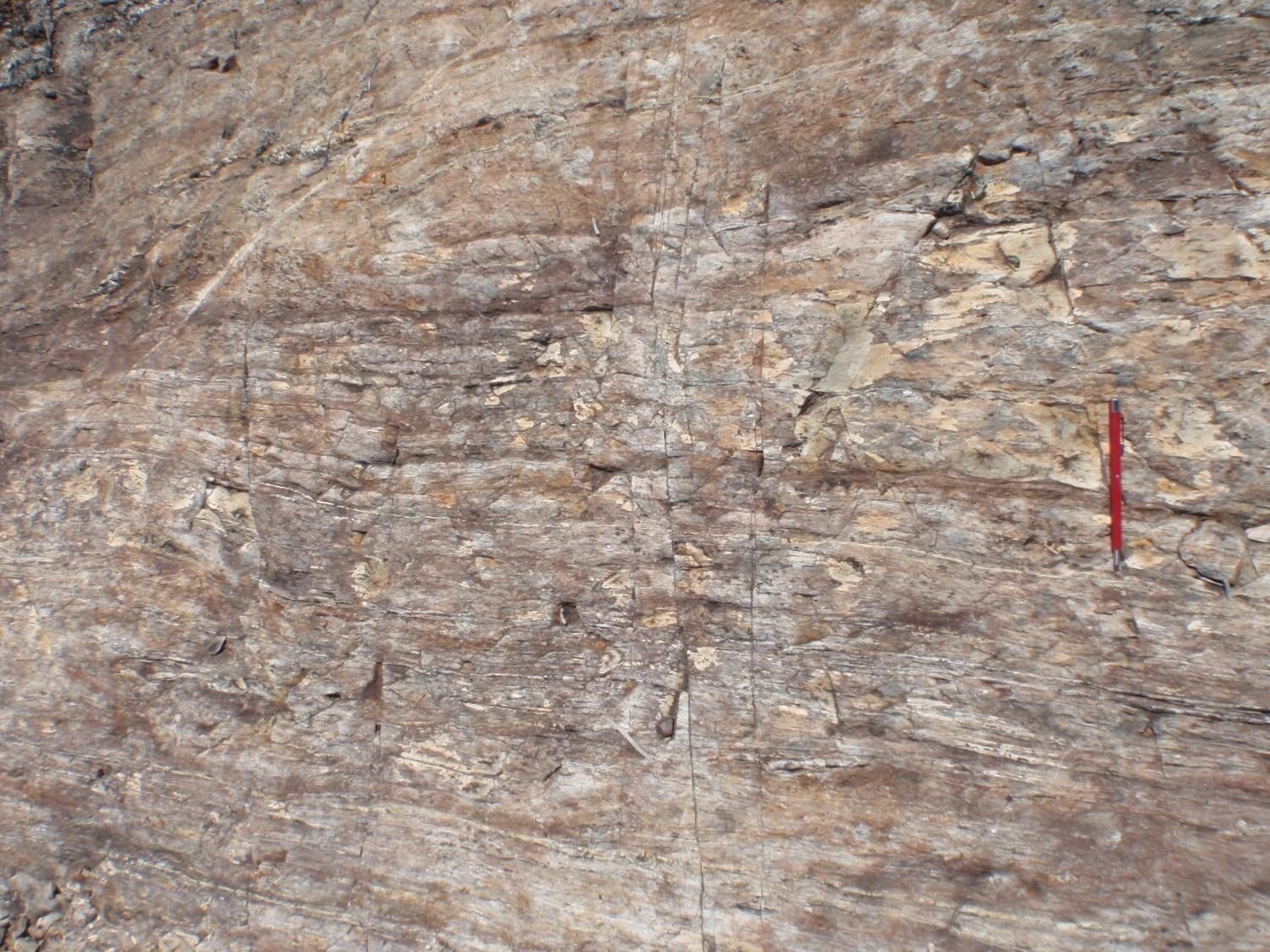
The intermediate volcanic rock unit is the least known of the Lac des Montagnes Group. These rocks are generally described in the field as amphibolitized basalt. They have been renamed based on lithogeochemical analysis results. Dark grey on an altered surface, medium grey to greenish grey on a fresh surface, these fine- to medium-grained rocks are homogeneous, foliated and locally magnetic. Locally, there are structures interpreted as isolated, stretched and flattened pillows, amphibolitized flow margins, or pillow breccias. The rock contains 60% hornblende (0.5 to 5 mm) and 1% to 2% magnetite (0.2 to 0.5 mm). In places, silicified and garnet-rich (up to 30%) layers are observed. Geochemically, these are andesites of calc-alkaline affinity and richer in SiO2, TiO2 and light rare earth elements than the basalt of unit nAmo1.
Lac des Montagnes Group 3 (nAmo3): Felsic Volcaniclastic Rock, Locally Intermediate
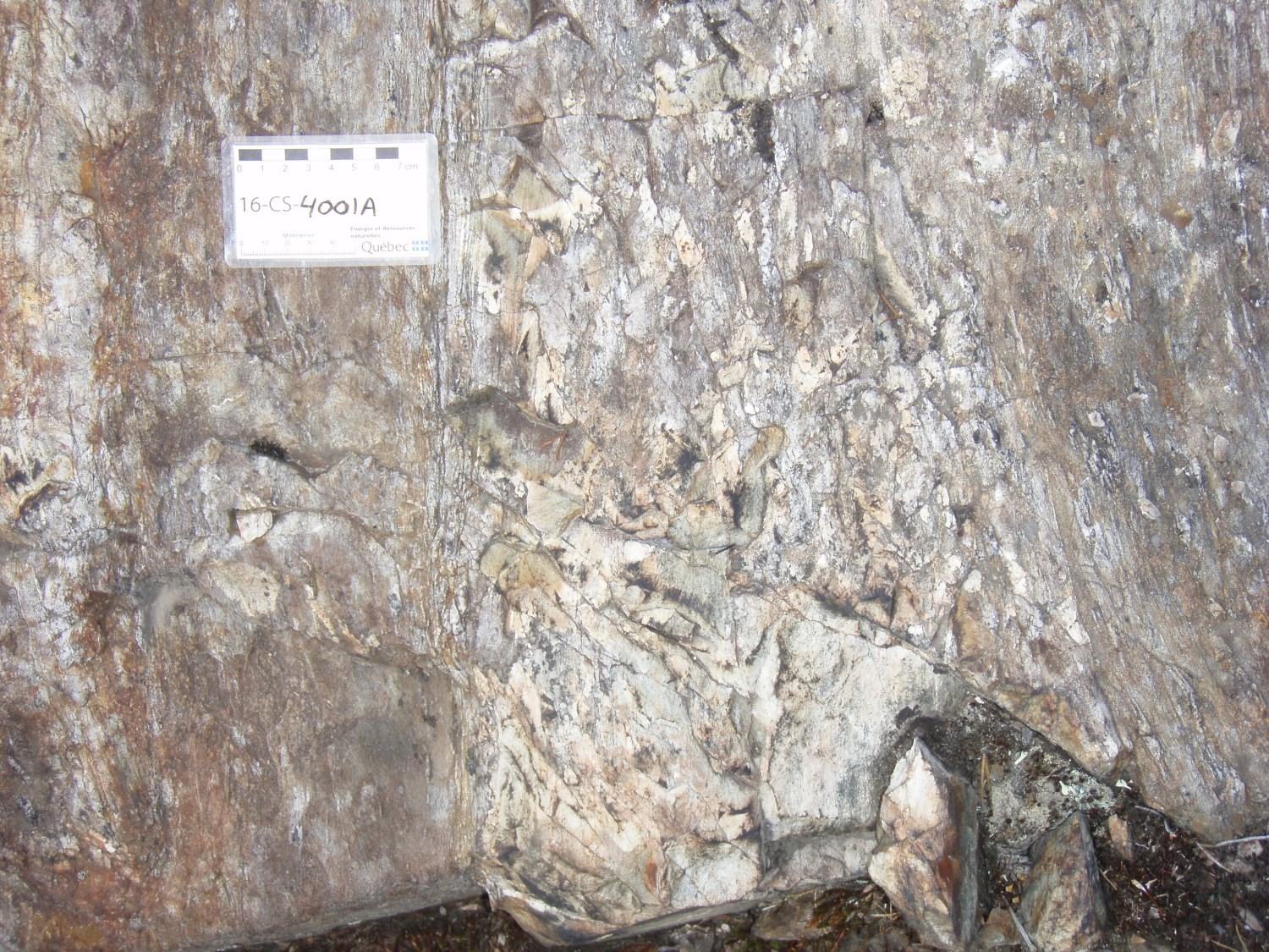
The felsic volcanic rock unit, in places intermediate, accounts for nearly 10% of the Lac des Montagnes Group. Unit nAmo3 consists of felsic volcaniclastic rocks in the form of decametric to hectometric layers, interstratified in the basaltic sequence of unit nAmo1. The best preserved sequences consist of bedded felsic tuffs characterized by alternating centimetric to metric beds of lapilli tuff, fine-grained massive ash tuff and conchoidal-fractured fine-grained tuff. The rock is whitish on an altered surface and greenish grey on a fresh surface. The matrix is sericitized and chloritized.
Locally, the felsic volcaniclastic rocks contain centimetric to metric beds of intermediate volcaniclastic rocks with mafic blocks and lapilli.
In thin section, the felsic tuffs are granoblastic and mainly composed of quartz and plagioclase grains in a fine-grained recrystallized matrix composed of chlorite, sericite, epidote, quartz and plagioclase. Apatite, sphene and sulphides are present as accessory minerals. Lithogeochemical analyses show that the felsic tuff of unit nAmo3 is of rhyodacitic, locally rhyolitic, composition and calc-alkaline affinity.
Lac des Montagnes Group 4 (nAmo4): Oxide Facies Iron Formation and Silicate Facies Iron Formation
Unit nAmo4 consists of several layers of iron formation <150 m thick, and up to 8 km in length, interstratified in the basalt unit (nAmo1). In places, they are located at the top of the basalts of unit nAmo1, and mark the transition between the volcanic rocks of the Lac des Montagnes Group and the sedimentary rocks of the Voirdye Formation. These highly magnetic layers are clearly visible on aeromagnetic maps.
The silicate and oxide facies iron formations are generally banded. Compositional variations between these two types (oxides or silicates) are observed in places at the outcrop scale. The oxide facies iron formations are characterized by massive magnetite bands, alternating with granoblastic chert bands. The massive magnetite layers are black to bluish grey and reach a metric thickness in places. The silicate facies iron formations consist of magnetite bands and laminae alternating with hornblende-garnet-biotite-chlorite rich magnetic layers and magnetite paragneiss layers. The amphibole-rich layers are greenish grey and very limited in extent. The beige-grey magnetite paragneiss represent about one third of the total thickness of the silicate facies iron formation. The entire iron formation unit is affected by numerous tight isoclinal folds that have axial planes parallel to the regional schistosity.
Layers of silicate facies iron formation have also been observed in volcano-sedimentary rock remnants of the Champion Complex. These have been incorporated into the Lac des Montagnes Group. In thin section, the rock contains up to 75% cummingtonite and 15% garnet poikiloblasts.
Lac des Montagnes Group 5 (nAmo5): Amphibolite Derived from Komatiitic Basalt
Unit nAmo5 represents a small proportion of the Lac des Montagnes Group and consists of amphibolite layers derived from komatiitic basalt. This unit occurs as decametre to hectometre-thick layers interstratified in the basaltic sequence of unit nAmo1. It appears to be spatially associated with a felsic volcanic rock layer of unit nAmo3 located north of Voirdye Lake. Amphibolites derived from komatiitic basalt are fine to medium grained and foliated. They are dark green both on a fresh surface and on an altered patina. They are mainly composed of actinolite (>90%) and contain accessory serpentine. On some outcrops, these rocks contain 1 to 5% tourmaline as millimetre-sized crystals.
Thickness and Distribution
The Lac des Montagnes Group extends discontinuously for ~175 km along a NE-SW axis (sheets 32N07 to 32O15). The unit generally ranges in width from 200 m to 1000 m. In sheet 32N, it occupies mainly the NW portion of the Lac des Montagnes Belt, whereas in sheet 32O, it occurs on both sides of the belt, on its NW and SE flanks.
Unit nAmo2 forms several small lenses that are sparsely distributed, notably west of Hutte Lake and south of Indien and Caumont lakes. Unit nAmo3 occurs mainly in the Voirdye Lake area as well as south of Indien Lake and NW of La Sicotière Lake. Iron formation unit nAmo4 was mapped very locally by Bandyayera and Daoudene (2018a and 2018b). It is located primarily south of Caumont Lake and east of Kanamekuskasich Lake (32N08 and 32N09). Unit nAmo5 is mainly observed between the Voirdye and Chlorite lake areas (Bandyayera and Caron-Côté, 2019). It has also been recognized in sheets 32N08 and 32N09, but does not appear on the geological map due to its small size.
Dating
The dating of felsic volcaniclastic rocks collected from the nAmo3 unit at various locations in the Lac des Montagnes Belt has been performed. In the SW of the belt, two samples collected from sheets 32N08 and 32N09 yielded ages of 2703.6 ±4.9 Ma for a sample 2.8 km east of Caumont Lake (outcrop 2017-DB-1037) and 2720.5 ±2.5 Ma for a sample collected 1 km SE of Kapapineyapiskach Lake (outcrop 2017-RP-6096) (David, 2020a). Further NE, NW, and SW of Voirdye Lake (sheet 32O12), two samples from outcrops 2018-EC-2155 and 2018-DB-1120 yielded crystallization ages of 2723.2 ±3.9 Ma and 2706.4 ±6.7 Ma, respectively (David, 2020b). The geographic distribution of these ages in the Lac des Montagnes Belt suggests a rejuvenation of volcanism from NE to SW.
| Unit | Sample Number | Isotopic System | Mineral | Crystallization Age (Ma) | (+) | (-) | Inherited Age (Ma) | (+) | (-) | Reference(s) |
| nAmo3 | 2017-DB-1037B | U-Pb | Zircon | 2703,6 | 4.9 | 4.9 | 3316 | 17 | 17 | David, 2020a |
| 2017-RP-6096A | U-Pb | Zircon | 2720,5 | 2.5 | 2.5 | 2823 | 15 | 15 | ||
| 2995 | 15 | 15 | ||||||||
| 2018-DB-1120A | U-Pb | Zircon | 2706,4 | 6.7 | 6.7 | 2798 | 7.6 | 7.6 | David, 2020b | |
| 2018-EC-2155B | U-Pb | Zircon | 2723,2 | 3.9 | 3.9 | 2781 | 13 | 13 |
Stratigraphic Relationship(s)
The Lac des Montagnes Group, formerly part of the Nemiscau Subprovince, has been reassigned to the La Grande Subprovince (Bandyayera et al., 2022). It is in structural contact with the plutonic and gneissic rocks of the La Grande and Opatica subprovinces. To the north, it is separated from the Champion Complex by the Nisk Shear Zone, and to the south, from the Théodat Complex by the Poste Albanel Shear Zone. These volcanic rocks are stratigraphically overlain by the sedimentary Voirdye Formation, which occupies essentially the central part of the Lac des Montagnes Belt. The contact between these two units is concordant, although locally sheared. This concordance is better exposed in the area south of Nemiscau Lake (sheet 32N07). The volcanic belt located south of the Rivière Nemiscau Shear Zone has also been included in the Lac des Montagnes Group, since it shares the same characteristics and lithological associations.
The Caumont Mafic-Ultramafic Suite is mostly intrusive in the Lac des Montagnes Group. White granitic pegmatites of the Spodumène Suite are also found very locally cutting the Lac des Montagnes Group, west of Spodumène Lake and east of Andalousite Lake. White granitic pegmatites of the Senay Suite also cut rocks of the Lac des Montagnes Group, mainly in sheet 32O12.
Paleontology
Does not apply.
References
Publications Available through Sigéom Examine
BANDYAYERA, D., DAOUDENE, Y., 2018. Geology of the Champion Lake region, La Grande and Nemiscau subprovinces, east of Waskaganish, Eeyou Istchee James Bay, Québec, Canada. MERN; BG 2018-06, 2 plans.
BANDYAYERA, D., DAOUDENE, Y. 2019. Géologie de la région du lac Nemiscau, secteur ouest de la rivière Rupert (SNRC 32N06, 32N07 ET 32N11). MERN; RG 2018-03, 58 pages, et 1 plan.
BANDYAYERA, D., CARON-CÔTÉ, E., 2019. Geology of the Montagnes Lake area, La Grande, Nemiscau and Opatica subprovinces, Eeyou Istchee James Jay, Québec, Canada. MERN; BG 2019-03, 1 plan.
BANDYAYERA, D., CARON-CÔTÉ, E., PEDREIRA, R. P., CÔTÉ-ROBERGE, M., CHARTIER-MONTREUIL, W. 2022. Synthèse géologique de la Sous-province de Nemiscau, Eeyou Istchee Baie-James, Québec, Canada. MERN; BG 2021-03, 1 plan.
DAVID, J., 2020a. Datations U-Pb dans les provinces du Supérieur et de Churchill effectuées au GEOTOP en 2017-2018. GEOTOP, MERN; MB 2020-05, 29 pages.
DAVID, J., 2020b. Datations U-Pb dans les provinces du Supérieur et de Churchill effectuées au GEOTOP en 2018-2019. GEOTOP, MERN; MB 2020-01, 30 pages.
VALIQUETTE, G., 1963. Géologie de la région du lac des Montagnes, territoire de Mistassini. MRN; RP 500, 12 pages, 1 plan.
VALIQUETTE, G., 1975. Région de la rivière Nemiscau. MRN; RG 158, 171 pages, 3 plans.
Other Publications
PEARCE, J.A., 2008. Geochemical fingerprinting of oceanic basalts with applications to ophiolite classification and the search for Archean oceanic crust. Lithos; volume 100, pages 14-48. doi.org/10.1016/j.lithos.2007.06.016
WOOD, D.A., 1980. The application of a Th-Hf-Ta diagram to problems of tectonomagmatic classification and to establishing the nature of crustal contamination of basaltic lavas of the British Tertiary volcanic province. Earth and Planetary Science Letters; volume 50, pages 11-30. doi.org/10.1016/0012-821X(80)90116-8
Suggested Citation
Ministère de l’Énergie et des Ressources naturelles (MERN). Lac des Montagnes Group. Quebec Stratigraphic Lexicon. https://gq.mines.gouv.qc.ca/lexique-stratigraphique/province-du-superieur/groupe-du-lac-des-montagnes_en [accessed on Day Month Year].
Contributors
|
First publication |
Daniel Bandyayera, P. Geo., Ph.D. daniel.bandyayera@mern.gouv.qc.ca (redaction) Mehdi A. Guemache, P. Geo., Ph.D. (coordination); Charles St-Hilaire, GIT, M.Sc. (critical review); Simon Auclair, P. Geo., M.Sc. (editing); Céline Dupuis, P. Geo., Ph.D. (English version); Nathalie Bouchard (HTML editing). |
|
Revision(s) |
Daniel Bandyayera, P. Geo., Ph.D. (redaction) Mehdi A. Guemache, P. Geo., Ph.D. (coordination); Abdelali Moukhsil, P. Geo., Ph.D. (critical review); Simon Auclair, P. Geo., M.Sc. (editing); André Tremblay (HTML editing). |


