


First published: 14 June 2019
Last modified:
DISCLAIMER: This English version is translated from the original French. In case of any discrepancy, the French version shall prevail.
| Author: | Clark, 1944 |
| Age: | Middle Ordovician |
| Stratotype: | None |
| Type area: | Montreal and surrounding areas (NTS sheet 31H) |
| Geological province: | St. Lawrence Platform |
| Geological subdivision: | St. Lawrence Lowlands Platform |
| Lithology: | Limestone with thin shale beds |
| Category: | Lithostratigraphic |
| Rank: | Formation |
| Status: | Formal |
| Use: | Active |
- Trenton Group
- Tétreauville Formation
- Montréal Formation
- Neuville Formation
- Deschambault Formation
- Hull Formation
- Saint-Marc Formation
- Mile End Formation
- Ouareau Formation
- Fontaine Formation
- Pont-Rouge Formation
- Sainte-Anne Formation
- Galets Formation
- Shipshaw Formation
- Simard Formation
- Tremblay Formation
- René-Levasseur Formation
Background
The Montréal Formation was defined by Clark (1944, 1952), who divided it into two members: (a) the Saint-Michel Member at the base, and (b) the Rosemont Member at the top. This division is primarily based on the faunal difference between the two members. The name refers to the city of Montreal, the type area of this unit.
Description
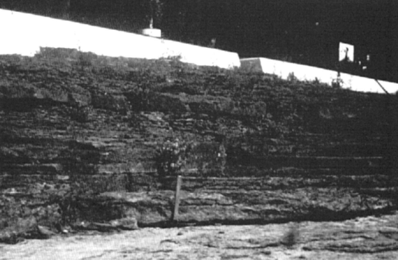
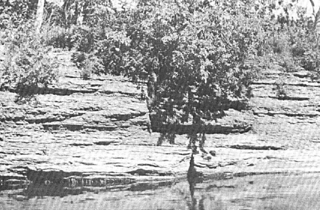
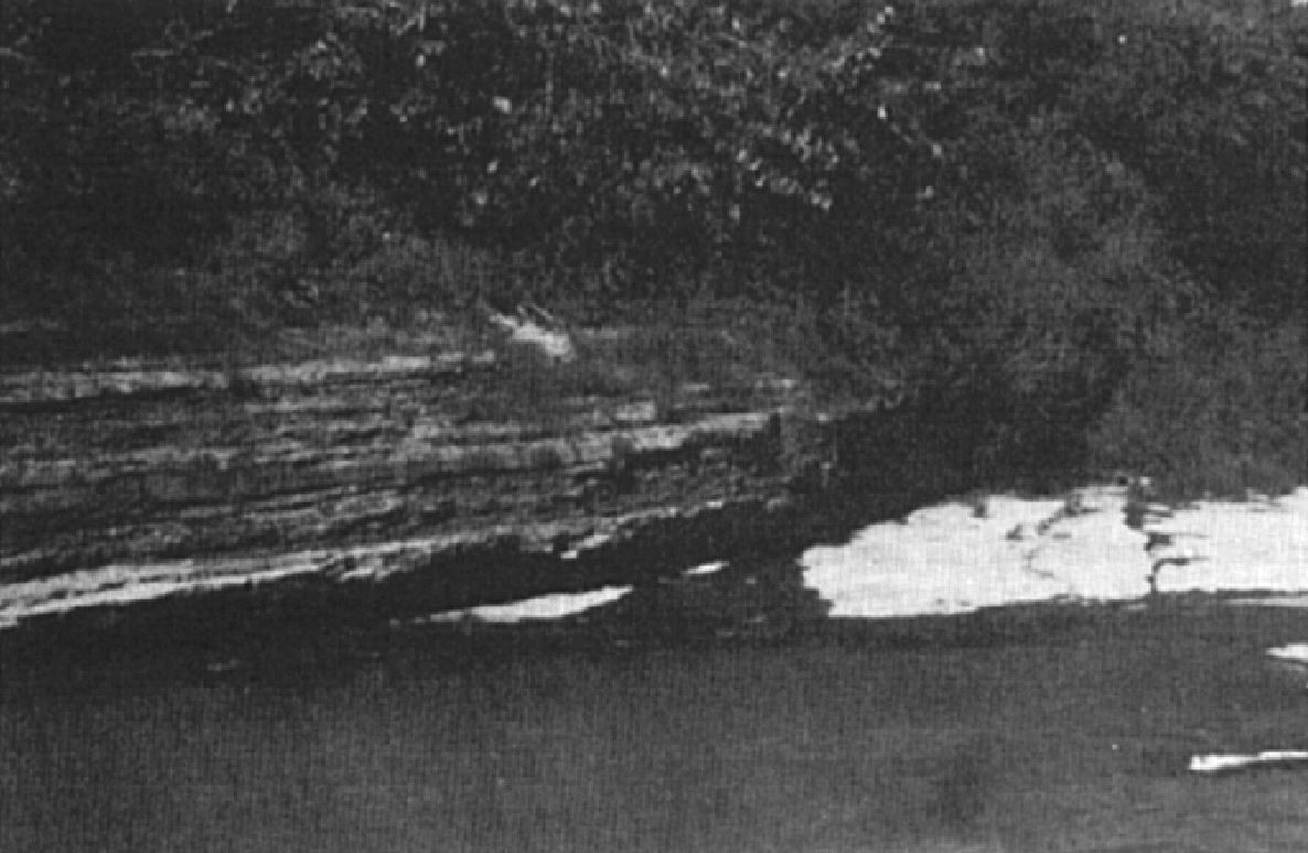
The Montréal Formation consists primarily of limestone with thin shale interbeds (Brun, 1974, 1975; Clark and Globensky, 1976a, b, 1977; Harland and Pickerill, 1982; Globensky, 1981, 1983, 1987, 1993; MNRF, 2009c, e, g, h). It is composed of a wide variety of lithologies (semi-crystalline, micritic or crystalline limestones), but highly-bioturbate argillaceous limestone, in thin and irregular beds, predominates (Harland and Pickerill, 1982; Globensky, 1993). The formation is divided into two faunal zones corresponding to two members: the Saint-Michel Member at the base and the Rosemont Member at the top (Clark, 1952, 1972; Brun, 1974, 1975; Harland and Pickerill, 1982; Globensky, 1981, 1986, 1987, 1993; MRNF, 2009b, d; Thériault, 2014). The Saint-Michel Member is particularly rich in bryozoa and consists of more crystalline and better bedded limestone. The Rosemont Member represents the most fossiliferous unit in the Trenton Group and contains different varieties of wavy-bedded argillaceous limestone. Besides, there is a gradual increase in dark micrite beds and fragmentary limestone beds upward. The variable lithologies of the Montréal Formation reflect equally varied deposition conditions in a shallow (subtidal), low to moderate energy, marine environment (Harland and Pickerill, 1982; Globensky, 1987).
Thickness and distribution
The Montréal Formation outcrops mainly between Joliette and Montréal and the best sections are found in Montréal quarries (Francon and Botanical Garden). Its thickness ranges from 30 to 140 m (Harland and Pickerill, 1982; Globensky, 1993). The unit is also present in the Saint-Jean-sur-Richelieu and Saint-Hyacinthe areas, south and east of Montreal.
Dating
None.
Stratigraphic Relationship(s)
In the Laurentides region, the Montréal Formation is unconformably overlying the Deschambault Formation, whereas in the Sorel area, this contact does not appear sharp, although there is no evidence of a gradual transition (Globensky, 1993). Where the contact was visible, the transition from the Deschambault Formation to the Montréal Formation was correlated by Clark (1952) to the Sherman Fall. The Saint-Casimir Member of the Neuville Formation, observed in areas to the NW, can be correlated with the Montréal Formation, particularly with the Saint-Michel Member (Globensky, 1987).
Paleontology
Abundant benthic fauna dominated by brachiopods is present in the Montréal Formation, with the most representative fossils being (Clark and Globensky, 1976a, b, 1977; Globensky, 1983, 1993): Prasopora simulatrix orientalis (Ulrich), Paucicrura rogata, (Sardeson), Sowerbyella sericea (Sowerby), Zygospira recurvirostris (Hall), Cryptolithus tesselatus (Green).
References
Publications Available Through SIGÉOM Examine
BRUN, J. 1974. ETUDE PETROGRAPHIQUE DES FORMATIONS DU BLACK RIVER ET DU TRENTON DU QUEBEC. MRN. DP 248, 24 pages and 4 plans.
BRUN, J. 1975. ETUDE GEOLOGIQUE ET GEOCHIMIQUE DES FORMATIONS DU BLACK RIVER ET DU TRENTON DU QUEBEC. MRN. DP 296, 45 pages and 4 plans.
CLARK, T H. 1952. MONTREAL AREA, LAVAL AND LACHINE MAPS AREAS. MRN. RG 046(A), 182 pages and 4 plans.
CLARK, T H. 1952. REGION DE MONTREAL, FEUILLES DE LAVAL ET DE LACHINE. MRN. RG 046, 189 pages and 4 plans.
CLARK, T H. 1972. REGION DE MONTREAL. MRN. RG 152, 260 pages and 1 plan.
CLARK, T H., GLOBENSKY, Y. 1976a. REGION DE SOREL ET PARTIE SUD-EST DE SAINT-GABRIEL-DE-BRANDON. MRN. RG 155, 166 pages and 1 plan.
CLARK, T H., GLOBENSKY, Y. 1976b. REGION DES LAURENTIDES (MOITIE EST) ET DE RAWDON (PARTIE SUD-EST). MRN. RG 157, 121 pages and 1 plan.
CLARK, T H., GLOBENSKY, Y. 1977. REGION DE VERCHERES. MRN. RG 190, 72 pages and 1 plan.
GLOBENSKY, Y. 1981. REGION DE LACOLLE - SAINT-JEAN (S). MRN. RG 197, 210 pages and 2 plans.
GLOBENSKY, Y. 1983. REGION DES LAURENTIDES (SW). MRN. MM 82-01, 42 pages and 1 plan.
GLOBENSKY, Y. 1986. GEOLOGIE DE LA REGION DE SAINT-CHRYSOSTOME ET DE LACHINE (SUD). MRN. MM 84-02, 182 pages and 2 plans.
GLOBENSKY, Y. 1987. GEOLOGIE DES BASSES-TERRES DU SAINT-LAURENT. MRN. MM 85-02, 71 pages and 1 plan.
GLOBENSKY, Y. 1993. LEXIQUE STRATIGRAPHIQUE CANADIEN - VOLUME V-B - REGION DES APPALACHES, DES BASSES-TERRES DU SAINT-LAURENT ET DES ILES DE LA MADELEINE. MRN. DV 91-23, 336 pages.
MRNF 2009a. GEOLOGIE 1/50 000, 31H05 - LACHINE. In : MRNF. 2010. CARTE(S) GÉOLOGIQUE(S) DU SIGEOM - feuillet 31h. CG SIGEOM31H, 22 plans.
MRNF 2009b. GEOLOGIE 1/50 000, 31H06 - SAINT-JEAN-SUR-RICHELIEU. In : MRNF. 2010. CARTE(S) GÉOLOGIQUE(S) DU SIGEOM - feuillet 31h. CG SIGEOM31H, 22 plans.
MRNF 2009c. GEOLOGIE 1/50 000, 31H10 - SAINT-HYACINTHE. In : MRNF. 2010. CARTE(S) GÉOLOGIQUE(S) DU SIGEOM - feuillet 31h. CG SIGEOM31H, 22 plans.
MRNF 2009d. GEOLOGIE 1/50 000, 31H12 - LAVAL. In : MRNF. 2010. CARTE(S) GÉOLOGIQUE(S) DU SIGEOM - feuillet 31h. CG SIGEOM31H, 22 plans.
MRNF 2009e. GEOLOGIE 1/50 000, 31H13 - LAURENTIDES. In : MRNF. 2010. CARTE(S) GÉOLOGIQUE(S) DU SIGEOM - feuillet 31h. CG SIGEOM31H, 22 plans.
MRNF 2009f. GEOLOGIE 1/50 000, 31H14 - VERCHÈRES. In : MRNF. 2010. CARTE(S) GÉOLOGIQUE(S) DU SIGEOM - feuillet 31h. CG SIGEOM31H, 22 plans.
MRNF 2009g. GEOLOGIE 1/50 000, 31I03 - SOREL. In : MRNF. 2010. CARTE(S) GÉOLOGIQUE(S) DU SIGEOM - feuillet 31i. CG SIGEOM31M, 16 plans.
MRNF 2009h. GEOLOGIE 1/50 000, 31I06 - SAINT-GABRIEL-DE-BRANDON. In : MRNF. 2010. CARTE(S) GÉOLOGIQUE(S) DU SIGEOM - feuillet 31i. CG SIGEOM31M, 16 plans.
THERIAULT, R. 2014. GEOLOGIE DES BASSES-TERRES DU SAINT-LAURENT. MERN. DV 2014-05, 1 plan.
Other Publications
CLARK, T.H. 1944. Structure and stratigraphy in the vicinity of Montréal. Transactions of the Royal Society of Canada; third series, volume 38, serie iv.
CLARK, T.H. 1959. Stratigraphy of the Trenton Group, St. Lawrence Lowlands, Quebec. Geological Association of Canada; proceedings 1959, pages 13-21.
HARLAND, T.L., PICKERILL, R.K. 1982. A review of Middle Ordovician sedimentation in the St. Lawrence Lowland, eastern Canada. Geological Journal; volume 17, pages 135-156. https://doi.org/10.1002/gj.3350170205