


First published: 14 June 2019
Last modified:
DISCLAIMER: This English version is translated from the original French. In case of any discrepancy, the French version shall prevail.
| Author: | Clark, 1959 |
| Age: | Middle Ordovician |
| Stratotype: | Type section described by Clark and Globenski (1973) on the right bank of the Jacques-Cartier River in Pont-Rouge |
| Type area: | Pont-Rouge area (NTS sheet 21L13) |
| Geological province: | St. Lawrence Platform |
| Geological subdivision: | St. Lawrence Lowlands Platform |
| Lithology: | Sandy limestone, argillaceous limestone |
| Category: | Lithostratigraphic |
| Rank: | Formation |
| Status: | Formal |
| Use: | Active |
- Trenton Group
- Tétreauville Formation
- Montréal Formation
- Neuville Formation
- Deschambault Formation
- Hull Formation
- Saint-Marc Formation
- Ouareau Formation
- Fontaine Formation
- Pont-Rouge Formation
- Mile End Formation
- Sainte-Anne Formation
- Galets Formation
- Shipshaw Formation
- Simard Formation
- Tremblay Formation
- René-Levasseur Formation
Background
Okulitch (1939) had noticed in Pont-Rouge (Sheet 21L13) the presence of limestone from the lower Trenton Group, which overlied the Leray Formation (Black River Group), and which he attributed to a transition zone between these two groups. Clark (1959) suggested the name Pont-Rouge for this unit in reference to the type locality. Subsequently, other limestones of the Pont-Rouge Formation were mapped in the Baie-Saint-Paul and La Malbaie area (sheets 21M07 to 21M09; Hébert and Bilodeau, 1999a-e; Lacoste et al., 1999).
Description
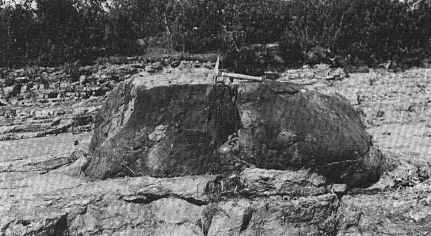
The Pont-Rouge Formation consists of fine-grained light grey to greenish grey crystalline limestone with minor amounts of schistose limestone and semi-lithographic limestone (Clark and Globensky, 1973; Harland and Pickerill, 1982; Globensky, 1993). The type section defined by Clark and Globensky (1973) shows well-exposed step outcrops along the right bank of the Jacques-Cartier River in Pont-Rouge:
| Pont-Rouge Formation | Top of the section, under the railway bridge | 0 m |
| Compact, crystalline limestone beds, grey in altered surface, largely hidden by sewers. | 0.46 m | |
| Crystalline limestone, mostly fine-grained, with minor amounts of schistose limestone. Bedding is irregular. Fossils are abundant, esspecially Receptaculites. | 1.09 m | |
| Fine-grained crystalline limestone, interstratified with whitish semi-lithographic limestone 51-76 cm thick. A 76 cm thick bed can be traced almost the entire length of the outcrop. Some of the semi-lithographic beds are very rich in fossils; most of these beds are overlain by a 3 cm thick bed of argillaceous schist. | 1.27 m | |
| Partially crystalline limestone, light grey to grey, in thin beds ~50 cm thick. A large block of Precambrian granite gneiss lies on limestone. | 0.20 m | |
| Crystalline limestone, fine-grained, light greenish grey. Abundance of irregular chert veinlets. | 0.38 m | |
| Crystalline limestone, fine-grained, slightly greenish grey. Chert veins closely following stratification. Unconformable contact with Black River Group beds. | 0.43 m | |
| 3.83 m |
The formation comprises intraclast layers, typically composed of bioclastic argillaceous limestone, and various quartz sand and silt veins and mixtures through the limestone unit (Harland and Pickerill, 1982). The presence of these quartz sand and silt veins and mixtures suggests a more proximal supply of coastal clastic material in a narrower and more confined deposition environment in the Quebec City area (Pont-Rouge) relative to the Montreal area.
Thickness and distribution
The maximum thickness (3.8 m) of the Pont-Rouge Formation is along the Jacques-Cartier River at the Pont-Rouge type section (Clark and Globensky, 1973). In this area (sheet 21L13), it forms a strip about 12 km by <300 m in width, folded and offset by the Rivière Jacques-Cartier Fault. It also forms several scattered and discontinuous segments not exceeding 2 km long in the Baie-Saint-Paul and La Malbaie area (sheets 21M07 to 21M09).
Dating
None.
Stratigraphic Relationship(s)
The Pont-Rouge Formation is linked to the Rockland Formation in Ontario and can be correlated with the Ouareau, Fontaine and Sainte-Anne formations (Clark and Globensky, 1973; Globensky, 1987, 1993). It lies between the underlying Black River Group and the overlying Deschambault Formation.
Paleontology
Based on an analysis of the fauna by Sinclair (1945) and more specifically of cephalopods by Flower (1945), these authors concluded that beds of the Pont-Rouge type section were of Rockland age, i.e., Lower Trenton Group. The main fossils of this unit are Prasopora simulatix var. orientales, Prasopora constrictus, Batostoma fertili, Subetepora reticulata, Phylloporena subloca (Hussain, 1955; Globensky, 1993).
References
Publications Available Through SIGÉOM Examine
BILODEAU, C., BRUN, J. 2001. GEOLOGIE 1/50 000, 21L13 - SAINT-RAYMOND. In : MRNF. 2010. CARTE(S) GÉOLOGIQUE(S) DU SIGEOM - feuillet 21l. CG SIGEOM21L, 43 plans.
CLARK, T H., GLOBENSKY, Y. 1969. PORTNEUF AND PARTS OF ST-RAYMOND AND LYSTER MAP-AREAS, PORTNEUF AND LOTBINIERE COUNTIES - GEOLOGICAL REPORT. MRN. DP 051, 284 pages and 3 plans.
CLARK, T H., GLOBENSKY, Y. 1973. PORTNEUF AND PARTS OF SAINT-RAYMOND AND LYSTER MAPS ARES, PORTNEUF AND LOTBINIERE COUNTIES. MRN. RG 148(A), 112 pages and 1 plan.
CLARK, T H., GLOBENSKY, Y. 1973. REGION DE PORTNEUF ET PARTIES DE ST-RAYMOND ET DE LYSTER, COMTES DE PORTNEUF ET DE LOTBINIERE. MRN. RG 148, 117 pages and 1 plan.
GLOBENSKY, Y. 1987. GEOLOGIE DES BASSES-TERRES DU SAINT-LAURENT. MRN. MM 85-02, 71 pages and 1 plan.
GLOBENSKY, Y. 1993. LEXIQUE STRATIGRAPHIQUE CANADIEN - VOLUME V-B - REGION DES APPALACHES, DES BASSES-TERRES DU SAINT-LAURENT ET DES ILES DE LA MADELEINE. MRN. DV 91-23, 336 pages.
HÉBERT, C., BILODEAU, C. 1999a. GEOLOGIE 1/20 000, 21M07-200-0202 - BAIE-SAINT-PAUL. In : MRNF. 2010. CARTE(S) GÉOLOGIQUE(S) DU SIGEOM - feuillet 21m. CG SIGEOM21M, 23 plans.
HÉBERT, C., BILODEAU, C. 1999b. GEOLOGIE 1/20 000, 21M09-200-0101 - SAINT-HILARION. In : MRNF. 2010. CARTE(S) GÉOLOGIQUE(S) DU SIGEOM - feuillet 21m. CG SIGEOM21M, 23 plans.
HÉBERT, C., BILODEAU, C. 1999c. GEOLOGIE 1/20 000, 21M09-200-0102 - SAINT-IRENEE. In : MRNF. 2010. CARTE(S) GÉOLOGIQUE(S) DU SIGEOM - feuillet 21m. CG SIGEOM21M, 23 plans.
HÉBERT, C., BILODEAU, C. 1999d. GEOLOGIE 1/20 000, 21M09-200-0201 - NOTRE-DAME-DES-MONTS. In : MRNF. 2010. CARTE(S) GÉOLOGIQUE(S) DU SIGEOM - feuillet 21m. CG SIGEOM21M, 23 plans.
HÉBERT, C., BILODEAU, C. 1999e. GEOLOGIE 1/20 000, 21M09-200-0202 - LA MALBAIE. In : MRNF. 2010. CARTE(S) GÉOLOGIQUE(S) DU SIGEOM - feuillet 21m. CG SIGEOM21M, 23 plans.
LACOSTE, P., HÉBERT, C., BILODEAU, C. 1999. GEOLOGIE 1/50 000, 21M08 - ILES AUX COUDRES. In : MRNF. 2010. CARTE(S) GÉOLOGIQUE(S) DU SIGEOM - feuillet 21m. CG SIGEOM21M, 23 plans.
Other Publications
CLARK, T.H. 1959. Stratigraphy of the Trenton Group, St. Lawrence Lowlands, Quebec. Geological Association of Canada; proceedings 1959, pages 13-21.
FLOWER, R.H. 1945. Brevicaonic Cephalopods from Pont-Rouge, Québec. The Canadian Field-Naturalist; volume 59; pages 74-81.
HARLAND, T.L., PICKERILL, R.K. 1982. A review of Middle Ordovician sedimentation in the St. Lawrence Lowland, eastern Canada. Geological Journal; volume 17, pages 135-156. https://doi.org/10.1002/gj.3350170205
HUSAIN, B.R., 1955. Semi-microfossils of the Black River and Trenton Groups of Quebec. Doctoral thesis, Université McGill, Montréal, 429 pages.
OKULITCH, V.J. 1939. The Black River Group in the region between Montreal and Quebec. American Journal of Sciences; volume 237, pages 81-93.
SINCLAIR, G.W. 1945. An Ordovician faunule from Quebec Province. The Canadian Field-Naturalist; volume 59; pages 71-74.