

First published: 14 June 2019
Last modified:
DISCLAIMER: This English version is translated from the original French. In case of any discrepancy, the French version shall prevail.
| Author: | Clark, 1952, 1959 |
| Age: | Middle Ordovician |
| Stratotype: | Several reference sections have been described in different regions (Clark and Globensky, 1975, 1976a, 1976c, 1977; Globensky, 1983) |
| Type area: | Deschambault area (NTS sheet 21L12) |
| Geological province: | St. Lawrence Platform |
| Geological subdivision: | St. Lawrence Lowlands Platform |
| Lithology: | Crystalline limestone |
| Category: | Lithostratigraphic |
| Rank: | Formation |
| Status: | Formal |
| Use: | Active |
- Trenton Group
- Tétreauville Formation
- Montréal Formation
- Neuville Formation
- Deschambault Formation
- Hull Formation
- Saint-Marc Formation
- Mile End Formation
- Ouareau Formation
- Fontaine Formation
- Pont-Rouge Formation
- Sainte-Anne Formation
- Galets Formation
- Shipshaw Formation
- Simard Formation
- Tremblay Formation
- René-Levasseur Formation
Background
When mapping the St. Lawrence Lowlands, Clark (1952, unpublished manuscript; in Globensky, 1993) gave the name of Deschambault to a limestone unit of the Lower Trenton Group in reference to the village of Deschambault, in the Portneuf area (sheet 21L12). Husain (1955) studied the main microfossils and Clark (1959) officially introduced the term Deschambault Formation.
Description

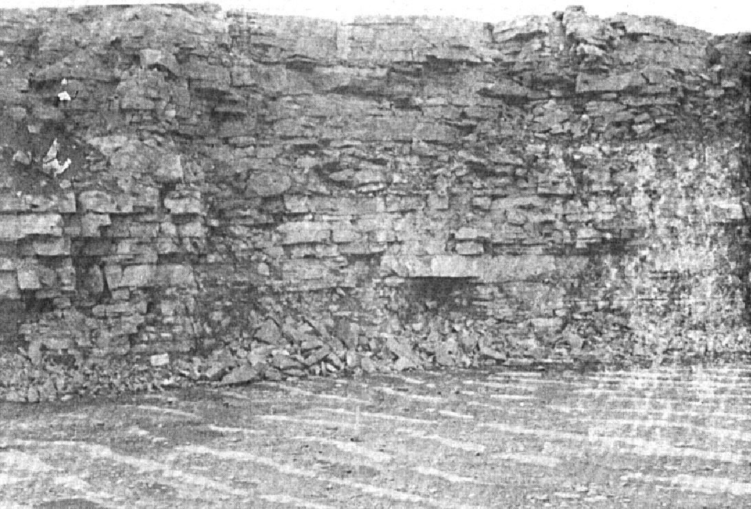
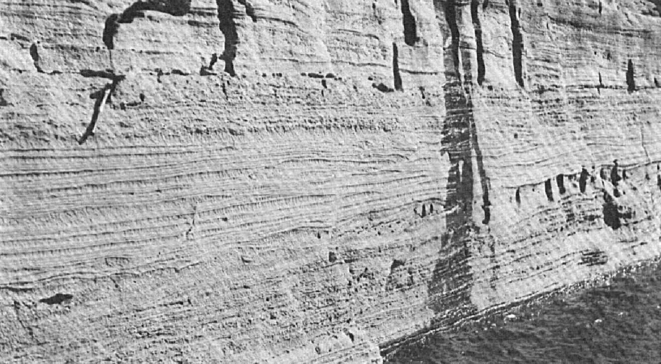
The Deschambault Formation is described in detail in several regions of the St. Lawrence Lowlands (Clark, 1972; Clark and Globensky, 1973a, b 1975, 1976a, b, c 1977; Brun, 1974, 1975; Globensky, 1983, 1986, 1987; Lacoste and Hébert, 1999; MNRF, 2009a-i; Bilodeau and Brun, 2001; Hébert et al., 2012; Lacoste et al., 2012); Harland and Pickerill (1982) and Globensky (1993) summarized it well: “The formation consists typically of a bioclastic crystalline limestone, thick-bedded, cross-bedded, containing several coquina and fragmented shell beds. Limestone is light grey to dark, slightly brown, and varies from very fine to very coarse grained. Bedding is irregular and the numerous basins and tabular cross-bedding are accentuated by the presence of argillaceous laminae. Otherwise, shale beds are sparse or non-existent, although more present at the top of the formation.”
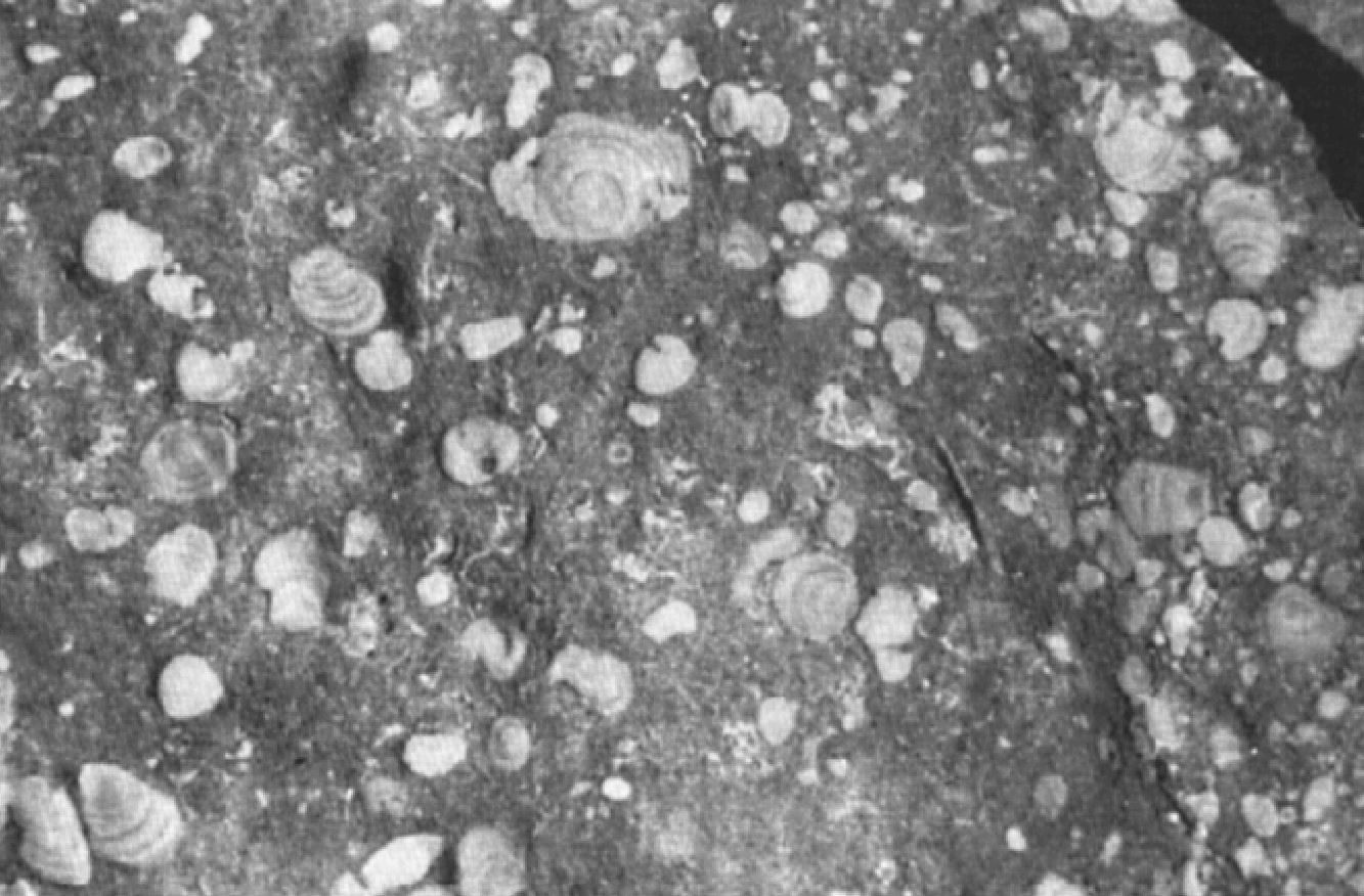
The formation is rich in fossils and contains a very diverse marine fauna, largely composed of polished and water-rounded crinoid plates and stems prior to sedimentation. The formation is dotted with chert nodules and lamellae, which can be up to 30 cm in diameter, but are usually only a few centimetres long. The Deschambault Formation is primarily a high-energy deposit that has accumulated in a complex environment of subtidal shoals, bars, and large moving wrinkles (Harland and Pickerill, 1982). Argillaceous laminae were deposited in calm periods reflecting pauses in the movement of these bottom floor sedimentary figures.
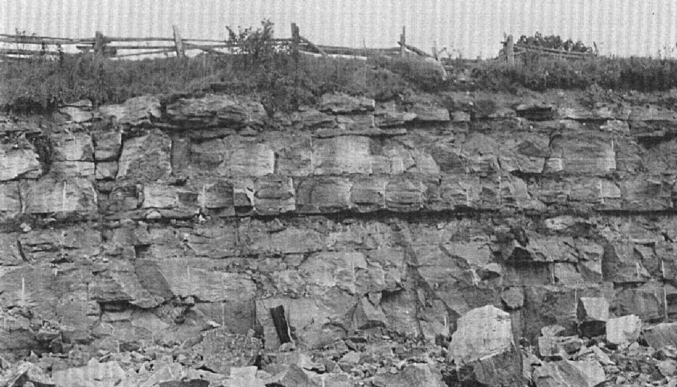
For more than a century, thick upper beds of the Deschambault Formation have been exploited for construction stone and lime-making in Saint-Marc-des-Carrières.
From five sections (Miron Ltd. Company Quarry, Montreal; St-Vincent de Paul Quarry, St-Vincent-de-Paul; Sintra Quarry, St-Jacques; Ciments Indépendants Inc. Quarry, Joliette; Turnbull Construction Inc. Quarry, St-Thomas), Brun (1974, 1975) defined boundary stratotypes between the Mile End and Deschambault formations, as well as between the Deschambault Formation and the Saint-Michel Member of the Montréal Formation: “Mile End-Deschambault boundary: Sharp transition from a very large ‘wakestone’ limestone bed with numerous internal discontinuous undulations (Mile End) to a succession of small ‘packstone’ or ‘wakestone’ limestones arranged in large undulations with shallow oblique laminations (Deschambault 1 [lower package]). Deschambault-St-Michel boundary: Transition from a large ‘grainstone’ or ‘packstone’ limestone bed with steep-slope oblique laminations (Deschambault 3 [upper package]) to small regular beds of dark grey ‘mudstone’ limestone (St-Michel).”
Deschambault Formation 1 (Omdc1): Fossiliferous Micrite
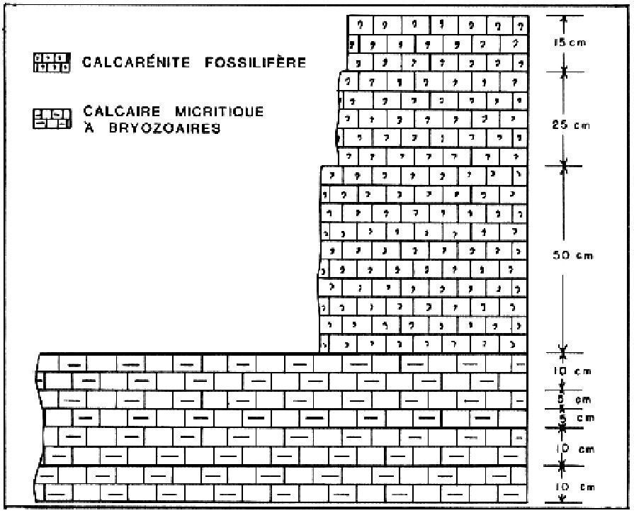
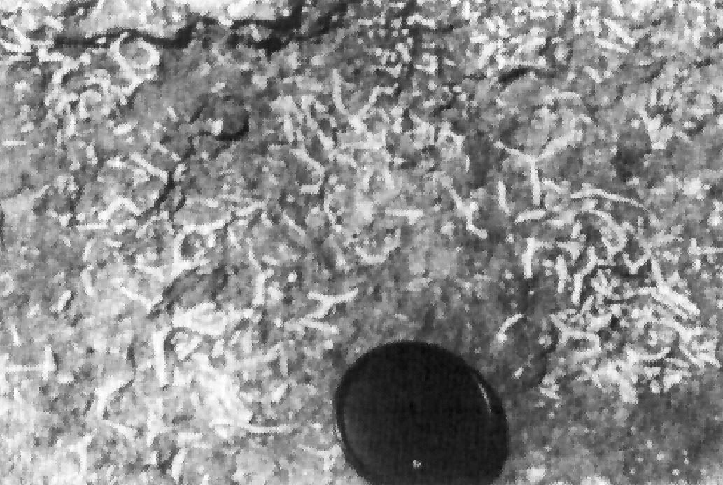
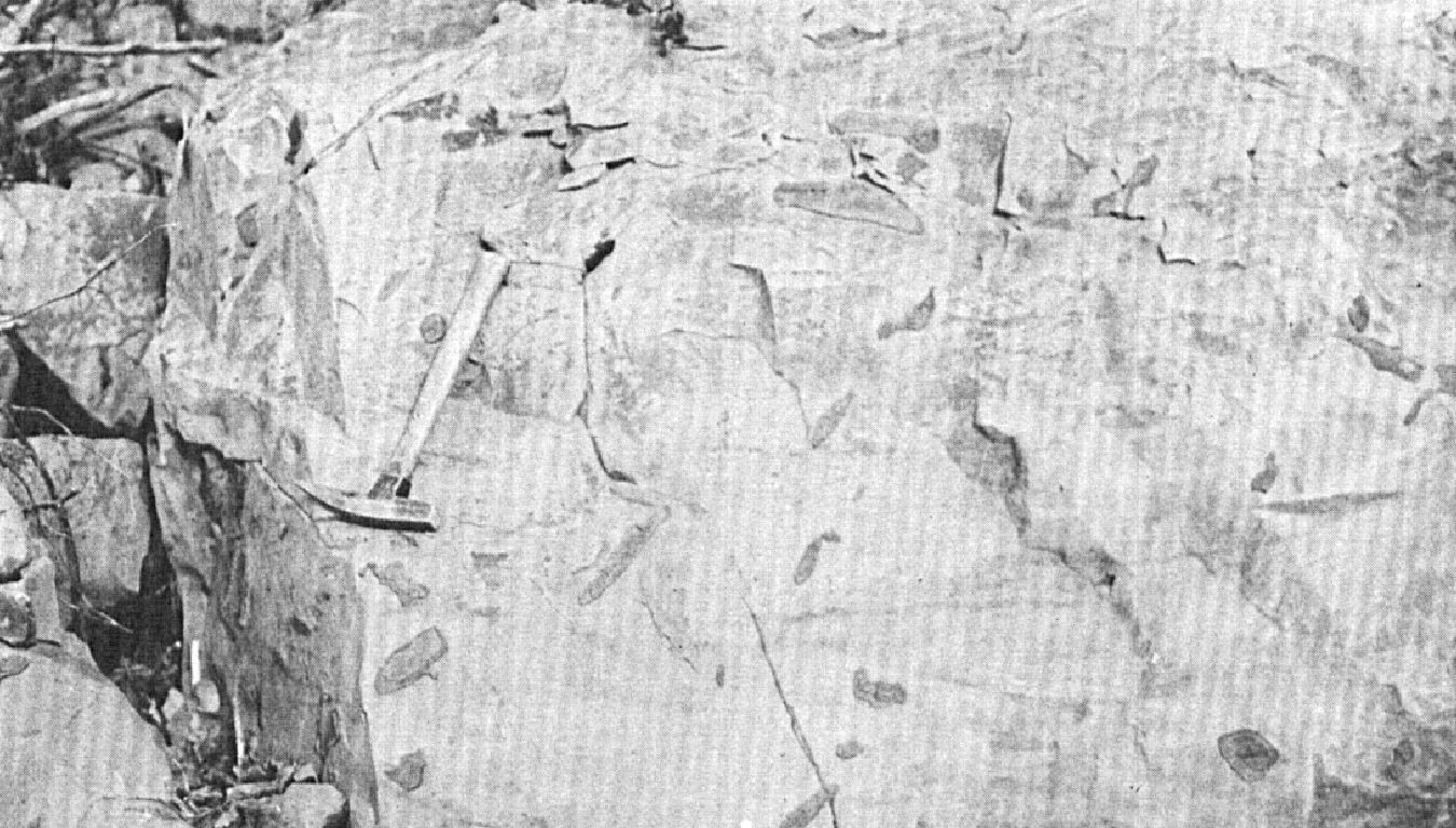
In the Beaupré area (sheet 21M02), Deschambault Formation limestone is described as a fossilliferous micrite. In addition, Globensky (1983) describes a 1.3 m section of the Deschambault Formation in an abandoned quarry of the Laurentian region, 2.5 km NE of Sainte-Anne-des-Plaines (sheet 31H13), the base of which consists of “a grey, micritic, very fossiliferous limestone; bryozoa form real mats there […] bedding is thin (2-10 cm) […]”
Thickness and distribution
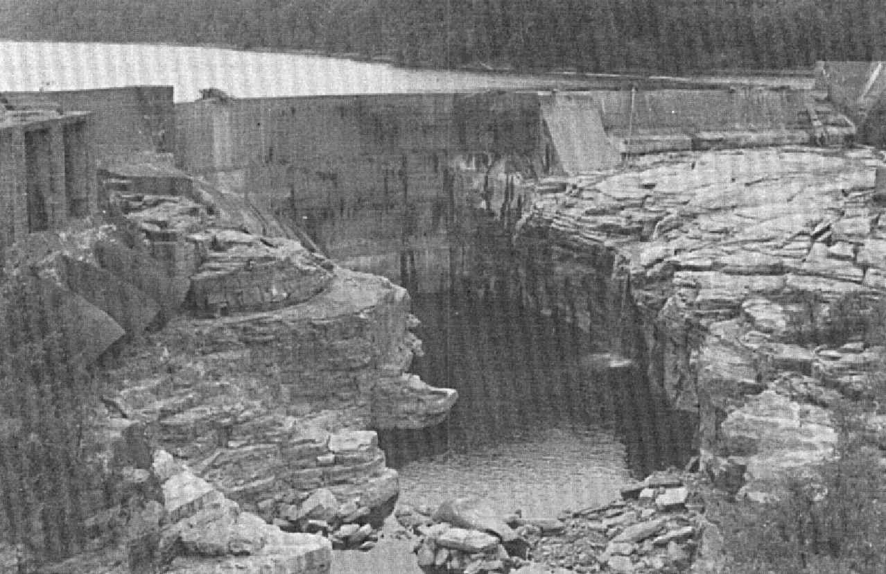
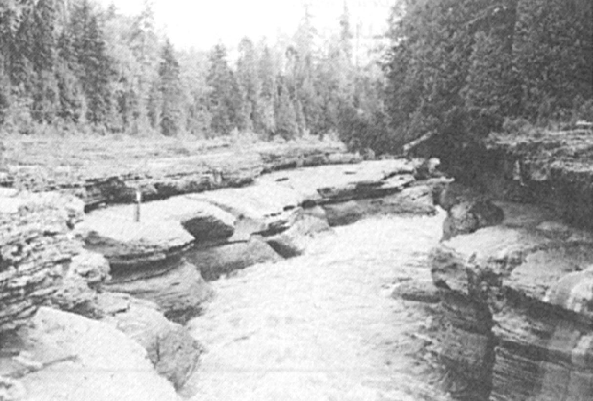
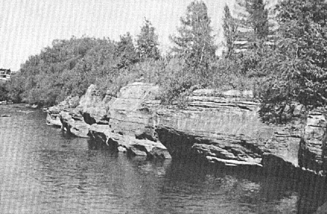
The Deschambault Formation is present throughout the St. Lawrence Lowlands between Montreal (sheet 31H) and Saint-Siméon (sheet 21N13), where the Trenton Group is observed. The thickness of the Deschambault Formation is generally 24-28 m, but decreases to 3-5 m in the Montreal area and reaches 64 m in the Trois-Rivières area (Harland and Pickerill, 1982; Globensky, 1993). The Deschambault Formation forms spectacular gorges where it is cut by important rivers (Clark and Globensky, 1973, 1975, 1976a, b, c, 1977; Globensky, 1987).
Dating
None.
Stratigraphic Relationship(s)
In general, contact with the lower and upper formations is gradual (Harland and Pickerill, 1982; Globensky, 1993). In the Quebec area, the Deschambault Formation rests directly on Precambrian bedrock, while in Charlevoix, it is underlain by the Cap-à-l’Aigle Formation (Black River Group). It is overlain by the Montréal Formation in the Montreal to Joliette areas, or by the Neuville Formation in the Trois-Rivières to Saint-Siméon areas (summarized in the schematic sections of Harland and Pickerill, 1982).
Paleontology
The fauna of the Deschambault Formation, which is very important, is represented by about 90 species. It consists mainly of brachiopods, bryozoans and trilobites, but also of gasteropods and ostracods, including Dinorthis browni, Dinorthis pectinella Emmons, Parastrophia hemiplicata, Solenopora compacta Billings, Refinesquina alternata Conrad, Zygospira recurvirostris (Hall), CaIyptauIax calderi Wilson, Bumastus mil-lent Billings, and Ceraunus pleurexanthemus Green (Husain, 1955; Clark and Globensky, 1975, 1976a, b, c, 1977; Harland and Pickerill, 1982; Globensky, 1987, 1993).
References
Publications Available Through SIGÉOM Examine
BILODEAU, C., BRUN, J. 2001. GEOLOGIE 1/50 000, 21L13 – SAINT-RAYMOND. In : MRNF. 2010. CARTE(S) GÉOLOGIQUE(S) DU SIGEOM – feuillet 21l. CG SIGEOM21L, 43 plans.
BRUN, J. 1974. ETUDE PETROGRAPHIQUE DES FORMATIONS DU BLACK RIVER ET DU TRENTON DU QUEBEC. MRN. DP 248, 24 pages and 4 plans.
BRUN, J. 1975. ETUDE GEOLOGIQUE ET GEOCHIMIQUE DES FORMATIONS DU BLACK RIVER ET DU TRENTON DU QUEBEC. MRN. DP 296, 45 pages and 4 plans.
CLARK, T H. 1972. REGION DE MONTREAL. MRN. RG 152, 260 pages and 1 plan.
CLARK, T H., GLOBENSKY, Y. 1973. PORTNEUF AND PARTS OF SAINT-RAYMOND AND LYSTER MAPS ARES, PORTNEUF AND LOTBINIERE COUNTIES. MRN. RG 148(A), 112 pages and 1 plan.
CLARK, T H., GLOBENSKY, Y. 1973. REGION DE PORTNEUF ET PARTIES DE ST-RAYMOND ET DE LYSTER, COMTES DE PORTNEUF ET DE LOTBINIERE. MRN. RG 148, 117 pages and 1 plan.
CLARK, T H., GLOBENSKY, Y. 1975. REGION DE GRONDINES. MRN. RG 154, 171 pages and 1 plan.
CLARK, T H., GLOBENSKY, Y. 1976a. REGION DE SOREL ET PARTIE SUD-EST DE SAINT-GABRIEL-DE-BRANDON. MRN. RG 155, 166 pages and 1 plan.
CLARK, T H., GLOBENSKY, Y. 1976b. REGION DE TROIS-RIVIERES. MRN. RG 164, 94 pages and 1 plan.
CLARK, T H., GLOBENSKY, Y. 1976c. REGION DES LAURENTIDES (MOITIE EST) ET DE RAWDON (PARTIE SUD-EST). MRN. RG 157, 121 pages and 1 plan.
CLARK, T H., GLOBENSKY, Y. 1977. REGION DE VERCHERES. MRN. RG 190, 72 pages and 1 plan.
GLOBENSKY, Y. 1983. REGION DES LAURENTIDES (SW). MRN. MM 82-01, 42 pages and 1 plan.
GLOBENSKY, Y. 1986. GEOLOGIE DE LA REGION DE SAINT-CHRYSOSTOME ET DE LACHINE (SUD). MRN. MM 84-02, 182 pages and 2 plans.
GLOBENSKY, Y. 1987. GEOLOGIE DES BASSES-TERRES DU SAINT-LAURENT. MRN. MM 85-02, 71 pages and 1 plan.
GLOBENSKY, Y. 1993. LEXIQUE STRATIGRAPHIQUE CANADIEN – VOLUME V-B – REGION DES APPALACHES, DES BASSES-TERRES DU SAINT-LAURENT ET DES ILES DE LA MADELEINE. MRN. DV 91-23, 336 pages.
HEBERT, C., BILODEAU, C., DE SOUZA, S., TREMBLAY, A. 2012. COMPILATION GEOLOGIQUE – SAINT-JOACHIM. MRN. CG-21M02-2012-01, 1 plan.
LACOSTE, P., HÉBERT, C., BILODEAU, C. 1999. GEOLOGIE 1/50 000, 21M08 – ILES AUX COUDRES. In : MRNF. 2010. CARTE(S) GÉOLOGIQUE(S) DU SIGEOM – feuillet 21m. CG SIGEOM21M, 23 plans.
LACOSTE, P., HEBERT, C., BILODEAU, C., DE SOUZA, S., TREMBLAY, A. 2012. COMPILATION GEOLOGIQUE – ILE AUX COUDRES. MRN. CG-21M08-2012-01, 1 plan.
MRNF 2009a. GEOLOGIE 1/50 000, 31H05 – LACHINE. In : MRNF. 2010. CARTE(S) GÉOLOGIQUE(S) DU SIGEOM – feuillet 31h. CG SIGEOM31H, 22 plans.
MRNF 2009b. GEOLOGIE 1/50 000, 31H06 – SAINT-JEAN-SUR-RICHELIEU. In : MRNF. 2010. CARTE(S) GÉOLOGIQUE(S) DU SIGEOM – feuillet 31h. CG SIGEOM31H, 22 plans.
MRNF 2009c. GEOLOGIE 1/50 000, 31H12 – LAVAL. In : MRNF. 2010. CARTE(S) GÉOLOGIQUE(S) DU SIGEOM – feuillet 31h. CG SIGEOM31H, 22 plans.
MRNF 2009d. GEOLOGIE 1/50 000, 31H13 – LAURENTIDES. In : MRNF. 2010. CARTE(S) GÉOLOGIQUE(S) DU SIGEOM – feuillet 31h. CG SIGEOM31H, 22 plans.
MRNF 2009e. GEOLOGIE 1/50 000, 31H14 – VERCHÈRES. In : MRNF. 2010. CARTE(S) GÉOLOGIQUE(S) DU SIGEOM – feuillet 31h. CG SIGEOM31H, 22 plans.
MRNF 2009f. GEOLOGIE 1/50 000, 31I03 – SOREL. In : MRNF. 2010. CARTE(S) GÉOLOGIQUE(S) DU SIGEOM – feuillet 31i. CG SIGEOM31M, 16 plans.
MRNF 2009g. GEOLOGIE 1/50 000, 31I07 – TROIS-RIVIÈRES. In : MRNF. 2010. CARTE(S) GÉOLOGIQUE(S) DU SIGEOM – feuillet 31i. CG SIGEOM31M, 16 plans.
MRNF 2009h. GEOLOGIE 1/50 000, 31I08 – BÉCANCOUR. In : MRNF. 2010. CARTE(S) GÉOLOGIQUE(S) DU SIGEOM – feuillet 31i. CG SIGEOM31M, 16 plans.
MRNF 2009i. GEOLOGIE 1/50 000, 31I09 – GRONDINES. In : MRNF. 2010. CARTE(S) GÉOLOGIQUE(S) DU SIGEOM – feuillet 31i. CG SIGEOM31M, 16 plans.
THERIAULT, R. 2014. GEOLOGIE DES BASSES-TERRES DU SAINT-LAURENT. MERN. DV 2014-05, 1 plan.
Other Publications
CLARK, T.H. 1959. Stratigraphy of the Trenton Group, St. Lawrence Lowlands, Quebec. Geological Association of Canada; proceedings 1959, pages 13-21.
HARLAND, T.L., PICKERILL, R.K. 1982. A review of Middle Ordovician sedimentation in the St. Lawrence Lowland, eastern Canada. Geological Journal; volume 17, pages 135-156. https://doi.org/10.1002/gj.3350170205
HUSAIN, B.R., 1955. Semi-microfossils of the Black River and Trenton Groups of Quebec. Doctoral thesis, Université McGill, Montréal, 429 pages.
YOUNG, F.G. 1964. Petrology of the Deschambault Formation, Trenton Group, St. Lawrence Lowlands of Quebec. Master’s thesis, Université McGill, Montréal. https://escholarship.mcgill.ca/concern/theses/h702q969p