
Geology of the Arnaud River Region, Superior (Minto) and Churchill (Labrador Trough) Provinces, Kangirsuk Area, Nunavik, Quebec, Canada
Project for NTS sheets 24M, 24N, 25C and 25D
Carl Bilodeau and Emmanuel Caron-Côté
BG 2018-04
Translated on 20 November 2018


In Essence
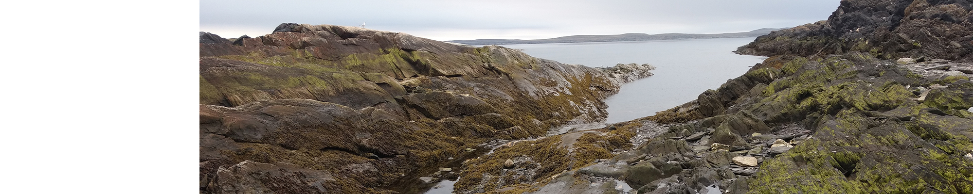
A geological survey was conducted during the summer of 2017 in the Kangirsuk region to map the northern end of the Labrador Trough and part of the Archean Minto Subprovince. Field work and interpretation of high-resolution aeromagnetic survey results have improved the geological map and enhanced the mineral potential of this region.
This part of the Labrador Trough consists of a succession of sedimentary rocks deposited in a continental margin and platform context (iron formation and turbidite), overlain by marine units (basalt and black shale). These rocks are intruded by mafic and ultramafic sills. The complex is found in discordant contact on Archean gneissic and plutonic rocks containing Archean supracrustal rock klippes (amphibolite, paragneiss and iron formation). These units were mostly deformed and metamorphosed during the New Quebec Orogenesis (1.82-1.77 Ga).
The main types of mineralization encountered in the Labrador Trough include massive sulphides associated with mafic volcanic rocks and Ni-Cu-PGE mineralization associated with ultramafic sills. Sulphide mineralization is also associated with localized hydrothermal remobilization in the rims of sulphide clusters and thrust fronts. Several new iron showings have been recognized in the Paleoproterozoic and Archean formations, some of which have gold potential.
Methodology
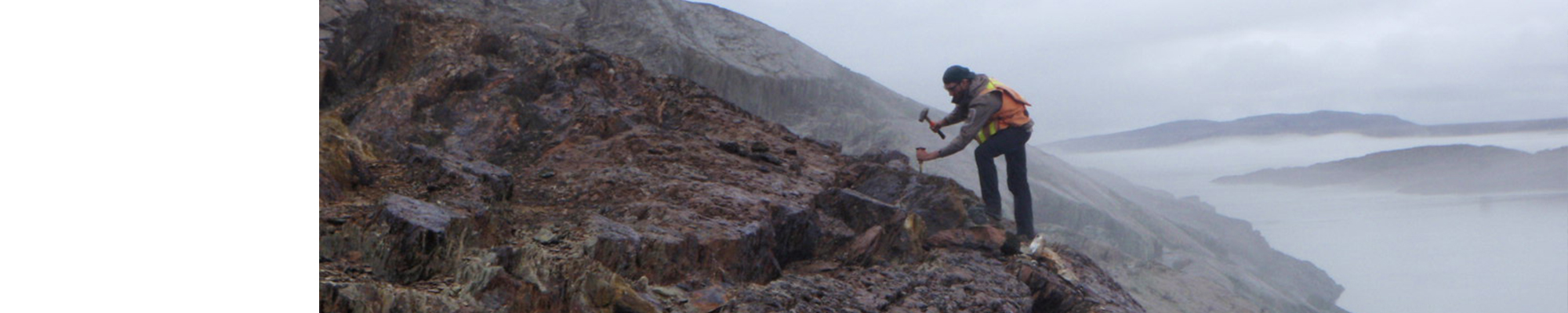
Work in the Kangirsuk region was conducted using the Ministère’s prescribed methodology for surveys conducted in isolated areas.
The work benefited from a recent high-resolution aeromagnetic survey (Benhamed and Intissar, 2015). Maps from these surveys have identified areas where the contacts of previously recognized lithostratigraphic units did not match their magnetic signature. In particular, two areas have undergone an in-depth review:
- the area west of Kangirsuk (NTS sheets 24M14 to 24M16 and 25D01), characterized by numerous Archean supracrustal rock klippes (Arnaud Complex);
- the Labrador Trough south of the Arnaud River (sheets 24N12 and 24N13).
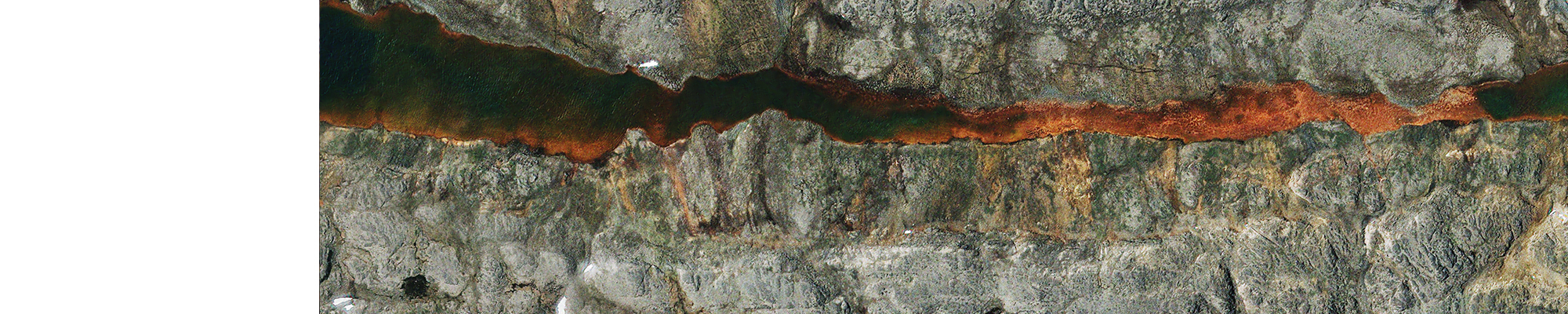
High resolution satellite images (Pléiades) were acquired in the Labrador Trough north of the Payne River (west portion of sheet 25C04, sheet 25D01 and south portion of sheet 25D08). These images helped refine the existing geological map and better target rusty zones and potential mineralization sites.
Mapping of the area helped to produce and update the information presented in the table below:
| Elements | Number |
|---|---|
| Described outcrops (“geofiches”) | 1 163 |
| Total lithogeochemical analyses | 249 |
| Lithogeochemical analyses of metals of economic interest | 227 |
| Geochronological analyses | 3 |
| Covered thin sections | 166 |
| Polished thin sections | 48 |
| Sodium cobaltinitrite stains | 0 |
| Stratigraphic units | 11 |
| Mineralization records | 74 |
Previous Work
| Author(s) | Type of work | Contribution |
|---|---|---|
| Bergeron, 1957 | Mapping work | Geology of the Brochant-de-Bonnard area |
| Hardy, 1976 | Mapping work | Geology of the Roberts and Chefs lakes area |
| Madore et al., 1999 | Mapping work | Geology of the Peters Lake area (sheet 24M) |
| Madore and Larbi, 2000 | Mapping work | Geology of the Arnaud River area (sheet 25D) and adjacent nearshore areas (sheets 25C, 25E and 25F) |
| Clark and Wares, 2004 | Synthesis | Lithotectonic and metallogenic synthesis of the New Quebec Orogen (Labrador Trough) |
| Simard et al., 2008 | Synthesis | Northeast summary of the Superior Province |
| Clark, 1987 | Mineral potential assessment | Platinum group elements in the Labrador Trough |
| Labbé and Lacoste, 2001 | Mineral potential assessment | Environments prospective for volcanogenic-type polymetalllic mineralization in Northern Quebec |
| Lamothe, 2013 | Mineral potential assessment | Assessing the potential for pelitic-mafic volcanic massive sulphide mineralization for the Labrador Trough |
| Lacoste and Sharma, 2010 | Petrographic study | Mineral assemblages, textures and metamorphic facies of northeastern Superior Province |
| Ferron, 2003 | M.Sc. thesis | Structural, stratigraphic and metamorphic correlations of the Cape Smith Belt Paleoproterozoic sequences and the northern Labrador Trough |
| Maurice, 2009 | Ph.D. thesis | Precambrian mafic magmatism in the northeastern Superior Province |
| David et al., 2008 | Geochronological study |
Isotope dating in northeastern Superior Province - 1998, 1999 and 2000 works |
| Benahmed and Intissar, 2015 | Geophysical survey | Magnetic and airborne spectrometry survey in the Arnaud River area, northwest coast of Ungava Bay |
| Intissar et al., 2015 | Interpretation of geophysical data | Qualitative interpretation of aeromagnetic data in the Buron and Brochant rivers areas, west coast of Ungava Bay |
| Benahmed et al., 2016 | Interpretation of geophysical data | Qualitative interpretation of aeromagnetic and spectrometric data in the Arnaud and Laflau rivers areas, west coast of Ungava Bay |
Lithostratigraphy
This section provides a summary description of the lithostratigraphic units encountered in the Kangirsuk region in the summer of 2017. A complete and up-to-date description of these units and associated geochronological data are available in the stratigraphic lexicon using the hyperlinks below. The Arnaud project is located in the Kangirsuk region. It covers the northern end of the Paleoproterozoic units of the Labrador Trough (Churchill Province) and part of the northeastern Archean Minto Subprovince (Superior Province).
The timing of emplacement of these units is illustrated in the stratigraphic diagram below. This interpretation was based on historical data, stratigraphic and cross-cutting relationships observed in the field, as well as available U-Pb and Pb-Pb geochronological data. The units' relative thickness and size are proportional to the mapped areas.
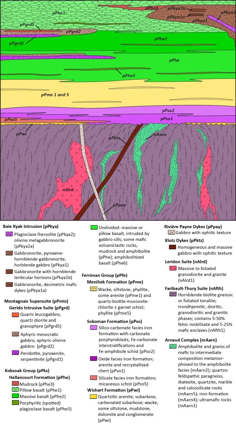
Superior Province
Archean units in the Kangirsuk region belong to the Minto Subprovince of the Superior Province (Simard et al., 2008). They consist of a plutonic and gneissic bedrock (Faribault-Thury Suite, Troie and Qimussinguat complexes) containing areas rich in klippes of older volcano-sedimentary rocks (Arnaud Complex). All of these units are cut by felsic intrusions (Leridon Suite) and two generations of Paleoproterozoic mafic dykes: the Klotz Dykes and the Payne River Dykes.
Archean Units
The Faribault-Thury Suite (nAfth; 2785-2751 Ma) is the most abundant Archean rock unit in the region. It consists of TTG (tonalite-trondhjemite-granodiorite) units dominated by gneissic or foliated tonalite (nAfth1) and, in lesser proportion, gneissic tonalite rich in mafic (nAfth1a) or trondhjemite (nAfth1b) enclaves. The Faribault-Thury Suite surrounds the Troie (mAtie) and Qimussinguat (mAqim) complexes which are interpreted as similar units with a higher metamorphic grade.
The Arnaud Complex (mAarn; Simard et al., 2008) groups the oldest rocks in the region (2870-2718 Ma) and consists mainly of amphibolite and melanocratic mafic gneiss (mAarn2), iron formation (mAarn4), paragneiss, diatexite, quartzite, marble and calcosilicate rocks (mAarn5). There is also a smaller proportion of ultramafic rocks (mAarn1) and dacite and rhyodacite (mAarn3). This unit forms large enclaves in the Faribault-Thury Suite and in the Troie and Qimussinguat complexes. The Arnaud Complex is also cut by intrusions belonging to these same three units.
The Leridon Suite (nAlrd; 2735-2720 Ma) includes several intrusions of massive to foliated granodiorite and granite (nAlrd1), porphyraceous granite (nAlrd2), monzonite and porphyraceous quartz monzonite (nAlrd2a). These rocks form kilometre-wide intrusions scattered in the Faribault-Thury Suite.
Paleoproterozoic Units
The Klotz Dykes (pPktz; 2209 Ma), WNW-ESE oriented, and thelarge Payne River Dykes swarm (pPpay; 2170 and 2160 Ma), NNW-SSE oriented, consist of uralitized gabbro dykes that cut all Archean units in the region. These dykes may have developed during initial rifting of the Labrador Trough (Madore et al., 2000).
Churchill Province
Paleoproterozoic units in the Kangirsuk region belong to the Labrador Trough and the Churchill Province Core Zone. The Labrador Trough units belong to the Ferriman Group of the second volcano-sedimentary cycle and form a normal sequence unconformably overlying rocks of the Superior Province. The pile consists, from base to top, of arenites (Wishart Formation), iron formations (Sokoman Formation), turbidites (Menihek Formation) and basalts (Hellancourt Formation). The sequence is intruded by mafic and ultramafic sills (Gerido Intrusive Suite) and the mafic Baie Kyak Intrusion. The Core Zone is in tectonic contact with the Labrador Trough and is interpreted as Archean terrains reworked in the Paleoproterozoic.
Labrador Trough Units
The Wishart Formation (pPwi) is a few metre-thick unit consisting of quartz arenite, local wacke and scarce conglomerate horizons. It is overlain by shale and ferriferous sandstone of the Ruth Formation (not observed in the mapped area) and ferriferous units of the Sokoman Formation (pPso; 1880 Ma). The Sokoman Formation is characterized by a very strong aeromagnetic anomaly and consists mainly of an oxide facies (pPso1) at the base and a silico-carbonate facies (pPso2) at the top. A silicate facies (pPso5) may also be observed at the base of the formation, in contact with the Wishart Formation, or as interbeds in the silico-carbonate facies. The Sokoman Formation may also be located on rocks of the Superior Province. The Menihek Formation (pPme1) is in normal and sharp contact with the Sokoman Formation and consists of wacke, silstone, phyllite, some arenite and a sandy dolomite horizon. Informal unit pPme5 consists of quartz-biotite-muscovite-chlorite-garnet schist interpreted as strongly metamorphosed equivalents of unit pPme1.
The Hellancourt Formation (pPhe), formed mainly of basalt, overlies the Menihek Formation in interlocking contact. The base of the unit is characterized by an abundance of mafic sills with a speckled appearance (pPhe and pPhe5) which frequency's decreases towards the top of the unit in favour of massive basalt (pPhe2), and then pillow basalt (pPhe1). The summit of the formation is marked by alternating pillow basalt and mudrock horizons (pPhe3) and disseminated sulphide lenses. Zones affected by higher metamorphism show amphibolite (pPhe6) interpreted as the basaltic facies equivalent. The Hellancourt Formation is intruded by differentiated gabbro sills from the Gerido Intrusive Suite (pPgrd) and late Baie Kyak Intrusion (pPkya). Gabbros of the Gerido Intrusive Suite are cut by ultramafic sills associated with nickel mineralization. The aeromagnetic signature of gabbro sills of the Hellancourt Formation (pPhe5) and Gerido Intrusive Suite (pPgrd2 and pPgrd5) is not distinguishable from that of basalt, unlike ultramafic sills (pPgrd1) characterized by strong positive anomalies, and the Baie Kyak Intrusion distinguished by an egg-shaped anomaly.
Core Zone Units
Terrains located east of the Labrador Trough are composed of gneissic and plutonic rocks and amphibolite dykes of undetermined origin and affiliation. There are also metasedimentary sequences containing iron formations and wackes similar to those in the Labrador Trough. This zone has not been extensively worked on.
Structural Geology
The Kangirsuk region is subdivided into three structural domains and a deformation corridor:
- Douglas-Harbour Domain (Minto Subprovince – Superior Province);
- Payne Domain (Labrador Trough – Churchill Province);
- Bonnard Domain (Core Zone – Churchill Province);
- Virgin Deformation Corridor.
The Douglas-Harbour and Payne domains are delimited by a locally sheared stratigraphic discordance. The boundary between the Payne and Bonnard domains is the Virgin Deformation Corridor, a dextral thrust and shear zone.
The region was affected by at least two deformation episodes:
- at least two Archean shortening phases affecting the Douglas- Harbour Domain;
- a shortening phase (D1) and a transpressionnal regime phase (D2) that occurred during the Paleoproterozoic New Quebec Orogenesis between 1.82 and 1.77 Ga (Clark and Wares, 2004). These episodes affect the Payne, Bonnard and eastern Douglas-Harbour domains (1b).

Superior Province
Douglas Harbour Structural Domain – West (1a)
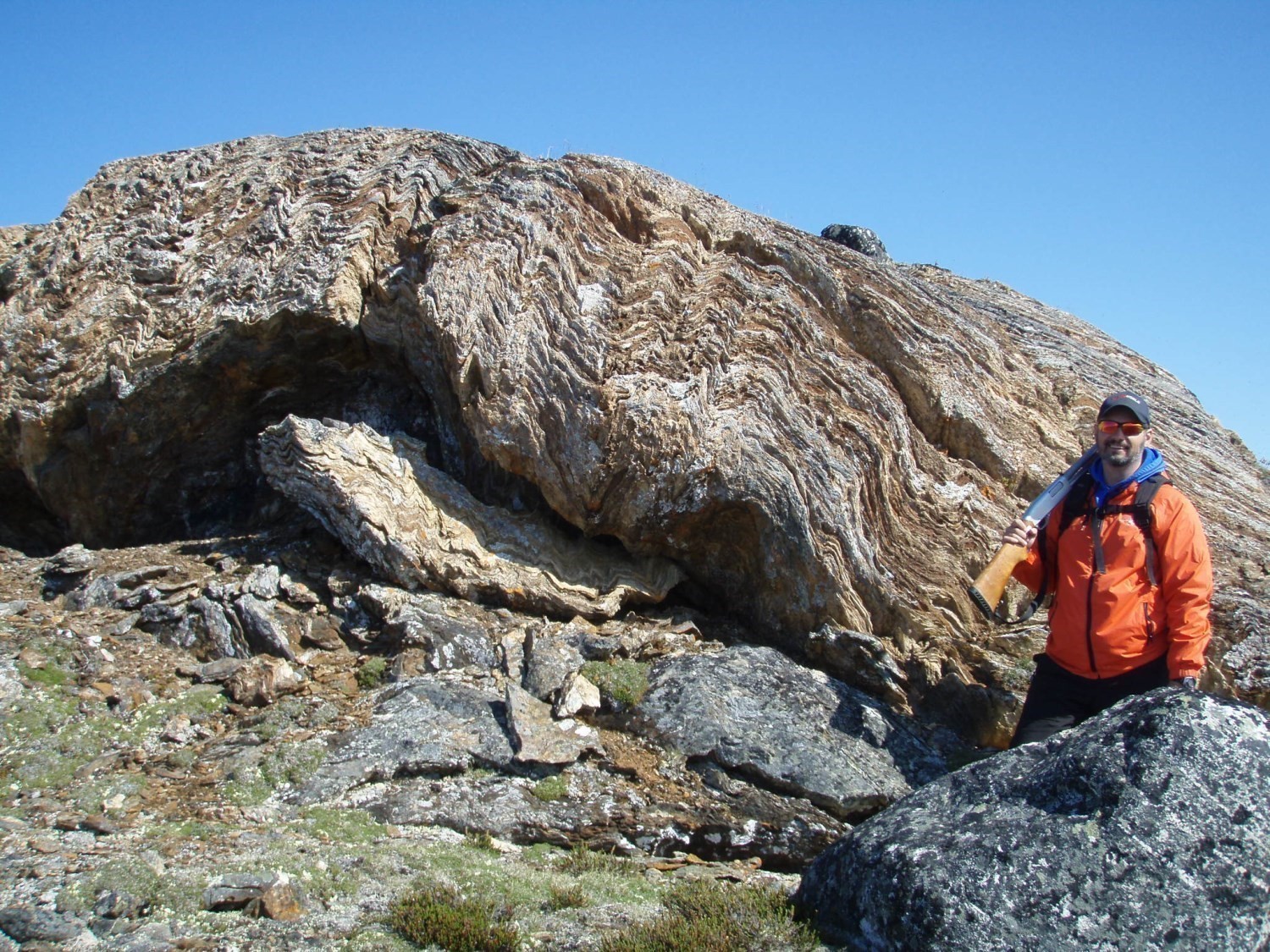
The western part of the Douglas Harbour Domain (1a) was affected by at least two phases of Archean folding. The aeromagnetic map recognizes the structural arrangement of units, including the complex deformation pattern in the supracrustal rock klippes of the Arnaud Complex (mAarn). The local presence of hook and dome structures indicates a complex structural history, but only one fabric and two folding phases have been recognized. The main deformation phase produced open to tight folds of NE-SW orientation and kilometric amplitude. These folds were overprinted by a second phase of open to tight, straight or slightly inclined folds with NNE-SSW axial traces. According to Madore et al. (2000), these structures were locally affected by a N-S ductile shear phase visible both at the outcrop scale and at the map scale. The main planar structure measured in outcrops is a folded gneissossity, with steep dip and locally injected with quartzofeldspathic mobilisate. This foliation is interpreted as a first-generation fabric, which was recrystallized and transposed parallel to the contact of supracrustal units. Shear zones are characterized by the presence of mineral lineation defined by the orientation of metamorphic or ferromagnesian minerals (Madore et al., 2000).
Douglas Harbour Structural Domain – East (1b)
The eastern part of the Douglas-Harbour Domain (1b) comprises the same Archean structural elements as the western part of the domain, which is overprinted by a folding phase and a fabric associated with the Paleoproterozoic New Quebec Orogenesis. The extent of its area of influence is uncertain, but it is assumed that the boundary should be approximately 20 km southwest of the Payne Domain. The Paleoproterozoic deformation phase is particularly evident south of the Arnaud River, where it occurs, in particular, in the hinges of regional folds affecting Paleoproterozoic units. This deformation is expressed by folding and obliteration of Archean gneissossity that is overprinted by the Paleoproterozoic deformation at the edge of folds. Some gabbro dykes (pPpay) in the eastern part of the Douglas-Harbour Domain show schistosity similar to the tonalite host. This fabric marks the axial traces of closed to tight NW-SE folds affecting, in particular, supracrustal klippes of the Arnaud Complex. It also corresponds to the axial schistosity orientation of major folds of the Payne Domain. These observations corroborate those of Madore et al. (2000), who noted the emergence of new cleavages and an increase in the density of faults in Archean units approaching the Payne Domain.
Churchill Province
The entire Churchill Province (Labrador Trought and Core Zone) was affected by the New Quebec Orogenesis. The direction of tectonic constraints has evolved over time, changing the tectonic style (Madore et al., 2000).
This event is associated with at least two distinct deformation phases:
- a shortening phase related to the generation of thrust faults and regional folds;
- a transpressional tectonic episode that causes rocks of the Bonnard Domain to overthrust those of the Payne Domain, via the Virgin Deformation Corridor, accompanied by dextral strike-slip along this latter structure.
A phase, occuring prior to these two deformation phases, was evident in the northern part of the Payne Domain (Madore et al., 2000; Ferron, 2003). This phase was not recognized in the region mapped in 2017.
Payne Structural Domain (2)
The Payne Domain was affected by at least two major deformation episodes associated with the New Quebec Orogenesis (1.82 and 1.77 Ga; Clark and Wares, 2004). Shortening phase D1 produced regional thrusts and folds, the main of which is the Roberts Synclinal located north of the Arnaud River. Rocks of the Payne Domain unconformably overlie (angular discordance) Archean rocks of the eastern part of the Douglas-Harbour Domain. The discordance is generally preserved in the western part of the domain, with the exception of some heavily sheared segments in the northern portion of Roberts Synclinal (Hardy, 1976). The reorientation of tectonic contraints resulted in the transpressional deformation episode D2 affecting the eastern margin of the Payne Domain. This episode resulted in the formation of local folds, imbrications, dextral shear corridors and overthrust of the Bonnard Domain on the Payne Domain. The eastern boundary of the Payne Domain is sheared along its entire length and corresponds to the Virgin Deformation Corridor.
Deformation Phase D1
The Payne Domain is affected by a shortening episode D1 that results in SW-facing thrust faults that produce imbrications parallel to bedding S0. The units and faults are overprinted by regional folding (P1), which is responsible for the formation of a series of overfold SE-dipping synclinals and anticlinals, including the Roberts Synclinal. The fabric associated with this episode is a schistosity with axial plane (S1) oriented at 335°. This fabric is particularly marked along the basal contact of the basaltic sequence of the Hellancourt Formation (units pPhe) with sedimentary rocks of the Menihek Formation (pPme), which suggests that there is decollement at the interface of sedimentary rocks and volcanics. In addition to schistosity S1, the main structural elements measured are fold axes, linear intersection between bedding and schistosity, and elongation of carbonate nodules in iron formations of the Sokoman Formation. These nodules define a lineation with a dip from 10 to 60° to the NE or SW, demonstrating that thrusting precedes folding.
Large-amplitude folds, straight or slightly inclined towards the SE with axial traces oriented NE-SW, were recognized north of Roberts Lake. The orientation of these folds and the associated mineral stretching shallowly dipping towards the NW may indicate a possible decollement phase prior to the formation of the Roberts Synclinal and structures associated with phase D1 (Madore et al., 2000).
Deformation Phase D2
The eastern part of the Payne Domain is affected by a second deformation episode D2 resulting from a transpresionnal tectonic regime. This phase is responsible for the formation of tight asymmetric folds (P2) of 30 to 300 m amplitude and orientation at 155°, subparallel to axial traces of P1 folds. Areas affected by folding phases P1 and P2 have hook or small elongated dome and basin interference patterns. This fold generation is associated with a schistosity S2 that transposes schistosity S1. The intensity of the deformation intensifies when approaching the Bonnard Domain and Virgin Deformation Corridor, notably by the appearance of dextral shear zones hectometre thick.
Bonnard Structural Domain (3)
The Bonnard Domain consists of recrystallized gneissic units of the Core Zone and of at least two folded strips of metasedimentary rocks of uncertain affiliation. The latter units, however, were assigned to the Labrador Trough due to the presence of oxide iron formation, but could also represent an extension of the Laporte Supersuite (pPlpt). They are interpreted as synclinal axial parts, but their structural arrangement has yet to be defined. These metasedimentary rocks are recrystallized with the main foliation parallel to the domain fabric and are intruded by syntectonic to post-tectonic felsic material. The Bonnard Domain also contains metamorphosed equivalents of the Payne River mafic Dykes, occuring as amphibolite boudins conformable with foliation (Madore et al., 2000).
Virgin Deformation Corridor (4)

The Virgin Deformation Corridor groups the deformation zones affecting volcano-sedimentary rocks located on the eastern edge of the Payne Structural Domain, in contact with gneissic rocks of the western margin of the Bonnard Domain. This structure is the result of a reorientation of the main tectonic constraint during the D2 episode of the collision between these two domains during the Paleoproterozoic New Quebec Orogenesis. The Virgin Corridor is a large aeromagnetic lineament that moves from a NW-SE direction north of the Payne River to N-S south of the Payne River. It is marked by the presence of shear zones, tightening of folds, local overfolding of units and a significant increase in the degree of metamorphism. Rocks are heavily deformed and heavily cut by boudinaged or dismembered quartz veins, most of which are kinetic indicators showing dextral strike-slip. The Virgin Deformation Corridor consists of several families of decametre to hectometre-thick mylonitic corridors in the Bonnard Domain. These subvertical zones, oriented at 320°, show a predominant subhorizontal stretching lineation in Archean units (Madore et al., 2000).
Metamorphism
All units in the region have been metamorphosed, with the exception of some Paleoproterozoic dykes that intrude into the Archean bedrock. The Faribault-Thury Suite and the Arnaud Complex contain few diagnostic minerals to determine their degree of metamorphism. The presence of garnet, muscovite, biotite and amphibole, as well as rock recrystallization, suggest conditions at the amphibolite facies. Rocks are locally retrograded to the upper greenschist facies or to the lower amphibolite facies. A significant proportion of these rocks have variably undergone partial melting, which can be noticed by the presence of 5 to 50% felsic mobilisate injections. This observation indicates that these rocks probably reached the upper amphibolite facies. This phenomenon is related to the New Quebec Orogenesis, which affects the eastern part of the Archean basement approaching the Labrador Trough. Associated shear zones consist of muscovite-biotite-epidote-chlorite schists (Madore et al., 2000). The western portion of the bedrock was subjected to high pressure and temperature conditions of the granulite facies (Troie and Qimussinguat complexes), as evidenced by the orthopyroxene-clinopyroxene-hornblende-plagioclase-quartz-biotite assemblage. Monazites gave metamorphic ages of 2707 ±3 Ma, while titanites gave an age of 2701 ±1 Ma (Madore et al., 2000).
Metabasalts of the Payne Domain are composed of actinolite, chlorite, epidote and quartz, a characteristic assemblage of the greenschist metamorphic facies. The majority of metasedimentary rocks in this part of the Labrador Trough are derived from mature, terrigenous sediments and therefore do not contain diagnostic metamorphic minerals. The western margin of the Virgin Deformation Corridor and the area south of the Payne River (Brochant River area) are composed of rocks metamorphosed to the upper greenschist facies up to the amphibolite facies. Garnet is ubiquitous in sedimentary rocks and granoblastic metabasalts contain hornblende and plagioclase. Mafic rocks, surrounding the thrust front approaching the Bonnard Domain, contain garnet and locally staurotide, indicating higher pressure conditions. Metamorphism of the Bonnard Domain is not known. The disappearance of original igneous textures of these rocks suggests high metamorphic conditions, but does not reach the upper amphibolite facies since no evidence of partial melting has been mentioned.
Economic Geology
The Kangirsuk area has prospective zones for four types of mineralization:
- base metal massive sulphide mineralization associated with mafic volcanic rocks;
- magmatic nickel-copper-PGE mineralization associated with mafic to ultramafic intrusions;
- paleoproterozoic and archean iron formations with iron and gold potential;
- epigenetic Cu mineralization associated with deformation corridors.
The table below presents the results of analyses for the 74 mineralized zones of the study area, including 15 new metallic showings and one new non-metallic showing discovered as part of our work.
(E) : selected sample; (R) : channel; (F) : drillhole
The table of lithogeochemical analyses of metals of economic interest provides the location, description and results of the samples selected to assess the economic potential of the region.
New Prospective Zones for Exploration of Base Metal Massive Sulphides Associated with Mafic Volcanic Rocks
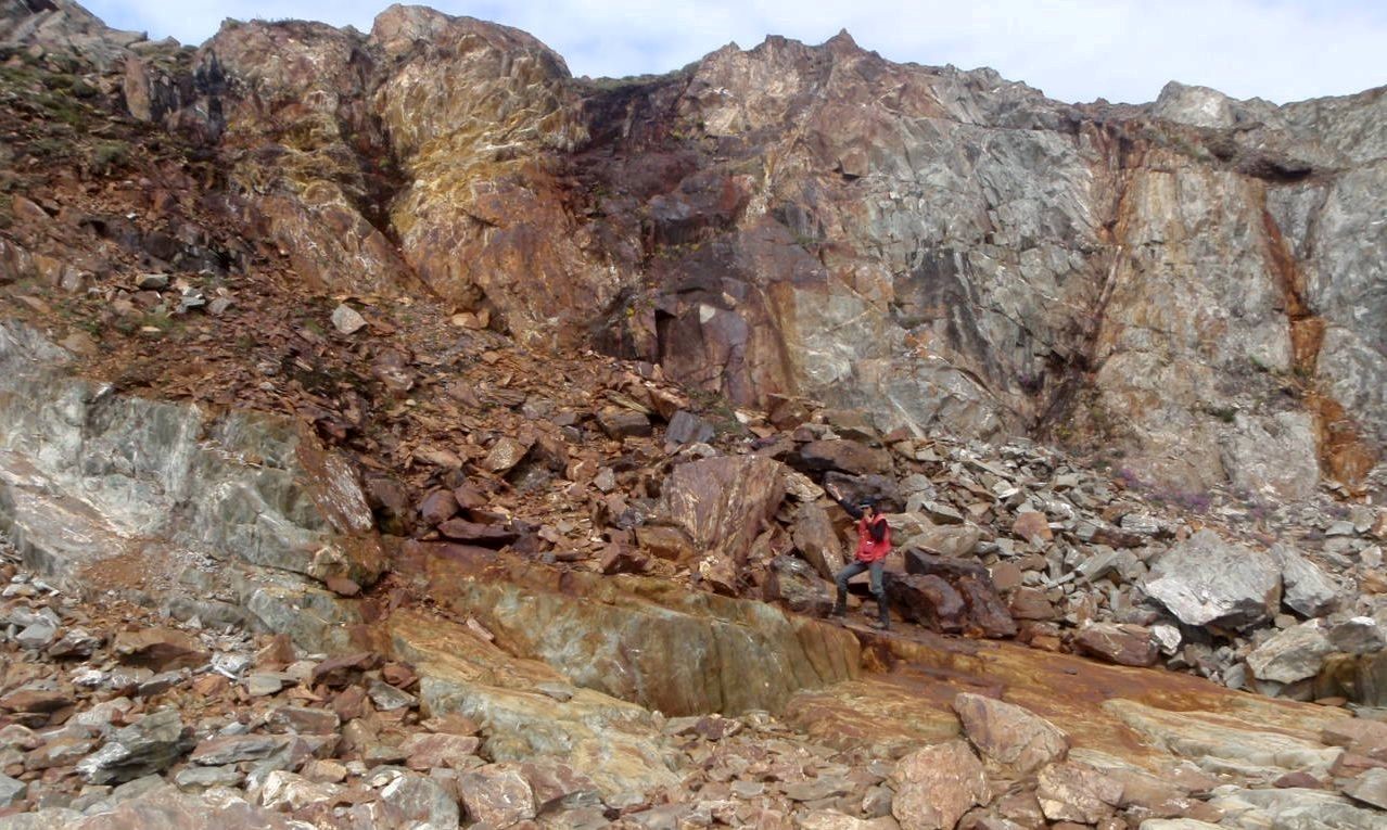

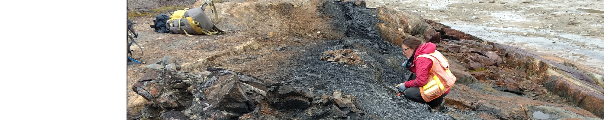
In the Kangirsuk area, the Hellancourt Formation has prospective zones for exploration of base metals (Cu-Zn). These stratiform mineralized zones are usually hosted in pillow basalt (pPhe1) and consist of tabular horizons, metre to decametre thick, and hectometre to kilometre long. A significant mineralized horizon of this type was identified over a distance of approximately 25 km along the eastern shore of the Hardy Lake tributary river. It is located on the western limb of the Roberts Synclinal and runs along the eastern contact of the largest sill of the Gerido Intrusive Suite in the region. Several other less significant horizons are located on the north shore of the Arnaud River, east of Kangirsuk. These prospective zones generally consist of silicified and pyrrhotite mineralized basalt, pyritic and graphitic mudrock and massive to semi-massive sulphides (PO-PY±CP±SP). They are locally associated with heavily altered albite mudrock characterized by high sodium contents (up to 9% Na2O; sample 2017070539). Silicified basalt occurs as metric to decametric horizons containing 1 to 20% of very fine-grained disseminated pyrrhotite accompanied by millimetric veinlets of black chlorite. Areas in between pillows also show quartz and carbonate replacement. Decimetric to metric horizons of pyritic mudrock contain 1 to 20% of fine-grained euhedral pyrite. Decimetric to metric horizons of semi-massive to massive sulphide are either in contact with silicified basalt or associated with pyritic mudrock horizons. These sulphides are fine to very fine grained and have either laminated, massive or brecciated textures. An example of this type of mineralization is the lac Chaunet NE mineralized zone. This mineralization was uncovered during exploration for nickel and copper associated with mafic and ultramafic intrusions in the region. In the Chaunet Lake area, basalt and graphitic and sulphidic sediments reported anomalous values in Cu, Zn and Au (Huot et al., 2011; Simard et al., 2012 ).
Ni-Cu-PGE Mineralization Associated with Mafic to Ultramafic Intrusions
The Roberts Synclinal in the Labrador Trough is known for its many Ni-Cu-PGE mineralized zones. These zones are hosted in mafic and ultramafic sills of the Gerido Intrusive Suite, as well as the Baie Kyak Intrusion. They are generally composed of pyrrhotite, chalcopyrite and pentlandite.
Mineralization Associated with Mafic Sills of the Gerido Intrusive Suite
Mafic sills (pPgrd) mainly intrude into basalts of the Hellancourt Formation and are locally associated with pyritic or graphitic mudrock and massive to semi-massive sulphides, which may have been the source of the sulphur that led to the formation of magmatic mineralization. Sulphides are disseminated in gabbro, peridotite and pyroxenite. The Lac Chaunet, Lac Chaunet 2 and Lac Chaunet Nord showings, about 30 km northwest of Kangirsuk, shows this type of mineralization.
Mineralization Associated with Ultramafic Sills of the Gerido Intrusive Suite
Ultramafic sills (pPgrd1) are the host units of the Qarqasiaq and Tasikutaak showings. These sills form differentiated intrusions, mostly composed of peridotite and, to a lesser extent, of gabbro. They are located in the Quarqasiaq Lake area, to the north and NW of Perron Lake and to the SW of Chaunet Lake. In some places, they are spatially associated with pelitic horizons that may be a source of sulphur relevant to the formation of magmatic Cu-Ni-PGE mineralization. These mineralizations are similar to those encountered at the Raglan Mine (Huot et al., 2011). They occur as metre-thick massive, semi-massive and disseminated sulphide lenses with a decametric lateral extension. Lenses are located at the contact between peridotite and basalt host-rock or in a thrust fault, which may have resulted in the remobilization of some of the mineralization.
Baie Kyak Intrusion
The Baie Kyak Intrusion (pPkya) is a kilometre-wide intrusion in the axial part of the Roberts Synclinal, north of Kangirsuk. This unit consists of a differentiated stock of mafic rocks of variable composition (pPkya1) and, locally, of ultramafic rocks (pPkya2). Its magmatic bedding shows a polarity towards the NW. The mafic and bedded Baie Kyak Intrusion (pPkya) contains the Twin Lake, Muscox and Sondage PB00-03 mineralization zones, located near the stratigraphic base and in the NE portion of the intrusion. Sulphides are disseminated, reticulate, semi-massive and massive. Mineralization is in several locations associated with dykes or peridotite and norite lenses. Systematic analysis of drilhole PB00-03 (Laporte et al., 2013) yielded 0.44% Ni and 0.16% Cu over 289 m.
Iron and Gold Potential of Paleoproterozoic and Archean Iron Formations

The Labrador Trough is known for its iron deposits found in the Sokoman Formation, near Schefferville. The Hopes Advances project includes several iron formations in the study area and was the subject of a pre-feasibility study in 2014. This work identified resources of 1251.6 Mt to 35.9% Fe in the Roberts Lake area (within the Roberts Synclinal) and 611.8 Mt to 22.2% Fe in the Morgann Lake area (corresponding to the Brochant River area of this report, immediately south of the Arnaud River; Canova, 2014). Three new showings are added to the list of 57 historical mineralized zones in rocks of the Sokoman Formation in the study area. These mineralizations consist of 10 to 50 m thick and hectometric banded sequences formed of magnetic iron formations, containing specular hematite locally.
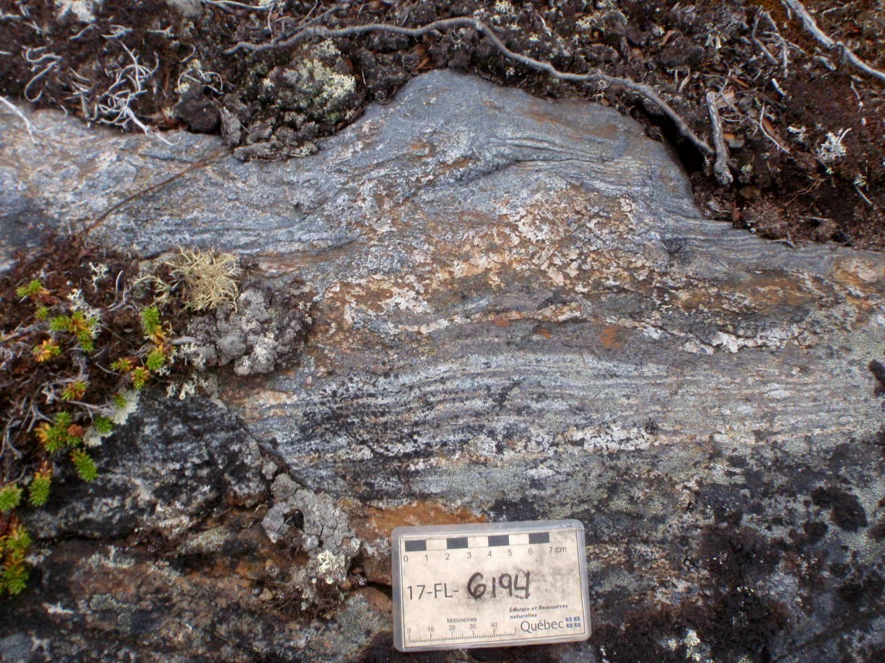
Nine new showings have been identified in the Algoma-type iron formations included in klippes of Archean supracrustal rock of the Arnaud Complex (Superior Province). They consist of magnetite and amphibole formations, metre to decametre thick. However, little is known about their distribution and lateral extension. In addition, an anomalous value of 735 ppb Au obtained from a selected sample (outcrop 17-FL-6194, analysis: 2017070532) confirms the gold potential of Archean iron formations recognized in the northeastern Superior Province, Ashuanipi Subprovince and other similar cratons (e.g., the Yilgarn Craton, Australia; Simard et al., 2008). There are also some examples of gold mineralization associated with partial replacement of silicate iron formations in the Baby Formation (north-central Labrador Trough), which have, however, experienced lower metamorphic conditions (Clark and Wares, 2004).
Epigenetic Cu Mineralization Associated with the Virgin Deformation Corridor

The west coast of Ungava Bay is crossed by a major deformation corridor, the Virgin Deformation Corridor, which marks thrusting of Archean units (Churchill Province Core Zone) over Paleoproterozoic volcano-sedimentary rocks of the Labrador Trough. This deformation zone is accompanied by an increase in the degree of metamorphism and the intensity of hydrothermal activity. A quartz vein 0.3 to 1.0 m thick sampled in the Sinaujarjuaq Lake area yielded 8020 ppm Cu (outcrop 17-RP-3158, Lac Sinaujarjuaq showing). The vein contains chalcopyrite and pyrite, disseminated and in clusters containing malachite. It cuts the foliation subconformably in an amphibolitized metabasalt unit of the Hellancourt Formation.
New Type of Mineralization in the Kangirsuk Area: Corindon showing
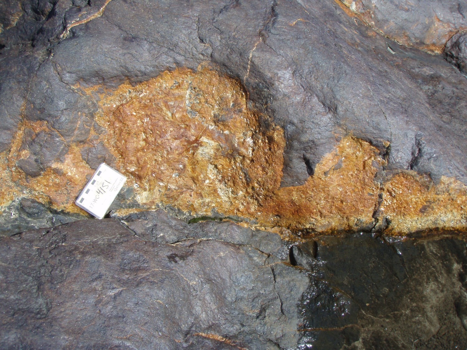
The Sitamat showing is the first mineralization of this type in the study area. This discovery may indicate potential for this industrial mineral in the Labrador Trough. The showing was found on outcrop 17-WC-4151 located on the southern edge of the Arnaud River, 1 km to the SW of the Sitamat islets and 11 km to the Kangirsuk SE. The mineralized body forms an area of low relief of about 5 m by 5 m. It is hosted in basalt of the Hellancourt Formation, adjacent to semi-massive sulphide and albitized mudrock horizons containing up to 9% Na2O. The rock, whose protolith is undetermined, contains 60 to 80% of medium-grained corundum. It is distinguished from the host basalt by its dark purple colour in altered surface, its conchoidal fracture, its larger positive relief, its greater hardness and the abundance of quartz, mica and amphibole veins. A sample analysis (2017070597) shows values of 76.7% Al2O3 and 3.8% TiO2, which suggests a leaching of major oxides, and an equivalent enrichment in immobile elements (Al2O3, TiO2, Zr, Nb). It is likely that the corundum mineralized area is the product of intense leaching followed by metamorphism of an already aluminum-rich protolith, such as a leucogabbro or a mudrock. The leaching is likely associated with circulation of the same hydrothermal fluids that altered adjacent mudrock into albite and deposited the semi-massive sulphides. The recrystallization is likely related to contact metamorphism, resulting from the intrusion of the Gerido Intrusive Suite or the Hellancourt Formation sills. However, no sills or intrusion were observed in the area of the corundum mineralized body.
| Authors | Carl Bilodeau, P.Geo., M.Sc. carl.bilodeau@mern.gouv.qc.ca Emmanuel Caron-Côté, GIT, M.Sc. emmanuel.caron-cote@mern.gouv.qc.ca |
| Geochemistry | Fabien Solgadi, P.Geo., Ph.D. |
| Geophysics | Siham Benhamed, GIT, M.Sc. Rachid Intissar, P.Geo, M.Sc. |
| Potential assessment | Hanafi Hammouche, P.Geo., M.Sc. |
| Logistics | Clotilde Duvergier, GIT, B.Sc. Marie-France Beaulieu, GIT, B.Sc. |
| Geomatics | Julie Sauvageau Kathleen O'Brien |
| Editing | Claude Dion, Eng., M.Sc. |
| Critical review | James Moorhead, P.Geo., M.Sc. Patrice Roy, P.Geo., M.Sc. |
| English version | Céline Dupuis, P.Geo., Ph. D |
| Organism | General direction of Géologie Québec, Ministère de l'Énergie et des Ressources naturelles, Government of Québec |
Acknowledgements:
The authors would like to thank geologists Renato Henrique-Pinto, William Chartier-Montreuil, Sacha Lafrance and Florence Lanouette, students Antoine April, Ariane Chourot, Gabriel Bolduc, Alexandra Harvey, Marjorie Larocque-Plante and Sean Kudluk, as well as Carole Conway, Calvin Buckle, Jannick Croteau, Benoit Demers, Peak Aviation team Eva, Joe, Alik and Elvis from the Kangirsuk community. In particular, the Arnaud team would like to thank Sean McDonagh of Arctic Adventures and the Fédération des coopératives du Nouveau-Québec (FCNQ) for its seamless logistical support throughout the project.
References
Publications available through Sigeom Examine
Other publications
BILODEAU, C., CARON-CÔTÉ, E., 2018. Geology of the Arnaud River Region, Superior (Minto) and Churchill (Labrador Trough) Provinces, Kangirsuk Area, Nunavik, Quebec, Canada. MRNF; BG 2018-04, 2 plans.