

Last modified: 13 February 2019
Translation of original French
| Author: | Buchan et al., 1998 |
| Age: | Paleoproterozoic |
| Reference section: | None |
| Type area: | Klotz Lake area (NTS sheet 35A) |
| Geological province: | Superior Province |
| Geological subdivision: | Minto Subprovince |
| Lithology: | Intrusive mafic rocks |
| Type: | Lithodemic |
| Rank: | Lithodeme |
| Status: | Formal |
| Use: | Active |
None
Background
Post-Archean diabase dykes and sills were recognized during the first geological mapping campaigns of the Canadian Shield in Quebec and Ontario (e.g., Murray et al., 1897). The Klotz Dyke unit was first documented by Fahrig and West (1986) as a result of their compilation work, supported by the interpretation of aeromagnetic surveys. They illustrated the distribution of the Canadian Shield diabase dyke swarms and their chronologies based on isotopic ages. On this map, the WNW-oriented dykes (Klotz Dykes) in northern Quebec are attributed to the New Quebec Swarm. Subsequently, rocks of the New Quebec Swarm were attributed to the new Klotz Dykes unit introduced by Buchan et al. (1998). These dykes are plotted from outcrops and the magnetic field vertical gradient map. They have a straight-line signature along kilometric distances with a WNW orientation. Reconnaissance work by the Quebec Ministère des Resources naturelles has mapped the Klotz Dykes in NTS sheets 24M (Madore et al., 1999), 25C, 25E and 25F (Madore and Larbi, 2000), 35A and 35H (Madore et al., 2001), 24E (Berclaz et al., 2001), 34P (Cadieux et al., 2002), 35B and 35G (Madore et al., 2002), 34O (Berclaz et al., 2002), 35C and 35F (Maurice et al., 2003), and 34N and 34M (Maurice et al., 2004).
Description
 The Klotz Dykes are similar in location to the Rivière Payne Dykes. They have therefore been documented in the same work with similar descriptions, since they show several mineralogical and petrographic affinities (Madore et al., 1999; Madore and Larbi, 2000; Madore et al., 2001; Madore et al., 2002; Maurice et al., 2003; Maurice et al., 2005). In some areas, the Klotz Dykes present some characteristics that differentiate them from the Rivière Payne Dykes (Berclaz et al., 2002; Cadieux et al., 2002).
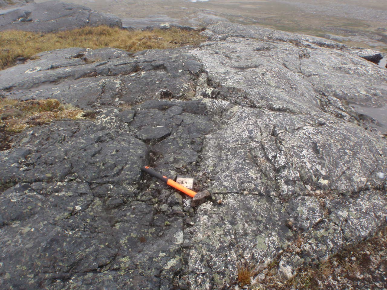
The Klotz Dykes consist of gabbro; they have a subophitic to ophitic texture, and are medium to coarse-grained. Rock is light medium green (Berclaz et al., 2002; Cadieux et al., 2002). Gabbro is composed of euhedral plagioclase crystals surrounded by a matrix of clinopyroxene and locally, anhedral to subhedral orthopyroxene. Dykes have aphanitic chilled margins of decimetric thickness, containing euhedral microcrystals of plagioclase and augite aligned with contact with the host rock (Madore et al., 1999). Common accessory minerals are quartz, iron and titanium oxides and biotite.
Deformation and metamorphism of dykes cutting the Troie and Qimussinguat complexes are generously null, while intrusions in the northeastern portion of the Faribault-Thury Suite show deformation and metamorphism that intensifies eastward towards the Labrador Trough (Madore et al., 1999). The amphibolite metamorphic facies is thus reached within the Diana Complex, as evidenced by the loss of their original igneous characteristics (Madore and Larbi, 2000). Metamorphic and alteration minerals include chlorite and amphibole partially replacing ferromagnesian minerals, as well as a sericite-epidote assemblage replacing plagioclase. Dykes located near large brittle faults are also altered and contain chlorite, hematite and epidote veins (Madore et al., 2001).
Thickness and Distribution
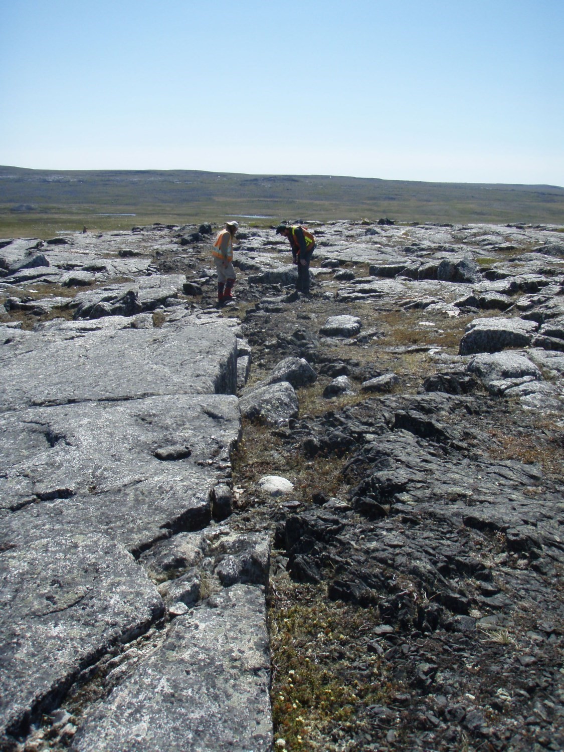
Klotz Dykes have thicknesses ranging from 0.5 m to 100 m, and range in lengths of up to 250 km. They are spaced from 1 to 20 km apart. Dykes are straight-lined and have a general WNW-ESE orientation. They are located to the northeast of the Minto Subprovince, and are predominant in NTS sheets 35A and 35B. Dykes are also highly present in sheets 34N and 34P and in smaller proportions in sheets 34M, 34O, 35C, 35F, 35G, 25D, 24M and 24N.
Dating
Buchan et al. (1998) conducted a geochronological study of baddeleyites and zircons collected from a Klotz Dyke sample and obtained an age of 2209 ±0.8 Ma.
| Isotopic System | Mineral | Crystallization Age (Ma) | (+) | (-) | Reference(s) |
| U-Pb | Zircon and baddeleyite | 2209.7 | 0.8 | 0.8 | Buchan et al., 1998 |
Stratigraphic Relationship(s)
Paleoproterozoic Klotz Dykes cut Minto Subprovince’s Archean rocks. Contacts with host rocks are sharp. Locally, these dykes are associated with brittle fault zones (Berclaz et al., 2002; Cadieux et al., 2002; Madore et al., 2001). Buchan et al. (1998) proposed that the Klotz, Maguire and Senneterre dykes collectively represent a giant dyke swarm that had dispersed laterally from a hearth southeast of Ungava Bay.
Paleontology
Does not Apply.
References
| Author(s) | Title | Year of Publication | Hyperlink (EXAMINE or Other) |
|---|---|---|---|
| BERCLAZ, A. – CADIEUX, A.-M. – SHARMA, K.N.M. – DAVID, J. – PARENT, M. – LECLAIR, A. | Géologie de la région du lac Aigneau (24E et 24F/04). Ministère des Ressources naturelles, Québec; RG 2001-01, 50 pages. | 2001 | RG 2001-01 |
| BERCLAZ, A. – CADIEUX, A.-M. – SHARMA, K.N.M. – DAVID, J. – PARENT, M. – LECLAIR, A. | Geology of the lac Aigneau area (24E et 24F/04). Ministère des Ressources naturelles, Québec; RG 2001-05, 50 pages. | 2002 | RG 2001-05 |
| BERCLAZ, A. – MAURICE, C. – LACOSTE, P. – DAVID, J. – LECLERC, F. – SHARMA, K.N.M. – LABBÉ, J.-Y. – GOULET, N. – BÉDARD, J. – VALLIÈRES, J. | Géologie de la région du lac Anuc (34O). Ministère des Ressources naturelles, Québec; RG 2002-14, 60 pages. | 2002 | RG 2002-14 |
| BERCLAZ, A. – MAURICE, C. – LACOSTE, P. – DAVID, J. – LECLERC, F. – SHARMA, K.N.M. – LABBÉ, J.-Y. – GOULET, N. – BÉDARD, J. – VALLIÈRES, J. | Geology of the lac Anuc area (34O). Ministère des Ressources naturelles, Québec; RG 2003-05, 55 pages. | 2005 | RG 2003-05 |
| BUCHAN, K.L. – ERNST, R.E. | Diabase dyke swarms and related units in Canada and adjacent regions. Commission géologique du Canada, Carte série « A » 2022A, 39 pages, 1 feuille. | 2004 | Source |
| BUCHAN, K.L. – MORTENSEN, J.K. – CARD, K.D. – PERCIVAL, J.A. | Paleomagnetism and U–Pb geochronology of diabase dyke swarms of Minto block, Superior Province, Quebec, Canada. | 1998 | Source |
| CADIEUX, A.-M. – BERCLAZ, A. – LABBÉ, J.-Y. – LACOSTE, P. – DAVID, J. – SHARMA, K.N.M. | Géologie de la région du lac Pélican (SNRC 34P). Ministère des Ressources naturelles, Québec; RG 2002-02, 49 pages. | 2002 | RG 2002-02 |
| CADIEUX, A.-M. – BERCLAZ, A. – LABBÉ, J.-Y. – LACOSTE, P. – DAVID, J. – SHARMA, K.N.M. | Geology of the lac du Pelican area (34P). Ministère des Ressources naturelles, Québec; RG 2002-08, 48 pages. | 2004 | RG 2002-08 |
| FAHRIG, W.F. – WEST, T.D. | Diabase dykes swarms of the Canadian Shield – Essaims de dykes diabasiques du Bouclier canadien. Commission géologique du Canada; carte 1627A. | 1986 | Source |
| GILL, J.E. – L’ESPÉRANCE, R. | Diabase Dykes in the Canadian Shield. Transactions of the Royal Society of Canada; volume XLVI, series III, section four, pages 25-36. | 1952 | – |
| L’ESPÉRANCE, R.L. | A study of the diabase dykes of the Canadian Shield. McGill University; Master’s thesis, 48 pages, 1 carte. | 1948 | – |
| MADORE, L. – LARBI, Y. – SHARMA, K.N.M. – LABBÉ, J.-Y. – LACOSTE, P. – DAVID, J. – BROUSSEAU, K. – HOCQ, M. | Géologie de la région du lac Klotz (35A) et du Cratère du Nouveau-Québec (1/2 sud de 35H). Ministère des Ressources naturelles, Québec; RG 2001-09, 44 pages. | 2001 | RG 2001-09 |
| MADORE, L. – LARBI, Y. – SHARMA, K.N.M. – LABBÉ, J.-Y. – LACOSTE, P. – DAVID, J. – BROUSSEAU, K. – HOCQ, M. | Geology of the lac Klotz (35A) and the Cratère du Nouveau-Québec (southern half of 35H) areas. Ministère des Ressources naturelles, Québec; RG 2002-05, 41 pages. | 2002 | RG 2002-05 |
| MADORE, L. – LARBI, Y. | Géologie de la région de la rivière Arnaud (SNRC 25D) et des régions littorales adjacentes (SNRC 25C, 25E et 25F). Ministère des Ressources naturelles, Québec; RG 2000-05, 35 pages. | 2000 | RG 2000-05 |
| MADORE, L. – LARBI, Y. | Geology of the riviere Arnaud area (25D) and adjacent coastal areas (25C, 25E and 25F). Ministère des Ressources naturelles, Québec; RG 2001-06, 35 pages. | 2001 | RG 2001-06 |
| MADORE, L. – BANDYAYERA, D. – BÉDARD, J.H. – BROUILLETTE, P. – SHARMA, K.N.M. – BEAUMIER, M. – DAVID, J. | Géologie de la région du lac Peters (SNRC 24M). Ministère des Ressources naturelles, Québec; RG 99-07, 39 pages. | 1999 | RG 99-07 |
| MADORE, L. – BANDYAYERA, D. – BÉDARD, J.H. – BROUILLETTE, P. – SHARMA, K.N.M. – BEAUMIER, M. – DAVID, J. | Geology of the Lac Peters area (24M). Ministère des Ressources naturelles, Québec; RG 99-16, 43 pages. | 2000 | RG 99-16 |
| MAURICE, C., – BERCLAZ, A., – DAVID, J., – SHARMA, K.N.M., – LACOSTE, P. | Géologie de la région de Povungnituk (35C) et de Kovik Bay (35F). Ministère des Ressources naturelles, Québec; RG 2003-06, 44 pages. | 2004 | RG 2003-06 |
| MAURICE, C. – BERCLAZ, A. – DAVID, J. – SHARMA, K.N.M. – LACOSTE, P. | Geology of the Povungnituk (35C) and Kovic Bay (35F)areas. Ministère des Ressources naturelles, Québec; RG 2004-05, 41 pages. | 2005 | RG 2004-05 |
| MAURICE, C. – LACOSTE, P. – BERCLAZ, A. – DAVID, J. – SHARMA, K.N.M. | Géologie de la région de Kogaluk Bay (34N et 34M). Ministère des Ressources naturelles, Québec; RG 2004-01, 37 pages. | 2005 | |
| MAURICE, C. | The Precambrian mafic magmatism of the Northeastern Superior Province, Canada. Ph. D. Thesis, McGill University, Montréal, 276 pages. | 2009 | Source |
| MOORE, E.S. | Keweenawan Olivine Diabase of the Canadian Shield. Transactions of the Royal Society of Canada; section IV, pages 39-45. | 1929 | – |
| MURRAY, A. – BELL, R. – BARLOW, A.E. | Province of Ontario, Nipissing, Algoma and Parry Sound districts, French River sheet. Geological Survey of Canada; map 570. | 1897 | Source |
| SIMARD, M. – LABBÉ, J.-Y. – MAURICE, C. – LACOSTE, P. – LECLAIR, A. – BOILY, M. | Synthèse du nord-est de la Province du Supérieur. Ministère des Ressources naturelles et de la Faune, Québec; MM 2008-02, 196 pages. | 2008 | MM 2008-02 |