

Last modified:
Translation of original French
| Author: | Harrison, 1952 |
| Age: | Paleoproterozoic |
| Stratotype: | The reference section is at Wishart Lake (54°43′ N, 66°50′ W, NTS sheet 23J10), south of Schefferville. |
| Type area: | Wishart Lake area (Newfoundland and Labrador, sheet 23J10) |
| Geological province: | Churchill Province |
| Geological subdivision: | New Quebec Orogen (Labrador Trough) / Bérard, Cambrien, Howse, Hurst, Mélèzes, Payne, Schefferville and Tamarack lithotectonic zones |
| Lithology: | Sedimentary rocks |
| Category: | Lithostratigraphic |
| Rank: | Formation |
| Status: | Formal |
| Use: | Active |
Background
The term Wishart Quartzite was introduced by the Labrador Mining and Exploration Company (1949, in Frarey and Duffell, 1964). The name Wishart Formation was formally proposed by Harrison (1952). The application of the name was extended by Rivers (1980) south of the Labrador Trough on the Newfoundland and Labrador side, where it replaced the term Carol Formation (Gastil and Knowles, 1960) which was discontinued.
Hardy (1976) mapped rocks of the Wishart Formation in the Roberts and Des Chefs lakes area, north of Kangirsuk, at the northern end of the Labrador Trough. Dimroth (1978) also mapped these rocks in the southern part of the Labrador Trough. Several works describing the Wishart Formation took place in the central Labrador Trough. The main ones are Dressler (1973, 1975, 1979) in the Patu Lake area and around Fort Mackenzie, and Clark (1977, 1979) in the Forbes and Napiers lakes area.
Description
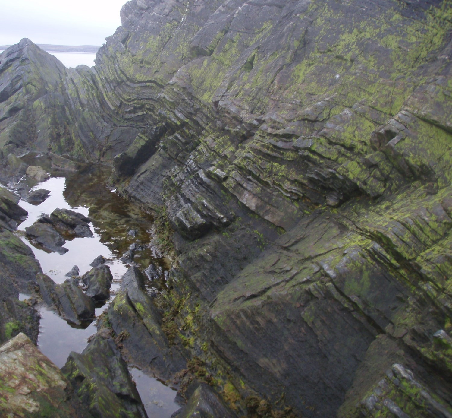
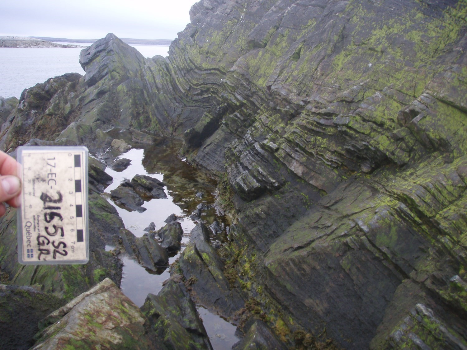
The Wishart Formation is a sedimentary unit found in all autochtonous, parautochtonous and allochtonous zones of the Labrador Trough, with the exception of the Howse Zone (Clark and Wares, 2004). It consists mainly of quartz arenite and smaller proportions of subarkose. More locally, it contains wacke, siltite, mudrock, dolomitic sandstone, dolomite, quartzite, micaceous schist and conglomerate.
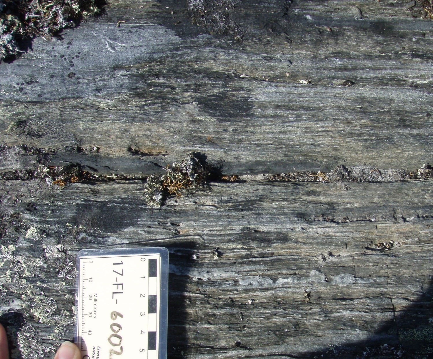
Quartz arenite is usually grey or white and more locally greenish grey. It is fine to medium-grained and commonly saccharoidal in appearance. It has a massive or bedded structure and in some places has sedimentary structures such as cross-bedding and current ripples (Harrisson, 1952; Dressler, 1973; Dimroth, 1972). In the Willbob and Griffis lakes area, the base and locally the top of the formation show bedded structure (Harrison, 1952). It is composed of about 90-95 % well-rounded quartz grains and generally contain less than 5 % feldspar. Accessory minerals are muscovite, carbonate, stilpnomelane, hornblende, cummingtonite, magnetite and pyrite. Harrison (1952) also observed tourmaline and zircon as accessory mineral phase. Quartz arenite is generally cemented by clay, chert or dolomite matrices (Dimroth, 1972).
Subarkose occurs as lenses (Dimorth, 1972). It ranges in length from 10 to 15 m and is 0.5 m thick (Harrison, 1952).It is fine to medium-grained and generally grey, white and locally pink (Dressler, 1975). It is composed of quartz and up to 25% feldspar, mostly represented by microcline (Dimroth, 1972).
The majority of wackes have been observed in the Roberts Synclinal, where these rocks predominate as well as quartz arenites (Bilodeau and Caron-Côté, 2018). Wackes are also observed in the centre and east of the Trough (Dimroth, 1978). Wacke is light medium grey and brownish medium grey in altered surface and medium grey in fresh exposure. It is very fine to fine-grained and has laminations and schist structure. It is composed of quartz, biotite and muscovite, and commonly has magnetite as an accessory mineral.
Siltite and mudrock occur locally and usually in the form of interbeds up to 30 cm thick (Dressler ,1973, 1975, 1979; Dimorth, 1971, 1972). They are grey to greenish grey. Locally they have cross-bedded laminations and load figures, and usually consist of alternating 5-mm mudrock, siltite and fine-grained arenite beds (Dimroth, 1972).
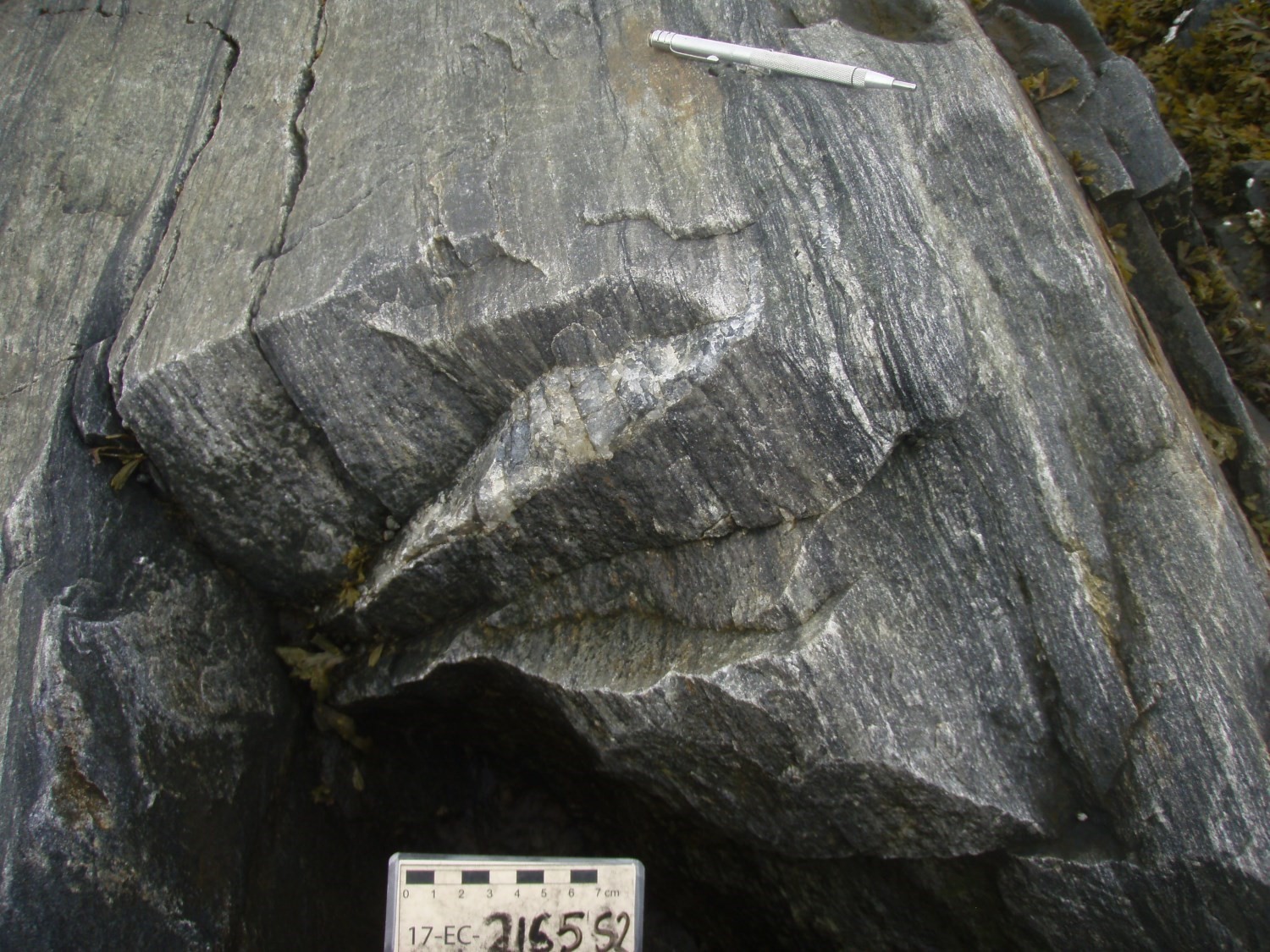
Conglomerate was observed very locally (Dressler, 1979; Dimroth, 1971, 1972). It occurs at different stratigraphic levels as beds about 30 cm thick (Dimroth, 1972). It is composed of quartz, feldspar and fragments of chert, mudrock, siltite and very locally dolomite (Dimroth, 1972, 1978). It is cemented by either clay, chert or dolomite matrices (Dimroth, 1972).
Basal conglomerate was described and observed exclusively on the western flank of the Roberts Synclinal, at a few locations in the area between the Faucons and Yvon lakes (Hardy, 1976). Bed thickness ranges from 1 to 5 m. Conglomerate contains 15 to 20% fragments of quartzofeldspathic rock measuring 2 to 20 cm. These fragments are generally very narrow and are surrounded by very rounded centimetric stones of quartz. In a few places, the matrix consists of more than 50% of these pebbles cemented by fine-grained quartz and dolomite.
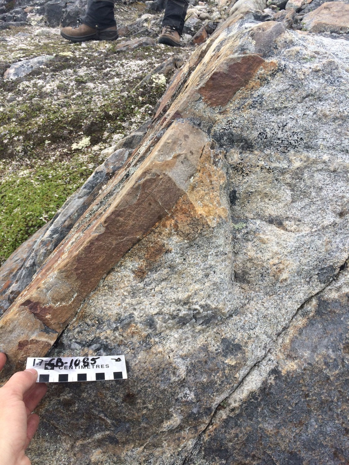
Dolomite beds are very local in the Forbes Lake area (Clark, 1977). These beds are 1 cm to 2 m thick. A dolomite unit is also found in the middle of the formation in the Goethite Lake area (Dimroth, 1978). Dolomitic sandstone is present very locally and is found in a few places at the formation’s base. It has a dark brown alteration patina (Dressler, 1973, 1979).
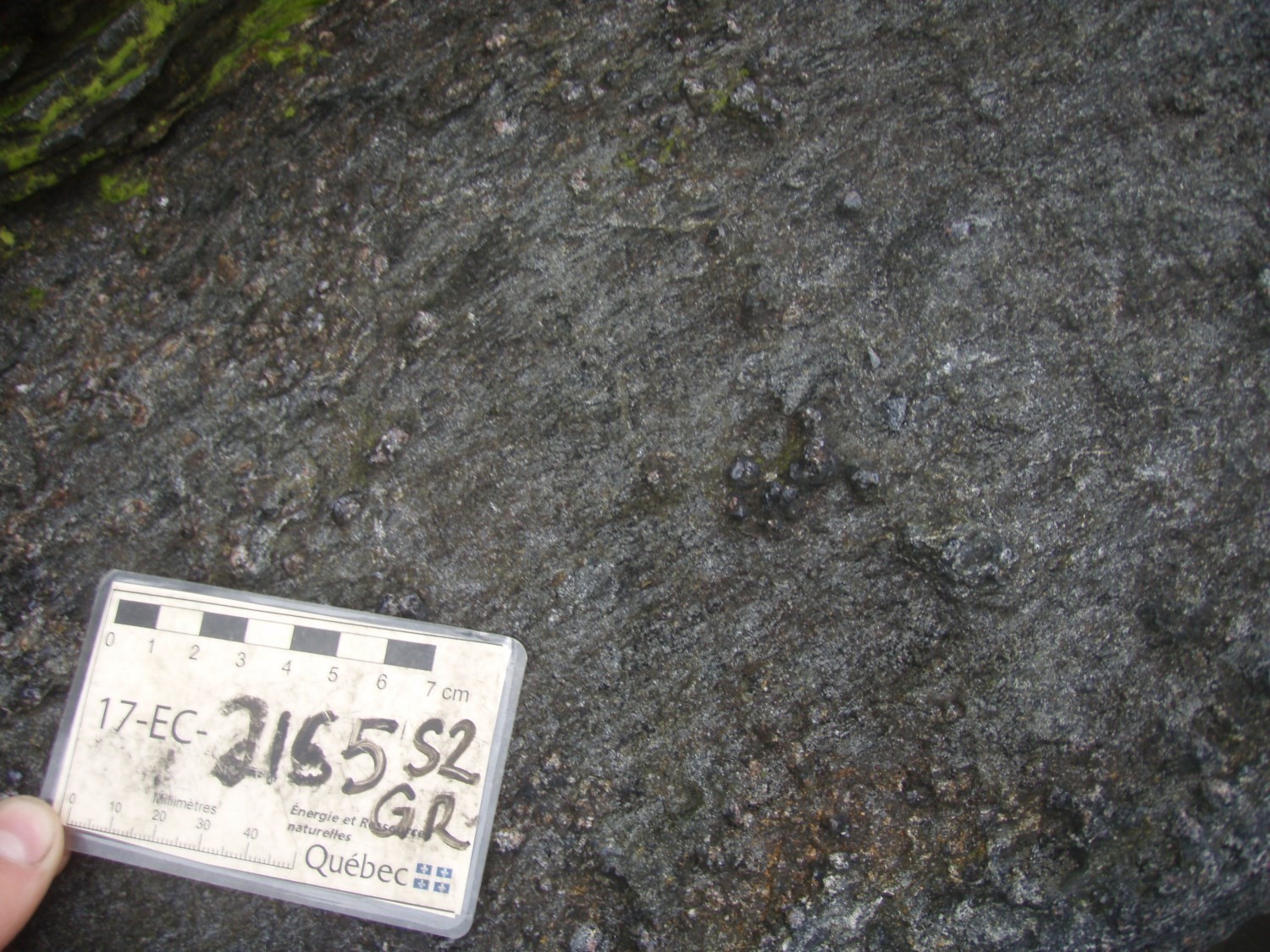
Quartzite is observed and well documented by Hardy (1976). It outcrops sporadically on the east and west sides of the Roberts Synclinal. It contains interstratifications of micaceous schist composed of quartz, muscovite and biotite. Quartzite is medium to coarse-grained and is composed of 60 % quartz and 35% garnet. Accessory mineral phases are grunerite, chlorite, stilpnomelane and magnetite. Garnets are millimetric and contain several quartz inclusions. They commonly have a long, narrow shape, which may indicate that they are pseudomorphs of micaceous minerals. Carbonates make up about 2 % of the rock and are fine-grained and interstitial. Grunerite contains quartz and magnetite inclusions.
Thickness and Distribution
The Wishart Formation stretches along the Labrador Trough. Its thickness generally ranges from 15 to 100 m. Within the Roberts Synclinal, its thickness ranges from 1 to 5 m and can very locally reach up to 50 m. Lateral variations in thickness have been observed. The formation’s thickness increases from 30 m at Stakit Lake to 50 m at Schefferville (Dimroth, 1972). It is also 30 m thick at the Goethite and Concession lakes, and reaches 60 to 75 m in the Hématite Lake area. The largest thicknesses are found at Lake des Oiseaux in the eastern part of the Labrador Trough (Dimroth, 1978).
Dating
None.
Stratigraphic Relationship(s)
In the Dyke Lake area, an age of 1877.8 ±1.3 Ma was obtained for a clast of syenite contained in a conglomerate interstratified with the Sokoman Formation, overlying the Wishart Formation. This dating provides a maximum sedimentation age slightly younger than the Wishart Formation in this area (Findlay et al., 1995).
 The Wishart Formation forms the base of the Ferriman Group. It overlies the Archean bedrock in erosional unconformity, along the western edge of the Labrador Trough. Towards the centre, it covers the older rocks of the first sedimentary cycle (Dimroth, 1978; Dressler, 1979). Lower Wishart contact is well defined. North of latitude 56°N, the Wishart Formation unconformably overlies (erosional unconformity) the Chakonipau Formation (Seward Group), Alder Formation (Pistolet Group) and Savigny Formation (Swampy Bay Group) (Dimroth, 1969, 1978; Dressler, 1973, 1979). According to Dressler (1979), the contact with underlying rocks is transgressive on the edge of the Trough, while in the centre contacts are transgressive and very weakly unconformable. Dimroth (1971) reports that the base of the Wishart Foramtion cuts weakly dipping folds of the underlying older units in the Otelnuk Lake area (sheet 24C). He cites other authors (Bergeron, 1954; Fahrig, 1957) who refer to a discordance under the Wishart Formation in the northern part of the Trough. South of latitude 56°N, the Wishart Formation is overlying the Denault, Fleming and Dolly formations of the Attikamagen Group (Dimroth, 1971, 1978; Harrison et al., 1972). These formations are separated from the Wishart Formation by an erosion discordance near the western margin of the Trough. Further east, the Wishart Formation overlies the Dolly and Fleming formations with gradual and conformable contact (Dimroth, 1971, 1978; Clark et al., 2008). The summit of the Wishart Foramtion was established by the Labrador Mining and Exploration Company at the upper contact of a chert index bed (Dimroth, 1978) associated with the Ruth Formation by Harrison (1952). The latter conformably and almost continuously overlies the Wishart Formation in the western part of the Trough. In the eastern part, the Wishart Formation is overlain directly by the Sokoman Formation (Baragar, 1967). Stratigraphy of the Wishart Formation is only established locally due to vertical and lateral variations (Dimroth, 1978).
The Wishart Formation is equivalent to the formation formerly identified as Allison by Bérard (1965) in the northern Trough (Clark, 1979; Clark and Wares, 2004; Goulet, 1995). The Wishart Formation is a platform sediment deposit in an energetic environment (Clark and Wares, 2004; Dimroth, 1978; Dressler, 1979; Harrison, 1952).
Paleontology
Does not apply.
References
Publications Available Through SIGÉOM Examine
BERARD, J., 1965. REGION DU LAC BERARD, NOUVEAU-QUEBEC. MRN; RG 111, 175 pages, 2 plans.
BILODEAU, C., CARON-COTE, E., 2018. Géologie de la région de la rivière Arnaud, provinces du Supérieur (Minto) et de Churchill (Fosse du Labrador), secteur de Kangirsuk, Nunavik, Québec, Canada. MERN; BG 2018-04, 2 plans.
CHEVE, S., 1993. CADRE GEOLOGIQUE DU COMPLEXE CARBONATIQUE DU LAC CASTIGNON – FOSSE DU LABRADOR. MRN; MB 93-64, 100 pages, 1 plan.
CIESIELSKI, A., 1975. CONTACT ARCHEEN-PROTEROZOIQUE ENTRE LES LACS FORBES ET SENAT (FOSSE DU LABRADOR) – RAPPORT PRELIMINAIRE. MRN; DPV 449, 28 pages, 1 plan.
CLARK, T., 1977. GEOLOGY OF THE FORBES LAKE AREA (NOUVEAU-QUEBEC). MRN; DPV 452, 19 pages, 1 plan.
CLARK, T., 1979. REGION DU LAC NAPIER (NOUVEAU-QUEBEC) – RAPPORT PRELIMINAIRE. MRN; DPV 663, 28 pages, 1 plan.
CLARK, T., LECLAIR, A., PUFAHL, P., DAVID, J., 2008. RECHERCHE GEOLOGIQUE ET METALLOGENIQUE DANS LES REGIONS DE SCHEFFERVILLE (23J15) ET DU LAC ZENI (23I16). COMMISSION GEOLOGIQUE DU CAN, UNIVERSITE ACADIA, MRNF, GEOTOP UQAM-MCGILL; RP 2008-01, 17 pages.
CLARK, T., WARES, R., 2004. SYNTHESE LITHOTECTONIQUE ET METALLOGENIQUE DE L’OROGENE DU NOUVEAU-QUEBEC (FOSSE DU LABRADOR). MRNFP; MM 2004-01, 182 pages, 1 plan.
CLARK, T., WARES, R., 2006. LITHOTECTONIC AND METALLOGENIC SYNTHESIS OF THE NEW QUEBEC OROGEN (LABRADOR TROUGH). MRNF; MM 2005-01, 178 pages, 1 plan.
DIMROTH, E., 1969. GEOLOGIE DE LA REGION DU LAC CASTIGNON, TERRITOIRE DU NOUVEAU-QUEBEC. MRN; RP 571, 62 pages, 7 plans.
DIMROTH, E., 1972. STRATIGRAPHY OF PART OF THE CENTRAL LABRADOR TROUGH. MRN; DP 154, 304 pages, 6 plans.
DIMROTH, E., 1978. Région de la fosse du Labrador entre les latitudes 54° 30′ et 56° 30′. MRN; RG 193, 417 pages, 16 plans.
DRESSLER, B., 1972. GEOLOGY OF THE PATU LAKE AREA (NEW QUEBEC TERRITORY). MRN; DP 116, 70 pages.
DRESSLER, B., 1972. GEOLOGY OF THE PATU LAKE AREA, NEW QUEBEC TERRITORY. MRN; DP 059, 21 pages, 1 plan.
DRESSLER, B., 1973. GEOLOGIE DE LA REGION DU LAC PATU, TERRITOIRE DU NOUVEAU-QUEBEC. MRN; RP 603, 26 pages, 1 plan.
DRESSLER, B., 1973. GEOLOGY OF THE FORT MCKENZIE, SHALE FALLS (EAST HALF) AND MORAINE LAKE (EAST HALF) AREAS (NEW QUEBEC TERRITORY). MRN; DP 119, 13 pages, 4 plans.
DRESSLER, B., 1973. GEOLOGY OF THE LA LANDE LAKE AREA, NEW QUEBEC TERRITORY. MRN; DP 192, 20 pages, 2 plans.
DRESSLER, B., 1974. GEOLOGY OF THE FORT MCKENZIE, SHALE FALLS (EAST HALF), MORAINE LAKE (EAST HALF) AND LA LANDE LAKE AREAS, NEW QUEBEC TERRITORY, INTERIM REPORT. MRN; DP 247, 60 pages.
DRESSLER, B., 1975. GEOLOGIE DE FORT MCKENZIE, CHUTE AUX SCHISTES (1/2E), LAC MORAINE (1/2E), NOUVEAU-QUEBEC. MRN; RP 608, 32 pages, 1 plan.
DRESSLER, B., 1979. Région de la fosse du Labrador. MRN; RG 195, 136 pages, 14 plans.
GOULET, N., 1995. ETUDE STRUCTURALE, STRATIGRAPHIQUE ET GEOCHRONOLOGIQUE DE LA PARTIE NORD DE LA FOSSE DU LABRADOR. MRN; MB 95-36, 41 pages, 1 plan.
HARDY, R., 1976. Région des lacs Roberts et des Chefs. MRN; RG 171, 109 pages, 2 plans.
HOCQ, M., 1977. REGION DE RAGEOT (OUEST) – LA TOUCHE (EST) (COMTE D’ABITIBI-EST) – RAPPORT FINAL. MRN; DPV 457, 79 pages, 1 plan.
KISH, L., TREMBLAY-CLARK, P., 1979. GEOCHIMIE ET RADIOACTIVITE DANS LA FOSSE DU LABRADOR. MRN; DPV 666, 33 pages.
LONGUEPEE, H., 2013. EVALUATION DU POTENTIEL DE LA FOSSE DU LABRADOR POUR LES MINERALISATIONS ASSOCIEES A LA PHASE D’OUVERTURE, CONSOREM, PROJET 2010-06. CONSOREM; MB 2014-23, 47 pages.
MRN, 2002. L’EXPLORATION MINERALE AU QUEBEC NOTRE SAVOIR, VOS DECOUVERTES. DV 2002-10, 60 pages.
Autres Publications
BARAGAR, W.R.A. 1967. Wakuach Lake map area, Quebec-labrador. Geological Survey of Canada, Memoir 344, 1967, 174 pages. https://doi.org/10.4095/123960
BERGERON, R. 1954. A study of the Quebec-Labrador iron belt between Derry Lake and Larch River. Laval University, Quebec; D.Sc. thesis.
CHEVÉ, S.R., MACHADO, N. 1988. Reinvestigation of the Castignon Lake carbonatite complex, Labrador Trough, New Quebec. Joint Annual Meeting of the Geological Association of Canada and the Mineralogical Association of Canada, St. John’s, Newfoundland; Program with Abstracts, volume 13, page 20.
DIMROTH, E. 1971. The Attikamagen-Ferriman Transition in Part of the Central Labrador Trough. Canadian Journal of Earth Sciences; volume 8 (11), pages 1432-1454. https://doi.org/10.1139/e71-132
FAHRIG, W.F. 1957. Geology of certain Proteozoic rocks in Quebec and Labrador. In Proterozoic of Canada. Roy. Soc. Can., Spec. Publ. No 2, pages 112-123.
FINDLAY, J.M., PARRISH, R.R., BIRKETT, T., WATANABE, D.H. 1995. U-Pb ages from the Nimish Formation and Montagnais glomeroporphyritic gabbro of the central New Quebec Orogen, Canada. Canadian Journal of Earth Sciences; volume 32, pages 1208-1220. https://doi.org/10.1139/e95-099
FRAREY, M.J., DUFFEL, S. 1964. Revised stratigraphic nomenclature for the central part of the Labrador Trough. Geological Survey of Canada; Paper 64-25, 13 pages.
GASTIL, G.R., KNOWLES, D.M. 1960. Geology of the Wabush Lake area, Southwestern Labrador and Eastern Quebec, Canada. Geological Society of America Bulletin; volume 71, pages 1243-1254.
HARRISON, J.M. 1952. The Quebec-Labrador iron belt, Quebec and Newfoundland. Geological Survey of Canada; Paper 52-20, 1952, 21 pages. https://doi.org/10.4095/123923
HARRISON, J.M., HOWELL, J.E., FAHRIG, W.F. 1972. A geological cross-section of the Labrador Miogeosyncline near Schefferville, Quebec. Geological Survey of Canada; Paper 70-37, 34 pages. https://doi.org/10.4095/102389
MACHADO, N., CLARK, T., DAVID, J., GOULET, N. 1997. U-Pb ages for magmatism and deformation in the New Quebec Orogen. Canadian Journal of Earth Sciences; volume 34, pages 716-723. https://doi.org/10.1139/e17-058
RIVERS, T. 1980. Revised stratigraphic nomenclature for Aphebian and other rock units, southern Labrador Trough, Grenville Province. Canadian Journal of Earth Sciences; volume 17, pages 668-670.
Suggested Citation
Ministère de l’Énergie et des Ressources naturelles (MERN). Wishart Formation. Quebec Stratigraphic Lexicon. https://gq.mines.gouv.qc.ca/lexique-stratigraphique/province-de-churchill/formation-de-wishart_en/ [accessed on day month year].
Contributors
|
Première publication |
Emmanuel Caron-Côté, P. Geo., M.Sc. emmanuel.caron-cote@mern.gouv.qc.ca (redaction) Mehdi A. Guemache, P. Geo., Ph.D. (coordination); nameless (critical review); Simon Auclair, P. Geo., M.Sc. (editing); Céline Dupuis, P. Geo., Ph. D. (English version); André Tremblay (HTML editing). |