

First published: 8 December 2020
Last modified:
DISCLAIMER: This English version is translated from the original French. In case of any discrepancy, the French version shall prevail.
| Author(s): | Harrison, 1952 |
| Age: | Paleoproterozoic |
| Stratotype: | None |
| Type area: | Area west of Scheffervile (NTS sheet 23J15) |
| Geological province: | Churchill Province |
| Geological subdivision: | New Quebec Orogen (Labrador Trough) / Gerido, Howse, Hurst, Mélèzes and Schefferville lithotectonic zones |
| Lithology: | Dolomite, chert breccia, mudstone, sandstone, siltstone |
| Category: | Lithostratigraphic |
| Rank: | Group |
| Status: | Formal |
| Use: | Active |
Background
Geologists from Labrador Mining and Exploration (1949) called « Attikamagen Shales » a sequence of predominantly argillaceous rocks in the southern part of the Labrador Trough. This name is derived from Attikamagen Lake (sheet 23J15), located on the Newfoundland and Labrador side. The company has located this sequence stratigraphically above the Seward Grits and below the Denault Dolomite and some volcanic rocks named « Nimish » (see Frarey and Duffell, 1964). The Seward Grits, Attikamagen Shales and Denault Dolomite were grouped in the Hamilton River Series and formed the lower part of the Labrador Trough stratigraphic column. Harrison (1952) formalized the name Attikamagen Formation to refer to the red, green and grey shale unit underlying the Denault Dolomite in the area west of Schefferville. Frarey and Duffell (1964) and Baragar (1967) later expanded the unit to include all predominantly argillaceous rocks underlying the Denault Formation, as well as volcanic rocks east of the Trough.
Dimroth (1970) and Dimroth et al. (1970) divided the Attikamagen Formation into four informal units called « Attikamagen I Slate », « basalt-shale sequence (Attikamagen II) », « Attikamagen III Slate » and « Attikamagen IV Slate ». Later, Dimroth (1972, 1978) elevated the Attikamagen to the « subgroup » rank and included in it the Denault, Fleming and Dolly formations, as well as two new units, the Bacchus and Le Fer formations. Thus, the « Attikamagen II » unit corresponded to the Bacchus Formation, the « Attikamagen III » unit to the Le Fer Formation and the « Attikamagen IV » unit to the Dolly Formation. South of latitude 56°N, in the western part of the Trough, the « Attikamagen I » unit represented the equivalent of the Swampy Bay Subgroup defined by Dimroth (1968), north of latitude 56°N, and including the Hautes-Chutes, Savigny and Otelnuc formations. The Attikamagen Subgroup then included, from bottom to top, the Bacchus, Le Fer, Denault, Fleming and Dolly formations (Dimroth, 1978). The use of the name Attikamagen Subgroup was extended by Wardle (1982) to the southern part of the Trough on the Labrador side. Since the rank of « subgroup » does not meet the criteria of the North American Stratigraphic Code (NACSN, 1983, 2005), Clark and Wares (2004) reclassified all of Dimroth’s subgroups as groups, including the Attikamagen Group.
The Le Fer and Bacchus formations are largely composed of flyschoid sedimentary rocks and, according to Dimroth (1978), constitute the lower part of the Attikamagen Group. According to Hoffman (1987), the upper part of the Attikamagen Group (Denault, Fleming and Dolly formations) represents marine regression and the generation of a carbonate platform, while the underlying formations (Swampy Bay Group) represent deep continental margin flyschoid sedimentation. Dimroth (1978) also points out that the Le Fer Formation is transitional and interstratified with the adjacent Savigny and Bacchus formations. Consequently, Clark and Wares (2004) included the Le Fer and Bacchus formations in the Swampy Bay Group because of their natural affinities. The Attikamagen Group would therefore only consist of, from bottom to top, the Denault, Fleming and Dolly formations (Clark and Wares, 2004).
Several formation names exist for units that are partly equivalent to the Attikamagen Group. Clark and Wares (2004) proposed abandoning the following formation names: Abner Formation (Berard, 1957, 1965), Harveng Formation (Sauvé and Bergeron, 1965; Bélanger, 1982) and Nachicapau Formation (Dressler, 1979) (all equivalent, totally or in part, to the Denault Formation).
Description
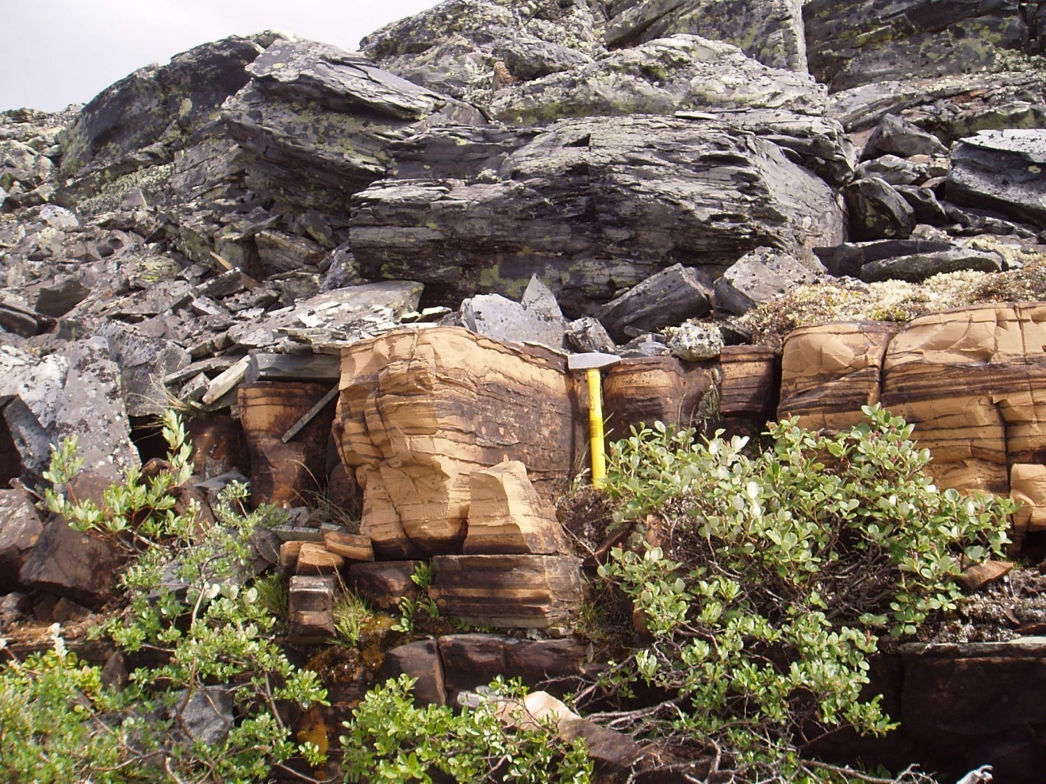
The Attikamagen Group is an allochthonous unit of sedimentary rocks in the upper part of the first volcano-sedimentary cycle of the Labrador Trough (Clark and Wares, 2004). It consists mainly of dolomite belonging to the Denault Formation, which is present along most of the length of the Trough. In the central part of the Trough, the top of the Attikamagen Group consists locally of grey siltstone and chert breccia of the Fleming Formation, as well as black, grey and green or red mudstone, sandstone and siltstone of the Dolly Formation. Rocks of the Attikamagen Group are slightly metamorphosed and at most reach the greenschist facies (Dimroth and Dressler, 1978).
Sedimentary rocks of the Attikamagen Group were deposited in a shallow environment and mark the re-establishment of a marine platform at the end of the first sedimentation cycle of the Trough. Small shallow basins subsequently developed on this platform. Siltstone and chert breccia layers of the Fleming Formation were deposited in a small basin near the western margin of the Trough, and the mudstone, sandstone and siltstone sequence of the Dolly Formation formed in a larger basin further east (Dimroth, 1972, 1978; Wardle and Bailey, 1981). The Attikamagen Group is interpreted as a dolomitic platform reef complex indicating marine regression towards the end of the first cycle (Hoffman, 1987; Hoffman and Grotzinger, 1989; Clark and Wares, 2004).
Thickness and Distribution
The Attikamagen Group belongs to the Gerido, Howse, Hurst, Mélèzes and Schefferville lithotectonic zones, as defined by Clark and Wares (2004). It extends from Hopes Advance Bay (sheet 24N05; latitude 59°17′N) to the Schefferville area (sheet 23J15), a distance of >500 km. However, it was not recognized in areas north of latitude 59° 17′ N. The Denault Formation is the only one of the Attikamagen Group that occurs along most of the length of the Labrador Trough. The Fleming and Dolly formations are only present in the western part of the Trough, south of latitude 55° 30′ N. On the Labrador side, rocks equivalent to those of the Attikamagen Group have been mapped as far SE as the Grenville Front, a distance of ~180 km (Wynne-Edwards, 1960; Frarey, 1961; Donaldson, 1963, 1966; Wardle, 1979a, b, 1982; Ware and Wardle, 1979).
The thickness of the Attikamagen Group is very variable. In the Schefferville area, the group includes the Denault, Fleming and Dolly formations. Its total thickness varies from a few metres near the western margin of the Trough to nearly 500 m NE of Schefferville (Dimroth et al., 1970; Harrison et al., 1972). Towards the NE, its thickness gradually increases to reach ~1300 m in the Chassin Lake area (sheet 23O10) (Baragar, 1967; Dimroth, 1978). In the northern part of the Trough, the thickness of the Attikamagen Group (Denault Formation) has been estimated at 150 m by Dressler (1979), ≥75 m by Clark (1979) and between 30 and 120 m by Bérard (1965). In the Minguarutittalik Lake (formerly Laurin Lake) area, Hoffman and Grotzinger (1989) estimated its total thickness at 345 m. On the Labrador side, the thickness of the Attikamagen Group (Denault and Dolly formations) reaches 3500 m in the eastern part of the Trough (Wardle, 1979a).
Dating
None.
Stratigraphic Relationship(s)
The Attikamagen Group forms the upper part of the first volcano-sedimentary cycle of the Labrador Trough. Rocks of the first cycle were deposited up to ≥2142 +4/-2 Ma, the age of a felsic dyke cutting the upper part of the Bacchus Formation (Swampy Bay Group) of this cycle (T. Krogh and B. Dressler, unpublished data cited in Clark, 1984, page 4). However, the first cycle may have ended at an even younger date. The maximum age of the Attikamagen Group is estimated from the isotopic composition of carbon in dolomites of the Denault Formation. This formation is estimated to be younger than 2.06 Ga (Melezhik et al., 1997). Thus, the age of the Attikamagen Group is estimated to be between 2.06 Ga and 1878-1880 Ma, the age of the Sokoman Formation (Ferriman Group) of the second cycle (Chevé and Machado, 1988; Findlay et al., 1995).
In the central part of the Labrador Trough, the Attikamagen Group conformably overlies rocks of the Swampy Bay Group and is overlain in low-angle erosional unconformity by the Ferriman Group (Dimroth, 1972, 1978). Towards the centre of the orogen, the Attikamagen Group displays gradual and conformable contacts with the Ferriman Group (Dimroth, 1971). According to Dimroth (1971), the best exposure of the contact between the Attikamagen and Ferriman groups is between latitudes 55° 30′ N and 54° 30′ N. In the northern part of the orogen, the Attikamagen Group (Denault Formation) is in gradual contact with the lower part of the overlying Koksoak Group (Lower Baby member) (Bérard, 1965; Sauvé and Bergeron, 1965; Clark, 1988; Wares et al., 1988; Clark and Wares, 2004).
Between latitude 57° 10′ N and Feuilles Bay, the Attikamagen Group overthrusts the Ferriman Group along a major thrust fault (Garigue Fault) (Clark, 1979; Budkewitsch, 1986; Goulet, 1986). Movement associated with this fault also brought the Attikamagen Group structurally above the Chioak Formation (Clark, 1979, 1988). At the northern end of the Trough, Attikamagen Group dolomite locally overthrusts the Ferriman Group (Clark and Wares, 2004).
Paleontology
No fossils reported.
References
Publications Available Through SIGÉOM Examine
BELANGER, M. 1982. REGION DU LAC FAUJAS, NOUVEAU-QUEBEC. MRN. DP-82-06, 1 plan.
BERARD, J. 1957. PRELIMINARY REPORT ON FINGER LAKE AREA, NEW QUEBEC. MRN. RP 360(A), 7 pages and 1 plan.
BERARD, J. 1957. RAPPORT PRELIMINAIRE SUR LA REGION DU LAC FINGER, NOUVEAU-QUEBEC. MRN. RP 360, 9 pages and 1 plan.
BERARD, J. 1965. BERARD LAKE AREA, NEW QUEBEC. MRN. RG 111(A), 148 pages and 2 plans.
BERARD, J. 1965. REGION DU LAC BERARD, NOUVEAU-QUEBEC. MRN. RG 111, 175 pages and 2 plans.
BERGERON, R., SAUVE, P. 1965. GERIDO LAKE – THEVENET LAKE AREA, NEW QUEBEC. MRN. RG 104(A), 131 pages and 3 plans.
BERGERON, R., SAUVE, P. 1965. REGION DES LACS GERIDO ET THEVENET, NOUVEAU-QUEBEC. MRN. RG 104, 141 pages and 3 plans.
CLARK, T. 1979. REGION DU LAC NAPIER (NOUVEAU-QUEBEC) – RAPPORT PRELIMINAIRE. MRN. DPV 663, 28 pages and 1 plan.
CLARK, T. 1984. GEOLOGIE DE LA REGION DU LAC CAMBRIEN – TERRITOIRE DU NOUVEAU-QUEBEC. MRN. ET 83-02, 77 pages and 1 plan.
CLARK, T. 1987. STRATIGRAPHIE, PETROGRAPHIE ET PETROCHIMIE DE LA FORMATION DE FER DE BABY DANS LA REGION DU LAC HERODIER (FOSSE DU LABRADOR). MRN. ET 87-13, 44 pages.
CLARK, T., WARES, R. 2004. SYNTHESE LITHOTECTONIQUE ET METALLOGENIQUE DE L’OROGENE DU NOUVEAU-QUEBEC (FOSSE DU LABRADOR). MRNFP. MM 2004-01, 182 pages and 1 plan.
DIMROTH, E. 1972. STRATIGRAPHY OF PART OF THE CENTRAL LABRADOR TROUGH. MRN. DP 154, 304 pages and 6 plans
DIMROTH, E. 1978. REGION DE LA FOSSE DU LABRADOR ENTRE LES LATITUDES 54° 30′ ET 56° 30′. MRN. RG 193, 417 pages and 16 plans.
DRESSLER, B., CIESIELSKI, A. 1979. REGION DE LA FOSSE DU LABRADOR. MRN. RG 195, 136 pages and 14 plans.
GOULET, N. 1986. ETUDE TECTONIQUE ET STRATIGRAPHIQUE DE LA PARTIE NORD DE LA FOSSE DU LABRADOR – REGION DE LA BAIE AUX FEUILLES ET DU LAC BERARD. MRN. MB 86-27, 22 pages and 6 plans.
WARES, R., BERGER, J., ST-SEYMOUR, K. 1988. SYNTHESE METALLOGENIQUE DES INDICES DE SULFURES AU NORD DU 57e PARALLELE (ETAPE 1) – FOSSE DU LABRADOR -. I R E M. MB 88-05, 202 pages and 1 plan.
Other Publications
BARAGAR, W.R.A. 1967. Wakuach Lake map-area, Quebec-Labrador (23O). Geological Survey of Canada; Memoir 344, 174 pages. https://doi.org/10.4095/123960
BUDKEWITSCH, P. 1986. A structural study of the Chioak-Abner formation contact, northern part of the Labrador Trough, New Quebec. Unpublished M.Sc. thesis, Concordia University, Montréal; 61 pages.
CHEVÉ, S.R., MACHADO, N. 1988. Reinvestigation of the Castignon Lake carbonatite complex, Labrador Trough, New Québec. Joint Annual Meeting of the Geological Association of Canada and the Mineralogical Association of Canada, St. John’s, Newfoundland; Program with Abstracts, volume 13, pages 20.
DIMROTH, E. 1968. The evolution of the central segment of the Labrador geosyncline; part I: stratigraphy, facies and paleogeography; Neues Jahrbuch für Geologie und Paläontologie; volume 132, pages 22-54.
DIMROTH, E. 1970. Evolution of the Labrador Geosyncline. Geological Society of America Bulletin; volume 81, pages 2717-2742. https://doi.org/10.1130/0016-7606(1970)81[2717:EOTLG]2.0.CO;2
DIMROTH, E. 1971. The Attikamagen-Ferriman transition in part of the central Labrador Trough. Canadian Journal of Earth Sciences; volume 8, pages 1432-1454. https://doi.org/10.1139/e71-132
DIMROTH, E., DRESSLER, B. 1978. Metamorphism of the Labrador Trough. In Metamorphism in the Canadian Shield. Geological Survey of Canada; Paper 78-10, pages 215-236. https://doi.org/10.4095/104534
DIMROTH, E., BARAGAR, W.R.A., BERGERON, R., JACKSON, GD. 1970. The filling of the Circum-Ungava geosyncline. In Symposium on Basins and Geosynclines of the Canadian Shield (A.J. Baer, editor). Geological Survey of Canada; Paper 70-40, pages 45-142. https://doi.org/10.4095/124922
DONALDSON, J.A. 1963. Stromatolites in the Denault Formation, Marion Lake, Coast of Labrador, Newfoundland. Geological Survey of Canada; Bulletin 102, 33 pages. https://doi.org/10.4095/123903
DONALDSON, J.A. 1966. Marion Lake map-area, Quebec-Newfoundland (23I/13). Geological Survey of Canada; Memoir 338, 85 pages. https://doi.org/10.4095/123900
FINDLAY, J.M., PARRISH, R.R., BIRKETT, T., WATANABE, D.H. 1995. U-Pb ages from the Nimish Formation and Montagnais glomeroporphyritic gabbro of the central New Québec Orogen, Canada. Canadian Journal of Earth Sciences; Volume 32, pages 1208-1220. https://doi.org/10.1139/e95-099
FRAREY, M.J. 1961. Menihek Lakes, Newfoundland and Québec; Geological Survey of Canada; Map 1087A. https://doi.org/10.4095/124105
FRAREY, M.J., DUFFELL, S. 1964. Revised stratigraphic nomenclature for the central part of the Labrador Trough. Geological Survey of Canada; Paper 64-25, 13 pages. https://doi.org/10.4095/123909
HARRISON, J.M. 1952. The Quebec-Labrador iron belt, Quebec and Newfoundland. Geological Survey of Canada; Paper 52-20, 21 pages. https://doi.org/10.4095/123923
HARRISON, J.M., HOWELL, J.E., FAHRIG, W.F. 1972. A geological cross-section of the Labrador miogeosyncline near Schefferville, Quebec. Geological Survey of Canada; Paper 70-37, 34 pages. https://doi.org/10.4095/102389
HOFFMAN, P. 1987. Early Proterozoic foredeeps, foredeep magmatism and Superior-type iron-formations of the Canadian shield. In Proterozoic Lithospheric Evolution (A. Kroner, editor). American Geophysical Union, Geodynamics Series; volume 17, pages 85-98.
HOFFMAN, P., GROTZINGER, J.P. 1989. Abner-Denault reef complex (2.1 Ga), Labrador Trough, N.E. Québec. In Reefs, Canada and Adjacent Area (H.H.J. Geldsetzer, N.P. James, and GE. Tebbutt, editors). Canadian Society of Petroleum Geologists; Memoir 13, pages 49-54.
MELEZHIK, V.A., FALLICK, A.E., CLARK, T. 1997. Two billion year old isotopically heavy carbon: evidence from the Labrador Trough, Canada. Canadian Journal of Earth Sciences; volume 34, pages 271-285. https://doi.org/10.1139/e17-025
NORTH AMERICAN COMMISSION OF STRATIGRAPHIC NOMENCLATURE (NACSN) North American Stratigraphic Code. 1983. American Association of Petroleum Geologists Bulletin, volume 67, pages 841-875. http://archives.datapages.com/data/bulletns/1982-83/data/pg/0067/0005/0800/0841.htm
NORTH AMERICAN COMMISSION OF STRATIGRAPHIC NOMENCLATURE (NACSN) North American Stratigraphic Code. 2005. American Association of Petroleum Geologists Bulletin, volume 89, pages 1547-1591. https://nacsn.americangeosciences.org/sites/default/files/2018-08/AAPG_Bull-89_NACSN-Code.pdf
WARDLE, R.J. 1979a. Geology of the eastern margin of the Labrador Trough. Department of Mines and Energy, Government of Newfoundland and Labrador; Report 78-9, 22 pages. https://gis.geosurv.gov.nl.ca/geofilePDFS/WBox040/LAB_0415.pdf
WARDLE, R.J. 1979b.The western Margin of the Labrador Trough. Department of Mines and Energy, Government of Newfoundland and Labrador; Report 79-1, 7 pages. https://www.gov.nl.ca/nr/files/mines-geoscience-publications-reportactivities-1979-wardle2-roa1979.pdf
WARDLE, R.J. 1982. Geology of the south-central Labrador Trough. Government of Newfoundland and Labrador, Department of Mines and Energy, Mineral Development Division, Map 82-005. https://gis.geosurv.gov.nl.ca/geofilePDFS/ReceivedBatch58/LAB_0603.pdf
WARDLE, R.J., BAILEY, D.G. 1981. Early Proterozoic sequences in Labrador. In Proterozoic basins of Canada (F.H.A. Campbell, editor). Geological Survey of Canada; Paper 81-10, pages 331-359. https://doi.org/10.4095/124192
WARE, M.J., WARDLE, R.J. 1979. Geology of the Sims-Evening Lake area, western Labrador with emphasis on the Helikian Sims Group. Government of Newfoundland and Labrador, Department of Mines and Energy, Mineral Development Division; Report 79-05, 27 pages. https://gis.geosurv.gov.nl.ca/geofilePDFS/WBox040/LAB_0458.pdf
WYNNE-EDWARDS, H.R. 1960. Michikamau Lake, West half, Quebec-Newfoundland. Geological Survey of Canada; Pre,iminary maps 2. https://doi.org/10.4095/124144
Suggested Citation
Ministère de l’Énergie et des Ressources naturelles (MERN). Attikamagen Group. Lexique stratigraphique du Québec. https://gq.mines.gouv.qc.ca/lexique-stratigraphique/province-de-churchill/groupe-attikamagen_en [accessed on Day Month Year].
Contributors
First publication | Charles St-Hilaire, GIT, M.Sc. charles.st-hilaire@mern.gouv.qc.ca; Thomas Clark, P. Geo., Ph.D. (redaction) Mehdi A. Guemache, P. Geo., Ph.D. (coordination); anonymous (critical review); Simon Auclair, P. Geo., M.Sc. (editing); Céline Dupuis, P. Geo., Ph.D. (English version); André Tremblay (HTML editing). |