

First published: 28 ocotber 2020
Last modified:
DISCLAIMER: This English version is translated from the original French. In case of any discrepancy, the French version shall prevail.
| Author(s): | Harrison, 1952 |
| Age: | Paleoproterozoic |
| Stratotype: | None |
| Type area: | Ruth Lake area (NTS sheet 23J15), SW of Schefferville |
| Geological province: | Churchill Province |
| Geological subdivision: | New Quebec Orogen (Labrador Trough) / Bérard, Cambrien, Hurst, Mélèzes, Payne, Schefferville and Tamarack lithotectonic zones |
| Lithology: | Chert, mudstone, siltstone, sandstone, slate |
| Category: | Lithostratigraphic |
| Rank: | Formation |
| Status: | Formal |
| Use: | Active |
Background
The term Ruth has been used in various ways by geologists in the central Labrador Trough. The name « Ruth Slate » was used by Labrador Mining and Exploration geologists in 1949 (see Frarey and Duffell, 1964). This unit comprised a package of iron-bearing slate, slate quarry iron formation, black and brown slate, carbonatized slate and argillaceous schist. Harrison (1952) introduced the name Ruth Formation in the southern part of the Trough after an eponymous lake in Labrador (sheet 23J15) to refer to a unit of black iron-bearing slate overlying quartzitic arenite of the Wishart Formation. Subsequent use of the name Ruth Formation has not been consistent everywhere because of the difficulty of distinguishing these rocks from those of the overlying Sokoman Formation. In general, rocks at the base of the sequence that are fissile, red or brown and partly terrigenous have been assigned to the Ruth Formation.
South of latitude 56° N, Frarey (1961) and Baragar (1967) did not map the Ruth Formation separately, but included it in the Sokoman Formation. However, they described it as a separate unit consisting mainly of brown to black fissile iron-bearing slate. The usefulness of the name Ruth Formation was questioned by Zajac (1974), who proposed to abandon it and to consider the Ruth iron-bearing rocks as a facies of the Sokoman Formation. Dimroth (1972, 1978) also pointed out that the Ruth Formation should be regarded as the clastic equivalent of the lower part of the Sokoman Formation. He nevertheless distinguished it on his maps and referred to it as the Ruth Formation. Zajac’s (1974) proposal was followed by Wardle and Bailey (1981), but not by Dimroth (1978), for whom these formations remain two distinct units.
The Ruth Formation was mapped in the northern part of the Trough by Dimroth (1969), Dressler (1973, 1975a, 1979), Ciesielski (1977) and Clark (1977, 1979, 1984). In Labrador, the name Ruth Formation has been used by Wardle (1979a, b) and others to refer to the unit underlying the Sokoman Formation. However, he did not map the Ruth Formation separately, but included it in the Sokoman Formation.
Description
The Ruth Formation is a unit of autochthonous/parochthonous or allochthonous sedimentary rocks belonging to the lower part of the Ferriman Group platform sequence. It consists mainly of mudstone, siltstone and sandstone beds, all of which are iron-bearing, and chert (Clark and Wares, 2004). The Ruth Formation may contain sufficient iron to be an iron formation as defined by Gross (1959). According to Gross (1968), most layers in this formation contain >20% iron (see Gross, 1968, p. 20). The Ruth Formation differs from the overlying Sokoman Formation in part by the terrigenous nature of its constituents (Gross, 1968; Zajac, 1974). It should be noted that marked iron enrichment is noticeable in sedimentary rocks of the Ruth Formation (Gross, 1968; Clark and Wares, 2004). Other features that distinguish it from other formations include its fissility, iron-bearing nature and chert content (Baragar, 1967; Gross, 1968; Ciesielski, 1977; Dimroth, 1972, 1978; Dressler, 1979).
The Ruth Formation generally consists of chert at the base and a mudstone and siltstone sequence at the top (Dimroth, 1972, 1978). The contact of the upper part of the Ruth Formation is interstratified with silicate-carbonate facies of the Sokoman Formation (Baragar, 1967; Gross, 1968; Dimroth et al., 1970; Dimroth, 1972, 1978). At Hematite Lake (sheet 24C10), the top is represented by a banded mudstone and siltstone package associated with chert (Dimroth, 1972, 1978; Dressler, 1979). The Ruth Formation commonly contains interstratified graphitic chert and silicate-carbonate iron formation, e.g. south of Helluva Lake (sheet 23O05). Pyrite-bearing tuff beds containing trachybasalt fragments occur east and west of Schefferville and near Attikamagen Lake (Gross, 1968; Dimroth, 1972, 1978; Zajac, 1974). Graphite and pyrite are observed locally in the Ruth Formation (Dimroth, 1972, 1978; Zajac, 1974). Interestingly, a thin pyrite-rich layer (20-30%) can be traced for over 3 km (Zajac, 1974, p. 39). In the Forbes Lake area (Clark, 1977), the Ruth Formation consists mainly of iron-bearing sandstone, sandstone and siltstone. Further north, in the Napier Lake area (Clark, 1979), the formation consists of a sequence of slate, silty slate and siltstone. North of Feuilles Lake, it is represented by iron-bearing schistose rocks (Gold, 1962; Bérard, 1965).
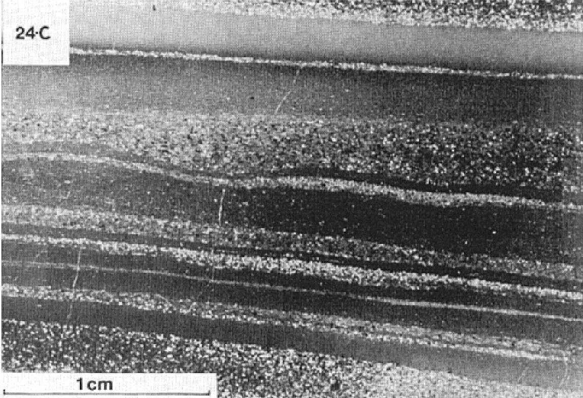
The mudstone is finely laminated and displays fissility parallel to stratification, whereas siltstone is massive or finely bedded. Cross bedding is common in siltstone (Dimroth, 1969, 1972, 1978; Dimroth et al., 1970). Sorting is observed locally in the Cambrian Lake (Clark, 1984) and Schefferville (Harrison et al., 1972) areas. The Ruth Formation is highly deformed and folded. Symmetrical kinks and folds are commonly observed (Harrison, 1952; Ciesielski, 1977). Metamorphism of Ruth Formation rocks generally varies from sub-greenschist to greenschist facies. North of latitude 59°N, it reaches the lower amphibolite facies (Dimroth and Dressler, 1978).
According to Dimroth et al. (1970), the source area of the detrital sedimentary rocks that make up the Ruth Formation is located west of the Labrador Trough. These rocks were deposited in calm, shallow water and mark a transition between the deposition of the detrital sediments of the Wishart Formation and the deposition of the chemically derived sediments of the Sokoman Formation (Gross, 1968; Dressler, 1979). In the Schefferville area, tuffaceous beds are evidence of contemporaneous volcanic activity east of the western margin of the Trough (Gross, 1968; Dimroth et al., 1970; Zajac, 1974). The high graphite and iron silicate content of the cherty and argillaceous rocks indicates that sedimentation took place in a strongly reducing environment rich in organic carbon (Gross, 1968).
Ruth Formation, Undivided (pPru): Iron-Bearing Mudstone, Siltstone and Sandstone, Chert,; Some Iron Formation Locally
The undivided unit includes all the rocks found in the Ruth Formation. It generally consists of iron-bearing mudstone, siltstone and sandstone, chert and micaceous schist. Interstratified jasper is observed locally (Ciesielski, 1977). Due to the map scale, the unit may also include minor amounts of iron formation or Wishart Formation rocks (Dimroth, 1972, 1978; Dressler, 1979).
North of latitude 58°45′N, the Ruth Formation is represented by iron-bearing schistose rocks (Gold, 1962; Bérard, 1965). South of Mannic Lake (sheet 24L16), it consists of thin beds (<3 m thick) of dark grey to black iron-bearing argillaceous schist having a brown to grey alteration patina. The rock is very fine grained, argillaceous and very soft. It is very magnetic, which distinguishes it from other argillaceous schists in the area. It has thin and regular stratification marked by beds whose colour varies according to their magnetite content. In thin sections, iron-bearing argillaceous schist is composed of magnetite, quartz, stilpnomelane, Fe-chlorite, graphite and pyrite (Bérard, 1965).
West of Ungava Bay (sheets 24N05 and 24N12), the Ruth Formation consists of a pelitic and iron-bearing schist unit up to 30 m thick. The latter is composed of biotite, muscovite, sericite, chlorite and fine to medium quartz. Accessory minerals are garnet and tremolite. Schist contains bands very enriched in garnet, some porphyroblasts reaching >2 cm in diameter. Locally interbedded dark grey-brown hematite and Fe-carbonate are observed near the top of the unit (Gold, 1962).
South of latitude 55°N, the Ruth Formation consists of iron-bearing mudstone, siltstone and sandstone, chert, micaceous schist and minor amounts of dolomite. The unit may include some iron formation or Wishart Formation rocks (Harrison et al., 1972; Dimroth, 1972, 1978). Mudstone is black and laminated. According to Zajac (1974), it is composed of chlorite, quartz, orthoclase and, locally, graphite and pyrite. Interstratified graphitic chert and silicate-carbonate facies iron formation are common. Grey tuff beds, 10 cm to 1 m thick, are observed east and west of Schefferville and near Attikamagen Lake (Gross, 1968; Dimroth, 1972, 1978; Zajac, 1974). Tuff is composed of K-feldspar porphyritic trachybasalt fragments, chlorite and opaque minerals in a matrix of chlorite, pyrite and K-feldspar. The fragments’ diameter varies from 1 to 20 mm. Some tuff beds are sorted (Zajac, 1974).
Ruth Formation 1 (pPru1): Black, Grey, Brown or Red Chert
Unit pPru1 forms the base or lies above the base of the Ruth Formation. It consists of layers of black, grey, brown or red chert varying in thickness from 0.30 to 3 m, more rarely reaching 5 and 10 m (Dressler, 1973, 1975a, 1979). Chert is massive, homogeneous, intraclastic, oolitic and, in places, bedded or brecciated (Dimroth, 1972, 1978; Ciesielski, 1977; Dressler, 1979; Clark, 1979). Black chert beds are slightly wavy (Dimroth, 1972, 1978). In thin sections, the rock is composed of quartz intraclasts 0.5 to 0.7 mm in diameter and coarser quartz grains cemented by microcrystalline quartz, quartz or chalcedony. Intraclasts are subangular to rounded, strongly compacted and made up of very fine (<0.02 mm) quartz. Locally, black chert changes to finely bedded and oolitic red chert. The chert’s red colour results from a fine hematite dust, whereas the black colour is due to finely disseminated graphite (Dimroth, 1972, 1978; Dressler, 1979).
Ruth Formation 2 (pPru2): Iron-Bearing Mudstone and Siltstone, Chert
Unit pPru2 consists mainly of iron-bearing mudstone and siltstone. Mudstone, which forms the lower part of the unit, is dark grey, brownish or greenish, and generally laminated. It consists of ~5 mm-thick argillaceous laminae, which alternate with 2-3 mm thick silty laminae. Mudstone exhibits characteristic fissility parallel to bedding (Dimroth, 1969, 1972, 1978; Dressler, 1979). Silty beds commonly display constriction, bulging and incipient boudinage structures (Dimroth, 1972, 1978). In the Goethite Lake (sheet 24C07) and Roussenet Lake (sheet 24C02) areas (Dimroth, 1969, 1972, 1978), mudstone is in gradual contact upwards with dark grey to greenish grey siltstone having a brown alteration patina. Siltstone is massive or forms 5 mm laminae. The rock is hard, conchoidal in fracture, and has no cleavage parallel to bedding. Cross bedding is commonly observed (Dimroth, 1969, 1972, 1978). In the Hématite Lake area (Dimroth, 1972, 1978; Dressler, 1979), mudstone is overlain by a package of iron-bearing siltstone and mudstone accompanied by mottled and banded chert. This package varies in thickness from a few millimetres to 6 m (Dressler, 1979). It occurs alternating red, green, brown or grey laminae having an average thickness of 5 mm (1-10 mm).
In thin sections, mudstone is composed of 25-30% angular quartz grains (<0.002 mm) in a matrix of chlorite, mica and iron oxides (lepidocrocite and goethite). Graphite, sericite and stilpnomelane are also observed (Dimroth, 1972, 1978; Dressler, 1979). Silty laminae contain 75-80% recrystallized quartz grains in a chlorite matrix (Dimroth, 1978; Dressler, 1979). Muscovite, biotite and graphite were also observed by Dimroth (1972, 1978). Siltstone is composed of ≥50% angular quartz fragments (maximum diameter of 0.05 mm) in a dark green matrix of clay minerals, mica and chlorite. Most quartz occurs as grains (~0.02 mm in diameter) that are difficult to distinguish from the matrix. Small chlorite eyes (0.05 mm) and minor amounts of muscovite, biotite (0.1 mm) and graphite (0.1 mm) are also observed (Dimroth, 1972, 1978).


In the banded (mottled) siltstone and mudstone package, the green and red laminae contain angular quartz and feldspar fragments as well as chlorite and iron oxide intraclasts in an argillaceous matrix (Dimroth, 1972, 1978; Dressler, 1979). Red laminae also contain jasper and hematite intraclasts (Dimroth, 1972, 1978). Chert laminae, where present, also contain small detrital fragments of quartz, feldspar or iron silicates (Dressler, 1979). Clay pebbles are also observed (Dimroth, 1978).
Ruth Formation 3 (pPru3): Iron-Bearing Siltstone
Unit pPru3 was mapped by Dimroth (1969, 1978) south of latitude 55° 30′ N and in the Luché and Giraffe lakes area (sheet 24C07). In the latter area, it is overlying unit pPru4. It consists of dark grey to greenish grey iron-bearing siltstone having a brown alteration patina. The rock is finely laminated (5 mm) or massive. It is hard, with a conchoidal fracture, and displays no cleavage parallel to bedding. Cross bedding is commonly observed and identify the tops of the beds. The rock is highly fractured and fracture planes are stained brown or black by manganese deposits. Iron-bearing siltstone has a similar mineralogical composition to unit pPru2 iron-bearing siltstone. According to Dimroth (1969, 1972, 1978), it is distinguished from the latter by a higher iron content.
Ruth Formation 4 (pPru4): Iron-Bearing Mudstone
Unit pPru4 is located in the Luché and Giraffe lakes area (Dimroth, 1969, 1978), where it is overlain by unit pPru3. It consists mainly of dark grey iron-bearing mudstone having a brown alteration patina. The rock is well laminated and occurs in ~5 mm-thick beds, which alternate with lighter grey silty beds 2-3 mm thick. The mudstone shows a characteristic fissility that is parallel to bedding; it breaks up into irregular fragments 5 cm in diameter and 5 mm thick. Dimroth (1972, 1978) points out that silty beds commonly display constriction, bulging and incipient boudinage structures. Iron-bearing mudstone has a similar mineralogical composition to unit pPru2 iron-bearing mudstone. According to Dimroth (1969, 1972, 1978), it is distinguished from the latter by a higher iron content.
Ruth Formation 6 (pPru6): Red Iron-Bearing Sandstone, Grey or Greenish Grey Sandstone and Siltstone, Some Mudstone and Jasper Locally
Unit pPru6 outcrops sparsely in the Forbes Lake area (sheet 24F05). It is in conformable contact with the oxide facies (pPso1) and carbonate facies (pPso3) iron formations of the overlying Sokoman Formation, and may be absent in places. Its total thickness is not known, but a thickness of up to 12 m was measured by Clark (1977). The unit consists of interstratified red iron-bearing sandstone, greenish sandstone and dark grey or greenish grey siltstone. The bed thickness varies from 0.01 to 1 m. In places, the unit includes subordinate layers of mudstone and jasper locally containing numerous quartz veins. Red iron-bearing sandstone is generally close to the contact with the Sokoman Formation, while sandstone and siltstone occur lower in the sequence. Jasper beds are located near or at the base of the unit (Clark, 1977).
Ruth Formation 7 (pPru7): Dark Grey to Black Slate, Silty Slate and Siltstone
Unit pPru7 consists mainly of a 15 to 35 m-thick sequence of dark grey to black, locally pyritic or graphitic slate, silty slate and siltstone (Clark, 1979). Near the north shore of the Mélèzes River, east of the Aigneau River, and east of Kanipitasachitich Lake, the base of the unit is in conformable contact with a 1.5 to 14 m-thick, finely bedded, dark grey to black chert unit assigned to unit pPru1 (Clark, 1979). The Wishart Formation appears to be absent from these areas.
Thickness and Distribution
The Ruth Formation belongs to the Bérard, Cambrien, Mélèzes, Payne, Schefferville and Tamarack lithotectonic zones, as defined by Clark and Wares (2004). It is located near the western margin of the Labrador Trough, where it is closely associated with the Sokoman Formation (Baragar, 1967). The Ruth Formation is recognized from the Ungava Bay area (sheet 24N12) to the southern Schefferville area of Quebec and continues into Labrador. According to Bérard (1965) and Harrison et al. (1972), the Ruth Formation has a high degree of lateral continuity.
The thickness of the Ruth Formation generally varies between ~3 and 60 m. The formation is very thin (~3 m) near the western edge of the Trough in the Schefferville area, but thickens towards the NE (Harrison et al., 1972). Its thickness has been estimated at 30 m in the Schefferville area, 6 m at Le Fer Lake and 15 m in the area between Goethite Lake and Helluva Lake (Dimroth, 1972, 1978). Near Cambrien Lake, Clark (1984) measured a maximum thickness of 23 m and an apparent thickness of 45 m. The Ruth Formation varies in thickness from 25 to 60 m in the Hématite Lake area (Dimroth, 1969, 1972, 1978; Dressler, 1973, 1979) and from 5 to 12 m in the Forbes Lake area (Clark, 1977; Dressler, 1979). South of Forbes Lake, Ciesielski (1977) estimates its total thickness to be between 25 and 40 m. At the Mélèzes River, the formation is 17 to 49 m thick (Clark, 1979). In places, intense folding amplifies the apparent thickness of the formation (Harrison, 1952; Ciesielski, 1977; Clark, 1984). North of Feuilles Lake, 2 to 3 m thick magnetite-bearing argillaceous schist represents the Ruth Formation (Bérard, 1965; Goulet, 1995).
On the Labrador side, the Ruth Formation is estimated to be 20 m thick (Wardle, 1979b) near the western margin of the Trough, thickening to 125 m near the eastern margin (Wardle, 1979a).
Dating
None.
Stratigraphic Relationship(s)
In the Hématite Lake area, a lamprophyre dyke associated with carbonatites of the Castignon Volcanic Complex and intrusive in the Ruth Formation has given a K-Ar age of 1873 ±53 Ma (Dressler, 1975b, 1979; Chevé, 1993). This age is consistent with the estimated Rb-Sr age of 1870 ±50 Ma (Fryer, 1972) for the overlying Sokoman Formation. Chevé and Machado (1988) obtained a concordant U-Pb age of 1880 ±2 Ma for a zircon megacrystal from a fluorite carbonatite feeder dyke. They interpreted this result as the age of crystallization of the dyke, which would be contemporaneous with the Sokoman Formation. Findlay et al. (1995) obtained a U-Pb age of 1878 ±1 Ma from a syenite pebble in a conglomerate interstratified in alkaline subaerial volcanics of the Nimish Volcanic Complex (Dimroth, 1970; Dimroth et al., 1970; Zajac, 1974; Evans, 1978; Wardle and Bailey, 1981) near Schefferville. The Nimish volcanics are contemporaneous with the Sokoman Formation, so the Ruth Formation is somewhat older.
The Ruth Formation conformably overlies the Wishart Formation (Harrison et al., 1972; Dimroth, 1972, 1978; Ciesielski, 1977; Clark, 1977, 1984; Dressler, 1979). A marker chert bed marks the base of the Ruth Formation, in contact with the underlying Wishart Formation (Harrison, 1952; Dimroth, 1972, 1978). In places, Dimroth (1972, 1978) reports the presence of gradual contacts between the Wishart Formation and basal chert of the Ruth Formation. South of latitude 56° N, the Ruth Formation overlies the Wishart Formation almost continuously in the western part of the Trough. Further east, it appears to be absent and the Sokoman Formation, usually overlying the Ruth Formation, lies directly on the Wishart Formation (Baragar, 1967).
The Ruth Formation is overlain by the Sokoman Formation (Harrison, 1952; Dimroth, 1969, 1972, 1978; Clark, 1977, 1984; Dressler, 1979). The upper part of the Ruth Formation is, in places, gradually changing in conformable contact, or interdigitated with the lower part of the Sokoman Formation (Baragar, 1967; Dimroth, 1969, 1972, 1978; Dimroth et al., 1970; Ciesielski, 1977). In the area west of Patu Lake (sheet 24C10), it is in sharp contact with the Sokoman Formation. Dressler (1973, 1979) established the contact of the Ruth Formation with iron-bearing rocks of the Sokoman Formation where he no longer observed silty bands in Ruth Formation rocks. According to Dimroth (1972, 1978) and Zajac (1974), the Ruth Formation is a clastic equivalent of the lower part of the Sokoman Formation, which has led some authors, including Zajac (1974), to include the Ruth Formation in the Sokoman Formation. According to Zajac (1974) and Dimroth (1972, 1978), the top of the Ruth Formation is made up of a 6 to 15 m-thick jasper layer in an area located west of Schefferville.
The Ruth Formation is partly correlated with the Lower Baby member in the eastern part of the Trough (Clark, 1988).
Paleontology
No fossils reported.
References
Publications Available Through SIGÉOM Examine
DIMROTH, E. 1972. STRATIGRAPHY OF PART OF THE CENTRAL LABRADOR TROUGH. MRN. DP 154, 304 pages and 6 plans.
CIESIELSKI, A. 1975. CONTACT ARCHEEN-PROTEROZOIQUE ENTRE LES LACS FORBES ET SENAT (FOSSE DU LABRADOR) – RAPPORT PRELIMINAIRE. MRN. DPV 449, 28 pages and 1 plan.
CLARK, T. 1977. GEOLOGY OF THE FORBES LAKE AREA (NOUVEAU-QUEBEC). MRN. DPV 452, 19 pages and 1 plan.
CLARK, T. 1979. REGION DU LAC NAPIER (NOUVEAU-QUEBEC) – RAPPORT PRELIMINAIRE. MRN. DPV 663, 28 pages and 1 plan.
CLARK, T. 1984. GEOLOGIE DE LA REGION DU LAC CAMBRIEN – TERRITOIRE DU NOUVEAU-QUEBEC. MRN. ET 83-02, 77 pages and 1 plan.
CHEVE, S. 1993. CADRE GEOLOGIQUE DU COMPLEXE CARBONATIQUE DU LAC CASTIGNON – FOSSE DU LABRADOR. MRN. MB 93-64, 100 pages and 1 plan.
GOULET, N. 1995. ETUDE STRUCTURALE, STRATIGRAPHIQUE ET GEOCHRONOLOGIQUE DE LA PARTIE NORD DE LA FOSSE DU LABRADOR. MRN. MB 95-36, 41 pages and 1 plan.
CLARK, T., WARES, R. 2004. SYNTHESE LITHOTECTONIQUE ET METALLOGENIQUE DE L’OROGENE DU NOUVEAU-QUEBEC (FOSSE DU LABRADOR). MRNFP. MM 2004-01, 182 pages and 1 plan.
BERARD, J. 1965. REGION DU LAC BERARD, NOUVEAU-QUEBEC. MRN. RG 111, 175 pages and 2 plans.
BERARD, J. 1965. BERARD LAKE AREA, NEW QUEBEC. MRN. RG 111(A), 148 pages and 2 plans.
DIMROTH, E. 1978. REGION DE LA FOSSE DU LABRADOR ENTRE LES LATITUDES 54° 30′ ET 56° 30′. MRN. RG 193, 417 pages and 16 plans.
DRESSLER, B., CIESIELSKI, A. 1979. REGION DE LA FOSSE DU LABRADOR. MRN. RG 195, 136 pages and 14 plans.
GOLD, D P. 1962. RAPPORT PRELIMINAIRE SUR LA REGION DE LA BAIE HOPES ADVANCE, NOUVEAU-QUEBEC. MRN. RP 442, 13 pages and 1 plan.
DIMROTH, E. 1969. PRELIMINARY REPORT, GEOLOGY OF THE CASTIGNON LAKE AREA, NEW QUEBEC TERRITORY. MRN. RP 571(A), 58 pages and 7 plans.
DRESSLER, B. 1973. GEOLOGIE DE LA REGION DU LAC PATU, TERRITOIRE DU NOUVEAU-QUEBEC. MRN. RP 603, 26 pages and 1 plan.
DRESSLER, B. 1975. GEOLOGIE DE FORT MCKENZIE, CHUTE AUX SCHISTES (1/2E), LAC MORAINE (1/2E), NOUVEAU-QUEBEC. MRN. RP 608, 32 pages and 1 plan.
DIMROTH, E. 1969. GEOLOGIE DE LA REGION DU LAC CASTIGNON, TERRITOIRE DU NOUVEAU-QUEBEC. MRN. RP 571, 62 pages and 7 plans.
Other Publications
BARAGAR, W.R.A., 1967. Wakuach Lake map-area, Quebec-Labrador (23O). Geological Survey of Canada; Memoir 344, 174 pages. https://doi.org/10.4095/123960
CHEVÉ, S.R., MACHADO, N., 1988. Reinvestigation of the Castignon Lake carbonatite complex, Labrador Trough, New Québec. Joint Annual Meeting of the Geological Association of Canada and the Mineralogical Association of Canada, St. John’s, Newfoundland; Program with Abstracts, volume 13, pages 20.
DIMROTH, E., 1970. Evolution of the Labrador Geosyncline. Geological Society of America Bulletin; volume 81, pages 2717-2742. https://doi.org/10.1130/0016-7606(1970)81[2717:EOTLG]2.0.CO;2
DIMROTH, E., BARAGAR, W.R.A., BERGERON, R., JACKSON, GD. 1970. The filling of the Circum-Ungava geosyncline. In Symposium on Basins and Geosynclines of the Canadian Shield (A.J. Baer, editor). Geological Survey of Canada; Paper 70-40, pages 45-142. http://doi.org/10.4095/124922
DIMROTH, E., DRESSLER, B., 1978. Metamorphism of the Labrador Trough. In: Metamorphism in the Canadian Shield. Geological Survey of Canada; Study 78-10, pages 215-236. https://doi.org/10.4095/104534
DRESSLER, B., 1975. Lamprophyres of the north-central Labrador Trough, Quebec, Canada. Neues Jahrbuch für Mineralogie, Monatshefte; volume 6, pages 268-280.
EVANS, J.L., 1978. The geology and geochemistry of the Dyke Lake area (parts of 23J8, 9), Labrador. Newfoundland Department of Mines and Energy, Mineral Development Division; Report 78-4, 39 pages. https://gis.geosurv.gov.nl.ca/geofilePDFS/WBox040/023J_0058.pdf
FINDLAY, J.M., PARRISH, R.R., BIRKETT, T., WATANABE D.H., 1995. U-Pb ages from the Nimish Formation and Montagnais glomeroporphyritic gabbro of the central New Québec Orogen, Canada. Canadian Journal of Earth Sciences; volume 32, pages 1208-1220. https://doi.org/10.1139/e95-099
FRAREY, M.J. 1961. Menihek Lakes, Newfoundland and Québec. Geological Survey of Canada; Map 1087A. http://doi.org/10.4095/124105
FRAREY, M.J., DUFFEL, S., 1964. Revised stratigraphic nomenclature for the central part of the Labrador Trough. Geological Survey of Canada; Paper 64-25, 13 pages. https://doi.org/10.4095/123909
FRYER, B.J., 1972. Age determinations in the Circum-Ungava Geosyncline and the evolution of Precambrian banded iron formations. Canadian Journal of Earth Sciences; volume 9, pages 652-663. https://doi.org/10.1139/e72-055
GROSS, G.A. 1959. A classification of iron deposits in Canada. Canadian Mining Journal; volume 80, pages 87-92.
GROSS, G.A. 1968. Geology of Iron Deposits in Canada: Iron Ranges of the Labrador Geosyncline. Geological Survey of Canada; Economic Geology Report 22, volume III, 179 pages. http://doi.org/10.4095/123961
HARRISON, J.M., 1952. The Quebec-Labrador iron belt, Quebec and Newfoundland. Geological Survey of Canada; Paper 5220, 21 pages. https://doi.org/10.4095/123923
HARRISON, J.M., HOWELL, J.E., FAHRIG, W.F. 1972. A geological cross-section of the Labrador miogeosyncline near Schefferville, Quebec. Geological Survey of Canada; Paper 70-37, 34 pages. http://doi.org/10.4095/102389
WARDLE, R.J. 1979a. Geology of the eastern margin of the Labrador Trough. Department of Mines and Energy, Government of Newfoundland and Labrador; Report 78-9, 22 pages. http://gis.geosurv.gov.nl.ca/geofilePDFS/WBox040/LAB_0415.pdf
WARDLE, R.J. 1979b. The western Margin of the Labrador Trough. Department of Mines and Energy, Government of Newfoundland and Labrador; Report 79-1, 7 pages. http://www.nr.gov.nl.ca/nr/mines/geoscience/publications/reportactivities/1979/Wardle2_ROA1979.pdf
WARDLE, R.J., BAILEY, D.G., 1981. Early Proterozoic sequences in Labrador. In: Proterozoic Basins in Canada (F.H.A. Campbell, editor). Geological Survey of Canada; Study 81-10, pages 331-358. https://doi.org/10.4095/124192
ZAJAC, I.S., 1974. The stratigraphy and mineralogy of the Sokoman Formation in the Knob Lake area, Quebec and Newfoundland. Geological Survey of Canada; Bulletin 220, 159 pages. https://doi.org/10.4095/123946
Suggested Citation
Ministère de l’Énergie et des Ressources naturelles (MERN). Ruth Formation. Quebec Stratigraphic Lexicon. https://gq.mines.gouv.qc.ca/lexique-stratigraphique/province-de-churchill/formation-de-ruth_en [accessed on Day Month Year].
Contributors
First publication | Charles St-Hilaire, GIT, M.Sc. charles.st-hilaire@mern.gouv.qc.ca (redaction) Mehdi A. Guemache, P. Geo., Ph.D. (redaction and coordination); Thomas Clark, P. Geo., Ph.D. (critical review); Simon Auclair, P. Geo., M.Sc. (editing); Céline Dupuis, P. Geo., Ph.D. (English version); Nathalie Bouchard (HTML editing). |