


First published: 12 March 2021
Last modified:
DISCLAIMER: This English version is translated from the original French. In case of any discrepancy, the French version shall prevail.
| Author(s): | Dimroth, 1969 |
| Age: | Paleoproterozoic |
| Stratotype: | The type locality is located on the eastern shore of Chakonipau Lake (56°17’N; 68°25’W). |
| Type area: | Chakonipau Lake area (NTS sheet 24C08) |
| Geological province: | Churchill Province |
| Geological subdivision: | New Quebec Orogen (Labrador Trough) / Schefferville and Howse lithotectonic zones, in particular |
| Lithology: | Sedimentary and locally volcanic rocks |
| Category: | Lithostratigraphic |
| Rank: | Formation |
| Status: | Formal |
| Use: | Active |
Background
The name Chakonipau Formation was proposed by Dimroth (1969) for a succession of red arkoses and arkosic conglomerates (« red beds »), typical outcrops of which are found at Chakonipau Lake (NTS sheet 24C08) and Castignon Lake (sheet 24C07) in the central Labrador Trough (New Quebec Orogen). Similar rocks located SE of these lakes were assigned to the Seward Formation (now Seward Group) by Frarey and Duffell (1964), Baragar (1967) and Wardle (1979). The Chakonipau Formation is the lower unit of the Seward Group, as defined by Clark and Wares (2004).
Description
The type locality of the Chakonipau Formation is located at latitude 56°17′N and longitude 68°25′W, near the eastern shore of Chakonipau Lake (Table 1; Dimroth, 1978). Other good sections are located near Chakonipau Lake and Prospecteurs Lake (Dimroth, 1978), as well as near Cramolet Lake (sheet 24O13), Musset Lake (sheet 23O11), Lerreau (Pickup) Lake (sheets 23O06, 23O11), Morambert Lake (sheet 23O14) and Wade Lake (sheet 23I05) (Table 2; Baragar, 1967; Wardle, 1979).
Table 1: Characteristics of the Type Locality
|
Type locality: Eastern shore Chakonipau Lake (56°17’N; 68°25’W) |
||
|
|
|
|
|
Member |
Thickness (m) |
Description |
|
3
|
90 |
Medium-grained pink arkose with interbedded dolomitic sandstone and calcarenite near the top |
|
270 |
Pebble conglomerate with interbedded arkose and fine-grained dark red arkose |
|
|
240 |
Medium-grained arkose |
|
|
|
|
|
|
2 |
210 |
Boulder conglomerate with interbedded pebble conglomerate, arkose and fine-grained arkose |
|
|
|
|
|
1 |
150 |
Fine-grained dark red arkose, commonly with white spots |
|
|
|
|
|
|
Undetermined base |
|
|
|
|
|
|
Reference: Dimroth (1978, Table 5 and page 45) |
||
Table 2: Characteristics of Representative Localities
|
Locality |
Area west of Portage Lake |
Southern Cramolet Lake |
Dunphy Lake |
|
|
|
||
|
|
Arkose, arkosic grit and conglomerate |
Pink arkose, pink arkosic grit and pebble conglomerate; agglomerate, basaltic tuff and lava |
Pink arkose, pink arkosic grit and pebble conglomerate |
|
|
|
||
|
Locality |
Area west of Romanet Lake |
Eastern end of Romanet River |
Mort River (Cambrien Lake) |
|
|
|
||
|
|
White, green or pink arkose, arkosic grit and pebble conglomerate |
Sheared, coarse-grained white arkose |
A bed of quartz pebble conglomerate in an arkosic matrix (60 cm) overlying Archean bedrock, overlain by 42 m of medium to coarse-grained pink arkosic sandstone and microconglomerate (grit) |
|
|
|
||
|
Locality |
Wade Lake area (Snelgrove Lake Arch) |
|
|
|
|
|
||
|
|
Feldspathic sandstone having a brown to white patina, quartz granule conglomerate, pebble and cobble conglomerate, quartzitic sandstone having a pink to red patina, interbedded red mudstone |
|
|
|
|
|
||
|
References: Dimroth (1978), Wardle (1979), Clark (1984) |
|
||
According to Baragar (1967) and Dimroth (1978), the detrital material constituting the Chakonipau Formation is thought to have been derived mostly from Archean bedrock of the Superior Province, west of the Labrador Trough. The detritus would have been initially transported by streams flowing eastwards. The mineralogical composition of sediments reflects the composition of the source. Some of the detritus may also have come from the erosion of basalts contemporaneous with sediments. Crossbedding measurements (indicating the direction of palaeocurrents) indicate that the sedimentary detritus was redistributed by NW-SE oriented rivers parallel to the axis of the Trough (Baragar, 1967; Wardle, 1979). In the Wakuach Lake and Snelgrove Lake Arch areas, palaeocurrent measurements indicate predominantly NW-directed flow (Baragar, 1967; Wardle, 1979).
Dimroth (1968, 1978) proposed that boulder conglomerates in the Chakonipau lake area were derived from an E-W oriented palaeoscarp extending between present-day Otelnuk and Cambrien lakes. These conglomerates would therefore be of local origin. At Cambrien Lake (west of Chakonipau Lake), the Chakonipau Formation unconformably overlies Archean bedrock (autochthonous relationship) and is much thinner than the allochthonous Chakonipau Formation (Clark, 1984).
Much of the sediments of the Chakonipau Formation would have been deposited rapidly by seasonal torrents, probably in an environment of foothills cones and anastomosing streams (Dimroth, 1978). The colour of red beds is due to hematite that coats silicate grains and is disseminated in the interstitial material (Baragar, 1967). This colour suggests strongly oxidizing transport and depositional conditions in a subaerial environment. Thus, 2.2 billion years ago, the Earth’s atmosphere was already sufficiently oxidizing to allow the deposition of red beds.
Volcanic rocks of the Chakonipau Formation are very different from other volcanic rock sequences of the Labrador Trough. They are distinguished by: 1) their geology (subaerial volcanic rocks associated with red sedimentary rocks versus marine volcanic rocks associated with shales and greywackes), and 2) their chemical composition (high alkali contents and high Fe2O3/FeO ratios in Chakonipau volcanic rocks versus very low K2O contents and low Fe2O3/FeO ratios in marine tholeiitic volcanic rocks).
The deposition of the Chakonipau Formation is thought to have marked the initiation of an intracratonic rift involving the Archean continent ~2.2 billion years ago (Hoffman, 1988; Wardle et al., 2002). The palaeorift now marks the NE edge of the Superior Province. Most of the normal faults associated with the rift were parallel to the rift axis; however, some faults may have been oriented at a steep angle to this axis. The absence of the Chakonipau Formation north of latitude 57°N suggests that rifting did not progress beyond this latitude at this time. In this regard, Skulski et al. (1993) proposed the presence of a « crustal promontory » north of latitude 57° N. The mafic and slightly alkaline volcanism of the Chakonipau Formation was probably associated with the development of the rift (Wardle and Bailey, 1981). The presence of mafic volcanic rocks indicates that rift faults reached the lower part of the crust or mantle. Most of the Chakonipau Formation outcrops within overthrusted slices where the degree of deformation is highly variable depending on the context and proximity of faults. Rocks of the formation are slightly metamorphosed to the greenschist facies or lower.
Economically, very little syndiagenetic to diagenetic copper mineralization was found to date in oxidized sandstones and conglomerates deposited in the Chakonipau Formation during early rifting of the Archean continent. However, an example of minor copper mineralization is located in basalts, SE of Mistamisk Lake (see Mineralized Zone #194 in Clark and Wares, 2004). A decametre-wide alkaline-trending gabbro dyke near Musset Lake contains low-grade copper and silver vein mineralization (Brassard, 1984). Some radioactivity associated with minor shear zones in the dyke has been noted locally. This dyke cuts oxidized red sandstone and may be contemporaneous with basalts. Apart from these examples of mineralization, the metallogenic importance of the Chakonipau Formation seems to imply that unstable minerals in sediments may have acted as a source of metals for copper mineralization hosted in reducing units higher in the sequence (Kupferschiefer or Zechstein style; Clark and Wares, 2004). Metals would have been remobilized by diagenetic and epigenetic fluids and subsequently deposited in reducing environments.
Chakonipau Formation, Undivided (pPcp): Pink or Red Arkose and Conglomerate, Some Mudstone, Siltstone and Locally Volcanic Rocks
This undivided unit includes all the rocks found in the Chakonipau Formation. It thus consists of various pink or red arkoses and conglomerates, with locally interbedded mudstone, siltstone and generally mafic, rarely felsic volcanic rocks.
Chakonipau Formation 1 (pPcp1): Red Arkose, with Locally Interbedded Red or Purple Mudstone and Red Conglomerate (Red Beds)
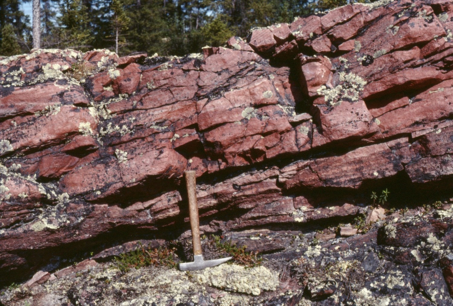
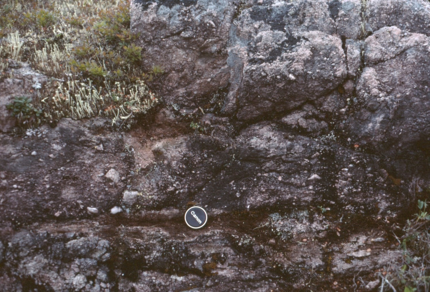
Recognized in the Chakonipau Lake area in the central part of the Trough (Dimroth, 1978), this unit comprises mainly fine to medium-grained dark red arkoses (red beds). These sedimentary rocks occur in centimetric beds displaying crossbedding. They are composed of 35 to 40% quartz and 50% plagioclase (derived from Archean gneiss and volcanics contemporaneous with arkoses) and include a few small millimetric fragments of andesitic or basaltic volcanic rocks. These components are cemented by an argillaceous matrix (<10%) enriched in hematite that typically coats detrital grains. Arkoses also contain minor amounts of magnetite and tourmaline. In the Patu Lake area (sheet 24C10) (Clark, unpublished), these arkoses include some interbedded red or purple mudstone and red conglomerate.
Chakonipau Formation 2 (pPcp2): Trachybasalt and Basalt, Locally Brecciated and Hematitized; Locally Mafic or Felsic Tuff
Unit pPcp2 includes trachybasalts and basalts locally associated with mafic or felsic tuffs. The unit was identified in the Musset Lake (sheet 23O11) (Baragar, 1967; Brassard, 1984) and Mistamisk Lake (sheet 24C08) areas (Clark, 1986). They consist of massive, grey to greenish grey aphanitic lavas, commonly with a reddish patina, pyroclastics and green- or red-spotted volcaniclastic rocks. Stratification was not recognized in basalts. In volcaniclastics, fragments of red sandstone, red siltstone and volcanic rocks up to 15 cm in diameter are observed. Volcanic rocks are highly altered and formed of tiny feldspar crystals, chlorite, hornblende and a considerable amount of fine iron oxides. The feldspars’ composition is difficult to determine because of their small size, but probably alkaline. In amygdaloidal basalt from Mistamisk Lake, plagioclase rods are present, as well as magnetite, pyrite and chalcopyrite (Clark, 1986). Chemical analyses of four massive volcanic rock samples indicate that they consist of trachybasalt (Dimroth, 1978; Brassard, 1984). These lavas are highly oxidized and enriched in alkalis (Dimroth, 1978, see Table 23, analyzes 281 and 282). At Mistamisk Lake, intensely fractured and hydrothermally altered basalt is enriched in Na2O (Clark, 1986). At Musset Lake, both volcanic rock samples are also fractured and altered (Brassard, 1984, analyzes 1982003206, éch. 82-BB-158, and 1982003207, éch. 82-BB-160c).
Chakonipau Formation 3 (pPcp3): Pink or Locally White, Grey or Green Arkose and Subarkose
In the Chakonipau Lake area (Dimroth, 1978), medium to coarse-grained arkoses are pink to salmon, or locally white, grey or green. They are composed of 30-35% detrital quartz, 35-40% plagioclase and ~1% detrital magnetite, all hosted in a sericite matrix (~15%). The rock’s grain size <5 mm. Some gneiss pebbles are present, while andesite pebbles are sparser and appear to be absent from higher stratigraphic levels. The degree of sericitization of plagioclase is variable. North of the Chakonipau lake area (Dressler, 1979), the unit comprises white to pink arkoses and subarkoses.
Chakonipau Formation 4 (pPcp4): Pink to Red, Locally Greenish Arkosic Sandstone with Interbedded Arkosic Polymictic Pebble (Locally Boulder) Conglomerate; Interbedded Siltstone and Rarely Red or Purple Mudstone

This unit represents a varied package of medium to coarse-grained arkosic sandstone (arkose, subarkose, arkosic lithic arenite, quartzitic sandstone), conglomerate, siltstone and mudstone, which vary in colour from pink to reddish brown or purple red. In the Chakonipau Lake area (Dimroth, 1978), arkosic sandstones are the most common sedimentary rocks, but conglomerates are locally abundant and have been individualized on the maps (units pPcp5 and pPcp6). SE of Chakonipau Lake, towards Attikamagen Lake (Baragar, 1967), arkosic sandstones that dominate unit pPcp4 contain locally poorly defined beds and lenses of pebble conglomerate (described in the sections of units pPcp5 and pPcp6). Baragar (1967) also noted the presence of quartzitic sandstone and siltstone. Unit pPcp4 more rarely includes interbedded red or purple mudstone.
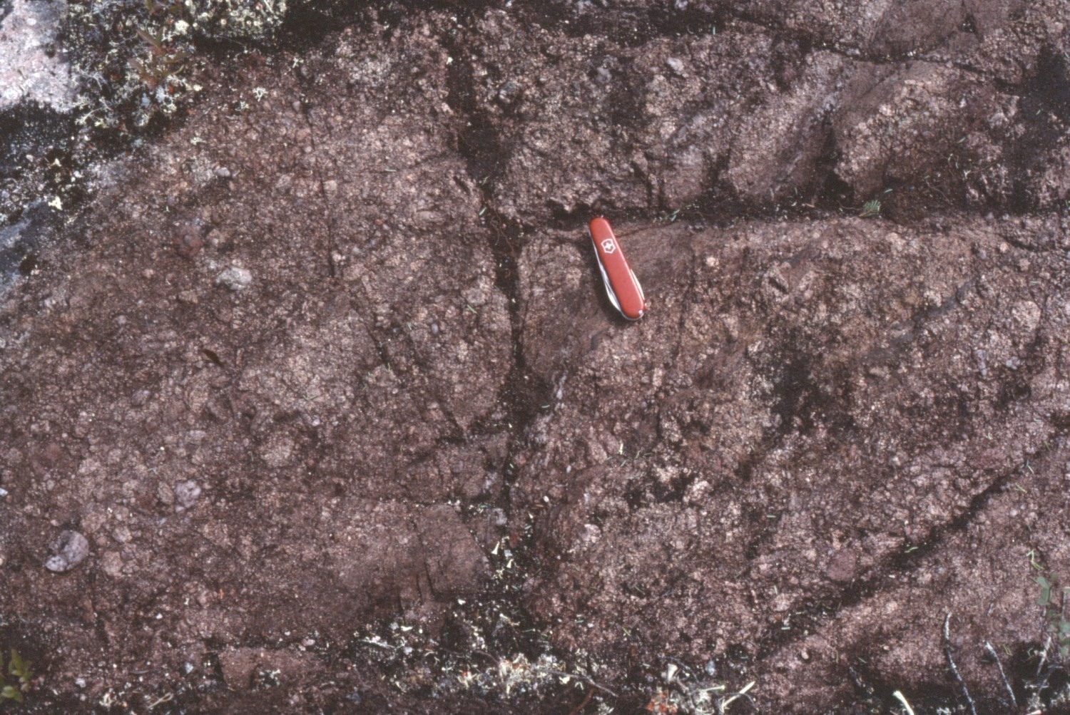
In the Chakonipau Lake area, the medium to coarse-grained arkoses are pink to salmon (Dimroth, 1978). They are composed of 30-35% detrital quartz, 35-40% plagioclase and ~1% detrital magnetite, all hosted in a sericite matrix (~15%). The grain size of the rock is <5 mm. In the Mort River area (Cambrien Lake), arkoses with red patina (red beds) form 25 cm thick crossbedded layers (Clark, 1984). In the area SE of Cramolet Lake, the colour of arkoses and siltstones varies from pink to reddish brown or brick red (Baragar, 1967). This colour is due to the presence of 1 to 5% hematite which, according to Baragar (1967), is more abundant in siltstones than in sandstones and conglomerates. Hematite coats most detrital grains and is disseminated in the matrix and interstitial material. SE of Cramolet Lake, cross-bedded beds are typically <30 cm thick, but can be up to 3 m thick in places. Crossbedding is of several types, ranging from fine lenticular to planar tabular.
In the Snelgrove Lake Arch area of Labrador (sheet 23I12), the Chakonipau Formation (formerly Seward Formation; Wardle, 1979) forms a varied sequence of feldspathic sandstone, quartz granule conglomerate, pebble and cobble conglomerate, quartzitic sandstone having a pink to red patina and red mudstone. Feldspathic sandstones and granule conglomerates form beds up to 20 cm thick that exhibit crossbedding.
Chakonipau Formation 5 (pPcp5): Pink to Red Arkosic Polymictic Conglomerate with Interbedded Arkose and Locally Purple Mudstone
In the Labrador Trough, conglomerates of the Chakonipau Formation are generally interbedded in arkosic sandstones (unit pPcp4) and are not individualized on the maps (Baragar, 1967). In the Chakonipau Lake area, Dimroth (1978) distinguished two conglomerate units: one is composed mainly of boulder conglomerate (pPcp6) and is located east of Chakonipau Lake; a second is dominated by pebble conglomerate (pPcp5) with a minor amount of interbedded coarse-grained arkose.
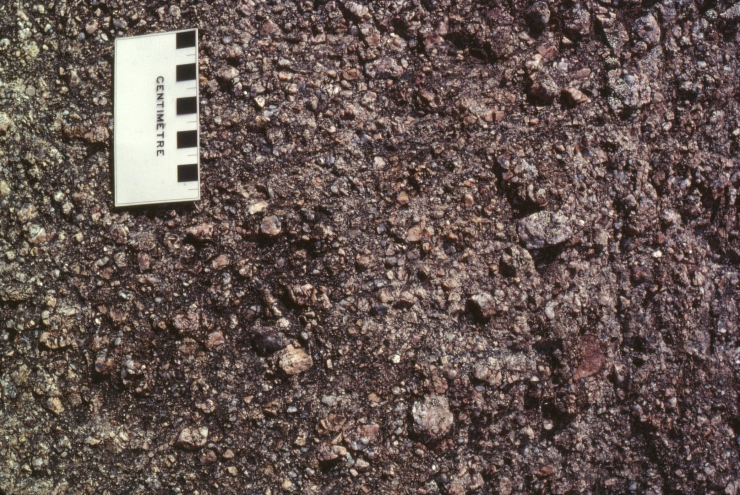
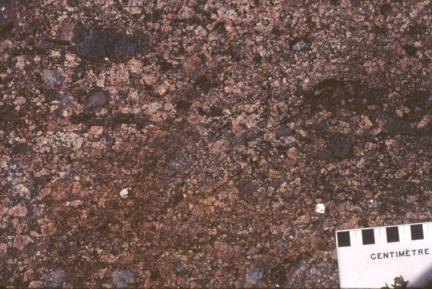
Pebble conglomerate was individualized south of Chakonipau and Castignon lakes (sheets 24C01, 24C02, 24C07), between Mistamisk and Du Chambon lakes (sheet 24C08) and near Patu Lake (sheet 24C10). The colour of these rocks varies from pink to red (red beds). Locally, unit pPcp5 includes interbedded purple mudstone. Conglomerates contains 30 to 65% pebbles and cobbles ranging in size from a few millimetres to 5 cm. Fragments are composed of granite, quartz, feldspar, biotite-plagioclase gneiss, micropegmatite and andesite or basalt. These are hosted in an arkosic matrix of quartz, plagioclase and a minor amount of microcline. Plagioclase is slightly sericitized. In the Chakonipau Lake area (Dimroth, 1978), conglomerates are highly compacted and the matrix accounts for <10% of the rock (of quartz, but more commonly hematite or sericite argillaceous gangue). Gneiss fragments, partially disaggregated before or during compaction of the rock, are homogeneous and consist of ~50% feldspar (mainly plagioclase), 45% quartz and 5% biotite. Biotite in these fragments is generally replaced by hematite, except when occurring as inlcusions in quartz or feldspar. The gneiss’s texture is granoblastic (1-5 mm in grain size). Volcanic rock fragments display in places a red alteration crust enriched in hematite. These pebbles with an intersertal texture are formed of plagioclase laths with some interstitial opaque minerals (probably pyroxene or biotite replaced by hematite) and a minor amount of quartz, also interstitial. Biotite is rarely preserved. These volcanic rocks’ grain size varies between 0.02 and 2 mm.
Chakonipau Formation 6 (pPcp6): Arkosic Polymictic Boulder Conglomerate with Interbedded Pebble Conglomerate and Arkose
Boulder conglomerate contains fragments of biotite-plagioclase gneiss, andesitic or basaltic volcanic rocks and, more rarely, micropegmatite. Boulders are between 5 and 30 cm in diameter and poorly rounded. They are hosted in an arkosic matrix composed of quartz, plagioclase and a small amount of microcline. At the type locality, boulder conglomerate contains interbedded pebble conglomerate and arkose; the latter commonly displays crossbedding.
Chakonipau Formation 7 (pPcp7): Quartz-Albite-Sericite Schist (Sheared Arkose)
This mylonitic rock was observed in the Romanet Lake area (sheet 24B05) (Dimroth, 1978). The light grey, fine-grained sericitized rock displays a flaser textture composed of deformed quartz and feldspar fragments (1-2 mm in diameter) in a matrix of sericite flakes oriented parallel to schistosity. This schist corresponds to sheared arkose and was formed in the vicinity of a major fault.
Chakonipau Formation 8 (pPcp8): Pink or Red Arkose with Interbedded Pink Pebble Conglomerate, Dolomitic Sandstone, Calcitic Cement Calcarenite and Green Siltstone
This unit consists mainly of pink or red arkose and includes interbedded pebble conglomerate, dolomitic sandstone, calcarenite and siltstone. Near the northern end of Otelnuk Lake (sheet 24C08), dolomitic sandstone and calcarenite are interbedded with medium-grained pink or red arkose. Dimroth (1978, legend of 1:50 000 scale maps) mentions that calcareous beds, also present in the upper part of the Chakonipau Formation at the type locality (Table 1), may be partly equivalent to the Portage Formation. Dolomitic sandstones is composed of ~70% clastic grains (quartz with overgrowth, minor amount of highly sericitized plagioclase) cemented by calcite and chert. Dolomitic sandstone beds alternate with calcarenite beds composed of 50 to 60% detrital grains (quartz, calcareous sandstone containing quartz chips and very little plagioclase) in calcite cement. Both rock types are relatively weakly compacted.
Chakonipau Formation 9 (pPcp9): Grey, Black, Green or Purple Mudstone, Siltstone and Chloritic Schist
A mudstone, siltstone and chloritic schist unit is recognized between Mistamisk and Du Chambon lakes in the Mistamisk-Romanet valley (sheet 24C08) (Clark, 1986). It consists of 18 m thick lenses having a hectometric lateral extent. These lenses are located within a sequence of red, pink or grey arkoses and arkosic conglomerates. Grey, black, green or purple mudstones and siltstones form beds up to 10 m thick. These contain rarely interbedded dolomite. In one place, a 10 m thick layer of chloritic schist is overlain by an 8 m thick bed of purple mudstone.
Chakonipau Formation 10 (pPcp10): Mafic Intrusive Rocks or Diabase of Trachybasaltic Composition
Two occurrences of unit pPcp10 are recognized in the Labrador Trough: east of Cambrien Lake (sheet 24C06) and north of Musset Lake (sheet 23O11). East of Cambrien Lake, an elongated intrusion 7 km long runs along the contact between sandstones of the Sakami Formation and sedimentary rocks of the basal part of the Labrador Trough sequence (Chakonipau, Portage and Lace Lake formations; Clark, 1984). The intrusion sharply cuts Sakami Foramtion sandstones and is subparallel to stratification in sedimentary units of the Trough. Its position probably marks an east-dipping fault. It consists of a fine-grained pinkish grey to red-brown (fresh surface) diabase-textured mafic igneous rock. This unit is cut by a polygonal network of subvertical diaclases. The rock is composed of crystals of plagioclase (≤1 mm), clinopyroxene, chlorite or serpentine, hematite and titanite. Its composition is alkaline, mostly sodic, and similar to that of trachybasalts at Musset Lake (unit pPcp2). Clark (1984) linked the emplacement of this intrusive body to contemporaneous volcanic activity.
The intrusion north of Musset Lake was identified by Brassard (1984) as an intermittently outcropping NW-SE dyke. The dyke occurs in two distinct areas where it cuts sandstones of the Chakonipau Formation. The highly fractured dyke has a total length of ~7 km and is 30 to 80 m wide. It is medium grained in the centre and fine grained at the edges. The rock is composed of plagioclase, augite, titanomagnetite, hematite, zircon, titanite and apatite. Its composition is also alkaline, mostly sodic. It is strongly altered to epidote, chlorite, carbonate, hematite and albite (propylitization). The dyke, which hosts copper and uranium mineralization (Brassard, 1984), is probably contemporaneous with trachybasaltic volcanic rocks (unit pPcp2) of the Musset Lake area.
Thickness and Distribution
The Chakonipau Formation in the Labrador Trough was only identified south of latitude 57°N over a distance of ~350 km. In this area, its distribution as observed is largely structural and probably does not correspond to the extent of its deposition (Baragar, 1967). Rocks typical of the formation occupy most of the Chakonipau Lake river basin and extend into Otelnuk Lake (Dimroth, 1978). Lithologically similar red beds continue east and SE of Otelnuk Lake and have also been identified at Dunphy, Ronsin and Luché lakes (sheets 24B04, 24B05, 24C07). Clark (1984) mapped arkoses attributed to the Chakonipau Formation at the base of the sedimentary succession near Cambrien Lake. Conglomerates and red arkoses have been traced towards the SE by Dimroth (1978) to the Cramolet Lake and Wakuach Lake areas (Baragar, 1967). Even further SE, the Chakonipau Formation occurs NE of Petitsikapau Lake and in the western flank of the Snelgrove Lake Arch (Anticline) (Wynne-Edwards, 1960; Dimroth, 1978; Wardle, 1979). In the flank of the Snelgrove Lake Arch, the Chakonipau Formation is thought to correspond to what Wardle (1979) previously identified as the Lower and Middle Seward formations. Volcanic rocks outcrop over a distance of ~10 km SE of Musset Lake (Baragar, 1967). Volcano-sedimentary rocks were observed over a thickness of 3 m north of Billiard Lake (sheet 23O06) (Baragar, 1967), and basalts were observed SE of Mistamisk Lake (Clark, 1986).
The minimum thickness estimated for this formation is 1100 m at Cramolet and Musset lakes, ~1400 m at Lerreau (Pickup) Lake and ~600 m near Morambert Lake (Baragar, 1967). This thickness was estimated at ~1100 m near Chakonipau Lake (Dimroth, 1978). These estimates are only valid in anticlines and thrust scales of the central allochthonous part of the Trough. The thickness of the formation decreases markedly westwards of the Trough. For example, it is <100 m thick near Cambrien Lake in the autochthonous zone, where the contact with Archean rocks of the Superior Province is visible (Clark, 1984). In Labrador, arkoses and conglomerates of the lower and middle parts of the « Seward Formation » are ≥2600 m thick (Wardle, 1979). The thickness of basalts at Musset Lake is not known, but that of those observed near Mistamisk Lake exceeds several metres (Clark, 1986).
Dating
None.
Stratigraphic Relationship(s)
A zircon U-Pb age of 2169 ±2 Ma was obtained for a gabbro sill of the Wakuach Suite (Montagnais Supersuite) emplaced in the Chakonipau Formation at Cramolet Lake (Rohon et al., 1993). A younger age of 2166 ±4 Ma was obtained by the SHRIMP method for the same sill (Corrigan et al., 2020). A sill higher up in this section was dated 2171 ±2 Ma (Corrigan et al., 2020). These ages imply that rifting of the Archean continent and deposition of the Chakonipau Formation began before 2171 Ma. Deposition ended before 2142 Ma due to a crystallization age of 2142 +4/-2 Ma in a rhyolite dyke cutting the upper part of the Bacchus Formation (younger than the Chakonipau Formation) at Colombet Lake (T. Krogh and B. Dressler, unpublished data cited in Clark, 1984). Volcanic rocks of the Chakonipau Formation were not dated, but are thought to be contemporaneous with detrital sedimentary rocks and reflect short periods of volcanism that punctuated the deposition of the sediments (Baragar, 1967).
In the central axis of the Labrador Trough, the stratigraphic base of the Chakonipau Formation is not visible because it is truncated by a thrust fault. In this area, the formation is allochthonous and is overthrusted over younger units (Dimroth, 1978). Near the Snelgrove Lake Arch (Anticline), the Chakonipau Formation (referred to as the « Lower and Middle Seward formations » by Wardle, 1979) is in fault contact with Archean rocks forming the axial part of the arch (Wardle, 1979). Arkoses and conglomerates correlated with the Chakonipau Formation unconformably overlie (erosional discordance, autochthonous relationship) on Archean rocks present in exhumed anticlinal inliers and tectonic slices at Colombet, Patu and Luché lakes (Dimroth, 1969; Girard, 1988; Dressler, 1979). In addition, the formation unconformably overlies (erosional discordance) Archean rocks of the Superior Province near the Mort River (southern part of Cambrien Lake; Clark, 1984).
According to Dimroth (1978), the upper contact of the Chakonipau Formation with the overlying Portage Formation is mostly defined arbitrarily. However, in some places this boundary was placed at the first appearance of a marine bed. At the type locality, the upper limit of the Chakonipau Formation (i.e. the base of the Portage Formation) corresponds to the lowest dolomite bed in the arenaceous sequence, although Dimroth (1978) specifies that this criterion has not been met everywhere. Elsewhere, in the central Trough, the first bed of marine origin is green siltstone. Near Mistamisk Lake, a thin basalt unit occurs at the top of the Chakonipau Formation, underlying dolomite of the Dunphy Formation (Clark, 1986). On the western flank of the Snelgrove Lake Arch in Labrador, the Snelgrove Lake Formation (Wardle and Bailey, 1981) (formerly Middle Seward Formation; Wardle, 1979) is in conformable and transitional contact with mudstones and red siltstones of the upper Seward Group; these sedimentary rocks are of marine shoreline origin (tidal floodplain; Wardle, 1979).
The Chakonipau and Sakami formations are roughly contemporaneous (Eade, 1966; Fahrig, 1969; Clark, 1984; Gehrisch, 1987). The Sakami Formation was originally identified in the James Bay region (Chown et al., 1977). The rocks attributed to the Sakami Formation have been identified within the Trough at Patu Lake, in the vicinity of arkoses and conglomerates mapped as Chakonipau (SIGÉOM interactive map). It should be noted that autochthonous arkose and conglomerate beds at the base of the Trough sequence near Cambrien Lake are very thin compared to the kilometric thickness of the Sakami Formation observed west of Cambrien Lake (Clark, 1984). Thus, the marked differences in thickness may be due to contrasting local tectonic settings.
Paleontology
Does not apply.
References
Publications Available Through SIGÉOM Examine
BRASSARD, B., 1984. GITOLOGIE DES INDICES DE CUIVRE DU LAC MUSSET, FOSSE DU LABRADOR. MRN; MB 84-03, 33 pages, 2 plans.
CLARK, T., 1984. GEOLOGIE DE LA REGION DU LAC CAMBRIEN – TERRITOIRE DU NOUVEAU-QUEBEC. MRN; ET 83-02, 77 pages, 1 plan.
CLARK, T., WARES, R., 2004. SYNTHESE LITHOTECTONIQUE ET METALLOGENIQUE DE L’OROGENE DU NOUVEAU-QUEBEC (FOSSE DU LABRADOR). MRNFP; MM 2004-01, 182 pages, 1 plan.
CORRIGAN, D., SAPPIN, A.-A., HOULÉ, M. G., RAYNER, N., VAN ROOYEN, D. 2020. Corrugated Hills : les restes d’une grande province ignée d’environ 2,17 Ga dans la Fosse du Labrador. In Résumés des conférences et des photoprésentations, Québec Mines+Énergie 2019. MERN; DV 2019-01, 78 pages.
DIMROTH, E., 1969. GEOLOGIE DE LA REGION DU LAC CASTIGNON, TERRITOIRE DU NOUVEAU-QUEBEC. MRN; RP 571, 62 pages, 7 plans.
DIMROTH, E., 1978. Région de la fosse du Labrador entre les latitudes 54° 30′ et 56° 30′. MRN; RG 193, 417 pages, 16 plans.
DRESSLER, B., CIESIELSKI, A., 1979. Région de la fosse du Labrador. MRN; RG 195, 136 pages, 14 plans.
GIRARD, A., 1988. GEOLOGIE ET METALLOGENIE DES INDICES CUPRIFERES ET URANIFERES DE LA REGION DU LAC COLOMBET (WAPANIKSKAN) – FOSSE DU LABRADOR. I N R S-GEORESSOURCES; MB 88-20, 85 pages, 2 plans.
Other Publications
BARAGAR, W.R.A. 1967. Wakuach Lake map-area, Quebec-Labrador (23 O). Geological Survey of Canada; Memoir 344, 174 pages. https://doi.org/10.4095/123960
CHOWN, E.H., SHARMA, K.N.M., DUBÉ, J.-P., LAVIGUEUR, C. 1977. Origin of the Sakami Formation, La Grande River, Québec. Annual meeting of the Geological Association of Canada and the Mineralogical Association of Canada; Program and Abstracts, volume 2, page 12.
DIMROTH, E. 1968. The evolution of the central segment of the Labrador geosyncline, Part I: Stratigraphy, facies and paleogeography. Neues Jahrbuch für Geologie und Palaeontologie, Abhandjungen, Stuttgart; volume 132, pages 22-54.
EADE, K.E. 1966. Fort George River and Kaniapiscau River (west half) map-areas, New Quebec. Geological Survey of Canada; Memoir 339, 84 pages. https://doi.org/10.4095/100562
FAHRIG, W.F. 1969. Géologie lac Cambrien, moitié ouest, Québec. Geological Survey of Canada; Map 1223A (1 : 250 000). https://doi.org/10.4095/108893
FRAREY, M.J., DUFFELL, S. 1964. Revised stratigraphic nomenclature for the central part of the Labrador Trough. Geological Survey of Canada; Paper 64-25, 13 pages. https://doi.org/10.4095/123909
GEHRISCH, W. 1987. Late Aphebian syngenetic uranium mineralization at Gayot Lake, northern Quebec, Canada. Monograph Series on Mineral Deposits. Gebrüder Borntraeger, Berlin-Stuttgart; Volume 27, pages 49-57.
HOFFMAN, P. 1988. United Plates of America, the birth of a Craton: Early Proterozoic assembly and growth of Proto-Laurentia. Annual Reviews of Earth and Planetary Sciences; volume 16, pages 543-603. https://doi.org/10.1146/annurev.ea.16.050188.002551
ROHON, M.-L., VIALETTE, Y., CLARK, T., ROGER, G, OHNENSTETTER, D., VIDAL, P. 1993. Aphebian mafic-ultramafic magmatism in the Labrador Trough (New Quebec): its age and the nature of its mantle source. Canadian Journal of Earth Sciences; volume 30, pages 1582-1593. https://doi.org/10.1139/e93-136
SKULSKI, T., WARES, R.P., SMITH, A.D. 1993. Early Proterozoic (1.88-1.87) tholeiitic magmatism in the New Québec Orogen. Canadian Journal of Earth Sciences; Volume 30, pages 1505-1520. https://doi.org/10.1139/e93-129
WARDLE, R.J. 1979. Geology of the eastern margin of the Labrador Trough. Department of Mines and Energy, Government of Newfoundland and Labrador; Report 78-9, 22 pages. https://gis.geosurv.gov.nl.ca/geofilePDFS/WBox040/LAB_0415.pdf
WARDLE, R.J., BAILEY, D.G. 1981. Early Proterozoic sequences in Labrador. In Proterozoic Basins in Canada (F.H.A. Campbell, editor). Geological Survey of Canada; Study 81-10, pages 331-358. https://doi.org/10.4095/124192
WARDLE, R.J., JAMES, D.T., SCOTT, D.J., HALL, J. 2002. The southeastern Churchill Province: synthesis of a Paleoproterozoic transpressional orogen. Canadian Journal of Earth Sciences; volume 39, pages 639-663. https://doi.org/10.1139/e02-004
WYNNE-EDWARDS, H.R. 1960. Michikamau Lake (west half), Quebec-Newfoundland. Geological Survey of Canada, Map 2-1960. https://doi.org/10.4095/124144
Suggested Citation
Ministère de l’Énergie et des Ressources naturelles (MERN). Chakonipau Formation. Quebec Stratigraphic Lexicon. https://gq.mines.gouv.qc.ca/lexique-stratigraphique/province-de-churchill/formation-de-chakonipau_en [accessed on Day Month Year].
Contributors
|
First publication |
Thomas Clark, P. Geo., Ph.D. (redaction) Mehdi A. Guemache, P. Geo., Ph.D. (coordination); Charles St-Hilaire, GIT, M.Sc. (critical review); Simon Auclair, P. Geo., M.Sc. (editing); Céline Dupuis, P. Geo., Ph.D. (English version); André Tremblay (HTML editing). |