


First published: 8 February 2021
Last modified:
DISCLAIMER: This English version is translated from the original French. In case of any discrepancy, the French version shall prevail.
| Author(s): | Dimroth, 1968b |
| Age: | Paleoproterozoic |
| Stratotype: | The type locality is to the west of the southern end of Portage Lake (approximat UTM NAD83, zone 19 coordinates: 534063 m E, 6241475 m N). |
| Type area: | Portage Lake area (NTS sheet 24C08) |
| Geological province: | Churchill Province |
| Geological subdivision: | New Quebec Orogen (Labrador Trough) / Cambrien, Howse, and Schefferville lithotectonic zones |
| Lithology: | Arkose, arkosic sandstone, quartzitic arenite, calcarenite, stromatolitic dolomite, dolomitic sandstone, siltstone, mudstone, microconglomerate |
| Category: | Lithostratigraphic |
| Rank: | Formation |
| Status: | Formal |
| Use: | Active |
Background
The first lithological descriptions of this unit come from the mapping work by Roscoe (1957) and Dimroth (1965) in the central Labrador Trough. The name Portage Formation was introduced by Dimroth (1968b) to refer to a sequence of red arkosic sandstone, pink quartzitic arenite, calcarenite and stromatolitic dolomite, the typical outcrops of which are found between Chakonipau and Portage lakes (NTS sheet 24C08), from which the unit takes its name. Similar rocks located to the SE of these lakes were assigned in part to the Seward Formation (now Seward Group) by Frarey and Duffell (1964), Baragar (1967) and Wardle (1979). Rocks of the Portage Formation were mapped by Fahrig (1969), Dimroth (1969, 1970, 1972, 1978), Dressler (1973, 1979), Clark (1984, unpublished data) and Brouillette (1989). The Portage Formation is the uppermost unit of the Seward Group, as defined by Clark and Wares (2004), in the western part of the Trough.
Description
The Portage Formation is a sedimentary unit that was deposited during the marine transgression that followed deposition of the Chakonipau Formation on the western margin of a shallow marine basin. It is the western equivalent of the Dunphy Formation, which is predominantly dolomitic (Dimroth, 1970, 1972, 1978; Wardle and Bailey, 1981; Clark and Wares, 2004). The type locality is located west of the southern end of Portage Lake (Dimroth, 1969, 1972, 1978). Elsewhere, representative sections of the unit are located near Lace Lake (sheet 24C02), at Cramolet Lake and Ribero Lake (sheet 23O13), and in the Cambrien Lake area (sheets 24C03 and 24C06) (Table 1).
Table 1: Characteristics of Representative Localities
| Locality | Lace Lake | Portage Lake | Cramolet Lake | |
| Fine-grained red arkosic sandstone; medium to coarse-grained red dolomitic sandstone and calcarenite; one or two beds (10 m thick) of pink stromatolitic dolomite | Fine-grained red arkosic sandstone; interbedded (3 m thick) medium-grained pink quartzitic arenite; three beds (10 m thick) of medium-grained pink dolomitic sandstone, pink calcarenite having a brown patina and pink stromatolitic dolomite | Fine-grained red sandstone; medium to coarse-grained pink dolomitic sandstone; interbedded (10 m thick) pink dolomite having a brown patina | ||
| Green siltstone and mudstone; interbedded (0.3 m thick) dolomite having a brown patina | ||||
| Locality | Mort River, Cambrien Lake | West of Cambrien Lake | ||
| Beige, pink or grey dolomitic sandstone, stromatolitic dolomite and calcarenite; some red sandstone, siltstone and mudrock | Pink or salmon stromatolitic dolomite | |||
| Fine to medium-grained red arkose, subarkose and arkosic sandstone; interbedded red siltstone and mudstone, grey, pink or purplish brown quartzitic arenite | Fine to medium-grained red arkose, subarkose and arkosic sandstone; interbedded red siltstone and mudstone, grey, pink or purplish brown quartzitic arenite | |||
| White, pink or brown quartzitic arenite; some red mudstone | ||||
| References: Dimroth (1978, Table 4), Clark (1984) | ||||
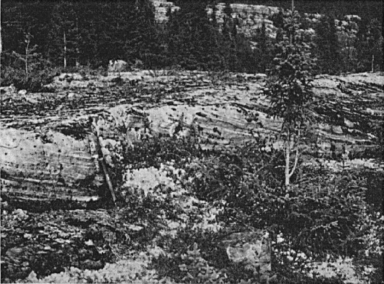
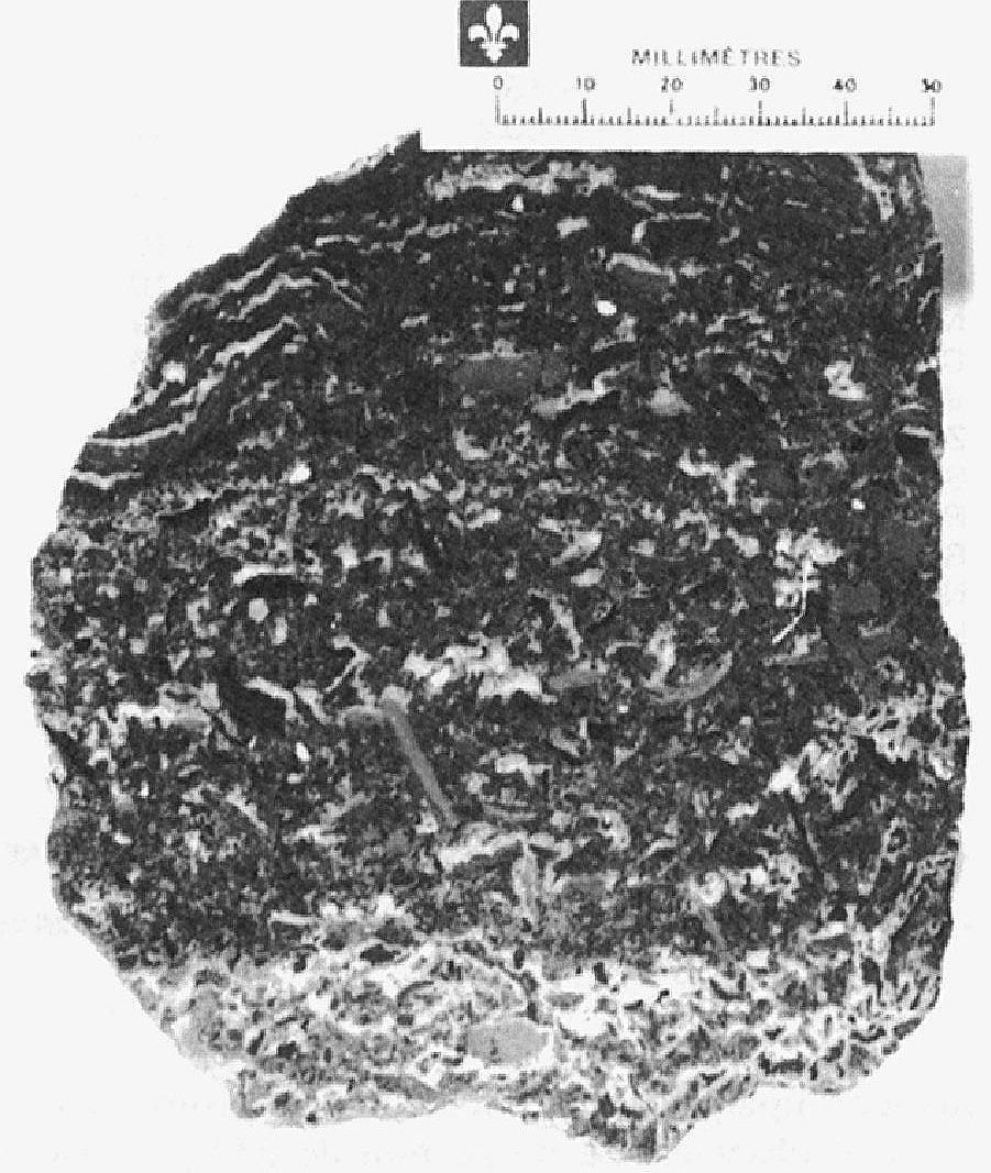
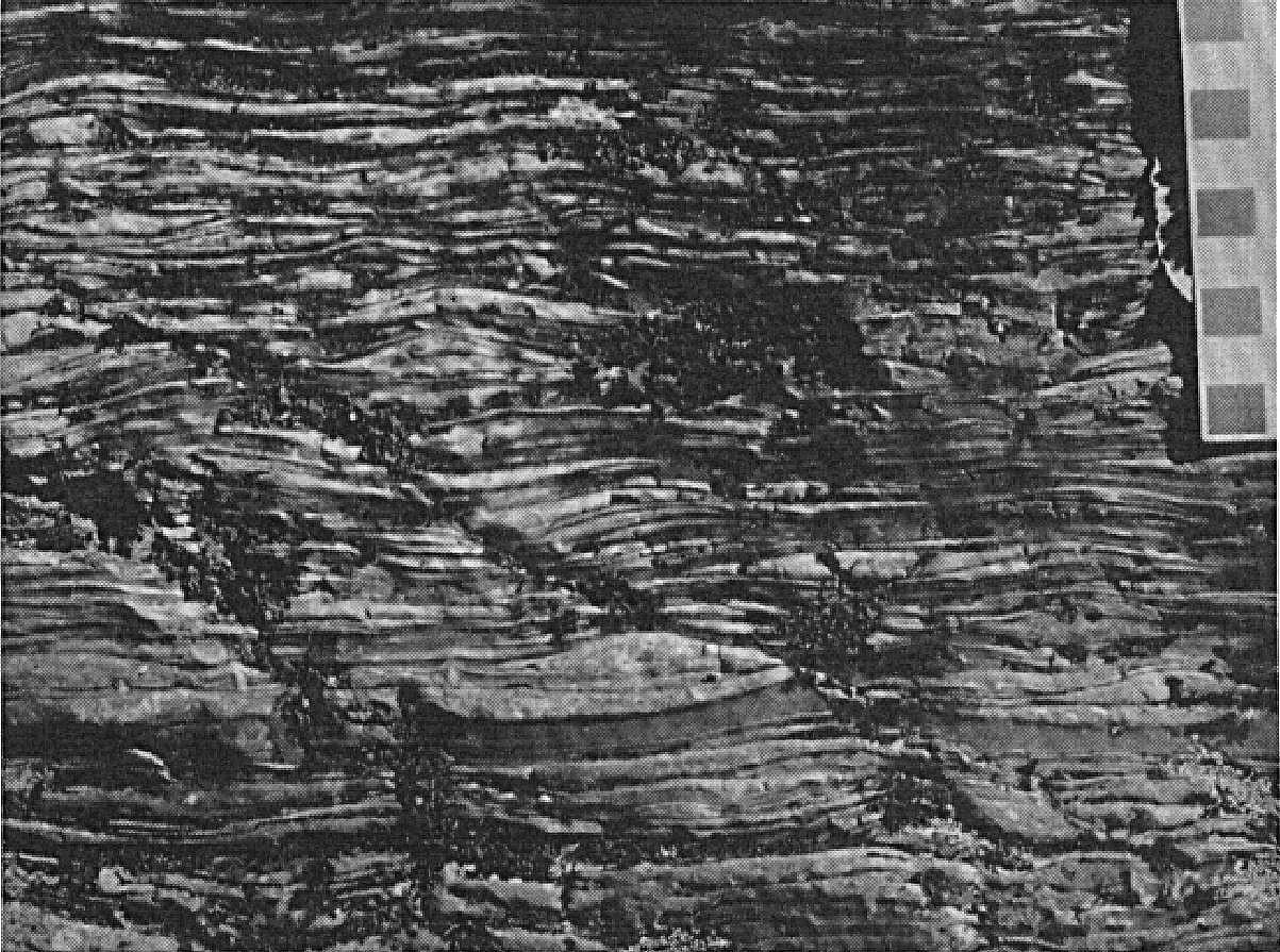
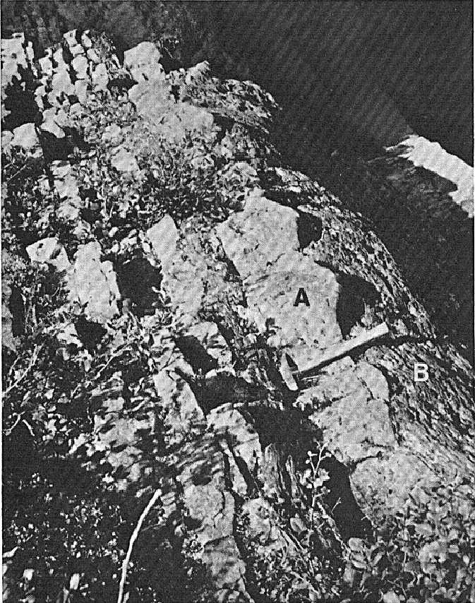
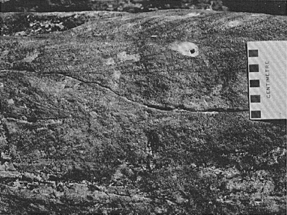
At the type locality, the Portage Formation consists mainly of fine-grained red arkosic sandstone with interbedded (3 m thick) medium-grained pink quartzitic arenite. Alternating arkosic sandstone and quartzitic arenite is characteristic of this formation in the type area (Dimroth, 1972, 1978). Other characteristic lithologies of the formation are medium-grained pink dolomitic sandstone and pink calcarenite having a brown patina, and pink stromatolitic dolomite. These sedimentary rocks form three to four layers (~10 m thick) interbedded with red arkosic sandstone (Dimroth, 1969, 1972, 1978). Generally, dolomitic sandstone changes laterally to calcarenite and then to stromatolitic dolomite. The latter changes laterally and vertically to calcarenite. According to Dimroth (1972, 1978), dolomitic layers have a constant thickness over several kilometres. A sequence of fine-grained red arkosic sandstone, green siltstone and interbedded grey mudstone (~6-10 m thick) occurs at the top of the formation (Dimroth, 1972, 1978). The most common sedimentary structures in arenaceous rocks of the Portage Formation are cross bedding, beach ripples and tabular stratification (Baragar, 1967; Dimroth, 1972, 1978; Clark, 1984).
The Portage Formation locally contains interbedded red mudstone and siltstone in the Minowean Lake area (Brouillette, 1989) and at Cambrien Lake (Clark, 1984). North and west of Castignon Lake (sheet 24C07), about six beds of white or pink quartzitic arenite (~6-10 m thick) occur in the formation (Dimroth, 1972, 1978). At Cramolet Lake, a greenish siltstone layer with interbedded brown patina dolomite forms the base of the Portage Formation (Dimroth, 1972, 1978). This layer indicates the existence of reducing conditions at the end of the deposition of the Chakonipau Formation in this area (Clark and Wares, 2004). In the Patu Lake area (sheet 24C10), red or purple siltstones and microconglomerates are attributed to the Portage Formation (Dressler, 1973, 1979; Clark, 1983, unpublished data).
The Portage Formation is of mixed fluvial and marine origin (Dimroth, 1970, 1972, 1978; Wardle and Bailey, 1981; Clark, 1984; Clark and Wares, 2004). According to Baragar (1967) and Dimroth (1972, 1978), the detrital material constituting the formation would have come mainly from a source area located west of the Labrador Trough. The detritus would have been transported in part by wind, as evidenced by good sorting, fine grain size and subangular shape of the grains, as well as the high proportion of feldspar (Dimroth, 1968a, 1972, 1978). In contrast, the constituents of medium-grained dolomitic sandstones and calcarenites are well rounded. These rocks, as well as stromatolitic dolomites, were deposited in a shallow marine environment (Dimroth, 1972, 1978). Rocks are slightly metamorphosed to the greenschist facies or lower (Dimroth and Dressler, 1978).
Copper and uranium mineralization, interpreted as epigenetic and syntectonic, has developed in recrystallized dolomites and mudstones of the Portage Formation. This mineralization is located in a transition zone that reflects the change in depositional environment from oxidizing to reducing conditions. This zone is located at the contact of the Portage and Lace Lake formations (Clark and Wares, 2004). In the Castignon, Chakonipau and Otelnuk Lakes area, abundant copper and uranium mineralization is associated with the faulted contact zone (Argencourt Fault) between the Portage and Lace Lake formations (Brouillette, 1989; Clark and Wares, 2004).
Portage Formation, Undivided (pPpo): Arkosic Sandstone, Quartzitic Arenite, Dolomitic Sandstone, Calcarenite, Stromatolitic Dolomite and Some Mudstone
This undivided unit includes all the rocks found in the Portage Formation. It consists of fine-grained red arkosic sandstone with interbedded beige, pink, red or grey dolomitic sandstone and calcarenite, white or pink quartzitic arenite, pink stromatolitic dolomite, and locally red mudstone (Dimroth, 1978).
Portage Formation 1 (pPpo1): White, Pink or Brown Quartzitic Arenite, Locally Dolomitic, and Less Commonly Subarkose, Locally Dolomitic; Some Red Mudstone Locally
Unit pPpo1 was identified in the Castignon Lake and Chakonipau Lake areas (sheets 24C07 and 24C08) (Dimroth, 1969, 1978; Brouillette, 1989) and west of Cambrien Lake (sheet 24C06) (Clark, 1984). It consists mainly of quartzitic arenite and, less commonly, subarkose. These rocks are locally dolomitic (Clark, 1984; Brouillette, 1989). Quartzitic arenite is generally found in 6 to 20 m thick beds inserted in reddish pelitic sequences (pPpo3). The rock is white or pink, locally greenish, reddish or brown, medium to coarse grained and massive (Dimroth, 1978; Clark, 1984; Brouillette, 1989). According to Dimroth (1978), it does not appear to have any structure. Rocks equivalent to unit pPpo1 were mapped by Baragar (1967) and Dimroth (1978) in the Ribero and Cramolet lakes area (sheets 23O13 and 23O14) and north of Musset Lake (sheet 23O11). These consist of fine-grained red arkosic sandstones and medium to coarse-grained pink quartzitic arenites with minor amounts of dolomite.
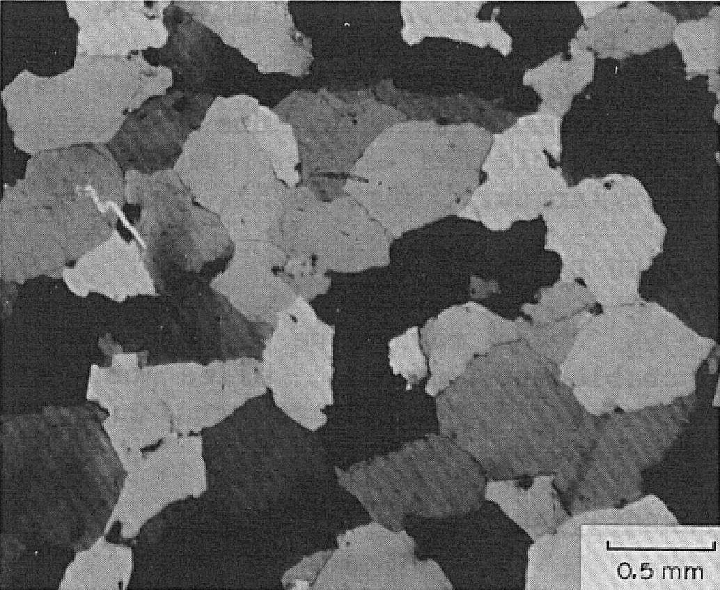
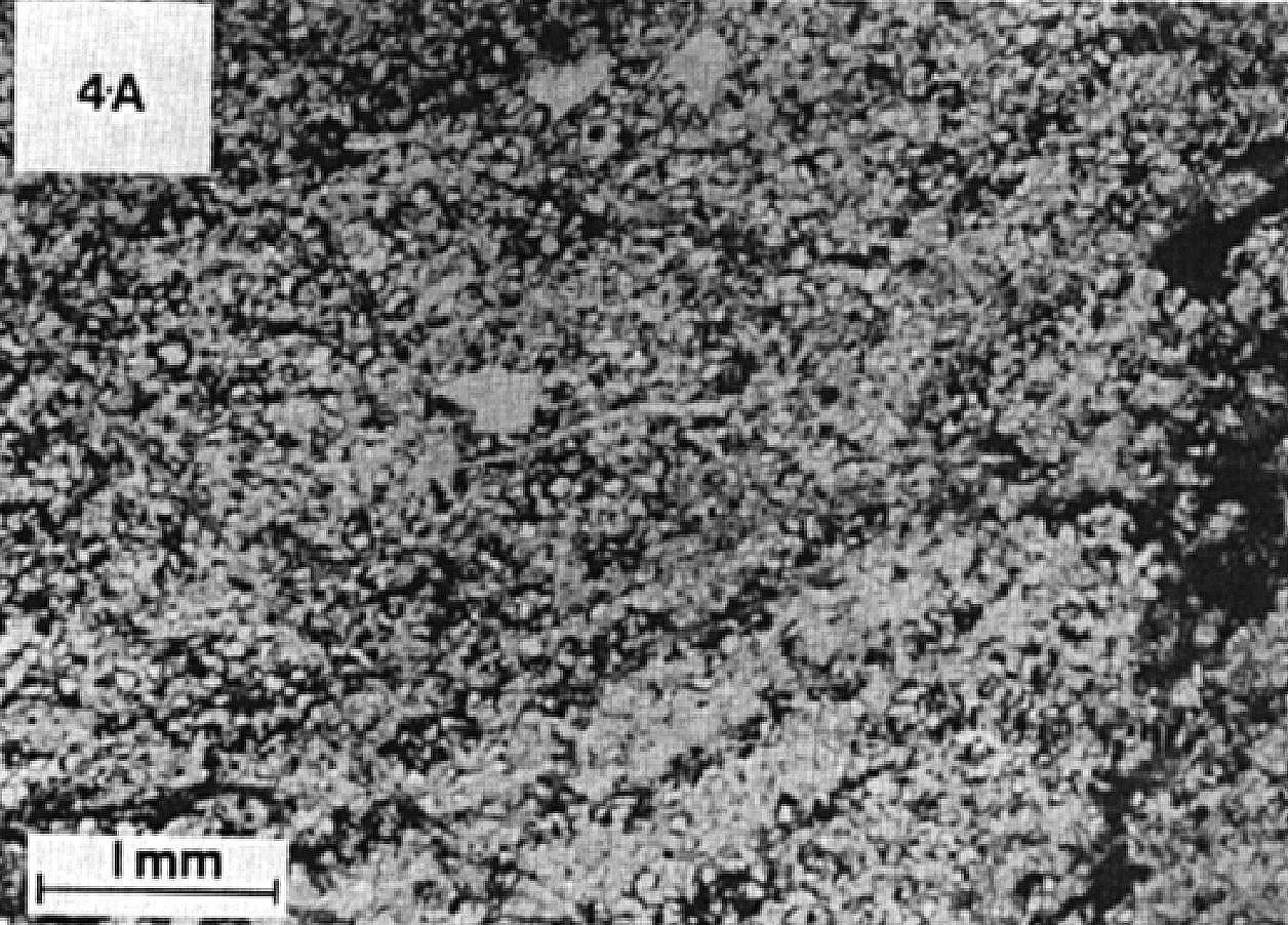
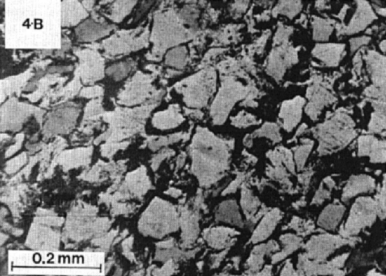
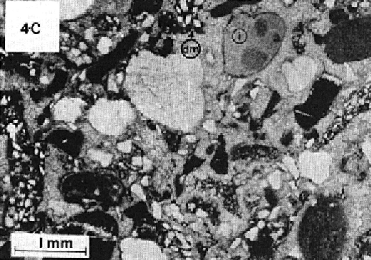
In thin sections, quartzitic arenite is mainly composed of quartz with 5% microcline and traces of plagioclase. Primary grains are moderately to well rounded, moderately sorted and cemented by quartz. A polygonal texture indicates recrystallization (Clark, 1984).
Portage Formation 2 (pPpo2): Beige, Pink or Red Dolomitic Sandstone; Interbedded Massive or Stromatolitic Pink Dolomite
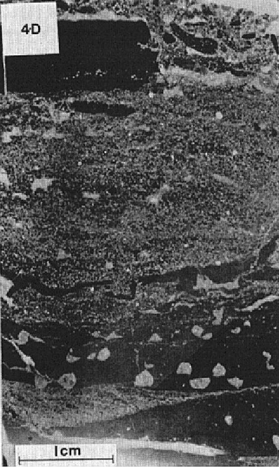
Unit pPpo2 was recognized by Brouillette (1989) in the area south of Minowean Lake. It consists of thick beds of beige, pink or red dolomitic sandstone and interbedded centimetric to metric massive dolomite or pink stromatolitic dolomite having a light grey patina. The diameter of stromatolites reaches 8 and 10 cm at the NW end of Chakonipau Lake. Intermediate facies of sandy dolomite, in beds a few tens of centimetres thick, are also observed within the unit. In places, Brouillette (1989) observed beds a few centimetres to ten metres thick of dolomitic conglomerate (calcarenite). The latter is formed of millimetric to centimetre fragments of pink dolomite and red dolomitic sandstone. These conglomerate beds are observed at various levels within the dolomitic sequence.
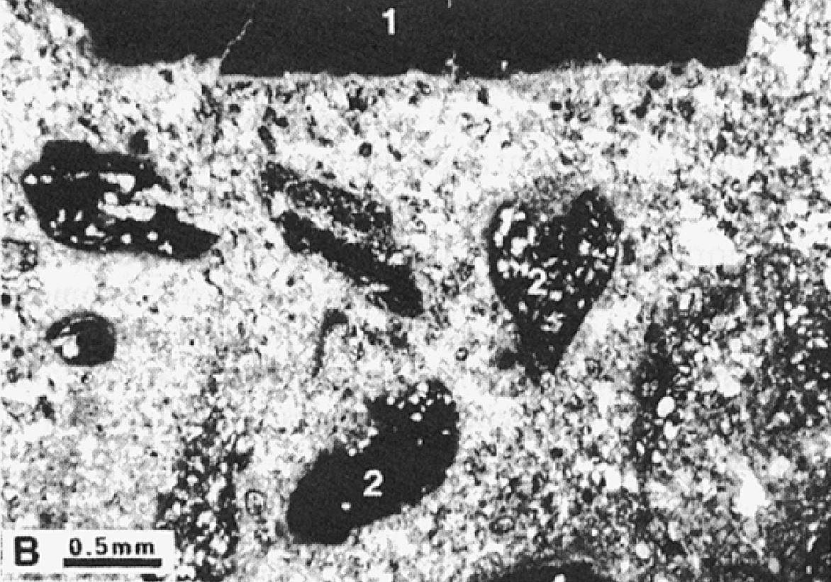
Brouillette (1989) identified two types of dolomitic sandstone: one formed mainly of terrigenous fragments and a second containing up to 70% allochemical fragments. In both types of sandstone, terrigenous fragments (0.4-0.6 mm) are composed of quartz (70-80%) and feldspar (1-2%) cemented by microcrystalline calcite. The allochemical fraction of the second type of sandstone is composed of peloids, oolites and intraclasts (up to 1 cm) of various compositions. Terrigenous fragments are well sorted whereas allochemical fragments are very variable. Conglomerate beds contain >40% fragments averaging 4-5 mm in diameter. These fragments consist mainly of quartz-peloid dolomitic lithoclasts as well as micritic lithoclasts, in microcrystalline carbonate cement.
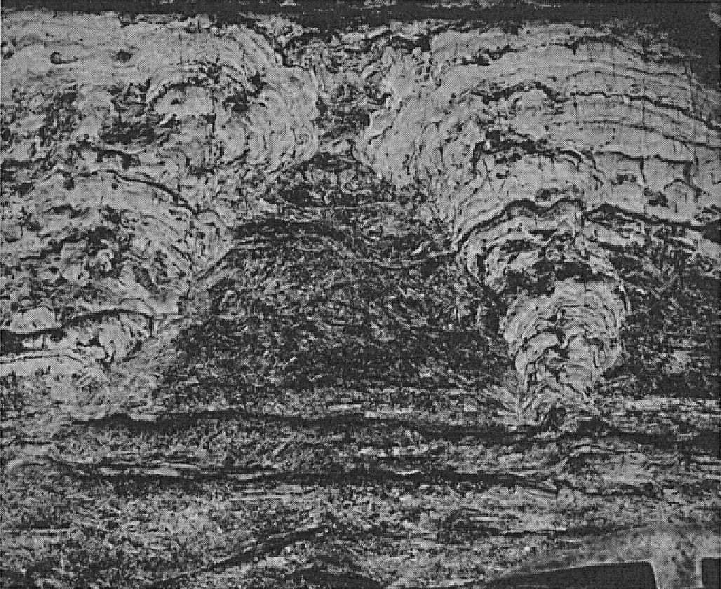
At the southern end of Cambrien Lake (Clark, 1984), unit pPpo2 is represented by a ≥55 m thick sequence of beige, pink or grey dolomitic sandstone, stromatolitic dolomite and calcarenite. Cross bedding (up to 0.3 m) is commonly observed in dolomitic sandstone. The sequence contains a 3 m interval of stromatolitic dolomite beds (5-30 cm thick) alternating with intraclastic conglomerate (calcarenite) beds 2 to 20 cm thick. Some thinly interbedded red sandstone, siltstone and mudrock are noted near the base of the unit. A ~5 m bed of pink dolomite having a yellow patina, with thinly interbedded red sandstone, occurs near the top of the sequence.
Portage Formation 3 (pPpo3): Fine to Medium-Grained Red Arkosic Sandstone, Subarkose and Arkosic Sandstone, Locally Carbonatized (Red Beds); Interbedded Red Mudstone and Siltstone, Locally Green; Interbedded Grey, Pink or Purplish Brown Quartzitic Arenite or Locally Green Siltstone
In the Castignon, Chakonipau, Portage and Minowean lakes area (sheets 24C07 and 24C08), unit pPpo3 consists of thick, finely bedded sequences of fine-grained red arkose and arkosic sandstone with locally interbedded quartzitic arenite or green siltstone (Dimroth, 1969, 1978; Brouillette, 1989). In the Minowean Lake area, the unit locally includes interbedded red siltstone and mudstone (Brouillette, 1989). The most common sedimentary structures are cross and tabular stratification (Dimroth, 1978). At Minowean Lake, the unit has a well-marked rhythmic bedding of millimetric to centimetric beds of red fine-grained sandstone, siltstone and mudstone. Sorting is commonly observed (Brouillette, 1989). Quartzitic arenite is pink, medium grained and forms centimetre to decimetre, locally metre (up to 3 m) thick beds (Dimroth, 1978; Brouillette, 1989).
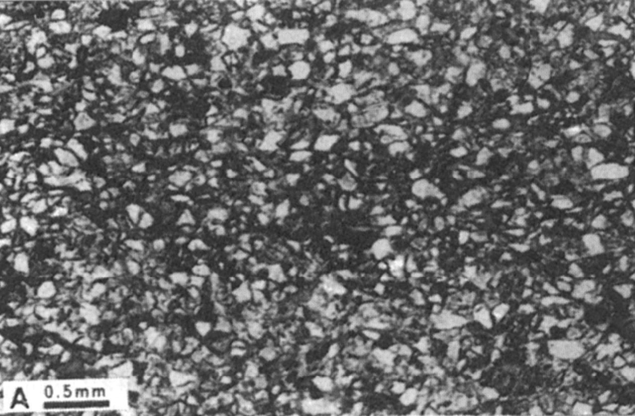
In thin sections, red arkose, arkosic sandstone and siltstone are composed of quartz and feldspar fragments (0.05-0.1 mm) in a sericite-chlorite matrix (Brouillette, 1989). The feldspar content (plagioclase and microcline) generally varies from 5 to 10 %, reaching locally 30 to 40 % (Dimroth, 1978; Brouillette, 1989). Feldspars are partially to totally replaced by white mica and calcite. Fragments are angular to subrounded, well sorted and well compacted. They are oriented parallel to stratification and covered with hematite (Dimroth, 1978; Brouillette, 1989). The hematite content can reach, according to Brouillette (1989), 20 or 25% of the total composition of some beds. Green siltstone is devoid of iron oxides and is characterized by the presence of euhedral pyrite disseminated in the matrix. Sorting is also observed (Brouillette, 1989).
In the Cambrien Lake area (sheets 24C03 and 24C06), unit pPpo3 ranges in thickness from 40 to 155 m (Clark, 1984). It consists of fine to medium-grained red arkose, subarkose and arkosic sandstone, locally carbonatized (red beds). These sedimentary rocks occur in beds a few centimetres to 2 m thick and include interbedded (1-2 mm) red, locally green siltstone and mudstone. Dolomitic sandstone and dolomite beds are locally observed. Fine-grained sandstones, siltstones and mudstones typically display cross bedding. Planar oblique stratification and chevron cross bedding are observed in places. Among the sedimentary structures observed, Clark (1984) notes mudstone rip-up clasts in sandstone beds, slip structures and tool marks. Locally, interbedded grey, pink or purplish brown quartzitic arenite or, locally, green siltstone are observed in the red beds.
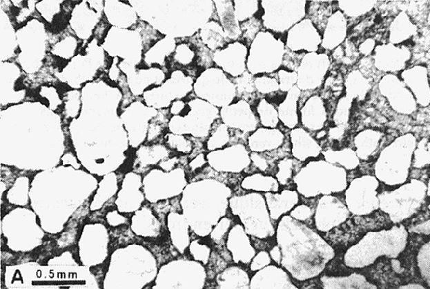
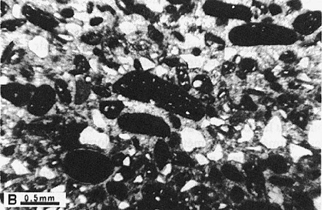
Sandstones are composed of detrital, subrounded to rounded quartz and microcline (5%) grains, in a very fine-grained quartz-microcline-plagioclase-sericite matrix. The grain size varies from 0.05 to 4 mm. The sandstone constituents are typically hematite-coated and cemented by quartz. Sandstones also contain smaller amounts of mica, tourmaline and zircon. Mudstones are also enriched in hematite. Quartzitic arenite is composed of well-rounded quartz grains and a few chert fragments cemented by quartz and coated with hematite. This rock is rather porous (Clark, 1984).
Portage Formation 4 (pPpo4): Interbedded Very Fine-Grained Red Arkosic Sandstone, Red Sandstone, Dolomitic Sandstone and Calcarenite
Unit pPpo4 was mapped by Dimroth (1969, 1978) in the Castignon and Chakonipau lakes area. It consists mainly of interbedded very fine-grained red arkosic sandstone, medium-grained pink dolomitic sandstone, red sandstone having a brown alteration patina and pink calcarenite (Dimroth, 1969, 1978). This unit appears to mainly vary laterally between these different lithofacies (Dimroth, 1969, 1978). The most common sedimentary structures are cross and tabular stratification (Dimroth, 1978).
Portage Formation 5 (pPpo5): Pink or salmon Stromatolitic Dolomite
Unit pPpo5 consists of pink or salmon stromatolitic dolomite (Dimroth, 1969, 1972, 1978; Clark, 1984). It forms ~10 m thick bands intercalated with red rocks of units pPpo3 and pPpo4 (Dimroth, 1972, 1978). According to Dimroth (1972, 1978), stromatolitic dolomite of the Portage Formation is identical to that of the Dunphy Formation. In the Chakonipau and Portage lakes area, stromatolitic dolomite changes laterally and vertically to calcarenite (Dimroth, 1972, 1978). In thin sections, dolomite has an intraclastic texture and contains fenestrae (Dimroth, 1978). West of Cambrien Lake, stromatolitic dolomite forms an 8 m thick band that directly overlies red beds of unit pPpo3. It includes locally 2 m of massive pink oolitic dolomite with interbedded fragmental calcarenite (Clark, 1984).
Portage Formation 6 (pPpo6): Coarse-Grained Red and Pink Dolomitic Sandstone; Interbedded Calcarenite
Unit pPpo6 consists of medium to coarse-grained (1-5 mm) red and pink dolomitic sandstone with interbedded pink calcarenite having a brown patina (Dimroth, 1969, 1972, 1978). These rocks form ~10 m thick bands, generally interbedded with fine-grained red arkoses and arkosic sandstones (unit pPpo3). According to Dimroth (1972, 1978), the thickness of these bands is constant over several kilometres. Dolomitic sandstone is mainly composed of detrital quartz and a minor amount of feldspar in carbonate cement. In some places, sandstone is highly compacted, while in others it is formed of almost pure dolomite with some quartz grains. Dolomitic sandstone changes to calcarenite, which is composed of pink, calcareous intraclasts (1-20 mm long), rare oolites, stromatolitic fragments and a few quartz grains cemented in dolomite. In thin sections, calcarenite is composed of well-rounded to moderately rounded quartz grains, elongated to spherical, well-rounded micrite intraclasts and silty dolomite fragments in a dolomite matrix. The constituents are moderately to poorly sorted (Dimroth, 1978).
Portage Formation 8 (pPpo8): Brecciated Light Beige to Reddish Calcareous Dolomite, Thinly Interbedded Red Mudstone
Unit pPpo8 outcrops in a few places east of Minowean Lake, in the area NW of Portage Lake (sheet 24C08). It consists of light beige to reddish calcareous dolomite with locally thinly interbedded red mudstone. Dolomite features brecciation and recrystallization structures that indicate significant tectonism and metasomatism (Brouillette, 1989).
Portage Formation 9 (pPpo9): Pink, Red or Purple Arkosic Siltstone; Some Grey Siltstone, Pink Arkose, Subarkose, Pink Dolomite and Grey or Pink Mudstone
Unit pPpo9 occurs east of Patu Lake (sheets 24C09 and 24C10). It consists mainly of finely bedded pink, red or purple arkosic siltstone with minor amounts of grey siltstone, pink arkose, subarkose, pink dolomite and grey or pink mudstone (Dressler, 1973, 1979). Arkosic siltstone usually has characteristic sedimentary structures such as cross bedding, beach ripples and decimetric channels. Mudstone is usually interbedded with arkosic siltstone. In thin sections, arkosic siltstone is composed of quartz, plagioclase and microcline as angular to subrounded grains ~0.05 to 0.2 mm in diameter. These components are hosted in a chlorite-sericite matrix (<5-10%). Accessory minerals are biotite, titanite and opaque minerals (Dressler, 1979).
Portage Formation 10 (pPpo10): Arkosic Sandstone with Dolomitic Matrix and White, Grey or Reddish Patina; Arkosic Microconglomerate with Dolomitic Matrix; Some Sandy Dolomite and Purple Mudrock
Unit pPpo10 was identified in the area north of Patu Lake (sheet 24C10). It consists of arkosic sandstone having a dolomitic matrix and a white, grey or reddish patina, arkosic microconglomerate having a dolomitic matrix, and minor amounts of sandy dolomite and purple mudrock (Clark, 1983, unpublished data).
Thickness and Distribution
The Portage Formation belongs to the autochthonous Cambrien and allochthonous Howse and Schefferville lithotectonic zones, as defined by Clark and Wares (2004). It extends over a distance of ~185 km in a NW-SE direction between latitudes 55°15′N and 56°45′N. Rocks typical of the formation occupy most of the Castignon Lake Basin and the area between Chakonipau and Portage lakes (Dimroth, 1969, 1978). Lithologically similar rocks have been identified south of Pistolet Lake, Lace Lake, Delta Lake (formerly Concession Lake) (Dimroth, 1969, 1978) and near Cambrien Lake (Clark, 1984). Siltstones, sandstones and arkosic microconglomerates attributed to the Portage Formation have also been recognized in the Patu Lake area (Dressler, 1979, Clark, 1983, unpublished data). The Portage Formation was poorly studied by Dimroth (1978) south of latitude 56°N. Red arkosic sandstones, pink quartzitic arenites and dolomites were traced SE by Dimroth (1978) to the Cramolet and Ribero lakes area. In this area, the formation would correspond in part to what Baragar (1967) identified as the Seward Formation. Further SE, stromatolitic dolomites belonging to the Portage Formation are present NW of Poupeau Lake (sheet 23O07) (Dimroth, 1978). On the Labrador side, the Portage Formation occurs on the west side of the Snelgrove Lake Arch (Anticline), NE of Petitsikapau Lake (sheet 23I12) (Wardle, 1979). In this area, it would correspond to what Wardle (1979) identified as the « Upper Seward Formation » (i.e. the upper part of the Seward Group according to the nomenclature of Clark and Wares, 2004).
The exact thickness of the Portage Formation is unknown. Dimroth (1969, 1970, 1978, page 67) suggests a thickness of 150 to >300 m. In the Minowean and Portage lakes area, Brouillette (1989) estimates the thickness of the formation at 800 m. In the Cambrian Lake area, Clark (1984) calculated thicknesses of ~96 m and 230 m west of Cambrien Lake, 139 m north of the Mort River and 110 m south of David Lake (sheet 24C06). In Labrador, mudstones and siltstones of the upper part of the « Seward Formation » are ≥325 m thick (Wardle, 1979).
Dating
None.
Stratigraphic Relationship(s)
Deposition of the Portage Formation occurred between 2169 ±2 and 2142 +4/-2 Ma, i.e. during the depositional period of the first cycle (T. Krogh and B. Dressler, unpublished data cited in Clark, 1984, page 4; Rohon et al., 1993; Clark and Wares, 2004). Recently, U-Pb ages of 2166 ±4 and 2171 ±2 Ma were obtained by Corrigan et al. (2019) for the beginning of the first cycle.
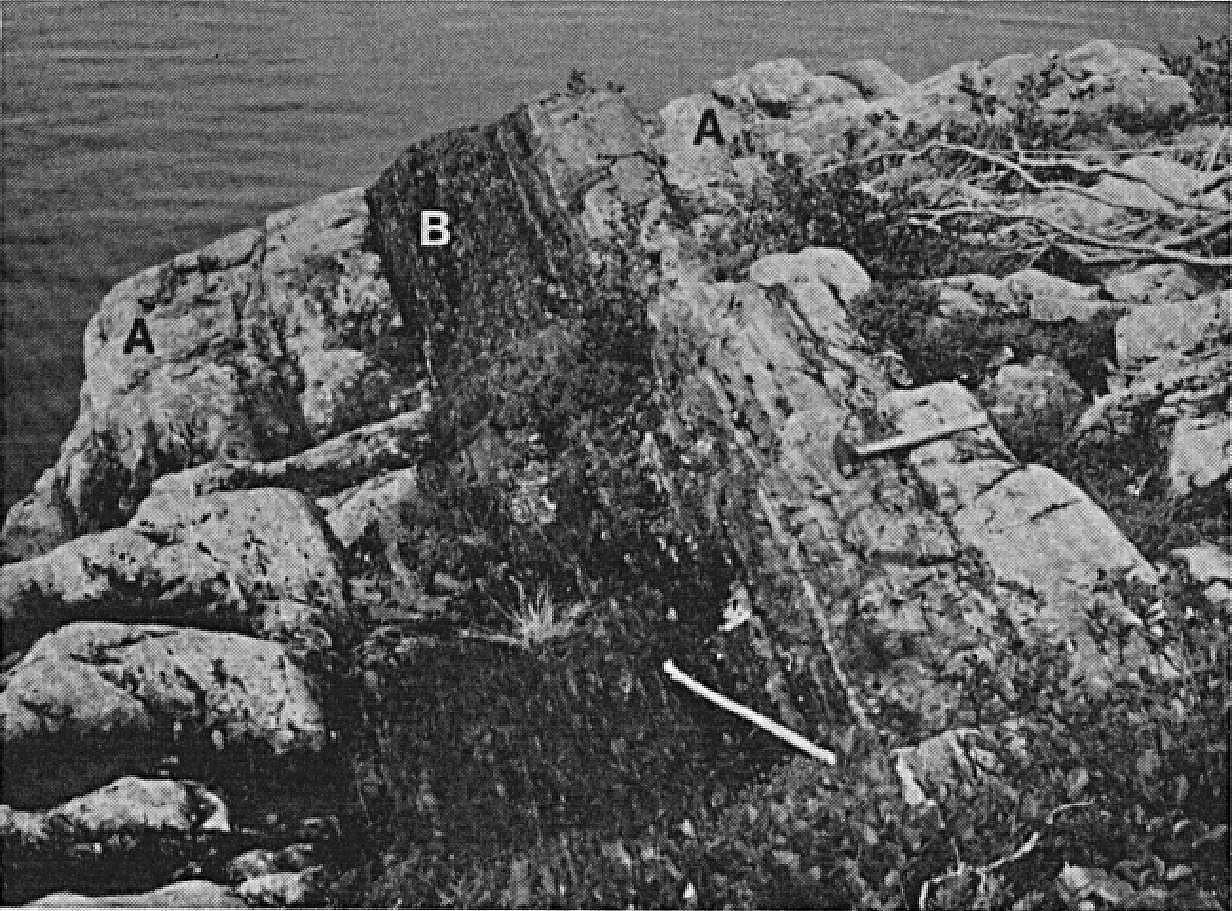
The Portage Formation is overlying the Chakonipau Formation and underlying the Lace Lake Formation (Pistolet Group). In the type area, the lower contact of the unit is exposed south of Portage Lake (Dimroth, 1969, 1978). According to Dimroth (1978), this lower contact with the Chakonipau Formation is most often defined arbitrarily. However, in some places in the centre of the Labrador Trough, the first appearance of a bed of marine origin (green siltstone) represents the lower limit of the Portage Formation. At the type locality, the lower limit corresponds to the lowest dolomite bed recognized in the arenaceous sequence. Contacts of the formation are not visible in the area between Delta and Pistolet lakes. In this area, the Chakonipau Formation is absent and the Portage Formation unconformably overlies (erosional discordance) Archean rocks of the Superior Province (Dimroth, 1969, 1978). West of the southern part of Cambrien Lake, the Portage Formation conformably overlies the Chakonipau Formation. To the NW of the Mort River and to the east of the neck of Cambrien Lake, it is in fault contact with Archean rocks. Further north, west of Cambrien Lake, it unconformably overlies (non-faulted erosional discordance) granitic bedrock (Clark, 1984). Arkosic sandstones and microconglomerates correlating with the Portage Formation are in fault contact (Castignon Fault) with Archean rocks present in tectonic slices at Patu Lake (SIGÉOM interactive map). On the west side of the Snelgrove Lake Arch, mudstones and red siltstones of the « Upper Seward Formation » are in conformable and transitional contact with the Chakonipau Formation (called the « Middle Seward Formation ») (Wardle, 1979).
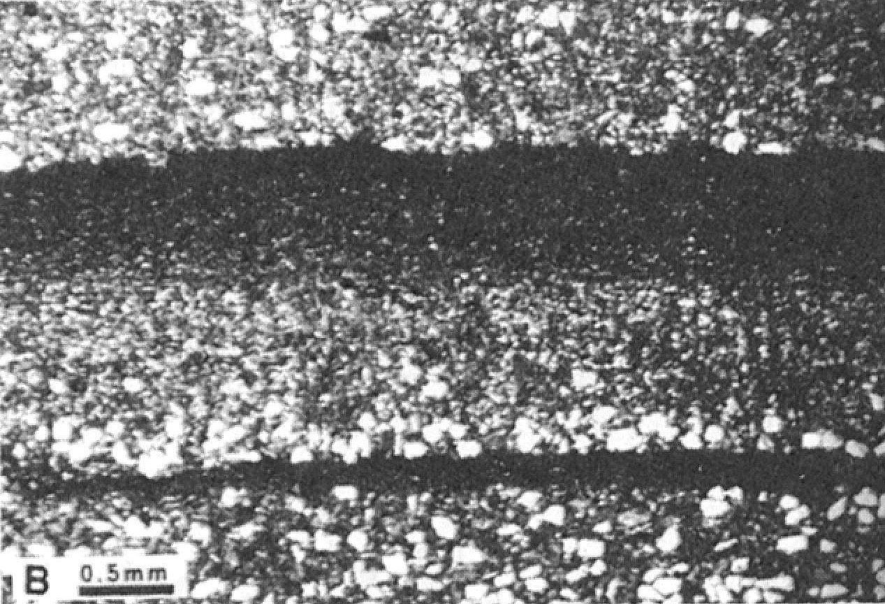
In the type area, the upper contact of the Portage Formation with marine detrital sedimentary rocks of the Lace Lake Formation is exposed west of Portage Lake (Dimroth, 1969, 1978). The contact is gradual over a few centimetres to several metres. It is represented by a transition zone of green and red layers, which reflects the change in sedimentation environment from oxidizing to reducing conditions (Dimroth, 1978; Brouillette, 1989; Clark and Wares, 2004). Moreover, detrital sedimentary rocks with a reduced character are generally sparse in the Portage Formation, except in the Cramolet Lake area, where they are located at the base of the formation (Dimroth, 1978). In the Mort River area (Clark, 1984), the contact between the Portage and Lace Lake formations is sharp and without interstratification. Near the Snelgrove Lake Arch, the contact of the « Upper Seward Formation » with the overlying formation (called the « Attikamagen Formation » there) is not exposed, but appears to be conformable (Wardle, 1979).
Paleontology
The Portage Formation comprises dolomites having cryptalgal and algal structures (stromatolites) (Dimroth, 1969, 1978, Clark, 1984; Brouillette, 1989).
References
Publications Available Through SIGÉOM Examine
BROUILLETTE, P., 1989. GEOLOGIE ET METALLOGENIE DE LA REGION DES LACS MINOWEAN ET DU PORTAGE (FOSSE DU LABRADOR). MRN; ET 88-06, 84 pages, 2 plans.
CLARK, T., 1984. GEOLOGIE DE LA REGION DU LAC CAMBRIEN – TERRITOIRE DU NOUVEAU-QUEBEC. MRN; ET 83-02, 77 pages, 1 plan.
CLARK, T., WARES, R., 2004. SYNTHESE LITHOTECTONIQUE ET METALLOGENIQUE DE L’OROGENE DU NOUVEAU-QUEBEC (FOSSE DU LABRADOR). MRNFP; MM 2004-01, 182 pages, 1 plan.
DIMROTH, E., 1965. GEOLOGIE DE LA REGION DU LAC OTELNUK, TERRITOIRE DU NOUVEAU-QUEBEC. MRN; RP 532, 30 pages, 1 plan.
DIMROTH, E., 1965. PRELIMINARY REPORT, GEOLOGY OF OTELNUK LAKE AREA, NEW QUEBEC TERRITORY. MRN; RP 532(A), 27 pages, 1 plan.
DIMROTH, E., 1969. GEOLOGIE DE LA REGION DU LAC CASTIGNON, TERRITOIRE DU NOUVEAU-QUEBEC. MRN; RP 571, 62 pages, 7 plans.
DIMROTH, E., 1969. PRELIMINARY REPORT, GEOLOGY OF THE CASTIGNON LAKE AREA, NEW QUEBEC TERRITORY. MRN; RP 571(A), 58 pages, 7 plans.
DIMROTH, E., 1972. STRATIGRAPHY OF PART OF THE CENTRAL LABRADOR TROUGH. MRN; DP 154, 304 pages, 6 plans.
DIMROTH, E., 1978. Région de la fosse du Labrador entre les latitudes 54° 30′ et 56° 30′. MRN; RG 193, 417 pages, 16 plans.
DRESSLER, B., 1973. GEOLOGIE DE LA REGION DU LAC PATU, TERRITOIRE DU NOUVEAU-QUEBEC. MRN; RP 603, 26 pages, 1 plan.
DRESSLER, B., CIESIELSKI, A., 1979. Région de la fosse du Labrador. MRN; RG 195, 136 pages, 14 plans.
M E R, 1983. TRAVAUX SUR LE TERRAIN – 1983. DV 83-13, 92 pages.
MERN, 2020. Résumés des conférences et des photoprésentations, Québec Mines+Énergie 2019. DV 2019-01, 78 pages.
Other Publications
BARAGAR, W.R.A. 1967. Wakuach Lake map-area, Quebec-Labrador (23O). Geological Survey of Canada; Memoir 344, 174 pages. https://doi.org/10.4095/123960
DIMROTH, E. 1968a. Sedimentary textures, diagenesis, and sedimentary environment of certain Precambrian ironstones. Neues Jahrbuch für Geologie und Paläontologie; volume 130, pages 247-274.
DIMROTH, E. 1968b. The evolution of the central segment of the Labrador geosyncline; part I: stratigraphy, facies and paleogeography. Neues Jahrbuch für Geologie und Paläontologie; volume 132, pages 22-54.
DIMROTH, E. 1970. Evolution of the Labrador Geosyncline. Geological Society of America Bulletin; Volume 81, pages 2717-2742. https://doi.org/10.1130/0016-7606(1970)81[2717:EOTLG]2.0.CO;2
DIMROTH, E., DRESSLER, B. 1978. Metamorphism of the Labrador Trough. In Metamorphism in the Canadian Shield. Geological Survey of Canada; Paper 78-10, pages 215-236. https://doi.org/10.4095/104534
FAHRIG, W.F. 1969. Géologie, Lac Cambrien (moitié ouest), Québec. Geological Survey of Canada; Map 1223A (1 : 250 000). https://doi.org/10.4095/108893
FRAREY, M.J., DUFFELL, S. 1964. Revised stratigraphic nomenclature for the central part of the Labrador Trough. Geological Survey of Canada; Paper 64-25, 13 pages. https://doi.org/10.4095/123909
ROHON, M.-L., VIALETTE, Y., CLARK, T., ROGER, G., OHNENSTETTER, D., VIDAL, P. 1993. Aphebian mafic-ultramafic magmatism in the Labrador Trough (New Quebec): its age and the nature of its mantle source. Canadian Journal of Earth Sciences; volume 30, pages 1582-1593. https://doi.org/10.1139/e93-136
ROSCOE, S.M. 1957. Cambrian Lake (east half), New Quebec. Geological Survey of Canada; Paper 57-6, 13 pages. https://doi.org/10.4095/101318
WARDLE, R.J. 1979. Geology of the eastern margin of the Labrador Trough. Department of Mines and Energy, Government of Newfoundland and Labrador; Report 78-9, 22 pages. https://doi.org/10.4095/101318
WARDLE, R.J., BAILEY, D.G. 1981. Early Proterozoic sequences in Labrador. In Proterozoic basins of Canada (F.H.A. Campbell, editor). Geological Survey of Canada; paper 81-10, pages 331-359. https://doi.org/10.4095/124192
Suggested Citation
Ministère de l’Énergie et des Ressources naturelles (MERN). Portage Formation. Quebec Stratigraphic Lexicon. https://gq.mines.gouv.qc.ca/lexique-stratigraphique/province-de-churchill/formation-de-portage_en [accessed on Day Month Year].
Contributors
|
First publication |
Charles St-Hilaire, GIT, M.Sc. charles.st-hilaire@mern.gouv.qc.ca; Thomas Clark, P. Geo., Ph.D (redaction) Mehdi A. Guemache, P. Geo., Ph.D. (coordination); anonymous (critical review); Simon Auclair, P. Geo., M.Sc. (editing); Céline Dupuis, P. Geo., Ph.D. (English version); André Tremblay (HTML editing). |