

First published: 7 December 2020
Last modified:
DISCLAIMER: This English version is translated from the original French. In case of any discrepancy, the French version shall prevail.
| Author(s): | Perrault, 1955 |
| Age: | Paleoproterozoic |
| Stratotype: | The type section is on the SE shore of Lace Lake (approximate UTM NAD83 zone 19 coordinates: 527155 m E, 6213737 m N). Another good section, through the lower part of the formation, is at Lace Lake Ravine (approximate UTM NAD83 Zone 19 coordinates: 525776 m E, 6217294 m N). |
| Type area: | Lace Lake area (NTS sheet 24C02) |
| Geological province: | Churchill Province |
| Geological subdivision: | New Quebec Orogen (Labrador Trough) / Cambrien, Howse, Romanet (formerly Wheeler) and Schefferville lithotectonic zones |
| Lithology: | Mudstone, siltstone, sandstone, dolomite, phyllite, schist, quartzite, conglomerate, basalt |
| Category: | Lithostratigraphic |
| Rank: | Formation |
| Status: | Formal |
| Use: | Active |
Background
The name Lace Lake Formation was introduced by Perrault (1955) to refer to a package of green siltstone, green micaceous sandstone and grey mudstone, with some interbedded silty dolomite and calcareous sandstone. The unit is named after Lace Lake (sheet 24C02). Dimroth (1968, 1969) subsequently assigned the Lace Lake Formation to the Pistolet Subgroup, the latter being redefined as the Pistolet Group by Clark and Wares (2004). Rocks of the Lace Lake Formation were mapped primarily by Dimroth (1964, 1965, 1966, 1969, 1972, 1978), Dressler (1973, 1979), Clark (1984, 1986), Chevé (1985) and Brouillette (1987, 1989). They have also been the subject of studies to evaluate their mineral potential (Kish and Tremblay-Clark, 1979; Kearvell, 1985; Kearvell and Clark, 1988; Brouillette, 1989).
Description
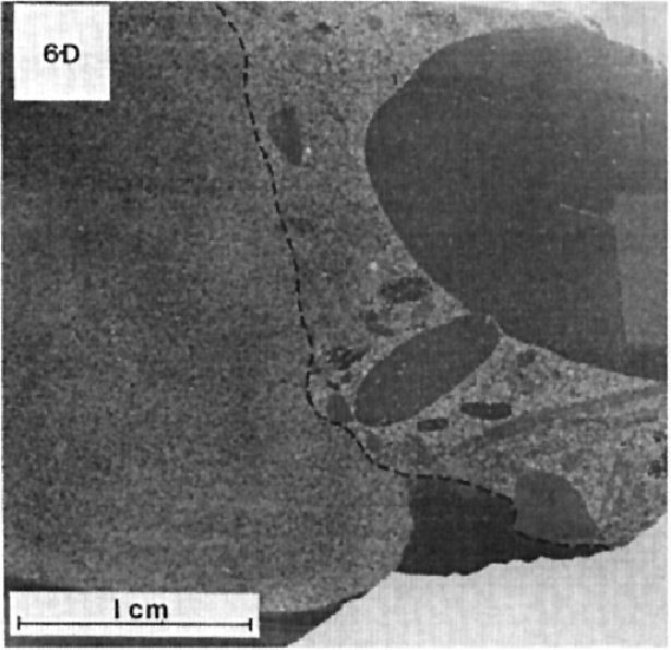
The Lace Lake Formation is a volcano-sedimentary unit consisting mainly of laminated, generally grey to green mudstone, siltstone and fine-grained sandstone with interbedded dolomite having a brown patina. It includes siltstone, sandstone and red mudstone, as well as dolomite having an orange patina locally (Dimroth, 1969, 1978). Rocks are locally graphitic. A minor amount of volcanic rocks is reported locally (Clark, 1986; Brouillette, 1989). According to Dimroth (1978), a pronounced change in lithology marks the base and top of the formation, which has a wide range of facies. Dimroth (1978) distinguishes three facies: 1) western marginal; 2) central basin; and 3) eastern. The western marginal facies is characterized by laminated green, red and grey siltstone and mudstone with interbedded fine-grained sandstone and grey dolomite having a brown or orange alteration patina. Grey mudstone and siltstone with interbedded grey dolomite having a brown alteration patina characterize the central basin facies. The latter passes laterally to the eastern facies corresponding of metamorphic equivalents of the basin facies. These consist of quartzitic phyllite, schist, quartzite and calcosilicate rocks (Dimroth, 1978).
The type locality is in the western marginal facies. It is located on the SE shore of Lace Lake (sheet 24C02) (Table 1; Dimroth, 1978). Another section representing the lower part of the formation has been described at the Lace Lake Ravine (Table 2). However, Dimroth (1978) points out that this section does not correlate with the section at the type locality. Slightly simplified sections also occur in other areas (Table 3).
Table 1: Characteristics of the Formation at the Type Locality
| Type locality: SE shore of Lace Lake (approximate UTM NAD83 zone 19 coordinates: 527155 m E, 6213737 m N) | ||||||||||
| Member | Thickness (m) | Description | ||||||||
| 5 | 30 | Interbedded fine-grained red sandstone, siltstone and quartzite; some interbedded intraclastic dolomite, dolololutite and dolomitic sandstone having an orange patina | ||||||||
| 4 | 60 | Laminated grey mudstone; interbedded grey silty or argillaceous calcilutite having a brown patina (5-8 cm thick) and green siltstone (0.6-1.8 m thick) | ||||||||
| 3 | 15 | Laminated green and red siltstone | ||||||||
| 18 | Laminated green and red siltstone; interbedded (0.5-1.8 m thick) grey intraclastic dolomite and calcilutite having a brown patina and crossbedding, and calcareous sandstone | |||||||||
| 45 | Laminated grey mudstone; interbedded (0.6-1.8m thick) very fine-grained green siltstone and sandstone | |||||||||
| 3 | Red siltstone slightly unconformable on underlying red sandstone | |||||||||
| 4.5 | Fine-grained red sandstone | |||||||||
| 2 | 1.3 | Laminated green siltstone | ||||||||
| 9 | Grey mudstone; interbedded laminated grey calcilutite having a brown patina (5-10 cm thick) and laminated green siltstone (5-30 cm thick) | |||||||||
| 1.5 | Laminated grey calcilutite having a brown patina | |||||||||
| 45 | Laminated green siltstone (more abundant siltstone) | |||||||||
| The base does not outcrop at the type locality. | ||||||||||
| 1 | 6 | Laminated red and green siltstone (outcrops below member 2 on the NE shore of Delta Lake [formerly Concession Lake], sheet 24C01) | ||||||||
| References: Dimroth (1969, 1978) | ||||||||||
Table 2: Characteristics of the Formation at Lace Lake Ravine
| Type locality: Lace Lake Ravine (approximate UTM NAD83 Zone 19 coordinates: 525776 m E, 6217294 m N) | ||||||||||
| Member | Thickness (m) | Description | ||||||||
| 13 | 0.6 | Red oolitic limestone | ||||||||
| 12 | 12 | Crossbedded, medium-grained green and red sandstone | ||||||||
| 11 | 30 | Laminated grey and green siltstone | ||||||||
| 10 | 3 | Grey mudstone | ||||||||
| 9 | 27 | Laminated grey mudstone; interbedded dolomite having an orange patina | ||||||||
| 8 | 1.5 | Brecciated buff-coloured dolomite having a brown patina | ||||||||
| 7 | 3 | Laminated green siltstone having an orange and yellow patina | ||||||||
| 6 | 3 | Grey siltstone | ||||||||
| 5 | 3 | Brecciated grey dolomite having an orange or brown patina | ||||||||
| 4 | 6 | Grey siltstone | ||||||||
| 3 | 13.5 | Laminated yellowish green siltstone having an orange-yellow patina; interbedded grey dolomite having an orange-brown patina | ||||||||
| 2 | 9 | Grey mudstone; interbedded dolomite having an orange-brown patina | ||||||||
| 1 | 4.5 | Green and red siltstone in thick beds | ||||||||
| Contact with the Portage Formation (Seward Group) | ||||||||||
| Reference: Dimroth (1978) | ||||||||||
Table 3: Characteristics of the Formation at Representative Localities
| Locality | NE of Lace Lake | Nona Lake | Trident Lake | ||||||||
| Facies | Western marginal facies | Western marginal facies | Western marginal facies | ||||||||
| See the type section (table 1) | Red and green mudstone, siltstone and very fine-grained sandstone; interbedded (0.3-3 m thick) dolomite having a brown or orange patina – 60 m | Red and green mudstone, siltstone and very fine-grained sandstone; interbedded (0.3-3 m thick) dolomite having a brown or orange patina – 60 m | |||||||||
| Base not outcropping | Base not outcropping | ||||||||||
| Locality | West of Castignon Lake | NW of Castignon Lake | Minowean Lake and west of Portage Lake | ||||||||
| Facies | Central basin facies | Central basin facies | Central basin facies | ||||||||
| Grey mudstone and siltstone; interbedded dolomite having a brown patina – 300 m | Grey mudstone and siltstone; interbedded dolomite having a brown patina – 300 m | Grey mudstone; interbedded grey dolomite having a brown patina Green mudstone and siltstone – 210 m | |||||||||
| Base not outcropping | Base not outcropping | ||||||||||
| Locality | West of Romanet Lake | Romanet River | NE of Romanet Lake | ||||||||
| Facies | Central basin facies | Central basin facies | Eastern facies | ||||||||
| Interbedded (0.1-0.3 m thick) siltstone, mudstone, very fine-grained white sandstone and grey dolomite having a brown patina Mudstone and siltstone; lesser amount of very fine-grained sandstone; interbedded grey dolomite having brown patina – 300 m Conglomeratic quartzitic arenite – 10 m | Interbedded (0.1-0.3 m thick) siltstone, mudstone, very fine-grained white sandstone and grey dolomite having a brown patina Mudstone and siltstone; lesser amount of very fine-grained sandstone; interbedded (2-30 cm thick) grey dolomite having brown patina – 300 m Conglomeratic quartzitic arenite – 10 m | Locally, beds (3-10 m thick) of massive grey dolomite having a brown patina; quartz-sericite schist with dolomite and phyllite beds Grey and black phyllite, quartzitic phyllite and sericite-quartz schist; interbedded grey dolomite having a brown patina – 300 m | |||||||||
| Base not outcropping | |||||||||||
| Locality | East of Romanet Lake and Wheeler River | ||||||||||
| Facies | Eastern facies | ||||||||||
| Sericite quartzite, phyllite, quartzitic phyllite and dolomite having a brown patina Grey or black biotite schist, quartzitic phyllite; interbedded grey dolomite having a brown patina – 300 m | |||||||||||
| Base not outcropping | |||||||||||
| Reference: Dimroth (1978) | |||||||||||
Detrital sediments of the Lace Lake Formation were deposited in a coastal environment or in a more distal marine basin (Dimroth et al., 1970; Dimroth, 1978). The source of these sediments was from terrains located to the west and east of the Labrador Trough (Dimroth, 1978). The chemical conditions of the sedimentation environment were transitional between oxidizing and reducing near the western margin of the Trough, and remained so during diagenesis. Conditions further east, in slightly deeper water, were reducing (Dimroth, 1978; Clark and Wares, 2004). The degree of metamorphism varies from lower greenschist to greenschist facies (Dimroth and Dressler, 1978).
The economic potential of the Lace Lake Formation lies in syngenetic, diagenetic and epigenetic copper and uranium mineralization. The contact zone between the Lace Lake and Portage formations is of regional metallogenic significance (Clark and Wares, 2004).
Lace Lake Formation, Undivided (pPll): Green, Grey, Purple, Red or Black Mudstone, Siltstone and Sandstone; Interbedded Dolomite, Silty Dolomite, Quartzitic Sandstone, Calcareous Sandstone, Conglomerate and Locally Volcanic Rocks
This undivided unit includes all the rocks found in the Lace Lake Formation. The unit consists of various beds of green, grey, purple, red or black mudstone, siltstone and sandstone, with interbedded dolomite, siltstone, quartzitic sandstone, calcareous sandstone, conglomerate and locally volcanic rocks (Dimroth, 1978; Dressler, 1975, 1979).
Lace Lake Formation 1 (pPll1): Grey, Green or Black Mudstone and Siltstone; Locally Some Sandstone or Dolomitic Siltstone
Unit pPll1 belongs to the central basin facies. It consists of grey, green or black mudstone and siltstone with a lesser amount of sandstone or dolomitic siltstone locally (Dressler, 1973, 1979; Dimroth, 1978; Clark, unpublished, 1984). This unit is similar to unit ppll2 and is distinguished from the latter by the absence of interbedded dolomite (Dressler, 1973; Dimroth, 1978). Mudstone and siltstone are laminated and locally exhibit ripple crossbedding. Sandstone is grey or green, fine grained and forms beds 1 to 5 cm thick (Dimroth, 1978; Clark, 1984).
Lace Lake Formation 2 (pPll2): Grey, Green or Black Mudstone and Siltstone; Interbedded Dolomite and Sandy Dolomite Both with a Brown Patina

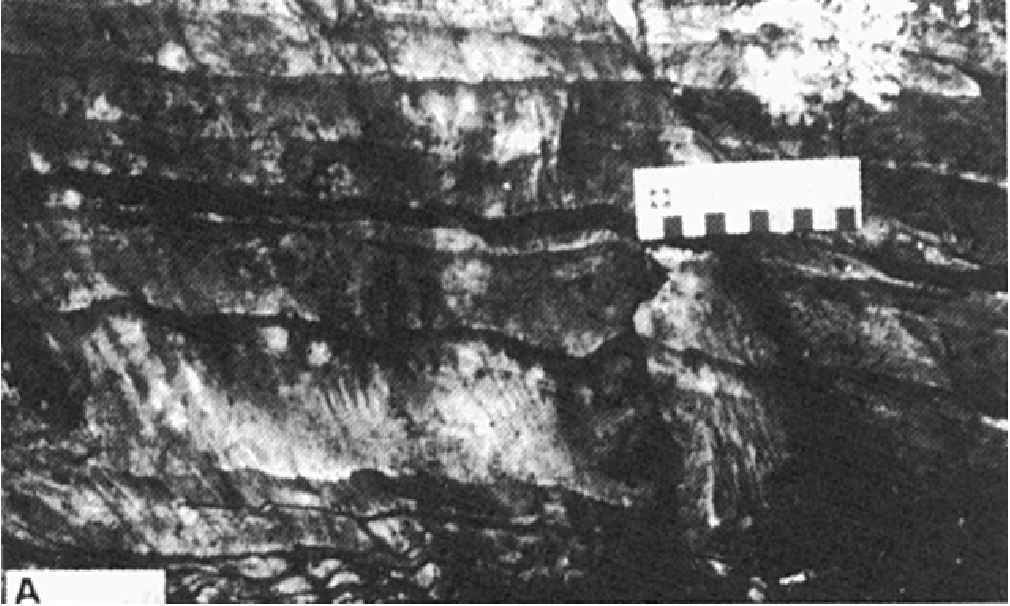
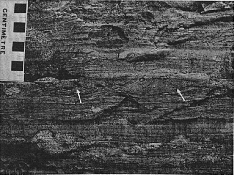
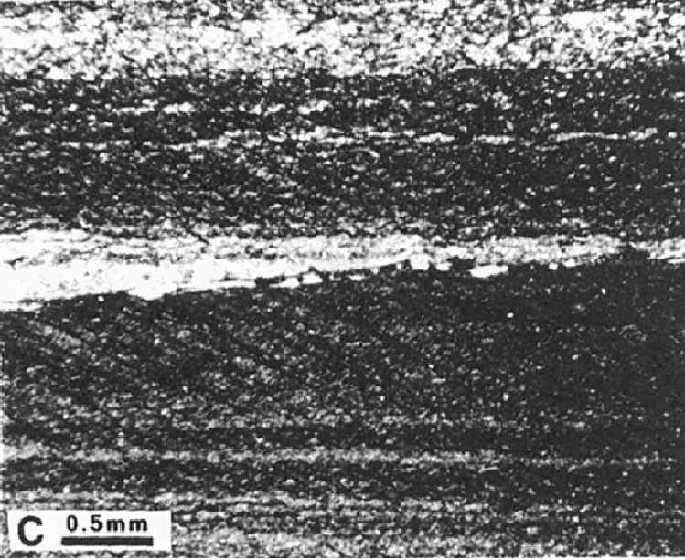
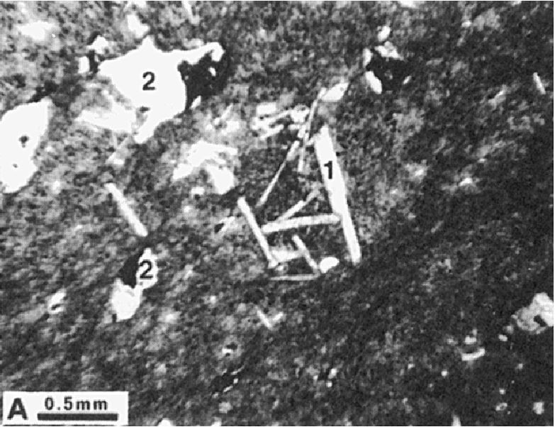
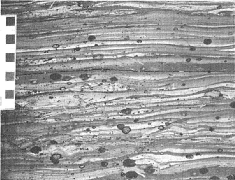
Unit pPll2 belongs to the central basin facies and is the most widespread unit of the Lace Lake Formation. It consists of laminated grey to dark grey, green to black mudstone and siltstone with interbedded dolomite and sandy dolomite both having a brown alteration patina (Dimroth, 1969, 1978; Dressler, 1973, 1979; Clark, unpublished, 1984, 1986; Brouillette, 1989). These interbedded dolomites represent the main difference with unit pPll1. Mudstone and siltstone occur in beds that are generally centimetre thick (5-20 cm on average); greater thicknesses are noted in places. These rocks are characterized by rhythmic bedding marked by alternating dark and light laminae 0.5 to 20 mm thick. Crossbedding and sorting are commonly observed. Slate cleavage is observed in several areas. A crenulation cleavage is also reported in the Romanet River area (Clark, 1986). Mudstone and siltstone are locally graphitic (Dimroth, 1978; Dressler, 1979; Clark, 1986; Brouillette, 1989).
The thickness of interbedded dolomite and sandy dolomite varies from 2 cm to >1 m, and is greater in places. Dolomite and sandy dolomite are grey to dark grey in fresh surface and brown in altered patina. They are usually finely bedded due to variations in grain size and composition (Dimroth, 1978; Dressler, 1979; Clark, 1986). In places, micas are preferentially oriented and define a cleavage. Small lenses of coarser carbonate are also observed (Clark, 1986).
In the Romanet River area and south of latitude 56° N, unit pPll2 locally includes a few rare beds of very fine-grained white sandstone (quartzitic sandstone or quartzite) and greenish schist (Dimroth, 1978; Clark, 1986). White sandstone is found at the top of the formation (Table 3).
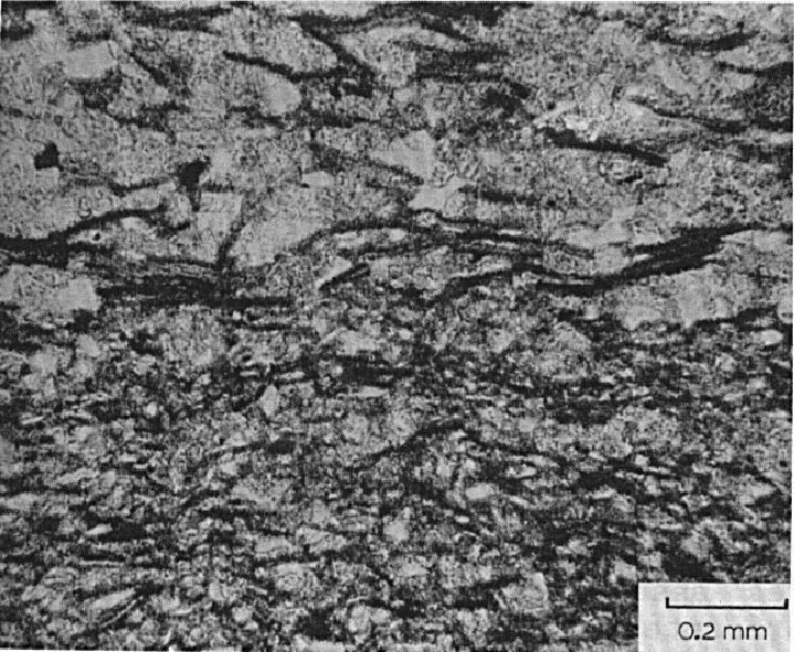
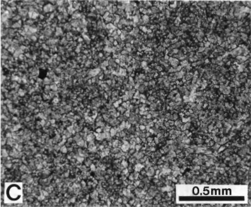
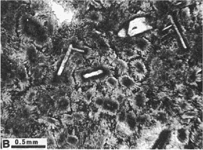
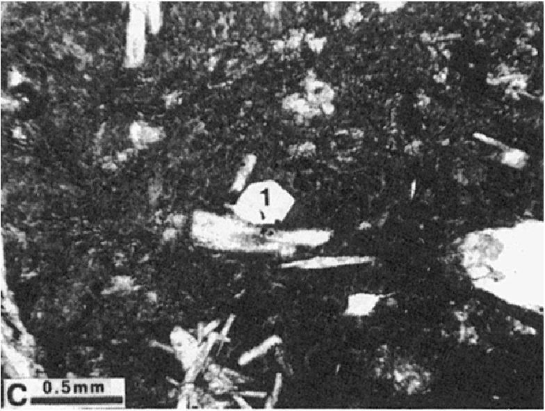
In thin sections, mudstone and siltstone are composed of angular fragments (0.05-0.1 mm in diameter) of quartz (0-80%) and albite in a matrix of sericite, chlorite, biotite, carbonate and a minor amount of opaque minerals. The carbonate content is highly variable (0-30%). It can reach >50% in the Cambrien Lake area. Mudstone contains sericite, chlorite and biotite oriented parallel to stratification (Dimroth, 1978; Dressler, 1979; Clark, 1984, 1986; Brouillette, 1989). The grey colour of these rocks is due to the presence of disseminated graphite. Dolomite is highly recrystallized and formed of microcrystalline carbonate aggregate (0.05-2 mm). The grain size is highly variable (Dimroth, 1978; Dressler, 1979).
Lace Lake Formation 3 (pPll3): Quartzitic Phyllite; Biotite-Sericite-Chlorite-Garnet Schist; Biotite-Sericite Quartzite; Calcite-Epidote-Tremolite Calcosilicate Rocks
Unit pPll3 belongs to the eastern facies. It consists of metamorphic equivalents of basin facies lithologies: quartz phyllites, biotite-sericite-chlorite-garnet schists, biotite-sericite quartzite and calcite-epidote-tremolite calcosilicate rocks. Quartzitic phyllites and micaceous schist are derived from mudstone. Phyllites generally have thin, inconspicuous laminae that are parallel to schistosity. These laminae are the result of metamorphic differentiation. In places, phyllites include more silty layers and calcareous beds. Micaceous schist is composed of biotite, sericite, chlorite, garnet, quartz and albite. It contains thinly interbedded biotite-sericite quartzite. Pelitic rocks have well-developed schistosity and one or two, rarely three, cleavage planes. Quartzitic rocks usually have one or two poorly developed cleavages. Calcosilicate rocks are derived from sandstone and dolomitic sandstone. They are relatively massive and more or less schistose. Stratification is generally well preserved (Dimroth, 1978). They are composed of calcite, epidote, tremolite, biotite, chlorite, quartz and albite.
Lace Lake Formation 4 (pPll4): Grey or White Quartzitic Arenite, Conglomeratic (« Nodular Quartzite »)
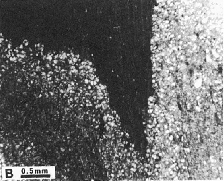
Unit pPll4 belongs to the central basin facies. In the Romanet Lake area, it represents the basal unit of the Lace Lake Formation (Table 3; Dimroth, 1978; Chevé, 1985). This unit consists of a conglomeratic quartzite arenite (« nodular quartzite ») layer 3 to 6 m thick. The rock is grey in fresh surface and white or brown in altered surface. Locally, the surface is rusty due to the presence of disseminated pyrite (~5%) (Chevé, 1985). According to Dimroth (1978), this conglomeratic quartz arenite layer is a characteristic marker underlying the grey and green mudstone and siltstone sequence of unit pPll2. On the south side of the Romanet River and north of Mistamisk Lake, the unit consists of white-grey, pink-grey or green-grey quartzitic arenite (Clark, 1986). South of the Romanet River, arenite is interbedded with unit pPll2 greenish grey rocks and becomes more prominent eastwards. Quartzitic arenite is fine to medium grained (up to 1 mm) and locally sorted. It is composed of rounded quartz grains (Clark, 1986).
Lace Lake Formation 5 (pPll5): Green, Grey, Purple and Red Siltstone and Mudstone; Very Fine-Grained Sandstone
Unit pPll5 forms the base of the sequence exposed at Lace Lake Ravine (Table 2). At this location it consists of thick beds of laminated green and red siltstone. The latter is similar to that observed at the base of the Lace Lake Formation at the type locality (pPll7). In the area NE of Portage Lake, the unit consists of laminated green, grey, purple and red siltstone and mudstone, and very fine-grained sandstone (Dimroth, 1969, 1978).
Lace Lake Formation 6 (pPll6): Green and Grey or Black Mudstone and Siltstone; Grey Calcilutite
Unit pPll6 is observed in the lower part (member 2) and upper part (member 4) of the Lace Lake Formation at the type locality (Table 1). This unit consists of a sequence of laminated green and grey or black mudstone and siltstone, with a few beds (5-10 cm thick) of laminated grey calcilutite having a brown alteration patina. The unit locally includes smaller amounts of quartzitic sandstone or greywacke (Dimroth, 1969, 1978).
In thin sections, mudstone and siltstone are composed of quartz fragments (60-70%) and plagioclase in a recrystallized sericite-chlorite-biotite-calcite matrix. A minor amount of graphite is observed. Micaceous minerals are oriented parallel to stratification. Sorting is also observed. Calcilutite is composed of very fine calcite, quartz and clay minerals (Dimroth, 1978).
Lace Lake Formation 7 (pPll7): Laminated Green and Red Siltstone; Laminated Grey Mudstone; Interbedded Fine-Grained Sandstone and Dolomite with Brown Patina; Locally Interbedded Grey Intraclastic Calcilutite, Calcareous Sandstone and Red Sandstone
Unit pPll7 forms the base of the Lace Lake Formation in the Lace Lake and Delta Lake areas (member 1, Table 1). It also occurs higher in the formation’s stratigraphic column (member 3). This unit consists of a sequence of laminated green and red siltstone and grey mudstone. These rocks contain interbedded fine-grained green, red or purple sandstone and grey dolomite having a brown alteration patina. They locally include interbedded intraclastic grey calcilutite having a brown alteration patina, calcareous sandstone and fine-grained red sandstone. Interstratifications vary in thickness from 0.5 to 1.8 m. Dolomite and calcilutite commonly have crossbedding (Dimroth, 1969, 1978).
In thin sections, siltstone is composed of quartz fragments (60-70%) and plagioclase in a recrystallized sericite-chlorite-biotite ± calcite matrix. Micaceous minerals are oriented parallel to stratification. Sorting is also observed. Grey mudstone is composed of chlorite, biotite and calcite in a matrix of clay minerals. Some graphite is also observed. Calcareous rocks (dolomite, calcilutite, calcareous sandstone) are composed of very fine calcite, quartz and clay minerals. Red sandstone consists of well-rounded quartz, limestone, chert and chlorite fragments in a calcite or chert matrix. Some fragments are covered with finely disseminated hematite. Sandstone is generally well sorted (Dimroth, 1978).
Lace Lake Formation 8 (pPll8): Interbedded Fine-Grained Red Sandstone, Siltstone and Quartzite; Some Interbedded Intraclastic Dolomite, Dolutite and Dolomitic Sandstone with an Orange Patina
Unit pPll8 forms the top of the Lace Lake Formation at the type locality (Table 1, Member 5). It consists of interbedded fine-grained red sandstone, siltstone and quartzite, with some interbedded intraclastic dolomite, dololutite and dolomitic sandstone having an orange patina (Dimroth, 1969, 1978). In thin sections, red sandstone is generally well sorted. It is composed of well-rounded quartz (up to 80%), limestone, chert and chlorite detrital fragments. Fragments are cemented by calcite or chert. Some fragments are coated with finely disseminated hematite which gives the rock its red colour. Calcareous rocks (intraclastic dolomite, dololutite) are composed of very fine calcite and minor amounts of quartz and clay minerals (Dimroth, 1978).
Lace Lake Formation 9 (pPll9): Grey, Green and Purple Siltstone and Fine-Grained Sandstone; Some Dolomitic Sandstone
Unit pPll9 was mapped locally in the Dantin Lake area (sheet 24B04). It consists of grey, green and purple fine-grained sandstone and siltstone, with a smaller amount of dolomitic sandstone (Dimroth, 1978).
Lace Lake Formation 10 (pPll10): Grey Dolomite with a Beige Patina
Unit pPll10 consists of grey dolomite having a beige alteration patina. It belongs to the central basin facies. In the area east of Minowean Lake (Brouillette, 1987, 1989), dolomite occurs in thick beds (8-10 m) interbedded in the mudstone and siltstone sequence of unit pPll13. Dolomite is recrystallized and formed of a crystalline carbonate aggregate (0.05-0.1 mm). The rock is cut by numerous millimetric quartz veinlets having no preferential orientation. Euhedral pyrite crystals are observed within quartz veinlets as well as in recrystallized dolomite. The presence of pyrite is characteristic of this unit (Brouillette, 1987, 1989). Other occurrences of this unit have been mapped west of Cambrien Lake (Clark, 1984) and in the Patu Lake area (Clark, unpublished). In these areas, dolomite is interbedded with unit pPll2 mudstone and siltstone.
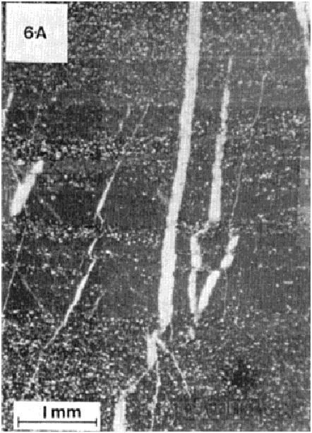
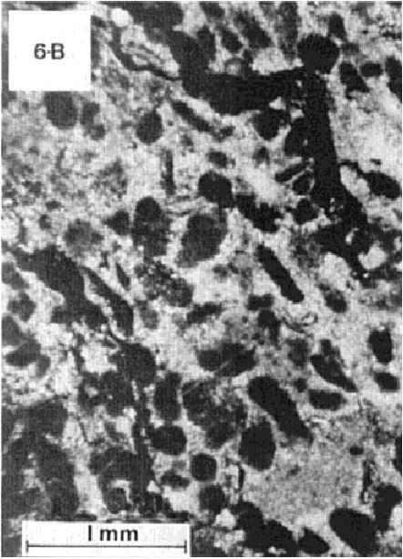
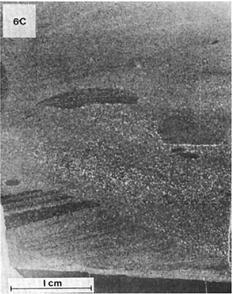
Lace Lake Formation 11 (pPll11): Epiclastic, Carbonatized and Pyritic Volcanic Conglomerate
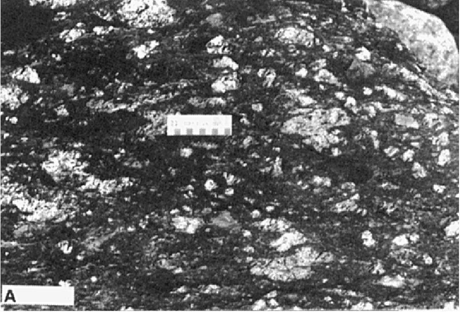
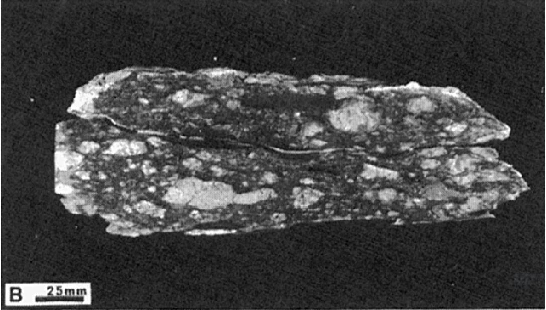
Unit pPll11 was only recognized at the outlet of Minowean Lake (Brouillette, 1989). It consists of a thin epiclastic volcanic conglomerate layer located stratigraphically above unit pPll13 grey and green mudstone and siltstone. Conglomerate mostly contains light grey volcanic rock fragments (50-70%) and some dark grey pelitic sediment fragments (1-2%). The fragments vary in diameter from a few millimetres to 10 cm. Locally, they can reach 20-25 cm. They are generally oriented and stretched in the direction of regional schistosity. On the eastern bank of the Swampy Bay River, Brouillette (1989) mentions the presence of an intermediate facies consisting of conglomerate containing >95% centimetric fragments and <5% volcanic fragments. Brouillette (1989) interprets unit pPll11 as a mudflow.
In thin sections, volcanic rock fragments are characterized by a microglomerophyric texture. They are composed of feldspar microlites (~1 mm diameter) in an aphanitic paste of feldspar, chlorite, sericite and ~10% microgranular pyrite. In places, spray-shaped spherulitic feldspar is evidence of rapid cooling. Olivine pseudomorphs completely replaced by chlorite are also observed. Many fragments are vesicular, with the proportion of vesicles varying from 5 to 30% in some fragments. Vesicles are 0.1 to 0.8 mm in size and are stretched in the direction of schistosity. The majority of them are filled with calcite, chlorite or a calcite-pyrite assemblage. Fragments are generally more or less intensely carbonatized (Brouillette, 1989).
Lace Lake Formation 12 (pPll12): Tuffaceous Basalt
Unit pPll12 was mapped locally in the Romanet River area (Clark, 1986) and west of Patu Lake (Clark, unpublished). It is represented by greenish schist layers interpreted as tuffaceous basalt. Near the outlet of Romanet Lake, north of the Romanet River, schist is interbedded for several metres with grey sedimentary rocks (unit pPll2) at the base of the Lace Lake Formation.
Lace Lake Formation 13 (pPll13): Grey and Green Mudrock and Siltstone, Locally Graphitic; Interbedded Dark Grey Quartzitic Arenite with a Light Grey to White Patina and Black Wacke
Unit pPll13 belongs to the central basin facies. It consists mainly of grey and green mudrock and siltstone (Dimroth, 1978; Brouillette, 1989; Clark, unpublished). Both lithologies are generally grey to dark grey and greenish grey to green in places. The rock is laminated and commonly display sorting and microfolding. Laminae are 0.5 mm to 2 cm thick. Mudrock and siltstone are locally graphitic. In places, these rocks contain centimetric to decimetric interbedded dark grey quartzitic arenite having a light grey to white alteration patina, and black wacke (Brouillette, 1989). Note that interbedded quartzitic arenite is darker than that observed in the Alder Formation.
In thin sections, mudrock consists of recrystallized clay minerals (chlorite, sericite, biotite) oriented parallel to local schistosity. Siltstone si composed of quartz fragments (60-80%) 0.05 to 0.1 mm in diameter and albite (0-5%), in a matrix of sericite, chlorite, biotite and variable amounts of carbonate. The matrix of grey to dark grey rocks also contains graphite (Dimroth, 1978; Brouillette, 1989).
Lace Lake Formation 14 (pPll14): Purple, Red and Green Siltstone; Interbedded Dolomite with Orange or a Brown Patina
Unit pPll14 consists mainly of purple, red and green siltstone with interbedded orange or brown patina dolomite (Dimroth, 1978; Clark, 1986). Siltstone is typically laminated on a millimetre scale. Crossbedding and sorting are also observed. Locally, crossbedded beds (<2 cm) alternate with sorted beds (1-10 mm). The latter are interpreted by Clark (1986) as thin turbidites deposited in shallow water. The thickness of interbedded dolomite varies from a few centimetres to 3 m. Dolomite is beige to greyish green in fresh surface and has a characteristic orange or brown patina. It is commonly laminated parallel to bedding.
Thickness and distribution
The Lace Lake Formation belongs to the Cambrien, Howse, Romanet (formerly Wheeler) and Schefferville lithotectonic zones, as defined by Clark and Wares (2004). It extends from the Canichico Lake area (sheet 24C15) to the Cramolet Lake area (sheet 23O14), a distance of ~145 km along a NW-SE axis. It extends laterally over >100 km from the Cambrian Lake area to the Wheeler River.
The thickness of the formation generally ranges from 213 to 305 m (Dimroth, 1970, 1978). Greater thicknesses are possible, however, as the base of the unit does not outcrop in several areas (Table 3). Dimroth (1978) estimates the thickness to be ~233 m at the type section, and ~134 m at Lace Lake Ravine. In the Cambrian Lake area, Clark (1984) measured minimum thicknesses of 105 m and 215 m in areas where the formation outcrops, but it may be as thick as ~430 m locally. In the Romanet River and Mistamisk Lake area, the thickness of the formation is uncertain due to folding and thrusting. Clark (1986) estimates thickness to be >30 m near Mistamisk Lake and 50 m near the Romanet River.
Dating
None.
Stratigraphic Relationship(s)
The rocks of the Lace Lake Formation were deposited between 2169 ±2 and 2142 +4/-2 Ma, i.e. during the depositional period of first-cycle sedimentary rocks (T. Krogh and B. Dressler, unpublished data cited by Clark, 1984, page 4; Rohon et al., 1993; Clark and Wares, 2004). Recently, U-Pb ages of 2166 ±4 and 2171 ±2 Ma were obtained by Corrigan et al. (2020) for the beginning of the first cycle.
The Lace Lake Formation conformably overlies the Portage, Dunphy and Milamar formations (Seward Group) and is overlain conformably by the Alder Formation. At the type locality, the base of the Lace Lake Formation is not exposed. It outcrops to the SE near Delta Lake (Table 1, Member 1). The top of the formation is in sharp contact with the Alder Formation (Dimroth, 1969, 1978). In other areas, the lower contact of the Lace Lake Formation with underlying units is gradual (Dimroth, 1978; Kish and Tremblay-Clark, 1979; Clark, 1986; Brouillette, 1989; Clark and Wares, 2004) or sharp and without interstratification (Clark, 1984). In the area west of Romanet Lake, the contact with the underlying Dunphy Formation is represented by a conglomerate and sandstone layer (Chevé, 1985). South of the Romanet River, a quartzitic sandstone unit (pPll4) overlies the Dunphy Formation (Clark, 1986). In the Minowean and Portage Lakes area, the upper contact of the Lace Lake Formation with the Alder Formation is locally visible. It is marked by interbedded characteristic lithologies of the two units (Brouillette, 1989). The upper contact of the Lace Lake Formation was not observed by Clark (1986) in the Mistamisk Lake and Romanet River area.
In the central part of the orogen, the formation is locally overlain by the Bacchus Formation (Swampy Bay Group). This stratigraphic relationship is due, according to Dimroth (1978), to an erosional unconformity caused by the emergence of the « central geanticline ». Dimroth (1978) also noted lithological similarities between the Lace Lake Formation and sedimentary rocks at the base of the Bacchus Formation. Furthermore, in the Mistamisk Lake and Romanet River area, Clark (1986) points out that it is not possible to determine the nature of the contact between these two formations as it is not exposed. Dimroth (1978) also mentioned that rocks of the Lace Lake Formation are similar to those of the Romanet Formation, and that west of longitude 67° 53′ W, the scarcity of outcrops makes it difficult to distinguish between these two formations. In the Romanet River area, the Lace Lake and Dunphy formations structurally overlie rocks of the Romanet Formation due to the presence of a major thrust fault (Dimroth, 1978; Clark, 1986). Polygenetic intrusive breccia clusters (Mistamisk Complex) were emplaced in the Lace Lake Formation at Romanet River (Kearvell, 1985; Clark, 1986; Kearvell and Clark, 1988; Clark and Wares, 2004).
Paleontology
No fossils reported.
References
Publications Available Through SIGÉOM Examine
BROUILLETTE, P. 1987. GÉOLOGIE ET MÉTALLOGÉNIE DE LA RÉGION DES LACS MINOWEAN ET DU PORTAGE – FOSSE DU LABRADOR. MINISTÈRE DE L’ÉNERGIE ET DES RESSOURCES, QUÉBEC; MB 86-75, 65 pages and 1 plan.
BROUILLETTE, P. 1989. GÉOLOGIE ET MÉTALLOGÉNIE DE LA RÉGION DES LACS MINOWEAN ET DU PORTAGE (FOSSE DU LABRADOR). MINISTÈRE DE L’ÉNERGIE ET DES RESSOURCES, QUÉBEC; ET 88-06, 84 pages and 2 plans.
CHEVÉ, S.R. 1985. LES INDICES MINÉRALISÉS DU LAC ROMANET, FOSSE DU LABRADOR. MINISTÈRE DE L’ÉNERGIE ET DES RESSOURCES, QUÉBEC; ET 83-13, 62 pages and 2 plans.
CLARK, T. 1984. GÉOLOGIE DE LA RÉGION DU LAC CAMBRIEN – TERRITOIRE DU NOUVEAU-QUÉBEC. MINISTÈRE DE L’ÉNERGIE ET DES RESSOURCES, QUÉBEC; ET 83-02, 77 pages and 1 plan.
CLARK, T. 1986. GÉOLOGIE ET MINÉRALISATIONS DE LA RÉGION DU LAC MISTAMISK ET DE LA RIVIÈRE ROMANET. MINISTÈRE DE L’ÉNERGIE ET DES RESSOURCES, QUÉBEC; ET 83-22, 56 pages and 1 plan.
CLARK, T., WARES, R. 2004. SYNTHÈSE LITHOTECTONIQUE ET MÉTALLOGÉNIQUE DE L’OROGÈNE DU NOUVEAU-QUÉBEC (FOSSE DU LABRADOR). MINISTÈRE DES RESSOURCES NATURELLES, DE LA FAUNE ET DES PARCS, QUÉBEC; MM 2004-01, 182 pages and 1 plan.
CORRIGAN, D., SAPPIN, A.-A., HOULÉ, M.G., RAYNER, N., VAN ROOYEN, D. 2020. Corrugated Hills: les restes d’une grande province ignée d’environ 2,17 Ga dans la Fosse du Labrador. In Résumés des conférences et des photoprésentations, Québec Mines+Énergie 2019. MERN; DV 2019-01, 78 pages..
DIMROTH, E. 1964. GÉOLOGIE DE LA RÉGION DU LAC ROMANET, NOUVEAU QUÉBEC. MINISTÈRE DES RICHESSES NATURELLES, QUÉBEC, RP 523, 20 pages and 1 plan.
DIMROTH, E. 1964. PRELIMINARY REPORT, GEOLOGY OF ROMANET LAKE AREA, NEW QUEBEC. MINISTÈRE DES RICHESSES NATURELLES, QUÉBEC, RP 523(A), 18 pages and 1 plan.
DIMROTH, E. 1965. GÉOLOGIE DE LA RÉGION DU LAC OTELNUK, TERRITOIRE DU NOUVEAU-QUÉBEC. MINISTÈRE DES RICHESSES NATURELLES, QUÉBEC; RP 532, 30 pages and 1 plan.
DIMROTH, E. 1965. PRELIMINARY REPORT, GEOLOGY OF OTELNUK LAKE AREA, NEW QUEBEC TERRITORY. MINISTÈRE DES RICHESSES NATURELLES, QUÉBEC, RP 532(A), 27 pages and 1 plan.
DIMROTH, E. 1966. GÉOLOGIE DE LA RÉGION DU LAC DUNPHY, TERRITOIRE DU NOUVEAU-QUÉBEC. MINISTÈRE DES RICHESSES NATURELLES, QUÉBEC; RP 557, 24 pages and 1 plan.
DIMROTH, E. 1966. PRELIMINARY REPORT, GEOLOGY OF DUNPHY LAKE AREA, NEW QUEBEC TERRITORY. MINISTÈRE DES RICHESSES NATURELLES, QUÉBEC, RP 557(A), 21 pages and 1 plan.
DIMROTH, E. 1969. GÉOLOGIE DE LA RÉGION DU LAC CASTIGNON, TERRITOIRE DU NOUVEAU-QUÉBEC. MINISTÈRE DES RICHESSES NATURELLES, QUÉBEC; RP 571, 62 pages and 7 plans.
DIMROTH, E. 1969. PRELIMINARY REPORT, GEOLOGY OF THE CASTIGNON LAKE AREA, NEW QUEBEC TERRITORY. MINISTÈRE DES RICHESSES NATURELLES, QUÉBEC, RP 571(A), 58 pages and 7 plans.
DIMROTH, E. 1972. STRATIGRAPHY OF PART OF THE CENTRAL LABRADOR TROUGH. MINISTÈRE DE L’ÉNERGIE ET DES RESSOURCES, QUÉBEC; DP 154, 304 pages and 6 plans.
DIMROTH, E. 1978. RÉGION DE LA FOSSE DU LABRADOR ENTRE LES LATITUDES 54°30′ ET 56°30′. MINISTÈRE DE RICHESSES NATURELLES, QUÉBEC; RG 193, 417 pages and 16 plans.
DRESSLER, B. 1973. GÉOLOGIE DE LA RÉGION DU LAC PATU, TERRITOIRE DU NOUVEAU-QUÉBEC. MINISTÈRE DES RICHESSES NATURELLES, QUÉBEC, RP-603, 26 pages and 1 plan.
DRESSLER, B. 1979. RÉGION DE LA FOSSE DU LABRADOR (56°30′ – 57°15′). MINISTÈRE DES RICHESSES NATURELLES, QUÉBEC; RG-195, 136 pages and 14 plans.
KEARVELL, G. 1985. BRÈCHES ET ALTÉRATIONS ALBITIQUES DE LA RIVIÈRE ROMANET – FOSSE DU LABRADOR. MINISTÈRE DE L’ÉNERGIE ET DES RESSOURCES, QUÉBEC; DP-85-24 et 2 plans.
KEARVELL, G., CLARK, T. 1988. ÉTUDE D’INDICES AU-U ET DE BRÈCHES POLYGÉNIQUES DANS LA VALLÉE DES LACS MISTAMISK ET ROMANET – FOSSE DU LABRADOR. MINISTÈRE DE L’ÉNERGIE ET DES RESSOURCES, QUÉBEC; DP-87-24, 32 pages and 1 plan.
KISH, L., TREMBLAY-CLARK, P. 1979. GÉOCHIMIE ET RADIOACTIVITÉ DANS LA FOSSE DU LABRADOR. MINISTÈRE DES RICHESSES NATURELLES, QUÉBEC; DPV-666, 33 pages.
Other Publications
DIMROTH, E. 1968. The evolution of the central segment of the Labrador geosyncline; part I: stratigraphy, facies and paleogeography; Neues Jahrbuch für Geologie und Paläontologie; volume 132, pages 22-54.
DIMROTH, E. 1970. Evolution of the Labrador Geosyncline. Geological Society of America Bulletin; volume 81, pages 2717-2742. http://doi.org/10.1130/0016-7606(1970)81[2717:EOTLG]2.0.CO;2
DIMROTH, E., DRESSLER, B. 1978. Metamorphism of the Labrador Trough. In: Metamorphism in the Canadian Shield. Geological Survey of Canada; Paper 78-10, pages 215. http://doi.org/10.4095/104534
DIMROTH, E., BARAGAR, W.R.A., BERGERON, R., JACKSON, G.D. 1970. The filling of the Circum-Ungava geosyncline. In: Symposium on Basins and Geosynclines of the Canadian Shield (A.J. Baer, editor). Geological Survey of Canada; Paper 70-40, pages 45-142. http://doi.org/10.4095/124922
PERREAULT, G. 1955. Geology of the western margin of the Labrador Trough. University of Toronto, Toronto, Unpublished Ph.D. thesis, 300 pages.
ROHON, M.-L., VIALETTE, Y., CLARK, T., ROGER, G., OHNENSTETTER, D., VIDAL, P. 1993. Aphebian mafic-ultramafic magmatism in the Labrador Trough (New Quebec): its age and the nature of its mantle source. Canadian Journal of Earth Sciences; volume 30, pages 1582-1593. https://doi.org/10.1139/e93-136
Suggested Citation
Ministère de l’Énergie et des Ressources naturelles (MERN). Lace Lake Formation. Quebec Stratigraphic Lexicon. https://gq.mines.gouv.qc.ca/lexique-stratigraphique/province-de-churchill/formation-de-lace-lake_en [accessed on Day Month Year].
Contributors
First publication | Charles St-Hilaire, GIT, M.Sc. charles.st-hilaire@mern.gouv.qc.ca; Thomas Clark, P. Geo., Ph.D. (redaction) Mehdi A. Guemache, P. Geo., Ph.D. (coordination); anonymous (critical review); Simon Auclair, P. Geo., M.Sc. (editing); Céline Dupuis, P. Geo., Ph.D. (English version); Ricardo Escobar Moran (HTML editing). |