

First published: 14 June 2019
Last modified:
DISCLAIMER: This English version is translated from the original French. In case of any discrepancy, the French version shall prevail.
| Author: | Clark, 1941 |
| Age: | Middle Ordovician |
| Stratotype: | None |
| Type area: | Montreal and surrounding areas (NTS sheet 31H) |
| Geological province: | St. Lawrence Platform |
| Geological subdivision: | St. Lawrence Lowlands Platform |
| Lithology: | Limestone alternating with shale beds |
| Category: | Lithostratigraphic |
| Rank: | Formation |
| Status: | Formal |
| Use: | Active |
- Trenton Group
- Tétreauville Formation
- Montréal Formation
- Neuville Formation
- Deschambault Formation
- Hull Formation
- Saint-Marc Formation
- Mile End Formation
- Ouareau Formation
- Fontaine Formation
- Pont-Rouge Formation
- Sainte-Anne Formation
- Galets Formation
- Shipshaw Formation
- Simard Formation
- Tremblay Formation
- René-Levasseur Formation
Background
Clark (1941, 1952) proposed the name Tétreauville Formation for limestone of fairly constant petrographic type throughout the northern part of the island of Montréal, which lies south of Bas-de-Sainte-Rose, as well as on most of its eastern shore. Clark (1952) considered the overlying nodular limestones sufficiently distinct to call them the “Terrebonne Formation”. These nodular limestones were later considered a “floating” member of the Tétreauville Formation (Clark, 1972) and are now known as simple facies variation (Clark and Globensky, 1976a, b, 1977). The name refers to the Tétreaultville district, also known as Mercier-Est, in the Mercier-Hochelaga-Maisonneuve borough of the City of Montreal (east end of sheet 31H12).
Description

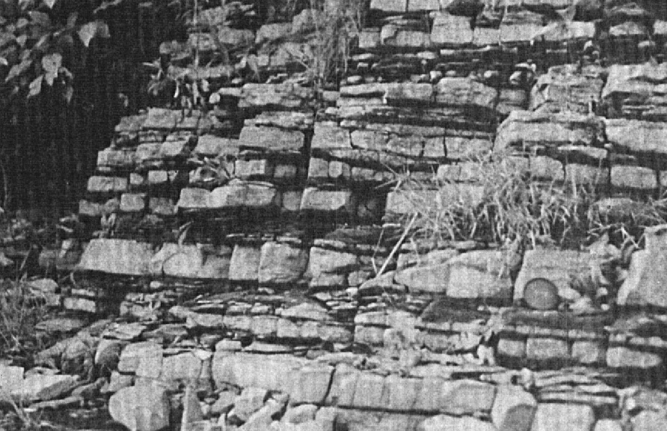
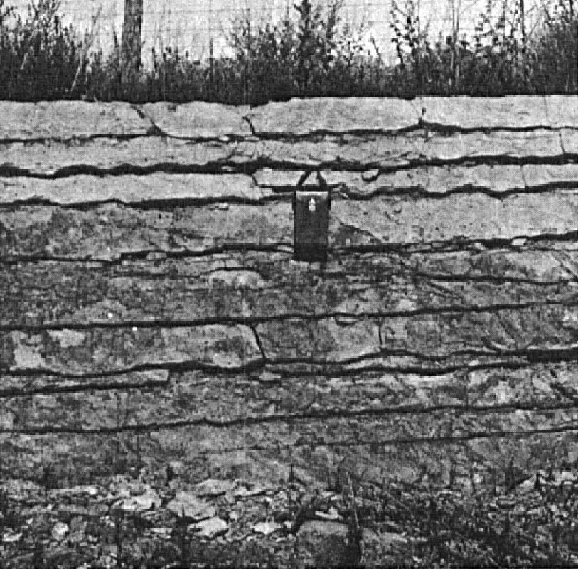
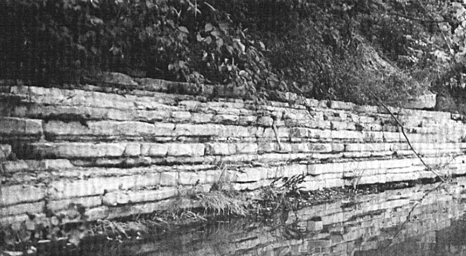
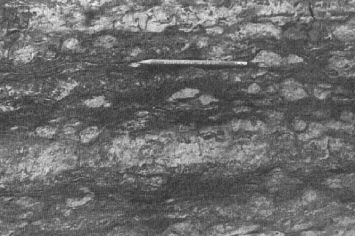
The Tétreauville Formation consists of a dense, dark bluish grey limestone in 2-15 cm beds alternating with shale beds 2 to 6 cm (Clark, 1941, 1952, 1959, 1972; Clark and Globensky, 1976a, b, 1977; Harland and Pickerill, 1982; Globensky, 1986, 1987, 1993; MNRF, 2009a-g; Thériault, 2014). Limestone is argillaceous, micritic, clean and contains, in places, crystalline lenses a few centimetres thick. Generally, shale and limestone beds are very sharply separated from each other, allowing this formation to be distinguished from other units of the Trenton Group. Exposed to air, limestone takes on a characteristic yellowish buff colour. In many places, there is a strong oil smell from the rock.

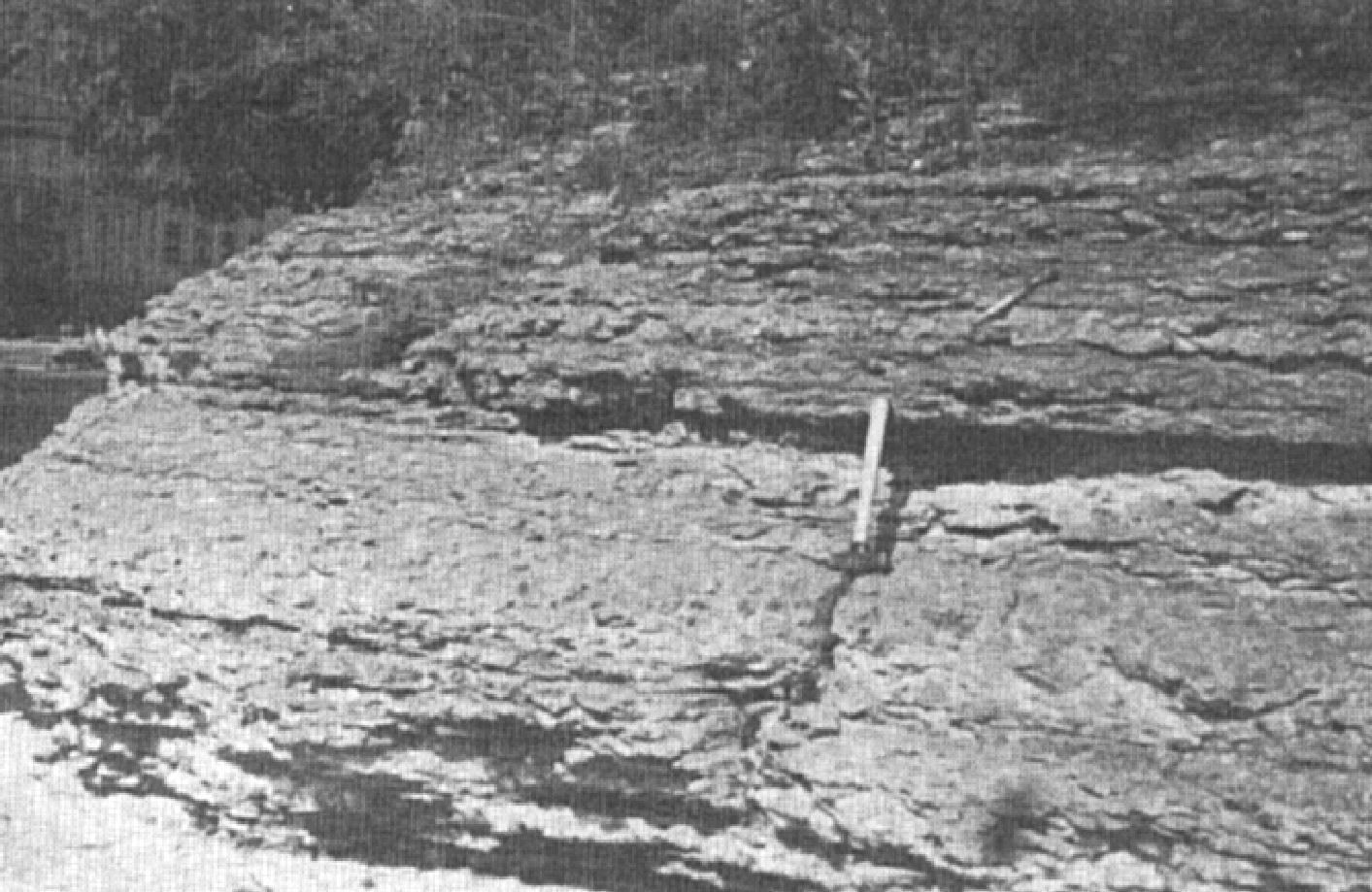
The Terrebonne facies, located at the top of the formation, consist of a blocky argillaceous or nodular bedded limestone separated or coated with thin layers or indistinct lenses of shale. Sediments of the Tétreauville Formation were deposited in a fairly deep marine environment and slowly accumulated, mainly by suspension, without being affected by wave action (Harland and Pickerill, 1982; Globensky, 1987).
From five sections (Miron Ltd. Company Quarry, Montreal; St-Vincent de Paul Quarry, St-Vincent-de-Paul; Sintra Quarry, St-Jacques; Ciments Indépendants Inc. Quarry, Joliette; Turnbull Construction Inc. Quarry, St-Thomas), Brun (1974, 1975) defined a boundary stratotype between the Rosemont Member of the Montréal Formation and the Tétreauville Formation: “Gradual transition from alternating small, regular, undulating beds of ‘wackestone’ and dark grey ‘mudstone’ limestone (Rosemont) to a sequence of large argillaceous ‘mudstone’ limestone beds whose locally poorly defined interbeds prevent good bed differentiation (Tétreauville).”
Thickness and distribution
The Tétreauville Formation forms a strip oriented NE-SW, from north of Trois-Rivières (sheet 31I07) to the island of Montreal. The formation extends briefly south of the St. Lawrence River in the St. Catherine area, on the south shore of Montreal (NE quarter of sheet 31H05). The thickness of the formation was estimated at 121 m in Montréal and 168 m at L’Assomption River (e.g., Globensky, 1993). Elsewhere, it is around 144 m.
Dating
None.
Stratigraphic Relationship(s)
The Tétreauville Formation is the upper unit of the Trenton Group in the greater Montreal area. It gradually overlies the Montreal Formation and is overlain by the Utica Shale. The presence of Conotreta rusa and Conularia trentonensis allows the lower part of the Grondines Member (summit of the Neuville Formation) to be seen in the lower part of the Tétreauville Formation, and the whole formation is correlated with the Cobourg Formation (Clark and Globensky, 1976b; Globensky, 1987, 1993).
Paleontology
The fauna of the Tétreauville Formation, like that of the Grondines Member, is abundant and includes 200 species of fossils (Clark, 1952, 1972; Clark and Globensky, 1976a, b, 1977; Harland and Pickerill, 1982; Globensky, 1987). The two most important species constitute two biozones, with their full suite of other species: Rafinesquina deltoidea (brachiopod) zone and Cryptolithus lorettensis (trilobite) zone (Globensky, 1987). Graptolites of this formation belong to the bottom part of the Utica Shale Climacograptus spiniferus Zone (Globensky, 1993).
References
Publications Available Through SIGÉOM Examine
BRUN, J. 1974. ETUDE PETROGRAPHIQUE DES FORMATIONS DU BLACK RIVER ET DU TRENTON DU QUEBEC. MRN. DP 248, 24 pages and 4 plans.
BRUN, J. 1975. ETUDE GEOLOGIQUE ET GEOCHIMIQUE DES FORMATIONS DU BLACK RIVER ET DU TRENTON DU QUEBEC. MRN. DP 296, 45 pages and 4 plans.
CLARK, T H. 1941. PRELIMINARY REPORT ON MONTREAL AREA. MRN. RP 158(A), 7 pages.
CLARK, T H. 1941. RAPPORT PRELIMINAIRE SUR LA REGION DE MONTREAL. MRN. RP 158, 7 pages.
CLARK, T H. 1952. MONTREAL AREA, LAVAL AND LACHINE MAPS AREAS. MRN. RG 046(A), 182 pages et 4 plans.
CLARK, T H. 1952. REGION DE MONTREAL, FEUILLES DE LAVAL ET DE LACHINE. MRN. RG 046, 189 pages and 4 plans.
CLARK, T H. 1972. REGION DE MONTREAL. MRN. RG 152, 260 pages and 1 plan.
CLARK, T H., GLOBENSKY, Y. 1976a. REGION DE SOREL ET PARTIE SUD-EST DE SAINT-GABRIEL-DE-BRANDON. MRN. RG 155, 166 pages and 1 plan.
CLARK, T H., GLOBENSKY, Y. 1976b. REGION DES LAURENTIDES (MOITIE EST) ET DE RAWDON (PARTIE SUD-EST). MRN. RG 157, 121 pages and 1 plan.
CLARK, T H., GLOBENSKY, Y. 1977. REGION DE VERCHERES. MRN. RG 190, 72 pages and 1 plan.
GLOBENSKY, Y. 1986. GEOLOGIE DE LA REGION DE SAINT-CHRYSOSTOME ET DE LACHINE (SUD). MRN. MM 84-02, 182 pages and 2 plans.
GLOBENSKY, Y. 1987. GEOLOGIE DES BASSES-TERRES DU SAINT-LAURENT. MRN. MM 85-02, 71 pages and 1 plan.
GLOBENSKY, Y. 1993. LEXIQUE STRATIGRAPHIQUE CANADIEN – VOLUME V-B – REGION DES APPALACHES, DES BASSES-TERRES DU SAINT-LAURENT ET DES ILES DE LA MADELEINE. MRN. DV 91-23, 336 pages.
MRNF 2009a. GEOLOGIE 1/50 000, 31H05 – LACHINE. In : MRNF. 2010. CARTE(S) GÉOLOGIQUE(S) DU SIGEOM – feuillet 31h. CG SIGEOM31H, 22 plans.
MRNF 2009b. GEOLOGIE 1/50 000, 31H11 – LAC VARIN. In : MRNF. 2010. CARTE(S) GÉOLOGIQUE(S) DU SIGEOM – feuillet 31h. CG SIGEOM31H, 22 plans.
MRNF 2009c. GEOLOGIE 1/50 000, 31H12 – LAVAL. In : MRNF. 2010. CARTE(S) GÉOLOGIQUE(S) DU SIGEOM – feuillet 31h. CG SIGEOM31H, 22 plans.
MRNF 2009d. GEOLOGIE 1/50 000, 31H13 – LAURENTIDES. In : MRNF. 2010. CARTE(S) GÉOLOGIQUE(S) DU SIGEOM – feuillet 31h. CG SIGEOM31H, 22 plans.
MRNF 2009e. GEOLOGIE 1/50 000, 31H14 – VERCHÈRES. In : MRNF. 2010. CARTE(S) GÉOLOGIQUE(S) DU SIGEOM – feuillet 31h. CG SIGEOM31H, 22 plans.
MRNF 2009f. GEOLOGIE 1/50 000, 31I03 – SOREL. In : MRNF. 2010. CARTE(S) GÉOLOGIQUE(S) DU SIGEOM – feuillet 31i. CG SIGEOM31M, 16 plans.
MRNF 2009g. GEOLOGIE 1/50 000, 31I06 – SAINT-GABRIEL-DE-BRANDON. In : MRNF. 2010. CARTE(S) GÉOLOGIQUE(S) DU SIGEOM – feuillet 31i. CG SIGEOM31M, 16 plans.
THERIAULT, R. 2014. GEOLOGIE DES BASSES-TERRES DU SAINT-LAURENT. MERN. DV 2014-05, 1 plan.
Other Publications
CLARK, T.H. 1944. Structure and stratigraphy in the vicinity of Montréal. Transactions of the Royal Society of Canada; third series, volume 38, serie iv.
CLARK, T.H. 1959. Stratigraphy of the Trenton Group, St. Lawrence Lowlands, Quebec. Geological Association of Canada; proceedings 1959, pages 13-21.
HARLAND, T.L., PICKERILL, R.K. 1982. A review of Middle Ordovician sedimentation in the St. Lawrence Lowland, eastern Canada. Geological Journal; volume 17, pages 135-156. https://doi.org/10.1002/gj.3350170205