

Last modified:
Translation of original French
| Author: | Daigneault and Allard, 1990 |
| Age: | Neoarchean |
| Reference section: | A series of reference outcrops is located south of Yvette Lake, near the former Lemoine Mine (UTM NAD 83, zone 18: 565356 mE, 5512953 mN) |
| Type area: | Area south of Chibougamau Lake (sheet 32G16-200-0102) |
| Geological province: | Superior Province |
| Geological subdivision: | Abitibi Subprovince |
| Lithology: | Volcanic rocks |
| Type: | Lithostratigraphic |
| Rank: | Member |
| Status: | Formal |
| Use: | Active |
- Roy Group
-
- Bordeleau Formation
- Ruisseau Dalime Formation
- Scorpion Formation
- Phooey Member
- Blondeau Formation
- Bruneau Formation
- Waconichi Formation
- Allard Member
- Scott Member
- Deux Orignaux Member
- Winchester Member
- Lemoine Member
- Portage Member
- Lacs Member
- Îles Member
- Coyote Member
- Chevrier Member
- Queylus Member
- Andy Member
- Obatogamau Formation
- Pichamobi Member
- Wachigabau Member
- David Member
Background
The works on the Waconichi Formation resulted in a distinction between the Lemoine and Queylus facies (Daigneault and Allard, 1990; p. 113): “We define the Lemoine-type Waconichi, which essentially consists of rhyolitic rocks on the edge of the Chibougamau Pluton, and the Queylus-type Waconichi, which consists of essentially pyroclastic rocks at the interface of the Obatogamau and Gilman Formations.” The name Lemoine Member is associated with the Lemoine Township and volcanogenic massive sulphide (VMS) mine of the same name. A lithostratigraphic synthesis of the Lemoine Mine area based on detailed mapping and multiparameter study of drillings (Lafrance et al., 2006; Roy et al., 2007; Boulerice et al., 2014; Mercier-Langevin et al., 2014; Ross et al., 2013; Ross et al., 2014) leads to an informal division of the Lemoine Member into lower and upper parts and allows for the the definition of up to ten informal subunits.
Description
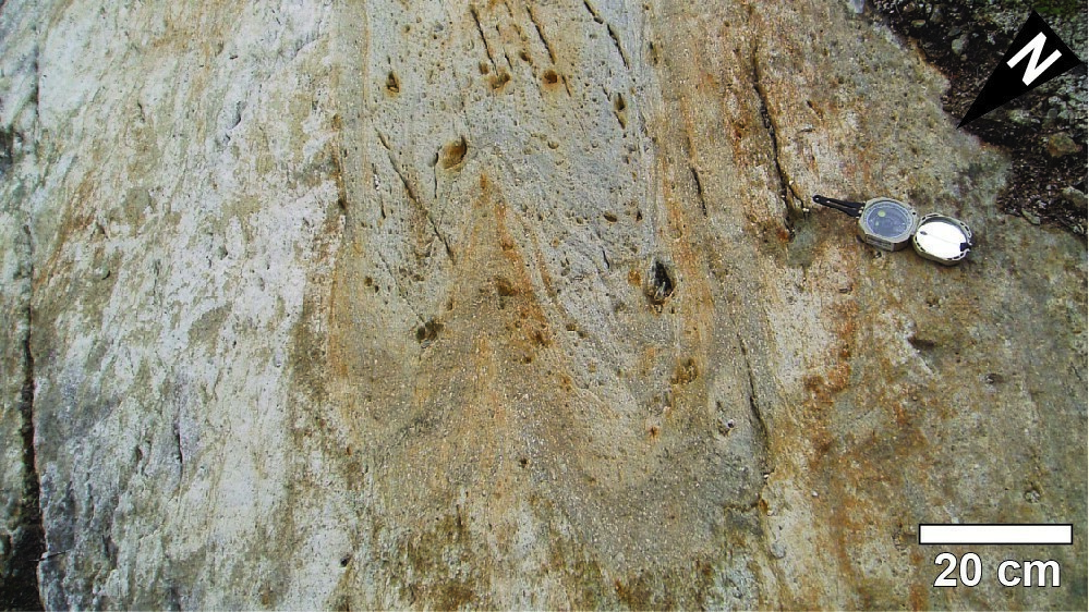
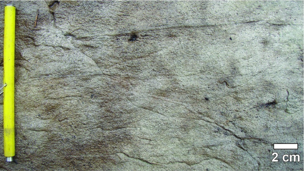
A detailed description of the Lemoine Member’s units can be found in the Daigneault and Allard (1990) report on page 117: “Rocks of this unit generally contain 2-10% quartz and plagioclase phenocrystals. Quartz is more abundant, making up on average more than 70% of phenocrystals. Their diameter is smaller than that which characterizes rhyolitic porphyries, varying around 1 mm. The interpretation of these rocks as flows is difficult to demonstrate with certainty. The unit is characterized by the presence of flow structures such as flow lines, which are well developed and locally closely resemble primary bedding. There are sericite-rich layers characterized by a high concentration of subspheric cavities interpreted as vesicles. Layers are thin (4-8 cm) and contain about 30% vesicles with an average diameter of 1 cm but locally a few centimetres. The edge zone is characterized by a cream colour likely due to high sericite content. These layers almost mimic stratification in tuffs. However, the irregular and closed geometry defined by margins contest this interpretation. Lobbed structures can reach 10 m in size; some are less than one metre. The larger ones have an irregular shape and the smaller ones are usually elliptical. It is possible that an emerging rhyolitic dome will produce this type of structure by budding of the warm rhyolitic mass upon contact with water. The high viscosity of rhyolitic fluid could be responsible for the complex geometries that these structures describe and which resemble lobes.”
The Lemoine Member is divided into two informal units based on the change in geochemical affinity of volcanic rocks on either side of the sulphide cluster represented by the Lemoine Mine mineralized deposit (Ross et al., 2014). The lower unit of the Lemoine Member (nAlem1) consists of six basal subunits, while the four top subunits are grouped in the upper unit (nAlem2).
Lemoine Member 1 (nAlem1): Lower Unit
Lemoine Member 1a (nAlem1a): Quartz-Plagioclase Porphyritic Dacite
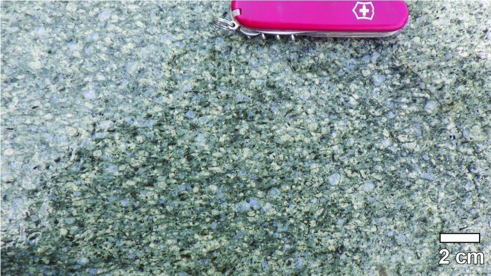
The base of the Lemoine Member’s lower unit corresponds to subunit nAlem1a. This is a horizon of dacite with bluish quartz (2-10%, 2-6 mm in diameter) and plagioclase phenocrystals (3-10%, 1-5 mm in diameter) similar to subunit nAlem1e, but with significantly higher Zr content (500-800 ppm Zr; see Figure 5 of Lafrance et al., 2006). Quartz phenocrystals are typically smaller and less abundant than plagioclase crystals (Boulerice et al., 2013). Hyaloclastites, lobe edges and laminar flow structures recognized in drilling and outcrop indicate that this unit is of extrusive origin (Riverin and Boily, 2003; Ross et al., 2014). The unit shows locally intense chlorite-sericite hydrothermal alteration and is therefore an interesting exploration target for sulphide clusters comparable to that of the Lemoine Mine (Riverin and Boily, 2003; Boulerice et al., 2014).
Lemoine Member 1b (nAlem1b): Quartz Porphyritic Dacite and Rhyolite, Derived Volcaniclastic Rocks
Subunit nAlem1b consists of quartz porphyritic dacite and rhyolite (2-5%, 1-2 mm in diameter) occurring as massive flows, hypovolcanic domes, sills and dykes (Lafrance et al., 2006). The sommital portion is characterized by the presence of volcaniclastic rock lenses of the same composition (Mercier-Langevin et al., 2014). Subunit nAlem1b is 200 to 500 m thick and corresponds to the wall of the Lemoine Mine VMS deposit (Ross et al., 2014). It has penetrative and spatially extensive hydrothermal alteration that is marked by assemblages of: a) sericite-carbonate, b) sericite-chlorite, and c) chlorite-sericite-chloritoid. A fourth association of chlorite-sericite-calcite forms centimetric to metric bands that cut other assemblages. Alteration minerals were defined using macroscopic observations and conventional geochemistry (Mercier-Langevin et al., 2014). The presence of white mica, chlorite and carbonates (locally difficult to identify with the naked eye) was confirmed by the use of near-infrared and visible spectrometry (Ross et al., 2014).
Lemoine Member 1c (nAlem1c): Dacite, Rhyolite and Derived Volcaniclastic Rocks
Subunit nAlem1c consists of a package of aphyritic dacite and rhyolite associated with volcaniclastic rocks of the same composition (Lafrance et al., 2006). In the eastern portion of the Lemoine Member’s lower unit, it overlies subunit nAlem1b.
Lemoine Member 1d (nAlem1d): Basalt, Andesite and Derived Volcaniclastic Rocks
Subunit nAlem1d consists of aphyritic basalt and andesite flows and derived volcaniclastic rocks up to 100 m thick (Lafrance et al., 2006; Ross et al., 2014; Mercier-Langevin et al., 2014). It is overlying subunits nAlem1b and nAlem1c.
Lemoine Member 1e (nAlem1e): Quartz-Plagioclase Porphyritic Dacite
In the sommital portion of the Lemoine Member’s lower unit, subunit nAlem1e consists of quartz (7-8%, 1-2 mm in diameter) and plagioclase (3-7%, 1-3 mm) porphyritic dacite, invariably of massive appearance in drilling, suggesting an intrusive origin.
Lemoine Member 1f (nAlem1f): Quartz-Plagioclase Porphyritic Andesite and Dacite
Subunit nAlem1f occurs as andesitic to dacitic hypovolcanic domes and dacitic sills characterized by bluish quartz (2-10%, 2-6 mm in diameter) and plagioclase (3-10%, 1-5 mm in diameter) phenocrystals. Unconformable contacts, as well as weak hydrothermal alteration, suggest an intrusive origin (Ross et al., 2014). Two dacite dykes <5 m thick and particularly rich in quartz and plagioclase phenocrystals have also been recognized in the Lemoine Mine area.
Lemoine Member 2 (nAlem2): Upper Unit
Lemoine Member 2a (nAlem2a): Andesite to Rhyolite, Crystal Tuff, Porphyritic Dacitie

The base of the Lemoine Member’s upper unit is characterized by subunit nAlem2a, which consists of porphyritic dacites, quartz (5-10%, 3-8 mm in diameter) and plagioclase (10-20%, 2-5 mm in diameter) crystal tuffs, as well as andesitic to porphyritic dacite (Roy et al., 2007). This 175 m-thick subunit forms the roof of the Lemoine Mine deposit (Riverin and Boily, 2003). Lobes and laminar flow structures indicate an effusive nature for part of the unit (Lafrance et al., 2006). Albite-quartz hydrothermal alteration characterizes the proximal portion of the deposit, while a chlorite-sericite assemblage is recognized in the distal portion of subunit nAlem2a (Mercier-Langevin et al., 2014).
Lemoine Member 2b (nAlem2b): Basalt to Andesite
Subunit nAlem2b includes massive and pillow basalts and andesitic basalts. The pillow morphology in this subunit (sheet 32G16-200-0102) indicates stratigraphic polarity to the south (Martin and Stewart, 1999).
Lemoine Member 2c (nAlem2c): Porphyritic Dacite
A few porphyritic dacite lenses belonging to subunit nAlem2c, as well as comagmatic gabbroic sills, increase the thickness of the basalt subunit estimated at <1.5 km thick (Lafrance et al., 2006; Ross et al., 2014; Mercier-Langevin et al., 2014).
Lemoine Member 2d (nAlem2d): Diorite
Diorite sills assigned to subunit nAlem2d were previously interpreted as cogenetic to subunit nAlem1d. However, these sills have a distinct geochemistry and cut several units of the Lemoine Member, demonstrating a later origin (Ross et al., 2014).
Thickness and Distribution
The Lemoine Member has an average thickness of 500 m (locally 1300 m) and extends laterally over an estimated distance of 17-20 km (Daigneault and Allard, 1990; Lafrance et al., 2006).
Dating
Analysis of a sample from a feldspar-quartz porphyritic felsic intrusion of subunit nAlem2a determined a crystallization age of 2729.7 +1.9/-1.6 Ma (Mortensen, 1993). A sample collected in a rhyolitic lava flow from subunit Alem1a yielded a crystallization age of 2728.0 +1.5/-1.4 Ma (Mortensen, 1993).
| Isotopic System | Mineral | Crystallization Age (Ma) | (+) | (-) | Reference(s) |
| U-Pb | Zircon | 2729.7 | 1.9 | 1.6 | Mortensen, 1993 |
| U-Pb | Zircon | 2728.0 | 1.5 | 1.4 | Mortensen, 1993 |
Stratigraphic Relationship(s)
The base of the Waconichi Formation’s Lemoine Member is cut by rocks of the Lac Doré Intrusive Suite, whose upper unit consists of a granophyric zone and an Edge zone (Daigneault and Allard, 1990). The Waconichi Formation felsic units are overlain by a transitional basalt attributed to earlier reports (e.g., Lavallière, 1995; Martin and Stewart, 1999; Martin, 2000; Riverin and Boily, 2003; Lafrance et al., 2006) to the Gilman Formation, but rather belonging to the Waconichi Formation (Lemoine Member’s upper unit) according to Leclerc et al. (2012). This basalt is itself unconformably overlain by sedimentary rocks of the Stella Formation (Martin and Stewart, 1999; Lafrance et al., 2006).
Paleontology
Does not apply.
References
| Author(s) | Title | Year of Publication | Hyperlink (EXAMINE or Other) |
|---|---|---|---|
| BOULERICE, A. – ROSS, P.-S. – MERCIER-LANGEVIN, P. – LÉPINE, S. – LECLERC, F. | Volcanologie de la Formation de Waconichi, secteur Lemoine, Chibougamau (sous-province de l’Abitibi). Abstracts of conferences and posters, Québec Mines 2013. Ministère des Ressources naturelles, Québec; DV 2014-03, page 59. | 2014 | DV 2014-03 |
| BOULERICE, A.R. – ROSS, P.-S. – MERCIER-LANGEVIN, P. – LÉPINE, S. – LECLERC, F. | Volcanologie et altération, Formation de Waconichi, Membre de Lemoine, Chibougamau (Sous-province de l’Abitibi) : implications pour l’exploration. Abstracts of conferences and posters, Québec Mines 2014. Ministère de l’Énergie et des Ressources naturelle, Québec; DV 2015-03, page 67. | 2015 | DV 2015-03 |
| DAIGNEAULT, R. – ALLARD, G.O. | Le Complexe du lac Doré et son environnement géologique (région de Chibougamau – Sous-province de l’Abitibi). Ministère de l’Énergie et des Ressources, Québec; MM 89-03, 275 pages. | 1989 | MM 89-03 |
| LAFRANCE, B. – BRISSON, T. – McNICHOLS, D. – LAMBERT, G. | Rapport sur le programme de forage 2005, Projet Lemoine. Ressources Cogitore, assessment work submitted to the Government of Québec; GM 62564, 334 pages, 13 plans. | 2006 | GM 62564 |
| LAVALLIÈRE, G. | Rapport annuel d’exploration 1994-1995, propriété Lemoine (1152). SOQUEM, assessment work submitted to the Gorvernment of Québec; GM 53829,101 pages, 12 plans. | 1995 | GM 53829 |
| LECLERC, F. – HARRIS, L.B. – BÉDARD, J.H. – VAN BREEMEN, O. – GOULET, N. | Structural and stratigraphic controls on magmatic, volcanogenic and syn-tectonic mineralization in the Chapais-Chibougamau mining camp, northeastern Abitibi, Canada. Economic Geology; volume 107, pages 963–989. | 2012 | Source |
| MARTIN, L. | Report on the 2000 diamond drilling program on the Lemoine property, assessment work submitted to the Gorvernment of Québec; GM 58048, 107 pages, 7 plans. | 2000 | GM 58048 |
| MARTIN, L. – STEWART, R. | Report on the 1999 exploration program, Lemoine property. Teck Exploration, assessment work submitted to the Gorvernment of Québec; GM 59206, 129 pages, 4 plans. | 1999 | GM 59206 |
| MERCIER-LANGEVIN, P. – LAFRANCE, B. – BÉCU, V. – DUBÉ, B. – KJARSGAARD, I. – GUHA, J. | The Lemoine Auriferous Volcanogenic Massive Sulfide Deposit, Chibougamau Camp, Abitibi Greenstone Belt, Quebec, Canada: Geology and Genesis. Economic Geology; volume 109, pages 231-269. | 2014 | Source |
| MORTENSEN, J.K. | U-Pb geochronology of the eastern Abitibi subprovince. Part 1: Chibougamau – Matagami – Joutel region. Canadian Journal of Earth Sciences; volume 30, pages 11-28. | 1993 | Source |
| RIVERIN, G. – BOILY, B. | Rapport sur le programme de forage 2002, projet Lemoine. Les Mines Inmet, assessment work submitted to the Gorvernment of Québec; GM 60029, 286 pages, 12 plans. | 2003 | GM 60029 |
| ROSS, P.-S. – BOURKE, A. – LECLERC, F. | Analyse multiparamétrique à haute résolution de carottes de forages dans la région de Chibougamau 2012-2013. Ministère des Ressources naturelles, Québec; MB 2013-07, 133 pages. | 2013 | MB 2013-07 |
| ROSS, P.-S. – BOURKE, A. – LECLERC, F. – BOULERICE, A. | Analyse multiparamétrique à haute résolution de carottes de forages dans la région de Chibougamau 2012-2014, rapport final. Ministère de l’Énergie et des Ressources naturelles, Québec; MB 2014-05, 131 pages. |
2014 | MB 2014-05 |
| ROY, P. – FALLARA, F. – HOULE, P. – CHENG, L.Z. – RABEAU, O. – BLAIS, A. – LAFRANCE, B. – LECLERC, F. – PILOTE, P. – RIVERIN, G. – SCHMITT, L. | Étude sur le flanc sud du Complexe du Lac Doré, Chibougamau : stratigraphie, veines Cu-Au et modèle 3D préliminaire. Abstracts fo conferences and posters, Québec Exploration 2007. Ministère des Ressources naturelles et de la Faune, Québec; DV 2007-04, page 37. | 2007 | DV 2007-04 |