

First published: 9 March 2021
Last modified:
DISCLAIMER: This English version is translated from the original French. In case of any discrepancy, the French version shall prevail.
| Author(s): | Harrison, 1952 |
| Age: | Paleoproterozoic |
| Stratotype: | None |
| Type area: | Scheffervile area (NTS sheets 23I, 23J and 23O) |
| Geological province: | Churchill Province |
| Geological subdivision: | New Quebec Orogen (Labrador Trough) / Gerido, Howse, Hurst, Mélèzes and Schefferville lithotectonic zones |
| Lithology: | Sedimentary rocks |
| Category: | Lithostratigraphic |
| Rank: | Formation |
| Status: | Formal |
| Use: | Active |
Background
The name Denault formation appeared in the late 1940s in a series of unpublished exploration reports by Labrador Mining and Exploration. The unit was named after Denault Lake (sheet 23J15) located near Schefferville. These reports describe it as consisting mainly of dolomite, dolomitic breccia and chert. This unit is thought to be stratigraphically above shales of the Attikamagen Group and volcanic rocks designated as Nimish, and underlying chert breccia of the Fleming Formation (see Frarey and Duffell, 1964). Harrison (1952) formalized the name Denault Formation in his description of the geology of a NE-SW oriented strip located at Schefferville ("Burnt Creek strip"). Subsequently, a homotaxial dolomite unit located further NE, between Marion Lake (sheet 23I13), in Labrador, and Gachet Lake (sheet 24B03), was assigned to the Denault Formation by Donaldson (1963, 1966) and Baragar (1967). However, Dimroth (1978, p. 173) questioned the physical continuity between the Denault Formation in its type area and this homotaxial dolomite unit, although he retained the name Denault for the latter unit (see Thickness and Distribution section).
Harrison (1952) gave a general overview of the Denault Formation in the Schefferville area. He mentioned that the formation contains mainly dolomite and chert, with interbedded slate and quartzitic sandstone. Dimroth (1971, 1978) recognized four lithological facies in the western part of the unit. Baragar (1967) described it between Attikamagen Lake to the south and Silver Lake to the north. Donaldson (1963, 1966) provided a detailed description of stromatolites that characterize this formation in the Marion Lake area. Dimroth (1978, pp. 198-200) located the Denault Formation below the Wishart Formation in a series of stratigraphic sections from the upper part of the first volcano-sedimentary cycle of the Labrador Trough.
The discovery of a major thrust fault (Garigue Fault) beneath the Abner Formation in the northern Labrador Trough (Clark, 1979; Budkewitsch, 1986; Goulet, 1986) led to a reinterpretation of the position of the latter unit in the stratigraphic pile (Clark and Wares, 2004). According to this new interpretation, rocks attributed to the Abner Formation were overthrusted over the Ferriman Group (including the Sokoman Formation), allowing the Abner Formation to be correlated with the Denault Formation. Consequently, the Abner Formation was abandoned. The Harveng (Sauvé and Bergeron, 1965) and Nachicapau (Dressler, 1979) formations have also been abandoned as dolomitic sedimentary rocks forming them were recognized equivalent to the Denault Formation (Clark and Wares, 2004).
Descriptions of units correlated with the Denault Formation were provided by Bérard (1965; Abner Formation), Sauvé and Bergeron (1965; Abner Formation, Harveng Formation), Ciesielski (1977; Abner Formation), Dressler (1979; Abner Formation, Nachicapau Formation, in part), Clark (1977, 1978, 1979, 1980; Abner Formation) and Bélanger (1982; Harveng Formation). Hoffman and Grotzinger (1989) interpreted the various lithofacies of the Abner/Denault Formation in terms of a reef complex. Rocks of the Denaut Formation have also been the subject of geological reconnaissance work in the Schefferville area (Clark et al., 2008).
Description

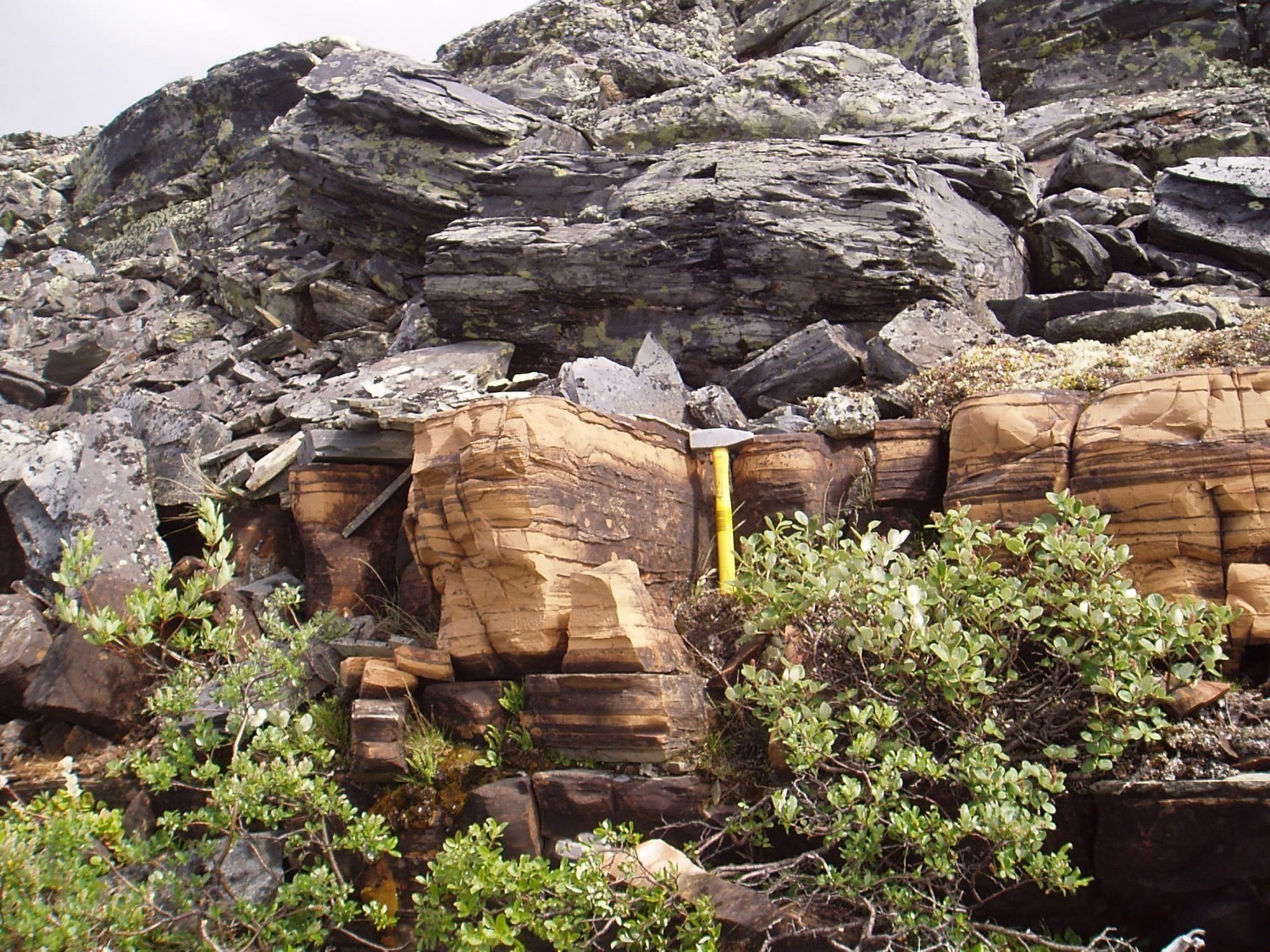
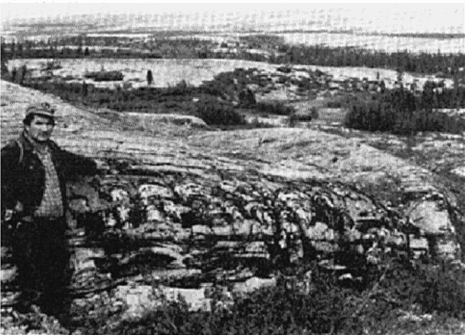
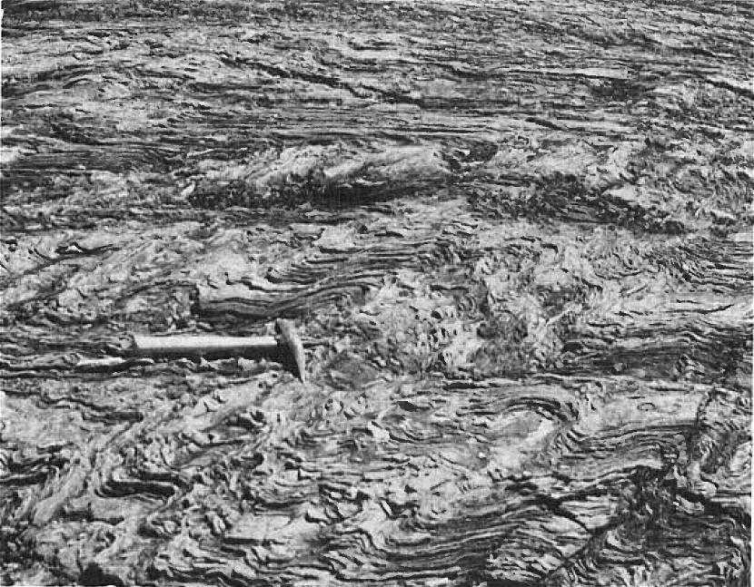
The Denault Formation is an allochthonous volcano-sedimentary unit forming the base of the Attikamagen Group. It is characterized by a wide variety of dolomitic lithofacies including massive, thickly bedded, crossbedded, brecciated, arenaceous and cherty varieties (Harrison et al., 1972). The Denault Formation consists mainly of dolomite, stromatolitic dolomite and laminated dolomite. Dolomite generally has a characteristic light grey or buff alteration patina. It commonly includes interbedded sandy dolomite, dolomitic sandstone, breccia and intraformational conglomerate. In addition, Denault dolomite commonly contains interbedded dark grey or black chert, siltstone, mudstone and sandstone. In the northern part of the Labrador Trough, the Denault Formation consists mainly of carbonate metasedimentary rocks, which consist mainly of dolomitic marble, dolomitic schist, micaceous schist, calcosilicate rocks, calcarenite, sandy dolomite and calcareous mudstone. It locally contains minor amounts of basalt. Metamorphism generally ranges from the lower greenschist to greenschist facies, except in the northern part of the Labrador Trough where it reaches the lower amphibolite facies (Dimroth and Dressler, 1978; Fraser et al., 1978).
Hoffman and Grotzinger (1989) interpreted the Denault Formation in the Minguarutittalik Lake area (sheet 24F03; formerly Lake Laurin) as representing a prograding carbonate reef with fore-reef, reef and back-reef facies. These facies are, according to Hoffman and Grotzinger (1989), as well exposed as those of the best reef complexes in the world. The Minguarutittalik Lake site (Complexe-Récifal-Laurin) is one of the Ministère's outstanding geological sites.
The Denault Formation was interpreted by Wardle and Bailey (1981) as a reef complex that developed near the eastern margin of the Labrador Trough by vertical aggradation during marine transgression. This origin is disputed by Hoffman and Grotzinger (1989), who argue instead for a progradation process near the western margin of the Trough. According to Hoffman and Grotzinger (1989), the reef complex is the result of a decrease in water depth linked to a marine regression. They interpret a marine setting corresponding to a foreland or intra-platform basin in which sediments from the upper part of the first Labrador Trough volcano-sedimentary cycle were deposited.
The economic potential of the Denault Formation lies in epigenetic lead-zinc mineralization hosted in stromatolitic dolomites (Clark and Wares, 2004).
Denault Formation, Undivided (pPde): Dolomite, Sandy Dolomite, Dolomitic Sandstone, Breccia and Intraformational Conglomerate; Stromatolitic Dolomite; Interstrtified Siltstone, Shale and Fine-Grained Sandstone
In the area south of latitude 56°N, Dimroth (1971, 1978) recognized four facies. Near the western margin of the Labrador Trough, the rock consists of fine-grained, grey, laminated dolomite having a brown alteration patina. It contains minor beds of medium to coarse-grained dolomitic sandstone and some red and green siltstone, shale and fine-grained sandstone strata of variable thickness. Rhythmic bedding consisting of tabular laminae millimetres to ~2-5 cm thick is common. Commonly observed sedimentary structures include crossbedding, contorted and convoluted laminations, and syn-sedimentary faults. Chert nodules are widespread in laminated dolomite. Eastward, laminated dolomite changes to intraformational breccias and conglomerates alternating with laminated dolomite beds and minor dolomitic sandstone beds. Some interbedded red and green, locally grey, siltstone and fine-grained sandstone are also present. Intraformational breccias and conglomerates gradually change eastward to fine fragment conglomerate alternating with laminated sandy dolomite and grey shale beds. East of the Ferrum River, the Denault Formation consists of lenses of light grey massive dolomite having a brown alteration patina. These different rocks are described in detail by Dimroth (1971).
Further east, between Oiseaux Lake and Argent Lake, three facies are recognized by Dimroth (1978) (from south to north): 1) fine-grained grey dolomite containing chert laminae and interbedded massive dolomite; 2) grey stromatolitic dolomite interbedded with intraclastic dolomite and dolomite containing chert laminae; and 3) facies similar to the previous one, but also including beds of coarse-grained dolomitic sandstone having a brown alteration patina and sandstone dolomite. In places, these rocks display strong synsedimentary deformation. A detailed description of the stromatolitic facies is given by Donaldson (1963, 1966) and Baragar (1967).
In the areas west of Hérodier Lake (sheets 24F03, 24F04 and 24F06), the unit consists of dolomite, sandy dolomite, dolomitic sandstone, mudstone, siltstone, conglomerate and undivided chert (Clark, 1978). In the area north of Feuilles Lake, it consists of generally fine-grained dolomite having a buff alteration patina and small folds. The rock is characterized by abundant quartz veins and contains interbedded chlorite-mica schist and talc schist. Marble occurs locally (Gold, 1962).
Denault Formation 2 (pPde2): Grey Dolomite, Stromatolitic Dolomite, Laminated Dolomite; Grey, Dark Grey or Black Chert; May Include Sandy Dolomite
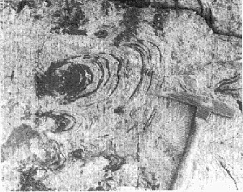
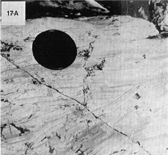
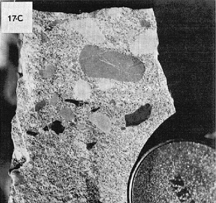
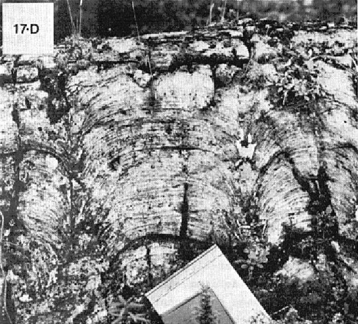
Unit pPde2 corresponds to the former Abner Formation (abandoned) and partly to the Nachicapau Formation (abandoned). It consists mainly of thick beds of massive dolomite, stromatolitic dolomite and laminated dolomite. Dolomite generally has a light grey or buff alteration patina (Berard, 1965; Clark, 1977, 1978, 1979; Dressler, 1979). In fresh surface, the dolomite's colour is highly variable: light grey, dark grey, buff, pinkish, red, yellow, orange, green, brown or white (Bérard, 1965; Clark, 1977; Dressler, 1979). According to Bérard (1965), the latter is partly determined by the presence of accessory minerals such as graphite, magnetite, hematite and chlorite. Dolomite is usually fine grained or aphanitic and is locally recrystallized. Stromatolitic dolomite is common and occurs in centimetre to metre-thick beds. Stromatolites are commonly bulbous and range from 2 cm to 1 m in diameter (Bérard, 1965; Clark, 1977, 1978, 1979; Dressler, 1979). In the Bérard Lake area (sheets 24L08 and 24L09), dolomite is cut by an orthogonal network of quartz veins and veinlets giving the rock a characteristic gridded appearance in altered surface (Bérard, 1965; Sauvé and Bergeron, 1965).
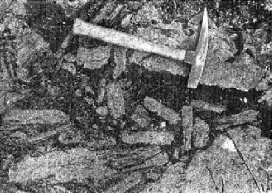
Dolomite is commonly interbedded with centimetric to metric beds of grey, dark grey or black chert, sandy dolomite, dolomitic sandstone and intraformational dolomitic conglomerate (Bérard, 1965; Clark, 1977, 1978, 1979; Dressler, 1979). Low-amplitude (10 cm) crossbedding is common in sandy dolomite. Locally, dolomite contains terrigenous fragments, oolites or pellets as well as oolite and pellet intraclasts, laminated or sandy dolomite (Clark, 1979; Dressler, 1979). In the Laumont Lake area (sheet 24L01), dolomite contains a dolomitic intraformational breccia consisting of angular dolomite fragments in a sandy ferrodolomite matrix (Bérard, 1965).
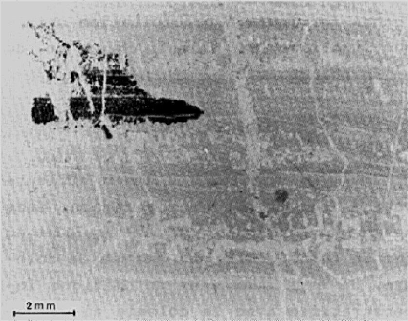
In thin sections, dolomite is microcrystalline with grains ranging from 0.05 to 0.6 mm in diameter. It also contains detrital quartz (up to 20% locally) and minor amounts of microcline, apatite and zircon (Bérard, 1965; Sauvé and Bergeron, 1965).
Denault Formation 3 (pPde3): Dolomitic Marble, Dolomitic Schist, Calcosilicate Rocks, Calcarenite, Sandy Dolomite, Calcareous Mudstone
Unit pPde3 consists of dolomitic marble, dolomitic schist, calcosilicate rocks, calcarenite, sandy dolomite and calcareous mudstone (Bérard, 1959, 1965; Sauvé, 1959; Sauvé and Bergeron, 1965; Clark, 1979; Bélanger, 1982). These rocks are closely associated and it is generally not possible to separate them into distinct units. Dolomitic marble, calcosilicate rocks and calcarenite generally have a light yellow, light grey or beige alteration patina. Dolomitic marble is common south and west of Sèche Bay, west of Profonde Bay and north of Feuilles Bay. It occurs in thin layers alternating with several beds of sandy dolomite or calcareous mudstone. The rock is finely bedded, rarely massive, foliated and commonly folded. The foliation is emphasized by numerous parallel quartz veinlets. Calcosilicate rocks and calcarenite do not form well-defined layers. These rocks are distinguished by a higher proportion of detrital components. They are particularly abundant to the south and east of Sèche Bay, in the islands of Feuilles Lake and in Refuges Bay (Bérard, 1959, 1965).
Dolomitic schist and sandy dolomite outcrop in the Faujas Lake area and NE of Deharveng Lake (Sauvé and Bergeron, 1965; Bélanger, 1982). Dolomitic schist is light grey in fresh surface, dark grey in altered surface, fine grained, schistose and occurs in beds 2 to 7 cm thick. Sandy dolomite is light grey in fresh surface, beige to reddish grey in altered surface, fine grained and massive. It forms beds 5 to 15 cm thick, up to 1 m thick. Locally, south of Napier Lake, the unit consists of argillaceous dolomite, dolomitic mudstone and mudstone (Clark, 1979).
Unit pPde3 rocks are composed of variable contents of dolomite (generally >50%), quartz, tremolite, calcite, microcline, biotite, sericite, muscovite and epidote. Smaller amounts of talc and albite are locally observed in dolomitic marble. Accessory minerals include allanite, zircon, magnetite, pyrite, limonite, chlorite and apatite. In thin sections, dolomite and calcite are microcrystalline (~0.05 mm) and have a granoblastic texture. Granoblastic quartz is variable in grain size (<1.5 mm) and usually has undulatory extinction. It is free of inclusions and fractures. Fibrous tremolite forms intergrown crystals. Muscovite and biotite have a lepidoblastic texture. Epidote, clinozoisite and allanite are commonly observed.
Denault Formation 4 (pPde4): Red Mudstone and Siltstone with Interbedded Dolomite; Argillaceous Dolomite, Dolomitic Shale, Shale
In the area west of Minguarutittalik Lake (sheet 24F04), unit pPde4 consists of red mudstone and siltstone with interbedded dolomite up to 20 cm thick (Ciesielski, 1977). These rocks are undeformed and outcrop over a few tens of metres thick at the base of a large dolomite cliff. The contact with massive dolomite (unit pPde2) is gradual and marked by the disappearance of red mudstone. South of Minguarutittalik Lake (sheet 24F03), the unit consists of argillaceous dolomite, dolomitic shale and shale.
Denault Formation 5 (pPde5): Dolomitic Quartzitic Sandstone
Unit pPde5 consists mainly of dolomitic quartzitic sandstone interbedded in unit pPde2 dolomite (Clark, 1979; Dressler, 1979). In the Minguarutittalik Lake area, dolomitic sandstone occurs in strips up to ~15 m thick. Sandstone is composed of medium to coarse, subangular to rounded quartz grains in a grey to buff dolomitic matrix. Quartz, and feldspar in lesser amounts, constitute ≤60% of the rock. Fragments of dolomite or dolomitic quartzitic sandstone (<4 cm) are observed locally (Dressler, 1979).
Denault Formation 6 (pPde6): Micaceous Schist, Slate, Phyllite
Unit pPde6 is located west of Profonde Bay. It consists of micaceous schist, slate and phyllite (Bérard, 1959, 1965). These rocks are green, grey or black, fine to medium grained, and have well-developed schistosity marked by micaceous minerals. In thin sections, these rocks are mainly composed of quartz, chlorite, sericite, albite, biotite, microcline and epidote. They also include several accessory minerals such as apatite, stilpnomelane, tourmaline, cordierite, calcite, zircon, graphite, magnetite, pyrite and sphene. Quartz (0.05-1.5 mm) has a characteristic granoblastic texture. It is usually clear, but may contain chlorite, sericite, apatite, zircon and microcline intrusions. It has an undulatory extinction. Chlorite usually has a lepidoblastic texture. Dark brown biotite has a lepidoblastic or porphyroblastic texture. Porphyroblastic biotite gives the rock a mottled appearance. Lepidoblastic muscovite is abundant and is closely associated with chlorite and biotite. Granoblastic albite in 0.3 to 1.5 mm crystals is closely associated with quartz. Microcline and epidote are observed locally.
Denault Formation 8 (pPde8): Quartzite Sandstone Having a White Patina
Unit pPde8 consists of quartzitic sandstone having a white altered patina (Bérard, 1959, 1965). Sandstone forms massive beds 15 cm to 1.30 m thick. The rock is white, grey or light yellow in fresh surface and white in altered surface. It is composed of quartz (75%), plagioclase (7%), muscovite (5%), calcite (3%), biotite (3%), chlorite (2%), dolomite (2%), phlogopite (1%), pyrite (1%) and traces of apatite, stilpnomelane, tourmaline and zircon. In thin sections, quartz has a granoblastic texture and an undulatory extinction. It contains some chlorite, sericite, biotite, zircon and plagioclase inclusions. Plagioclase (albite) is closely associated with quartz. It is twinned and has a granoblastic texture. Some grains have a poikiloblastic texture. Biotite, chlorite and muscovite are observed between quartz grains, in the stratification plane (Bérard, 1965).
Denault Formation 9 (pPde9): Grey, Dark Grey or Black Chert, Locally Containing Detrital Quartz Grains; Locally Pyritic Chert; Chert Containing Argillaceous or Dolomite Laminae; Chert Pebble Conglomerate
Unit pPde9 occurs as strips of grey, dark grey or black chert, generally <10 m thick (Clark, 1978, 1979). In places, the unit may be absent. Chert is fine grained, laminated, and locally includes detrital quartz grains and interbedded quartzitic sandstone. It is locally pyritic. In places, thin argillaceous laminae and metre-thick dolomite layers are observed. Near the base, the unit comprises a chert-dolomite pebble conglomerate (Clark, 1978, 1979). Chert fragments are dark grey, and elongated and irregular in shape. They range in size from <2 cm to 1 m long. Dolomite clasts are stratified. The conglomerate's matrix consists of dolomitic chert.
Denault Formation 10 (pPde10): Quartzitic Sandstone, Locally with Cherty Cement; Mudstone Laminae and Interstratification in Places
Unit pPde10 forms quartzitic sandstone strips generally up to <10 m thick. In places, the unit may be absent. Quartzitic sandstone is grey to dark grey, fine grained, laminated, and locally includes cherty cement. Thin mudstone laminae and beds are observed locally (Clark, 1978).
Denault Formation 11 (pPde11): Mudstone, Siltstone, Slate, Phyllite
Unit pPde11 occurs as strips of mudstone, siltstone, slate and phyllite within dolomite (unit pPde2). These rocks are grey, dark grey or black, locally fissile (Hashimoto, 1964; Clark, 1977, 1978; Dressler, 1979). In the area east of the Caniapiscau River (sheet 24F11), they are commonly pyritic (Clark, 1978).
Denault Formation 12 (pPde12): Pyritic Ferruginous (Siderite) Dolomite, Chloritic Schist, Black Slate, Chert
Unit pPde12 consists of pyritic ferruginous (siderite) dolomite, chloritic schist, black slate and chert. It occurs locally within dolomite (unit pPde2) (Clark, 1977).
Denault Formation 13 (pPde13): Pillow or Massive Basalt
Unit pPde13 consists of pillow or massive basalt, or both (Dressler, 1979; Clark, 1978). At Limestone Falls near the Caniapiscau River, a highly vesicular pillow basalt flow forms a ~30 m thick lens in dolomite (unit pPde2) (Clark, 1978).
Thickness and Distribution
The Denault Formation belongs to the Gerido, Howse, Hurst, Mélèzes and Schefferville lithotectonic zones as defined by Clark and Wares (2004). It was mapped from the west coast of Ungava Bay to the Grenville Front, a distance of ~700 km. The unit continues SW into the Grenville Province as the Duley Formation to the area west of the Manicouagan Reservoir (Clarke, 1977; Moukhsil et al., 2013), an additional distance of 230 km.
Initially, the Denault Formation was mapped from the Grenville Front in Labrador to the southern end of Wakuach Lake in Quebec (sheet 23O06) (Baragar, 1967). A homotaxial dolomite unit was also recognized between Marion Lake (sheet 23I13), in Labrador, and Gachet Lake (sheet 24B03) (Donaldson, 1963, 1966; Frarey, 1967; Baragar, 1967; Dimroth, 1978). Further north, the former Abner Formation was mapped between Minguarutittalik Lake (sheet 24F03) and Feuilles Lake (sheet 24K13) (Bérard, 1965; Dressler, 1979; Clark, 1979). North of Feuilles Lake, as far as Hopes Advance Bay (sheet 24N05), some dolomitic metasedimentary rocks are probably equivalent to the Abner Formation further south (Bérard, 1965). These metasedimentary rocks have been assigned to the Denault Formation. Thus, the Denault Formation is the first formation of the first volcano-sedimentary cycle present along the entire length of the Labrador Trough.
Baragar (1967) mentions that the thickness of the Denault Formation varies greatly from one area to another. Harrison (1952) reported a thickness of 30 m SW of Schefferville, which increases towards the NE to reach 185 m near Schefferville. A thickness of ~120 m was estimated near Annabel Lake, NW of Schefferville (Baragar, 1967). Harrison et al. (1972) assumed that the formation thickened to the NE, from Schefferville, reaching >300 m thick west of the Ferrum River. This possibility was confirmed by observations made ~35 km NE of Schefferville (see Dimroth, 1978, Figure 23). Thus, in the area NE of Chassin Lake, the thickness of the formation has been estimated at 1280 m (Baragar, 1967). At Lake Marion, the Denault Formation reaches a maximum thickness of 850 m (Donaldson, 1966). In the northern part of the Labrador Trough, the thickness of the former Abner Formation was estimated at 150 m (for the dolomitic part) by Dressler (1979), at ≥75 m by Clark (1979) and between 30 and 120 m by Bérard (1965). Hoffman and Grotzinger (1989) interpreted the Denault Formation at Minguarutittalik Lake as representing a prograding carbonate reef having a total thickness of 345 m. The thickness of the former Harveng Formation was estimated at ~215 m by Sauvé and Bergeron (1965), but this does not take into account thickening by folding.
Dating
None.
Stratigraphic Relationship(s)
Harrison (1952) located the Denault Formation stratigraphically above a slate unit which he called the Attikamagen Formation, later renamed the Le Fer Formation (Swampy Bay Group) by Dimroth (1978). The contact between the two formations is generally sharp and appears to be interdigitated at large scale. South of Wakuach Lake, the Le Fer Formation gradually changes eastward to the Denault Formation (Dimroth, 1978). From SW to NE, the Wishart (Ferriman Group), Fleming and Dolly formations, respectively, overlie the Denault Formation (Harrison, 1952; Harrison et al., 1972; Dimroth, 1978). According to Dimroth (1978), the Le Fer, Denault, Fleming and Dolly formations are located in the upper part of the first volcano-sedimentary cycle of the Labrador Trough. The Fleming and Dolly formations are lateral equivalents and are in conformable contact with the underlying Denault Formation. In the Schefferville area, the Dolly Formation is interbedded eastward with the Denault Formation (Dimroth et al., 1970; Dimroth, 1971, 1978). The Wishart Formation, the basal formation of the second cycle, displays at its base unconformable low-angle erosional contact with the underlying sequence, including the Le Fer and Denault formations (Dimroth, 1978).
In the northern part of the Trough, the Denault Formation structurally overlies the Chioak Formation along the Garigue Fault (Clark, 1988). It is conformably overlain by the Lower Baby member. According to Clark (1988), these two units are commonly interstratified over a few metres. East of the Caniapiscau River (sheet 24F11), the Denault Formation is in sharp contact with the underlying Le Fer Formation. The contact between the two formations is well exposed and shows no interstratification (Clark, 1978). Dolomitic rocks of the Denault Formation may be equivalent to carbonate rocks of the Freneuse Suite (Simard et al., 2013; Lafrance et al., 2014) located further east in the Laporte Supersuite.
The Abner Formation (now abandoned), mapped in the northern part of the Labrador Trough, has been interpreted as the equivalent of the southern Denault Formation by Clark (1988), Hoffman and Grotzinger (1989) and Clark and Wares (2004). This interpretation is based on the discovery of a major thrust fault (Garigue Fault) beneath the Abner Formation (Clark, 1979; Budkewitsch, 1986; Goulet, 1986; Hoffman and Grotzinger, 1989). The equivalence of the two formations is also supported by the fact that their carbon isotopic compositions are similar (Melezhik et al., 1997). Indeed, dolomites of the Denault Formation are composed of isotopically light carbon (δ13C values between -3 and +5‰), which distinguishes them from the other stratigraphically lower dolomites of the first cycle, which are composed of isotopically heavier carbon (δ13C values between +5 and +16‰) (Melezhik et al., 1997; Clark and Wares, 2004). Elsewhere in the world, isotopically heavy carbonate rocks have been dated between 2.33 and 2.06 Ga (see Melezhik et al., 1997). On this basis, the Denault Formation is thought to be younger than 2.06 Ga and older than 1878-1880 Ma, the age range of the Sokoman Formation (Chevé and Machado, 1988; Findlay et al., 1995). These observations justified abandoning the Abner Formation (Clark and Wares, 2004).
Paleontology
Dolomites of the Denault Formation locally exhibit cryptalgal and algal structures (stromatolites) (Baragar, 1967; Donaldson, 1963, 1966; Dimroth, 1978; Clark, 1977, 1979; Dressler, 1979).
References
Publications Available Through SIGÉOM Examine
BELANGER, M., 1982. REGION DU LAC FAUJAS, NOUVEAU-QUEBEC. MRN; DP-82-06, 1 plan.
BERARD, J., 1959. RAPPORT PRELIMINAIRE SUR LA REGION DU LAC AUX FEUILLES, NOUVEAU-QUEBEC. MRN; RP 384, 10 pages, 1 plan.
BERARD, J., 1965. REGION DU LAC BERARD, NOUVEAU-QUEBEC. MRN; RG 111, 175 pages, 2 plans.
CIESIELSKI, A., 1975. CONTACT ARCHEEN-PROTEROZOIQUE ENTRE LES LACS FORBES ET SENAT (FOSSE DU LABRADOR) - RAPPORT PRELIMINAIRE. MRN; DPV 449, 28 pages, 1 plan.
CLARK, T., 1977. GEOLOGY OF THE FORBES LAKE AREA (NOUVEAU-QUEBEC). MRN; DPV 452, 19 pages, 1 plan.
CLARK, T., 1978. REGION DU LAC HERODIER (NOUVEAU-QUEBEC) - RAPPORT PRELIMINAIRE. MRN; DPV 568, 48 pages, 2 plans.
CLARK, T., 1979. REGION DU LAC NAPIER (NOUVEAU-QUEBEC) - RAPPORT PRELIMINAIRE. MRN; DPV 663, 28 pages, 1 plan.
CLARK, T., 1980. REGION DE LA RIVIERE KOKSOAK (NOUVEAU-QUEBEC) - RAPPORT PRELIMINAIRE. MRN; DPV 781, 24 pages, 1 plan.
CLARK, T., 1984. GEOLOGIE DE LA REGION DU LAC CAMBRIEN - TERRITOIRE DU NOUVEAU-QUEBEC. MRN; ET 83-02, 77 pages, 1 plan.
CLARK, T., 1987. STRATIGRAPHIE, PETROGRAPHIE ET PETROCHIMIE DE LA FORMATION DE FER DE BABY DANS LA REGION DU LAC HERODIER (FOSSE DU LABRADOR). MRN; ET 87-13, 44 pages.
CLARK, T., LECLAIR, A., PUFAHL, P., DAVID, J., 2008. RECHERCHE GEOLOGIQUE ET METALLOGENIQUE DANS LES REGIONS DE SCHEFFERVILLE (23J15) ET DU LAC ZENI (23I16). COMMISSION GEOLOGIQUE DU CAN, UNIVERSITE ACADIA, MRNF, GEOTOP UQAM-MCGILL; RP 2008-01, 17 pages.
CLARK, T., WARES, R., 2004. SYNTHESE LITHOTECTONIQUE ET METALLOGENIQUE DE L'OROGENE DU NOUVEAU-QUEBEC (FOSSE DU LABRADOR). MRNFP; MM 2004-01, 182 pages, 1 plan.
CLARKE, P J., 1977. Région de Gagnon. MRN; RG 178, 89 pages, 2 plans.
DIMROTH, E., 1978. Région de la fosse du Labrador entre les latitudes 54° 30' et 56° 30'. MRN; RG 193, 417 pages, 16 plans.
DRESSLER, B., CIESIELSKI, A., 1979. Région de la fosse du Labrador. MRN; RG 195, 136 pages, 14 plans.
GOLD, D P., 1962. RAPPORT PRELIMINAIRE SUR LA REGION DE LA BAIE HOPES ADVANCE, NOUVEAU-QUEBEC. MRN; RP 442, 13 pages, 1 plan.
GOULET, N., 1986. ETUDE TECTONIQUE ET STRATIGRAPHIQUE DE LA PARTIE NORD DE LA FOSSE DU LABRADOR - REGION DE LA BAIE AUX FEUILLES ET DU LAC BERARD. MRN; MB 86-27, 22 pages, 6 plans.
MOUKHSIL, A., SOLGADI, F., CLARK, T., BLOUIN, S., INDARES, A., DAVIS, D W., 2013. GEOLOGIE DU NORD-OUEST DE LA REGION DU BARRAGE DANIEL-JOHNSON (MANIC 5), COTE-NORD. MRN, UQAT, URSTM, UNIVERSITE MEMORIAL DE TERRE-NEUVE-ET-LABRADOR; RG 2013-01, 46 pages, 1 plan.
SAUVE, P., 1959. RAPPORT PRELIMINAIRE SUR LA REGION DE LA BAIE AUX FEUILLES, NOUVEAU-QUEBEC. MRN; RP 399, 15 pages, 1 plan.
SAUVE, P., 1959. PRELIMINARY REPORT ON LEAF BAY AREA, NEW QUEBEC. MRN; RP 399(A), 11 pages, 1 plan.
SAUVE, P., BERGERON, R., 1965. REGION DES LACS GERIDO ET THEVENET, NOUVEAU-QUEBEC. MRN; RG 104, 141 pages, 3 plans.
SAUVE, P., BERGERON, R., 1965. GERIDO LAKE - THEVENET LAKE AREA, NEW QUEBEC. MRN; RG 104(A), 131 pages, 3 plans.
SIMARD, M., LAFRANCE, I., HAMMOUCHE, H., LEGOUIX, C., 2013. GEOLOGIE DE LA REGION DE KUUJJUAQ ET DE LA BAIE D'UNGAVA (SNRC 24J, 24K). MRN; RG 2013-04, 62 pages, 1 plan.
Other Publications
BARAGAR, W.R.A. 1967. Wakuach Lake map-area, Quebec-Labrador (23O). Geological Survey of Canada; Memoir 344, 174 pages. https://doi.org/10.4095/123960
BUDKEWITSCH, P. 1986. A structural study of the Chioak-Abner formation contact, northern part of the Labrador Trough, New Quebec. Concordia University; M.Sc. thesis, 61 pages.
CHEVÉ, S.R., MACHADO, N. 1988. Reinvestigation of the Castignon Lake carbonatite complex, Labrador Trough, New Québec. Joint Annual Meeting of the Geological Association of Canada and the Mineralogical Association of Canada, St. John's, Newfoundland; Program with Abstracts, volume 13, pages 20.
CLARK, T., THORPE, R.I. 1990. Model lead ages from the Labrador Trough and their stratigraphy implications. In The Early Proterozoic Trans-Hudson Orogen of North America: Lithotectonic Correlations and Evolution (J.F. Lewry, J.F. and M.R. Stauffer, editors). Geological Association of Canada; Special Paper 37, pages 413-432.
DIMROTH, E. 1971. The Attikamagen-Ferriman transition in part of the central Labrador Trough. Canadian Journal of Earth Sciences; volume 8, pages 1432-1454. https://doi.org/10.1139/e71-132
DIMROTH, E., DRESSLER, B. 1978. Metamorphism of the Labrador Trough. In Metamorphism in the Canadian Shield. Geological Survey of Canada; Paper 78-10, pages 215-236. https://doi.org/10.4095/104534
DIMROTH, E., BARAGAR, W.R.A., BERGERON, R., JACKSON, GD. 1970. The filling of the Circum-Ungava geosyncline. In Symposium on Basins and Geosynclines of the Canadian Shield (A.J. Baer, editor). Geological Survey of Canada; Paper 70-40, pages 45-142. https://doi.org/10.4095/124922
DONALDSON, J.A. 1963. Stromatolites in the Denault Formation, Marion Lake, Coast of Labrador, Newfoundland. Geological Survey of Canada; Bulletin 102, 33 pages. https://doi.org/10.4095/123903
DONALDSON, J.A. 1966. Marion Lake map-area, Quebec-Newfoundland (23I/13). Geological Survey of Canada; Memoir 338, 85 pages. https://doi.org/10.4095/123900
FINDLAY, J.M., PARRISH, R.R., BIRKETT, T., WATANABE, D.H. 1995. U-Pb ages from the Nimish Formation and Montagnais glomeroporphyritic gabbro of the central New Québec Orogen, Canada. Canadian Journal of Earth Sciences; Volume 32, pages 1208-1220. https://doi.org/10.1139/e95-099
FRAREY, M.J. 1961. Menihek Lakes, Newfoundland and Québec; Geological Survey of Canada; Map 1087A. https://doi.org/10.4095/124105
FRAREY, M.J., DUFFELL, S. 1964. Revised stratigraphic nomenclature for the central part of the Labrador Trough. Geological Survey of Canada; Paper 64-25, 13 pages. https://doi.org/10.4095/123909
FRASER, J.A., HEYWOOD, W.W., MAZURSKI, M.A., 1978. Carte métamorphique du Bouclier canadien. Geological Survey of Canada; Map 1475A. doi.org/10.4095/133909
HARRISON, J.M. 1952. The Quebec-Labrador iron belt, Quebec and Newfoundland. Geological Survey of Canada; Paper 52-20, 21 pages. https://doi.org/10.4095/123923
HARRISON, J.M., HOWELL, J.E., FAHRIG, W.F. 1972. A geological cross-section of the Labrador miogeosyncline near Schefferville, Quebec. Geological Survey of Canada; Paper 70-37, 34 pages. https://doi.org/10.4095/102389
HOWELL, J.E., 1954. Silicification in the Knob Lake Group of the Labrador iron belt. University of Wisconsin; Doctoral thesis.
HOFFMAN, P., GROTZINGER, J.P. 1989. Abner-Denault reef complex (2.1 Ga), Labrador Trough, N.E. Québec. In Reefs, Canada and Adjacent Area (H.H.J. Geldsetzer, N.P. James, and GE. Tebbutt, editors). Canadian Society of Petroleum Geologists; Memoir 13, pages 49-54.
MELEZHIK, V.A., FALLICK, A.E., CLARK, T. 1997. Two billion year old isotopically heavy carbon: evidence from the Labrador Trough, Canada. Canadian Journal of Earth Sciences; volume 34, pages 271-285. https://doi.org/10.1139/e17-025
WARDLE, R.J., BAILEY, D.G. 1981. Early Proterozoic sequences in Labrador. In Proterozoic basins of Canada (F.H.A. Campbell, editor). Geological Survey of Canada; Paper 81-10, pages 331-359. https://doi.org/10.4095/124192
Suggested Citation
Ministère de l’Énergie et des Ressources naturelles (MERN). Denault Formation. Quebec Stratigraphic Lexicon. https://gq.mines.gouv.qc.ca/lexique-stratigraphique/province-de-churchill/formation-de-denault_en/ [accessed on Day Month Year].
Contributors
|
First publication |
Charles St-Hilaire, GIT, M.Sc. charles.st-hilaire@mern.gouv.qc.ca; Thomas Clark, P. Geo., Ph.D. (redaction) Mehdi A. Guemache, P. Geo., Ph.D. (coordination); Claude Dion, Eng., M.Sc. (critical review); Simon Auclair, P. Geo., M.Sc. (editing); Céline Dupuis, P. Geo., Ph.D. (English version); André Tremblay (HTML editing). |