

First published: 9 December 2020
Last modified:
DISCLAIMER: This English version is translated from the original French. In case of any discrepancy, the French version shall prevail.
| Author(s): | Harrison et al., 1972 |
| Age: | Paleoproterozoic |
| Stratotype: | A section of the formation is well exposed immediately to the NE of Dolly Lake (NTS sheet 23J15). |
| Type area: | Scheffervile area (sheet 23J15) |
| Geological province: | Churchill Province |
| Geological subdivision: | New Quebec Orogen (Labrador Trough) / Schefferville Lithotectonic Zone |
| Lithology: | Mudstone, sandstone, siltstone |
| Category: | Lithostratigraphic |
| Rank: | Formation |
| Status: | Formal |
| Use: | Active |
Background
The term « Railroad slates » was used by Harrison (1952) to describe a thin slate unit overlying the Denault Formation along the railway west of Knob Lake (sheet 23J15). The terrigenous sedimentary rocks now assigned to the Dolly Formation were included in the Attikamagen Formation (later Attikamagen Group) by Harrison (1952), Wynne-Edwards (1960), Frarey (1961), Frarey and Duffell (1964), Baragar (1967), Dimroth (1970, 1971) and Dimroth et al. (1970). The name Dolly Formation was formally introduced by Harrison et al. (1972) to describe a unit of slate and siltstone of various colours that overlies the Denault Formation, NE of Dolly Lake. This lake, from which the unit takes its name, is located ~3.5 km east of Schefferville (sheet 23J15). Harrison et al. (1972) briefly described the general nature of the Dolly Formation at the type locality east of Schefferville. Subsequently, Dimroth (1978) mapped the Dolly Formation in the Schefferville area to include it in the upper part of the Attikamagen Subgroup, which was later reclassified as the Attikamagen Group by Clark and Wares (2004). The rocks of the Dolly Formation were followed towards the SE by Wardle (1979a, b; 1982) on the Labrador side. They have also been the subject of geological reconnaissance work in the Schefferville area (Clark et al., 2008).
Description
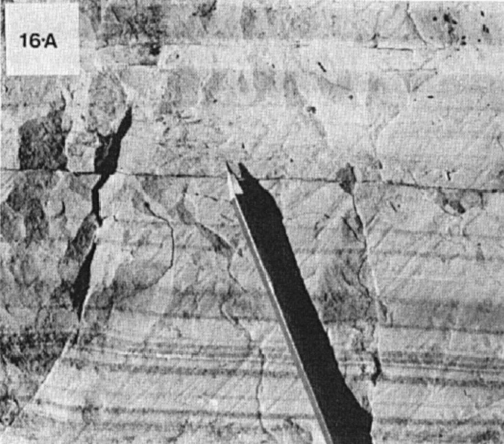
The Dolly Formation is the sedimentary unit forming the upper part of the Attikamagen Group, as defined by Clark and Wares (2004). Dimroth (1971, 1972, 1978) divided the formation into two members: a lower member consisting of black and grey mudstone, and an upper member consisting of siltstone, sandstone and red and green mudstone. According to Dimroth (1971, 1972, 1978), the lower member of the Dolly Formation is present only in the Squaw and Knob Lake areas and is interbedded with or overlies the underlying Denault Formation. The lower member is well exposed near the railway south of Schefferville. It consists of laminated black and grey mudstone with interbedded (10-30 cm) medium to coarse-grained grauwacke and sandstone. Mudstone commonly exhibits tabular stratification and vortical structures (Dimroth, 1972, 1978). Interstratified finely bedded intraclastic dolomite (up to 6 m thick) are characteristic. Thinly, interstratified black chert is observed higher in the sequence (Harrison et al., 1972; Dimroth, 1972, 1978). According to Harrison et al. (1972), dolomite present at the base of the Dolly Formation is similar to that of the underlying Denault Formation. The rocks of the lower member were deposited in a relatively deep marine environment and are thought to represent in part the lateral equivalent of the Denault Formation (Dimroth, 1971, 1978).

The upper member of the Dolly Formation occurs in the area east of Schefferville. In the area east of Dolly Lake, where it is very well exposed, this member consists of well-stratified and finely bedded red and green fine-grained sandstone and siltstone. These rocks commonly display crossbedding and tabular stratification. Towards the NE, the upper member changes to red and green siltstone and mudstone with tabular stratification. These rocks are well exposed at the NW end of Attikamagen Lake (Dimroth, 1971, 1972, 1978). Dimroth (1971, 1978) indicates that the upper member changes rapidly to grey mudstone with interbedded sandstone towards the east and SE. The upper member of the Dolly Formation is similar to the Le Fer Formation (Swampy Bay Group), which underlies the Denault Formation, and reflects a prograde deltaic deposit that accumulated in a west-to-east basin (Dimroth, 1971, 1978). SE of the Schefferville area, rocks of the upper member change to mudstone and grey siltstone locally having turbidite characteristics. These rocks were deposited towards the central part of the basin in deeper water (Dimroth, 1971, 1978; Wardle, 1979a, b; Wardle and Bailey, 1981).
Sedimentary rocks of the Dolly Formation were deposited in a shallow marine basin developed on the carbonate platform of reef stromatolitic dolomite of the Denault Formation (Dimroth, 1972, 1978; Wardle and Bailey, 1981; Hoffman and Grotzinger, 1989; Birkett, 1991). Rocks of the formation are slightly metamorphosed and at most reach the greenschist facies (Dimroth and Dressler, 1978). From an economic point of view, phosphate-rich sedimentary rocks (phosphatic cherty mudstone) were reported by Harrison et al. (1972) and Birkett (1991) in the Dolly Formation (Clark et al., 2008).
Thickness and Distribution
The Dolly Formation belongs to the allochthonous Schefferville Lithotectonic Zone as defined by Clark and Wares (2004). It has only been identified in the western part of the Labrador Trough, south of latitude 55°15′N (Dimroth et al., 1970; Dimroth, 1971, 1972, 1978; Wardle, 1979b). In Quebec, the distribution of this formation is limited, forming two parallel strips, oriented NW-SE, extending ~35 km and 13 km NE of Schefferville, respectively. On the Labrador side, the Dolly Formation occupies much of the Petitsikapau Lake basin (sheet 23J09) and extends SE to latitude 54°N (Wardle, 1979b, 1982; Wardle and Bailey, 1981). West of Schefferville, a grey mudstone and siltstone unit has been identified east of Stakit Lake (sheet 23J10) (Wardle, 1979b).
According to Harrison et al. (1972), the Dolly Formation is very thin near the western edge of the Trough (west of Knob Lake) and thickens considerably towards the NE. The minimum thickness of the formation is estimated between 2 m and 4 m at the crest of Knob Lake (Clark et al., 2008). NE of Dolly Lake (type locality), Harrison et al. (1972) estimated the thickness of the formation at >300 m. In the same area, Dimroth (1971) reported a thickness of 230 m at Dolly Ridge, NE of Schefferville. On the Labrador side, the Dolly Formation is ~180 m thick east of Stakit Lake, gradually increasing eastward to ~500 m in the Petitsikapau Lake basin (Wardle, 1979b). To the SE, the Dolly Formation thickens eastward to a maximum thickness of 1000 m to 2500 m (Wardle, 1979a).
Dating
None.
Stratigraphic Relationship(s)
Rocks of the Dolly Formation, Paleoproterozoic in age, were deposited towards the end of the first Labrador Trough sedimentation cycle at ~2142 +4/-2 Ma (T. Krogh and B. Dressler, unpublished data cited in Clark, 1984, page 4). However, these rocks may be much younger, as they were deposited towards the end of the Attikamagen Group sedimentation period estimated to be between 2.06 Ga and 1878-1880 Ma (Chevé and Machado, 1988; Findlay et al., 1995; Melezhik et al., 1997).
The Dolly Formation occupies the top of the Attikamagen Group east of the western margin of the Trough. It is overlying the Denault Formation and underlying the Wishart Formation (Ferriman Group) (Harrison et al., 1972; Dimroth, 1971, 1972, 1978; Wardle, 1979a, b). The lower contact of the Dolly Formation is generally conformable with dolomite of the Denault Formation (Dimroth, 1978; Wardle, 1979b). At the type locality, Harrison et al. (1972) indicate that this contact appears to be gradual. Near the base, the Dolly Formation includes interbedded dolomite similar to that of the underlying Denault Formation. The lower part of the Dolly Formation is partly considered to be a lateral equivalent of the Denault Formation with which it interdigitates eastward in the Schefferville area (Dimroth et al., 1970; Dimroth, 1971, 1972, 1978).
According to Dimroth (1971), there is a possible conformable relationship between the Dolly and Wishart formations in the central Trough near Schefferville. At the type locality, Harrison et al. (1972) indicate that the upper part of the Dolly is in gradual contact with the base of the Wishart Formation. Further south, Wardle (1979b) mentions that the upper part of the Dolly Formation is interbedded with the basal part of the Wishart Formation. The Dolly Formation is the lateral equivalent of the Fleming Formation further west (Wardle and Bailey, 1981). According to Dimroth et al. (1970), the Dolly Formation appears to be interstratified with the Fleming Formation westward.
Paleontology
Does not apply.
References
Publications Available Through SIGÉOM Examine
CLARK, T. 1984. GEOLOGIE DE LA REGION DU LAC CAMBRIEN – TERRITOIRE DU NOUVEAU-QUEBEC. MRN. ET 83-02, 77 pages and 1 plan.
CLARK, T., LECLAIR, A., PUFAHL, P., DAVID, J. 2008. RECHERCHE GEOLOGIQUE ET METALLOGENIQUE DANS LES REGIONS DE SCHEFFERVILLE (23J15) ET DU LAC ZENI (23I16). COMMISSION GEOLOGIQUE DU CAN, UNIVERSITE ACADIA, MRNF, GEOTOP QAM-MCGILL. RP 2008-01, 17 pages.
CLARK, T., WARES, R. 2004. SYNTHESE LITHOTECTONIQUE ET METALLOGENIQUE DE L’OROGENE DU NOUVEAU-QUEBEC (FOSSE DU LABRADOR). MRNFP. MM 2004-01, 182 pages and 1 plan.
DIMROTH, E. 1970. CARTES GEOLOGIQUES DU LAC ROMANET ET DU LAC CRAMOLET (FOSSE DU LABRADOR). MRN. DP 068, 3 plans.
DIMROTH, E. 1972. STRATIGRAPHY OF PART OF THE CENTRAL LABRADOR TROUGH. MRN. DP 154DP 154, 304 pages and 6 plans.
DIMROTH, E. 1978. REGION DE LA FOSSE DU LABRADOR ENTRE LES LATITUDES 54° 30′ ET 56° 30′. MRN. RG 193, 417 pages and 16 plans.
Other Publications
BARAGAR, W.R.A. 1967. Wakuach Lake map-area, Quebec-Labrador (23O). Geological Survey of Canada; Memoir 344, 174 pages. https://doi.org/10.4095/123960
BIRKETT, T.C. 1991. Origin of the Lower Proterozoic Fleming chert-breccia, Newfoundland, Labrador-Québec. Geological Survey of Canada; Map 91-12, 44 pages. https://doi.org/10.4095/132666
CHEVÉ, S.R., MACHADO, N. 1988. Reinvestigation of the Castignon Lake carbonatite complex, Labrador Trough, New Québec. Joint Annual Meeting of the Geological Association of Canada and the Mineralogical Association of Canada, St. John’s, Newfoundland; Program with Abstracts, volume 13, pages 20.
DIMROTH, E. 1968. The evolution of the central segment of the Labrador geosyncline; part I: stratigraphy, facies and paleogeography; Neues Jahrbuch für Geologie und Paläontologie; volume 132, pages 22-54.
DIMROTH, E. 1970. Evolution of the Labrador Geosyncline. Geological Society of America Bulletin; volume 81, pages 2717-2742. https://doi.org/10.1130/0016-7606(1970)81[2717:EOTLG]2.0.CO;2
DIMROTH, E. 1971. The Attikamagen-Ferriman transition in part of the central Labrador Trough. Canadian Journal of Earth Sciences; volume 8, pages 1432-1454. https://doi.org/10.1139/e71-132
DIMROTH, E., BARAGAR, W.R.A., BERGERON, R., JACKSON, GD. 1970. The filling of the Circum-Ungava geosyncline. In Symposium on Basins and Geosynclines of the Canadian Shield (A.J. Baer, editor). Geological Survey of Canada; Paper 70-40, pages 45-142. https://doi.org/10.4095/124922
DIMROTH, E., DRESSLER, B. 1978. Metamorphism of the Labrador Trough. In Metamorphism in the Canadian Shield. Geological Survey of Canada; Paper 78-10, pages 215-236. https://doi.org/10.4095/104534
FINDLAY, J.M., PARRISH, R.R., BIRKETT, T., WATANABE, D.H. 1995. U-Pb ages from the Nimish Formation and Montagnais glomeroporphyritic gabbro of the central New Québec Orogen, Canada. Canadian Journal of Earth Sciences; Volume 32, pages 1208-1220. https://doi.org/10.1139/e95-099
FRAREY, M.J. 1961. Menihek Lakes, Newfoundland and Québec; Geological Survey of Canada; Map 1087A. https://doi.org/10.4095/124105
FRAREY, M.J., DUFFELL, S. 1964. Revised stratigraphic nomenclature for the central part of the Labrador Trough. Geological Survey of Canada; Paper 64-25, 13 pages. https://doi.org/10.4095/123909
HARRISON, J.M. 1952. The Quebec-Labrador iron belt, Quebec and Newfoundland. Geological Survey of Canada; Paper 52-20, 21 pages. https://doi.org/10.4095/123923
HARRISON, J.M., HOWELL, J.E., FAHRIG, W.F. 1972. A geological cross-section of the Labrador miogeosyncline near Schefferville, Quebec. Geological Survey of Canada; Paper 70-37, 34 pages. https://doi.org/10.4095/102389
MELEZHIK, V.A., FALLICK, A.E., CLARK, T. 1997. Two billion year old isotopically heavy carbon: evidence from the Labrador Trough, Canada. Canadian Journal of Earth Sciences; volume 34, pages 271-285. https://doi.org/10.1139/e17-025
WARDLE, R.J. 1979a. Geology of the eastern margin of the Labrador Trough. Department of Mines and Energy, Government of Newfoundland and Labrador; Report 78-9, 22 pages. https://gis.geosurv.gov.nl.ca/geofilePDFS/WBox040/LAB_0415.pdf
WARDLE, R.J. 1979b.The western Margin of the Labrador Trough. Department of Mines and Energy, Government of Newfoundland and Labrador; Report 79-1, 7 pages. https://www.gov.nl.ca/nr/files/mines-geoscience-publications-reportactivities-1979-wardle2-roa1979.pdf
WARDLE, R.J. 1982. Geology of the south-central Labrador Trough. Government of Newfoundland and Labrador, Department of Mines and Energy, Mineral Development Division, Map 82-005. https://gis.geosurv.gov.nl.ca/geofilePDFS/ReceivedBatch58/LAB_0603.pdf
WARDLE, R.J., BAILEY, D.G. 1981. Early Proterozoic sequences in Labrador. In Proterozoic basins of Canada (F.H.A. Campbell, editor). Geological Survey of Canada; Paper 81-10, pages 331-359. https://doi.org/10.4095/124192
WARE, M.J., WARDLE, R.J. 1979. Geology of the Sims-Evening Lake area, western Labrador with emphasis on the Helikian Sims Group. Government of Newfoundland and Labrador, Department of Mines and Energy, Mineral Development Division; Report 79-05, 27 pages. https://gis.geosurv.gov.nl.ca/geofilePDFS/WBox040/LAB_0458.pdf
WYNNE-EDWARDS, H.R. 1960. Michikamau Lake, West half, Quebec-Newfoundland. Geological Survey of Canada; Pre,iminary maps 2. https://doi.org/10.4095/124144
Suggested Citation
Ministère de l’Énergie et des Ressources naturelles (MERN). Dolly Formation. Quebec Stratigraphic Lexicon. https://gq.mines.gouv.qc.ca/lexique-stratigraphique/province-de-churchill/formation-de-dolly_en [accessed on Day Month Year].
Contributors
|
First publication |
Charles St-Hilaire, GIT, M.Sc. charles.st-hilaire@mern.gouv.qc.ca; Thomas Clark, P. Geo., Ph.D. (redaction) Mehdi A. Guemache, P. Geo., Ph.D. (coordination); anonymous (critical review); Simon Auclair, P. Geo., M.Sc. (editing); Céline Dupuis, P. Geo., Ph.D. (English version); André Tremblay (HTML editing). |