


First published: 14 June 2019
Last modified:
DISCLAIMER: This English version is translated from the original French. In case of any discrepancy, the French version shall prevail.
| Author: | Moukhsil et al., 2013 |
| Age: | Middle Ordovician |
| Stratotype: | The most significant outcrop is located in the NE corner of NTS sheet 22N03 (11-AM-133; UTM NAD 83, Zone 19: 499367 m E, 567676763 m N; Moukhsil et al., 2013) |
| Type area: | Manicouagan Reservoir area (René-Levasseur Island; sheet 22N) |
| Geological province: | St. Lawrence Platform |
| Geological subdivision: | St. Lawrence Lowlands Platform |
| Lithology: | Limestone locally rich in fossils, minor amounts of siltstone and shale |
| Category: | Lithostratigraphic |
| Rank: | Formation |
| Status: | Formal |
| Use: | Active |
- Trenton Group
- Tétreauville Formation
- Montréal Formation
- Neuville Formation
- Deschambault Formation
- Hull Formation
- Saint-Marc Formation
- Mile End Formation
- Ouareau Formation
- Fontaine Formation
- Pont-Rouge Formation
- Sainte-Anne Formation
- Galets Formation
- Shipshaw Formation
- Simard Formation
- Tremblay Formation
- René-Levasseur Formation
Background
Ordovician sedimentary rocks were first reported in the Daniel-Johnson Reservoir area on the former shore of Manicouagan Lake (Kish, 1962; Murtaugh and Currie, 1969; Murtaugh, 1976). Moukhsil et al. (2013) subsequently grouped these sedimentary rocks in a formal unit called the René-Levasseur Formation. This formation probably represents klippes of the St. Lawrence Platform (Moukhsil et al., 2013) that was preserved from erosion by landfilling during the meteoritic impact that occurred in this area in the Trias. The René-Levasseur Formation is therefore included in the Trenton Group. The name refers to the René-Levasseur Island, located in the centre of the Manicouagan Reservoir on the banks of which the formation outcrops (sheet 22N).
Description
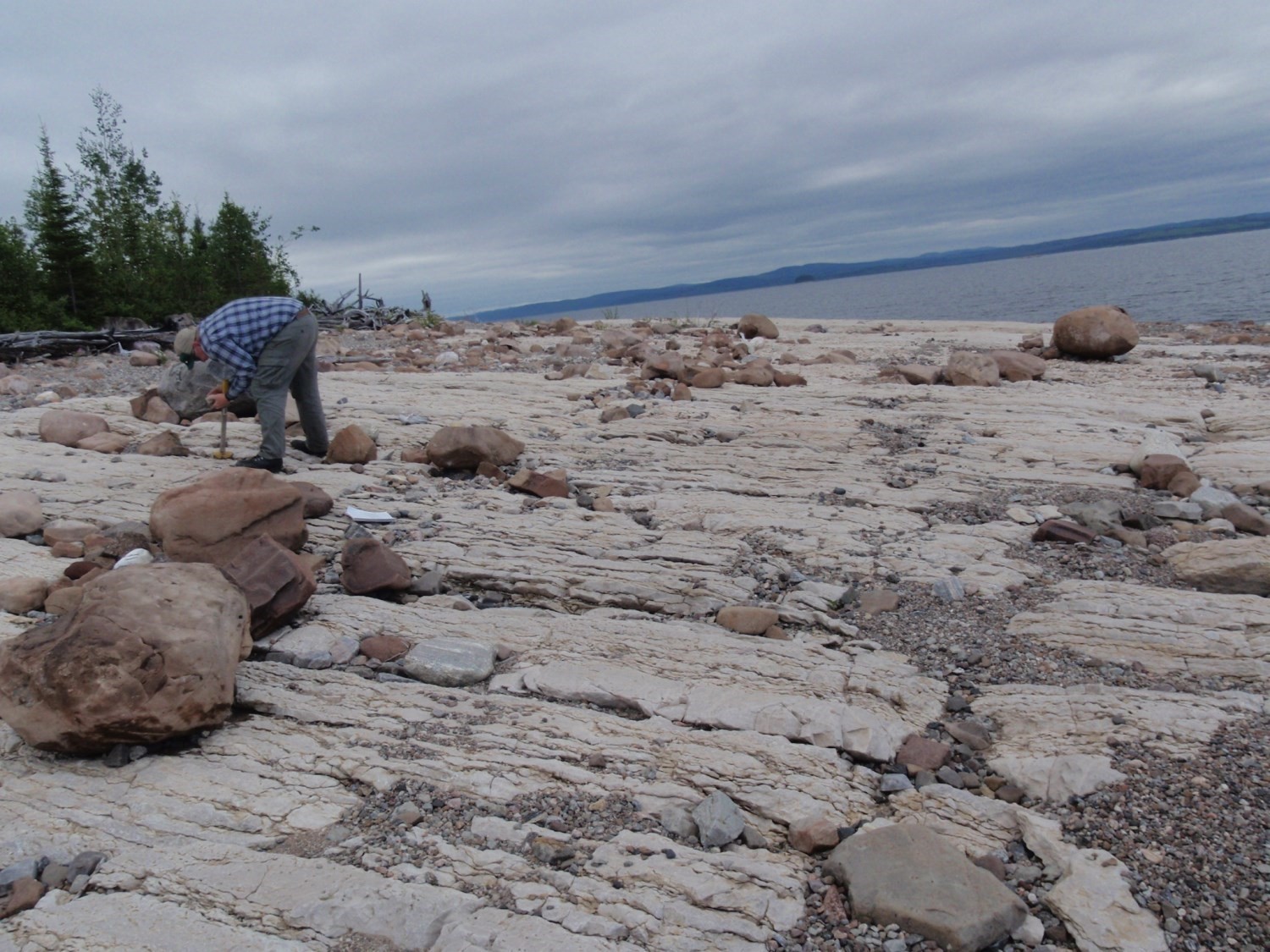
The René-Levasseur Formation consists of limestone beds dipping to the SE and slightly deformed (Moukhsil et al., 2013). Most outcrops consist of fossiliferous grey limestone with thin grey argillaceous beds (Murtaugh, 1976; Moukhsil et al., 2017; MNRF, 2009a, b; Moukhsil and Solgadi, 2011a, b; Bilodeau and Mathieu, 2016). According to Moukhsil et al. (2013): “The most spectacular outcrop […] consists of a grey limestone bed (2-3 m thick) and a greyish to whitish bed (3-4 m thick), locally characterized by its varied fossil content.” Basal beds of the formation, millimetres to centimetres when exposed, consist of red siltstone and green fissile shale (Murtaugh, 1976).
Thickness and distribution
Limestone outcrops of the René-Levasseur Formation are isolated and mainly located on the inner banks of the Manicouagan Reservoir. Currently, outcrops on the east side of the René-Levasseur Island (sheets 22N08 and 22N09) are below water level, only those on the south and east sides of the island (sheets 22N02, 22N03 and 22N06) can be observed. They are <5 km long and have a maximum thickness of ~25 m (Murtaugh, 1976).
Dating
None.
Stratigraphic Relationship(s)
Ordovician rocks of the René-Levasseur Formation unconformably lie on Precambrian bedrock. They also occur as inclusions in overlying Triassic breccia and igneous rocks (Murtaugh, 1976).
Paleontology
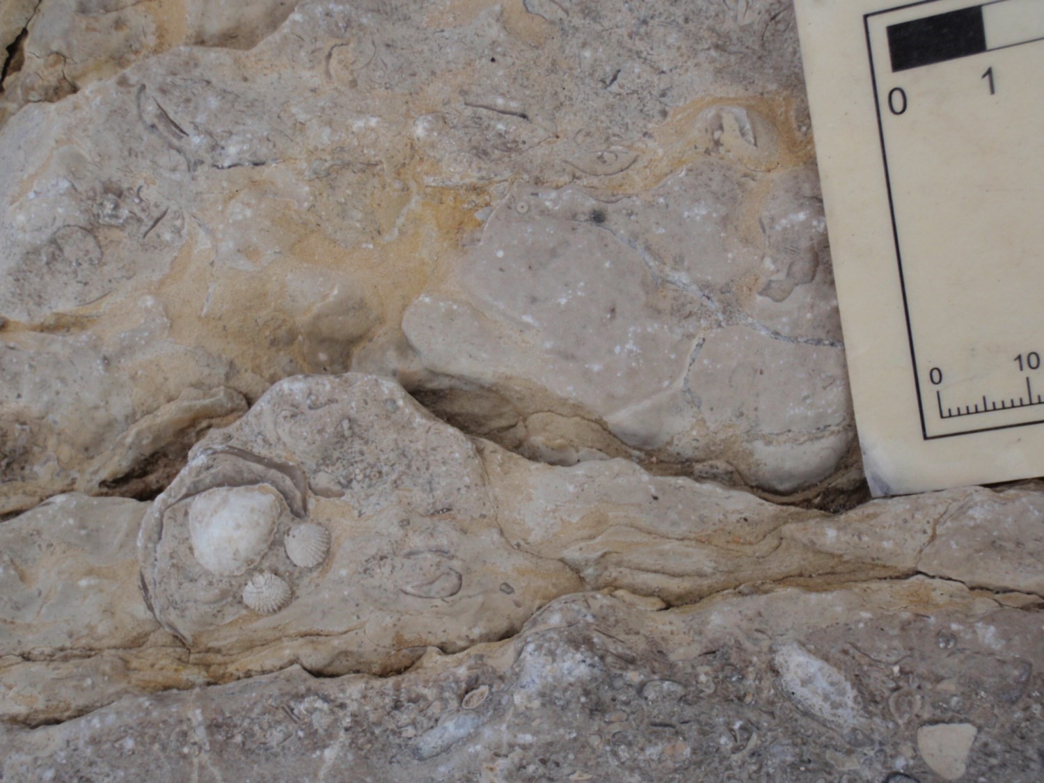
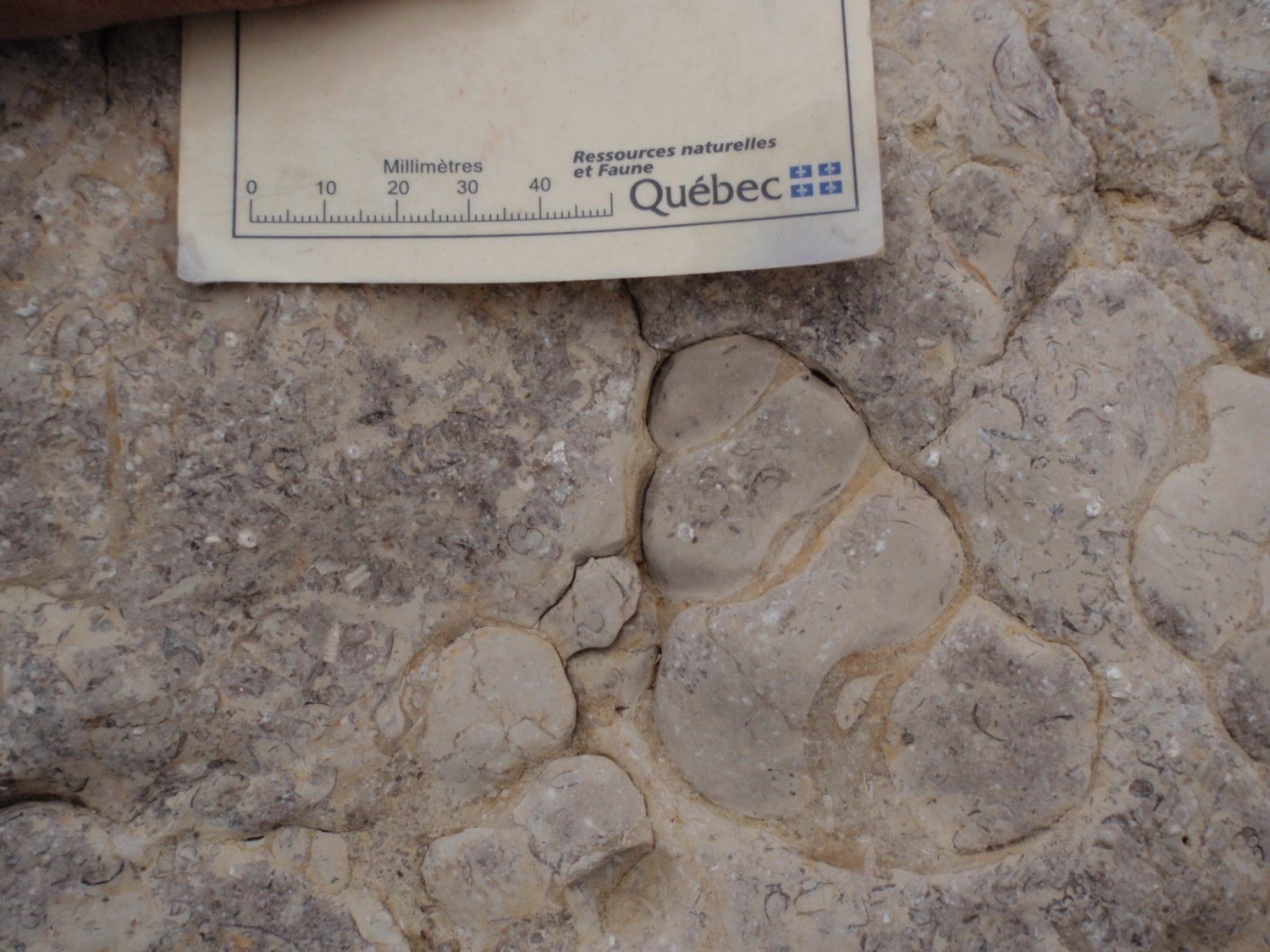
Several fossils (bivalves, orthoceras and gasteropods) and worm bioturbations are visible in limestone beds (Moukhsil et al., 2013). Kish (1968) recognized al least 12 species and described the following assemblages: Receptaculites, Streptelasma, Diplogratus, Hormotoma, Lophospira, Trochonema, Maclurites, Vaginoceras, Ephipiorthoceras, Westonoceras, Isotelus, Cryptophragmus, crinoid fragments and bryozoa. Kish (1968) and Clark (1972) concluded that this fossil wealth was characteristic of the Middle Ordovician.
References
Publications Available Through SIGÉOM Examine
BILODEAU, C., MATHIEU, G. 2016. GEOLOGIE – PARTIE NORD-OUEST DU RESERVOIR MANICOUAGAN. MERN. CG-2016-06, 1 plan.
CLARK, T H. 1972. REGION DE MONTREAL. MRN. RG 152, 260 pages and 1 plan.
KISH, L. 1962. PRELIMINARY REPORT ON LOWER HART-JAUNE RIVER AREA, SAGUENAY COUNTY. MRN. RP 486(A), 10 pages et 1 plan.
KISH, L. 1962. RAPPORT PRELIMINAIRE SUR LA REGION DE LA RIVIERE HART-JAUNE INFERIEURE, COMTE DE SAGUENAY. MRN. RP 486, 12 pages and 1 plan.
KISH, L. 1968. HART-JAUNE RIVER AREA, SAGUENAY COUNTY. MRN. RG 132(A), 107 pages et 1 plan.
KISH, L. 1968. REGION DE LA RIVIERE HART-JAUNE, COMTE DE SAGUENAY. MRN. RG 132, 113 pages and 1 plan.
MOUKHSIL, A., SOLGADI, F. 2011a. GEOLOGIE 1/50 000 – LAC LACOSTE. MRNF. CG-22N02-2011-01, 1 plan.
MOUKHSIL, A., SOLGADI, F. 2011b. GEOLOGIE 1/50 000 – LAC TETEPISCA. MRNF. CG-22N03-2011-01, 1 plan.
MOUKHSIL, A., SOLGADI, F., CLARK, T., BLOUIN, S., INDARES, A., DAVIS, D W. 2013. GEOLOGIE DU NORD-OUEST DE LA REGION DU BARRAGE DANIEL-JOHNSON (MANIC 5), COTE-NORD. MRN, UQAT, URSTM, UNIVERSITE MEMORIAL DE TERRE-NEUVE-ET-LABRADOR. RG 2013-01, 46 pages and 1 plan.
MOUKHSIL, A., SOLGADI, F., JANNIN, S., GERVAIS, F., CROWLEY, J L., AUGLAND, L E., INDARES, A., LETOURNEAU, M., DUNNING, G., CLARK, T., GOBEIL, A., OHNENSTETTER, D., LAMOTHE, D., INTISSAR, R., BENAHMED, S., GROULIER, P A. 2017. GEOLOGIE, POTENTIEL MINERAL ET CADRE GEODYNAMIQUE DES ROCHES DE LA REGION DU RESERVOIR DANIEL-JOHNSON (MANICOUAGAN), PARTIE CENTRALE DE LA PROVINCE DE GRENVILLE. MRN. MM 2017-01, 307 pages and 1 plan.
MRNF 2009a. GEOLOGIE 1/50 000, 22N02 – LAC LACOSTE. In : MRNF. 2010. CARTE(S) GÉOLOGIQUE(S) DU SIGEOM – feuillet 22n. CG SIGEOM22N, 16 plans.
MRNF 2009b. GEOLOGIE 1/50 000, 22N06 – RIVIÈRE UTISHKU. In : MRNF. 2010. CARTE(S) GÉOLOGIQUE(S) DU SIGEOM – feuillet 22n. CG SIGEOM22N, 16 plans.
MURTAUGH, J G. 1976. MANICOUAGAN IMPACT STRUCTURE AREA ( SAGUENAY COUNTY). MRN. DPV 432, 194 pages and 1 plan.
MURTAUGH, J C., CURRIE, K L. 1969. ETUDE PRELIMINAIRE DE LA STRUCTURE DE MANICOUAGAN. MRN. RP 583, 16 pages and 1 plan.
MURTAUGH, J C., CURRIE, K L. 1969. PRELIMINARY STUDY OF MANICOUAGAN STRUCTURE. MRN. RP 583(A), 11 pages et 1 plan.