DISCLAIMER: This English version is translated from the original French. In case of any discrepancy, the French version shall prevail.
| Author: | Clark, 1959; Clark and Globensky, 1976 |
| Age: | Middle Ordovician |
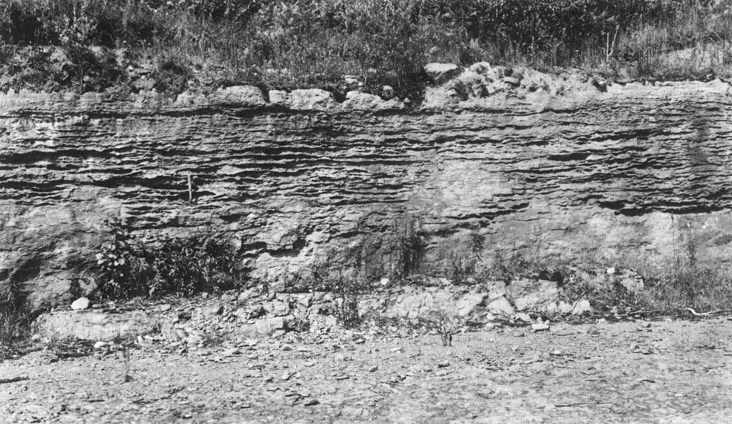
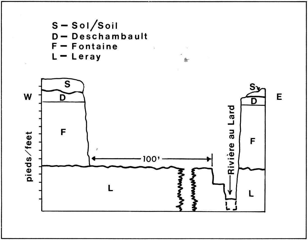
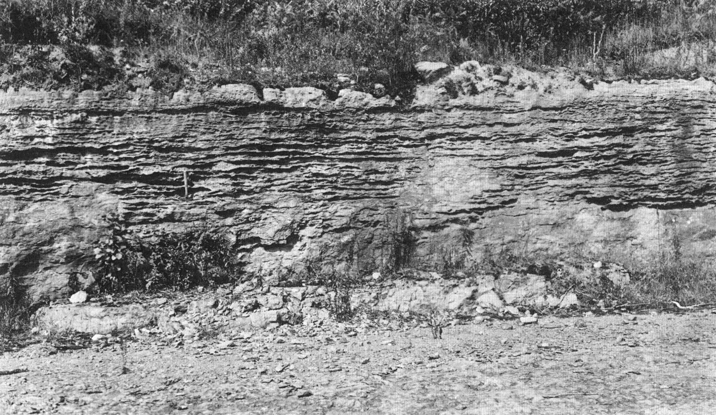
| Stratotype: | Type section at the Fontaine Quarry, on the Lard River (Clark and Globensky, 1976) |
| Type area: | Area north of Trois-Rivières (NE corner of NTS sheet 31I07) |
| Geological province: | St. Lawrence Platform |
| Geological subdivision: | St. Lawrence Lowlands Platform |
| Lithology: | Limestone, argillaceous material |
| Category: | Lithostratigraphic |
| Rank: | Formation |
| Status: | Formal |
| Use: | Active |
- Trenton Group
- Tétreauville Formation
- Montréal Formation
- Neuville Formation
- Deschambault Formation
- Hull Formation
- Saint-Marc Formation
- Ouareau Formation
- Fontaine Formation
- Pont-Rouge Formation
- Mile End Formation
- Sainte-Anne Formation
- Galets Formation
- Shipshaw Formation
- Simard Formation
- Tremblay Formation
- René-Levasseur Formation
Background
The Fontaine Formation is mentioned by Clark (1959), but its detailed description is by Clark and Globensky (1976). The name refers to the Fontaine Quarry, along the Lard River, where the type section was described (NE corner of sheet 31I07).
Description
According to Clark and Globensky (1976): The Fontaine Formation “consists of dark crystalline limestone, finely bedded and generally fine-grained. It includes a lot of argillaceous material, either in laminated beds or in irregular networks of veinlets cutting limestone. These argillaceous beds are very rich in bryozoans and inarticulate brachiopod debris. At the Fontaine Quarry and upstream, most of the formation consists of alternating bryozoan-rich beds (in which bryozoans are found in a flattened network of dark siliceous material) and dark bituminous limestone altering to blue and, in places, discreetly crystalline.”
Thickness and distribution
At the type section of the Fontaine Quarry, located along the Lard River north of Trois-Rivières, the Fontaine Formation reaches 2.5 m for over 800 m (Clark and Globensky, 1976). Just north of the Fontaine Quarry, the formation forms a thin band (~300 m wide) slightly curved extending almost 35 km between the Saint-Prosper Fault, to the east and Saint-Cuthbert Fault, to the west (north of sheet 31I07 and SW corner of sheet 31I09) (MNRF, 2009a, b; Thériault, 2014).
Dating
None.
Stratigraphic Relationship(s)
The Ouareau, Fontaine, Pont-Rouge and Sainte-Anne formations occupy the same stratigraphic level, between the underlying Black River Group and the Deschambault Formation (Clark and Globensky, 1976; Globensky, 1987, 1993). Their lithology is different, but they contain fauna belonging to the Trenton and Black River groups. The Fontaine Formation is equivalent to the Rockland Formation in the Ottawa area.
Paleontology
Although this formation occupies the same stratigraphic level as the Ouareau Formation, Husain (1955) observed a marked difference in the bryozoan variety encountered within each of these two formations. Fossils of the Fontaine Formation include: Prasopora sp., Arthroclema sp., Arthrostylus obliques, Bumastus miIleri, Dinorthis browni et Receptaculites sp. (Clark and Globensky, 1976; Globensky, 1993).
References
Publications Available Through SIGÉOM Examine
CLARK, T H., GLOBENSKY, Y. 1976. REGION DE TROIS-RIVIERES. MRN. RG 164, 94 pages and 1 plan.
GLOBENSKY, Y. 1987. GEOLOGIE DES BASSES-TERRES DU SAINT-LAURENT. MRN. MM 85-02, 71 pages and 1 plan.
GLOBENSKY, Y. 1993. LEXIQUE STRATIGRAPHIQUE CANADIEN – VOLUME V-B – REGION DES APPALACHES, DES BASSES-TERRES DU SAINT-LAURENT ET DES ILES DE LA MADELEINE. MRN. DV 91-23, 336 pages.
MRNF 2009a. COMPILATION GÉOLOGIQUE, 31I07 – TROIS-RIVIERES. In : MRNF. 2010. CARTE(S) GÉOLOGIQUE(S) DU SIGEOM – feuillet 31i. CG SIGEOM31M, 16 plans.
MRNF 2009b. COMPILATION GÉOLOGIQUE, 31I10 – SHAWINIGAN. In : MRNF. 2010. CARTE(S) GÉOLOGIQUE(S) DU SIGEOM – feuillet 31i. CG SIGEOM31M, 16 plans.
THERIAULT, R. 2014. GEOLOGIE DES BASSES-TERRES DU SAINT-LAURENT. MERN. DV 2014-05, 1 plan.
Other Publications
CLARK, T.H. 1959. Stratigraphy of the Trenton Group, St. Lawrence Lowlands, Quebec. Geological Association of Canada; proceedings 1959, pages 13-21.
HARLAND, T.L., PICKERILL, R.K. 1982. A review of Middle Ordovician sedimentation in the St. Lawrence Lowland, eastern Canada. Geological Journal; volume 17, pages 135-156. https://doi.org/10.1002/gj.3350170205
HUSAIN, B.R., 1955. Semi-microfossils of the Black River and Trenton Groups of Quebec. Doctoral thesis, Université McGill, Montréal, 429 pages.


