


Last modified:
Translation of original French
| Author: | Allard and Caty, 1969 |
| Age: | Neoarchean |
| Reference section: | A good example of anorthosite sensu stricto can be observed along Road 113 towards the Chapais Airport. The milky white colour and homogeneous grain size of the rock make it difficult to observe plagioclase cumulates, but these are distinguished by their large size (≤20 cm) and Carlsbad twinning (UTM NAD83, Zone 18: 539936 m E, 5518176 m N). |
| Type area: | The anorthositic zone is very well exposed along Campbell Route and Portage Island Route, north of Chibougamau Lake (northern section of NTS sheet 32G16). |
| Geological province: | Superior Province |
| Geological subdivision: | Abitibi Subprovince |
| Lithology: | Gabbro, anorthosite |
| Type: | Lithodemic |
| Rank: | Lithodeme |
| Status: | Informal |
| Use: | Active |
Background
The unit was originally named “anorthosite zone” by Allard and Caty (1969) and subsequently “anorthositic zone” by Allard (1976). It was first included in the “Lower Series” by Daigneault and Allard (1990); it now constitutes an informal lithodeme within the Lac Doré Lower Unit (Leclerc et al., 2017).
Description
According to Leclerc et al. (2017, pp. 22–23):
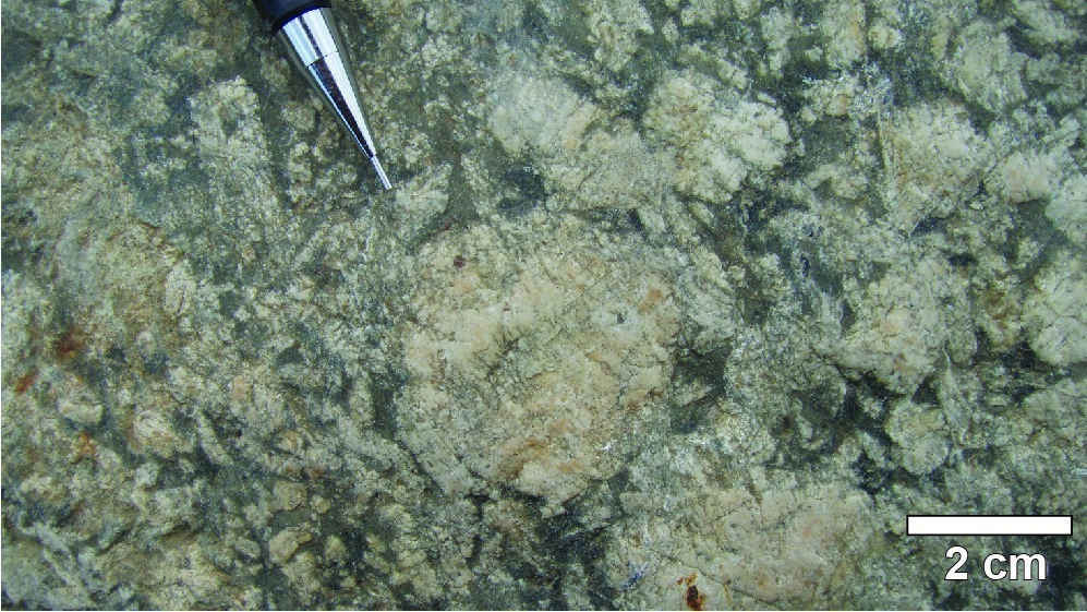
“The anorthositic zone is the main part of the Lac Doré Lower Unit. It includes a variety of rocks that gradually transition from anorthosite to gabbro, which has fostered the emergence in the local community of geologists of terms such as “gabbroic anorthosite” and “anorthositic gabbro”. Anorthosite sensu stricto is rather sparse in the anorthositic zone. Elsewhere in the area, anorthosite may also be medium grained and light brown to light grey in patina, making crystal identification difficult. Gabbroic “anorthosite” is a local term for a coarse-grained leucocratic gabbro. The cumulate phase consists of white to beige plagioclase crystals (50-70%) ranging from a few millimetres to 4 cm, while the intercumulate phase consists of clinopyroxene and orthopyroxene altered to chlorite and actinolite. Secondary titanite is locally present in significant amounts. The term anorthositic “gabbro” is used locally to refer to a leucocratic to mesocratic subophitic gabbro. This gabbro is characterized by fine to medium grain size and equivalent proportions of plagioclase and pyroxenes. Gabbro strictly speaking is the most melanocratic lithology of the anorthositic zone. In the Portage Island area, gabbro is dark green and fine grained. Its typically high titanite content distinguishes it from comagmatic gabbro sills within the Roy Group. All units in the anorthositic zone have local layering.”
Thickness and Distribution
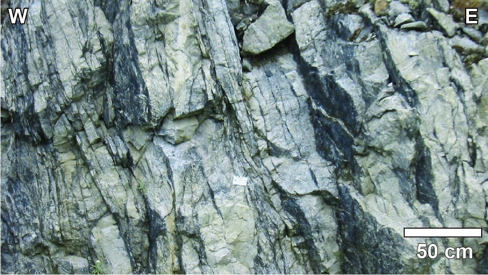
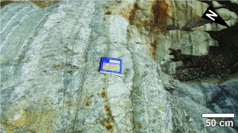
The anorthositic zone has been identified on the northern flank of the Chibougamau Anticline for a distance of >53 km. On the southern flank of the anticline, the anorthositic zone outcrops for >42 km. The thickness is estimated between 2500 m and 3600 m (Daigneault and Allard, 1990).
Dating
None.
Stratigraphic Relationship(s)
Rocks of the anorthositic zone cut volcanic rocks of the Obatogamau and Waconichi formations (Roy Group’s first volcanic cycle). They are overlain by rocks of the Lac Doré Layered Unit and intruded by the Chibougamau Pluton. They are also cut by a granodiorite unit in the Grenville Front transitional zone (Bandyayera et al., 2005).
Paleontology
Does not apply.
References
| Author(s) | Title | Year of Publication | Hyperlink (EXAMINE or Other) |
|---|---|---|---|
| ALLARD, G.O. | Doré Lake Complex and its importance to Chibougamau geology and metallogeny. Ministère des Richesses naturelles, Québec; 486 pages, 2 plans. | 1976 | DPV 368 |
| ALLARD, G.-O. – CATY, J.-L. | Géologie du Quart nord-est et d’une partie du Quart sud-est du canton de Lemoine, comtés d’Abitibi-Est et de Roberval. Ministère des Richesses naturelles, Québec; 25 pages, 1 plan. | 1969 | RP 566 |
| BANDYAYERA, D. – CADÉRON, S. – HOULE, P. – SHARMA, K.N.M. | Géologie de la région du lac Mitchisso (SNRC 32H13). Ministère des Ressources naturelles et de la Faune, Québec; 12 pages, 4 plans. | 2005 | RP 2005-04 |
| DAIGNEAULT, R. – ALLARD, G.O. | Le Complexe du lac Doré et son environnement géologique (région de Chibougamau – Sous-province de l’Abitibi). Ministère de l’Énergie et des Ressources, Québec; 290 pages. | 1990 | MM 89-03 |
| LECLERC, F. – ROY, P. – HOULE, P. – PILOTE, P. – BÉDARD, J.H. – HARRIS, L.B. – McNICOLL, V.J. – VAN BREEMEN, O. – DAVID, J. – GOULET, N. | Géologie de la région de Chibougamau. Ministère de l’Énergie et des Ressources naturelles, Québec; 97 pages, 6 plans. | 2017 | RG 2015-03 |