


Last modified:
Translation of original French
| Author: | Allard, 1976 |
| Age: | Neoarchean |
| Reference section: | None |
| Type area: | The ferrodiorite zone occupies primarily the axial part of the Lac Caché Syncline, and outcrops along Road 167 west of Caché Lake (SW of NTS sheet 32G16). |
| Geological province: | Superior Province |
| Geological subdivision: | Abitibi Subprovince |
| Lithology: | Mafic to ultramafic intrusive rocks |
| Type: | Lithodemic |
| Rank: | Lithodeme |
| Status: | Informal |
| Use: | Active |
Background
The ferrodiorite zone, established by Allard (1976), was originally included as a subdivision of the « Layered Series » by Daigneault and Allard (1990). It is now designated as an informal lithodeme of the Lac Doré Layered Unit (Leclerc et al., 2017).
Description
According to Leclerc et al. (2017, p. 23):
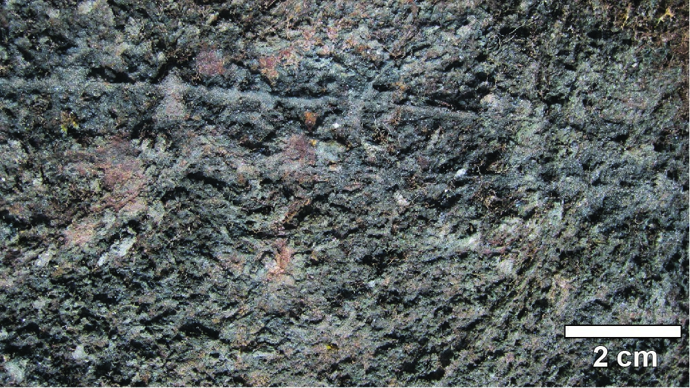
“The ferrodiorite zone consists of ferrodiorite, ferrogabbro and ferropyroxenite. Outcrops visited along Road 167, west of Caché Lake, expose dark grey, medium-grained ferrogabbro that is magnetic, brecciated and intruded by a grey to white pegmatite from the Chibougamau Pluton. A detailed study of the ferrodiorite zone by Baskin (1975) suggests the subdivision into subzones F1, F2 and F3. Ferrogabbros, ferropyroxenites, ferroperidotites and ferrodiorites of subzone F1 are grey to dark green, and display a cumulate structure, magmatic foliation and local rhythmic layering (Daignault and Allard, 1990). Subzone F2 consists of fine-grained plagioclase-pyroxene ferrodiorites and ferronorites, while subzone F3 is very similar to subzone F1 (Daigneault and Allard, 1990).”
Thickness and Distribution
The ferrodiorite zone occupies the axial part of the Lac Caché Syncline, an open P1 fold moderately dipping towards the NW (Daigneault, 1991).
Dating
None.
Stratigraphic Relationship(s)
In the Caché Lake area, the ferrodiorite zone gradually replaces the layered zone and is overlain by the granophyric zone (Daigneault and Allard, 1990). In the Clark Lake area, it occurs between the anorthositic zone and the border zone.
Paleontology
Does not apply.
References
| Author(s) | Title | Year of Publication | Hyperlink (EXAMINE or Other) |
|---|---|---|---|
| ALLARD, G.O. | The geology of a portion of McKenzie Township, Chibougamau District, Quebec. John Hopkins University; thèse de doctorat, 168 pages. | 1956 | – |
| ALLARD, G.O. | Doré Lake Complex and its importance to Chibougamau geology and metallogeny. Ministère des Richesses naturelles, Québec; 486 pages, 2 plans. | 1976 | DPV 368 |
| BASKIN, G.D. | The petrology and chemistry of a portion of the North limb of the Dore Lake Complex, Chibougamau, Quebec, Canada. Université Georgia; thèse de maîtrise, 180 pages. |
1975 | – |
| DAIGNEAULT, R. – ALLARD, G.O. | Le Complexe du lac Doré et son environnement géologique (région de Chibougamau – Sous-province de l’Abitibi). Ministère de l’Énergie et des Ressources, Québec; 290 pages. | 1990 | MM 89-03 |
| DAIGNEAULT, R. | Évolution structurale du segment de roches vertes de Chibougamau, Sous-province archéenne de l’Abitibi, Québec. Université Laval; thèse de doctorat, 352 pages. | 1991 | – |
| LECLERC, F. – ROY, P. – HOULE, P. – PILOTE, P. – BÉDARD, J.H. – HARRIS, L.B. – McNICOLL, V.J., VAN BREEMEN, O. – DAVID, J. – GOULET, N. | Géologie de la région de Chibougamau. Ministère de l’Énergie et des Ressources naturelles, Québec; 97 pages, 6 plans. | 2017 | RG 2015-03 |
| MINISTÈRE DE L’ÉNERGIE ET DES RESSOURCES (MER) | Code stratigraphique nord-américain. Ministère de l’Énergie et des Ressources, Québec; 76 pages. | 1986 | DV 86-02 |
| NORTH AMERICAN STRATIGRAPHIC COMMISSION ON STRATIGRAPHIC NOMENCLATURE (NASC) | North American Stratigraphic Code. AAPG Bulletin; volume 29, pages 1547-1591. | 2005 | Source |