

Last modified: 14 June 2019
Translation of original French
| Author: | Imreh, 1984 |
| Age: | Neoarchean |
| Reference section: | None |
| Type area: | Various volcanic units belonging to this formation are located in NTS sheets 32D08 and 32C05. However, the most representative outcrops are located on forest roads of sheet 32C05. |
| Geological province: | Superior Province |
| Geological subdivision: | Abitibi Subprovince |
| Lithology: | Volcanic and volcano-sedimentary rocks |
| Type: | Lithostratigraphic |
| Rank: | Formation |
| Status: | Formal |
| Use: | Active |
None
Background
Sharpe (1961) was one of the first to describe these volcanic lithologies during regional mapping, but did not assign them to any particular formation. Imreh (1984) had grouped these and other lithologies under the name “Harricana Group”. This group, which at the time included the Landrienne Formation, as well as the Lower Figuery and Higher Figuery formations (now Figuery Group), was the stratigraphic roof of the Héva-Nord Formation (now the Lanaudière Formation). Labbé (1999) reused the name “Landrienne Formation” but gave it a smaller area. Pilote (2017) mapped the following units in the area west of Barraute: nAla1, nAla2, nAla5, nAla7, nAla10, nAla11, nAla12, nAla13, nAla14 and nAla15. The other units are described below based on the work of Sharpe (1961) and McDougall (1965), as well as mapping compilations of the Ministère (MNRF, 2010).
It is important to note that units nAla3, nAla4 and nAla6 have been abandoned. In fact, trachyte of unit nAla3, originally described in the NE portion of sheet 32C05 by Beullac (1986), was reassigned to units nAla1 and nAla2. In addition, andesitic volcanics of unit nAla4, originally described in the NE portion of sheet 32C05 by Beullac (1986), were reassigned to unit nAla1. Lastly, undifferentiated volcanics of unit nAla6, described very broadly and shortly by McDougall (1965) and Beullac (1986) in the NE quarter of sheet 32C05, were reassigned to units nAla2 and nAla10.
Description
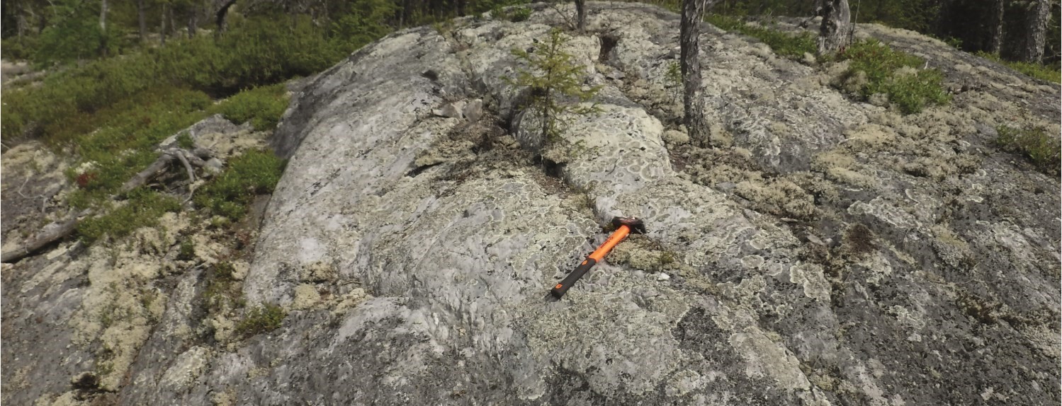
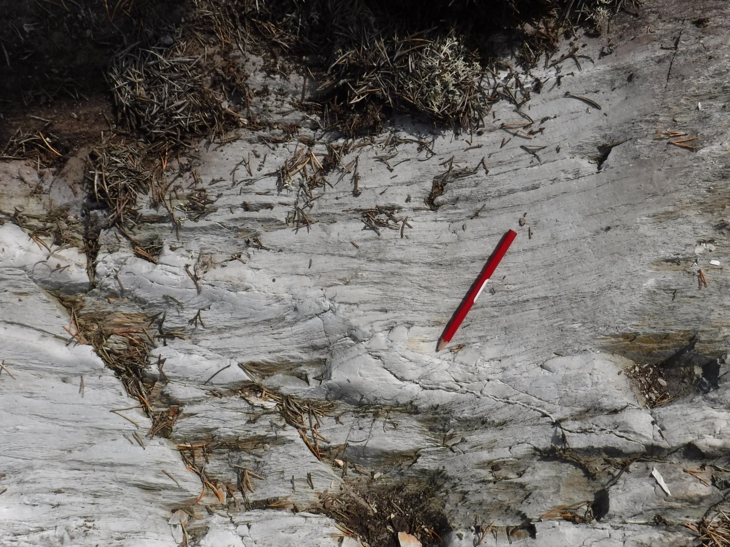
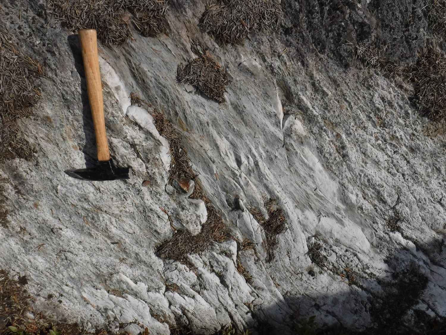
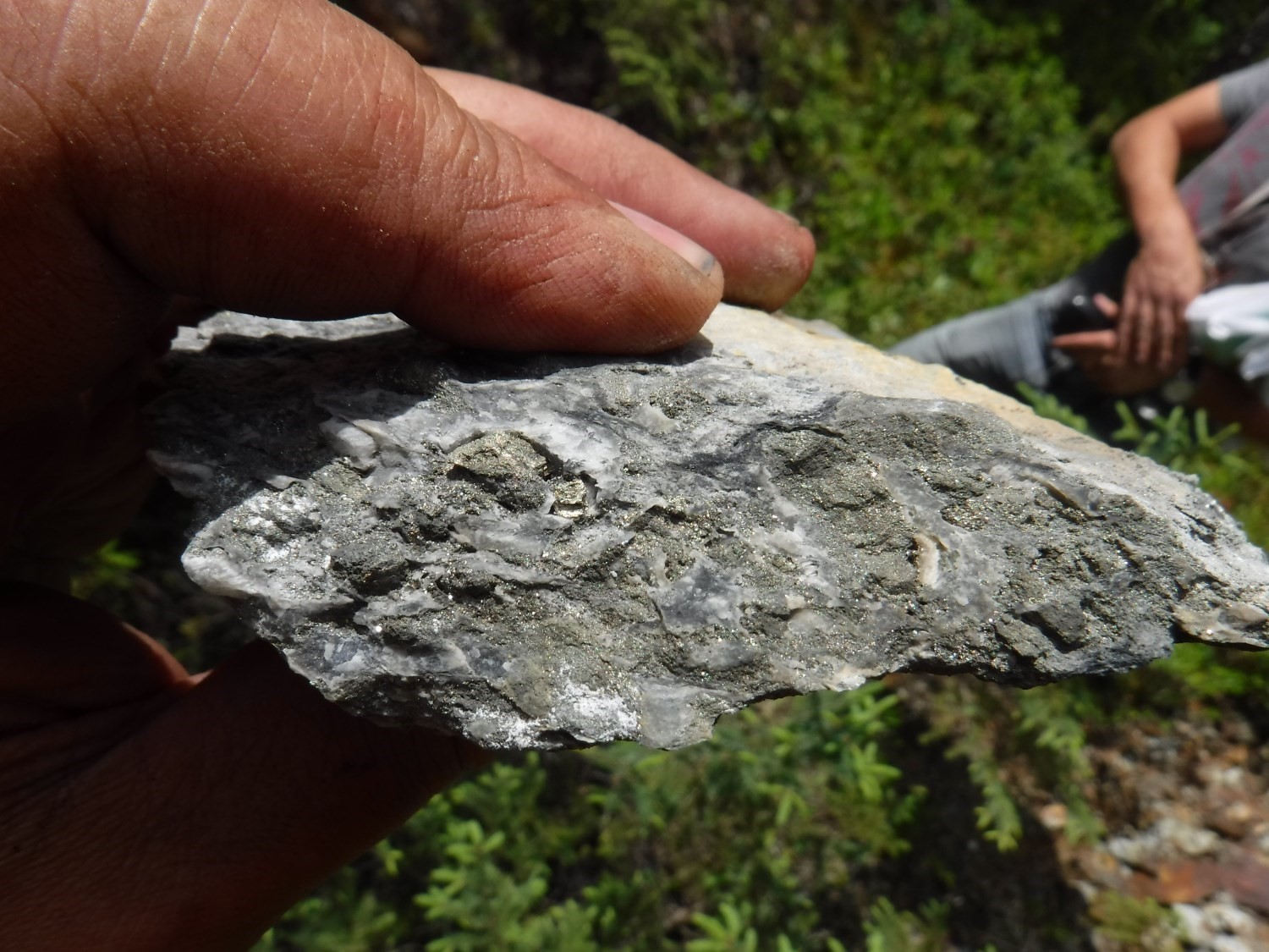
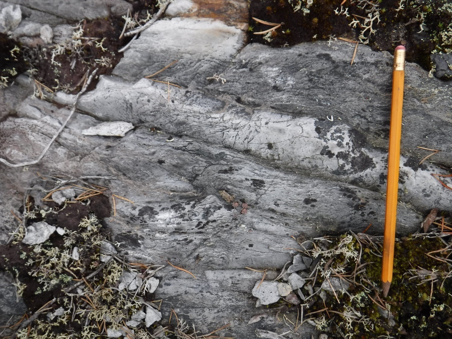
The Landrienne Formation is characterized by the preponderance of chloritic basalt, occasionally with magnetite, arranged in massive, pillowed and brecciated flows, as well as large and voluminous dacitic to rhyolitic flows of tholeiitic affinity. East of the Harricana River, massive and pillow basaltic horizons predominate, accompanied by brecciated flows. Gabbroic sills are common.
Landrienne Formation 1 (nAla1): Chlorite-Epidote Massive Pillow Basalt


It is the most commonly encountered unit in surrounding areas of Barraute. It has an E-W orientation, a dip varying from 35 to 50° north and reverse polarities. The unit consists of basaltic (very locally andesitic) greenish flows, plagioclase porphyritic, massive and pillowed (McDougall 1965; Beullac 1983). These flows are locally heavily deformed and sheared. In the vicinity of synvolcanic tonalitic intrusions, volcanics were silicified and carbonatized, while in the western and NW parts of the Barraute area, they were amphibolized near various intrusive units associated with the La Corne Batholith.
Landrienne Formation 2 (nAla2): Basalt, Magnetite-Chlorite-Epidote Basaltic Tuff, Gabbro
Unit nAla2 consists of thin volcanic and volcaniclastic mafic horizons having strong magnetic susceptibility. They are widespread over the entire area of the Landrienne Formation and define several large folds interpreted from their folded trajectory, visible on aeromagnetic surveys (Geological Survey of Canada et al., 2009).
Landrienne Formation 5 (nAla5): Volcanics and Felsic Volcaniclastics, Fine-Grained Graphitic Mudrock
Unit nAla5 consists of massive, lobed and fragmented dacitic to rhyolitic flows of tholeiitic affinity. With a maximum thickness of one kilometre, this unit extends over 20 km in an E-W orientation in the northern portion of sheet 32C05-200-0201 and NE portion of sheet 32D08-200-0202. In the NW portion of sheet 32C05-200-02020, this unit extends just over 7 km in an ENE-WSW orientation. Other smaller horizons of this unit continue towards the SW. Unit nAla5 hosts the Projet 70-Landome mineralized zone.
Landrienne Formation 7 (nAla7): Sandstone, Graphitic and Pyritic Turbiditic Mudrock, Black Claystone
Unit nAla7 consists of thin sedimentary horizons ranging in thickness from 20 to 60 m. These are relatively present along stratification and arranged within unit nAla11.
Landrienne Formation 8 (nAla8): Intermediate Lapilli and Block Tuff
Unit nAla8 consists of a thin horizon oriented NE-SW, 2.5 km long by 50 to 100 m wide. It is located at the SW end of the Landrienne Formation on the north side of Tiblemont Lake (sheet 32C06).
Landrienne Formation 9 (nAla9): Mafic Tuff
Unit nAla9 consists of three horizons of mafic tuff interbedded in chlorite-epidote basalt (nAla1) horizons. It extends over 1.5 km in a NW-SE direction west of Courville Lake (sheet 32C06).
Landrienne Formation 10 (nAla10): Dacite, Rhyodacite and Rhyolite
 This unit is located in the southern half of unit nAla5. The largest flow, located in the centre of sheet 32C05-200-0202, follows the general NE-SW orientation of flows in the area west of Barraute.
Landrienne Formation 11 (nAla11): Felsic Lapilli and Block Tuff
This fragmentary unit is located on the south side of unit nAla5, at its interpreted stratigraphic summit.
Landrienne Formation 12 (nAla12): Felsic Crystal and Lapilli Tuff
Unit nAla12 consists of a fragmentary unit located on the north side of unit nAla5, towards its interpreted stratigraphic base.
Landrienne Formation 13 (nAla13): Magnetite Sandstone and Wacke
Unit nAla13 consists of thin sedimentary horizons, ranging in thickness from 5 to 30 m, within the nAla5 unit.
Landrienne Formation 14 (nAla14): Semi-Massive to Massive Sulphides
Unit nAla14 was primarily recognized in drilling in the vicinity of the Marcoland and Projet 70-Landome mineralized zones, more precisely on the edge of unit nAla5, in the NW quarter of sheet 32C05.
Landrienne Formation 15 (nAla15): Volcanics and Felsic Volcaniclastics, Graphitic Mudrock
Unit nAla15 is located in the south-central part of unit nAla5. It consists of massive rhyolitic to dacitic volcanics, block, lapilli and crystal tuffs, as well as thin horizons of graphitic mudrock of limited extent, less than a few hundred metres. Unit nAla15 hosts the Marcoland mineralized zone.
Thickness and Distribution
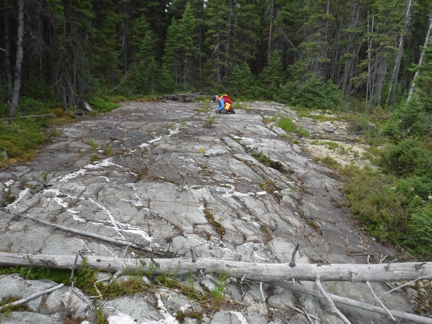
The Landrienne Formation is located in the middle of the Barraute area and appears intensely folded. Its actual thickness is difficult to estimate due to the many folds observed and interpreted (Geological Survey of Canada et al., 2008). It is in contact with the Deguisier Formation in the north and the Lanaudière Formation in the south. Some lithologies are less severely folded, particularly those on the north and south edges of the formation. These units continue west in sheet 32C05-200-0201 and east in sheet 32C06-200-201.
Dating
Felsic volcaniclastics were dated 2727 ±2 Ma (Labbé, 1999). This age is 8 to 10 My older than volcanics of the Deguisier and Lanaudière formations, immediately adjacent to the north and south.
| Isotopic System | Mineral | Crystallization Age (Ma) | (+) | (-) | Sample Number | Reference(s) |
| U-Pb | Zircon | 2727 | 2 | 2 | AB-91-3 | Labbé, 1999 |
Stratigraphic Relationship(s)
The Landrienne Formation occupies a particular geometric situation in sheets 32D08, 32C05 and 32C06. It is in regional-fault contact with volcanics from neighbouring formations, with which it shows a gap in age of almost 10 Ma, which accentuates the importance of these faults. This formation is located in the heart of the Manneville Thrust Zone. Regional schistosity and stratification are subparallel and slightly inclined northward, with angles ranging from 30º to 45°. This formation has a particular structural style involving many synform and antiform folds. Such folds are absent from the formations immediately adjacent to the north and south. These observations raise the hypothesis that this formation represents a tectonic slice carried in the Manneville Thrust Zone.
Paleontology
Does not apply.
References
| Author(s) | Title | Year of Publication | Hyperlink (EXAMINE or Other) |
|---|---|---|---|
| GEOLOGICAL SURVEY OF CANADA – MINES D’OR VIRGINIA INC. – NORANDA EXPLORATION | Cartes géophysiques couleur Mégatem – 32C05. Ministère de l’Énergie et des Ressources naturelles, Québec; DP 2008-06, 5 pages, 4 cartes. | 2009 | DP 2008-06 |
| MRNF | Cartes géologiques du SIGEOM — feuillet 32C. Ministère des Ressources naturelles et de la Faune, Québec; CG SIGEOM32C, 49 plans. | 2010 | CG SIGEOM32C |
| BEULLAC, R. | Région de Barraute-Fiedmont. Ministère des Richesses naturelles, Québec; DP-84-02, 1 plan. | 1983 | DP-84-02 |
| IMREH, L. | Sillon de La Motte-Vassan et son avant-pays méridional : synthèse volcanologique, lithostratigraphique et gîtologique. Ministère de l’Énergie et des Ressources, Québec; MM 82-04, 72 pages. | 1984 | MM 82-04 |
| IMREH, L. | Cartes géologiques préliminaires au 1/15 840 de l’Abitibi-Est méridional — Quart nord-ouest du feuillet SNRC 32C05. Ministère de l’Énergie et des Ressources, Québec; MB 90-39, 18 pages, 2 plans. | 1991 | MB 90-39 |
| LABBÉ, J.-Y. | Évolution stratigraphique et structurale dans la région d’Amos-Barraute. Ministère de l’Énergie et des Ressources naturelles, Québec; ET 98-04, pages 5-18. | 1999 | |
| McDOUGALL, D.J. | Quart sud-est du canton de Barraute, comté d’Abitibi-Est. Ministère des Richesses naturelles, Québec; RG 114, 37 pages, 1 carte. | 1965 | RG 114 |
| SHARPE, J.I. | Rapport préliminaire sur la demie Sud du canton de Figuery et le quart sud-Ouest du canton de Landrienne, comté d’Abitibi-Est. Ministère des Richesses naturelles, Québec; RP 446, 18 pages, 1 carte (échelle 1/24 000). | 1961 | RP 446 |
| PILOTE, P. | Géologie de la région de Barraute ouest, Sous-Province de l’Abitibi, région de l’Abitibi-Témiscamingue, Québec, Canada. Ministère de l’Énergie et des Ressources naturelles, Québec; CG-2017-05, 1 carte. | 2017 | CG-2017-05 |