

Last modified:
Translation of original French
| Author: | Sinclair, 1953 |
| Age: | Upper Ordovician |
| Reference section: | Plourde Quarry (type locality) |
| Type area: | Saguenay area (NTS sheets 22D06 and 22D07) |
| Geological province: | St. Lawrence Platform |
| Geological subdivision: | St. Lawrence Lowlands Platform |
| Lithology: | Limestone, siltstone |
| Type: | Lithostratigraphic |
| Rank: | Formation |
| Status: | Formal |
| Use: | Active |
- Trenton Group
- Tétreauville Formation
- Montréal Formation
- Neuville Formation
- Deschambault Formation
- Hull Formation
- Saint-Marc Formation
- Mile End Formation
- Ouareau Formation
- Fontaine Formation
- Pont-Rouge Formation
- Sainte-Anne Formation
- Galets Formation
- Shipshaw Formation
- Simard Formation
- Tremblay Formation
- René-Levasseur Formation
Background
The Upper Ordovician Simard Formation was introduced by Sinclair (1953) in the Lake Saint-Jean area. This formation belongs to the St. Lawrence Platform, which forms a slice in the Grenville Province. All Ordovician sedimentary rocks in this region were assigned to the Trenton Group by several authors from a chronostratigraphic perspective (e.g., Dresser and Denis, 1946; Sinclair, 1953). Other authors have done so on lithostratigraphic bases (Benoit and Valiquette, 1971; Harland et al., 1985, 1987). Instead, Desbiens and Lespérence (1989) proposed the creation of a new group for these rocks, but did not. Although spatial correlation between these Ordovician rocks in the Lake Saint-Jean area and those of the Trenton Group of the St. Lawrence Platform is not formally established, the Simard Formation is maintained in this group.
Description
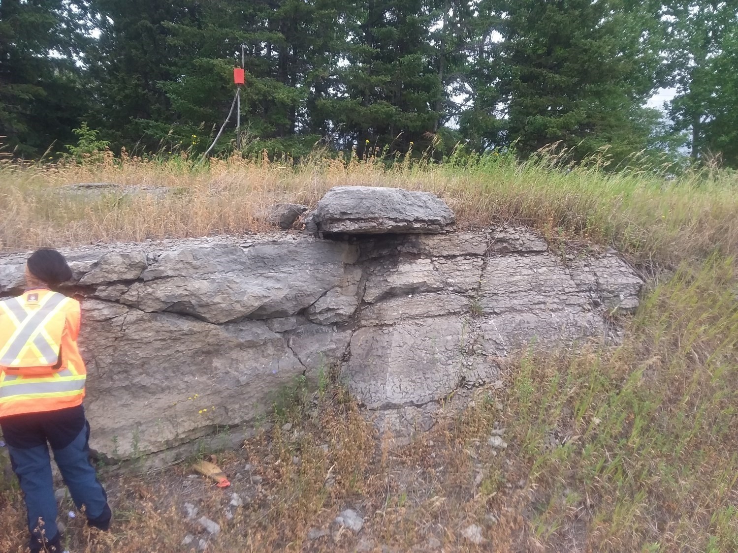
The Simard Formation consists of limestone and siltstone beds. The carbonate facies of this formation represent deposits in a shallow sedimentary basin in a calm or protected marine environment. In the Lake Saint-Jean area, the Shipshaw Formation and the three other related formations (Galets, Shipshaw and Tremblay) cannot be mapped at the 1:50 000 scale because they are generally not more than 50 m thick and subhorizontal (<4° dip). On the geological map of the Saguenay-Lac-Saint-Jean region (sheets 32A08 and 22D), the Trenton Group is hence shown instead of these four related formations. Four separate units, also non-mappable at the 1:50 000 scale, make up the Simard Formation. These units have been recognized throughout the Lake Saint-Jean area and north of Saguenay, except near the village of Mashteuiatsh (Pointe-Bleue) (Desbiens and Lespérence, 1989).
Simard Formation 1 (Ossz1): Calcilutite, Sandstone, Siltstone
Unit Ossz1 consists of alternating centimetric beds, thin and regular, of calcilutite and coarse-grained sandstone (15-20% of beds). These sandstones may be arkosic and/or conglomeratic. These sandstone beds are replaced along the Shipshaw River by argillaceous siltstone beds that contain fragments of crushed fossils. Desbiens and Lespérence (1989) observed two corrosion surfaces in carbonate facies along the Chambord road. The thickness of this unit ranges from 0.4 to 2.3 m in the Plourde quarry.
Simard Formation 2 (Ossz2): Calcilutite, Shale, Limestone
Unit Ossz2 consists of dark grey calcilutite that forms several beds 10 to 30 cm thick. Interstratifications are very thin and consist of dark grey mudshale and limestone. The thickness of this unit ranges from 1.5 m at Chambord to 11.25 m at Rapides des Boucher.
Simard Formation 3 (Ossz3): Calcilutite Locally with Chert Nodules
Unit Ossz3 consists mainly of calcilutite beds containing black chert nodules locally. It is also characterized by the absence of shale beds. Beds are less regular than in underlying units. The thickness of that unit is fairly regular, 10 to 20 cm at the Plourde quarry and 30 cm at Chambord (Desbiens et Lespérence, 1989).
Simard Formation 4 (Ossz4): Various Fossil-Rich Limestones (Wackestone, Packstone, Grainstone)
Unit Ossz4 consists mainly of thick (50 cm) limestone beds. It contains thin, undulating shale beds locally. Limestones are grey to grey-brown in fresh exposure and yellowish brown in altered surface. Limestones consist of wackestone (the most abundant), packstone and grainstone (Desbiens and Lespérence, 1989). Unit Ossz4 is the richest in fossils compared to other units in this formation.
Thickness and distribution
The thickness of the Simard Formation varies from one locality to another. Sinclair (1953) did not define a reference section, but he did define a 19.5 m thick sequence consisting mainly of thick, massive limestone, of which approximately 6.5 m do not outcrop, probably at the Plourde quarry. At the same quarry, Desbiens and Lespérence (1989) reported a minimum thickness of 26.5 m, of which 22 m is observable. At the Pic quarry, the Simard Formation is 4.5 m thick (Desbiens and Lespérence, 1988). It is 17.5 m thick in the Chambord area (Desbiens and Lespérence, 1989).
Dating
None.
Stratigraphic Relationship(s)
The Simard Formation is stratigraphically located between the underlying Tremblay Formation and the overlying Shipshaw Formation (section along Road 169 near Chambord). Contact with the latter can be tracked for approximately 0.5 km along the Shipshaw River, 1 km from Chute-aux-Galets. Contact with the Tremblay Formation can be observed in the Chambord area.
The stratigraphic column shows the pile of the other three formations in relation to the Simard Formation in the section studied by Lavoie and Asselin (1998) in the Chambord area (NE corner of NTS sheet 32A08).
Paleontology
The Simard Formation is rich in fossil fragments, including “arctic-type” fossils such as chitinozoans and metazoans, but also in several species of trilobites (Eobronteus benoratus, Eobronteus sp., Isotelus sp., Ceraurus sp., Amphilichas ottawaensis, Bumastoides sp., Failleana indeterminata, Flexicalymene senaria, Cyphoproetus sp., Borealaspis sp., Ceraurinus marginatus Bar, Achatella achates, Dimeropyge lucifer, Calyptaulax callicephalus, Hemiarges paulianus, Dolichoharpes dentoni et Illaenus americanus). These trilobites are observed in units Ossz2 to Ossz4 (see Table 1 of Desbiens and Lespérence, 1989). Fossil analysis of the Simard Formation indicates an Upper Ordovician age (457 to 454 Ma; Desbiens and Lespérence, 1989). According to these authors, the lower units (Ossz1 to Ossz3) would be Kirkfieldian and the sommital unit (Ossz4) Edenian.
References
Publications available through Sigéom Examine
BENOIT, F W., VALIQUETTE, G. 1971. REGION DU LAC SAINT-JEAN (PARTIE SUD). MRN. RG 140, 29 pages and 5 plans.
DENIS, T C., DRESSER, J A. 1946. LA GEOLOGIE DE QUEBEC – GEOLOGIE DESCRIPTIVE. MRN. RG 020-II, 731 pages and 4 plans.
Other publications
DESBIENS, S., LESPÉRENCE, P. J. 1989. Stratigraphy of the Ordovician of the Lac Saint-Jean and Chicoutimi outliers, Quebec. Canadian Journal of Earth Sciences; volume 26, pages 1185-1202. doi.org/10.1139/e89-101.
HARLAND, T.L., PICKERILLR, K., FILLION, D. 1985. Ordovician intracratonic sediments from the Lac-St-Jean and Chicoutimi areas, Quebec, eastern Canada. Canadian Journal of Earth Sciences; volume 22, pages 240 -255. doi.org/10.1139/e85-021.
HARLANDT, L., PICKERILL, R.K., FILLION, D. 1987. Establishment and development of patch reefs in the intracratonic Ordovician sequence near Chicoutimi, Quebec. Lethaia; volume 20, pages. 189-208. doi.org/10.1111/j.1502-3931.1987.tb02038.
LAVOIE, D., ASSELIN, E. 1998. Upper Ordovician facies in the Lac Saint-Jean outlier, Québec (eastern Canada): palaeoenvironmental significance for Late Ordovician oceanography. Sedimentology; volume 45, pages 817-832. doi.org/10.1046/j.1365-3091.1998.00170.x.
SINCLAIR, G.W. 1953. Middle Ordovician beds in the Saguenay Valley, Québec. American Journal of Sciences; volume 251, pages 841-854. doi.org/10.2475/ajs.251.12.841.