

First published: 23 October 2020
Last modified:
DISCLAIMER: This English version is translated from the original French. In case of any discrepancy, the French version shall prevail.
| Author: | Labbé, 1994, 1999 |
| Age: | Neoarchean |
| Stratotype: | None. Representative outcrops of this sequence are particularly well exposed <3 km north of the town of Amos (outcrop 93-JY-248), as well as along logging roads located in the NW part of NTS sheet 32C12-SE (outcrops 19-PP-382 and 19-JM-582). |
| Type area: | Volcanic units of varied appearance belonging to this group are well exposed in the central parts of sheets 32C12 and 32D09. |
| Geological province: | Superior Province |
| Geological subdivision: | Abitibi Subprovince |
| Lithology: | Volcanic and volcano-sedimentary rocks |
| Category: | Lithostratigraphic |
| Rank: | Group |
| Status: | Formal |
| Use: | Active |
None
Background
Through their regional mapping surveys, Weber and Latulippe (1964) were the first to describe volcanic rocks in great detail at scale 1:24 000, and on an essentially lithodemic basis. These volcano-sedimentary units were previously included under the general designation of the “Keewatin” type (Weeks, 1935, 1937).
The first mention of the name “Lac Arthur Formation” in the geological nomenclature is attributed to Labbé (1994). At that time, this author had begun mapping the vast Amos-Barraute area, which included an update of the work of Weber and Latulippe (1964), the geological synthesis of Imreh (1984) and the work of Otis and Béland (1986). In this initial version of Labbé (1994), the Dalquier group was created. The latter was introduced informally, with the aim of characterizing lithological units previously associated with the Amos Group (Imreh, 1984; Otis and Béland, 1986), but with geochemical characteristics different from basalts of this group. The Dalquier Group consisted at that time of two distinct stratigraphic units: the Jonpol rhyolite and the Lac Arthur formation.
Labbé (1995) later redefined the Dalquier Group into two informal formations with distinct geochemical affinities: 1) the La Morandière formation, a basal unit that outcrops mainly in the half-centre of sheet 32C12 and consists mainly of basalt of tholeiitic affinity; and 2) the larger Lac Arthur formation (Labbé, 1994), consisting mainly of calc-alkaline andesite. The Jonpol rhyolite is then incorporated into the Lac Arthur formation.
In a synthesis of his work, Labbé (1999) proposes new formal stratigraphic subdivisions, identifying two distinct groups, the Lac Arthur and La Morandière groups, which were previously assigned as formations within the Dalquier group (Labbé, 1995). The name “Dalquier group” was then abandoned.
Description
Units composing the Lac Arthur Group, included in the southern part of the Taschereau-Amos-Senneterre segment, have been described on the basis of the work of Cooke et al. (1931), Weeks (1935), Tremblay (1956), Webber and Latulippe (1964), Imreh (1979, 1984), Vogel and Keating (1979), Ciesielski (1980), Hébert (1981, 1982), Otis and Béland (1986), Labbé (1994, 1995, 1999), Doucet and Dion (1998a, 1998b), Doucet (2000), Faure (2016) and the work of the Ministère. This group consists of intermediate to felsic volcanic rocks as well as gabbroic, dioritic, tonalitic and granodioritic intrusive rocks. Regional metamorphism reaches the greenschist facies.
Lac Arthur Group 1 (nAur1): Calc-Alkaline Amygdaloidal Andesite
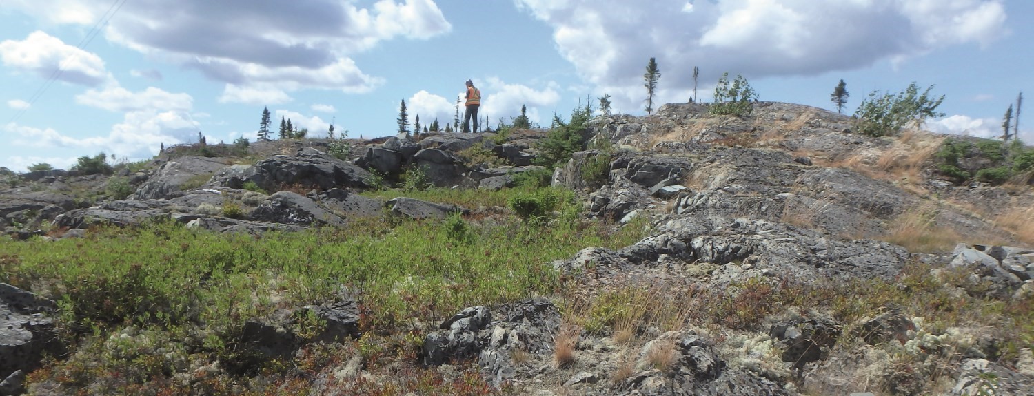
This is the unit covering the largest area of the Lac Arthur Group. It mainly occupies the central parts of sheets 32C12-SE, 32D09 and a narrow part of sheet 32C11. It consists mainly of calc-alkaline, aphanitic andesitic flows exhibiting massive, pillowed and brecciated morphofacies. Individual flows reach an average thickness of 4 m to 10 m. The pillowed morphofacies is the most abundant, pillows are not very flattened, voluminous and can reach 2 m to 3 m in length. Amygdules are filled with quartz. They are abundant (3-6%) and their diameter is variable (2-4 mm). Flows are oriented E-W to WNW-ESE and have a dip varying from 60° to 75°. The rock’s magnetic susceptibility is low and homogeneous (Geological Survey of Canada et al., 2009). The trace of the Duverny Syncline passes through the centre of this unit.
Lac Arthur Group 2 (nAur2): Calc-Alkaline Porphyritic Andesite
Unit nAur2 consists mainly of calc-alkaline plagioclase porphyritic andesitic flows, located inside or at the lower and upper edges of unit nAur1. The pillowed morphofacies is the most commonly observed, pillows being of comparable size (2-3 m long) to those of unit nAur1. Amygdules, on the other hand, are sparse (absent or up to 2-3%). Flows vary in thickness from a few metres to about ten metres.
Lac Arthur Group 3 (nAur3): Calc-Alkaline Porphyritic Andesite
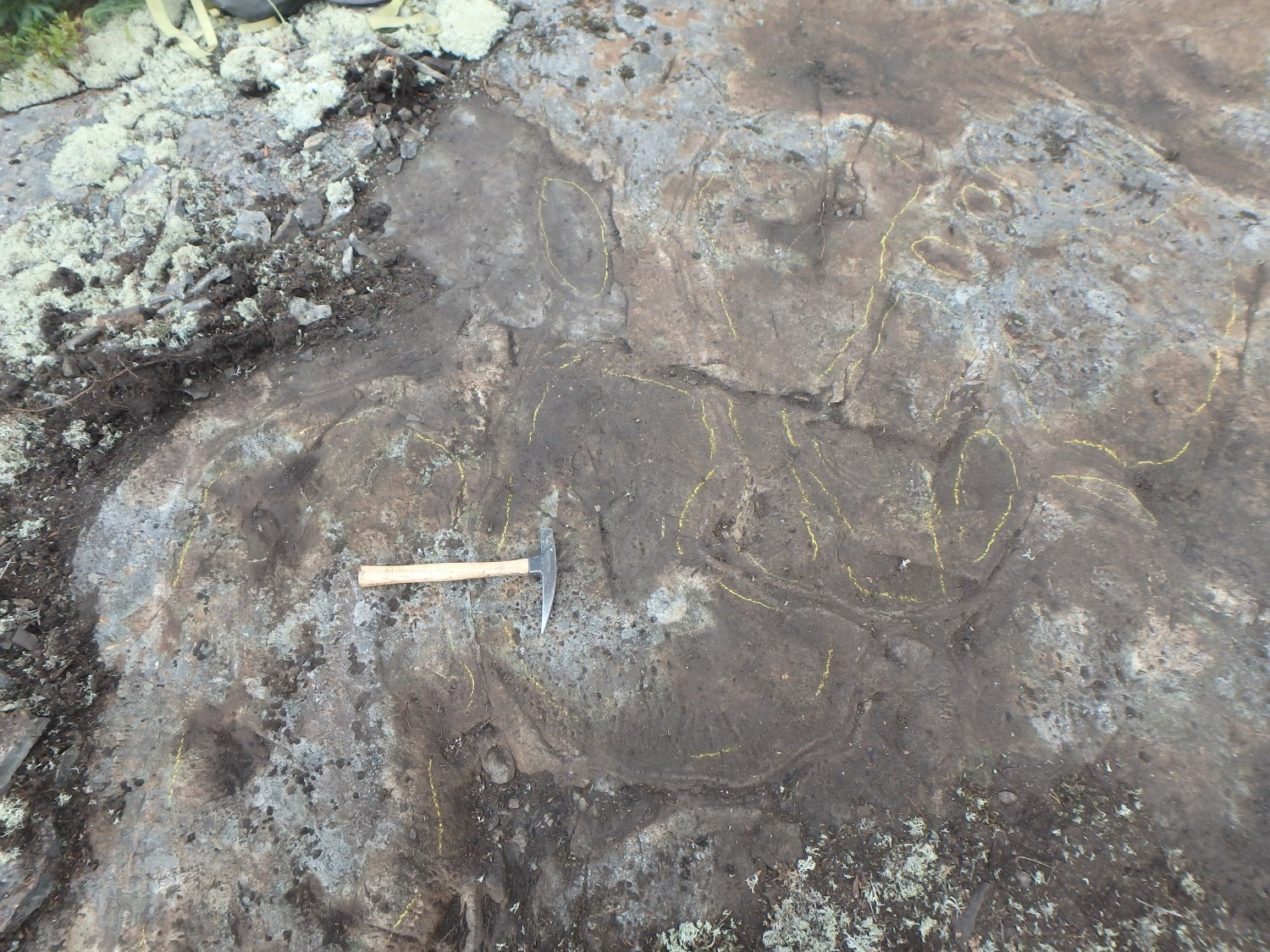
Unit nAur3 includes equal proportions of intermediate to felsic volcaniclastics (50%) and andesitic flows (50%). Volcaniclastics generally occur as thin layers a few tens of metres thick in sheets 32C12, 32D09, 32D15 and 32D16. These layers are commonly poorly arranged and rarely stratified or sorted. More specifically, lapilli and block tuff is characterized by rounded to subangular, millimetric to decimetric fragments of mafic, intermediate or felsic rock having an aphanitic texture, and surrounded by an aphanitic matrix (Labbé, 1995, 1998; Doucet and Dion, 1998b; this study). This matrix is composed of quartz, hornblende, carbonate, biotite and opaque minerals.
Andesite flows locally accompany volcaniclastic layers. These are massive, rarely brecciated and characterized by a green alteration patina, a pale green fresh surface and an aphanitic texture. Massive rocks display low to medium deformation. Flows vary from a few metres to about ten metres in thickness. Andesite is composed of amphibole (actinolite and very locally hornblende), plagioclase, quartz and biotite. Epidote, sphene and opaque minerals are the accessory minerals. Some samples display medium to high epidotization and highly variable chloritization.
All these lithologies form much larger and poorly differentiated units in sheets 32D09, 32D10, 32D14, 32D15 and 32D16 (Doucet and Dion, 1998a, 1998b; Doucet, 2000).
Lac Arthur Group 4 (nAur4): Calc-Alkaline Andesite and Basalt
Unit nAur4 forms the base of the Lac Arthur Group (Labbé, 1994, 1995, 1998). It outcrops in sheets 32C12, 32D09, 32D10, 32D14 and 32D15. Aphanitic and poorly vesicular massive and pillowed flows similar to those of unit nAur1 are observed. The presence of basaltic flows, on the other hand, is much more common.
Lac Arthur Group 5 (nAur5): Rhyolite and Felsic Volcaniclastics
Unit nAur5 occupies the upper part of the Lac Arthur Group. It consists of rhyolite, more locally dacite, and felsic volcaniclastic material. These felsic volcanic rocks (quartz-plagioclase porphyritic rhyolite) outcrop especially NE of the town of Amos (central part of sheet 32D09). The unit is historically known as the “Jonpol rhyolite” (Labbé, 1994, 1995). This particular layer contains the Amos Mine (Jay Copper) and Zone Jay Copper copper mineralized zones.
Lac Arthur Group 6 (nAur6): Intermediate Volcaniclastics, Graphite-Pyrite Mudstone and Siltstone
Unit nAur6 occurs as thin layers a few tens of metres thick in sheets 32D14 (Doucet and Dion, 1998a, 1998b; Doucet, 2000) and 32D11. These layers consist of fragmentary volcanic material of intermediate composition, accompanied and/or overlain by mudstone and siltstone sequences rich in graphite and pyrite. The response of these particular sequences on electromagnetic surveys is very good (Geological Survey of Canada et al., 2009).
Lac Arthur Group 7 (nAur7): Massive and Brecciated Dacite
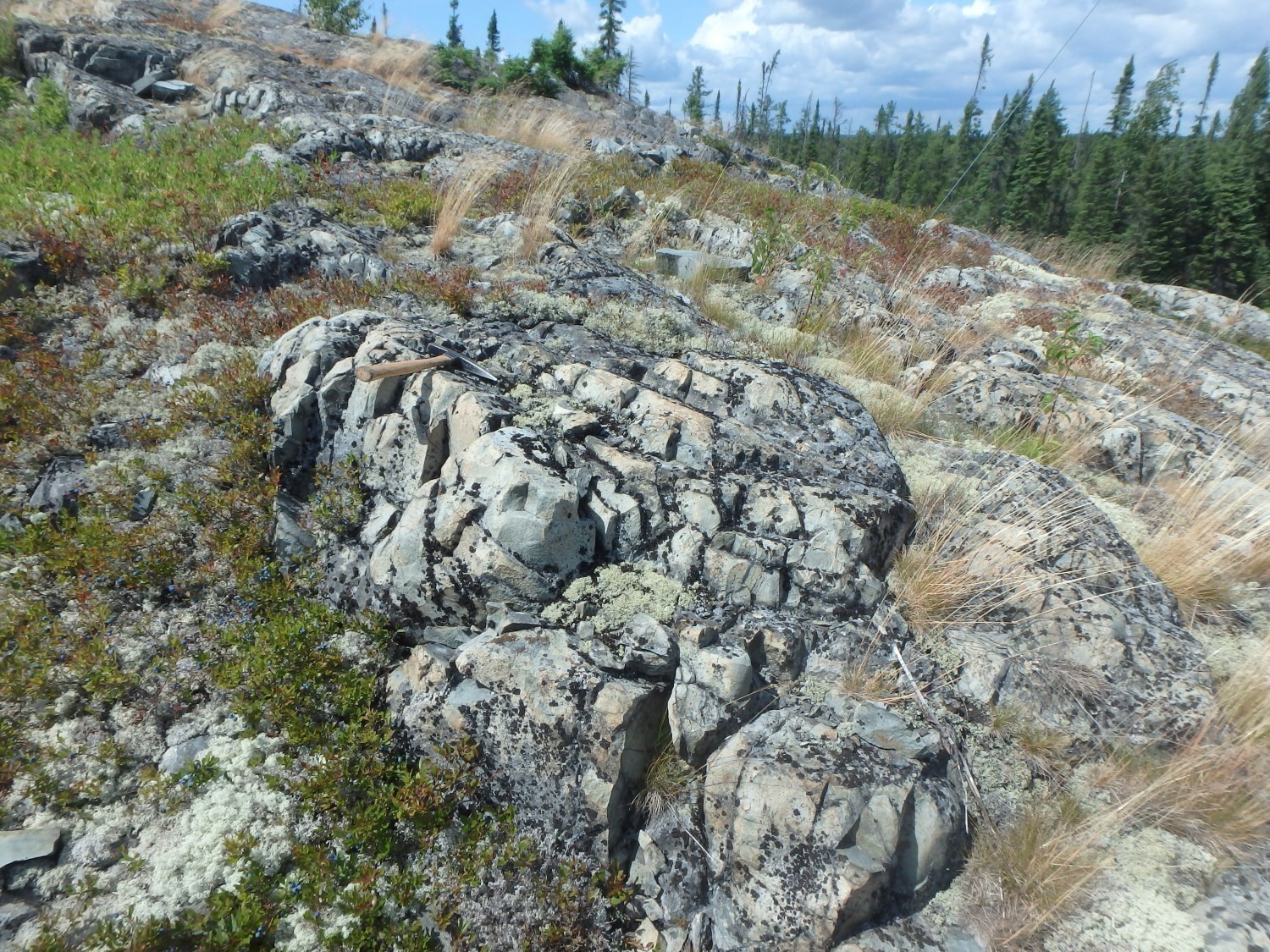

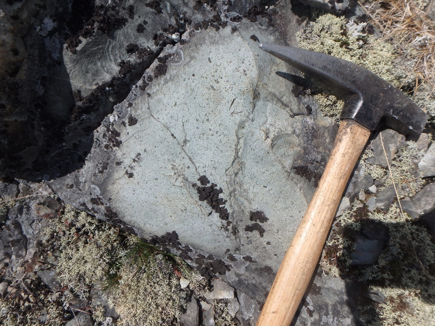
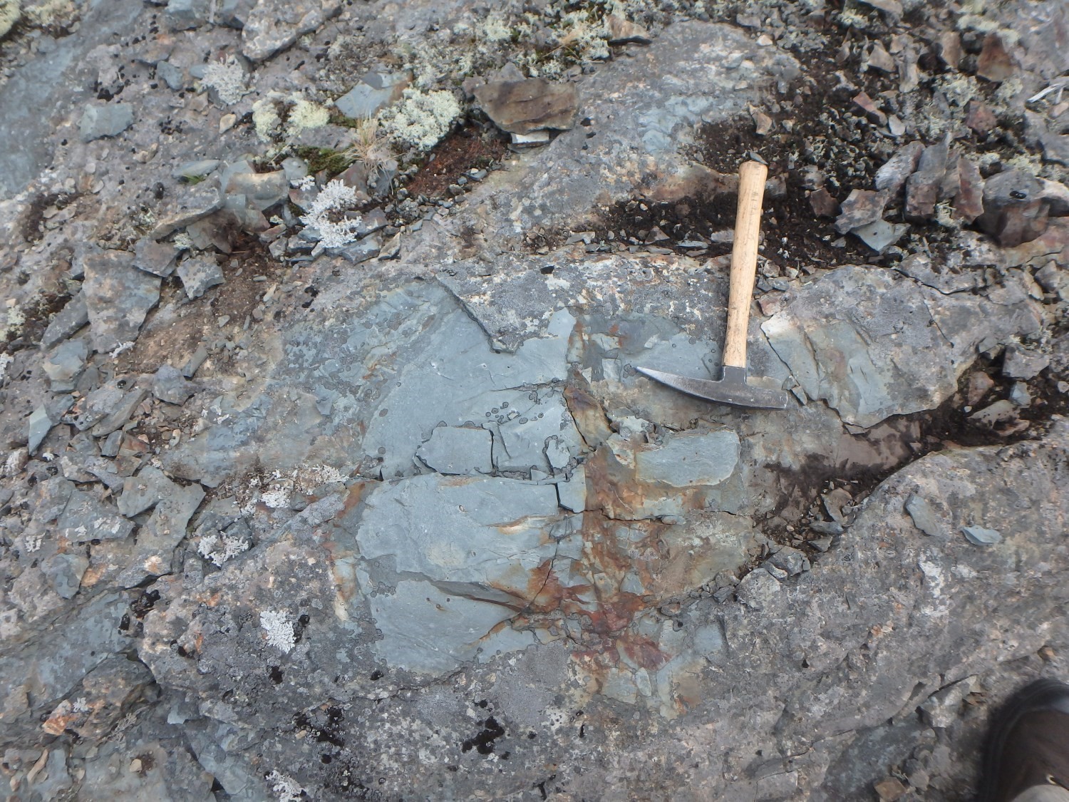
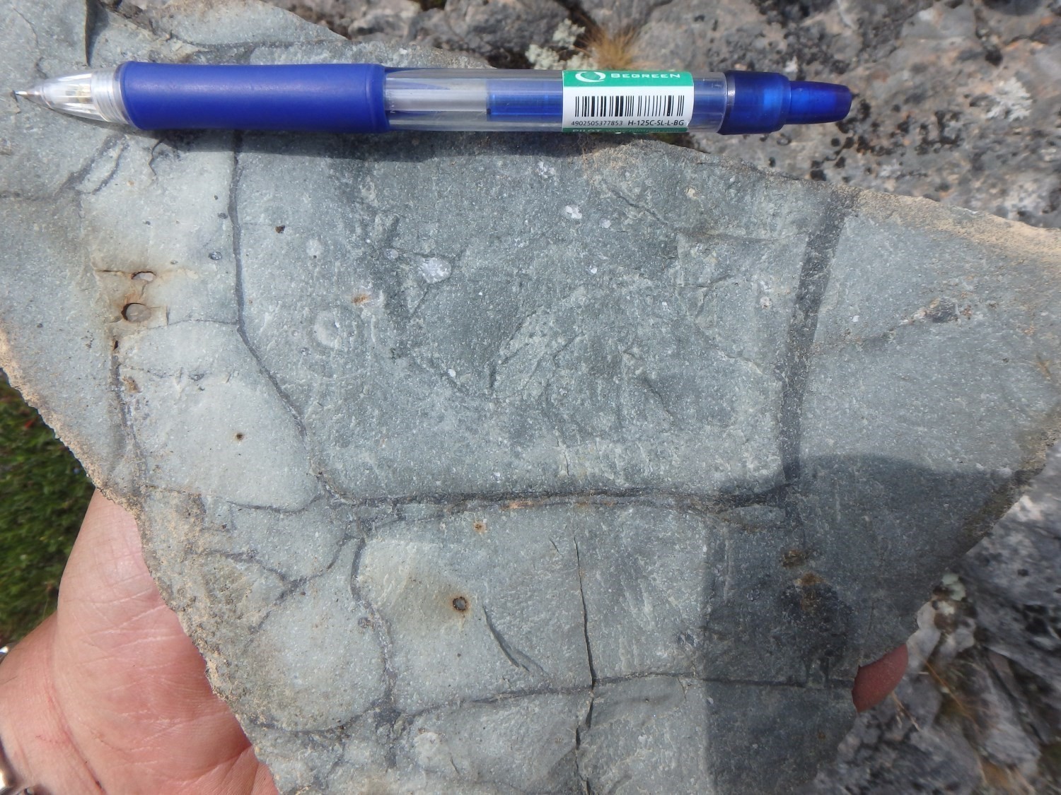

Unit nAur7 is found in sheets 32D09, 32D15 and 32D16 (Otis and Béland, 1986; Labbé, 1994, 1995, 1998). It occurs in the upper part of this group and is included in the nAur4 package. Unit nAur7 consists of plagioclase porphyritic dacite exhibiting the following morphofacies: massive, carapace breccia, lobed and fragmentary. The matrix and fragmentary material surrounding these lobes consist of hyaloclastite. Outcrops 19-PP-382 and 19-JM-582, located in the NW part of sheet 32C12-SE, are good examples.
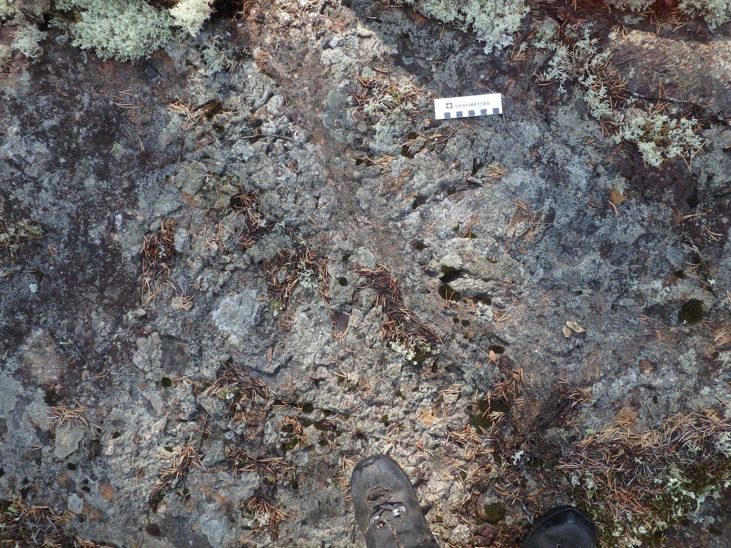
Dacite is buff-brown to greenish white in patina and light green in fresh exposure. Some flows are vesicular (lithophysae) and amygdaloidal. Quartz amygdules can locally make up 5% (up to 30%) of the volume of the rock, their diameter varies from 2 mm to 2 cm. Another characteristic aspect of dacite is the presence of a multitude of cooling fractures subparallel to the flow surface. These fractures are filled with microcrystalline quartz, forming whitish laminae 2-3 mm thick which give a zebra-like appearance to the flow. Millimetric to centimetric vesicles locally contain pyrite. The overall dimensions of the sequences of flows and/or endogenous lobes are difficult to determine, but they are at least several tens of metres thick. The dimensions of individual lobes are 40-60 cm thick and 1-4 m long.
Otis and Béland (1986) observed the presence of thin (0.1-2 m) gabbroic dykes that cut some dacitic flows. These gabbros could possibly prove to be the feeder dykes of mafic flows overlying the surrounding dacites. Otis and Béland (1986) also observed thin (2-20 m) subconformable quartzofeldspathic porphyry dykes that intrude into dacite, mainly along the axis of the Duverny Syncline.
These characteristics, taken as a whole, allow interpreting the presence of a proximal effusive complex in this area (in the vicinity of outcrop 19-JM-582) in the NW corner of sheet 32C12-SE. Sericitization is the most common alteration, but of low intensity. Several other layers of lenticular felsic volcanic rocks, of lesser volume, are observed in this area. Unit nAur7 is affected by the Duverny Syncline.
Lac Arthur Group 8 (nAur8): Wacke and Intermediate Tuff
Units of wacke and intermediate tuff are included in volcanic rocks located NE and SW of the Guyenne Batholith (sheets 32D10 and 32D15, see Doucet and Dion, 1998a). Units to the NE consist of dark laminated intermediate tuff, light grey siltstone and dark grey mudstone, generally, locally heavily, folded and metamorphosed. There is no graphite or pyrite accompanying these lithologies. Doucet and Dion (1998a) suggest that these units could continue on the NE side of the Guyenne Batholith, since relatively comparable beds are located in the NE corner of sheet 32D10.
Thickness and distribution
The Lac Arthur Group mainly occupies the central parts of sheets 32C12-SE and 32D09. It also occupies more limited areas in sheets 32C06, 32D11, 32D15 and 32D16. The maximum thickness of this group is ~6.5 km. It is globally E-W oriented, but it curves towards the SEE in its eastern extension (central part of sheet 32C12). Observed stratification is generally oriented WNW-ESE and dips steeply northward. The Duverny Syncline affects the central part of this group; it produces the duplication of felsic volcanic units on either side of the Duverny Pluton, at the boundary of sheets 32C12 and 32D09. These units are globally limited in their extents by the Lapaix Fault to the south and the Champneuf Fault to the north. It should be noted that the trace of this syncline’s axial plane is oblique with respect to the trace of these two faults.
Dating
Isotopic dating was carried out at the Geotop laboratory of the Université du Québec à Montréal. Sample AB-91-4 (outcrop 93-JY-221) comes from a rhyolitic tuff of the Lac Arthur Group collected 4 km NE of the town of Amos, within the Jonpol Deformation Corridor (Labbé, 1999). Zircons used for dating show morphological characteristics of detrital zircons. The obtained age of 2714 ±3 Ma corresponds to the maximum age of the rhyolitic tuff. The Lake Arthur Group corresponds in age to the La Motte-Vassan Formation (2714 ±2 Ma; Pilote et al., 1998, 1999, 2014; Pilote, 2000), located at the base of the Malartic Group. Felsic units of similar age (2713 ±2 Ma; Corfu et al., 1989; Ayer et al., 2002) are recognized in Ontario, south of Abitibi Lake and in the Timmins area, and occupy the top of the Kidd-Munro assemblage at these locations.
| Unit | Sample Number | Isotopic System | Mineral | Crystallization Age (Ma) | (+) | (-) | Reference(s) |
| nAur2 | AB-91-4 | U-Pb | Zircon | 2714 | 3 | 3 | Labbé, 1999 |
Stratigraphic Relationship(s)
The Lac Arthur Group is bordered to the north by the La Morandière Group (Labbé, 1999) and to the south by the Amos Group (Imreh, 1984; Labbé, 1999). The southern limit of this segment of Archean volcanic rocks is marked by the Lapaix Fault (Labbé, 1995) and the northern limit by the Champneuf Fault (Labbé, 1995).
Paleontology
Does not apply.
References
Publications Available Through SIGÉOM Examine
AVRAMTCHEV, L., LEBEL-DROLET, S. 1981. CATALOGUE DES GÎTES MINÉRAUX – RÉGION DE L’ABITIBI – FEUILLET SENNETERRE 32C. MINISTÈRE DE L’ÉNERGIE ET DES RESSOURCES, QUÉBEC; DPV 744, 106 pages and 15 plans.
CIESIELSKI, A. 1980. GÉOLOGIE DU CANTON DE VILLEMONTEL (COMTÉ D’ABITIBI-OUEST). MINISTÈRE DES RESSOURCES NATURELLES, QUÉBEC; DPV 706, 78 pages and 1 plan.
COMMISSION GÉOLOGIQUE DU CANADA, MINES D’OR VIRGINIA INC., NORANDA EXPLORATION. 2009. CARTES GÉOPHYSIQUES COULEUR MÉGATEM – 32C05. MINISTÈRE DE L’ÉNERGIE ET DES RESSOURCES NATURELLES, QUÉBEC; DP 2008-06, 5 pages and 4 cartes.
DOUCET, P. 2000. GÉOLOGIE DE LA RÉGION DE TASCHEREAU, DE SAINTE-GERTRUDE-MANNEVILLE ET DE VILLEMONTEL. MINISTÈRE DES RESSOURCES NATURELLES, QUÉBEC; RG 2000-08, 34 pages and 3 cartes
DOUCET, P., DION, D.-J. 1998a. GÉOLOGIE DE LA RÉGION DE LANGUEDOC (SNRC 32D/ 15-200-0 102). MINISTÈRE DES RESSOURCES NATURELLES, QUÉBEC; RG 98-12, 29 pages.
DOUCET, P., DION, D.-J. 1998b. GÉOLOGIE DE LA RÉGION D’AUTHIER-NORD (SNRC 32D/15-200-0101). MINISTÈRE DES RESSOURCES NATURELLES, QUÉBEC; RG 98-11, 28 pages.
IMREH, L. 1984. SILLON DE LA MOTTE-VASSAN ET SON AVANT-PAYS MÉRIDIONAL: SYNTHÈSE VOLCANOLOGIQUE, LITHOSTRATIGRAPHIQUE ET GÎTOLOGIQUE. MINISTÈRE DE L’ÉNERGIE ET DES RESSOURCES, QUÉBEC; MM 82-04, 72 pages.
JOHNSON, I. 1990. REPORT ON A COMBINED HELICOPTER-BORNE MAGNETIC, ELECTROMAGNETIC AND VLF-EM SURVEY, ABCOURT OPTION. MINES ABCOURT INC. RAPPORT STATUTAIRE SOUMIS AU GOUVERNEMENT DU QUÉBEC. GM 50183, 55 pages and 4 plans.
LABBÉ, J.-Y. 1994. SYNTHÈSE GÉOLOGIQUE DE LA RÉGION D’AMOS, ABITIBI. MINISTÈRE DES RESSOURCES NATURELLES, QUÉBEC; MB 94-09, 13 pages.
LABBÉ, J.-Y. 1995. SYNTHÈSE GÉOLOGIQUE DE LA RÉGION D’AMOS, ABITIBI. MINISTÈRE DES RESSOURCES NATURELLES, QUÉBEC; MB 95-24, 27 pages.
LABBÉ, J.-Y. 1999. ÉTUDES GÉOLOGIQUES DANS LA RÉGION D’AMOS. MINISTÈRE DES RESSOURCES NATURELLES, QUÉBEC; ET 98-04, 87 pages.
MRNF. 2010. CARTES GÉOLOGIQUES DU SIGEOM – FEUILLET 32C. MINISTÈRE DES RESSOURCES NATURELLES ET DE LA FAUNE, QUÉBEC; CG SIGEOM32C, 49 plans.
OTIS, M., BÉLAND, G. 1986. PROJET DE CARTOGRAPHIE – RÉGION D’AMOS. MINISTÈRE DE L’ÉNERGIE ET DES RESSOURCES, QUÉBEC; MB 86-21, 138 pages and 14 plans.
PILOTE, P. 2000. GÉOLOGIE DE LA RÉGION DE VAL-D’OR, SOUS-PROVINCE DE L’ABITIBI: VOLCANOLOGIE PHYSIQUE ET ÉVOLUTION MÉTALLOGÉNIQUE. MINISTÈRE DE L’ÉNERGIE ET DES RESSOURCES DU QUÉBEC; MB 2000-09.
PILOTE, P., MUELLER, W., SCOTT, C., LAVOIE, S., CHAMPAGNE, C., MOORHEAD, J. 1998. VOLCANOLOGIE DE LA FORMATION VAL-D’OR ET DU GROUPE DE MALARTIC, SOUS-PROVINCE DE L’ABITIBI: CONTRAINTES GÉOCHIMIQUES ET GÉOCHRONOLOGIQUES. MINISTÈRE DES RESSOURCES NATURELLES DU QUÉBEC; DV 98-05, page 48.
PILOTE, P., SCOTT, C., MUELLER, W., LAVOIE, S., RIOPEL, P. 1999. GÉOLOGIE DES FORMATIONS VAL-D’OR, HÉVA ET JACOLA – NOUVELLES INTERPRÉTATIONS DU GROUPE DE MALARTIC. MINISTÈRE DES RESSOURCES NATURELLES DU QUÉBEC; DV 99-03, page 19.
PILOTE, P., DAIGNEAULT, R., DAVID, J., McNICOLL, V. 2014. ARCHITECTURE DES GROUPES DE MALARTIC, DE PICHÉ ET DE CADILLAC ET DE LA FAILLE DE CADILLAC, ABITIBI. RÉVISION GÉOLOGIQUE, NOUVELLES DATATIONS ET INTERPRÉTATIONS. MINISTÈRE DE L’ÉNERGIE ET DES RESSOURCES NATURELLES, QUÉBEC, DV 2015-03, p. 37.
VOGEL, D.E., KEATING, P. 1979. CANTON DE TRECESSON. MINISTÈRE DES RESSOURCES NATURELLES, QUÉBEC; RG 194, 50 pages and 2 plans.
WEBER, W.W., LATULIPPE, M. 1964. RÉGION D’AMOS- BARRAUTE, COMTÉ D’ABITIBI-EST. MINISTÈRE DES RICHESSES NATURELLES, QUÉBEC; RG-109.
Other Publications
AYER, J., AMELIN, Y., CORFU, F., KAMO, S., KETCHUM, J., KWOK, K.. TROWELL, N., 2002. Evolution of the southern Abitibi greenstone belt based on U-Pb geochronology: autochthonous volcanic construction followed by plutonism, regional deformation and sedimentation. Precambrian Research; volume 115, pages 63-95. doi.org/10.1016/S0301-9268(02)00006-2
CORFU, F., KROGH, T.E., KWOK, Y.Y., JENSEN, L.S., 1989. U-Pb zircon geochronology in the southwestern Abitibi greenstone belt, Superior Province. Canadian Journal of Earth Sciences; volume 26, pages 1747-1763. doi.org/10.1139/e89-148
COOKE, H.C., JAMES, W.F., MAWDSLEY, J.B., 1931. Geology and ore deposits of Rouyn-Harricanaw region, Quebec. Geological Survey, Department of Mines, Canada; Memoir 166, 314 pages. doi.org/10.4095/119956
FAURE, S., 2016. Le segment volcanique Taschereau-Amos-Senneterre (Abitibi) et son potentiel métallogénique pour l’or et les métaux de base. Consortium de recherche en exploration minéral (CONSOREM); Projet 2015-01, 59 pages.
IMREH, L., 1979. Lithostratigraphie et roches ultramafiques du secteur de Val-d’Or – Amos. Geological Association of Canada – Mineralogical Association of Canada, Québec Congress, 1979; field trip guidebook A-4, p. 1-40.
TREMBLAY, L.-P., 1956. Région de Fiedmont. Geological Survey of Canada; Memoir 253, 141 pages and 1 map. doi.org/10.4095/119963
WEEKS, L.J., 1935. Amos sheet, Abitibi County, Quebec. Geological Survey of Canada, Ottawa; map 327A. doi.org/10.4095/107158
WEEKS, L.J., 1937. Rochebaucourt, Abitibi County, Quebec; Geological Survey of Canada, Map 553A. doi.org/10.4095/107764
Suggested Citation
Ministère de l’Énergie et des Ressources naturelles (MERN). Lac Arthur Group. Quebec Stratigraphic Lexicon. https://gq.mines.gouv.qc.ca/lexique-stratigraphique/province-du-superieur/groupe-du-lac-arthur_en [accessed on Day Month Year].
Contributors
|
First publication |
Pierre Pilote, Eng., M.Sc. A. pierre.pilote@mern.gouv.qc.ca (redaction) Mehdi A. Guemache, P. Geo., Ph.D. (coordination); James Moorhead, P. Geo., M.Sc. (critical review); Simon Auclair, P. Geo., M.Sc. (editing); Céline Dupuis, P. Geo., Ph.D. (English version); André Tremblay (HTML editing). |