

Last modified:
Translation of original French
| Author: | Mathieu and Beaudette, 2019 |
| Age: | Paleoproterozoic |
| Reference section: | None |
| Type area: | Western area of Watts Lake (NTS sheet 35G16) |
| Geological province: | Churchill Province |
| Geological subdivision: | Ungava Orogen / Ungava Trough / Northern Domain |
| Lithology: | Felsic to mafic layered intrusion, garnet-rich locally |
| Type: | Lithodemic |
| Rank: | Lithodeme |
| Status: | Formal |
| Use: | Active |
Background
The Kinguppak Pluton was defined by Mathieu and Beaudette (2019) to individualize a kilometre-sized pluton belonging to the Cape Smith Suite. This intrusion had already been partially mapped by Lamothe et al. (1984), and then Mathieu and Beaudette (2019) increased its area. The Cape Smith Suite was introduced by Taylor (1982) to group a sequence of late intrusions of various natures (granitic to peridotitic). These intrusions are observed at the scale of the Ungava Orogen, mostly in the Northern Domain.
Description

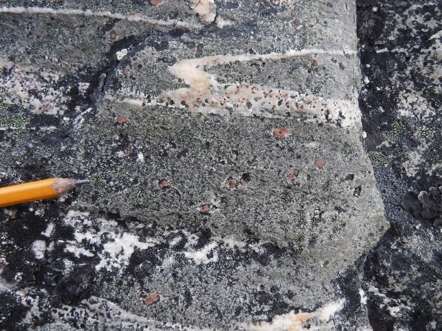
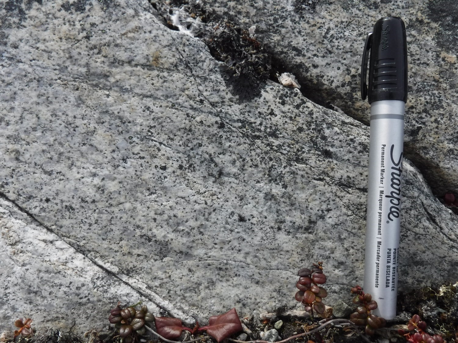
 The Kinguppak Pluton consists of a foliated intrusion whose composition varies from tonalitic to gabbroic. The more differentiated tonalitic member outcrops mostly in the SW half of the intrusion and underlies gabbro. At the outcrop scale, the transition from gabbro to diorite and from diorite to tonalite is gradual over ~10 m; therefore the intrusion is considered layered. Gabbro also incorporates metric melanograbbro layers interpreted as pyroxene cumulates. These layers are mineralized in pyrite (≤2% of the rock). Gabbro and diorite show a green and white patina and fresh surface as a result of plagioclase recrystallization. For the same reason, tonalite is white. Gabbro has an ophitic texture. Samples are characterized by low magnetic susceptibility.
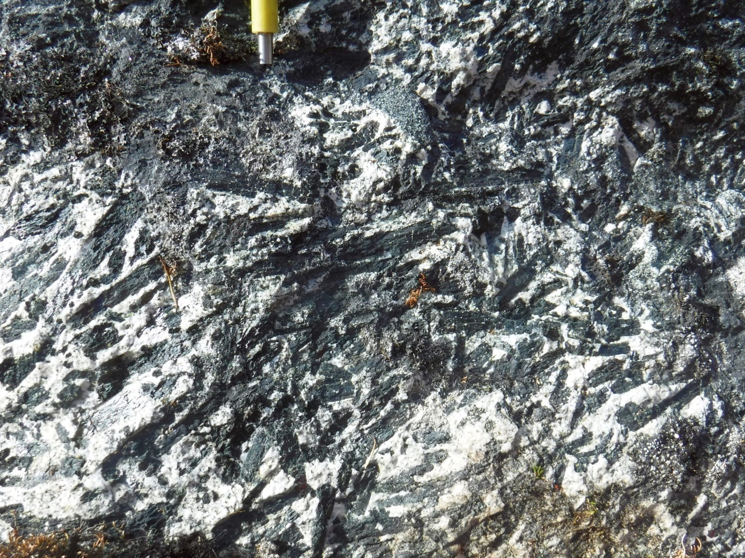
The rock is medium grained and all minerals are oriented along foliation. Quartz accounts for 5 to 30%, while ferromagnesian minerals account for 10 to 45% of the rock. These are mainly represented by poikiloblastic amphibole with recrystallized margins and, locally, with preserved pyroxene core. Biotite is replacing amphibole margins, whose cleavage is highlighted by opaque mineral lamellae. Plagioclase, visible in almost 80% of the samples, is systematically recrystallized and partially replaced by an assemblage of zoisite-pistachite and sericite flakes. However, the presence of millimetric garnet in all facies (≤5% of the rock) is not systematic. Garnet is euhedral, poikiloblastic and inclusions are confined to its margin. It locally has chlorite rim. A few sparse samples show garnet completely retromorphosed to chlorite. Sphene, allanite, scapolite and zircon are present as trace.
Deformation results in the development of recrystallization tails around garnet, which indicate late cinematic growth. It is also evidenced by the presence of corridors with finer grain size.
Thickness and Distribution
The Kinguppak Pluton has an oval shape that covers an area of 30 km2 west of Watts Lake. The minimum apparent thickness, calculated by using topographic curves, is 450 m.
Dating
Parrish (1989) obtained an imprecise zircon age between 1870 Ma and 1880 Ma on a sample described as biotite-muscovite tonalite. Dunphy and Ludden (1998) cite a crystallization age reinterpreted by Parrish at 1888 +6/-4 Ma.
| Unit | Sample | Lithology | Isotopic System | Mineral | Âge de cristallisation (Ma) | (+) | (-) | Reference |
| pPkik | P23-87 | Tonalite | U-Pb | Zircon | 1888 | 6 | 4 | Dunphy and Ludden, 1998 |
Stratigraphic Relationship(s)
A foliated garnet-rich tonalite dyke intrudes into Watts Group mesocratic gabbro (subunit pPwa3d).
Paleontology
Does not apply.
References
Publications available through Sigéom Examine
LAMOTHE, D. 2007. Lexique stratigraphique de l’orogène de l’Ungava. Ministère des Ressources naturelles et de la Faune, Québec; DV 2007-03, 66 pages and 1 plan.
LAMOTHE, D., PICARD, C., MOORHEAD, J. 1984. Région du lac Beauparlant, bande de Cap Smith-Maricourt. MRN. DP-84-39, 2 plans.
MATHIEU, G., BEAUDETTE, M. 2019. Géologie de la région du lac Watts, Domaine Nord, Fosse de l’Ungava, Nunavik, Québec, Canada. MERN. BG 2019-04.
Other publications
Dunphy, J.M., Ludden, J.N. 1998. Petrological and geochemical characteristics of a Paleoproterozoic magmatic arc (Narsajuaq terrane, Ungava Orogen, Canada) and comparisons to Superior Province granitoids. In Precambrian Research; volume 91, pages 109–142. https://doi.org/10.1016/S0301-9268(98)00041-2.
Machado, N., David, J., Scott, D.J., Lamothe, D., Philippe, S., Gariépy, C. 1993. U-Pb geochronology of the western Cape Smith Belt, Canada: new insights on the age of initial rifting and arc magmatism. In Precambrian Research; volume 63, pages 211–223. doi:https://doi.org/10.1016/0301-9268(93)90034-Y.
Parrish, R.R. 1989. U-Pb geochronology of the Cape Smith Belt and Sugluk block, northern Quebec. Geoscience Canada; volume 16, pages 126–130. doi:10.1016/j.electacta.2016.11.028.
St-Onge, M.R., Lucas, S.B. 1989. Géologie, lac Watts, Québec. Geological Survey of Canada, « A » Series Map 1721A, 1 sheet. doi.org/10.4095/127673.
Taylor, F.C. 1982. Reconnaissance geology of a part of the Canadian Shield, northern Quebec and Northwest Territories. Geological Survey of Canada, Memoir 399, 32 pages (7 sheets). doi.org/10.4095/109241.