DISCLAIMER: This English version is translated from the original French. In case of any discrepancy, the French version shall prevail.
| Author(s): | Lafrance et al., 2015 |
| Age: | Archean; Paleoproterozoic |
| Stratotype: | None |
| Type area: | Henrietta Lake area (NTS sheet 24H) |
| Geological province: | Churchill Province |
| Geological subdivision: | Falcoz Lithotectonic Domain |
| Lithology: | Orthopyroxene intrusive rocks and gneiss |
| Category: | Lithodemic |
| Rank: | Complex |
| Status: | Formal |
| Use: | Active |
None
Background
The Imaapik Complex was introduced by Lafrance et al. (2015) in the Henrietta Lake area to group a package of orthopyroxene rocks located in the central western part of the Falcoz Lithotectonic Domain, an area that is rather characterized by orthopyroxene-free rocks.
Description
The Imaapik Complex comprises two units: 1) orthopyroxene intrusive and metamorphic rocks (ApPima1), and 2) massive purplish tonalite (ApPima2).
Rocks of this complex are characterized by orthopyroxene replaced to varying degrees by serpentine and fibrous amphiboles, locally leaving only preserved pyroxene cores. The Imaapik Complex is made up of little deformed intrusive rocks. It also includes orthogneiss and migmatites similar to those of the Kangiqsualujjuaq and Fougeraye complexes, except that those assigned to the Imaapik Complex contain orthopyroxene. The units surrounding the Imaapik Complex are also highly migmatized.
Imaapik Complex 1 (ApPima1): Orthopyroxene Intrusive and Metamorphic Rocks
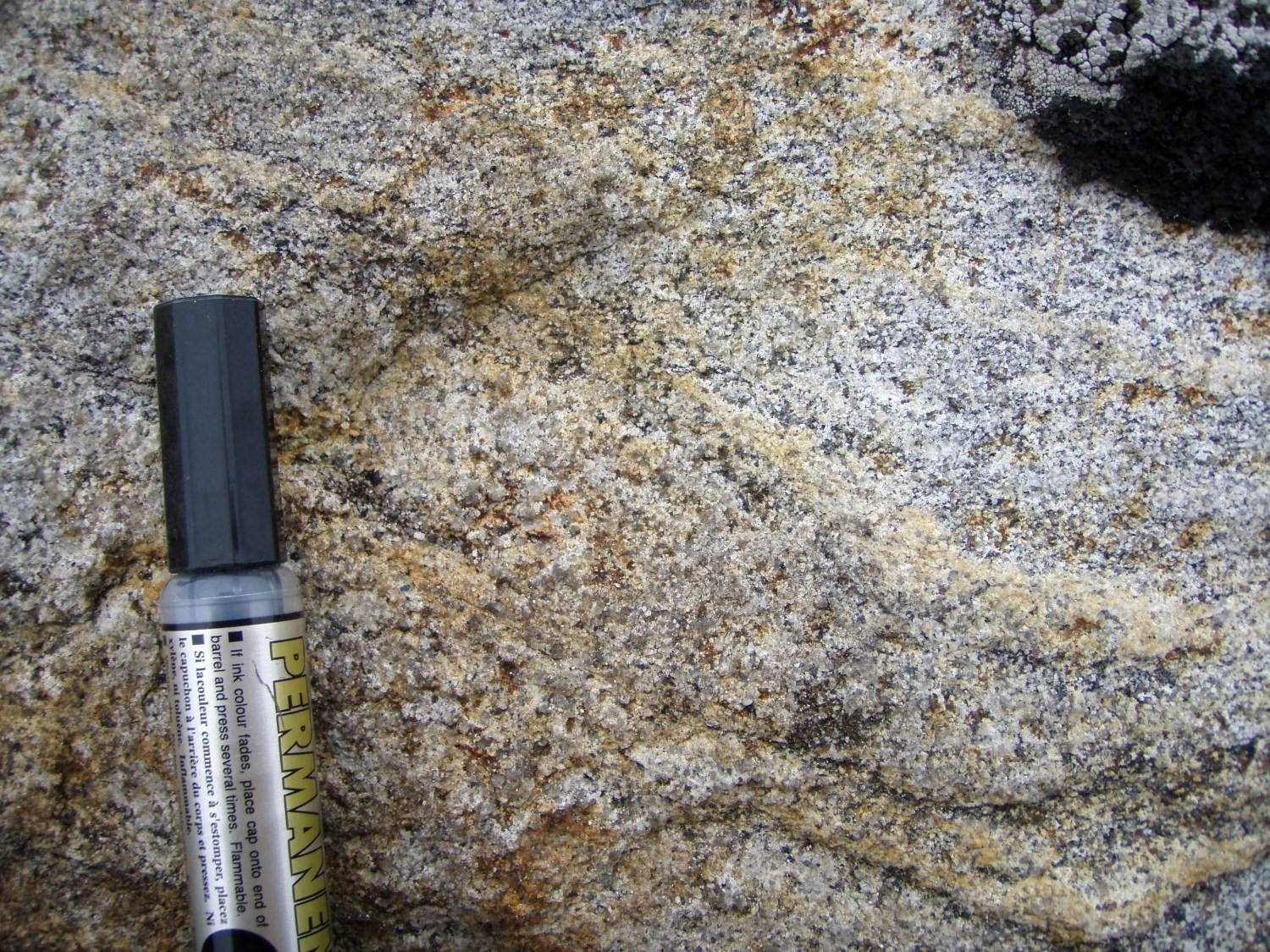
Unit ApPima1 forms the major part of the Imaapik Complex. It comprises several different lithological facies that are commonly present simultaneously in outcrops and are indistinguishable on the scale of the mapping work carried out. The main facies observed all contain orthopyroxene and consist of tonalitic to granitic gneiss, migmatitic rocks, granoblastic diorite and massive enderbite and charnockite intrusions. There is also a pink pegmatitic granite phase that intrudes into all the other units as subconformable centimetric bands or decimetric to metric dykes.
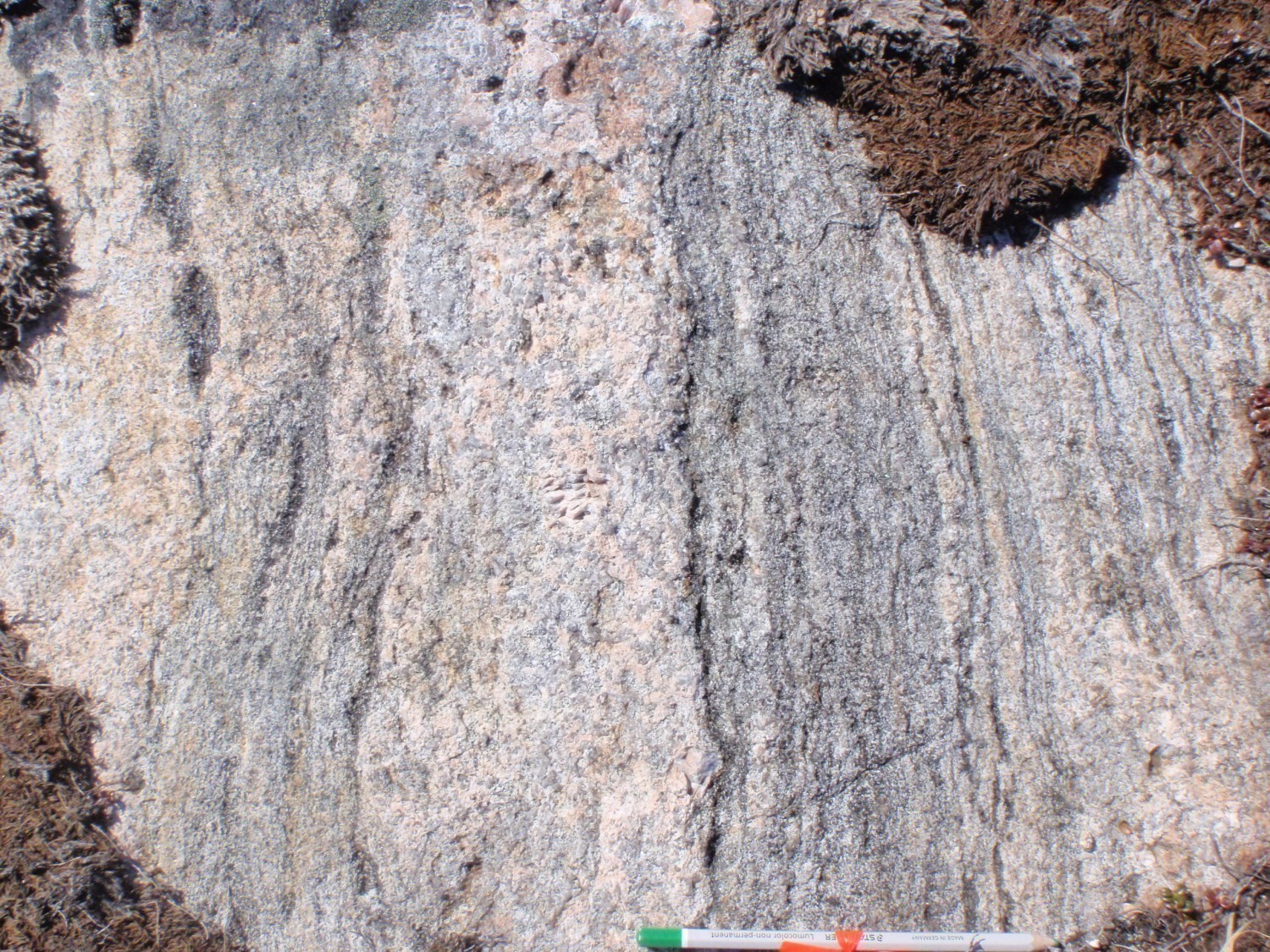
Gneissic and migmatitic rocks as well as diorites occur as enclaves within intrusive rocks and are in places highly assimilated. On some outcrops, intrusive rocks are dominant, particularly in the central part of the complex, but they mostly occur as diffuse intrusions (10-30%) within the other lithologies of the complex. These intrusions occur as dykes, clusters, but most often as bands parallel to gneissosity. Outcrops are complex and heterogeneous; the brown sugar to greenish colour and smoky quartz make it difficult to determine the composition of the rock. Contacts between the different lithologies are generally not very contrasted and may only be visible by a slightly different grain size.
Gneiss are even grained, fine to medium grained, well foliated and fairly well recrystallized. They contain 5 to 8% ferromagnesian minerals, mainly biotite with some hornblende and relics of orthopyroxene highly altered into a mixture of serpentine and fibrous amphiboles. They display banding formed by alternating tonalite and diorite bands or tonalite and granite bands. Diorite is fine grained and completely granoblastic. In several places, these lithologies are migmatitized and characterized by the presence of wavy and discontinuous banding and biotite schlierens. The mobilisate is granular, brownish to greenish and of variable composition.
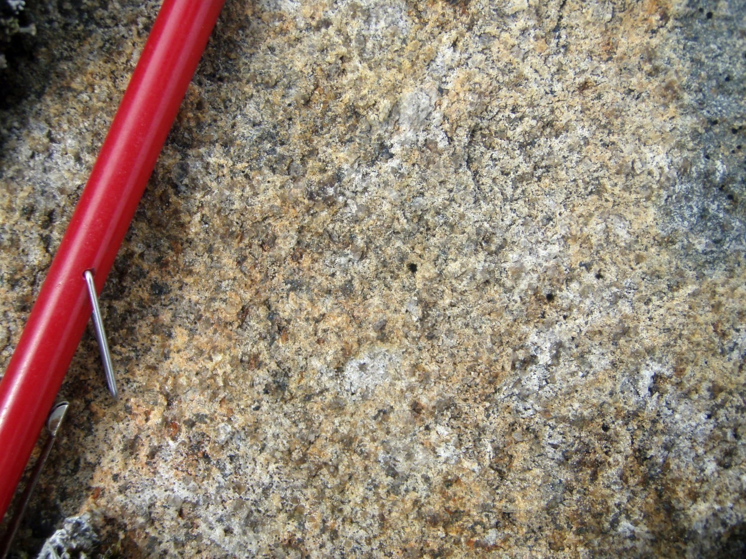
Intrusive rocks are brown sugar coloured in fresh exposure and whitish to beige in altered surface. They are massive to very slightly foliated, homogeneous, even grained and medium grained. Their composition is mainly enderbitic but charnockitic phases are also present. These two compositions are impossible to differentiate on outcrops. The rocks are rich in quartz (30-40%), magnetic, and contain 5 to 10% ferromagnesian minerals commonly forming small millimetric to centimetric clusters. They consist of biotite and orthopyroxene with some magnetite and locally hornblende.
Imaapik Complex 2 (ApPima2): Massive Purplish Tonalite
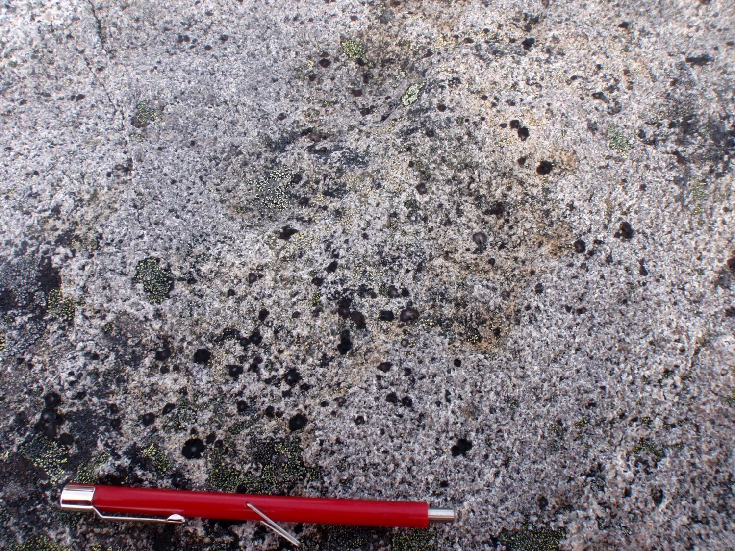
The massive purplish tonalite unit (ApPima2) is very homogeneous and limited to the eastern edge of the Imaapik Complex. It is similar to the intrusive phase observed in unit ApPima1 except that the rock, which is purplish grey, is invariably tonalitic in composition and does not contain orthopyroxene. Clinopyroxene was observed locally. Unit ApPima2 locally contains 5-10% enclaves of diorite and tonalitic gneiss.
Thickness and distribution
The Imaapik Complex corresponds to a circular positive magnetic anomaly measuring ~30 km in diameter and located in the central western part of the Falcoz Lithotectonic Domain. It covers a total area of ~620 km2. Unit ApPima1 forms the major part of the complex (~495 km2), while unit ApPima2 is limited to its eastern edge (~125 km2).
Dating
U-Pb dating of samples from outcrops 2013-IL-3073, 2013-IL-3076 and 2013-DB-1057 indicate that the intrusive rocks of the Imaapik Complex (enderbite and charnockite) were emplaced in the Paleoproterozoic. The Archean ages are probably derived from relics of Archean orthogneiss in which the intrusion was emplaced. The Imaapik Complex therefore comprises both Paleoproterozoic intrusive rocks and Archean orthogneiss.
| Unit | Sample Number | Isotopic System | Mineral | Crystallization Age (Ma) | (+) | (-) | Inherited Age (Ma) | (+) | (-) | Reference(s) |
| ApPima1 | 2013-IL-3073A | U-Pb | Zircon | 1851 | 6 | 6 | 2700-2400 | Davis et al., 2018 | ||
| Monazite | 1875 | 8 | 8 | |||||||
| 2013-IL-3076 | U-Pb | Zircon | 1,83 Ga | 2,73 Ga | Corrigan and McFarlane, personal communication, 2018 | |||||
| ApPima2 | DB-1057-A13 | U-Pb | Zircon | 1865 | 5 | 5 | 2100-2720 | Corrigan et al., 2018 |
Stratigraphic Relationship(s)
The Imaapik Complex may represent better preserved parts of an earlier granulite facies; such zones have been described by Verpaelst et al. (2000) in the Koroc River area (NTS sheet 24I). However, the rounded shape of the Imaapik Complex, well defined on the aeromagnetic survey, suggests emplacement of an underlying charnockitic magma, outcropping only in some places (Lafrance et al., 2015). This mass of charnockitic rocks could also explain the formation of orthopyroxene within host rocks. The retrogradation of orthopyroxene to biotite and textures indicating two phases of deformation support the interpretation of a syntectonic intrusion (Charette and Guilmette, 2014).
Paleontology
Does not apply.
References
Publications Available Through SIGÉOM Examine
CHARETTE, B., GUILMETTE, B., 2014. PETROLOGIE METAMORPHIQUE DE L’OROGENE DES TORNGAT ET DE LA MARGE EST DE LA ZONE NOYAU – PROVINCE DE CHURCHILL SUD-EST, RAPPORT PRELIMINAIRE. MERN, UNIVERSITY OF WATERLOO; MB 2014-34, 50 pages.
DAVIS, D. W., LAFRANCE, I., GOUTIER, J., BANDYAYERA, D., TALLA TAKAM, F., GIGON, J., 2018. Datations U-Pb dans les provinces de Churchill et du Supérieur effectuées au JSGL en 2013-2014. MERN; RP 2017-01, 63 pages.
LAFRANCE, I., BANDYAYERA, D., BILODEAU, C., 2015. GÉOLOGIE DE LA RÉGION DU LAC HENRIETTA (SNRC 24H). MERN; RG 2015-01, 62 pages, 1 plan.
VERPAELST, P., BRISEBOIS, D., PERREAULT, S., SHARMA, K. N. M., DAVID, J., 2000. Géologie de la région de la rivière Koroc et d’une partie de la région de Hébron, 24I et 14L. MRN; RG 99-08, 62 pages, 10 plans.
Other Publications
CORRIGAN, D., WODICKA, N., MCFARLANE, C., LAFRANCE, I., VAN ROOYEN, D., BANDYAYERA, D., BILODEAU, C., 2018. Lithotectonic Framework of the Core Zone, Southeastern Churchill Province, Canada. Geoscience Canada; volume 45, pages 1-24. https://doi.org/10.12789/geocanj.2018.45.128
Suggested Citation
Ministère de l’Énergie et des Ressources naturelles (MERN). Imaapik Complex. Quebec Stratigraphic Lexicon. https://gq.mines.gouv.qc.ca/lexique-stratigraphique/province-de-churchill/complexe-imaapik_en [accessed on Day Month Year].
Contributors
|
First publication |
Isabelle Lafrance, P.Geo., M.Sc. isabelle.lafrance@mern.gouv.qc.ca (redaction) Mehdi A. Guemache, P.Geo., Ph.D. (coordination); Claude Dion, Eng., M.Sc. (critical review and editing); Céline Dupuis, P.Geo., Ph.D. (English version); Caroline Thorn (HTML editing). |
|
Revision(s) |
Isabelle Lafrance, P.Geo., M.Sc. (redaction) Céline Dupuis, P.Geo., Ph.D. (coordination); Marc-Antoine Vanier, Eng., M.Sc. (critical review); Simon Auclair, P.Geo., M.Sc. (editing); Dominique Richard, GIT, Ph.D. (English version); André Tremblay (HTML editing). |


