The SIGÉOM geochemistry database is divided into two layers or attribute tables:
Rock samples
Sediment samples (secondary environment samples)
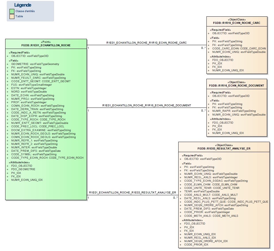
In each of these two layers, data is contained in an entity class (main table) to which several related tables are attached, as in the following examples: (You can consult the data models for these layers here).
This type of relational structure makes it possible to obtain complete information and avoid overwriting data, as in the case of a sample reanalysis. Complete information, including all relationships between tables, is only available in ArcGIS File Geodatabase (FGDB) and Geopackage (GPKG) files.
In the case of GPKG format, we recommend the use of the QGIS software to view the data. A turnkey SIGEOM_geopackage.qgz is included with every SIGÉOM à la carte download. Table relationships are pre-established. For more information, visit this page (coming soon).
This relational table structure can prove difficult to manipulate. Therefore, it’s important to note that a simplified table for analysis results is always included with the downloaded file in FGDB format. For this purpose, you will need to import into your project the point files “R1E01_ECHANTILLON_ROCHE_RESULTAT” or “R1E02_ECHANTILLON_SEDIMENT_RESULTAT” as appropriate. This table details all analytical techniques for the analyzed geochemical elements. At the end of the table, the most relevant results (best analytical technique or most recent analysis) are listed.
Information provided in other formats, such as Shapefile (SHP) and Comma-Separated Values (CSV), is incomplete. In fact, these files only present the results deemed most relevant. This means that it is impossible to know which method was used for analysis, or to see if several analyses were carried out using different methods.
Information About the Database
Code
Description
Unité
AE
%
AH
%
AI
%
AP
%
Ac
Actinium
ppm
Ag
Silver
ppm
Al
Aluminum
ppm
Al2O3
Aluminum oxide
%
Ar
Argon
ppm
As
Arsenic
ppm
At
Astatine
ppm
Au
Gold
ppb
B
Boron
ppm
BC
%
BL
%
BO
%
BR
%
Ba
Barium
ppm
BaO
Barium oxide
%
Be
Beryllium
ppm
Bi
Bismuth
ppm
Br
Bromine
ppm
C org
Organic carbon
ppm
C tot
Total carbon
%
CC
%
CO2 in
Inorganic carbon
%
CS
%
Ca
Calcium
ppm
CaO
Calcium oxide
%
Cd
Cadmium
ppm
Ce
Cerium
ppm
Cgraph
Graphitic carbon
ppm
Cl
Chlorine
ppm
Co
Cobalt
ppm
Cr
Chromium
ppm
Cr2O3
Chromium oxide
%
Cs
Cesium
ppm
Ct:CO2
Total carbon in CO2
%
Cu
Copper
ppm
DD
cct
DM
%
DO
%
DP
%
Dy
Dysprosium
ppm
EGP
Platinum group elements (Pt+Pd)
ppb
ETR
Rare earth minerals (sum of lanthanides)
ppm
Er
Erbium
ppm
Eu
Europium
ppm
F
Fluorine
ppm
FK
%
FL
%
FP
%
Fe
Iron
ppm
Fe sol
Soluble iron
ppm
Fe2O3t
Total iron oxide
%
Fe2O3v
Ferric-iron oxide
%
FeO
Ferrous-iron oxide
%
Fr
Francium
ppm
GE
%
GP
%
GR
%
Ga
Gallium
ppm
Gd
Gadolinium
ppm
Ge
Germanium
ppm
Gp
ppb
H2O+
H2O+ (constitution water)
%
H2O-
H2O- (weakly fixed water 'humidity')
%
HB
%
HL
%
He
Helium
ppm
Hf
Hafnium
ppm
Hg
Mercury
ppb
Ho
Holmium
ppm
I
Iodine
ppm
IM
%
In
Indium
ppm
Ir
Iridium
ppb
JP
%
K
Potassium
ppm
K2O
Potassium oxide
%
KC
%
KL
%
KN
%
Kr
Krypton
ppm
LB
%
La
Lanthanum
ppm
Li
Lithium
ppm
Li2O
Lithium oxyde
%
Lu
Lutetium
ppm
MA
%
MF
%
MG
%
MI
%
MN
%
MZ
%
Mg
Magnesium
ppm
MgO
Magnesium oxide
%
Mn
Manganese
ppm
MnO
Manganese oxide
%
Mo
Molybdenum
ppm
MoS2
Molybdenite
%
N
Nitrogen
ppm
NP
%
Na
Sodium
ppm
Na2O
Sodium oxide
%
Nb
Niobium
ppm
Nb2O5
Niobium oxide
%
Nd
Neodymium
ppm
Ne
Neon
ppm
Ni
Nickel
ppm
Np
Neptunium
ppm
OC
%
OV
%
Os
Osmium
ppb
P
Phosphorus
ppm
P2O5
Phosphorus oxide
%
PAF
Loss on ignition
%
PAF2
Loss on ignition (FeO and Fe2O3)
%
PG
%
PH
%
PL
%
PX
%
Pb
Lead
ppm
Pd
Palladium
ppb
Pm
Promethium
ppm
Po
Polonium
ppm
Pr
Praseodymium
ppm
Pt
Platinum
ppb
Pu
Plutonium
ppm
QZ
%
Ra
Radium
ppm
Rb
Rubidium
ppm
Re
Rhenium
ppb
Rh
Rhodium
ppb
Rn
Radon
ppm
Ru
Ruthenium
ppb
S
Sulfur
%
SC
%
SM
%
SN
%
ST
%
Sb
Antimony
ppm
Sc
Scandium
ppm
Se
Selenium
ppm
Si
Silicon
ppm
SiO2
Silicon oxide
%
Sm
Samarium
ppm
Sn
Tin
ppm
Sr
Strontium
ppm
SrO
Strontium oxide
%
TC
%
TL
%
TM
%
TOT
Total
%
TOT2
Total 2
%
TS
ppm
TZ
%
Ta
Tantalum
ppm
Ta2O3
Tantalum oxide
%
Ta2O5
Tantalum pentoxide
%
Tb
Terbium
ppm
Te
Tellurium
ppm
Th
Thorium
ppm
ThO2
Thorium oxyde
%
Ti
Titanium
ppm
TiO2
Titanium oxide
%
Tl
Thallium
ppm
Tm
Thulium
ppm
Tr2O3
Rare earth
%
U
Uranium
ppm
V
Vanadium
ppm
V2O5
Vanadium oxide
%
W
Tungsten
ppm
WL
%
Xe
Xenon
ppm
Y
Yttrium
ppm
Y2O3
Yttrium oxide
%
Yb
Ytterbium
ppm
ZC
%
ZL
%
Zn
Zinc
ppm
Zr
Zirconium
ppm
ZrO2
Zirconium oxide
%
Code
Catégorie
Description
ST
Scintillation counter
SX
X-ray spectrometry
YO
Unknown
FL
Fluorometry
FX
X-ray fluorescence
ICP
Inductively coupled plasma + MS/AES/OES
IF
Infrared
IR
Infrared spectroscopy
PL
Plasma emission
PY
Fire assay
SG
Gamma spectroscopy
SM
Mass spectrometry
SO
Optical spectometry
SP
Spectrophotometry
AA
Atomic absorption
AG
Gravimetric analysis
AN
Neutron activation analysis
AS
Anodic stripping voltammetry
CG
Classical chemical analysis
CM
Chromatography and mass spectrometry
CO
Colorimetry
CP
Paper chromatography
DX
X-ray diffraction
EA
Atomic emission spectroscopy (AES)
ED
Densitometer emission
EF
Flame emission spectroscopy
EL
Electrolysis
ES
Ion selective electrode (ISE)
ICPt
Total dissolution
DNC
Delayed neutron counting (DNC)
KOH_ES
KOH fusion + Ion-selective electrode
PY_AN
Fire assay + INAA
PY_NI_AN
NiS Fire assay + INAA
CAL
Calculation
PY_PCC
Fire assay + direct current plasma (DCP)
FUS_NA_ICP
Sodium peroxide fusion + ICP-AES/OES
PCC
Direct current plasma (DCP)
SOM_EGP
Pt + Pd only
SOM_ETR
Sum of lanthanides
PY_SM
Fire assay + ICP-MS
PY_AA
Fire assay + atomic absorption
PY_AG
Fire assay + gravimetric analysis
DT_SM
4 acid total digestion + ICP-MS
AR_AA
Aqua regia + atomic absorption
DT_AA
4 acid total digestion+ atomic absorption
KOH_CI
KOH fusion + ionic chromatography
COUL
Coulometry
HPA_ID
High Pressure Asher Isotope Dilution + ICP-MS (HPA-ID-MS)
AR_ICP
Aqua regia + ICP-AES/OES
AR_SM
Aqua regia + ICP-MS
DT_OES
4 acid total digestion + ICP-OES
DT_ICP
4 acid total digestion + ICP-AES/OES
FUS_ES
Lithium meta/tetraborate fusion + ISE
FUS_FX
Lithium meta/tetraborate fusion + XRF
FUS_ICP
Lithium meta/tetraborate fusion + ICP-AES/OES
FUS_NA
Sodium peroxide fusion + ICP-MS
FUS_SM
Lithium meta/tetraborate fusion + ICP-MS
PGNAA
Prompt gamma neutron activation analysis
PY_ICP
Fire assay + ICP-AES/OES
PY_NI
NiS Fire assay + ICP-MS
The units for each chemical element are specified in this table
In the data tables, “AS_O” and “IN_O” correspond respectively to the chemical elements arsenic (As) and indium (In). The “O” has been added to these elements to avoid possible confusion in query environments (“AS” and “IN” are logical operators in SQL, for instance)
Results below detection limits are stored in the database as a negative number corresponding to the minimum detection limit (e.g., “-1” equals “< 1”)
When no analysis has been carried out for an element, this will be indicated by the value “” or “Null” in FGDB or GPKG table formats, and by the value “0” in SHP or CSV formats
Type of Rock Sample [CODE_TYPE_ECHN_ROCH] [CODE_ECHN]
Type
Code
Description
Government data
G
Geochemical analyses carried out or requested by the Ministère or the federal government. They may also have been commissioned by the Ministère for partnership projects with universities. Some data have been entered from the Ministère’s reports, particularly older data from before 1980. Since 2016, a strict quality control process has been in place for analyses carried out on behalf of the Ministère.
Manual compilation
C
Geochemical analyses manually compiled from works outside the Ministère (companies, university works, etc.). Samples with a « Descar » project number correspond to samples from the database compiled by Jean Descarreaux. It should be noted that Géologie Québec only performs quality control on data transfer (extraction). Possible errors may be found in the source documents. Géologie Québec is not responsible for errors in these documents. Certain data may be deleted if they appear to be erroneous (e.g., an overt location error).
Artificial intelligence compilation
I
Geochemical analyses manually compiled from works outside the Ministère (companies, university works, etc.). The compilation work was carried out using reports in PDF format from the EXAMINE record holdings. The data was extracted and classified using artificial intelligence. It should be noted that Géologie Québec only performs quality control on data transfer (extraction). Possible errors may be found in the source documents. Géologie Québec is not responsible for errors in these documents. Certain data may be deleted if they appear to be erroneous (e.g., an overt location error).
Numeric data from assessment work
S
Geochemical analyses obtained from statutory work reports submitted directly by the companies in numeric format. Therefore, there was no manual or automated compilation of data. It should be noted that Géologie Québec only performs quality control on data transfer (extraction). Possible errors may be found in the files submitted. Géologie Québec is not responsible for errors in these files. Certain data may be deleted if they appear to be erroneous (e.g., an overt location error).
Data source not specified
N
Geochemical analyses from unknown sources.
Unique Sample Number [NUMR_ECHN_UNIQ] [NUMR_ECHN]
Corresponds to the unique sample identification number assigned by the SIGÉOM. This number is made up of 10 digits and normally begins with the sampling year. For numbers starting with:
6666: manually compiled analyses (type C)
5555: analyses compiled by artificial intelligence (type I)
Sample Number Rock Geologist [NUMR_ECHN_ROCH_GEOLG] [N/A]
Corresponds to the original sample number assigned on site by the geologist.
Sample taken by a geologist from the Ministère:
The number is generally composed of the following elements:
the last two digits of the observation year;
the geologist’s initials;
the outcrop number;
an alphabetical code (corresponding to the lithology of the géofiche) and a sequential number corresponding to the sample number taken for the same lithology.
Example: 22DB1003-A1
Sample from sources other than the government (company, university, etc.):
Original sample number entered in an EXAMINE record holdings report.
Example: 126501
Notes [COMN_ECHN_ROCH] [COMN_ECHN]
Additional comments or notes related to a rock sample. It can also be used to indicate document references not included in the EXAMINE record holdings.
It can also be used to:
Indicate borehole identifier when sample origin is “Diamond drilling”;
Indicate certificate of analysis number (e.g., CER:A16-08999);
Indicate project number, geologist’s name, rock type, etc.
Provenance [CODE_ENTT_GEOMT] [CODE_ENTT]
This field is used to specify from which geological entity or environment the rock sample was taken.
Type
Code
Description
Compilation outcrop
AC
The sample was taken from an outcrop that was compiled from maps or historical reports. In some cases, these data are taken from previous works by the Ministère or from assessment work reports.
Géofiche outcrop
AG
The sample comes from an outcrop observed on site, for which the geological information has been entered in the SIGÉOM database.
Erratic boulder
BE
The sample comes from an erratic boulder.
Ore body
CM
The sample comes from a mineralized zone.
Rock sample
ER
The sample comes from an in-place outcrop.
Diamond drilling
FD
The sample comes from a diamond drilling.
Overburden drilling
FM
The sample comes from a rock located beneath Quaternary deposits and sampled during drilling.
Non-metallic deposit
GNM
The sample comes from a mineralized zone containing a non-metallic substance.
Construction materials and industrial stone
PI
The sample comes from a site for construction materials or industrial stone.
Showing, Anomalous and Significant Values [ERO_VAL_INDIC],[ERO_VAL_ANOMA],[ERO_VAL_SIGNI] [ERO_INDIC],[ERO_ANOMA],[ERO_SIGNI]
Showing, anomalous and significant values are automatically detected by the metallic substances system. For more information on determining these values, click here (coming soon).
Information Specific to Sediment Samples (Secondary Environment Samples)
Field [FGDB and GPKG] [SHP and CSV]
Information
Sediment Sample Type [CODE_TYPE_ECHN_SEDM] [CODE_ECHN]
Type
Code
Description
Undefined
00
Geochemical analyses of an unknown-type sample.
Water
01 02 03 04 05 06 07
Geochemical analyses of a water sample:
01 : Undifferentiated groundwater
02 : Surface water
03 : Spring water
04 : Well water
05 : Overburden drill water
06 : Rock drill water
07 : Drill water
Water analyses are rare in the SIGÉOM database and date back many years. Géologie Québec no longer performs this type of analysis. Other databases are therefore probably more useful for obtaining water quality data.
Lake-bottom sediments
20
Geochemical analysis of a lake-bottom sediment sample. These analyses cover most of Quebec. The western part of the James Bay region was not surveyed, as the marine clay deposits present in the area were likely to provide an unrepresentative bedrock signal. Regarding analysis methods, the reader is referred to the various reports accompanying each survey. In most cases, however, samples were dried, crushed and homogenized before being analyzed by inductively coupled plasma mass spectrometry (ICP-MS) after dissolution in aqua regia (0.5 g aliquots).
Stream sediments
30 31
Geochemical analyses of a stream sediment sample:
30 : Undifferentiated stream sediment
31 : Stream sediment, heavy minerals
Soil
40 41 42 43 44 45 46 47 48 49
Geochemical analysis of a soil sample:
40 : Undifferentiated soil
41 : Soil, horizon O
42 : Soil, horizon AO
43 : Soil, horizon A
44 : Soil, horizon AB
45 : Soil, horizon B
46 : Soil, horizon BC
47 : Soil, horizon C
48 : Soil, horizon C, heavy minerals
49 : Soil, horizon C, clay collected from drilling
Fine fraction of till
60 61 62 63 64 65 66 67 68
Geochemical analyses of the fine fraction (<63 µm) of till:
60 : Fine fraction of undifferentiated till
61 : Fine fraction of till collected by pionjar
62 : Fine fraction of till collected by reverse circulation
63 : Fine fraction of till collected by rotosonic
64 : Fine fraction of till collected with an auger or shovel
65 : Fine fraction of basal till
66 : Fine fraction of basal till collected by pionjar
67 : Fine fraction of basal till collected by reverse circulation
68 : Fine fraction of basal till collected by rotosonic
Heavy fraction of till
70 71 72 73 74 75 76 77 78 79
Analyses géochimiques de la fraction lourde du till :
70 : Heavy fraction of undifferentiated till
71 : Heavy fraction of till collected by pionjar
72 : Heavy fraction of till collected by reverse circulation
73 : Heavy fraction of till collected by rotosonic
74 : Heavy fraction of till collected with an auger or shovel
75 : Heavy fraction of basal till
76 : Heavy fraction of basal till collected by pionjar
77 : Heavy fraction of basal till collected by reverse circulation
78 : Heavy fraction of basal till collected by rotosonic
79 : Heavy fraction of till >177 microns
Light fraction of till
80 81 82 83 84 85 86 87 88 89
Geochemical analyses of the light fraction of till:
80 : Light fraction of undifferentiated till
81 : Light fraction of till collected by pionjar
82 : Light fraction of till collected by reverse circulation
83 : Light fraction of till collected by rotosonic
84 : Light fraction of till collected with an auger or shovel
85 : Light fraction of basal till
86 : Light fraction of basal till collected by pionjar
87 : Light fraction of basal till collected by reverse circulation
88 : Light fraction of basal till collected by rotosonic
89 : Light fraction of till >177 microns
Coarse fraction of till
90
90 : Geochemical analyses of the coarse fraction (>177 microns) of till
Corresponds to the sample identification number assigned by SIGÉOM. This number is made up of 10 digits and often begins with the year of sampling.
Depth [PROF_SEDM] [PROF]
Depth (in meters) at which the sample was taken. For most samples, the depth is measured from the surface of the soil. In the case of lake-bottom sediments, this value corresponds to the water depth at the sampling site.
pH [PH] [PH]
The pH of a sediment is measured by adding demineralized water to part of the sample. It is carried out no later than the day after sampling. The usual procedure is as follows:
Using a spatula, scoop out a sample of approximately 3.5 cm3 (1.5 x 1.5 x 1.5 cm) and place it in a small porcelain crucible.
Add demineralized water until the material is slightly oversaturated with water.
Stir thoroughly and break up all concretions.
Let it rest for about five minutes.
Measure with pH meter and combination electrode. E.g.:
Carefully lower the electrode into the solution (with minimal movement) to avoid damaging it. Make sure to submerge the sensor tip, wait a few seconds for the instrument to stabilize, and record the pH value on the 0.1-unit scale.
Clean crucibles thoroughly with demineralized water between each preparation.
After completing the day’s readings, cover the reservoir hole on top of the electrode with the provided rubber. Clean the instrument thoroughly, following the instrument’s cleaning instructions. The instrument should be calibrated before each series of determinations to achieve an accuracy of 0.1 pH unit.
The KCl solution supplied with the instrument may need to be added to the electrode sometimes.
A project number is assigned to each secondary environment geochemistry survey (e.g., lake-bottom sediment survey or stream sediment survey). This number is often recorded in reports. It can also be viewed on the interactive map via the “Ministry geoscientific works” tab.