

Last modified:
Translation of original French
| Author: | Vermette and de Chavigny, 2002 |
| Age: | Neoarchean |
| Reference section: | Reference outcrops 18-PP-92 and 18-JM-292 located ~10 km east of the city of Barraute |
| Type area: | NTS sheets 32C05 and 32C06 |
| Geological province: | Superior Province |
| Geological subdivision: | Abitibi Subprovince |
| Lithology: | Intrusive rocks |
| Type: | Lithodemic |
| Rank: | Lithodeme |
| Status: | Formal |
| Use: | Active |
None
Background
The Carpentier Pluton and its potential for gold spreads over several mineralized zones, including D-4 (sheet 32C05), 1694 (sheet 32C06) and several others, were recognized during geological surveys and exploration work, with no formal given name (see among others Borduas, 1983; Otis and Béland, 1986; McNeill et al., 1986; Descarreaux, 1988; de Corta and d’Amours, 1988; Lombardi, 1995; Lavallée and Bourgoin, 2003; Tremblay, 2008). Vermette and de Chavigny (2002) were the first to propose the name “Carpentier Pluton”.
Description
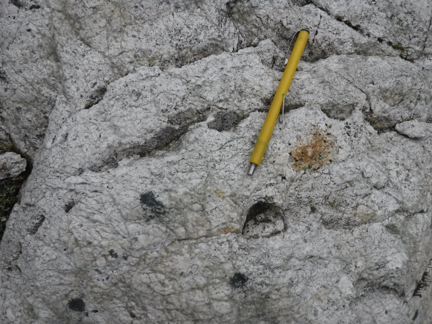
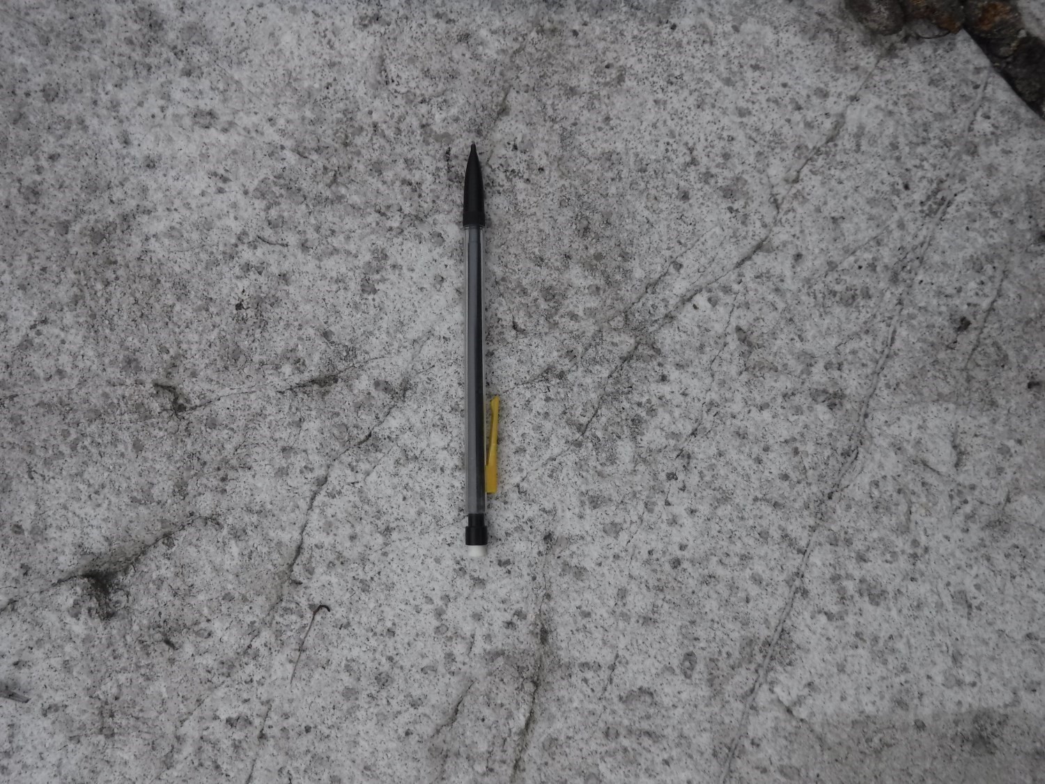
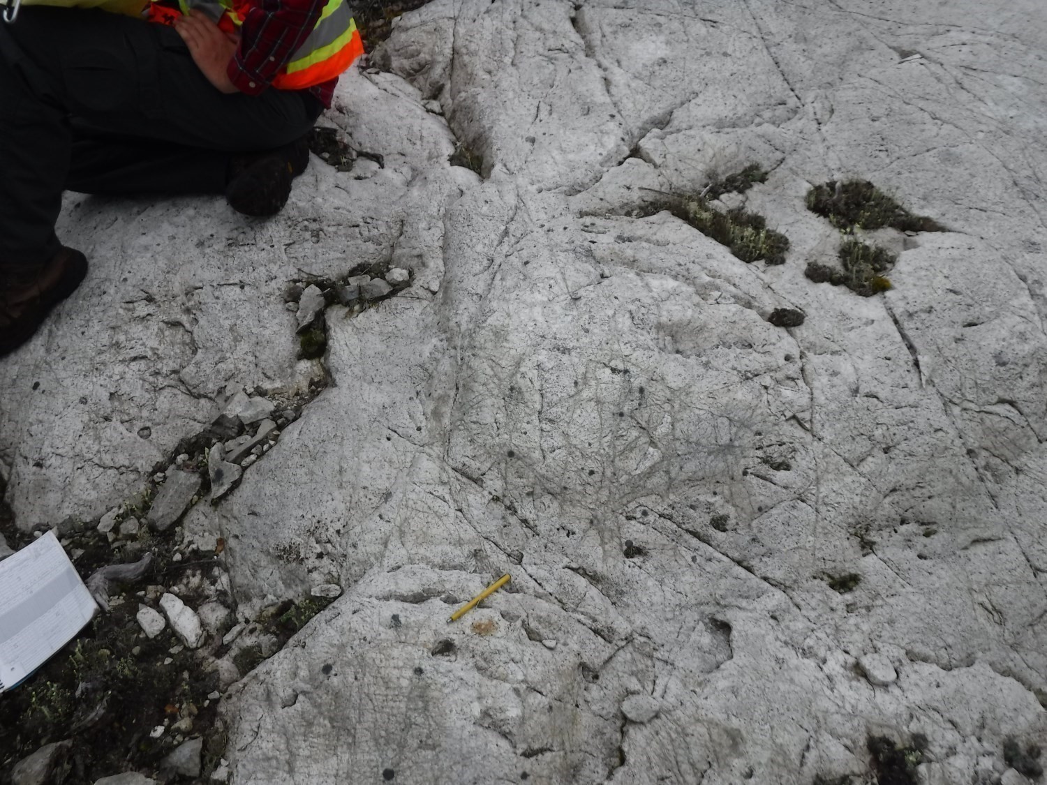
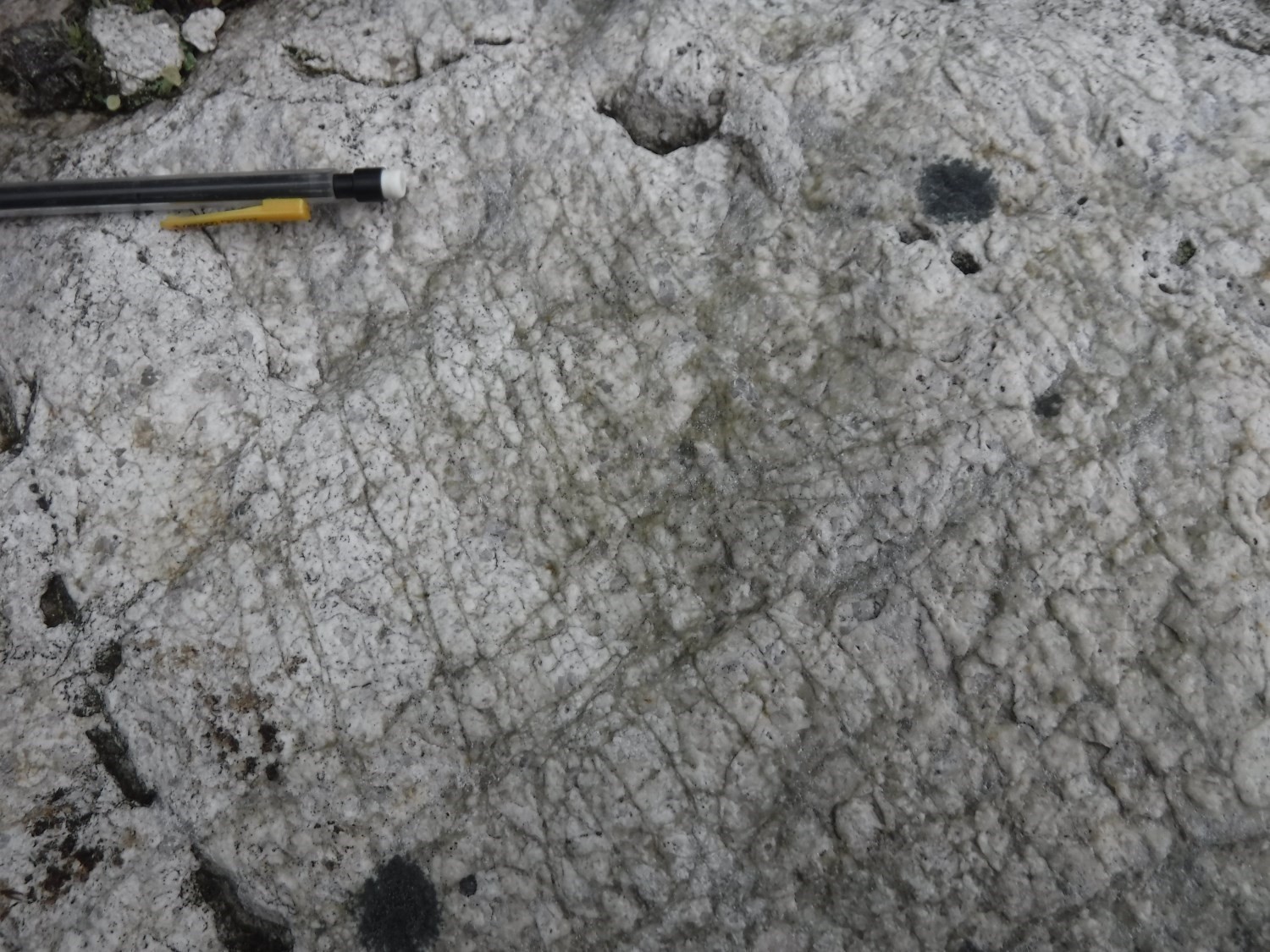
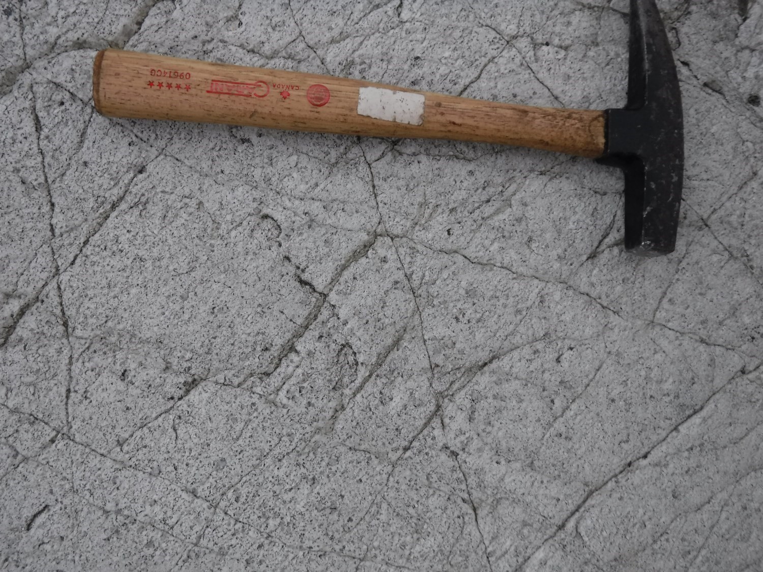
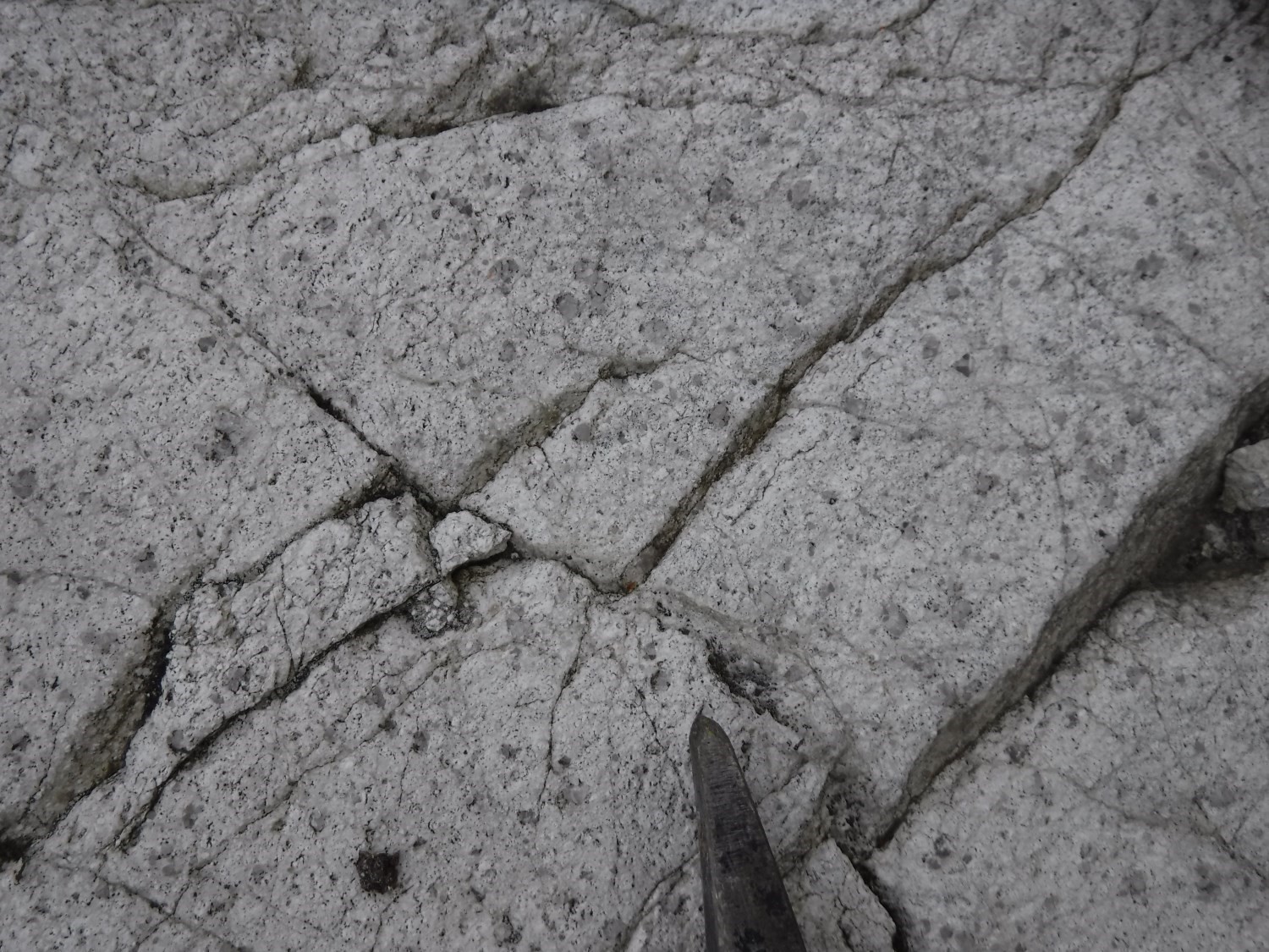
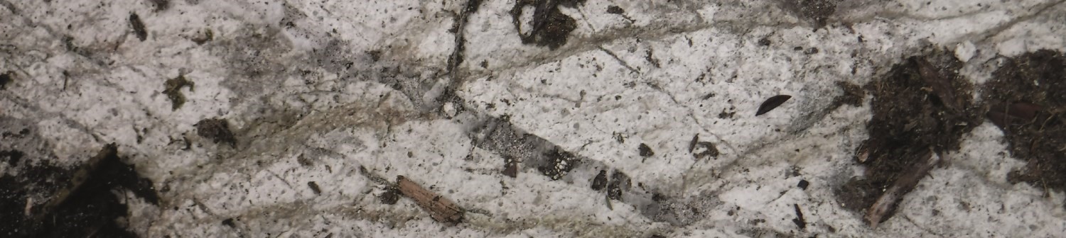
The Carpentier Pluton consists of a pinkish-white porphyritic tonalitic rock, massive and locally highly fractured. The fine-grained matrix contains ~10% coarse quartz and pinkish feldspar phenocrystals (1.5-3 mm in diameter). This porphyritic rock also contains 1% coarse pyrite cubes and 1% interstitial calcite. It contains enclaves of felsic volcanic rocks, mainly at its margin and eastern half. Enclaves seem recrystallized and coarser-grained, indicating the effect of contact metamorphism (McNeil et al., 1986). Vermette and de Chavigny (2002) preliminary attributed a granodioritic composition to the pluton, as well as a calc-alkaline affinity and possibly a synvolcanic character. On the other hand, the work of Pilote et al. (2019) indicates that it is rather a tonalite, indeed of calc-alkaline affinity comparable to the Barraute Pluton, and confirms its synvolcanic age.
Thickness and Distribution
The Carpentier Pluton covers an area of ~25 km2. Its long axis is oriented NW-SE and reaches 8 km, while its short axis is oriented NE-SO over 3 km. This pluton outcrops in sheets 32C05 and 32C06.
Dating
None.
Stratigraphic Relationship(s)
This intrusion is hosted in the Figuery Group. It follows the NE edge of the Lyndhurst Fault, which separates the Figuery Group from the Deguisier Formation, for almost 30% of its length. The intrusion is more or less conformable with adjacent volcanic units.
Paleontology
Does not apply.
References
Publications available through Sigéom Examine
BORDUAS, B. 1983. EXPLORATION PROGRAM REPORT ON CARPENTIER PROPERTY. ESSO RESSOURCES CANADA LTEE. Assessment work submitted to the Government of Québec. GM 40698, 67 pages and 5 plans.
DE CORTA, H., D’AMOURS, C. 1988. RAPPORT GEOLOGIQUE, PROPRIETE JOLIN. PLACEMENTS J E JOLIN INC, MINES DE METAUX ABITIBI LTEE. Assessment work submitted to the Government of Québec. GM 49134, 65 pages and 7 plans.
DESCARREAUX, J. 1988. RAPPORT GEOLOGIQUE SUR LA PROPRIETE JOLIN. MINES DE METAUX ABITIBI LTEE. Assessment work submitted to the Government of Québec. GM 61131, 40 pages and 21 plans.
LAVALLEE, J F., BOURGOIN, M. 2003. RAPPORT D’UNE CAMPAGNE DE 9 SONDAGES AU DIAMANT, PROPRIETE CHARLEBOIS (PN-122). SUDBURY CONTACT MINES LTD. Assessment work submitted to the Government of Québec. GM 60879, 482 pages and 5 plans.
LOMBARDI, D. 1995. REPORT ON DIAMOND DRILLING (WINTER 1995), CARPENTIER A. SUDBURY CONTACT MINES LTD. Assessment work submitted to the Government of Québec. GM 53428, 187 pages and 9 plans.
MacNEIL, K A., AVERILL, S A., EDWARDS, M. 1986. REVERSE CIRCULATION OVERBURDEN DRILLING AND HEAVY MINERAL GEOCHEMICAL SAMPLING, CARPENTIER PROJECT, RESSOURCES BP CANADA LTEE. Assessment work submitted to the Government of Québec. GM 44343. 219 pages and 9 plans.
OTIS, M., BÉLAND, G. 1986. PROJET DE CARTOGRAPHIE — REGION D’AMOS. EDWIN GAUCHER & ASSOCIES INC. MB 86-21, 138 pages and 14 plans.
PILOTE, P., MARLEAU, J., DAVID, J. 2019. Géologie de la région de Barraute, Sous-province de l’Abitibi, région de l’Abitibi-Témiscamingue, Québec, Canada. MERN. BG 2019-06.
TREMBLAY, D. 2008. RAPPORT DE TRAVAUX, CAMPAGNES DE FORAGE, PROPRIETE JOLIN. RESSOURCES ABITEX INC, PLACEMENTS J E JOLIN INC. Assessment work submitted to the Government of Québec. GM 63843. 425 pages and 2 plans.
VERMETTE, D., DE CHAVIGNY, B. 2002. RAPPORT D’UN FORAGE AUX DIAMANTS, PROPRIETE CHARLEBOIS (PN-122). SUDBURY CONTACT MINES LIMITED. Assessment work submitted to the Government of Québec. GM 59778, 44 pages and 2 plans.