

Last modified: 14 June 2019
Translation of original French
| Author(s): | Ambrose, 1944; Norman, 1944; Dimroth et al., 1973 |
| Age: | Neoarchean |
| Stratotype: | None |
| Type area: | Volcanic units can be found north of the Porcupine-Destor Fault Zone (NTS sheets 32D07, 32D08, 32D09, 32D10, 32D11, 32C05 and 32C12). The most representative outcrops are found on forest roads in the Aiguebelle National Park (NTS sheets 32D07, 32D08 and 32D10) |
| Geological province: | Superior Province |
| Geological subdivision: | Abitibi Subprovince |
| Lithology: | Volcanic and volcano-sedimentary rocks |
| Category: | Lithostratigraphic |
| Rank: | Group |
| Status: | Formal |
| Use: | Active |
- Kinojévis Group
Background
The first mention of the Kinojévis Group appeared in the geological mapping and compilation work of Ambrose (1944) and Norman (1944), covering rocks on either side of the Porcupine-Destor and Larder Lake-Cadillac faults (Jackson and Fyon, 1991), stretching in Abitibi from the NE region of Ontario to the NW region of Quebec. It was also at this time that the name “Kinojévis Group” was first used to designate volcanic units north of Porcupine-Destor Fault. Later, Dimroth et al. (1973) redefined the Kinojévis Group and subdivided it into three units: the Hunter Mine, Ruisseau Deguisier (now the Dehuisier Formation) and Ruisseau Paré formations. Even later, the Hunter Mine Formation was elevated to group status by Dimroth et al. (1982); it is considered an independent and older unit (2730 ±1 Ma; Mortensen, 1993). More recently, the Kinojévis Group was subdivided by Goutier (1997) in the Destor area (sheet 32D07-200-0201) into two formations: the Deguisier Formation (nAdg) at the base and the Lanaudière Formation (nAln) at the top. This latter formation includes most of the units previously assigned to the Ruisseau Paré Formation. According to Goutier (1997), this group includes volcanics located on the north side of the Porcupine-Destor Fault Zone in Quebec, based on specific compositions of the present units and geochronological criteria. These formations continue eastward in the Preissac (sheet 32D08), La Motte Lake and Barraute-Senneterre (sheets 32C05 and 32C06; Pilote et al., 2018) areas.
The Ruisseau Deguisier Formation is the main unit of the Kinojévis Group and is one of the most important units in sheet 32D10, in the heart of the Aiguebelle National Park (Goutier and Melançon, 2003). Its units were described in detail by Boivin (1974) on the Quebec side, and by Jensen (1978, 1981 and 1985) and Letros et al. (1983) on the Ontario side.
Units composing the Lanaudière Formation were initially identified in sheets 32D07 and 32D06 (Aiguebelle and Destor townships). They were successively described by Larouche (1974), Hocq (1979), Sanschagrin and Leduc (1979), and Dimroth et al. (1982) as the “Destor Volcanic Complex”. At the same time, Boivin (1974) interpreted the western extension of these units in sheet 32D06, west of Road 101 (Destor and Duparquet townships), and assigned them to the Lac Lanaudière Formation. Goutier and Lacroix (1992) used the name Lanaudière Complex to designate this unit due to the abundance of westbound intrusions and intense regional deformation in this area. The base of the Lanaudière Formation was arbitrarily set for the appearance of the first rhyolitic volcanics (Goutier and Lacroix, 1992). To remain consistent with mapping by Goutier (1997) and Pilote et al. (2009), the “Herva-Nord” and “Dubuisson Supérieur” designations proposed by Imreh (1984) were abandoned and combined in favour of the “Lanaudière Formation” in the NE quarter of sheet 32D08 and the northern half of sheet 32C05 (Pilote et al., 2018).
Description
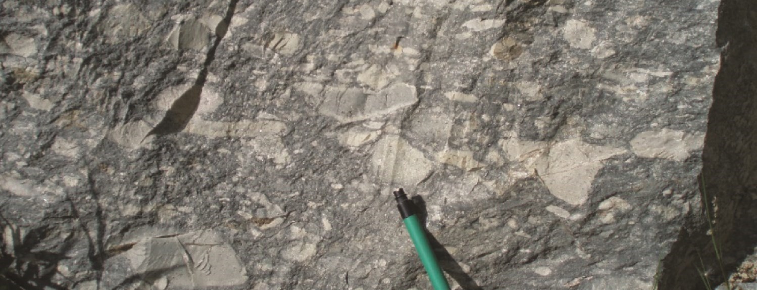
The Deguisier Formation (nAdg) consists of massive and pillow Fe-high and Mg-high tholeiitic basalt, thin chert horizons between flows, lobbed tholeiitic rhyolite and intermediate to felsic volcaniclastics, some of which were dated 2719.4 ±1 Ma and 2718.1 ±1.3 Ma (McNicoll, in Pilote et al., 2009). The abundance of gabbroic sills is its most distinctive character, coupled with the absence of ultramafic flows and sills. Gabbro is more abundant in the upper (southern) part of the formation. This formation is also characterized by two marker horizons of glomerophyric basalt in the Duparquet, Destor and Aiguebelle townships (sheet 32D10, Buffam, 1927; Bannerman, 1940; Graham, 1954; Hocq, 1979; Sanschagrin and Leduc, 1979; Goutier and Lacroix, 1992). These horizons allow for tracing the Abijévis Synclinal’s hinge in the SE quarter of Aiguebelle Township (Sanschagrin and Leduc, 1979). Volcanic facies and petrography of lava were described in detail in the works of Sanschagrin and Leduc (1979), Leduc (1981) and Sanschagrin (1981).
The Lanaudière Formation (nAla) consists of ultramafic lava, mafic and felsic volcanics (Sanschagrin and Leduc, 1979; Goutier 1997), as well as numerous tonalitic to monzonitic intrusions. Volcanic units are E-W oriented and have moderate to shallow dip to the north. They have polarity that systematically faces south. Two of the rhyolitic complexes of this formation, which define tholeitic suites, delivered zircon U-Pb ages of 2718.7 ±0.7 Ma and 2716.2 ±0.8 Ma (McNicoll, in Pilote et al., 2009). The Lanaudière Formation is bounded to the north by the Aiguebelle Fault and to the south by the Manneville Nord Fault, which has shallow to moderate dip to the north (Mueller et al., 1996; Daigneault et al., 2002; Pilote et al., 2009). These faults are possible subsidiary to the more westerly Destor-Porcupine system (Goutier, 1997; Legault et al., 2005). Goutier (1997) proposed that the Deguisier and Lanaudière formations were initially contiguous and subsequently separated by faults.
Basalts are predominant in the Lanaudière Formation. They are interbedded with felsic and ultramafic rocks. This formation also contains felsic pyroclastics and rhyolitic flows. Rhyolites form strips 10 to 150 m thick and are located in sheets 32D06, 32D07 and 32D08. The appearance and facies of rhyolitic flows are wide ranging: massive, lobbed, brecciated, aphanitic, quartz or feldspath porphyritic and spherulitic. The most commonly encountered facies are lobes and breccias, which have fluid flow structures. These facies and structures are indicative of submarine flows fed by small felsic centres. Isotopic dating on a rhyolite sample taken in sheet 32D06 yielded an age of 2718 ±2 Ma (Zhang et al., 1993).
Ultramafic lava flows, Mg-high basalts and komatiites with breccia, cumulate and spinifex facies, outcrop throughout this formation. These ultramafic and mafic units, in normal contact with other lithologies, are commonly located in the upper half of this formation. In addition, peridotite intrusions and pyroxenites are found in several locations adjacent to ultramafic lava. These intrusions are genetically associated with ultramafic lava according to lithogeochemical data (Goutier, 1997; Pilote et al., 2009).
Regional metamorphism affecting the Kinojévis Group is to the greenschist facies. However, in the south-central portion of the area west of Barraute (NW quarter of sheet 32C05), it reaches the amphibolite facies in an E-W-oriented strip approximately 2 km thick, located immediately on the north side of the La Corne Batholith (outcrops 17-PP-80 and 17-PP-81). The typical mineralogical assemblage of massive and pillow mafic volcanics is thus albite-actinolite or pale green hornblende-chlorite-epidote-quartz-carbonate. Ultramafic units are tremolitized and serpentinized (i.e., converted to talc and chlorite schists). More precisely, the mineralogical assemblage of serpentinized ultramafics consists of serpentine-magnetite-chlorite ± talc ± carbonate ± quartz (Jones, 1964; Brett et al., 1976; Imreh, 1984, 1991; Daigneault et al., 2002, 2004).
Thickness and Distribution
The entire Kinojévis Group has a thickness of approximately 6 to 7 km. The group is recognized from the Quebec and Ontario border to the eastern part of the La Corne Batholith, as well as in the Barraute–Senneterre area, over a length of >175 km. The Deguisier Formation (Dimroth et al., 1973; Hocq, 1977; Sanschagrin and Leduc, 1979; Goutier, 1997; Pilote et al., 2018; Pilote et al., 2019) forms a package of overall E-W-oriented volcanic lithologies, with stratigraphic thickness ranging from 1 km to nearly 5 km, and affected by the Abijévis Synclinal. Various volcanic units belonging to this formation can be found in sheets 32D07, 32D08, 32D09, 32D10, 32D11, 32C05, 32C06 and 32C12, north of the Porcupine-Destor Fault Zone. The formation has an average thickness of approximately 1000 to 1500 m. In the Aiguebelle National Park area, this thickness can reach 5 km (Goutier and Melançon, 2003). The Lanaudière Formation has a thickness varying from 1200 to 2000 m.
Dating
Felsic volcaniclastics of the Deguisier Formation were dated 2719.4 ±1 Ma and 2718.5 ±1.1 Ma (sheet 32D08; McNicoll, in Pilote et al., 2009), confirming the position of this formation at the base of the Kinojévis Group.
Two of the Lanaudière Formation’s rhyolitic complexes, which define tholeiitic suites, gave zircon U-Pb ages of 2718.7 ±0.7 Ma and 2716.2 ±0.8 Ma (McNicoll, in Pilote et al., 2009). The respective datings of the Deguisier and Lanaudière formations show a very narrow time gap of 2 Ma between emplacement of these two formations.
| Unit | Sample Number | Isotopic System | Mineral | Crystallization Age (Ma) | (+) | (-) | Reference(s) |
| nAdg6 | P8-6-D | U-Pb | Zircon | 2719.4 | 1 | 1 | McNicoll, in Pilote et al., 2009 |
| nAdg7 | P8-41-C2 | U-Pb | Zircon | 2718.5 | 1.1 | 1.1 | McNicoll, in Pilote et al., 2009 |
| nAln1 | PP-07-144 | U-Pb | Zircon | 2718.7 | 0.7 | 0.7 | McNicoll, in Pilote et al., 2009 |
| nAln1 | PP-06-118A | U-Pb | Zircon | 2716.2 | 0.8 | 0.8 | McNicoll, in Pilote et al., 2009 |
| nAln1 | Kinojévis | U-Pb | Zircon | 2718.0 | 2 | 2 | Zhang et al., 1993 |
Stratigraphic Relationship(s)
The Deguisier and Lanaudière formations are in fault contact (Aiguebelle Fault) over the entire range of sheets 32C05 to 32D11, a distance of >150 km. The Aiguebelle Fault and several other subparallel faults are possibly subsidiary to the Destor-Porcupine system recognized further west (Goutier, 1997; Legault et al., 2005). To the east of the intersection of the Abijévis Synclinal axial plane with the Aiguebelle Fault (sheet 32D07), volcanics of these two formations have opposite polarities.
The ages obtained for the formations composing the Kinojévis Group, as well as the close spatial association observed between ultramafic lava and rhyolitic complexes of this group, point to several significant and favourable comparisons with the Kidd- Munro assemblage described on the Ontario side of the Abitibi Subprovince (Berger, 2002; Ayer et al., 2002; Thurston et al., 2008). This assemblage hosts the Kidd Creek volcanogenic massive sulphide mine (Bleeker et al., 1996; Bleeker, 1999).
Paleontology
Does not apply.