

First published: 29 January 2019
Last modified: 23 January 2024
DISCLAIMER: This English version is translated from the original French. In case of any discrepancy, the French version shall prevail.
| Author: | Lafrance et al., 2018 |
| Age: | Paleoproterozoic |
| Stratotype: | None |
| Type area: | Griffis Lake area (NTS sheet 23P04) |
| Geological province: | Churchill Province |
| Geological subdivision: | Baleine Lithotectonic Domain |
| Lithology: | Enderbite |
| Category: | Lithodemic |
| Rank: | Lithodeme |
| Status: | Formal |
| Use: | Active |
None
Background
The Gamelin Enderbite was recognized during the Ministère’s fieldwork in 2017 as part of a regional synthesis of Southeastern Churchill Province (Lafrance et al., 2018). It consists of three small orthopyroxene intrusions in the southern Baleine Lithotectonic Domain. Only one was observed in outcrops with the other two being interpreted from aeromagnetic maps by their strong magnetic anomalies. Taner (1964) had mapped this area as a complex of metamorphosed rocks and more recent intrusive rocks.
Description

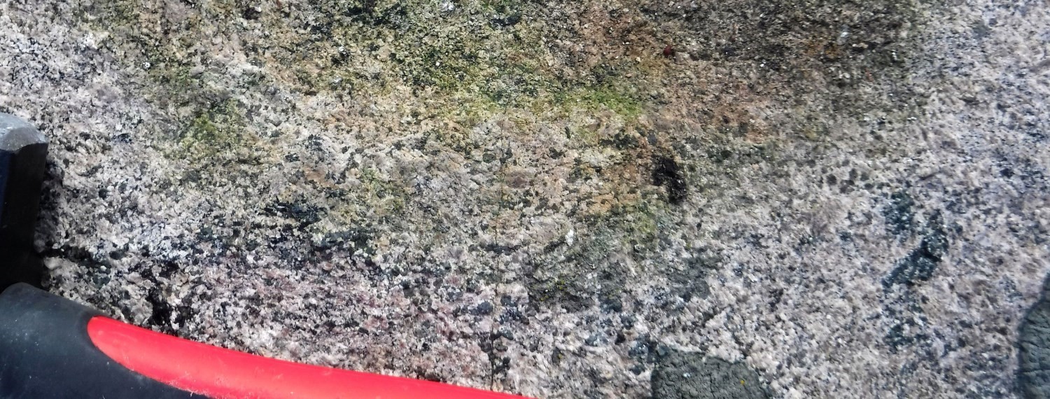
The Gamelin Enderbite is brown with a lighter brownish beige alteration patina. It is magnetic, medium to coarse grained and massive. In places, enderbite is pegmatitic. The rock consists of ~5% ferromagnesian minerals (biotite and orthopyroxene) disseminated as fine crystals or in small centimetric clusters.
Thickness and distribution
The Gamelin Enderbite forms three restricted intrusions inside the Griffis Complex, in the southern Baleine Lithotectonic Domain (Lafrance et al., 2020). The size of these intrusions ranges from 1 to 8 km2, for a total area of 14 km2.
Dating
None.
Stratigraphic Relationship(s)
The Gamelin Enderbite intrudes into the Griffis Complex. Decimetric to decametric enclaves of gneiss and diorite of the Griffis Complex are present in enderbite.
Paleontology
Does not apply.
References
Publications available through SIGÉOM Examine
LAFRANCE, I., CHARETTE, B., VANIER, M.-A., 2018. Sud-est de la Province de Churchill, Nunavik, Québec, Canada: synthèse de la géologie. MERN; BG 2018-12
LAFRANCE, I., VANIER, M.-A., CHARETTE, B., 2020. Domaine lithotectonique de Baleine, sud-est de la Province de Churchill, Québec, Canada: synthèse de la géologie. MERN; BG 2020-07, 4 plans.
Other publications
TANER, W.F., 1964. Geology, Griffis Lake, New Quebec / Géologie, Griffis Lake, Nouveau Québec. Geological Survey of Canada, « A » Series Map 1121A, 1 sheet. https://doi.org/10.4095/107788
Suggested Citation
Ministère de l’Énergie et des Ressources naturelles (MERN). Gamelin Enderbite. Quebec Stratigraphic Lexicon. https://gq.mines.gouv.qc.ca/lexique-stratigraphique/province-de-churchill/enderbite-de-gamelin_en [accessed on Day Month Year].
Contributors
|
First publication |
Benoit Charette, P.Geo., M.Sc. benoit.charette@mern.gouv.qc.ca (redaction) Mehdi A. Guemache, P.Geo., Ph.D. (coordination); Pierre Lacoste, P.Geo., M.Sc. (critical review); Simon Auclair, P.Geo., M.Sc. (editing); Céline Dupuis, P.Geo., Ph.D. (English version); Nathalie Bouchard (HTML editing). |
|
Revision(s) |
Isabelle Lafrance, P.Geo., M.Sc. isabelle.lafrance@mern.gouv.qc.ca (redaction; 06/08/2019) Mehdi A. Guemache, P.Geo., Ph.D. (coordination); Simon Auclair, P.Geo., M.Sc. (editing); Céline Dupuis, P.Geo., Ph.D. (English version). |