Français
 
La Dauversière Pluton
Stratigraphic label: [narc]lad
Map symbol: nAlad

First published: 7 December 2018
Last modified:


Translation of original French

Informal subdivision(s)
Numbering does not necessarily reflect the stratigraphic position.
 
None
 
Author:Hébert, 1980
Age:Neoarchean
Reference section:None
Type area:La Dauversière Lake, southwest portion of NTS sheet 32G09
Geological province:Superior Province
Geological subdivision:Abitibi Subprovince
Lithology:Tonalite, granodiorite
Type:Lithodemic
Rank:Lithodeme
Status:Formal
Use:Active

Background

The intrusion was first named the “La Dauversière Stock” by Hébert (1980), then the “La Dauversière Batholith” or “La Dauversière Pluton” by subsequent authors (Racicot et al., 1984; Daigneault, 1991; Roy et al., 2005).

Description

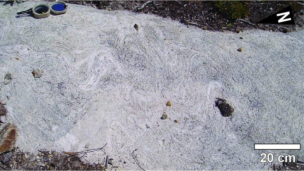
The inner part of the pluton consists of tonalite (≤10% biotite) that gradually evolves into granodiorite towards the core of the intrusion (Racicot et al., 1984). The La Dauversière Pluton is characterized by an intensively deformed edge zone, where tonalite develops a blastomylonitic texture and includes enclaves of Obatogamau Formation mafic volcanic rocks. The contact metamorphism aureole is up to 450 m thick (Hébert, 1979). Regionally, the La Dauversière Pluton is cut by several NNE-SSW faults related to the Grenvilian deformation (Hébert, 1979; Roy et al., 2005).

Thickness and Distribution

The La Dauversière Pluton is a 15-km-diameter subcircular intrusion located along the La Dauversière Anticline’s axial trace (Daigneault and Allard, 1990).

Dating

Sample LDP-1 returned a crystallization age of 2719.8 +3.0/-0.6 Ma (Mortensen, 1993).

Isotopic SystemMineralCrystallization Age (Ma)(+)(-)Reference(s)
U-PbZircon2719.83.00.6Mortensen, 1993

Stratigraphic Relationship(s)

The La Dauversière Pluton cuts mafic volcanic rocks of the Obatogamau Formation. It is cut by the NNE-SSW-oriented Chef Dykes (2408 ±3 Ma; Ciborowski et al., 2014). 

Paleontology

Does not apply.

References

Author(s)TitleYear of PublicationHyperlink (EXAMINE or Other)
CIBOROWSKI, T.J.R. – KERR, A.C. – McDONALD, I. – ERNST, R.E. – HUGHES, H.S.R. – MINIFIE, M.J.The geochemistry and petrogenesis of the Paleoproterozoic du Chef dyke swarm, Québec, Canada. Precambrian Research; volume 250, pages 151-166.2014Source
DAIGNEAULT, R.Évolution structurale du segment de roches vertes de Chibougamau, Sous-province archéenne de l’Abitibi, Québec. Université Laval; doctoral thesis, 352 pages.1991
DAIGNEAULT, R. – ALLARD, G.O.Le Complexe du lac Doré et son environnement géologique (région de Chibougamau – Sous-province de l’Abitibi). Ministère de l’Énergie et des Ressources, Québec; MM 89-03, 290 pages.1990MM 89-03
HÉBERT, C.Contexte géologique régional du gisement aurifère de la Mine Chibex, Chibougamau, Québec. Université du Québec à Chicoutimi; master’s thesis, 106 pages.1979Source
HÉBERT, C.Géologie du quart sud-ouest du canton de La Dauversière et du quart nord-ouest du canton de Rohault, district de Chibougamau, Québec. Ministère de l’Énergie et des Ressources, Québec; DPV 723, 55 pages, 1 plan.1980DPV 723
MORTENSEN, J.K.U-Pb geochronology of the eastern Abitibi subprovince. Part 1: Chibougamau – Matagami – Joutel region. Canadian Journal of Earth Sciences; volume 30, pages 11–28.1993Source
RACICOT, D. – CHOWN, E.H. – HANEL, T.Plutons of the Chibougamau-Desmaraisville belt; a preliminary survey. In Chibougamau : stratigraphy and mineralization (Guha, J. and Chown, E.H., editors). Canadian Institute of Mining and Metallurgy; volume 34, pages 178-197.1984
ROY, P. – TURCOTTE, S. – CADÉRON, S. – HOULE, P. – SHARMA, K.N.M.Géologie de la région du lac Charron (32G/08 et 32G/09). Ministère des Ressources naturelles et de la Faune, Québec; RG 2005-02, 35 pages, 3 plans.2005RG 2005-02
15 octobre 2019