

Last modified: 11 June 2019
Translation of original French
| Author: | Beauchamp et al., 2018 |
| Age: | Neoarchean |
| Reference section: | None |
| Type area: | Bohier Island region (NTS sheet 33A08) |
| Geological province: | Superior Province |
| Geological subdivision: | Opatica Subprovince |
| Lithology: | Tonalite |
| Unit type: | Lithodemic |
| Rank: | Lithodeme |
| Status: | Formal |
| Use: | Active |
None
Background
The Île Bohier Pluton was introduced by Beauchamp et al. (2018). The first 1:50 000 scale mapping in the region, conducted by Hocq (1976) and then improved in a regional synthesis (Hocq, 1985), identified an assemblage of “light diorite and biotite hornblende leucotonalite to the east” of Bohier Island. The outline of this unit was quite imprecise. In 1987, Couture refined mapping of the area and placed a central tonalitic complex east of NTS sheet 33A08. This complex includes the current Île Bohier and Chiyaaskw plutons. In 1988, the central tonalitic complex was renamed the Île Bohier Granodiorite by Roy. Following the summer 2017 mapping work, Beauchamp et al. introduced the Île Bohier Pluton, a unit that is distinct from the large Chiyaaskw Pluton to the east.
Description
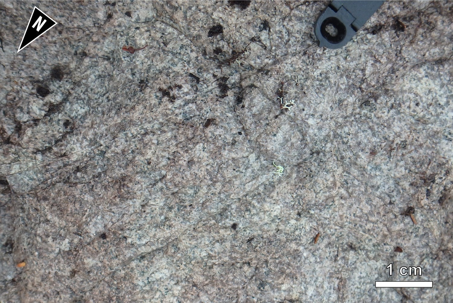
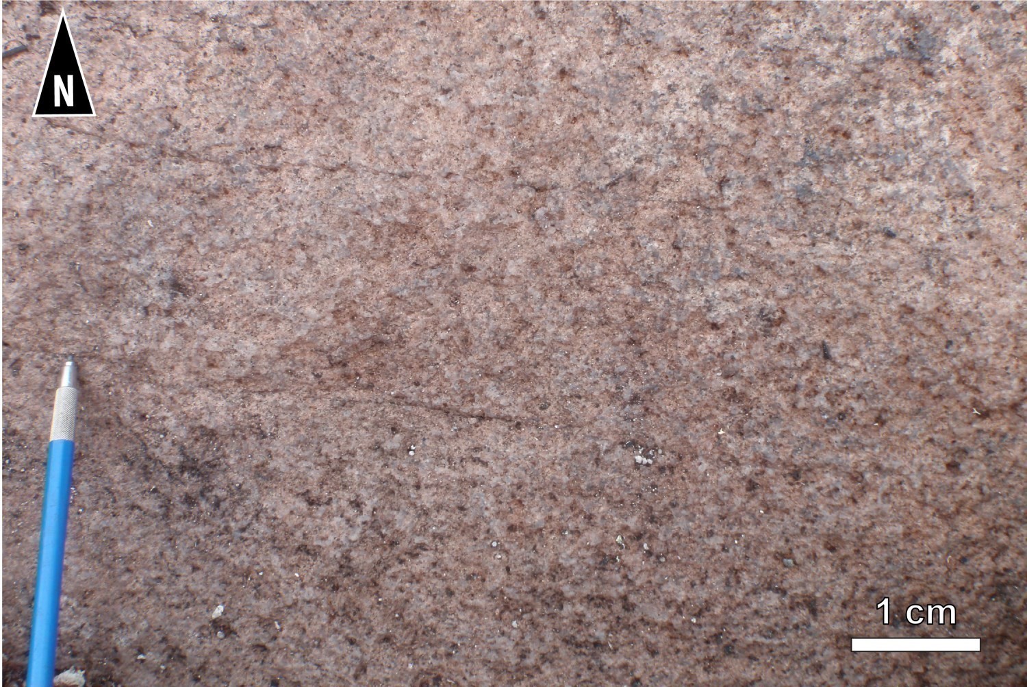
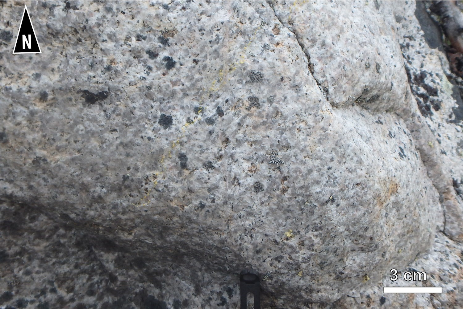
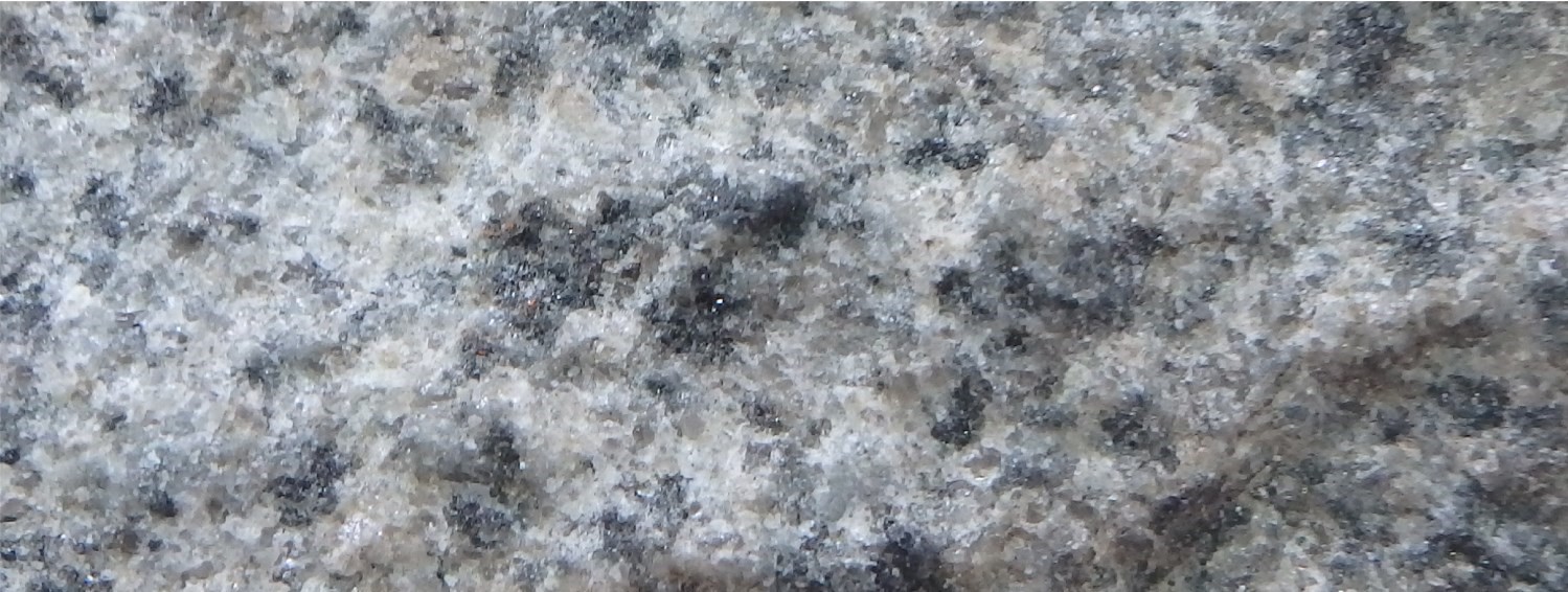
The Île Bohier Pluton is a homogenous, medium-grained, equigranular tonalite appearing slightly deformed. This intrusion is more competent than adjacent volcanic rocks and is located in the hinge of a regional fold (Île Bohier Anticlinal). This seems to have shielded it from the main deformation. Rocks of the Chiyaaskw Pluton, directly to the east, show a much more marked deformation. Locally, the composition of the Île Bohier Pluton can become more granodioritic. In altered surface, the rock is light grey-white with a greenish shade locally. In fresh exposure, it is white-grey to slightly darker pink grey. Although deformation appears weak, aeromagnetic maps indicate that this unit follows the shape of the Upper Eastmain Greenstone Belt (UEGB), just to the west. The total residual magnetic gradient map shows lineaments overprinting in the field magmatic banding and S1 foliation, which range in orientation from NNW-SSE to N-S to NNE-SSW. S1 foliation is marked by a preferential alignment of quartz crystals and mafic minerals. Mafic minerals usually appear in small clusters, giving the rock a distinctive spot appearance. Some large quartz grains are slightly elongated and appear in mosaic with an undulating extinction in thin section. Another characteristic of this rock is its alteration; it is affected by low and diffuse carbonatation causing hydrochloric acid effervescence, which is not the case for other plutons in the region. The carbonate type observed is calcite. The rock also shows propylitic alteration, moderate to high chlorite and sericite alteration, and mild epidotization. Locally, the replacement of biotite with chlorite is complete. The Île Bohier Pluton is also cut by potassic alteration veinlets, an alteration typical of the proximal zone of porphyry-type mineralization. Although difficult to see with the naked eye, 0.5% tourmaline can be observed on thin section. Thus, the rock is affected by carbonate-sericite-tourmaline alteration. Finally, the rock is slightly hematitised.
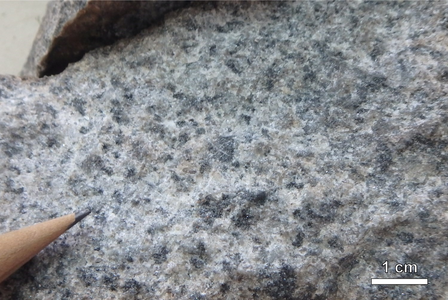
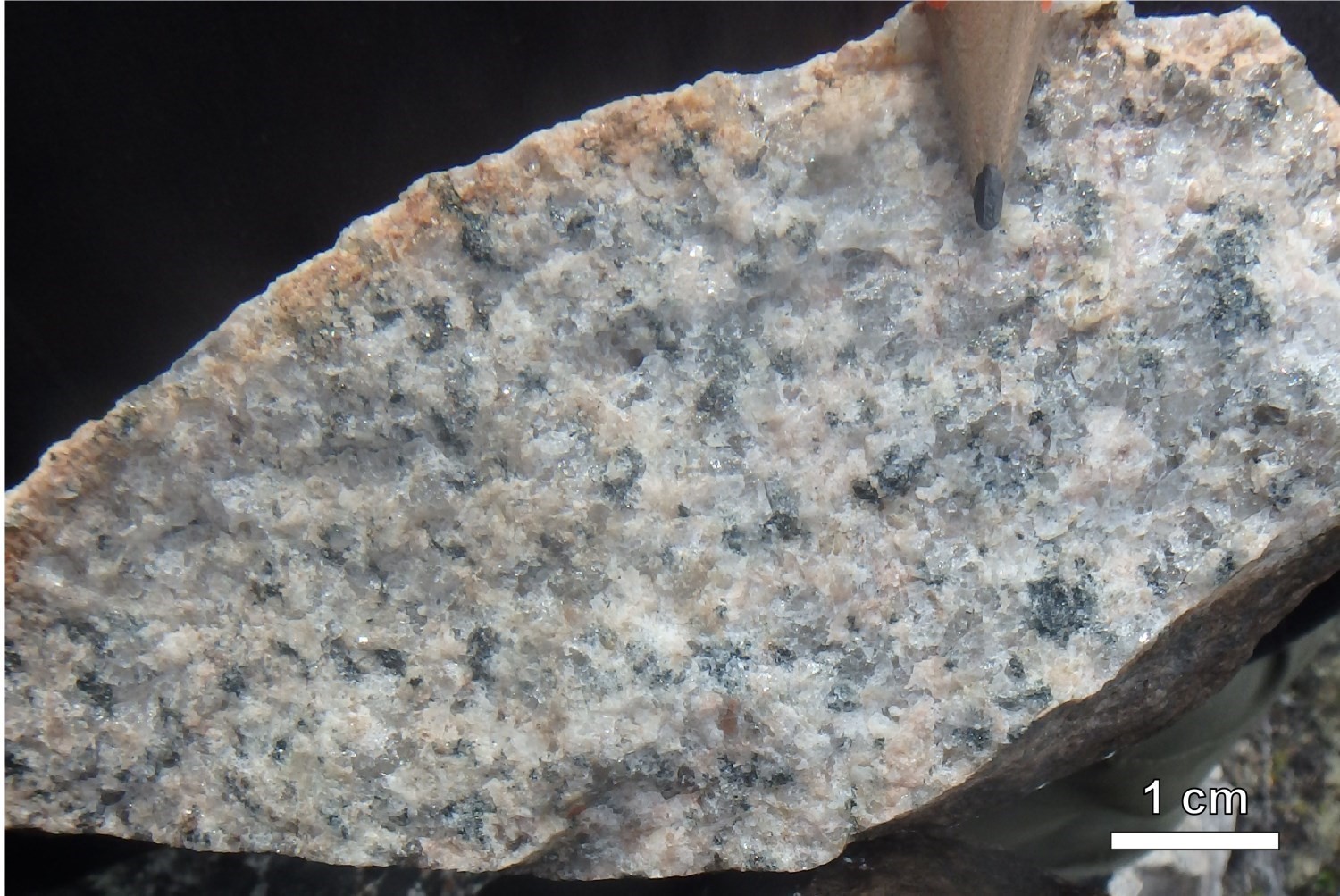

The main ferromagnesian minerals are biotite (2-10%), muscovite (up to 4%) and, locally, hornblende. These minerals form small clusters. Magnetite gives the rock a variable magnetic susceptibility depending on outcrops, ranging from weak to strong. Traces of pyrite and pyrrhotite are disseminated in rock or in veinlets.
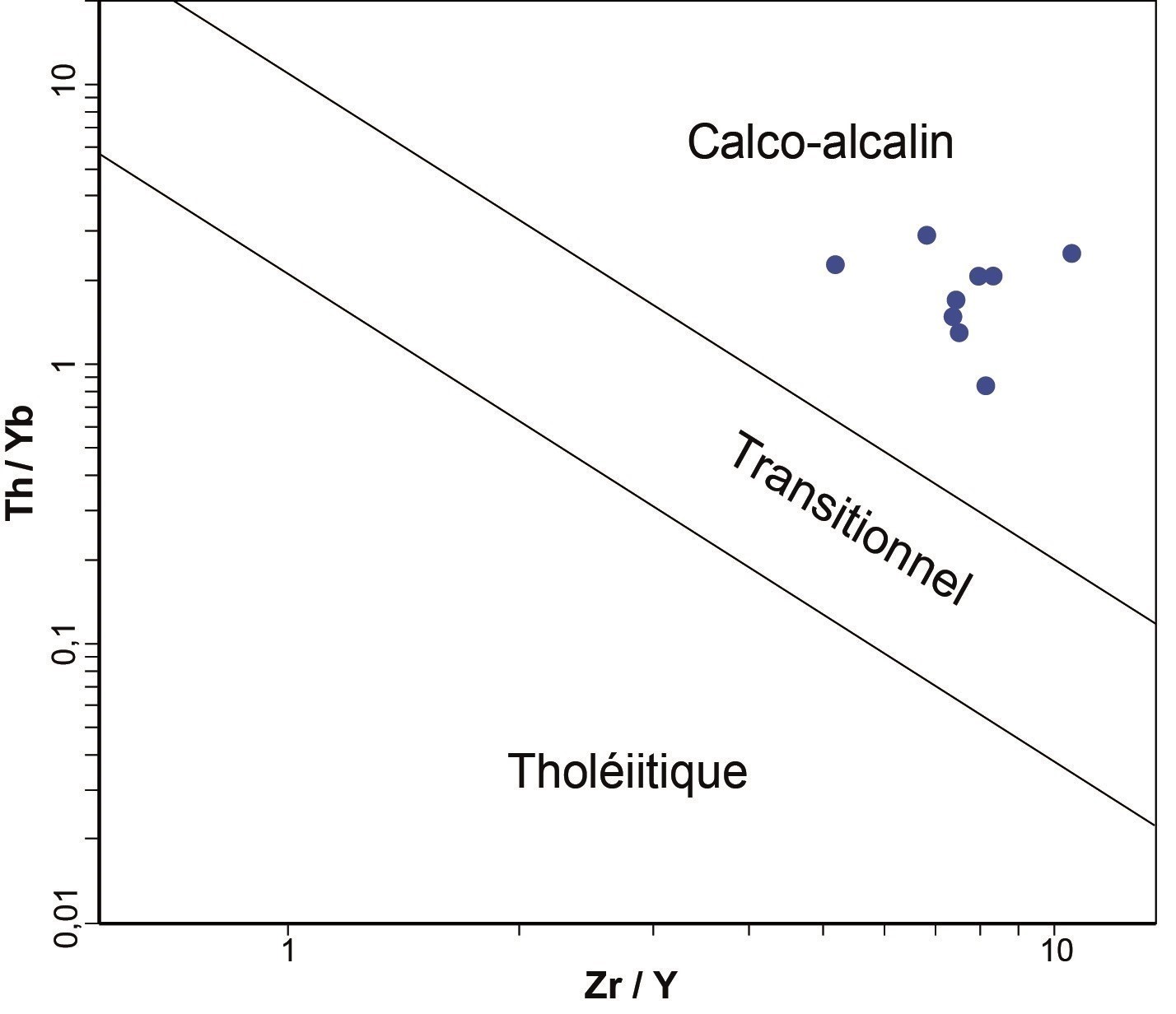
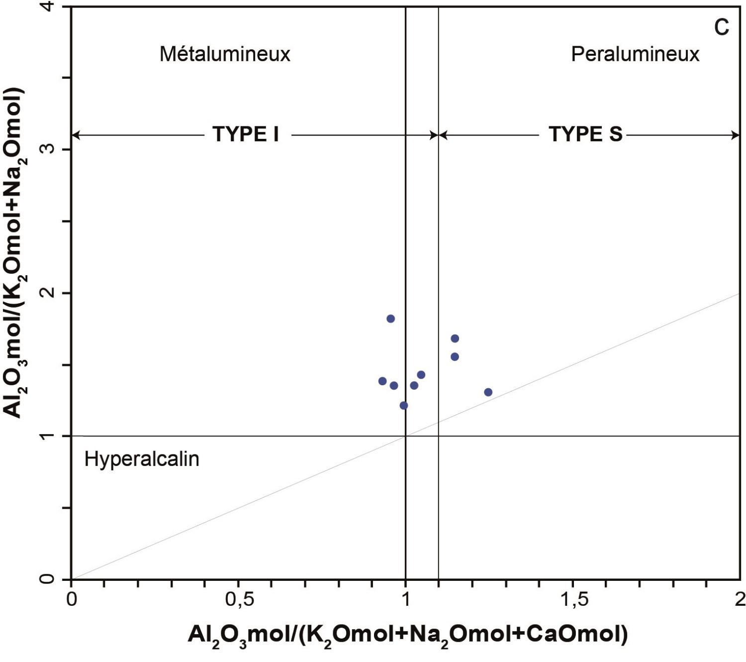
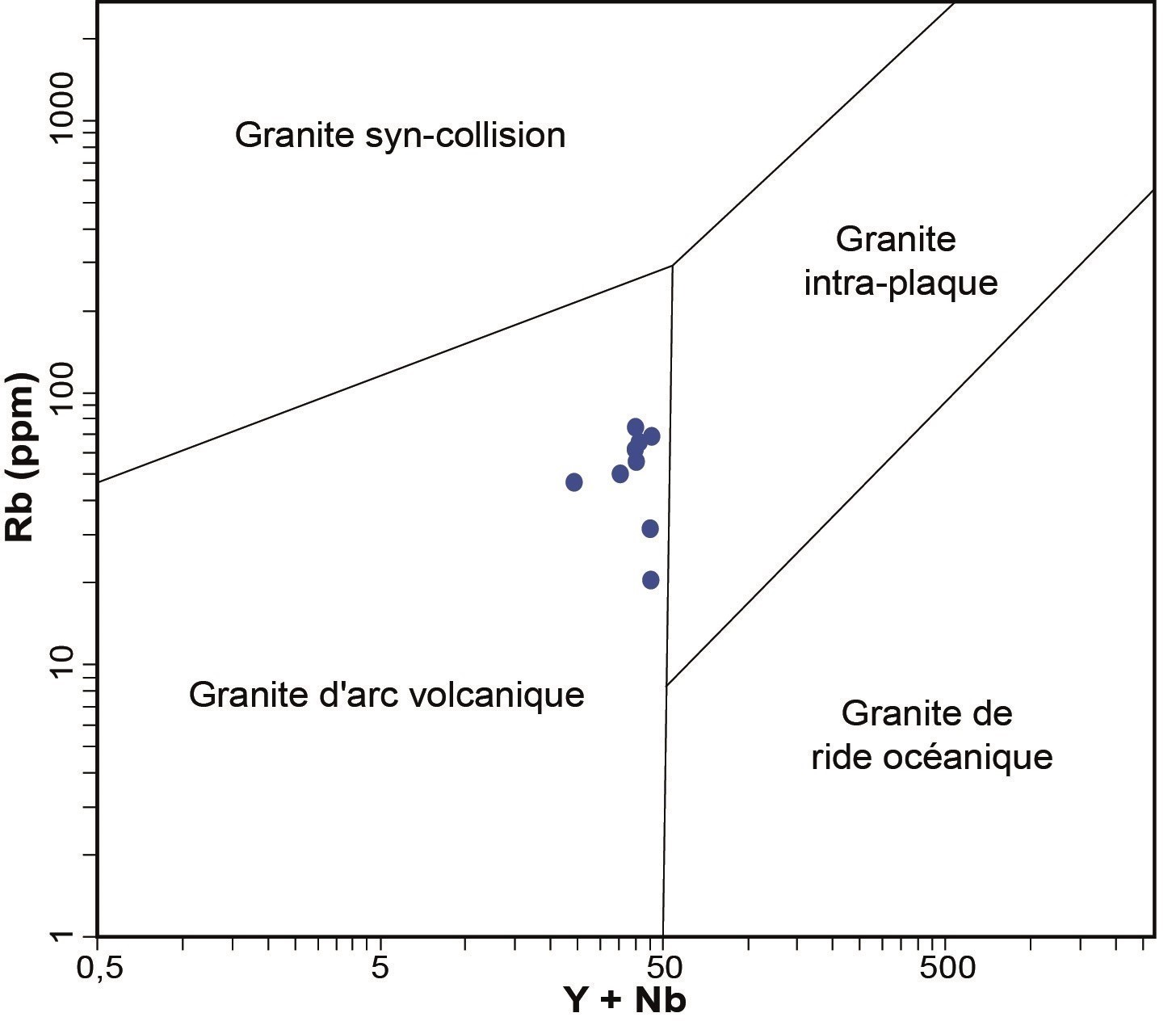
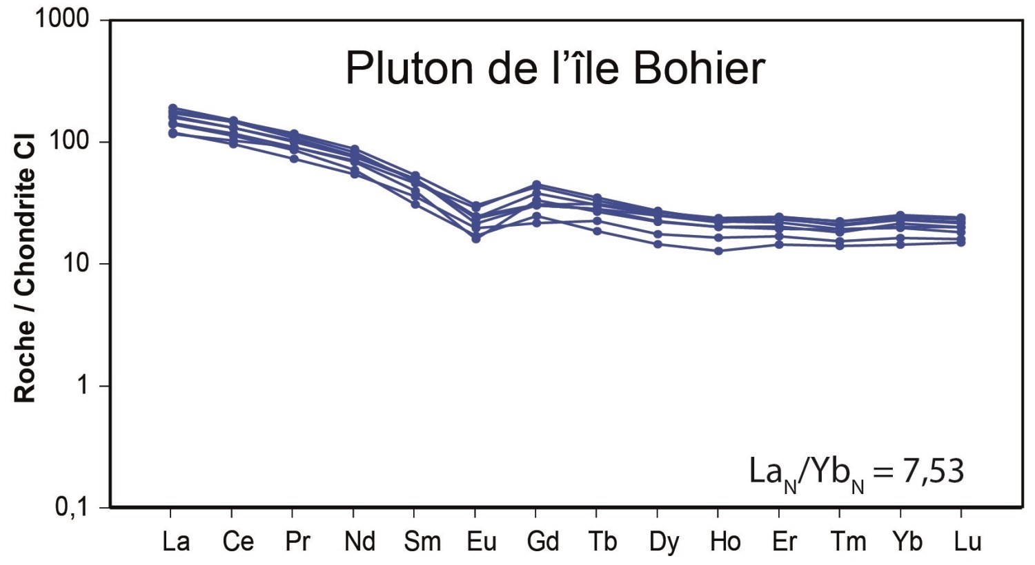
From a geochemical perspective, the rock is of calc-alkaline affinity (Ross and Bédard, 2009). Type I, it is peraluminous to metaluminous (Maniar and Piccoli, 1989). In the diagram of Pearce et al. (1984), samples are located in the field of volcanic arc granites. Finally, the rare earth diagram normalized to CI chondrite (McDonough and Sun, 1995) shows a slight enrichment of light rare earth elements compared to heavy rare earth elements and a negative europium anomaly.
Thickness and Distribution
The Île Bohier Pluton is 14 km long by 8 km wide. It is located in NTS sheet 33A08, directly east and southeast of Bohier Island.
Dating
A U-Pb age of 2771 ±6 Ma (Davis and Sutcliffe, 2018b) was obtained for the Île Bohier Pluton, confirming a synvolcanic setting contemporary to the Roman Formation. Indeed, rocks of the UEGB gave an age of 2800 ±6 Ma (Davis and Sutcliffe, 2018b) for the first volcanic episode and 2770 ±3 Ma (Davis and Sutcliffe, 2018b) and 2774 ±6 Ma (Davis and Sutcliffe, 2018a) for the second episode (Davis, personal communication). The youngest third volcanic episode (the Clément Formation) was not dated, but rby elative chronology it would be younger than 2770 Ma. The Dolent Formation (2751 ±5 Ma, Davis, personal communication, 2019) was also emplaced after the Île Bohier Pluton. Furthermore, the latter is older than the Chiyaaskw Pluton (2746 ±3 Ma; Davis and Sutcliffe, 2018a), just to the east.
| Isotopic System | Mineral | Crystallization Age (Ma) | (+) | (-) | Inherited Age (Ma) | (+) | (-) | Metamorphic Age (Ma) | (+) | (-) | Reference(s) |
| U-Pb | Zircon | 2771 | 6 | 6 | Davis and Sutcliffe, 2018b |
Stratigraphic Relationship(s)
The Île Bohier Pluton is synvolcanic. Geochronological results indicate that it is contemporary to the second volcanic episode of the UEGB (Roman Formation). The Île Bohier Pluton intrudes the Érasme Formation, which is the first volcanic episode of the UEGB. The Chiyaaskw Pluton, on the east side, is younger and therefore intrusive in the Île Bohier Pluton. Several EW-oriented dykes are located east of the Île Bohier Pluton. Very few outcrops have been described on these dykes. They have been interpreted using aeromagnetic maps.
Paleontology
Does not apply.
References
| Author(s) | Title | Year of Publication | Hyperlink (EXAMINE or Other) |
|---|---|---|---|
| BEAUCHAMP, A.-M. – MASSEI, F. – DAOUDENE, Y. | Géologie de la région de l’île Bohier, au contact entre les sous-provinces d’Opatica, d’Opinaca et le bassin d’Otish, au nord de Mistassini, municipalité Eeyou Istchee Baie-James, Québec, Canada. Ministère de l’Énergie et des Ressources naturelles, Québec. | 2018 | BG 2018-02 |
| COUTURE, J.-F. | Géologie de la partie occidentale de la bande volcano-sédimentaire de la rivière Eastmain supérieure – rapport intermédiaire. Ministère des Ressources naturelles, Québec, 110 pages. | 1987 | MB 87-51 |
| DAVIS, D.W. – SUTCLIFFE, C.N. | Geochronology of Zircon and Monazite by LA-ICPMS in samples from northern Quebec. UNIVERSITY OF TORONTO, 54 pages. | 2018a | MB 2018-18 |
| DAVIS, D.W. – SUTCLIFFE, C.N. | U-Pb Geochronology of Zircon and Monazite by LA-ICPMS in Samples from Northern Quebec. UNIVERSITY OF TORONTO 113 pages. | 2018b | MB 2019-01 |
| HOCQ, M. | Géologie de la région du lac Cadieux (Nouveau-Québec). Ministère des Ressources naturelles, Québec, 17 pages. | 1976 | DPV 433 |
| HOCQ, M. |
Géologie de la région des lacs Campan et Cadieux, Territoire-du-Nouveau-Québec. Ministère des Ressources naturelles, Québec, 188 pages. |
1985 | ET 83-05 |
| MANIAR, P. D. – PICCOLI, P.M. | Tectonic discrimination of granitoids. Geological Society of America Bulletin, volume 101, pages 635-643. | 1989 | Source |
| MCDONOUGH, W. F. – SUN, S. S. | The composition of the earth. Chemical Geology, volume 120, pages 223-253. | 1995 | Source |
| PEARCE, J. A. – HARRIS, N. W. – TINDLE, A. G. | Trace element discrimination diagrams for the tectonic interpretation of granitic rocks. Journal of Petrology, volume 25, pages 956-983. | 1984 | Source |
| ROSS, P.-S. – BÉDARD, J.H. | Magmatic affinity of modern and ancient subalkaline volcanic rocks determined from trace-element discriminant diagrams. Journal Canadien des Sciences de la Terre, volume 46, pages 823-839. | 2009 | Source |
| ROY, C. | Géologie du secteur de l’île Bohier de la bande volcano-sédimentaire de la rivière Eastmain supérieure. Ministère des Ressources naturelles, Québec, 115 pages. | 1988 | MB 88-16 |