

Last modified:
Translation of original French
| Author: | Faribault et al., 1912 |
| Age: | Paleoproterozoic |
| Reference section: | None |
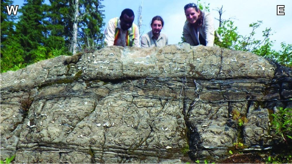
| Type area: | The “Papaskwasati Bowl”, located in the northern part of Mistassini Lake, is the preferred location for studying the gradual contact between the four formations of the Mistassini Group (see Caty, 1976, figure 15); NTS sheets 32P02, 32P07 and 32P10 |
| Geological province: | Superior Province |
| Geological subdivision: | Opatica Subprovince |
| Lithology: | Sedimentary rocks |
| Type: | Lithostratigraphic |
| Rank: | Group |
| Status: | Formal |
| Use: | Active |
- Mistassini Group
- Témiscamie Formation
- Albanel Formation
- Cheno Formation
- Papaskwasati Formation
Background
Rocks of the Mistassini Group were initially compared to Cambrian rocks on the east side of James Bay (Low, 1886), and then to Upper Huronian limestone (Low, 1906). This unit was initially designated as the Mistassini Limestone and correlated with the Lower Huronian (Faribault et al., 1912). It was later named Mistassini Series (Norman, 1940), then renamed Mistassini Group by Bergeron (1957) to include all sedimentary rock units characterizing the Mistassini and Albanel lake areas, namely the Papaskwasati, Cheno, Albanel and Témiscamie formations.
Description
The Mistassini Group includes the following four formations:
- the Témiscamie Formation (pPte), consisting of cherty iron formation, clayshale, quartzite, wacke and siltstone;
- the Albanel Formation (ppal), consisting of dolomite, stromatolitic dolomite, clay dolomite, intraformational breccia, graphitic dolomite and chert;
- the Cheno Formation (pPcn), consisting of sandstone, conglomerate, sandy dolomite and stromatolitic dolomite;
- the Papaskwasati Formation (pPpw), consisting of conglomeratic sandstone, conglomerate and sandstone.
Thickness and distribution
The Mistassini Group, also known as the Mistassini Basin, covers an area of 7300 km2. It includes the four sedimentary formations mentioned above, located on the periphery of Mistassini and Albanel lakes and in the Pépeshquasati River area (Caty, 1976).
Dating
Seven (7) samples of mudslate from the Témiscami Formation, which lies at the top of the Mistassini Group, were analyzed with the Rb-Sr method and helped define an isochrone at 1787 ±55 Ma (Fryer, 1972).
| Isotopic System | Mineral | Crystallization Age (Ma) | (+) | (-) | Reference(s) |
| Rb-Sr | Biotite | 1787 | 55 | 55 | Fryer, 1972 |
Stratigraphic Relationship(s)
From a chronostratigraphic point of view, the Mistassini Group sedimentary rocks postdate those of the Chibougamau Formation, although the two units never appear in direct contact. On the field, the Mistassini Group sedimentary rocks unconformably overlie a basement made up of Mesoarchean to Neoarchean rocks in contact with the Opatica Subprovince and the Parautochton of the Grenville Province. The basement, which appears heavily altered in the first few metres of contact with sedimentary rocks, corresponds to a paleoregolith (Caty, 1976).
Paleontology
Does not apply.
References
| Author(s) | Title | Year of Publication | Hyperlink (EXAMINE or other) |
|---|---|---|---|
| BERGERON, R. | Late Precambrian Rocks of the North Shore of the St. Lawrence River and of the Mistassini and Otish Mountain Areas, Quebec. In: The Proterozoic in Canada (Gill, J.E., editor), Royal Society of Canada, Special Publication 2, pages 124-131. | 1957 | – |
| CATY, J.L. | Stratigraphie et pétrologie de la Formation de Papaskwasati (Aphébien) de la région du lac Mistassini, Québec. Université de Montréal; doctoral thesis, 235 pages, 6 plans. | 1976 | – |
| FARIBAULT, E.R. – GWILLIM, J. C. – BARLOW, A.E. | Rapport sur la géologie et les ressources minières de la région de Chibougamau. Ministère de la colonisation, des mines et des pêcheries, Québec; AP 1912-01, 366 pages, 2 plans. | 1912 | AP 1912-01 |
| FRYER, B.J. | Age Determinations in the Circum-Ungava Geosyncline and the Evolution of Precambrian Banded Iron-Formations. Canadian Journal of Earth Sciences; volume 9, pages 652-663. | 1972 | Source |
| LOW, A.P. | Lake Mistassini, With Geological Boundaries. Geological Survey of Canada; Multicoloured Map 228, 1 plan. | 1886 | Source |
| LOW, A.P. | Rapport géologique sur la région minière de Chibougamau dans la partie septentrionale de la Province de Québec. Geological Survey of Canada; Separate Report 955, 63 pages, 1 plan. | 1906 | Source |
| NORMAN, G.W.R. | Thrust faulting of Grenville gneisses northwestward against the Mistassini Series of Mistassini Lake, Quebec. Journal of Geology; volume 48, pages 512-525. | 1940 | Source |