

Last modified:
Translation of original French
| Author: | Mathieu and Beaudette, 2019 |
| Age: | Paleoproterozoic |
| Reference section: | None |
| Type area: | Watts Lake (NTS sheet 35G16) and Purtuniq (sheet 35H13) areas, near the Faucon River |
| Geological province: | Churchill Province |
| Geological subdivision: | Ungava Orogen / Ungava Trough / Northern Domain |
| Lithology: | Tonalite |
| Type: | Lithodemic |
| Rank: | Lithodeme |
| Status: | Formal |
| Use: | Active |
Background
The Qimmiq Pluton was defined by Mathieu and Beaudette (2019) to individualize two kilometre-sized tonalitic plutons included in the Cape Smith Suite. The Cape Smith Suite was introduced by Taylor (1982) to describe a late intrusion. Subsequent authors (Lamothe, 2007) used the suite to group a series of late intrusions of various natures (granitic to peridotitic) that outcrop in the Ungava Orogen, mostly in the Northern Domain.
Description

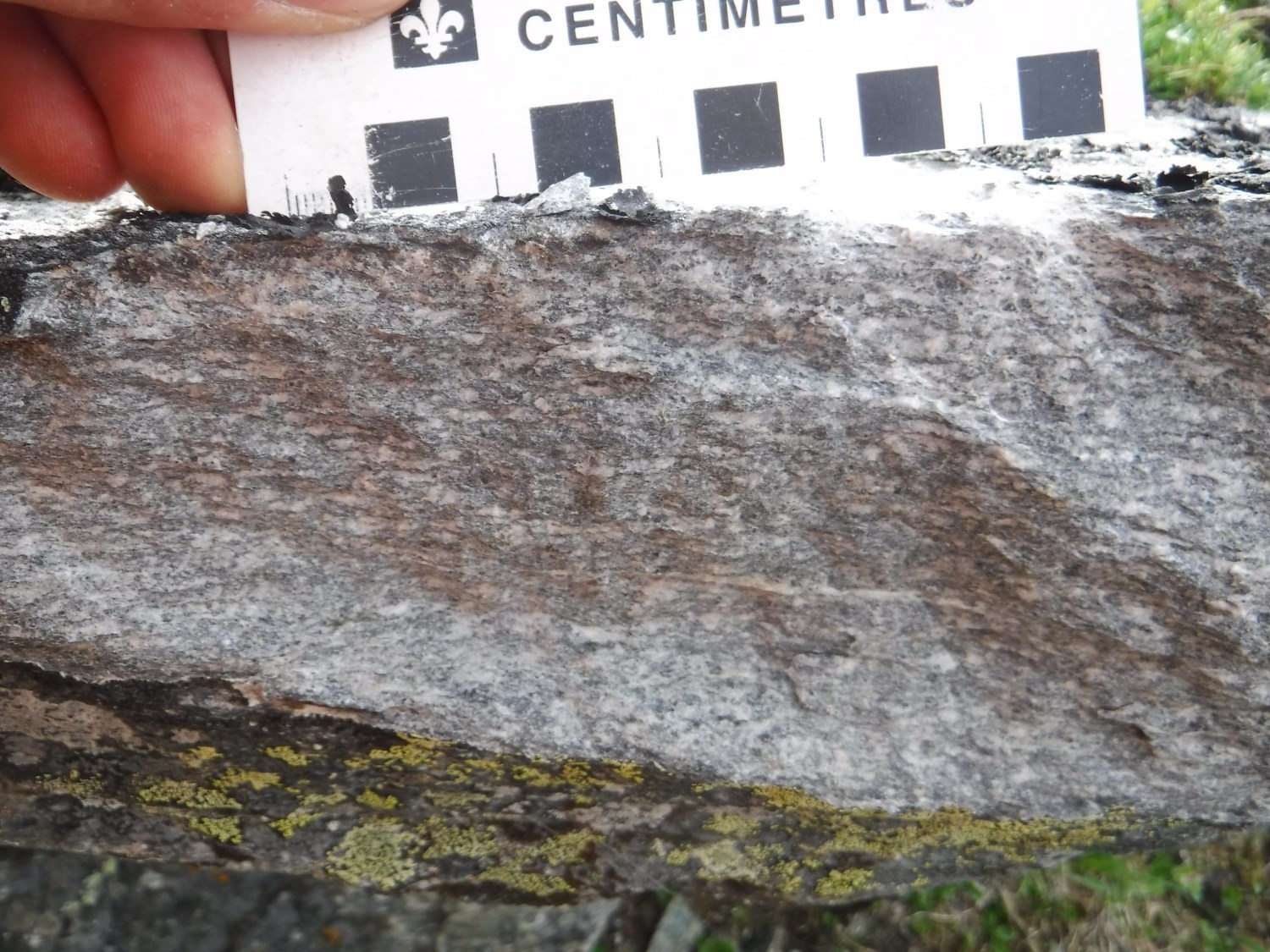
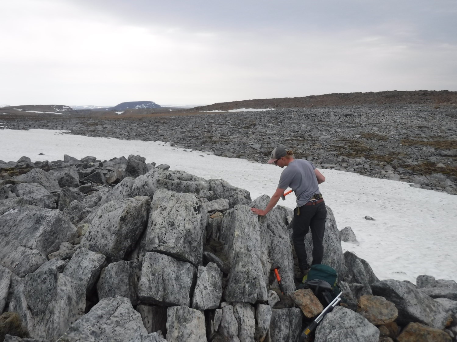
Qimmiq Pluton outcrops are easily distinguished from the dominant lithologies of the area by their whitish patina and rounded shape. The rock is light grey in fresh exposure. Samples are not magnetic. Tonalite contains 25 to 30% quartz and 10% ferromagnesian minerals (biotite and chlorite). It is medium grained and plagioclase is recrystallized as a subgrain at the edge of primary crystals. Conferring a slightly greenish colour to the rock in fresh exposure, sericitization (and more locally carbonatization and chloritization) is observed in thin section. Strong deformation results in the alignment of all mineral phases.
In the vicinity of the Watts Group’s western thrusting over the Spartan Group, disseminated pyrrhotite-chalcopyrite mineralization is visible in tonalite cutting Watts Group chlorite-actinolite schist (unit pPwa5). A chalcopyrite veinlet is also reported (Cool-Kuluk mineralized zone).
Thickness and Distribution
The intrusion outcrops at two locations on either side of the Faucon River. These are of limited dimensions: 3 km long by 250 m wide for the western intrusion, 1 km by 250 m for the eastern intrusion, and both having a thickness of ~40 m. The intrusive bodies’ elongation is generally N-S oriented.
Dating
The Qimmiq Pluton was not dated, but several intrusions from the Cape Smith Suite gave ages ranging from 1898 +12/-9 Ma to 1836 ±3 Ma (Parrish, 1989; Machado et al., 1993).
Stratigraphic Relationship(s)
The Qimmiq Pluton outcrops on both sides of the Watts Group’s thrusting over the Spartan Group in the Faucon River area, straddling sheets 35G16 and 35H13. Qimmiq Pluton dykes cut both the extrusive (west of the river) and intrusive (east) facies of the Watts Group.
Paleontology
Does not apply.
References
Publications available through Sigéom Examine
LAMOTHE, D. 2007. Lexique stratigraphique de l’Orogène de l’Ungava. Ministère des Ressources naturelles et de la Faune, Québec; DV 2007-03, 66 pages and 1 plan.
MATHIEU, G., BEAUDETTE, M. 2019. Géologie de la région du lac Watts, Domaine Nord, Fosse de l’Ungava, Nunavik, Québec, Canada. MERN. BG 2019-04.
Other publications
Machado, N., David, J., Scott, D.J., Lamothe, D., Philippe, S., anGariépy, C. 1993. U-Pb geochronology of the western Cape Smith Belt, Canada: new insights on the age of initial rifting and arc magmatism. In Precambrian Research; volume 63, pages 211–223. doi.org/10.1016/0301-9268(93)90034-Y.
Parrish, R.R. 1989. U-Pb geochronology of the Cape Smith Belt and Sugluk block, northern Quebec. Geoscience Canada; volume 16, pages 126–130. doi:10.1016/j.electacta.2016.11.028.
Taylor, F.C. 1982. Reconnaissance geology of a part of the Canadian Shield, northern Quebec and Northwest Territories. Geological Survey of Canada, Memoir 399, 32 pages (7 sheets). doi.org/10.4095/109241.