

First published: 22 March 2021
Last modified:
DISCLAIMER: This English version is translated from the original French. In case of any discrepancy, the French version shall prevail.
| Author(s): | Frarey and Duffell, 1964 |
| Age: | Paleoproterozoic |
| Stratotype: | Significant outcrops are located close to Thompson Lake |
| Type area: | Thompson Lake area (NTS sheet 23O08) |
| Geological province: | Churchill Province |
| Geological subdivision: | New Quebec Orogen (Labrador Trough) / Retty Lithotectonic Zone |
| Lithology: | Iron formation, chert, mudrock, basalt, conglomerate, quartzite |
| Category: | Lithostratigraphic |
| Rank: | Formation |
| Status: | Formal |
| Use: | Active |
Background
Rocks of this unit were originally included in an undivided volcano-sedimentary unit called the Doublet Series by Labrador Mining and Exploration geologists (1949, in Frarey and Duffell, 1964), and then the Doublet group by Harrison (1952). Frarey and Duffell (1964) later formalized the name Doublet Group and introduced the name Thompson Lake Formation to refer to the mainly sedimentary sequence overlying the Murdoch Formation. The unit takes its name from Thompson Lake (sheet 23O08) where it is well exposed (Frarey and Duffell, 1964). Rocks of the Thompson Lake Formation have been described by Frarey (1952, 1967), Donaldson (1966), Baragar (1967) and Dimroth (1972, 1978). Wardle (1979, 1982) mapped sedimentary rocks of the Thompson Lake Formation on the Labrador side.
Description

The Thompson Lake Formation is an allochthonous volcano-sedimentary unit forming the middle part of the Doublet Group. It consists mainly of mudrock, locally pyritic, quartzite and minor amounts of wacke, siltstone, chert and conglomerate (Donaldson, 1966; Baragar, 1967; Frarey, 1967; Dimroth, 1972, 1978). These rocks commonly display crossbedding. The Thompson Lake Formation includes a small occurrence of oxide facies and carbonate facies iron formations present only NE of Murdoch Lake (Baragar, 1967). A conglomerate and quartzite unit locally forms the base of the formation (Frarey, 1967). There is also a volcanic unit consisting of a pillow basalt layer interstratified with rhythmites (Frarey, 1967). Rocks of the Thompson Lake Formation are commonly metamorphosed to the greenschist facies (Baragar, 1967; Dimroth, 1972, 1978; Fraser et al., 1978). They were deposited in a marine basin that gradually deepened from west to east (Wardle and Bailey, 1981; Le Gallais and Lavoie, 1982).
In terms of economic potential, a mafic-ultramafic sill of the Gerido Intrusive Suite intruding along the upper contact of the Thompson Lake Formation contains abundant copper, nickel and PGE mineralization including Lac Retty (Lac Bleu), Lac Retty (Lac Pogo), Lac Retty (Centre) and Lac de la Chance (Clark and Wares, 2004). In addition, a sulphide-rich (pyrite and pyrrhotite) black mudrock probably of syngenetic exhalative origin is found near the top of Thompson Lake (Frarey, 1967; Rohon, 1989).
Thompson Lake Formation 1 (pPtl1): Oxide Facies, Carbonate Facies Iron Formations and Chert (Irène Lake Iron Formation)
Unit pPtl1 was mapped locally SE of Irène Lake (sheet 23O10), in the contact zone between the Murdoch and Thompson Lake formations (Baragar, 1967; Dimroth, 1972, 1978). It consists of oxide facies and carbonate facies iron formations associated with chert. Iron formations occur as NW-SE oriented lenses, the largest of which extends for >3.2 km with a maximum thickness of ~200 m. Other smaller lenses are located a few hundred metres north and ~2 km south of the main lens. They are hosted by the Thompson Lake and Murdoch formations respectively. Oxide facies rocks are finely banded with alternating hematite or magnetite-rich bads and white, red, green or brown chert or quartz-carbonate bands. The bed thickness generally varies from 5 mm to 10 cm. Some beds are dominated by iron oxides. Locally, they can be cut by 5 to 12 mm wide, massive hematite veinlets. Quartz veinlets are ubiquitous. Carbonate-facies iron formations are formed by alternating bands, 1 to 20 cm thick, of iron carbonate having a brown altered patina and grey chert (Baragar, 1967).
In thin sections, oxide facies rocks are composed of microcrystalline quartz, 5 to 50% iron oxides (magnetite and hematite) and a minor amount of iron hydroxides (limonite, goethite). Iron carbonate constitutes ~5% of the rock. Variable amounts of riebeckite-arfvedsonite, tremolite-actinolite, acmite and stilpnomelane are also present. Quartz grains vary in size from 0.01 to 0.5 mm, but most are 0.03 to 0.05 mm in diameter. Iron oxide crystals generally range in size from 0.05 to 0.1 mm, while crystal aggregates can be 1 mm or larger. Magnetite is commonly euhedral and appears to be the dominant oxide. Carbonate facies iron formations contain 10 to 50% carbonate. Iron oxides are sparse or absent. Minor amounts of stilpnomelane, goethite or limonite, graphite and quartz are also present. Carbonate grain size generally ranges from 0.03 to 0.3 mm (Baragar, 1967).
Thompson Lake Formation 2 (pPtl2): Mudrock (Locally Pyritic) and Impure Quartzite with Some Greywacke, Siltstone, Chert and Conglomerate
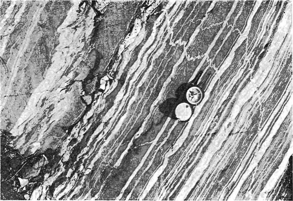
Unit pPtl2 consists of rhythmites formed of mudrock and impure quartzite with lesser amounts of wacke, silstone, chert and conglomerate (Donaldson, 1966; Baragar, 1967; Frarey, 1967; Dimroth, 1972, 1978). The mudrock is black or grey in fresh surface and grey to rusty in altered surface. The rock is laminated and contains millimetric to centimetric siltstone interstratifications. Crossbedding is common. Near the top of the formation, mudrock is locally graphitic and pyritic (Baragar, 1967; Frarey, 1967; Dimroth, 1972, 1978). In places it contains 1-10 mm thick pyrite laminae. Beds of massive pyrite are also observed. In thin sections, mudrock is composed of quartz and plagioclase as well as chlorite, biotite, muscovite and epidote (zoisite). Accessory minerals are opaque minerals (iron oxides, sulphides), carbonate, sphene and tourmaline (Baragar, 1967).
Quartzite is light grey to greenish grey in fresh surface, white to rusty brown in altered patina, fine to coarse grained and massive (Donaldson, 1966). It forms millimetre to centimetre-thick beds. Crossbedding is observed in places (Donaldson, 1966; Baragar, 1967; Frarey, 1967; Dimroth, 1972, 1978). In thin sections, quartzite is recrystallized and no sedimentary texture is preserved. The rock is composed of quartz (55-90%) and plagioclase in a matrix of sericite, quartz, plagioclase, chlorite and biotite. Quartz grains are angular to rounded, poorly sorted and millimetric in size (up to 2.5 mm). They have strong undulatory extinction. Pyrite, epidote (zoisite), muscovite, microcline, carbonate, leucoxene, iron oxides and zircon constitute the accessory minerals (Donaldson, 1966; Baragar, 1967; Frarey, 1967).
Wacke occurs in beds a few metres thick interstratified with mudrock beds. The rock is grey to black in altered surface. It is composed of angular quartz and plagioclase grains associated with mudrock fragments in a sericite-biotite-chlorite matrix (Baragar, 1967; Frarey, 1967; Dimroth, 1972, 1978). The matrix may constitute >50% of the rock (Frarey, 1967).
Thompson Lake Formation 3 (pPtl3): Pillow Basalt
Unit pPtl3 consists of generally pillow tholeiitic basalt flows. These flows are well exposed in the Thompson Lake area (sheet 23O08) where they form a strip >150 m thick (Frarey, 1967; Dimroth, 1972, 1978). According to Dimroth (1972, 1978), it is difficult to distinguish these lavas from those of the Bacchus (Swampy Bay Group), Menihek (Ferriman Group) and Willbob formations. He also points out that it is generally impossible to distinguish between extrusive and intrusive varieties. Basalt flows vary in thickness from 2 to 15 m, but greater thicknesses are also observed. Basalt is grey to black in fresh surface and light grey, green or buff in altered surface. It is usually fine grained to aphanitic, locally medium grained. Pillows usually have a chilled margin and are surrounded by a black crust of hyaloclastic material. In places, they are tightly packed together and have almost no interstitial material. The spaces between pillows are usually filled with cherty black slate. Parallel tabular cavities filled with quartz (quartz chamber) are commonly observed (Dimroth, 1972, 1978).
Thompson Lake Formation 4 (pPtl4): Conglomerate and Quartzite
Unit pPtl4 consists of pebble conglomerate and quartzite (Baragar, 1967; Frarey, 1967; Dimroth, 1972, 1978). According to Frarey (1967), these rocks form the base of the Thompson Lake Formation NW of Marbrelle Lake (sheet 23O01). Outcrops are fractured into blocks of variable size. The rock has a white to pinkish white alteration patina and is generally carbonatized. Conglomerate consists of well-rounded, centimetric quartzite pebbles in positive relief in a carbonate-rich, friable sandstone matrix. Pinkish carbonatized quartzite accompanies conglomerate. These rocks do not appear to be stratified (Frarey, 1967).
Thickness and distribution
The Thompson Lake Formation belongs to the Retty Lithotectonic Zone as defined by Clark and Wares (2004). The Thompson Lake volcano-sedimentary sequence is restricted to the eastern side of the central Labrador Trough. It extends from the Argent Lake area (sheet 23O14) to the Roymart Lake area (sheet 23I12), a NW-SE distance of ~170 km. The Thompson Lake Formation occurs as narrow strips that are easily eroded and form valleys. These strips are interstratified with mafic to ultramafic sills (Gerido Intrusive Suite) (Baragar, 1967). The thickness of the formation is difficult to estimate due to the lack of outcrops and sill intercalation (Baragar, 1967). It is estimated at 600 m in the Doublet Lake area, 700 m in the Hyland Lake area and 500 m in the Ahr Lake area. The Thompson Lake Formation thins to the north and is ~90 m thick NE of Silver Lake (Baragar, 1967; Frarey, 1967; Dimroth, 1972, 1978).
Dating
None.
Stratigraphic Relationship(s)
The Thompson Lake Formation is Paleoproterozoic in age. It was deposited between 1.88 and 1.87 Ga, during the second volcano-sedimentary cycle of the Labrador Trough (Clark and Wares, 2004). It conformably overlies the Murdoch Formation and is conformably overlain by basalts and interstratified sedimentary layers of the Willbob Formation (Baragar, 1967; Frarey, 1967; Dimroth, 1972, 1978). The lower boundary of the Thompson Lake Formation has not been observed due to the lack of outcrops, except in the Thompson and Ahr lakes areas and north of latitude 56°N (Frarey, 1967; Dimroth, 1972, 1978). Locally, the contact between the Murdoch and Thompson Lake formations is interdigitated, particularly near the northern end of Murdoch Lake (Baragar, 1967; Dimroth, 1972, 1978). The upper contact of the Thompson Lake Formation with the Willbob Formation is generally obscured by mafic-ultramafic sills (Gerido Intrusive Suite) or by lack of outcrops (Baragar, 1967). The Thompson Lake Formation is interpreted as equivalent to the middle part of the Menihek Formation by Findlay et al. (1995). Numerous mafic-ultramafic sills of the Gerido Intrusive Suite are interspersed in the formation. According to Frarey (1967) and Dimroth (1972, 1978), some of these may represent thick basaltic flows that are therefore an integral part of the formation. Finally, the Irène Lake iron formation unit (unit pPtl1) represents an equivalent of the Sokoman Formation (Ferriman Group).
Paleontology
Does not apply.
References
Publications Available Through SIGÉOM Examine
CLARK, T., WARES, R., 2004. SYNTHESE LITHOTECTONIQUE ET METALLOGENIQUE DE L’OROGENE DU NOUVEAU-QUEBEC (FOSSE DU LABRADOR). MRNFP; MM 2004-01, 182 pages, 1 plan.
DIMROTH, E., 1972. STRATIGRAPHY OF PART OF THE CENTRAL LABRADOR TROUGH. MRN; DP 154, 304 pages, 6 plans.
DIMROTH, E., 1978. Région de la fosse du Labrador entre les latitudes 54° 30′ et 56° 30′. MRN; RG 193, 417 pages, 16 plans.
Other Publications
BARAGAR, W.R.A. 1967. Wakuach Lake map-area, Quebec-Labrador (23O). Geological Survey of Canada; Memoir 344, 174 pages. https://doi.org/10.4095/123960
DONALDSON, J.A.1966. Marion Lake map-area, Quebec-Newfoundland (23I/13). Geological Survey of Canada; Memoir 338, 85 pages. https://doi.org/10.4095/123900
FINDLAY, J.M., PARRISH, R.R., BIRKETT, T., WATANABE D.H. 1995. U-Pb ages from the Nimish Formation and Montagnais glomeroporphyritic gabbro of the central New Québec Orogen, Canada. Canadian Journal of Earth Sciences; volume 32, pages 1208-1220. https://doi.org/10.1139/e95-099
FRAREY, M.J. 1952. Preliminary map Willbob Lake, Quebec and Newfoundland. Geological Survey of Canada; Paper 52-16, 10 pages. https://doi.org/10.4095/124122
FRAREY, M.J. 1967. Willbob Lake and Thompson Lake map-areas, Quebec and Newfoundland (23 O/1 and 23 O/8). Geological Survey of Canada; Memoir 348, 73 pages. https://doi.org/10.4095/123896
FRAREY, M.J., DUFFELL, S. 1964. Revised stratigraphic nomenclature for the central part of the Labrador Trough. Geological Survey of Canada; Paper 64-25, 13 pages. https://doi.org/10.4095/123909
FRASER, J.A., HEYWOOD, W.W., MAZURSKI, M.A. 1978. Carte métamorphique du Bouclier Canadien. Geological Survey of Canada; Map 1475A. https://doi.org/10.4095/133909
HARRISON, J.M. 1952. The Quebec-Labrador iron belt, Quebec and Newfoundland. Geological Survey of Canada; Paper 52-20, 21 pages. https://doi.org/10.4095/123923
LE GALLAIS, C.J., LAVOIE, S. 1982. Basin evolution of the Lower Proterozoic Kaniapiskau Supergroup, central Labrador Miogeocline (Trough), Quebec. Bulletin of Canadian Petroleum Geology; volume 30, pages 150-166. https://doi.org/10.35767/gscpgbull.30.2.150
ROHON, M.-L. 1989. Magmatisme protérozoïque et indices de Cu-Ni sulfurés (+ EGP) dans la Fosse du Labrador (Québec, Canada) entre les lacs Retty et Low. Université Pierre et Marie Curie, Paris VI; Doctoral thesis, 333 pages. http://www.theses.fr/1989PA066428
WARDLE, R.J. 1979. Geology of the eastern margin of the Labrador Trough. Department of Mines and Energy, Government of Newfoundland and Labrador; Report 78-9, 22 pages. https://gis.geosurv.gov.nl.ca/geofilePDFS/WBox040/LAB_0415.pdf
WARDLE, R.J. 1982. Geology of the south-central Labrador Trough. Government of Newfoundland and Labrador, Department of Mines and Energy, Mineral Development Division, Map 82-005.
WARDLE, R.J., BAILEY, D.G. 1981. Early Proterozoic sequences in Labrador. In Proterozoic basins of Canada (F.H.A. Campbell, editor). Geological Survey of Canada; Paper 81-10, pages 331-359. https://doi.org/10.4095/124192
Suggested Citation
Ministère de l’Énergie et des Ressources naturelles (MERN). Thompson Lake Formation. Quebec Stratigraphic Lexicon. https://gq.mines.gouv.qc.ca/lexique-stratigraphique/province-de-churchill/formation-de-thompson-lake_en [accessed on Day Month Year].
Contributors
|
First publication |
Charles St-Hilaire, GIT, M.Sc. charles.st-hilaire@mern.gouv.qc.ca; Thomas Clark, P. Geo., Ph.D. (redaction) Mehdi A. Guemache, P. Geo., Ph.D. (coordination); Claude Dion, Eng., M.Sc. (critical review); Simon Auclair, P. Geo., M.Sc. (editing); Céline Dupuis, P. Geo., Ph.D. (English version); Ricardo Escobar Moran (HTML editing). |