

First published: 17 March 2022
Last modified:
DISCLAIMER: This English version is translated from the original French. In case of any discrepancy, the French version shall prevail.
| Author(s): | Eade, 1966 |
| Age: | Paleoproterozoic |
| Stratotype: | None |
| Type area: | Area north of Sakami Lake (NTS sheet 33F10) |
| Geological province: | Superior Province, Churchill Province |
| Geological subdivision: | La Grande and Minto subrpovinces, Labrador Trough |
| Lithology: | Sandstone, arkose, subarkose, conglomerate, quartzitic arenite, mudstone, siltstone |
| Category: | Lithostratigraphic |
| Rank: | Formation |
| Status: | Formal |
| Use: | Active |
None
Background
Paleoproterozoic sedimentary rocks were recognized in the early geological mapping of the Superior Province from the James Bay region to the western edge of the Labrador Trough (Fahrig, 1956; Eade et al., 1958; Brett et al., 1959). These sedimentary rocks were not assigned to a specific stratigraphic unit. During a helicopter-borne exploration campaign, Eade (1966) defined the Sakami Formation to refer to several isolated klippes of sedimentary rocks lying unconformably on Archean rocks of the Superior Province. He proposed the name « Sakami » in reference to Sakami Lake, located south of the Coutaceau Lake basin (part of the Robert-Bourassa Reservoir) (sheet 33F10).
Subsequently, Sharma (1974, 1975, 1976, 1977a, 1977b, 1979) carried out detailed mapping of the Grande River area and defined the limits of the various sedimentary basins of the Sakami Formation. In the course of his work, he also recognized two other basins, namely that of Elizabeth and Harry lakes (NW part of sheet 33G15) and that of Canard Lake (sheet 33G15) (Sharma, 1977). Note that these lakes are no longer part of the Quebec toponymy. Elisabeth Lake and Harry Lake were respectively replaced by Mintischiminan Lake and Ministikutaukw Lake. Canard Lake is now unrecognizable due to the development of the La Grande 3 reservoir (LG-3). Three klippes of the Sakami Formation were also recognized by Sharma (1979) in the Grande River area (sheets 33I02, 33I03 and 33H14) before it was partially submerged by the waters of Laforge-1 (LA-1) and La Grande 4 (LG-4) reservoirs. Sharma (1979) informally referred to these as the « Béatrice basin », « Catherine basin » and « Laforge basin ».
The Sakami Formation was mapped during various geological surveys conducted by the Ministère (Mills, 1973; Clark, 1984; Gosselin and Simard, 2000; Simard et al., 2001; Goutier et al., 2001a, 2001b; Gosselin et al., 2002; Simard and Lafrance, 2011; Bandyayera et al., 2013; Hammouche et al., 2015) Two new klippes of very limited areas were discovered during this work: west of Châteauguay Lake (sheet 24D08) (Simard et al., 2001) and west of Bellemant Lake, formerly known as Ballamant Lake (sheet 33I16) (Simard and Lafrance, 2011).
West of the Labrador Trough, klippes of Palaeoproterozoic sedimentary rocks were mapped by Fahrig (1956, 1969). These sedimentary rocks are commonly preserved in half-grabens outlining the Cambrien Lake rift zone, oriented perpendicular to the orogen, and are considered to be contemporaneous with sandstones and conglomerates of the Chakonipau Formation (Seward Group) (Eade, 1966; Fahrig, 1969; Séguin et al., 1981; Clark, 1984; Gehrisch, 1987). The Sakami Formation indeed correlated with the Chakonipau Formation (Fahrig, 1969; Clark, 1984; Clark and Wares, 2004).
Authors who have contributed to the description of rocks of the Sakami Formation include Kish and Tremblay-Clark (1978, 1979) and Fougues and Schumacher (1979). The Sakami Formation was also the subject of a detailed stratigraphic and sedimentological study by Portella (1980). It was also studied in the context of various exploration works focused on the search for uranium (Oakes, 1975; Meusy, 1977, 1982; Lafontaine, 1978; Tremblay, 1978; Gariepy et al., 1979; Gehrisch et al., 1982; Holmstead et al., 1978, 1979, 1981; Orr, 1979a, 1979b; Marcoux, 1980).
Description
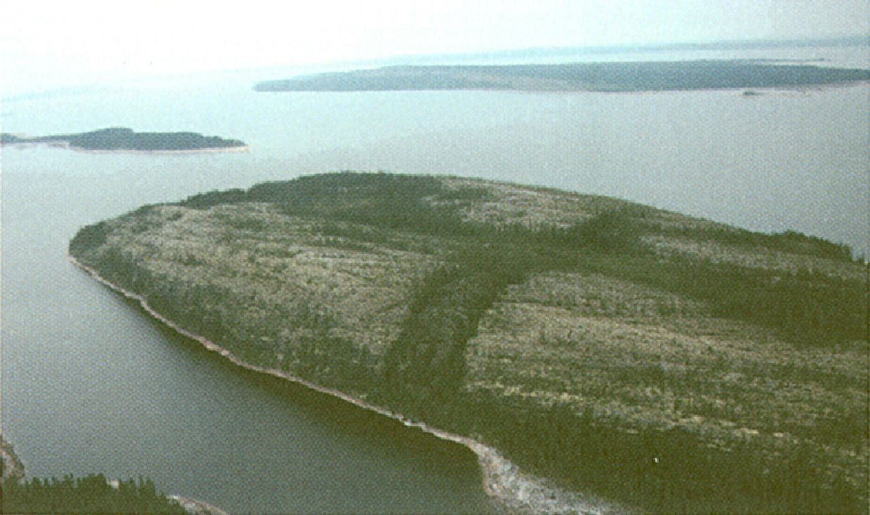
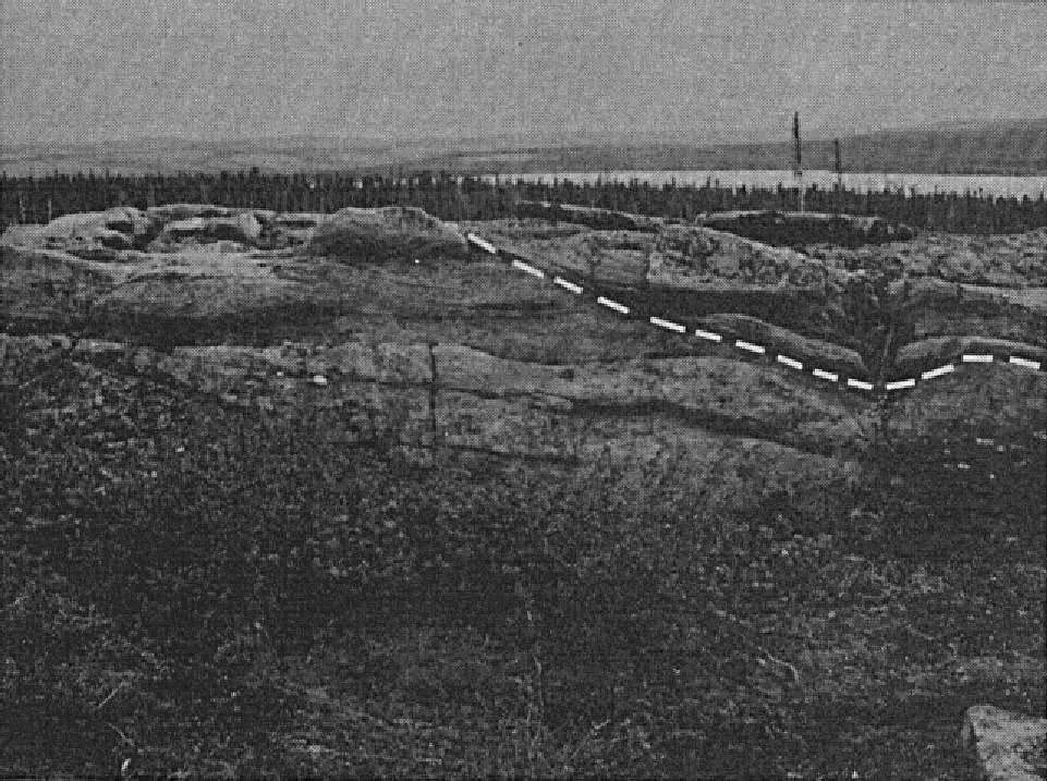
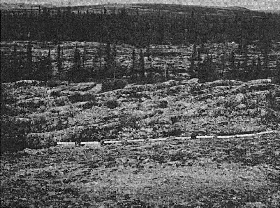
The Sakami Formation consists of clastic sedimentary rocks preserved in E-W to NE-SW oriented klippes in the Superior Province. These klippes are generally associated with half-grabens and grabens bounded by brittle faults (Fougues and Schumacher, 1979). Although they are isolated from each other, these klippes share a high degree of lithological similarity according to Eade (1966). There does not appear to be a type section for the Sakami Formation. Detailed stratigraphic sections are described by Eade (1966) in the Grande River (formerly Fort George River) (sheet 33H14), Tilly Lake (sheet 33H13), Sakami River (sheet 33F10), Little Baleine River (sheet 33P15) and Gayot Lake (sheets 23M15 and 23M16) areas. According to Sharma (1979), the most complete sequence of the Sakami Formation is in the « Laforge basin », most of which is now submerged by waters of the La Grande 4 reservoir.
On a regional scale, the Sakami Formation comprises three main units (Sharma, 1979; Fougues and Schumacher, 1979; Portella, 1980), namely:
- a basal unit consisting of layers of hematite arkose, mudstone, siltstone and polymictic conglomerate (pPsa1);
- a middle unit consisting of quartzitic arenite, sandstone and conglomerate (pPsa2);
- an upper unit consisting of polymictic conglomerate, coarse-grained sandstone, sandstone and calcareous siltstone (pPsa3).
West of the New Québec Orogen, the Sakami Formation sedimentary sequence typically consists of arkose, microconglomerate and mudstone (pPsa3), subarkose and arkose (pPsa4), and microconglomerate and arkose with interbedded siltstone, mudstone and fine-grained arkose (pPsa5). Partial stratigraphic sections of the Boule de Neige Lake and Luché Lake areas are described by Clark (1984).
Metamorphism of sedimentary rocks of the Sakami Formation varies from lower greenschist to greenschist facies (Portella, 1980; Goutier et al., 2001a, 2001b; Simard and Lafrance, 2011). Sedimentary rocks are of detrital origin. They are interpreted as being mainly of fluvial and deltaic origin (Fougues and Schumacher, 1979; Clark, 1984). The numerous Proterozoic klippes possibly represent remnants of a sedimentary basin that extended between the Sakami Lake and Cambrien Lake areas (Chown et al., 1977; Kish and Tremblay-Clark, 1978). The economic potential of the Sakami Formation lies in sedimentary uranium mineralization hosted in the lower part of the formation (Clark and Wares, 2004).
Sakami Formation, Undivided (pPsa): Sandstone, Mudstone, Siltstone; Microconglomerate and Conglomerate
This unit was described by Sharma (1979) in the La Grande River area (Béatrice, Catherine and Laforge basins) before the latter was partially submerged by waters of Laforge 1 and La Grande 4 reservoirs, and by Simard and Lafrance (2011) west of Bellemant Lake (formerly Ballamant Lake) (sheet 33I16). Further north, the Little Baleine River klippe (sheets 33P15 and 33P16) was described briefly by Gosselin et al. (2002) and in more detail by Eade (1966). The klippe of the Dieter and Bouteille lakes area, NE of Gayot Lake (sheets 23M15 and 23M16) was described by Eade (1966), Kish and Tremblay-Clark (1979) and Gosselin and Simard (2000), among others. A detailed stratigraphic section of the Gayot Lake klippe is also presented by Clark (1984, p. 69). Note that the Gayot Lake klippe includes the Lac Gayot uranium mineralized zone. Pons Lake and Gerzine Lake klippes (sheets 23N13, 24C04 and 24C05) were described by Holmstead et al. (1978), Orr (1979a, 1979b) and Simard et al. (2001). The klippe west of Châteauguay Lake (sheet 24D08) was described by Simard et al. (2001).
Eade (1966) generally divides the unit into a lower sequence of red beds (microconglomerate, conglomerate, arkose, mudstone and siltstone) belonging to the lower part of the Sakami Formation, and an upper sequence of quartzitic arenite belonging to the middle part of the formation. The lower sequence consists, at the base, of red pebble microconglomerate and polymictic pebble conglomerate, overlain by brick-red, locally grenish or greyish arkose, mudstone and siltstone. The upper part consists mainly of medium-grained whitish, pinkish or orange sandstones (quartzitic arenite, arkosic sandstone, subarkosic sandstone). These sandstones are commonly found in massive, crossbedded, decimetric to metric beds. Interbedded (1-2 cm) red mudstone and a few lenses of quartz pebble conglomerate are reported in the Dieter Lake, Pons Lake and Gerzine Lake areas (Eade, 1966; Holmstead et al., 1978; Orr, 1979a, 1979b).
Sakami Formation 1 (pPsa1): Red and Green Hematite Arkose, Mudstone and Siltstone, Polymictic Conglomerate; Microconglomerate and Arkose, Locally with Pebbles; Subarkose; Local Radioactive Minerals
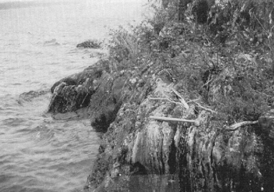
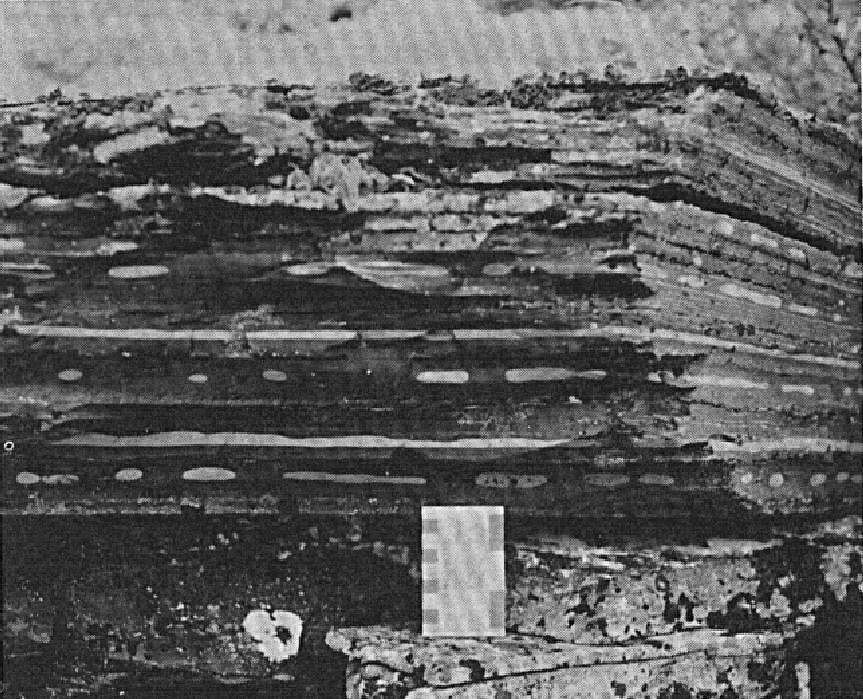
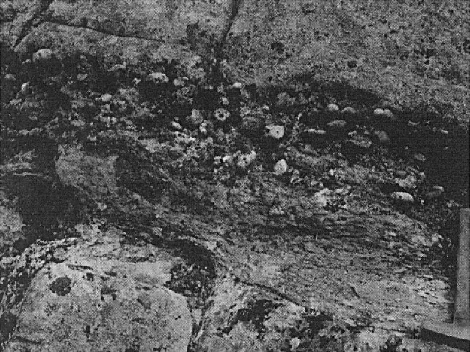
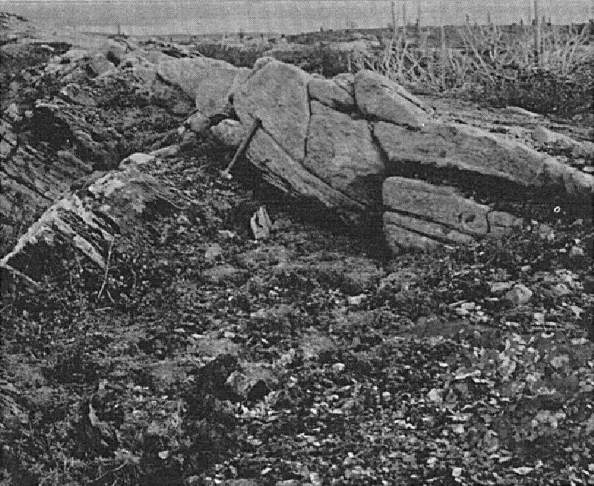
Unit pPsa1 is the basal unit of the Sakami Formation. Its maximum thickness, calculated by drilling (hole LG-77-1 by Séguin, 1978), is 128 m in the Robert-Bourassa Reservoir area (Goutier et al., 2001b). The unit consists generally of interbedded red and green mudstone and siltstone, millimetre to centimetre thick, in which are intercalated hematite arkose (red sandstone) layers and red polymictic conglomerate beds (0.5-0.8 m thick) containing angular to subrounded pebbles of quartz, iron formation, granitoid and mudstone hosted in an argillaceous matrix. The fragments’ size varies from a few millimetres to >50 cm (Sharma, 1977a). Mudstone beds commonly feature primary sedimentary structures such as convolute laminae. Sharma (1977b) also notes crossbedding, reduction cracks and coiled mudstone beds. Hematite arkose is more abundant towards the top of the unit. At the top of the unit, there is a layer of sorted whitish grey sandstone containing conglomeratic occurrences and interbedded red mudstone (Fougues and Schumacher, 1979; Portella, 1980; Goutier et al., 2001a, 2001b; Hammouche et al., 2015).
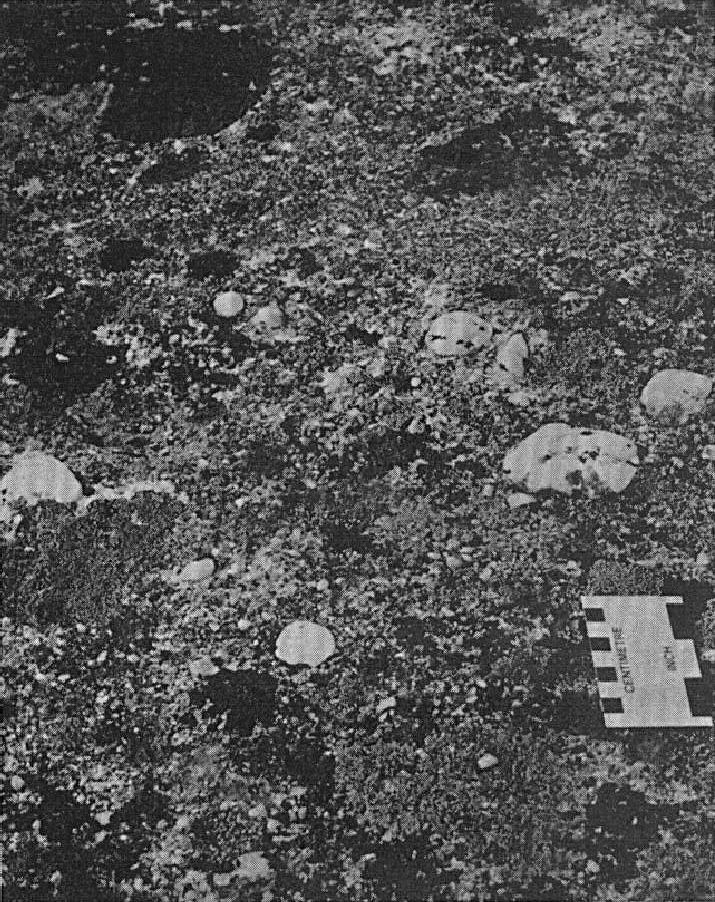
In the area west of Cambrien Lake (Tremblay, 1978, Clark, 1984), this unit is ~1300 m thick. It consists mainly of pink or beige microconglomerate and arkose with scattered pebbles as well as arkose and subarkose with or without pebbles. In places, these rocks include interbedded (<15 cm) quartz pebble-rich conglomerate. Scattered pebble microconglomerate and arkose occur in generally massive beds 0.3 to 2.5 m thick. Pebbles, typically quartz and locally granite, are 1 to 8 cm (up to 25 cm locally) in diameter and moderately to well rounded. They are uniformly distributed and supported by a poorly sorted microconglomerate matrix, the average grain size of which varies from 1 to 5 mm. In quartz pebble-rich conglomerate, pebbles are matrix supported; their short axis is perpendicular to bedding. Arkose and subarkose are fine to medium grained and may or may not contain disseminated pebbles. In the Outardes Lake area (sheet 24C06), Clark (1984) notes that arkose and subarkose beds are more abundant southwards. The most common sedimentary structures are planar oblique stratification, in beds 1 to 3 m thick, and pit crossbedding. The latter are usually characterized by pits 0.15 to 0.6 m deep and 0.6 to 1.2 m wide. East of Outardes Lake, Clark (1984) observed pits 0.3 to 1 m deep and 1 to 3 m wide (7 m in places). The presence of radioactive minerals (monazite) is reported locally in beige to red arkoses, microconglomerates and conglomerates to the NW of Boule de Neige Lake (Lafontaine, 1978). Note that in the Cambrien Lake area, unit pPsa1 is distinguished from unit pPsa5 by the absence of interstratified red beds.
Sakami Formation 2 (pPsa2): Quartzitic Arenite; Subarkose and Arkose, Locally with Pebbles; Interbedded Brick-Red Siltstone and Fine-Grained Arkose

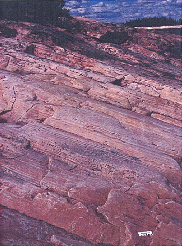
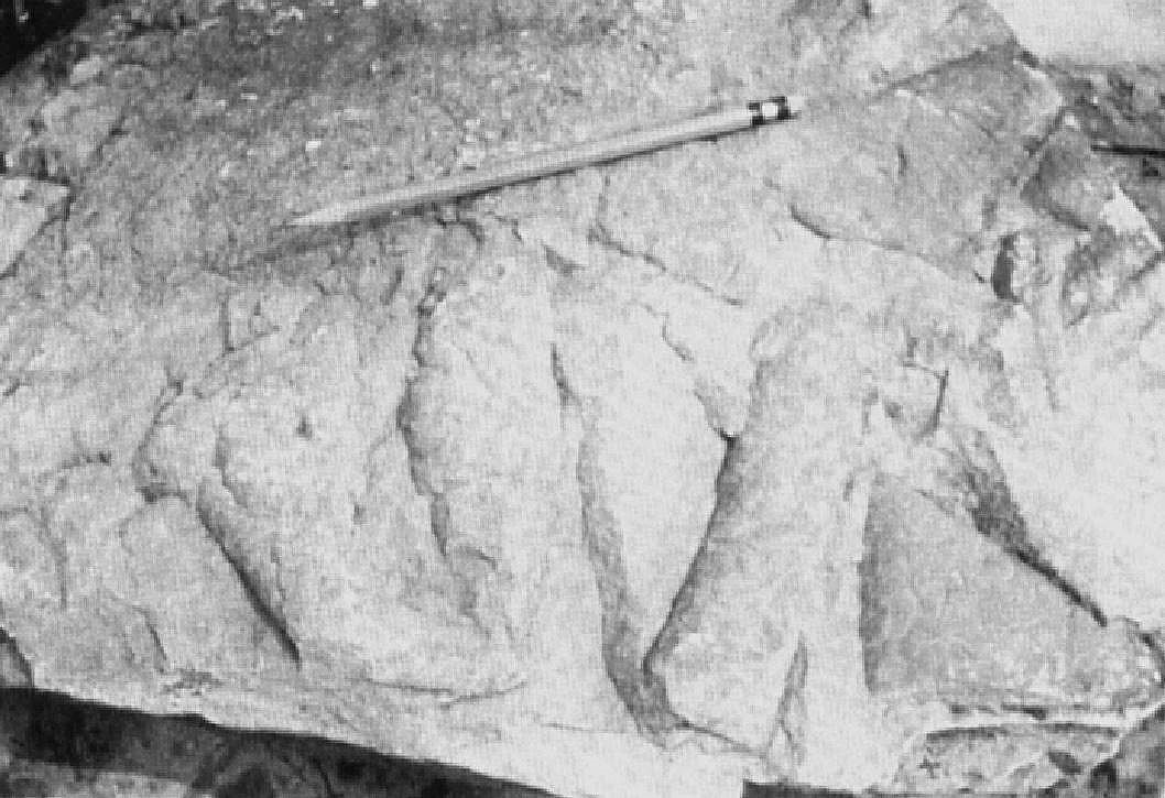
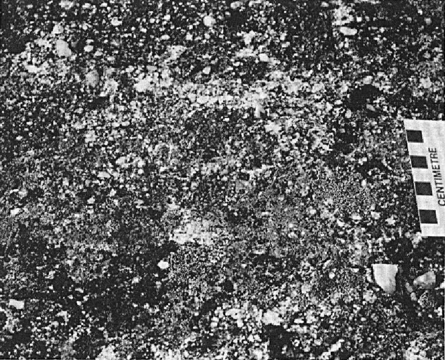
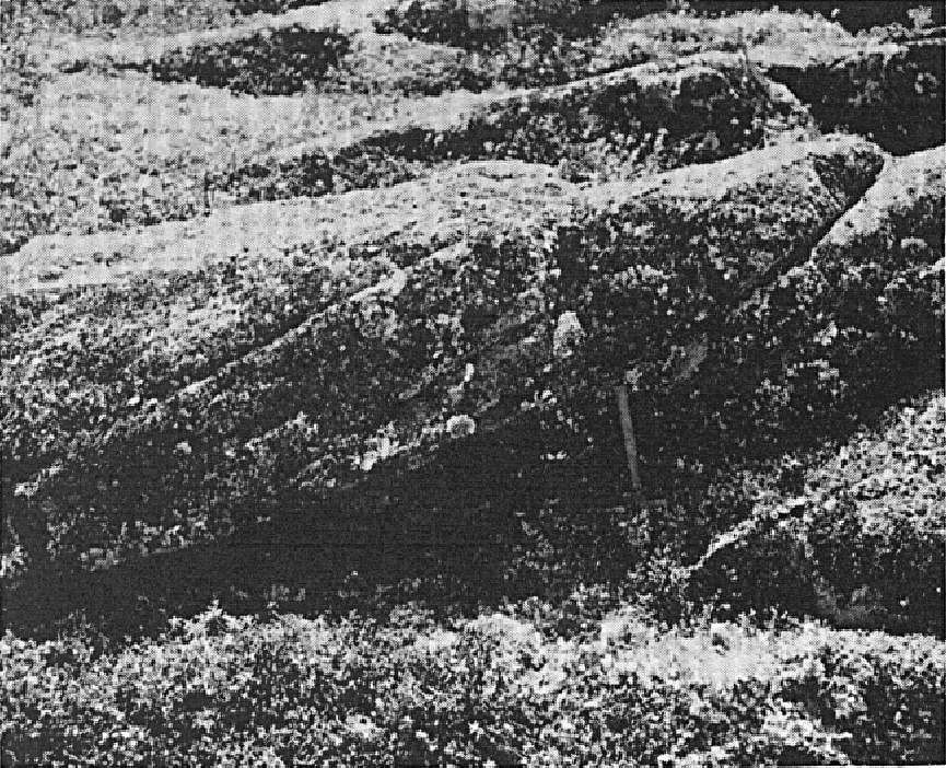
Unit pPsa2, essentially composed of quartzitic arenite, represents the middle unit of the Sakami Formation. Goutier et al. (2001b) calculated a maximum thickness of 1500 m for this unit, taking into account drilling LG-77-1 (Séguin, 1978) and the dip of the strata. Quartzitic arenite outcrops as large hills in the Robert-Bourassa Reservoir and bordering the LG-3 Reservoir (Goutier et al., 2001a, 2001b), as well as on some islands and the north shore of the LG-4 Reservoir (Hammouche et al., 2015). Arenite occurs in centimetre to metre-thick beds, commonly sorted, and features large parallel, oblique and cross-stratification. According to Portella (1980), stratification indicates normal eastward polarity. Beds are white at the base of the unit and gradually turn pink or orange towards the top. Some red arenite layer are associated with marked hematitization (Goutier et al., 2001a). Arenite is composed of well-sorted, rounded quartz grains (up to 90% of the total rock) up to 3 mm in diameter, and smaller amounts of feldspar or rock fragments. The matrix (<15%) is fine grained, siliceous and formed of carbonate or locally recrystallized sericite (Sharma, 1977a, 1977b, 1979; Goutier et al., 2001a, 2001b; Bandyayera et al., 2013; Hammouche et al., 2015). The pink or orange colour of quartzitic arenite is attributed to a thin layer of ferruginous material around quartz grains (Sharma, 1977a).
The base of the unit (~100 m) is locally formed of coarse-grained to conglomeratic white sandstone (Fouques and Schumacher, 1979; Portella, 1980; Goutier et al., 2001b). Locally, the unit also contains poorly sorted red to purple polymictic conglomerate layers containing angular, subrounded or rounded clasts of white quartz, dark quartz and red mudstone hosted in a beige or red quartzitic arenite matrix (Bandyayera et al., 2013).
In the area west of Cambrien Lake (Tremblay, 1978; Clark, 1984), unit pPsa2 consists of subarkose and arkose with or without pebbles, and interbedded brick-red siltstone and fine-grained arkose (red beds). Its calculated thickness is ~900 m. The lower boundary of the unit is characterized by a decrease in pebbly beds relative to pebble-free beds and the appearance of brick-red siltstone layers. The number of pebbles in pebbly beds is negligible. The latter consist of white quartz and, less commonly, granite. Subarkose and arkose commonly feature planar oblique stratification in beds 0.3 to 3 m thick. Interbedded (0.3-5 m) brick-red siltstone and fine-grained arkose (red beds) constitute 10 to 20% of the sedimentary sequence. Siltstone is fissile, features planar stratification and commonly contains beige reduction spots. Fine-grained arkose usually features pit crossbedding.
Sakami Formation 3 (pPsa3): Polymictic Conglomerate, Sandstone and Siltstone; Brick-Red Arkose, Scattered Pebble Microconglomerate and Mudstone
Unit pPsa3 forms the upper part of the Sakami Formation. It is located at the southern edge of the formation, in the Tilly Lake (sheet 33H13) and La Grande 4 Reservoir (sheet 33H14) areas (Sharma, 1979; Fougues and Schumacher, 1979; Hammouche et al., 2015). Its thickness is unknown. The unit is bounded at its southern contact by the Grande Rivière Fault. In these areas, the unit is composed of red rocks consisting of polymictic conglomerate with interbedded coarse-grained sandstone, calcareous siltstone and some lenses of medium-grained sandstone. Conglomerate is composed of fragments of quartz, feldspar, tonalite, white and pink pegmatitic granite, diorite and metasedimentary rocks in an argillaceous and carbonatized matrix. Fragments are angular, poorly sorted and generally varying in diameter from 1 to 25 cm (locally 2 m) (Fougues and Schumacher, 1979; Portella, 1980; Hammouche et al., 2015).
In the Cambrien Lake area (sheet 24C06), red rocks of unit pPsa3 occupy the northern edge of the formation, where they unconformably overlie (erosional discordance) Archean bedrock (Clark, 1984). Their thickness varies from 10 to 52 m. The unit is generally characterized by a decrease in grain size towards the top. The lower part (~10-20 m thick) comprises mainly brick-red rocks consisting of arkose and scattered pebble microconglomerate. These rocks locally include thinly interbedded (<3 m) brick-red, rarely grey or green mudstone featuring planar stratification, beige pebble-free arkose and pebble-rich conglomerate. In arkose and microconglomerate, fragments (<8 cm) are angular and poorly sorted. They consist of granite, quartz, pink feldspar and mudstone. These rocks are massive to laminated. They include planar stratification and rare crossbedding. Desiccation cracks are locally observed in intervals (~1 m) of finely interbedded mudstone and sandstone.
The upper part of the unit (~2-30 m) consists mainly of brick-red mudstone. In places, it contains interbedded (0.3-1 m) beige and red arkose observed especially near the base. Mudstone is characterized by planar stratification and the absence of desiccation cracks. Crossbedding is rarely observed. Orange to beige reduction spots are common (Clark, 1984).
Sakami Formation 4 (pPsa4): Laminated Subarkose and Arkose; Locally Interbedded Polymictic Scattered Pebble Microconglomerate; Minor Amounts of Brick-Red Fine-Grained Sandstone, Mudstone and Siltstone
Unit pPsa4 is located in the Cambrien Lake area (Clark, 1984) and west of Patu Lake (Clark, T., Patu Lake, unpublished). It consists of a thick sequence of laminated, fine to medium-grained, beige, pink or grey subarkose and arkose. At Cambrien Lake, this sequence is ~3800 m thick and abruptly overlies rocks of unit pPsa3. Subarkose and arkose are generally characterized by stratification (1 – >20 mm thick) caused by variations in the grain size and colour of the rock, giving it a banded appearance. The subarkose and arkose feature planar oblique stratification, usually in beds 0.3 to >5 m thick, but greater thicknesses are also reported. Beds featuring planar stratification parallel to bedding are common. Large (7-135 m wide by 1-6 m deep) pit crossbedding is observed in places, notably 6 km west of Cambrien Lake. These rocks are composed of quartz (50-85%), K-feldspar (5-30%) and rock fragments (5-10%) in a matrix of very fine white mica forming 5-20% of the rock. Grain size ranges from 0.1 to >2 mm (≤1.5 mm in general). Grains are angular to well rounded and sorting is moderate to poor.
In the area west of Cambrien Lake, the unit contains locally interbedded (1 – >15 cm) scattered pebble polymictic microconglomerate representing only a small proportion (<5%) of the total thickness of the sequence. Pebbles are subangular to subrounded, generally ranging from 0.5 to 8 cm in diameter (10-30 cm locally) and matrix supported. They consist mostly of quartz (90%), feldspar (10%) and rarely granite. A minor amount of red beds consisting of brick-red fine-grained sandstone, mudstone and siltstone are present in places. These rocks are bedded on a centimetre scale and form interbeds 2 cm to 13 m thick. Sandstone beds are ~1 cm thick, mudstone beds a few millimetres to 15 cm thick. The latter commonly display desiccation cracks. Crossbedding is not observed. The scarcity of red beds distinguishes unit pPsa4 from unit pPsa5.
Sakami Formation 5 (pPsa5): Microconglomerate and Arkose, Locally with Radioactive Minerals; Interbedded Brick-Red Siltstone, Mudstone and Fine-Grained Arkose as Well as Pebble-Rich Conglomerate with Radioactive Minerals
Unit pPsa5 is located in the Boule de Neige Lake area, west of Cambrien Lake (sheet 24C06) (Kish and Tremblay-Clark, 1979; Clark, 1984). It consists of varying amounts of brick-red microconglomerate and arkose with or without pebbles, siltstone, mudstone and fine-grained arkose, and interbedded quartz pebble-rich conglomerate. Clark (1984) points out that lithological packages have significant differences from place to place in this area. Generally, microconglomerate, arkose and quartz-pebble-rich conglomerate dominate NW of Boule de Neige Lake, whereas north and east of the lake, arkose dominates and quartz pebble-rich conglomerate is absent. Siltstone, mudstone and fine-grained arkose constitute ~10% of the sequence in all areas. Note that unit pPsa5 is distinguished from unit pPsa1 by the presence of interstratified red beds. The unit has a minimum thickness of 100 m and gradually thins towards the east (Kish and Tremblay-Clark, 1979).
Microconglomerate and arkose with or without pebbles usually occur in thick beds (0.3-2 m thick). These rocks are beige, pink or grey, medium grained (1-5 mm) and poorly sorted. They commonly feature planar stratification (oblique or parallel to bedding) and pit crossbedding. Pits are 0.3 to 5 m wide and up to 1 m deep. Pebbles are uniformly distributed and consist of quartz, feldspar and, less commonly, granite. NW of Boule de Neige Lake, layers of pebble microconglomerate and coarse-grained arkose have a very intense red colour. These highly oxidized layers are generally more radioactive than the surrounding sedimentary rocks (Lafontaine, 1978; Kish and Tremblay-Clark, 1979; Clark, 1984).
Quartz pebble-rich conglomerate is interbedded (2 cm to 1 m thick, ~15-30 cm in general) in microconglomerate and arkose. NW of Boule de Neige Lake, interbedded quartz pebble-rich conglomerate becomes more abundant northwards. Conglomerate is matrix supported or clast supported. Pebbles have a diameter of 2 to 10 cm and are well rounded. They consist mainly of quartz and, less commonly, granite, in a matrix of red arkosic microconglomerate containing radioactive minerals (Lafontaine, 1978; Kish and Tremblay-Clark, 1979; Clark, 1984).
Brick-red siltstone and mudstone (red beds) are interbedded (0.3-6 m) fairly evenly in the sedimentary sequence. Typically, these rocks are finely laminated and display parallel stratification and, in places, ripple crossbedding. Siltstone and mudstone are commonly accompanied by laminated, fine-grained, brick-red arkose featuring pit crossbedding. Arkose usually forms layers (1-2 m thick) overlying siltstone and mudstone, but is also interbedded with them. More rarely, it underlies them.
Thickness and Distribution
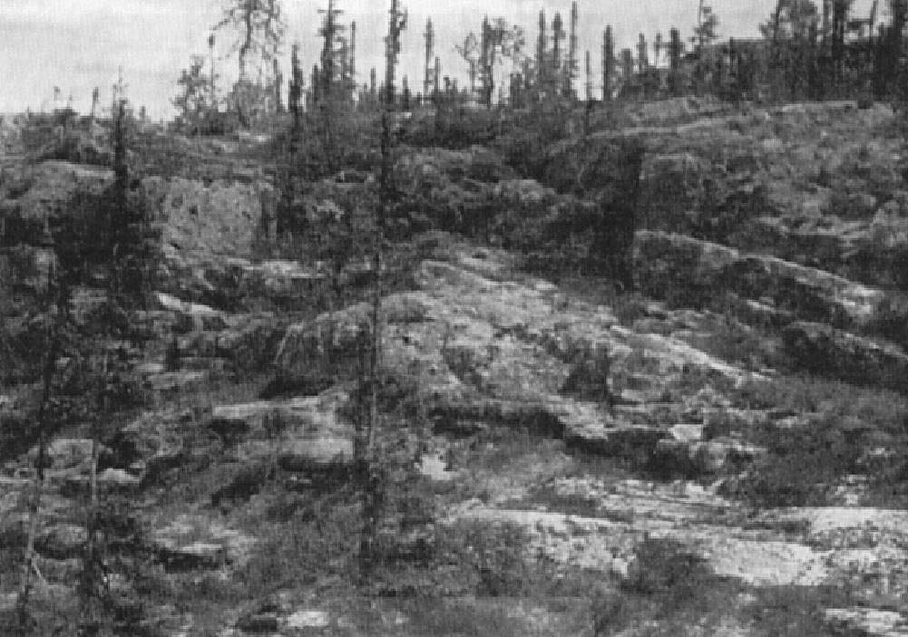
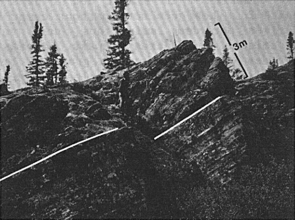
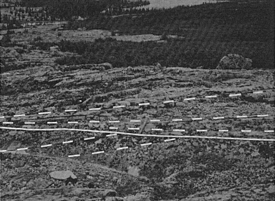
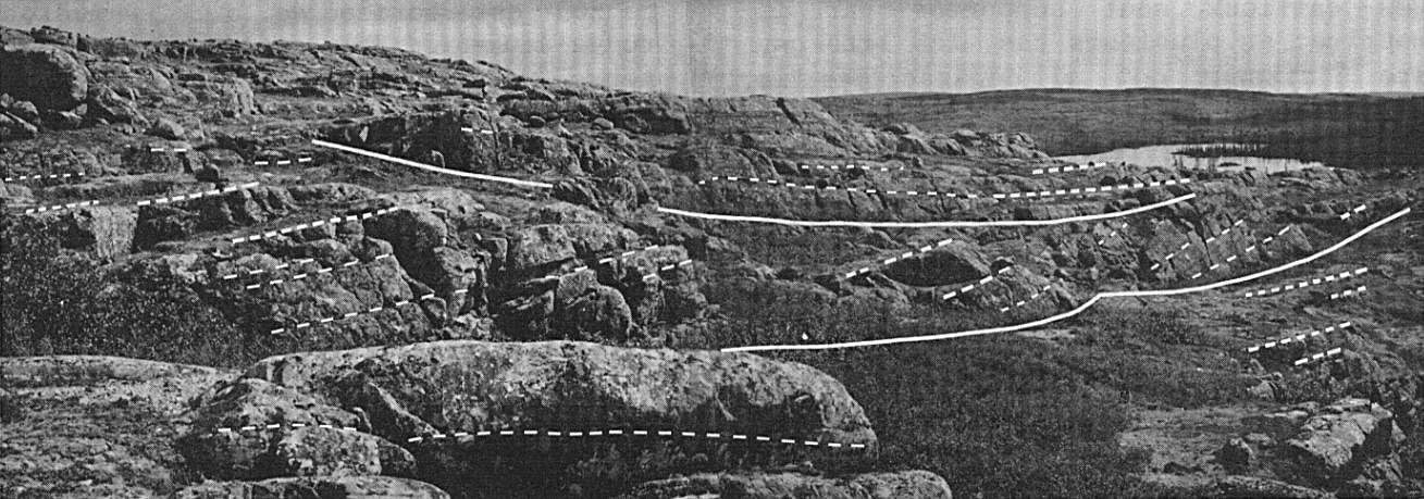
The Sakami Formation extends from the Sakami Lake area in James Bay to Cambrien Lake near the western edge of the Labrador Trough. It occurs as isolated basins or klippes that unconformably overlie Archean rocks in the northern La Grande Subprovince and southern Minto Subprovince. These klippes are commonly preserved in half-grabens and grabens bounded by weak ENE-WSW, WNW-ESE and NE-SW faults (Fougues and Schumacher, 1979). At the western margin of the Labrador Trough, sedimentary rocks of the Sakami Formation are included in the Cambrien Lithotectonic Zone, as defined by Clark and Wares (2004). They are preserved mainly in half-graben structures outlining the Cambrien Lake rift zone, which is oriented perpendicular to the general direction of the orogen (Clark, 1984).
Klippes of the Sakami Formation are regionally divided into two main strips oriented ENE-WSW. The first corresponds approximately to the La Grande River basin, and the second lies at latitude 56° N between longitudes 69° W and 73° W.
The thickness of the Sakami Formation varies considerably from one basin to another. Using drilling data, a maximum thickness of ~1200 m was estimated by Fougues and Schumacher (1979) for rocks located along the La Grande River basin, while Goutier et al. (2001b) calculated a maximum thickness of 1628 m for the same area. The minimum thickness of the Sakami Formation is estimated to be between 500 and 575 m at Tilly Lake (Eade, 1966), 1030 m in the Little Baleine River area (Eade, 1966; Gosselin et al., 2002) and 890 m in the Gayot Lake area (Gosselin and Simard, 2000). In the Cambrien Lake area, Clark (1984) reports calculated thicknesses of 200 to 2000 m for the Outardes Lake klippe and up to 3852 m for the Boule de Neige Lake klippe. A thickness of ~1845 m is estimated for the Luché Lake klippe (Clark, 1984).
The maximum thicknesses of informal units, already mentioned above, are summarized in the following table:
| Unit | Maximum thickness (m) |
| pPsa1 | 1300 |
| pPsa2 | 1500 |
| pPsa3 | Unknown |
| pPsa4 | 3800 |
| pPsa5 | 100 |
Dating
A Pb-Pb age of 1.85 Ga was reported for pitchblende (uraninite) from mudstones in the lower Sakami Formation (Holmstead et al., 1981; Gehrisch et al., 1982). This age is much younger than that assigned to the surrounding sedimentary rocks and its significance is uncertain (Clark and Wares, 2004).
An age of 1362 ±109 Ma (sample 87-341) was estimated by the K-Ar method on a gabbro intersected by drilling NE of Gayot Lake (sheet 23M15) (Stevens et al., 1982). These authors point out that this dating does not indicate the age of gabbro nor that of the Sakami Formation. However, they report that it could indicate the alteration age of gabbro or correspond to a period when uranium-bearing minerals hosted in Sakami Formation rocks were remobilized and concentrated.
Stratigraphic Relationship(s)
Séguin et al. (1981) estimated the minimum age of the Sakami Formation as early Proterozoic (~2.0 Ga) by means of a paleomagnetic study. Based on crosscutting relationships with Neoarchean (Mistassini Dyke Swarm) and Paleoproterozoic (Senneterre Dykes, Lac Esprit Dykes) diabase dykes, Goutier et al. (2001a) estimated an age between 2510 and 2216 Ma. The Mistassini Dyke Swarm (2503-2515 Ma) does not cut the Sakami Formation. Its age corresponds to the maximum age of deposition of the Sakami Formation.
Sedimentary rocks of the Sakami Formation form subhorizontal beds (~15-40° E, SE or SSE dip) overlying in erosional unconformity or fault contact Archean rocks of the La Grande Subprovince and southern Minto Subprovince (Eade, 1966; Sharma, 1977, 1979; Portella, 1980; Gosselin and Simard, 2000; Goutier et al., 2001a, 2001b; Gosselin et al., 2002; Simard and Lafrance, 2011; Hammouche et al., 2015). Proterozoic faults that bound sedimentary basins of the Sakami Formation continue within Archean units (Simard and Lafrance, 2011).
West of the Labrador Trough, the Sakami Formation occurs locally in half-grabens oriented perpendicular to the Trough, notably in the Cambrien Lake area (Clark, 1984). These structures were interpreted as remnants of an aulacogen by Hoffman (1988), an aborted episode of rifting associated with initial rifting of the Trough (Clark and Wares, 2004). The Sakami and Chakonipau (Seward Group) formations are roughly contemporaneous (Eade, 1966; Fahrig, 1969; Clark, 1984; Gehrisch, 1987). Rocks attributed to the Sakami Formation were also identified at Patu Lake, within the Labrador Trough (Clark, T., Patu Lake, unpublished), in the vicinity of arkose and conglomerate beds mapped as the Chakonipau Formation. In the Luché Lake area, east of Cambrien Lake, the Sakami Formation is in fault contact with rocks of the Ferriman Group. West of Cambrien Lake, in the Outardes Lake area, Sakami Formation rocks are in fault contact with sedimentary rocks of marine origin of the Seward and Pistolet groups (Clark, 1984). Note that autochthonous arkoses and conglomerates at the base of the Kaniapiscau Supergroup near Cambrien Lake are of limited thickness compared to the kilometre-thick Sakami Formation west of Cambrien Lake (Clark, 1984). It is possible that the marked differences in thickness are locally attributable to contrasting tectonic settings.
Paleontology
No fossils reported.
References
Publications Available Through SIGÉOM Examine
BANDYAYERA, D., BURNIAUX, P., CHAPON, B., 2013. GEOLOGIE DE LA REGION DU LAC MAGIN (33G09), DE LA COLLINE CAPTEL (33G15) ET DU LAC FONTAY (33G16), BAIE-JAMES, QUEBEC. MRN, UQAM; RP 2013-01, 32 pages, 3 plans.
CLARK, T., 1984. GEOLOGIE DE LA REGION DU LAC CAMBRIEN – TERRITOIRE DU NOUVEAU-QUEBEC. MRN; ET 83-02, 77 pages, 1 plan.
CLARK, T., WARES, R., 2004. SYNTHESE LITHOTECTONIQUE ET METALLOGENIQUE DE L’OROGENE DU NOUVEAU-QUEBEC (FOSSE DU LABRADOR). MRNFP; MM 2004-01, 182 pages, 1 plan.
FOUQUES, J P., SCHUMACHER, F., 1979. RAPPORT DE SYNTHESE DU PERMIS SES. GROUPE MINIER S E S, Assessment report submitted to the Government of Québec; GM 37017, 156 pages, 22 plans.
GARIEPY, Y., GEHRISCH, W., HOLMSTEAD, W., ORR, R G., 1979. ASSESSMENT REPORT 1979, GAYOT LAKE PROJECT. URANERZ EXPL & MINING LTD, Assessment report submitted to the Government of Québec; GM 36497, 219 pages, 1 plan.
GEHRISCH, W., GATZWEILER, R., LAMBERT, R., 1982. THE SYNGENETIC U-DEPOSIT AT GAYOT LAKE. URANERZ EXPL & MINING LTD, S D B J, Assessment report submitted to the Government of Québec; GM 57799, 47 pages, 2 plans.
GOSSELIN, C., ROY, P., DAVID, J., 2002. GEOLOGIE DE LA REGION DU LAC BIENVILLE (33P). MRN; RG 2002-11, 40 pages, 1 plan.
GOSSELIN, C., SIMARD, M., 2000. GEOLOGIE DE LA REGION DU LAC GAYOT. MRN; RG 99-06, 32 pages, 1 plan.
GOUTIER, J., DION, C., OUELLET, M C., 2001a. GEOLOGIE DE LA REGION DE LA COLLINE BEZIER (33G/12) ET DU LAC DE LA MONTAGNE DU PIN (33G/13). MRN; RG 2001-13, 55 pages, 2 plans.
GOUTIER, J., DION, C., OUELLET, M C., MERCIER-LANGEVIN, P., DAVIS, D W., 2001b. GEOLOGIE DE LA COLLINE MASSON (33F/09), DE LA PASSE AWAPAKAMICH (33F/10), DE LA BAIE CARBILLET (33F/15) ET DE LA PASSE PIKWAHIPANAN (33F/16). MRN; RG 2000-10, 69 pages, 4 plans.
HAMMOUCHE, H., BURNIAUX, P., KHARIS, A A., 2015. GEOLOGIE DE LA REGION DU LAC CARMOY, BAIE-JAMES. MERN; RG 2015-02, 44 pages, 3 plans.
HOLMSTEAD, W., LEPPIN, M., ORR, R G., 1979. ASSESSMENT REPORT, PROJECT 71-86 GAYOT LAKE, DIETER LAKE CLAIM GROUP. URANERZ EXPL & MINING LTD, Assessment report submitted to the Government of Québec; GM 34793, 127 pages, 10 plans.
HOLMSTEAD, W., ORR, R., 1978. ANNUAL REPORT, DECEMBER 1978, PROJECT NO 71-86, GAYOT LAKE AREA. URANERZ EXPL & MINING LTD, Assessment report submitted to the Government of Québec; GM 34313, 29 pages, 9 plans.
HOLMSTEAD, W., ORR, R., GEHRISCH, W., 1981. YEARLY REPORT 1980, PROJECT 71-86, GAYOT LAKE. URANERZ EXPL & MINING LTD, S D B J, Assessment report submitted to the Government of Québec; GM 57807, 41 pages, 2 plans.
KISH, L., TREMBLAY-CLARK, P., 1978. GEOCHIMIE ET RADIOACTIVITE DANS LA FOSSE DU LABRADOR. MRN; DPV 567, 73 pages.
KISH, L., TREMBLAY-CLARK, P., 1979. GEOCHIMIE ET RADIOACTIVITE DANS LA FOSSE DU LABRADOR. MRN; DPV 666, 33 pages.
LAFONTAINE, M A., 1978. PROGRAMME 1978, PROJET 527. ELDORADO NUCLEAIRE LTEE, Assessment report submitted to the Government of Québec; GM 34926, 19 pages, 2 plans.
MEUSY, G X., 1982. RAPPORT DE SYNTHESE, PROJET 523. ELDORADO NUCLEAIRE LTEE, Assessment report submitted to the Government of Québec; GM 38502, 21 pages, 10 plans.
MEUSY, G., 1977. PROJET 523 VILLEMURE. ELDORADO NUCLEAIRE LTEE, Assessment report submitted to the Government of Québec; GM 33713, 84 pages, 23 plans.
MILLS, J P., 1973. GEOLOGY OF THE SAKAMI LAKE (NORTH) AREA, NOUVEAU-QUEBEC. MRN. DP 148, 9 pages, 1 plan.
OAKES, B W., 1975. PRELIMINARY REPORT, LAC TILLY WEST & LG-4. S D B J, GROUPE MINIER S E S, Assessment report submitted to the Government of Québec; GM 34095, 13 pages.
ORR, R G., 1979a. ASSESSMENT REPORT 1978, PROJECT 71-86, GAYOT LAKE, PERMIT AREAS. URANERZ EXPL & MINING LTD, Assessment report submitted to the Government of Québec; GM 34390, 45 pages, 15 plans.
ORR, R., 1979b. ASSESSMENT REPORT 1979, PROJECT 71-86. URANERZ EXPL & MINING LTD, Assessment report submitted to the Government of Québec; GM 36171, 51 pages, 28 plans.
SEGUIN, E., 1978. RAPPORT DU GERANT POUR L’ANNEE 1977. S D B J, GROUPE MINIER S E S, Assessment report submitted to the Government of Québec; GM 34753, 89 pages, 4 plans.
SHARMA, K N M., 1974. LA GRANDE RIVER AREA (1974 PROJECT), NEW QUEBEC TERRITORY, PRELIMINARY GEOLOGICAL REPORT. MRN; DP 275, 24 pages, 3 plans.
SHARMA, K N M., 1975. LA GRANDE RIVER AREA (1973-1974 PROJECT) NEW-QUEBEC TERRITORY – GEOLOGICAL REPORT. MRN; DP 311, 80 pages.
SHARMA, K N M., 1976. LA GRANDE RIVIERE AREA (1975 PROJECT), NEW QUEBEC TERRITORY. MRN; DP 345, 25 pages, 3 plans.
SHARMA, K N M., 1977a. REGION DE LA GRANDE RIVIERE. MRN; RG 184, 83 pages, 3 plans.
SHARMA, K N M., 1977b. LA GRANDE RIVIERE AREA (NOUVEAU-QUEBEC) – PRELIMINARY GEOLOGICAL REPORT. MRN; DPV 493, 22 pages, 1 plan.
SHARMA, K N M., 1979. REGION DU LAC VINCELOTTE (NOUVEAU-QUEBEC) – RAPPORT INTERIMAIRE. MRN. DPV 730, 26 pages, 1 plan.
SIMARD, M., GOSSELIN, C., DAVID, J., 2001. GEOLOGIE DE LA REGION DE MARICOURT (SNRC 24D). MRN; RG 2000-07, 52 pages, 1 plan.
SIMARD, M., LAFRANCE, I., 2011. GEOLOGIE DE LA REGION DU RESERVOIR LAFORGE 1 (33I). MRNF; RG 2011-01, 49 pages, 1 plan.
TREMBLAY, R J., 1978. PROJET 527, PROGRAMME 1977. ELDORADO NUCLEAIRE LTEE, Assessment report submitted to the Government of Québec; GM 33712, 184 pages, 23 plans.
Other Publications
BRETT, S.E., CURRIE, K.L., EADE, K.E., HEYWOOD, W.W., 1959. La Grande – Lac Bienville, New Quebec. Geological Survey of Canada; Preliminary Map 23-1958. doi.org/10.4095/108534
CHOWN, E.H., SHARMA, K.N.M., DUBÉ, J.-P., LAVIGEUR, C., 1977. Origin of the Sakami Formation, La Grande River, Québec. Geological Association of Canada, Annual Meeting of the Geological Association of Canada and the Mineralogical Association of Canada; Program with Abstracts, volume 2, pages 12.
EADE, K.E., 1966. Fort George River and Kaniapiskau River, west half, map areas, new Quebec. Geological Survey of Canada; Memoir 339. doi.org/10.4095/100562
EADE, K.E., HEYWOOD, W.W., LEE, H.A. 1958. Sakami Lake area, New Quebec. Geological Survey of Canada; Preliminary Map 23-1957. doi.org/10.4095/108545
FAHRIG, W.F., 1956. Cambrian Lake (west half), New Quebec. Geological Survey of Canada; Paper 55-42. doi.org/10.4095/108312
FAHRIG, W.F., 1969. Géologie, Lac Cambrien (moitié ouest), Québec. Geological Survey of Canada; Map 1223A (1 : 250 000). doi.org/10.4095/108893
GEHRISCH, W., 1987. Late Aphebian syngenetic uranium mineralization at Gayot Lake, northern Quebec, Canada. Monograph Series on Mineral Deposits. Gebriider Borntraeger, Berlin-Stuttgart; volume 27, pages 49-57.
HOFFMAN, P., 1988. United Plates of America, the birth of a Craton: Early Proterozoic assembly and growth of Proto-Laurentia. Annual Reviews of Earth and Planetary Sciences; volume 16, pages 543-603.
PORTELLA, P., 1980. Les bassins sédimentaires protérozoïques du lac Tilly et de la rivière Laforge. Leur place dans l’agencement structural du territoire du Nouveau-Québec dégagé par photographies de satellites et cartes aéromagnétiques. Thèse de doctorat de spécialité (géologie appliquée), Université scientifique et médicale de Grenoble, France; 197 pages. tel.archives-ouvertes.fr/tel-00745516
SEGUIN, M.K., SHARMA, K.N.M., WOUSSEN, G., 1981. Étude paléomagnétique des roches Protérozoïques de la formation de Sakami, région de la Grande Rivière, Territoire du Nouveau-Québec, Canada. Canadian Journal of Earth Sciences; volume 18, pages 1893-1899. doi.org/10.1139/e81-175
STEVENS, R.D., LACHANCE, G.R., DELABIO, R.N., 1982. Age determinations and geological studies K-Ar isotopic ages, report 16. Commission géologique du Canada; Études no. 82-2. doi.org/10.4095/109257
Suggested Citation
Ministère de l’Énergie et des Ressources naturelles (MERN). Sakami Formation. Quebec Stratigraphic Lexicon. https://gq.mines.gouv.qc.ca/lexique-stratigraphique/province-de-churchill/formation-de-sakami_en [accessed on Day Month Year].
Contributors
|
First publication |
Charles St-Hilaire, GIT, M.Sc. charles.st-hilaire@mern.gouv.qc.ca (redaction) Mehdi A. Guemache, P. Geo., Ph.D. (redaction and coordination); anonymous (critical review); Simon Auclair, P. Geo., M.Sc. (editing); Céline Dupuis, P. Geo., Ph.D. (English version); André Tremblay (HTML editing). |