


Last modified:
Translation of original French
| Author: | Gouthier et al., 1998a,b |
| Age: | Precambrian / Proterozoic / Paleoproterozoic |
| Reference section: | |
| Type area: | The Lac Esprit Dykes occur in the municipality of Eeyou Istchee James Bay. The main type area of the Lac Esprit Dykes is located in the area of the Esprit lake, in the NTS sheet 33F05, mapped by Goutier et al. (1998b). The type area of the pPesp1 unit corresponds to the LE4 dyke of Buchan et al. (2007), which cuts Archean rocks in the Kowskatehkakmow Lake area (33F06). This dyke outcrops at the following coordinates: UTM, NAD83, zone 17, 332958 mE, 5917437 mN. This site corresponds to outcrop 1997-JG-999 and was sampled for paleomagnetic study (site 11, Buchan et al., 2007), U-Pb isotopic dating (Hamilton et al., 2001) and geochemistry (SGDAC 2015058849). The type area of the pPesp2 unit corresponds to the LE1 dyke of Buchan et al. (2007) which cuts Archean rocks in the Esprit lake (33F05) and Threefold Lake (33F04) area. This dyke outcrops at the following coordinates: UTM, NAD83, zone 17, 331027 mE, 5890056 mN. This site corresponds to outcrop 1997-MH-7264 and was sampled for paleomagnetic study (Site 03, Buchan et al., 2007), U-Pb isotope dating (Hamilton, work in progress) and geochemistry (# 457, 97-MH-7264-1, Ernst and Buchan, 2010). |
| Geological province: | Superior Province |
| Geological subdivision: | Opatica, Opinaca, La Grande and Minto subprovinces |
| Lithology: | Diabase |
| Unit type: | Lithodemic |
| Rank: | Suite |
| Status: | Formal |
| Use: | Active |
- None
Background
Diabase dykes of the James Bay Eeyou Istchee municipality have been recognized since the beginning of geological mapping (Eade et al., 1958; Heywood et al., 1959; Eade, 1966). These dykes were not assigned to specific units. Subsequently, thanks to federal aeromagnetic surveys and new provincial government surveys, it was possible to extrapolate dykes over greater distances. During regional mapping of the Middle North program, a joint project between Géologie Québec, the Geological Survey of Canada and the Jack Satterly Geochronology Laboratory was undertaken to sample diabase dykes of the Yasinski Lake (NTS sheet 33F) and the western half of NTS sheet 33G. The purpose of this project was to determine the paleomagnetic signature, petrography, geochemistry and age of these dykes. New dyke families have been defined (Lac Esprit Dykes, Goutier et al., 1998a,b, Hamilton et al., 2001, Buchan et al., 2007; Shpogan Dykes, Buchan et al., 2007) and known swarms have been recognized farther north (Buchan et al., 2007: Mistassini and Matachewan dyke swarms, Senneterre Dykes).
Description
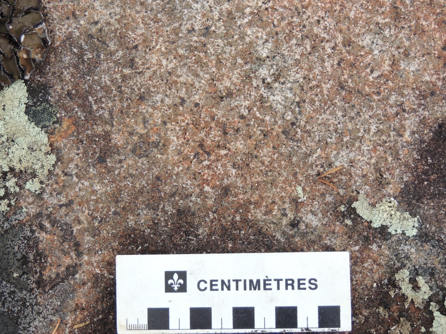
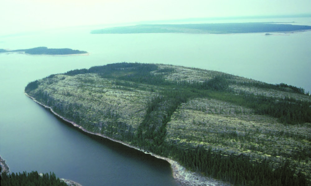
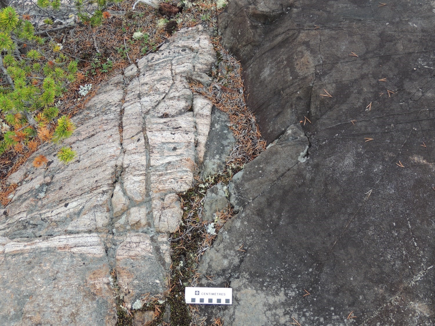 The Lac Esprit Dykes are composed of diabase of gabbroic to gabbronoritic composition. They are characterized by a positive relief and a positive linear aeromagnetic anomaly, as well as a strong magnetic susceptibility. The rock is medium-grained in the center of the dyke and is very fine-grained at the edge. It has a gray to dark green color in fresh exposure and is brown in altered surface. The rock is magnetic, massive and homogeneous. It has a chill margin and a sharp contact with surrounding rocks. Dykes are composed of plagioclase generally altered to damourite and locally porphyritic, with partially uralitized augite, magnetite-ilmenite (between 1 and 5%) and locally leucoxene. A mineral completely replaced by an assemblage of chlorite and acicular amphibole, which could be orthopyroxene, is observed in thin sections. Fine pyrite and pyrrhotite are commonly observed. Accessory minerals in thin sections include biotite (<2%) commonly altered to chlorite, epidote, apatite, quartz and zircon.
The Lac Esprit Dykes and those of the Mistassini Dyke Swarm are distinguished by their petrography (orthoclase, apatite, biotite and quartz more abundant in the Mistassini Dyke Swarm) and their geochemistry (Mistassini: TiO2+K2O+P2O5 generally greater than 5%, average Fe2O3v/FeO = 0.4, Zr/Y> 8 and La/Yb>4.5; Lac Esprit: TiO2+K2O+P2O5 generally less than 5%, average Fe2O3v/FeO = 0.24, Zr/Y<5.5 and La/Yb<8).
Lac Esprit Dykes 1 (pPesp1)
The pPesp unit is the general unit used on previous maps. The dominant unit of the Lac Esprit Dykes is pPesp1. Dykes of this unit are aphyric and homogeneous while those of the pPesp1a unit are porphyritic with plagioclase phenocrysts, 0.5 to 2 cm in size, composing 1 to 5% of the rock.
Lac Esprit Dykes 2 (pPesp2)
The pPesp2 unit is currently limited to two NW-oriented dykes, one of which is older (2090 Ma, preliminary age, M. Hamilton, personal communication 2016).
Thickness and distribution
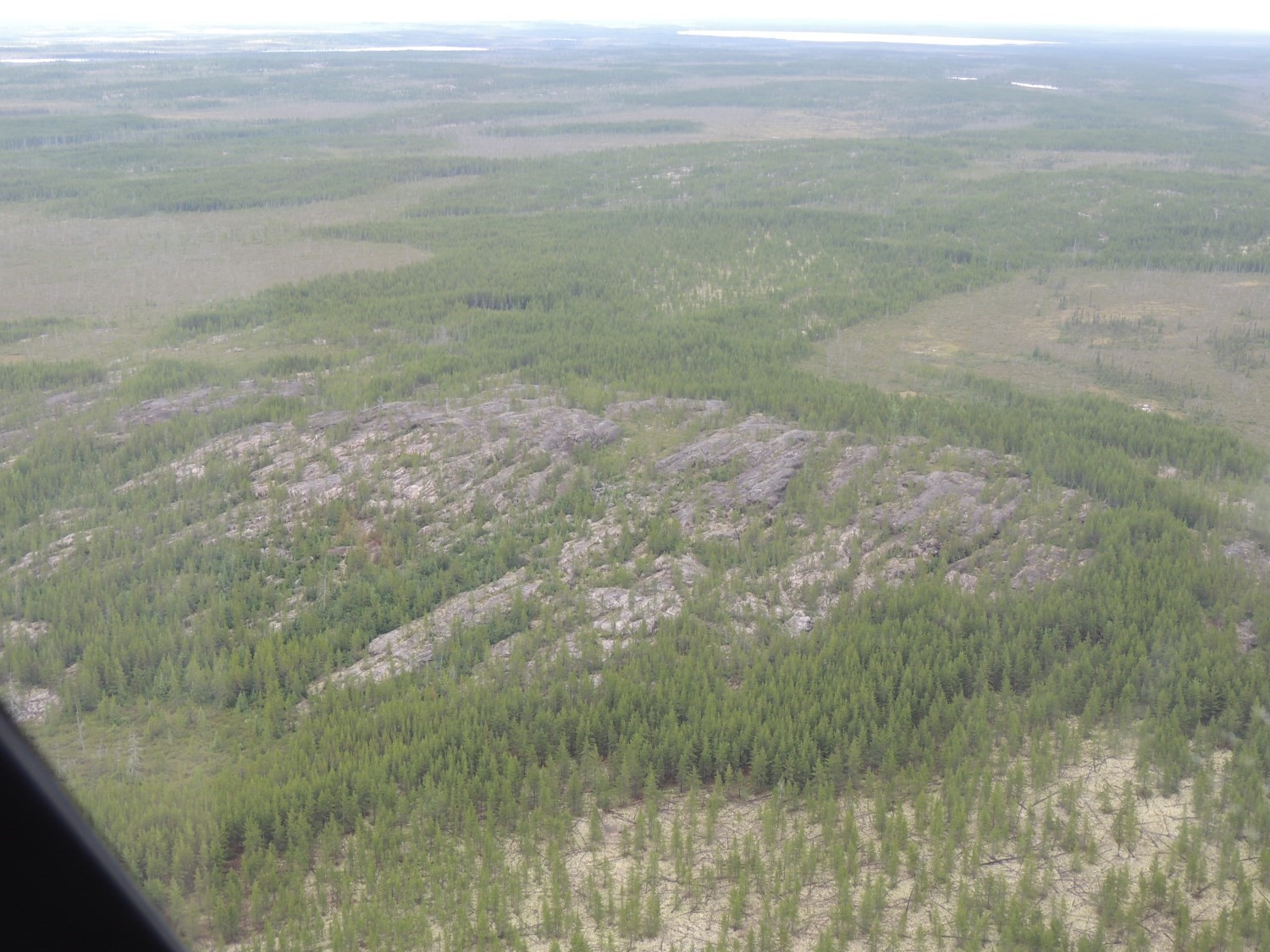
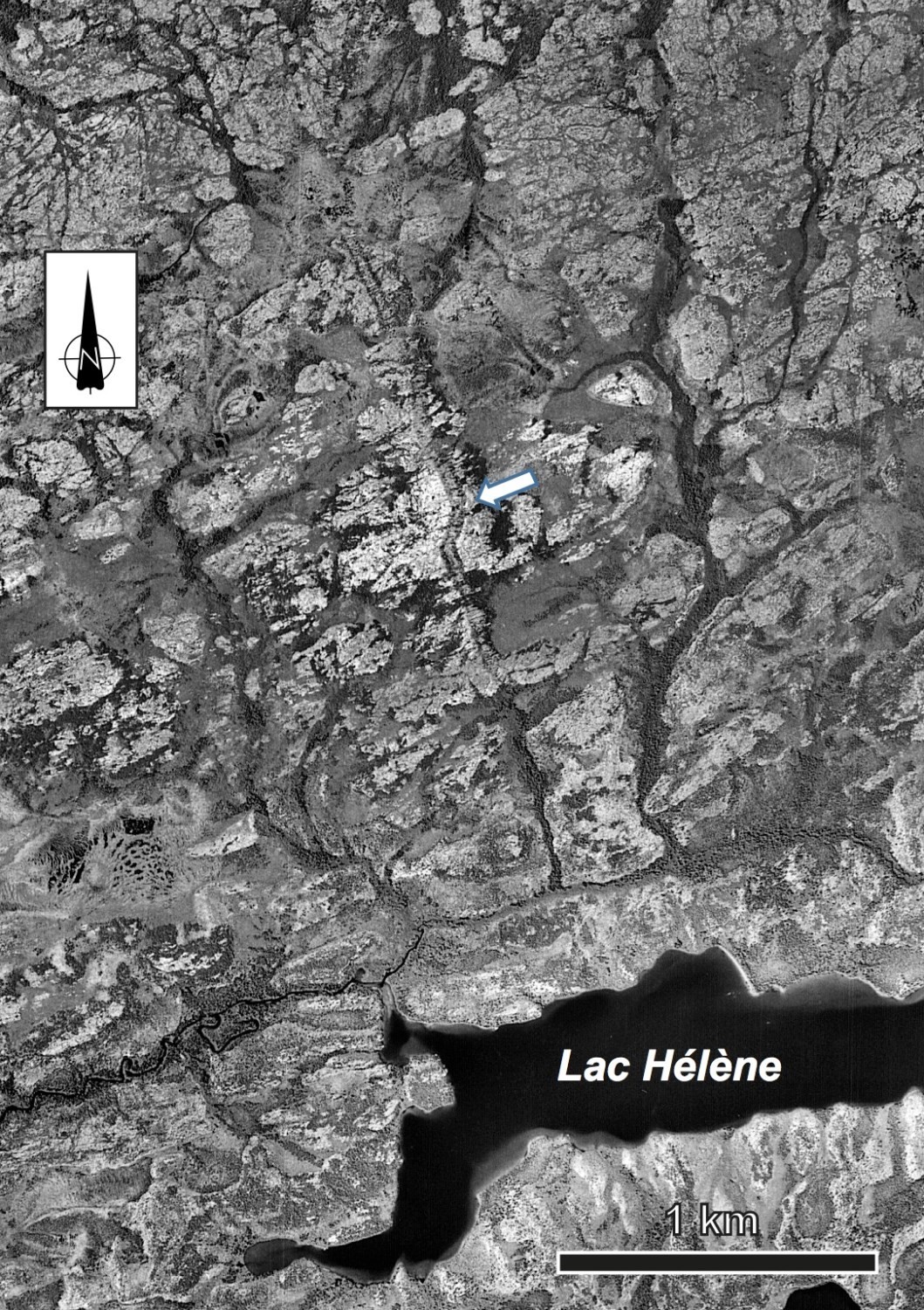 Dykes have an average thickness of 35 meters and a maximum thickness of 100 meters (Buchan et al., 2007). The Lac Esprit Dykes were recognized over an area extending from Robert-Bourassa Reservoir to south of Evans Lake, and from south of Laforge 1 Reservoir to north of Mistassini Lake, covering an area of 125,000 km2. They are observed in outcrop from the air, or in some cases on aerial photographs and satellite images and on aeromagnetic maps. They cut Archean rocks of the Minto, La Grande, Opinaca and Opatica subprovinces of the Superior Province, as well as clastic rocks of the Sakami Formation. They have an NW to NNE orientation radial to a focus centered about 250 km SE of Mistassini Lake, such as the Mistassini Dyke Swarm.
Dating
Diabase sample JG97-EKN (outcrop 1997-JG-999) gave a crystallization age of 2069 ±1 Ma for a dyke of the pPesp1 unit (U-Pb on baddeleyite; Hamilton et al., 2001). Preliminary results of L. Heaman on a sample from dyke 6547 of W.F. Farhig and Hamilton and on a dyke sample from outcrop 1997-MH-7264 indicate an age of ~2090 Ma for the pPesp2 unit.
| Isotopic System | Mineral | Cristallization Age (Ma) | (+) | (-) | Reference(s) |
| U-Pb | Baddeleyite | 2069 | 1 | 1 | Hamilton et al., 2001 |
| U-Pb | Baddeleyite | 2090 | Hamilton (communication personnelle, 2016) |
Stratigraphic relationship(s)
 The Lac Esprit Dykes cut Archean rocks of the Superior Province, as well as clastic rocks of the Paleoproterozoic Sakami Formation. Although the Lac Esprit Dykes are younger than those of the Mistassini, Matachewan and Senneterre swarms, no crosscutting relationships has been observed in the field.
Paleontology
Does not apply.
References
| Author(s) | Title | Year of Publication | Hyperlink (EXAMINE or Other) |
|---|---|---|---|
| BUCHAN, K.L. – GOUTIER, J. – HAMILTON, M.A. – ERNST, R.E. – MATTHEWS, W.A. | Paleomagnetism, U-Pb geochronology, and geochemistry of Lac Esprit and other dyke swarms, James Bay area, Quebec, and implications for Paleoproterozoic deformation of the Superior Province. Canadian Journal of Earth Sciences; volume 44, pages 643-664. | 2007 | Source |
| EADE, K. E. – HEYWOOD, W. W. – LEE, H. A. | Sakami Lake area, New Quebec. Geological Survey of Canada; map 23-1957. | 1958 | Source |
| ERNST, R.E. – BUCHAN, K.L. | Geochemical database of Proterozoic intraplate mafic magmatism in Canada. Geological Survey of Canada, Open File 6016, 1 CD-ROM. | 2010 | Source |
| GOUTIER, J. – DION, C. – LAFRANCE, I. – DAVID, J. – PARENT, M. – DION, D.-J. | Géologie de la région des lacs Langelier et Threefold. Ministère des Ressources naturelles, Québec; RG 98-18, 52 pages. | 1999 | RG 98-18 |
| GOUTIER, J. – DOUCET, P. – DION, C. – BEAUSOLEIL, C. – DAVID, J. – PARENT, M. – DION, D.-J. | Géologie de la région du lac Kowskatehkakmow (33F/06). Ministère des Ressources naturelles, Québec; RG 98-16, 48 pages. | 1998a | RG 98-16 |
| GOUTIER, J. – DOUCET, P. – DION, C. – BEAUSOLEIL, C. – DION, D.-J. | Géologie de la région du lac Esprit (33F/05). Ministère des Ressources naturelles, Québec; RG 98-09, 39 pages. | 1998b | RG 98-09 |
| HAMILTON, M.A. – GOUTIER, J. – MATTHEWS, W. | U-Pb baddeleyite age for the Paleoproterozoic Lac Esprit dyke swarm, James Bay region, Quebec. Geological Survey of Canada; Current Research 2001-F5, 8 pages. | 2001 | Source |
| HEYWOOD, W.W. – BRETT, S.E. – CURRIE, K.L. – EADE, K.E. | La Grande – Lac Bienville, New Quebec. Geological Survey of Canada; map 23-1958. | 1959 | Source |