DISCLAIMER: This English version is translated from the original French. In case of any discrepancy, the French version shall prevail.
| Author(s): | Maurice et al., 2005 |
| Age: | Neoarchean |
| Stratotype: | None |
| Type area: | Kogaluk Bay area (NTS sheet 34N07) |
| Geological province: | Superior Province |
| Geological subdivision: | Minto Subprovince |
| Lithology: | Volcano-sedimentary rocks |
| Category: | Lithodemic |
| Rank: | Lithodeme |
| Status: | Formal |
| Use: | Active |
None
Background
Although they did not define the unit at scale 1:1 000 000, Stevenson et al. (1969) observed a sequence in the Mangnuc and Roulier lakes area containing numerous basic intrusions, migmatites and gneiss, as well as a gabbro intrusion. About 30 years later, Maurice et al. (2005) formally introduced the Roulier Belt in the Kogaluk Bay area to describe a sequence of well-preserved isolated supracrustal rocks. The unit is named after Roulier Lake (sheet 34N07), ~60 km east of Hudson Bay. This lithodeme was not assigned to a volcano-sedimentary complex (Simard, 2008).
Description
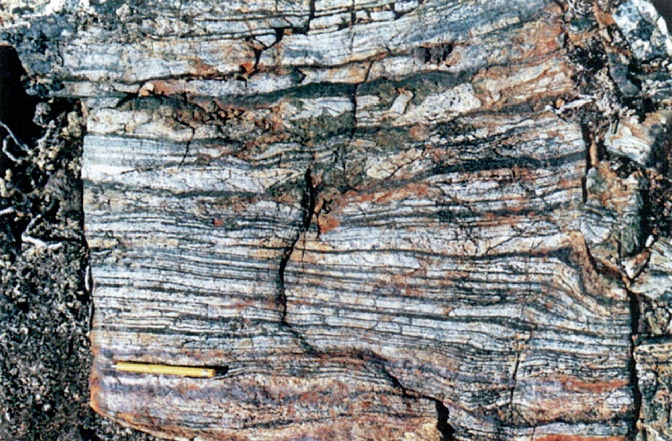
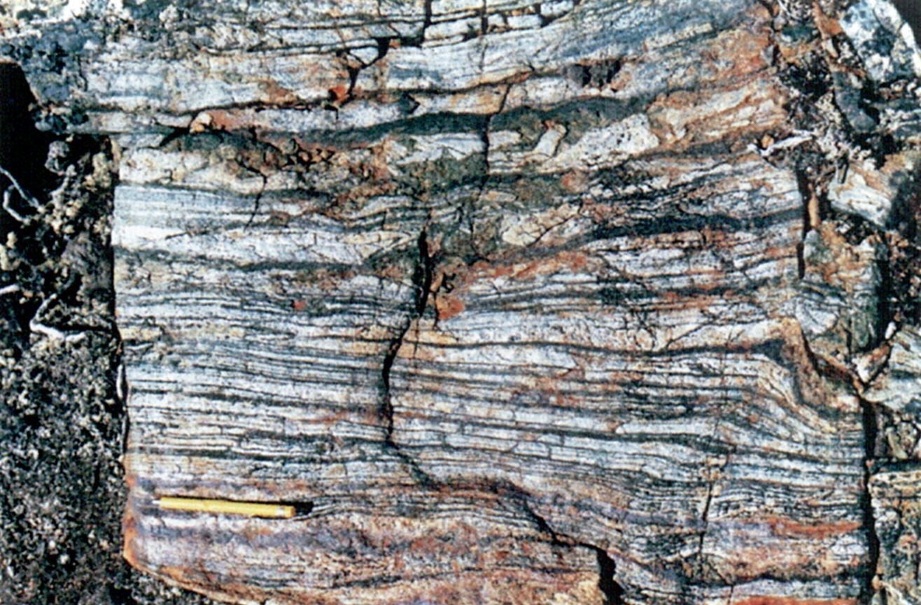
The Roulier Belt corresponds to a sequence of volcano-sedimentary rocks consisting of mafic volcanic rocks (unit nArlr1), gabbro dykes (subunit nArlr1a), metasedimentary rocks (unit nArlr2) and pyroclastic rocks (unit nArlr3) (Maurice et al., 2005). Although these rocks are less recrystallized and less metamorphosed than other supracrustal rocks in the Kogaluk Bay area, they are significantly deformed (mylonitic deformation, isoclinal folds and late crenulation) and metamorphosed to the amphibolite facies (Maurice et al., 2005; Simard, 2008). Informal unit descriptions are taken from Maurice et al. (2005), Simard et al. (2008) and Simard (2008).
Roulier Belt 1 (nArlr1) : Mafic Metavolcanic Rocks and Hornblende Gabbro
Unit nArlr1 consists mainly of mafic metavolcanic rocks containing hornblende, and locally plagioclase phenocrysts. The rock is dark green, fine grained to aphanitic, granoblastic, massive to foliated and tholeiitic in affinity. Accessory minerals present are biotite, magnetite, titanite and quartz. In areas that have been leached, mafic volcanics are rusted, silicified and contain disseminated or veinlet sulphides (pyrite, pyrrhotite and locally chalcopyrite), micas and traces of tourmaline crystals. These mafic metavolcanic rocks are the dominant lithology of the Roulier Belt. The unit also contains dykes and intrusions of massive gabbro, as well as felsic rocks and tuff interstratified in metasedimentary rocks.
Roulier Belt 1a (nArlr1a) : Homogeneous, Massive to Foliated Gabbro
Unit nArlr1a consists of three hornblende gabbro ovoid intrusions. They are a few kilometres long and cut through the Roulier Belt. Gabbro is mesocratic, homogeneous, fine to medium grained, and massive to foliated. The subophitic igneous texture is well preserved locally. The rock is mostly composed of hornblende, plagioclase and a small amount of brown biotite. Locally, clinopyroxene relics can be observed within hornblende crystals. Coarser plagioclase crystals are usually zoned and surrounded by granoblastic crystals.
Roulier Belt 2 (nArlr2) : Biotite-Garnet-Sillimanite-Cordierite Paragneiss, Iron Formation
Unit nArlr2 consists of biotite-garnet ± cordierite ± sillimanite ± staurolite ± andalusite paragneiss. Paragneiss is schistose and rusty on altered surface. Rocks correspond to more or less migmatized metapelites (0-50% felsic mobilisate). They form metric to decametric layers inserted in the mafic rock sequence, but may also form larger units. Banded iron formations <30 m thick were observed in the metasedimentary sequence.
Roulier Belt 3 (nArlr3) : Volcaniclastic Rocks
Unit nArlr3 consists of kilometric lenses of volcaniclastic rock of intermediate to felsic composition. These pyroclastic rocks, which are fairly abundant (~10% of the volume of the Roulier Belt), are mainly represented by crystal and lapilli tuffs, rounded to elongated in foliation, but the unit locally includes block tuff of andesite composition. They are white to light grey, of heterogeneous to homogeneous particle size, foliated, usually finely banded and highly sheared. The dominant mineral phases are quartz, biotite, sericite and epidote, with local sillimanite, cordierite and garnet. Tuffs are calc-alkaline in affinity.
Thickness and distribution
The Roulier Belt forms a volcano-sedimentary sequence 30 km long by 10 km wide on average, but which pinches towards the SSE. It mostly outcrops near Roulier and Mangnuc lakes (sheet 34N07), ~50 km east of Hudson Bay.
Dating
U-Pb dating on zircon of a felsic lapilli tuff yielded an age of 2759 ±1 Ma, interpreted as the volcanism age (David, 2012).
| Unit | Sample Number | Isotopic System | Mineral | Crystallization Age (Ma) | (+) | (-) | Metamorphic Age (Ma) | (+) | (-) | Reference(s) |
| nArlr3 | 03-AB-062A | U-Pb | Zircon | 2759 | 1 | 1 | 2731 | 3 | 3 | David, 2012 |
Stratigraphic Relationship(s)
Essentially, the Roulier Belt is hosted in tonalites of the Qilalugalik Suite and granite of the Pinguq Suite. Pegmatitic dykes of white granite containing tourmaline and quartz veins cut all other units of the belt (Maurice et al., 2005). Some amphibolite klippes of the Innuksuac Complex are located near the Roulier Belt and could be associated with it (Simard, 2008). These klippes would have been dismembered and metamorphosed to the granulite facies during intrusion of the surrounding granitoids.
Paleontology
Does not apply.
References
Publications available through SIGÉOM Examine
DAVID, J., 2012. DATATIONS ISOTOPIQUES EFFECTUÉES DANS LE NORD-EST DE LA PROVINCE DU SUPÉRIEUR (TRAVAUX DE 2001, 2002 ET 2003). MRNF. DV 2012-05, 84 pages.
MAURICE, C., LACOSTE, P., BERCLAZ, A., DAVID, J., SHARMA, K.N.M., 2005. GÉOLOGIE DE LA RÉGION DE KOGALUK BAY (34N ET 34M). MRNFP. RG 2004-01, 37 pages and 2 plans.
SIMARD, M., 2008. LEXIQUE STRATIGRAPHIQUE DES UNITÉS ARCHÉENNES DU NORD-EST DE LA PROVINCE DU SUPÉRIEUR. MRNF. DV 2008-03, 107 pages.
SIMARD, M., LABBÉ, J.-Y., MAURICE, C., LACOSTE, P., LECLAIR, A., BOILY, M., 2008. SYNTHÈSE DU NORD-EST DE LA PROVINCE DU SUPÉRIEUR. MRNF. MM 2008-02, 198 pages and 8 plans.
Other publications
STEVENSON, I.M., FAHRIG, W.F., CURRIE, K.L., SCHILLER, A.E., ROACH, T., TAYLOR, F.C., SKINNER, R., BOSTOCK, H.H., WILLIAMS, M.H., MIRYNECH, E., 1969. Geology, Leaf River, Québec, Geological Survey of Canada, Map Series « A » 1229A, 1 sheet. https://doi.org/10.4095/109106
Suggested Citation
Ministère de l’Énergie et des Ressources naturelles (MERN). Roulier Belt. Quebec Stratigraphic Lexicon. http://gq.mines.gouv.qc.ca/lexique-stratigraphique/province-du-superieur/ceinture-de-roulier_en [accessed on Day Month Year].
Contributors
|
First publication |
Céline Dupuis, P. Geo., Ph.D. (redaction and English version) céline.dupuis@mern.gouv.qc.ca Mehdi A. Guemache, P. Geo., Ph.D. (coordination); Charles St-Hilaire, GIT, M.Sc. (critical review); Simon Auclair, P. Geo., M.Sc. (editing); André Tremblay (HTML editing). |


