

Last modified: 13 February 2019
Translation of original French
| Author: | Fahrig and West, 1986 |
| Age: | Paleoproterozoic |
| Reference section: | None |
| Type area: | Arnaud River area (NTS sheet 25D) |
| Geological province: | Superior Province |
| Geological subdivision: | Minto Subprovince |
| Lithology: | Mafic to ultramafic intrusive rocks |
| Type: | Lithodemic |
| Rank: | Lithodeme |
| Status: | Formal |
| Use: | Active |
None
Background
Post-Archean diabase dykes and sills were recognized during the first geological mapping campaigns of the Canadian Shield in Quebec and Ontario (e.g., Murray et al., 1897). The Rivière Payne Dyke unit was introduced by Fahrig and West (1986) from their compilation map and interpretation of aeromagnetic surveys. They illustrated the distribution of the Canadian Shield diabase dyke swarms and their chronologies based on isotopic ages. On this map, the northern Quebec NNW dykes are attributed to the Rivière Payne Swarm. The Rivière Payne Dykes were plotted from outcrops and the magnetic field vertical gradient map. They have a straight-line signature for kilometres with a NNW orientation. The Rivière Payne Dykes were mapped in NTS sheets 24M (Madore et al., 1999), 25D, 25C, 25E and 25F (Madore and Larbi, 2000), 35A and 35H (Madore et al., 2001), 24E (Berclaz et al., 2001), 34P (Cadieux et al., 2002), 35B and 35G (Madore et al., 2002), 34O (Berclaz et al., 2002), 35C and 35F (Maurice et al., 2003), and 34N and 34M (Maurice et al., 2004).
Description
 The Rivière Payne Dykes are similar in location to the Klotz Dykes. They have therefore been documented in the same work with similar descriptions, since they show several mineralogical and petrographic affinities (Madore et al., 1999; Madore and Larbi, 2000; Madore et al., 2001; Madore et al., 2002; Maurice et al., 2003; Maurice et al., 2005). In some areas, the Rivière Payne River Dykes have some characteristics that differentiate them from the Klotz Dykes (Berclaz et al., 2001; Berclaz et al., 2002; Cadieux et al., 2002).
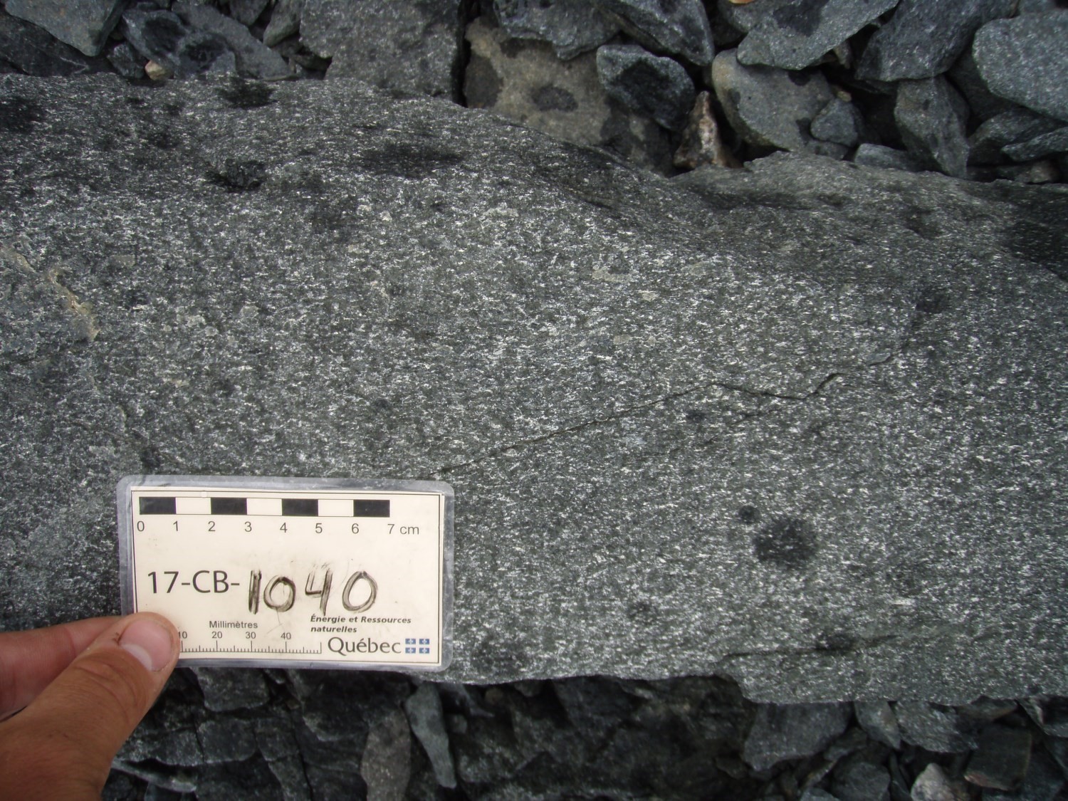
The Rivière Payne Dykes consist of gabbro; they have a subophitic to ophitic texture and are medium to coarse-grained. In some areas, these dykes have a greater variety of petrographic facies. They are fine grained to aphanitic and have ophitic to trachyoidal textures due to a magmatic flow structure (Berclaz et al., 2001; Berclaz et al., 2002; Cadieux et al., 2002). Rock is bluish grey in fresh exposure and greenish brown in altered patina (Berclaz et al., 2001; Berclaz et al., 2002; Cadieux et al., 2002). Gabbro is composed of euhedral plagioclase crystals surrounded by a matrix of clinopyroxene and locally, anhedral to subhedral orthopyroxene. Dykes have aphanitic chilled margins of decimetric thickness, containing euhdral microcrystals of plagioclase and augite aligned with contact with the host rock (Madore et al., 1999). Common accessory minerals are quartz, iron and titanium oxides and biotite.
Deformation and metamorphism of dykes cutting the Troie and Qimussinguat complexes are generally null, while intrusions in the northeastern portion of the Faribault-Thury Suite show deformation and metamorphism that intensifies eastward towards the Labrador Trough (Madore et al., 1999). The amphibolite metamorphic facies is thus reached within the Diana Complex, as evidenced by the loss of their original igneous characteristics (Madore and Larbi, 2000). Metamorphic and alteration minerals include chlorite and amphibole partially replacing ferromagnesian minerals, as well a sericite-epidote assemblage replacing plagioclase. Dykes located near large brittle faults are also altered and contain chlorite, hematite and epidote veins (Madore et al., 2001).
Thickness and Distribution
The Rivière Payne Dykes are located in the Minto Subprovince. They predominate in sheet 25D, occupied by the northeast part of the Douglas-Harbour Domaine, near contact with the Labrador Trough. Dykes are also highly present in sheets 35H and 35B, and in smaller proportions in sheets 24M, 25C, 25E, 34N, 34O, 34P, 35A, 35C, 35F and 35G.
The dykes are planar, straight-lined and their general orientation is NNW-SSE. They vary in thickness from 0.5 to 100 m. The majority of these are discontinuous in space, forming segments 1 to 30 km long. They are grouped into a few swarms of denser dykes spaced 1-5 km apart and rarely up to 10 km apart. These clusters of denser swarms are spaced by several tens of kilometres.
Dating
Fahrig et al. (1985) performed K-Ar dating analyses on two samples of dyke’s chilled margins and obtained the ages of 1875 and 1790 Ma. These authors later concluded that the crystallization age of the dykes was older than 2000 Ma. In their compilation work, Fahrig and West (1986) cite an age of 2175 Ma for the intrusion of the Rivière Payne Dykes. The method and the analyzed mineral are not mentioned. Also, the compilation work of Buchan and Ernst (2004) indicates an age between 2170 and 2160 Ma. The analysis was done by the U-Pb method, but the mineralized mineral is not mentioned.
Stratigraphic Relationship(s)
Paleoproterozoic Rivière Payne Dykes cut Minto Subprovince’s Archean rocks. Contacts with host rocks are sharp and locally lobbed. These dykes are in places associated with brittle fault zones (Madore et al., 2001). Ernst and Buchan (2004), as well as Clark and Wares (2004), mention the Rivière Payne River Dykes’s association with mafic volcanics at the base of the stratigraphic sequence of the Labrador Trough’s first volcano-sedimentary cycle.
Paleontology
Does not apply.