

Last modification:
| Author(s) | Beauchamp, 2019 |
| Methodology | Defined from geological survey |
| Geological(s) subdivision(s) | Superior Province / Opatica Subprovince |
| Main movement | Does not apply |
| Deformation style | Parallel |
| Metamorphic facies (mean facies related to main deformation) | Granulites |
Background and Methodology
The Maingault Structural Domain was defined by Beauchamp (2019) following a mapping survey conducted in the Cadieux Lake area in the summer of 2018. The following description is based primarily on geological observations gathered during the Ministère‘s field work as well as on the analysis of geophysical imagery (total magnetic field and vertical gradient) from the SIGÉOM.
Boundaries and Morphology
| Width | 3 km (in sheet 33A02 only) |
| Length | 18 km (in sheet 33A02 only) |
| Orientation | E-W elongation |
The Maingault Structural Domain was initially defined in the SE part of sheet 33A02, but extends further south in sheet 32P15, which has not been recently mapped. The domain is located south of the Mabille Structural Domain. An undetermined shear zone marks the boundary between the Mabille and Maingault structural domains, and possibly the contact between the Opatica and Opinaca subprovinces.
Stratigraphic Units Concerned
The Maingault Structural Domain is only composed of plutonic rocks of the Maingault Complex (nAmai1, nAmai2 and nAmai3) which belong to the Opinaca Subprovince.
Structural Characteristics
❯ Main Fabrics
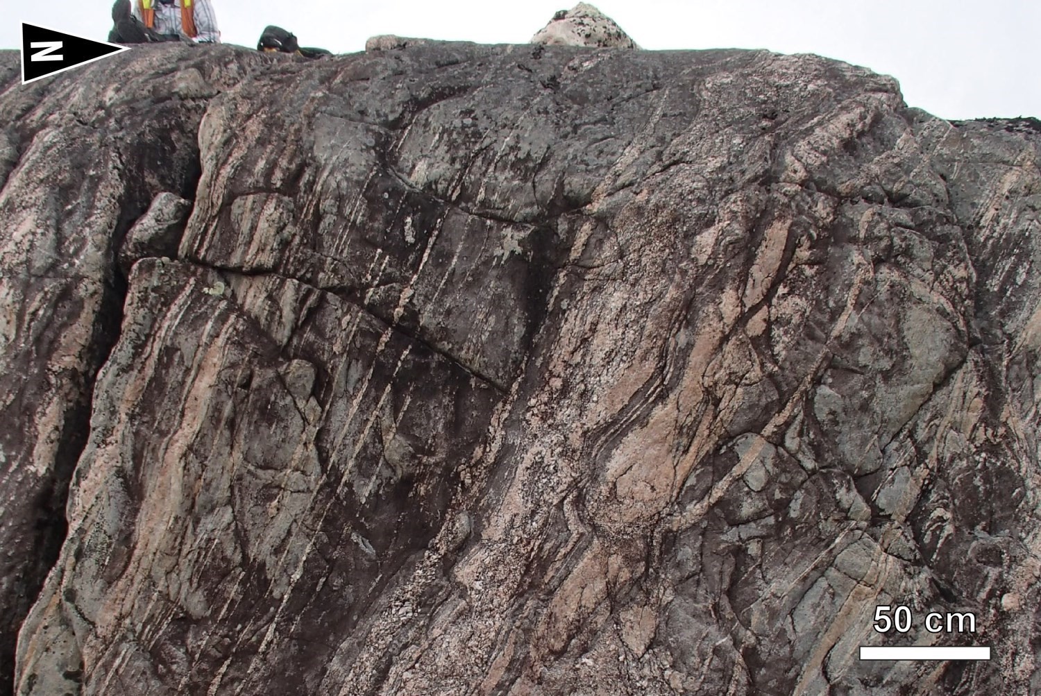
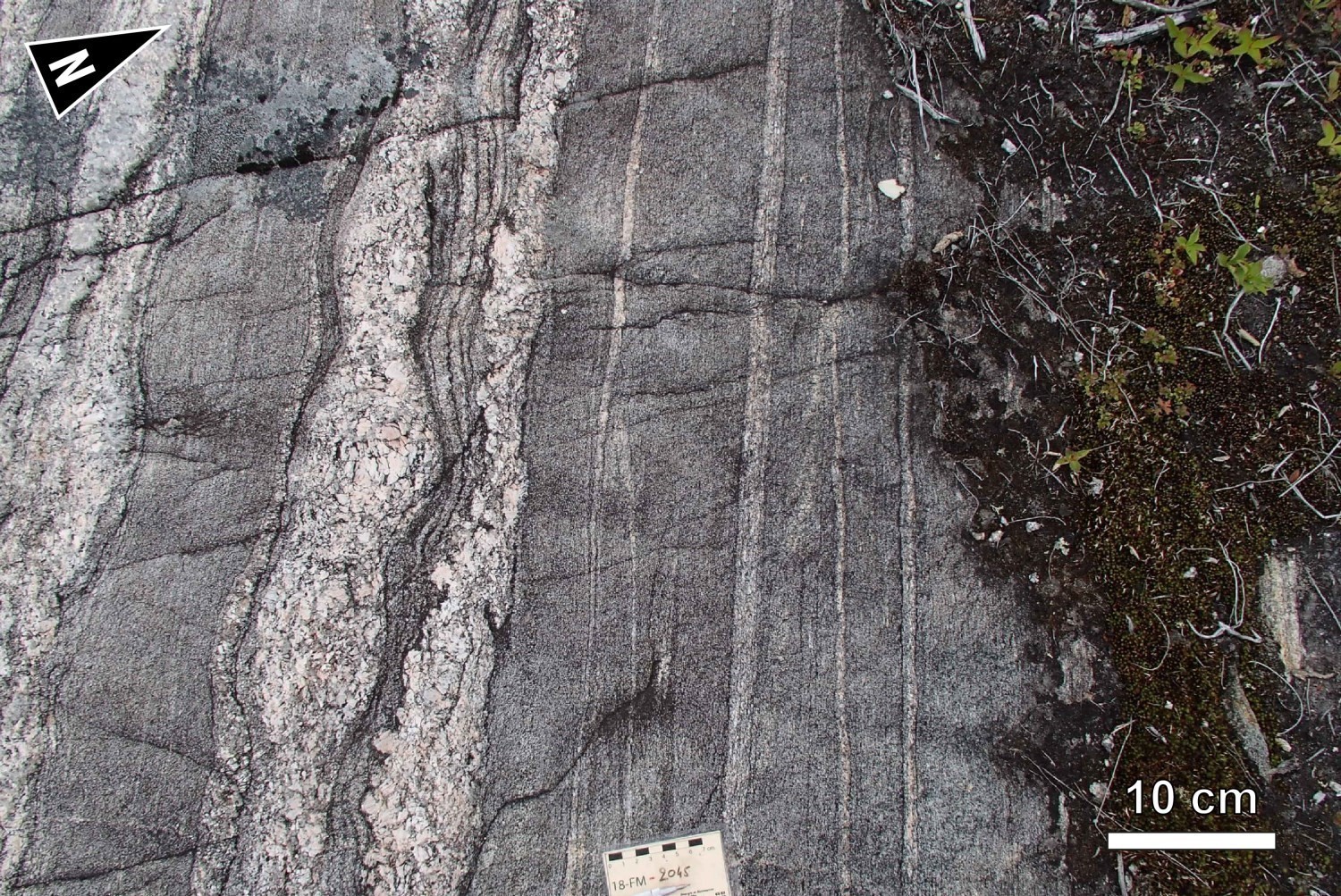
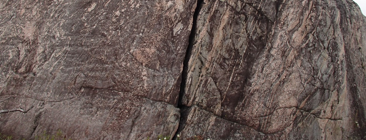
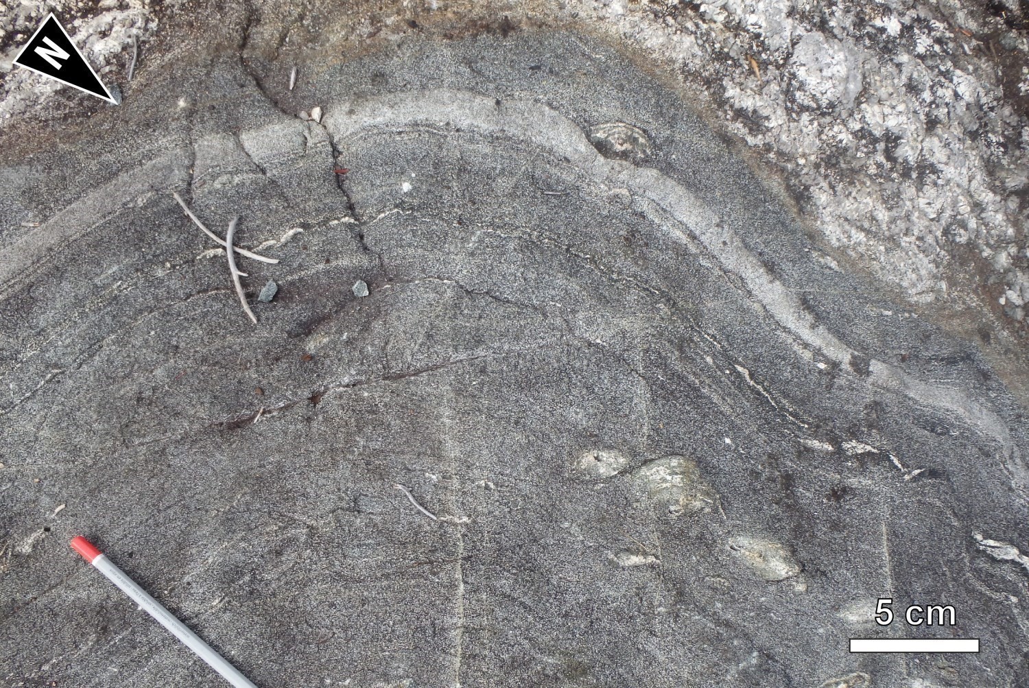
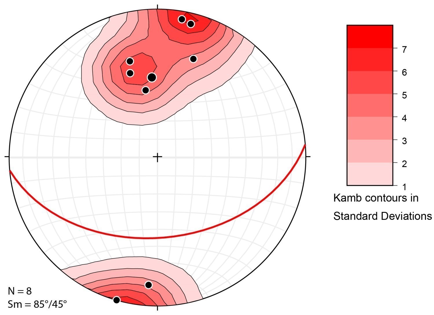 Regional foliation Sn in the Maingault Structural Domain is marked by the alignment of ferromagnesian minerals (biotite and hornblende), but also regularly by intense banding of the rock. Bands are of dioritic, tonalitic or granitic composition and are all parallelized, reflecting intense deformation affecting this domain. Intrusions also display pinch and swell and boudinage structures. Some outcrops also exhibit migmatization which has also developed in a context of N-S compression. In contrast to the Mabille Structural Domain located directly to the north, regional foliation Sn of the Maingault Structural Domain is south-dipping. Although it is predominantly oriented E-W (stereogram), it curves gradually to become SW-NE towards the SW.
| Main Fabric | Type of Fabric | Direction (°) | Dip / Plunge (°) | Number of Measurements | Comments |
| Foliation Sn | Tectonometamorphic mineral foliation and migmatitic banding | 085 | 45 | 8 | |
| Lineation Ln | Stretch lineation | 110 | 12 | 1 | Number of measurements too limited to be representative. |
❯ Other Fabrics
Not observed.
❯ Folds
 Rocks of the Maingault Complex are affected by a Pn fold overturned northward, the axis of which is mainly E-W. A single axial plane was measured in sheet 33A02, having a direction of 060° and an axis oriented 060°/82°.
Geometric Parameters of Regional Folds:
| Fold or Family of Folds | Type (Anticline, Syncline or Undetermined) | Shape (Antiform or Synform) | Attitude (Overturned or Upright) | Axial Plane | Fold Axis | Position (Certain or Probable) | Deformation Phase | Comments | ||
| Direction | Dip | Direction | Dip | |||||||
| Fold Pn | Undetermined | Synform | Overturned northward | 060-090° | – | – | – | Probable | Dn | |
❯ Crosscutting Relationships
A NW-SE orientated fragile fault displaying dextral movement was interpreted using magnetic anomaly maps.
Geometric Parameters of Regional Faults Cutting the Maingault Structural Domain:
| Fault or Family of Faults | Type | Mean Direction (°) | Mean Dip (°) | Lineation Plunge in the Fault Plane | Estimated Width (m) | Estimated Length (km) | Apparent Movement | Position | Comments |
| Fault | Regional fault | 145 | Steep | – | Meters | Kilometric | Dextral | Inferred from magnetic imagery |
❯ Kinematics
Does not apply.
Deformation Style
The Maingault Structural Domain results from high rock deformation caused by N-S shortening and marked by intense banding and boudinage.
Metamorphic Characteristics
At the southern end of the Cadieux Lake map, rocks of the Maingault Complex have reached the upper amphibolite facies up to the granulite facies. Tonalite and quartz diorite, which form the main unit of the complex (nAmng1), contain biotite and varying amounts of hornblende and magnetite. This assemblage does not provide much information on metamorphic conditions reached by these rocks. On the other hand, mafic rocks of the complex (nAmng2), with their HB-PG-CX ± OX assemblage, have reached the granulitic facies. Ultramafic sills are composed of an assemblage typical of the upper amphibolite facies. They contain prograde TM-AC-MG ± OV ± OX ± SL and retrograde ST-TC assemblages.
Alterations
Does not apply.
Geophysical Characteristics
The map of the vertical gradient of the total magnetic field indicates that this domain has a shagreened texture with some marked heterogeneity, notably due to strongly magnetic bands corresponding to E-W oriented ultramafic intrusions belonging to unit nAmng3 of the Maingault Complex.
Chronological Markers
This structural domain has not yet been dated.
References
Publications Available Through Sigéom Examine
BEAUCHAMP, A M. 2019. Géologie et potentiel minéral de la région du lac Cadieux, sous-provinces d’Opatica et d’Opinaca, Eeyou Istchee Baie-James, Québec, Canada. MERN. BG 2019-02, 2 plans.
Suggested Citation
Contributors
First publication | Anne-Marie Beauchamp, P. Geo., M.Sc. anne-marie.beauchamp@mern.gouv.qc.ca (redaction) Ghyslain Roy, P. Geo. (coordination); Patrice Roy, P. Geo., Ph.D. (critical review); Simon Auclair, P. Geo., M.Sc. (editing); André Tremblay (HTML editing); Céline Dupuis, P. Geo., Ph.D. (English version) |