

First published: 23 October 2020
Last modified:
DISCLAIMER: This English version is translated from the original French. In case of any discrepancy, the French version shall prevail.
| Author: | Pilote et al., 2020 |
| Age: | Neoarchean |
| Stratotype: | None. Reference outcrops 19-PP-304 and 19-JM-515, located ~12 km NNE of Barraute |
| Type area: | Barraute area, central part of the SE quarter of NTS sheet 32C12 |
| Geological province: | Superior Province |
| Geological subdivision: | Abitibi Subprovince |
| Lithology: | Hornblende monzonite, monzodiorite, quartz monzonite and granodiorite |
| Category: | Lithodemic |
| Rank: | Lithodeme |
| Status: | Formal |
| Use: | Active |
None
Background
This pluton appears for the first time on the geological maps of Weber and Latulippe (1964). These authors indicate that it is an intrusion whose composition varies from syenite, monzonite to granodiorite. They propose that this pluton is probably multiphase, due to this diversity of compositions, but do not give it a formal name. Labbé (1995) agrees with these descriptions and reproduces these contacts in his own work. On the other hand, outcrops are very limited in number. Pilote et al. (2020) name this intrusion the Laflamme Pluton; they do not formally observe true syenite facies and somewhat reduce the surface area of this pluton, thanks to information provided by drilling campaigns (Dumont, 1969; Bérubé, 1978; Cloutier, 1993) and regional aeromagnetic surveys (Geological Survey of Canada et al., 2009).
Description
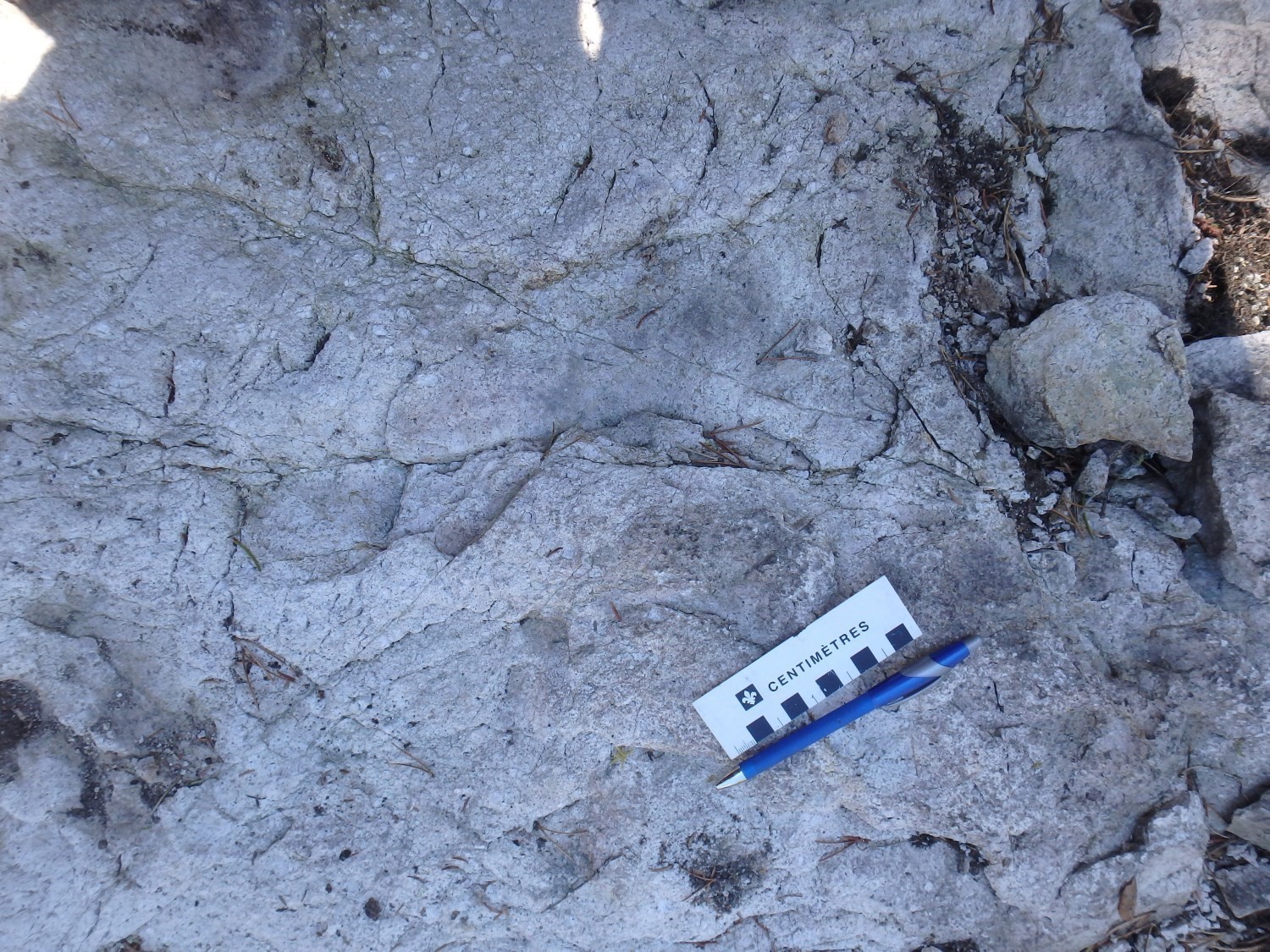

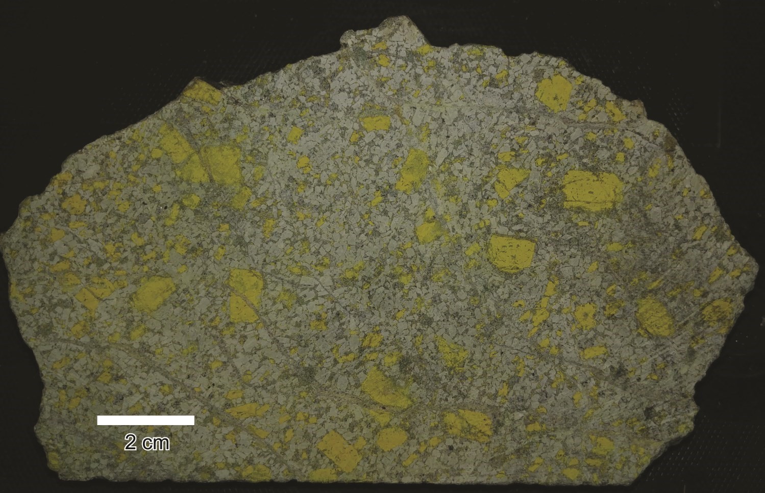
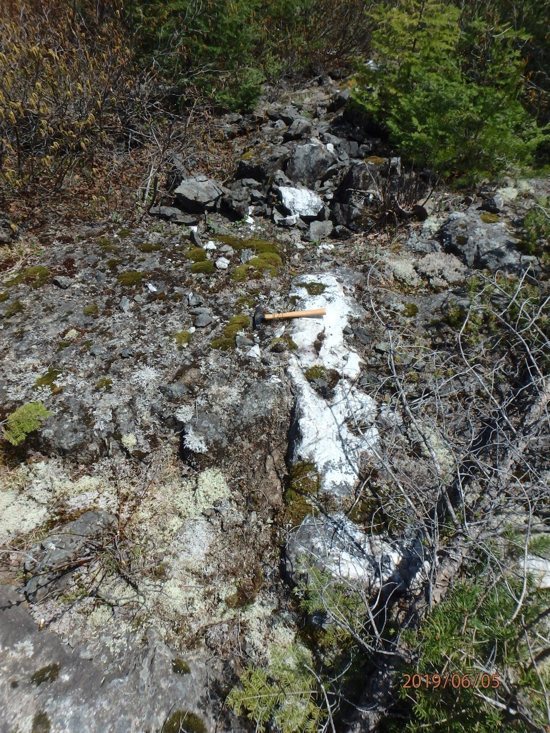
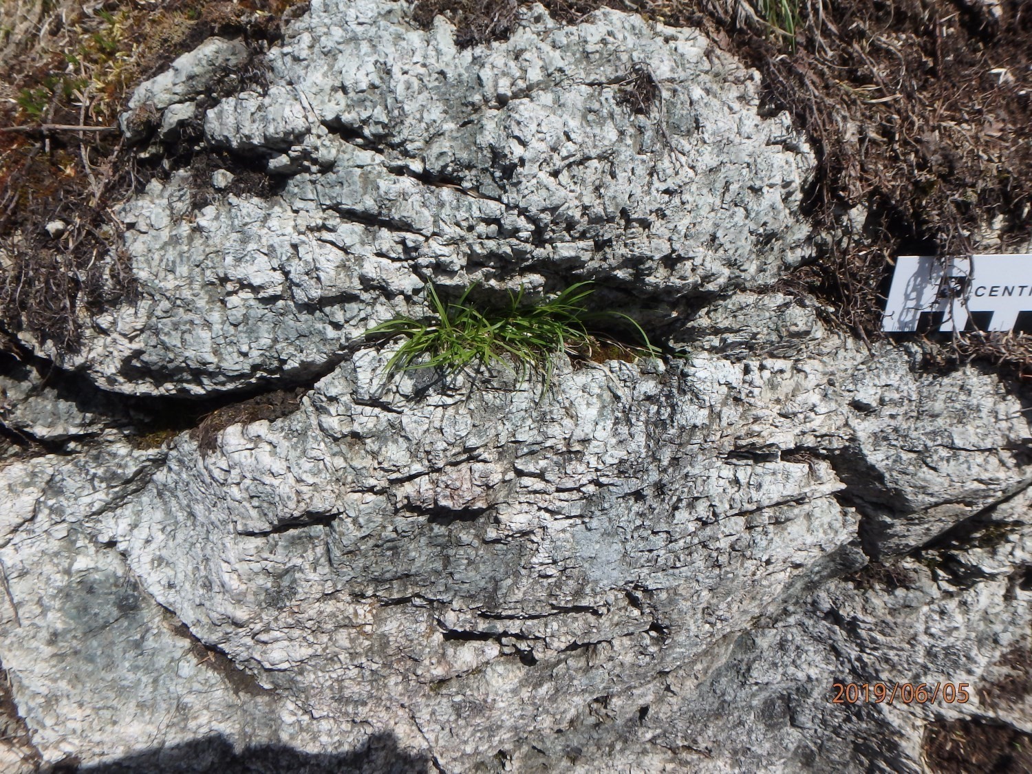
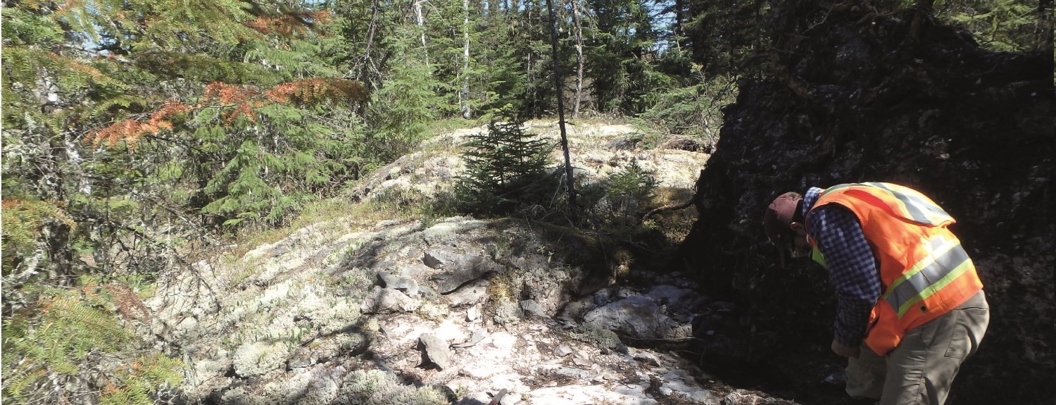
The Laflamme Pluton consists of varying proportions of monzonite, quartz monzonite, monzodiorite and, in rare places, granodiorite. Monzodiorite and granodiorite are porphyraceous, containing plagioclase rods oriented E-W to WNW-ESE in the southern part of the pluton, while monzonite K-feldspar porphyraceous in its central-western part. Phenocrystals are pinkish white and millimetre-sized. Porphyraceous phases exhibit a coarse magmatic foliation oriented E-W to NW-SE.
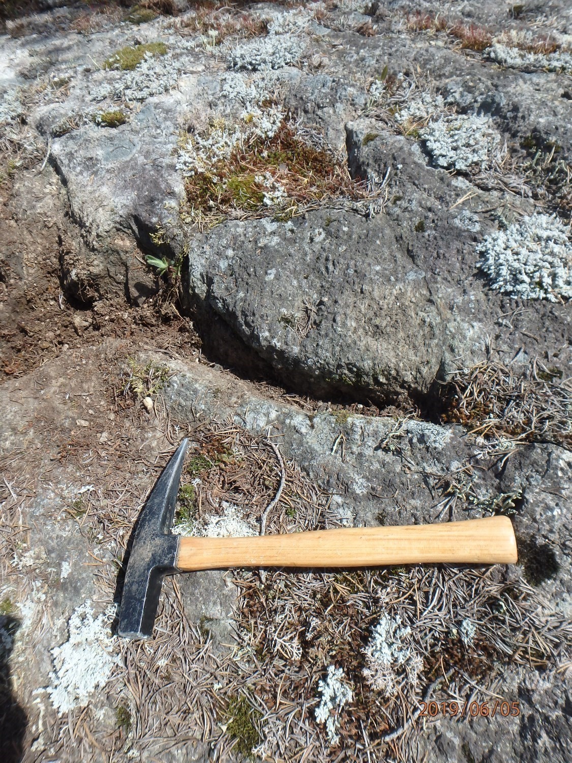
These lithologies are whitish grey in altered surface and greenish in fresh exposure. They are massive and, in places, intensely fractured. The matrix is fine to medium grained and composed of feldspar, chloritized hornblende, and quartz. Pilote et al. (2020) attributed a predominantly monzonitic composition and a calc-alkaline affinity to this pluton. Regional schistosity is little or not visible in this pluton. Its potassic nature gives it a possible syntectonic to late-tectonic age. No lithology of syenitic composition has been observed, however, contrary to the original interpretations made by Weber and Latulippe (1964). This syntectonic to late-tectonic interpreted age provides it with some gold potential (Legault and Lalonde, 2009; Legault and Goutier, 2014). This intrusion indeed presents anomalous gold and molybdenum contents associated with quartz veins (Barraute Vll-56 mineralization zone; see Bérubé, 1978; Tremblay, 2007; Pelletier, 2016) also containing chlorite, carbonate and magnetite.
The contacts of this intrusion were traced from aeromagnetic surveys (Geological Survey of Canada et al., 2009). No outcrop contacts were observed, however, some were intersected by drilling in the southern half of the intrusion. The work of Pilote et al.(2020) did not reveal any significant metamorphic aureole around this pluton. The different lithologies show very different magnetic susceptibilities, which suggests a high level of differentiation. The very small number of outcrops does not, however, allow drawing distinct mappable lithological envelopes on a scale of 1:20 000.
Thickness and distribution
The Laflamme Pluton covers an area of ~6 km2. Its long axis is oriented WNW-ESE and reaches 3.6 km, while its short axis is oriented NE-SW and extends over 1.7 km. This pluton outcrops in the SE quarter of sheet 32C12.
Dating
None.
Stratigraphic Relationship(s)
This intrusion is hosted in the Figuery Group. It is partially bordered by the Beauchamp Fault (Bolduc corridor), which marks the contact between the Figuery and Amos groups. The Laflamme Pluton is secant to the regional stratification and schistosity. It contains enclaves of volcanic and volcaniclastic rocks at its southern and NW borders (see Damascus mineralization zone).
Paleontology
Does not apply.
References
Publications Available Through SIGÉOM Examine
AVRAMTCHEV, L., LEBEL-DROLET, S. 1981. CATALOGUE DES GITES MINERAUX DU QUEBEC; REGION DE L’ABITIBI. MRN. DPV 744, 106 pages and 15 plans.
BERUBE, M. 1978. JOURNAL DE SONDAGES AU DIAMANT, TERRAIN BROMINCO INC. BROMINCO INC. Assessment report submitted to the Government of Québec. GM 34345, 8 pages and 1 plan.
CLOUTIER, R. 1993. JOURNAL DE SONDAGE, PROPRIETE BARRAUTE. CLAIMS MICHAUD. Assessment report submitted to the Government of Québec. GM 52196, 9 pages and 1 plan.
COMMISSION GEOLOGIQUE DU CAN, NORANDA EXPLORATION, MINES D’OR VIRGINIA INC. 2009. CARTES GEOPHYSIQUES COULEURS MEGATEM – 32C05. DP 2008-06, 5 pages and 4 plans.
DUMONT, G H. 1969. DIAMOND DRILL HOLE, BARRAUTE TOWNSHIP PROPERTY. DENAIN SYND, CLAIMS DUMONT. Assessment report submitted to the Government of Québec. GM 25485, 12 pages and 1 plan.
IMREH, L. 1984. SILLON DE LA MOTTE-VASSAN ET SON AVANT-PAYS MERIDIONAL: SYNTHESE VOLCANOLOGIQUE, LITHOSTRATIGRAPHIQUE ET GITOLOGIQUE. MRN. MM 82-04, 85 pages and 3 plans.
LABBE, J Y. 1995. GEOLOGIE DE LA REGION D’AMOS. MRN. MB 95-24, 31 pages and 5 plans.
LABBE, J Y. 1999. ETUDES GEOLOGIQUES DANS LA REGION D’AMOS (RECUEIL DE 4 ARTICLES). MRN. ET 98-04, 89 pages.
LABBE, J Y., TREMBLAY, D. 1994. SYNTHESE GEOLOGIQUE DE LA REGION D’AMOS, ABITIBI. MRN. MB 94-09, 15 pages and 1 plan.
LATULIPPE, M., WEBER, W W. 1964. Région d’Amos-Barraute, comté d’Abitibi-Est. MRN. RG 109, 88 pages and 3 plans.
LATULIPPE, M., WEBER, W W. 1964. Amos-Barraute area, Abitibi-East county. MRN. RG 109(A), 76 pages and 3 plans.
LEGAULT, M., GOUTIER, J. 2014. EVALUATION DE LA FERTILITE AURIFERE D’INTRUSIONS ALCALINES DANS LES SOUS-PROVINCES DE L’ABITIBI ET DU PONTIAC AU QUEBEC. MRN. RP 2014-01, 8 pages.
LEGAULT, M., GOUTIER, J. 2014. GOLD FERTILITY ASSESSMENT OF ALKALINE INTRUSIONS IN THE ABITIBI AND PONTIAC SUBPROVINCES OF QUEBEC. MRN, CEGEP DE L’ABITIBI-TEMISCAMINGUE. RP 2014-01-A, 1 page.
LEGAULT, M., LALONDE, A E. 2009. DISCRIMINATION DES SYENITES ASSOCIEES AUX GISEMENTS AURIFERES DE LA SOUS-PROVINCE DE L’ABITIBI, QUEBEC, CANADA. UNIVERSITE D’OTTAWA – DEPT SCIENCES DE LA TERRE, MRNF. RP 2009-04, 10 pages.
LEGAULT, M., LALONDE, A E. 2009. DISCRIMINATION OF SYENITES ASSOCIATED WITH GOLD DEPOSITS IN THE ABITIBI SUBPROVINCE, QUEBEC, CANADA. MRNF. RP 2009-04(A), 1 page.
MRNF. 2010. CARTE(S) GÉOLOGIQUE(S) DU SIGEOM – feuillet 32C. CG SIGEOM32C, 49 plans.
OTIS, M., BELAND, G. 1986. PROJET DE CARTOGRAPHIE – REGION D’AMOS. EDWIN GAUCHER & ASSOCIES INC. MB 86-21, 138 pages and 14 plans.
PELLETIER, P-A. 2016. Evaluation report on the Barraute property. CLAIMS LAUZIER. Assessment report submitted to the Government of Québec. GM 70123, 24 pages.
PILOTE, P., MARLEAU, J. 2020. Géologie de la région d’Amos, Sous-province de l’Abitibi, région de l’Abitibi-Témiscamingue, Québec, Canada. MERN. BG 2020-06, 1 plan.
TREMBLAY, R J. 2007. Travaux d’exploration 2004-2006, propriété Barraute. CLAIMS BEAUDOIN. Assessment report submitted to the Government of Québec. GM 63153, 71 pages and 4 plans.
Other Publications
COOKE, H.C., JAMES, W.F., MAWDSLEY, J.B., 1931. Geology and ore deposits of Rouyn-Harricanaw region, Quebec. Geological Survey, Department of Mines, Canada; Memoir 166, 314 pages. doi.org/10.4095/119956
FAURE, S., 2016. Le segment volcanique Taschereau-Amos-Senneterre (Abitibi) et son potentiel métallogénique pour l’or et les métaux de base. Consortium de recherche en exploration minéral (CONSOREM); Projet 2015-01, 59 pages.
IMREH, L., 1979. Lithostratigraphie et roches ultramafiques du secteur de Val-d’Or – Amos. Geological Association of Canada – Mineralogical Association of Canada, Québec Congress, 1979; field trip guidebook A-4, p. 1-40.
WEEKS, L.J., 1935. Amos sheet, Abitibi County, Quebec. Geological Survey of Canada, Ottawa; map 327A. doi.org/10.4095/107158
WEEKS, L.J., 1937. Rochebaucourt, Abitibi County, Quebec; Geological Survey of Canada, Map 553A. doi.org/10.4095/107764
Suggested Citation
Ministère de l’Énergie et des Ressources naturelles (MERN). Laflamme Pluton. Quebec Stratigraphic Lexicon. https://gq.mines.gouv.qc.ca/lexique-stratigraphique/province-du-superieur/pluton-de-laflamme_en [accessed on Day Month Year].
Contributors
|
First publication |
Pierre Pilote, Eng., M.Sc. A. pierre.pilote@mern.gouv.qc.ca (redaction) Mehdi A. Guemache, P. Geo., Ph.D. (coordination); James Moorhead, P. Geo., M.Sc. (critical review); Simon Auclair, P. Geo., M.Sc. (editing); Céline Dupuis, P. Geo., Ph.D. (English version); Ricardo Escobar Moran (HTML editing). |