

First published: 14 June 2019
Last modified:
DISCLAIMER: This English version is translated from the original French. In case of any discrepancy, the French version shall prevail.
| Author: | Clark and Globensky, 1973, 1975, 1976 |
| Age: | Middle Ordovician |
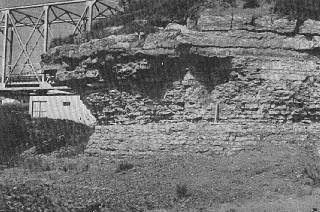
| Stratotype: | Sections (1) of the Saint-Casimir Member and upper beds of the Deschambault Formation along the railway, 2.4 km NE of the Neuville wharf, and (2) of the Grondines and Saint-Casimir members along the shore of the St. Lawrence River upstream and downstream of the Neuville wharf (base of section 520 m east of wharf) described by Clark and Globensky (1973) |
| Type area: | Neuville area (NTS sheet 21L12) |
| Geological province: | St. Lawrence Platform |
| Geological subdivision: | St. Lawrence Lowlands Platform |
| Lithology: | Limestone with shale interbeds |
| Category: | Lithostratigraphic |
| Rank: | Member |
| Status: | Formal |
| Use: | Active |
- Trenton Group
- Tétreauville Formation
- Montréal Formation
- Neuville Formation
- Grondines Member
- Saint-Casimir Member
- Deschambault Formation
- Hull Formation
- Saint-Marc Formation
- Mile End Formation
- Ouareau Formation
- Fontaine Formation
- Pont-Rouge Formation
- Sainte-Anne Formation
- Galets Formation
- Shipshaw Formation
- Simard Formation
- Tremblay Formation
- René-Levasseur Formation
Background
Clark (1959) introduced the names “Neuville” and “Saint-Casimir” to define a section of the Trenton Group overlying the Deschambault Formation in the Neuville area (sheet 21L12). Thus presented, the “Saint-Casimir Formation” was overlying the Deschambault Formation and was overlain by the Neuville Formation. He suggested that, in the event of a division of the Neuville Formation, this term be kept for the Mid Trenton Group and that the term “Grondines” applies to the Upper Trenton Group. Clark and Globensky (1973, 1975, 1976) used the term “Neuville Formation” to define the lithology between the Deschambault Formation and the Utica Shale, and divided this formation into the Saint-Casimir Member (lower) and Grondines Member (upper). In a revision of the Neuville Formation, Globensky and Jauffred (1971) lowered the contact between the Saint-Casimir and Grondines members by 21 m at the type section along the St. Lawrence River. The name refers to the village of saint-Casimir, where the member outcrops (sheet 31I09).
Description

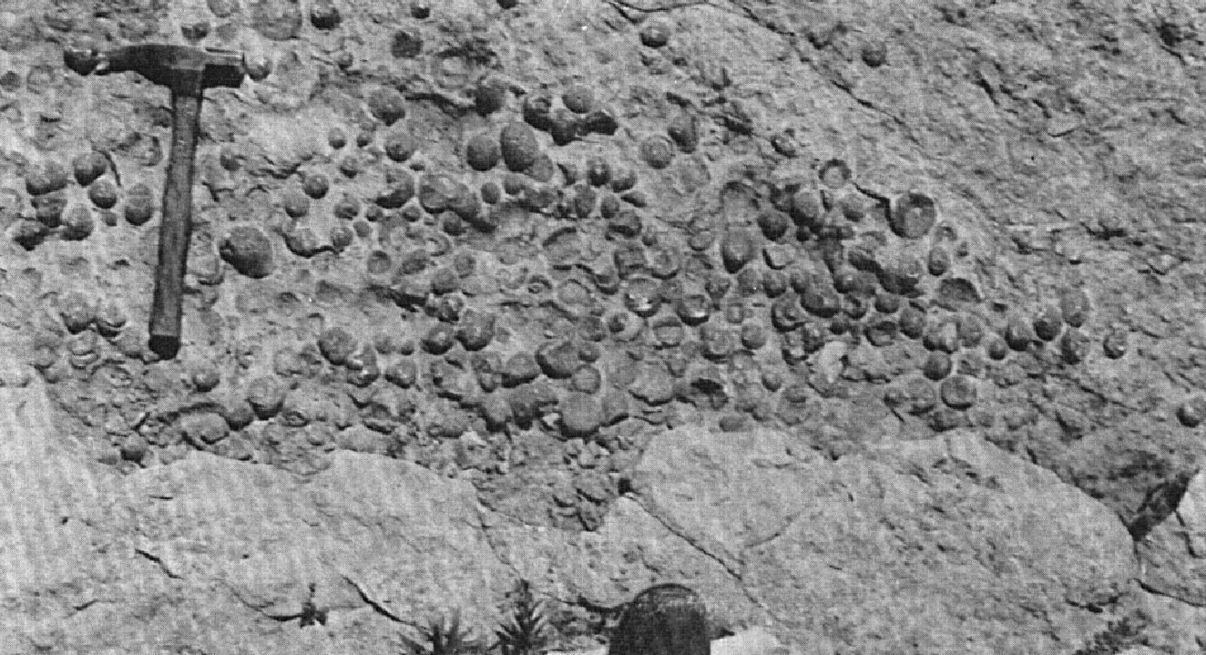
The Saint-Casimir Member consists of fine-bedded (5-15 cm) argillaceous limestone containing abundant fossils, particularly large cephalopods (Clark and Globensky, 1973, 1975, 1976; Harland and Pickerill, 1982; Globensky, 1987). It displays a wide variety of lithologies (semi-crystalline, micritic or crystalline limestone), a large range of colours (mostly dark), and high variability in grain size although fine-grained lithologies approaching lithographic limestone predominate. Shale interbeds are scarce and thin.
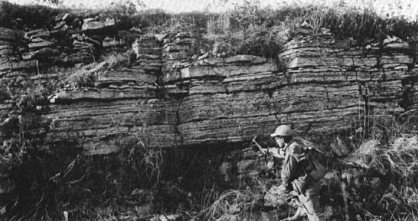
Two sections were described by Clark and Globensky (1973): a section of the Saint-Casimir Member and upper beds of the Deschambault Formation along the railway, 2.4 km NE of the Neuville wharf, and a section of the Grondines and Saint-Saint-Casimir members along the shore of the St. Lawrence River upstream and downstream of the Neuville wharf, whose base is located 520 m east of the wharf (the porttion of the section west of the Neuville wharf was removed from this record as it describes only the Grondines Member).
| Neuville Formation | Grondines Member | Top of the Grondines Member. | 111.2 m |
| … | … | ||
| Base of the section west of wharf. Top of section east of wharf. | 26.8 m | ||
| Grey to dark grey chemical limestone. | 26.8 m | ||
| Schistose limestone forming thick (15 cm) and thin (5 cm) beds with argillaceous partings. Lithographic limestone beds are present. | 25.5 m | ||
| Dark crystalline and argillaceous limestone. | 23.9 m | ||
| Idem with interstratified fine-grained lithographic limestone. | 23.2 m | ||
| Thick bed of fine-grained limestone. | 21.0 m | ||
| Thin-bedded limestone, highly altered. | 18.3 m | ||
| Thick-bedded limestone. | 15.8 m | ||
| Brown limestone and argillaceous schist, interstratified in beds 5-20 cm thick. | 12.5 m | ||
| Saint-Casimir Member | Crystalline limestone, fine-grained, dark grey, small amount of brownish limestone. | 11.9 m | |
| Impure limestone, crystalline, fine-grained, dark grey. | 9.8 m | ||
| Almost lithographic limestone with a few crystalline limestone beds 1.3 cm thick. | 9.2 m | ||
| Crystalline limestone, very fine-grained, dark, with a few lithographic limestone beds. | 7.1 m | ||
| Lithographic limestone with a few argillaceous partings. | 4.4 m | ||
| Crystalline limestone, fine-grained, dark. | 3.8 m | ||
| Base of the section measured, 518 m eat of the Neuville wharf. | 0.0 m | ||
| Neuville Formation | Saint-Casimir Member | Top. SW end of the railway trench. | 27.7 |
| Almost lithographic limestone, very fine-grained, altered cream colour, very finely bedded and, in places, cross-bedded. Frequent argillaceous partings. Individual beds are rarely thicker than 10 cm. In the following descriptions, this type will be refferd by the letter “Y”. | 27.7 | ||
| Crystalline limestone interstratified with Y. Abundant crinoids and other fossile. Giant Isotelus and translucent stems, frequent on the shore of Neuville, are present here. | 26.4 | ||
| Y, with argillaceous partings. | 26.1 | ||
| Y, interstratified with a crystalline rock containing fragments. Minor unconformities are prsent almost every 2.5 cm. | 22.9 | ||
| Crystalline limestone, containing fragments, fine-grained, irregularly bedded, interstratified with Y. Above this horizon, Y predominates. | 21.0 | ||
| Y | 20.2 | ||
| Light and dark limestone with irregular bedding, with 2.5 cm of Y. | 20.0 | ||
| Crystalline limestone, medium to fine-grained, in beds 2.5-5 cm thick with argillaceous partings 0.6-1.3 cm thick. One Y bed 2.5 cm thick. | 19.5 | ||
| Various types of limestone, with irregular bedding. | 17.4 | ||
| Crystalline limestone containing fragments, interstratified with a smaller amount of Y, the latter never exceeding 15 cm in thickness. | 16.8 | ||
| Fine-grained argillaceous limestone, in beds 2.5-5 cm thick. | 13.3 | ||
| Coarse-grained crystalline limestone, cross-bedded. Prasopora and crinoids at 12.2 m. | 12.8 | ||
| Interstratified crystalline limestone and Y. | 11.4 | ||
| Finely and uniformly bedded limestone, interstratified with medium-grained crystalline limestone. | 9.6 | ||
| Medium and coarse-grained limestone with cross-bedding. | 9.4 | ||
| Y, at its lowest position. | 7.3 | ||
| Deschambault Formation | Fine, medium and coarse-grained crystalline limestone with cross-bedding. | 7.2 | |
| Very fine-grained limestone. | 3.7 | ||
| Very coarse-grained crystalline limestone with cross-bedding. Prasopora and Rafinesquina very frequent. | 3.6 | ||
| Fine-grained limestone, very finely bedded, in beds up to 2.5 cm thick. | 3.2 | ||
| Coarse and fine-grained crystalline limestone. Prasopora frequent. | 2.7 | ||
| Base of the section. | 0.0 |
Two other sections by the Saint-Casimir Member are described by Clark and Globensky (1975) along the Sainte-Anne River, between Saint-Alban and Saint-Casimir, and on the shore of Grondines (sheet 31I09); they are not shown here. Sediments of the Saint-Casimir Member were deposited in a shallow, low to moderate energy marine environment with periodic influxes of skeletal material from the coast (Harland and Pickerill, 1982; Globensky, 1993).
Thickness and distribution
The Saint-Casimir Member may be observed north of the St. Lawrence River in the Trois-Rivières (sheets 31I06-31I07), Saint-Casimir (sheet 31I09), and Pont-Rouge and Neuville (sheets 21L12-21L13) areas. In the various sections described, its thickness varies from >9 m to 56 m (Clark and Globensky, 1973, 1975; Globensky, 1987).
Dating
None.
Stratigraphic Relationship(s)
The Saint-Casimir Member overlies the Deschambault Formation and is overlain by the Grondines Members in the Trois-Rivières, Portneuf and Quebec areas. It is of Sherman Fall age and can be correlated with the Saint-Michel Member of the Montréal Formation (Clark and Globensky, 1973, 1976; Harland and Pickerill, 1982; Globensky, 1987).
Paleontology
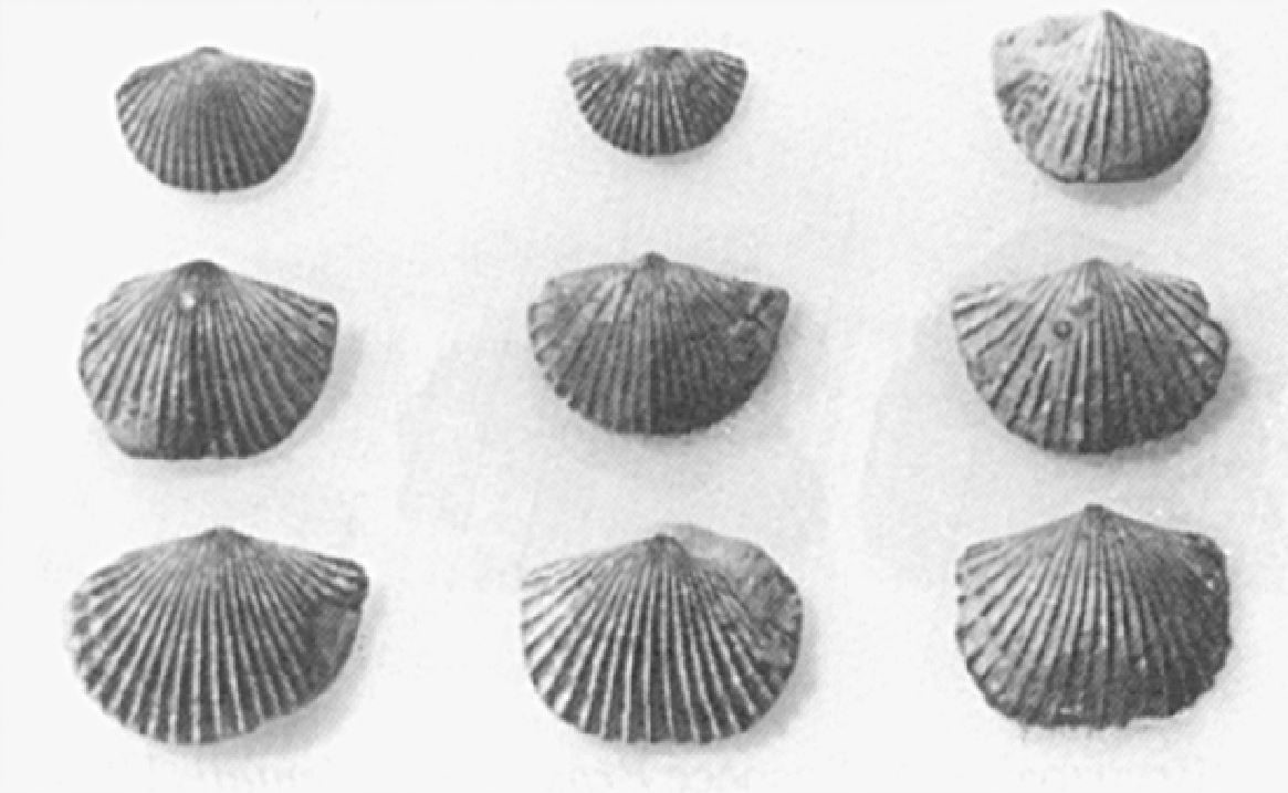
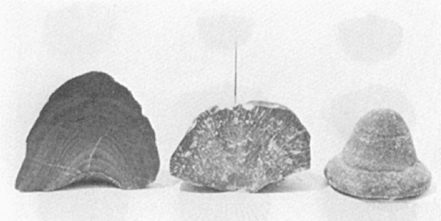

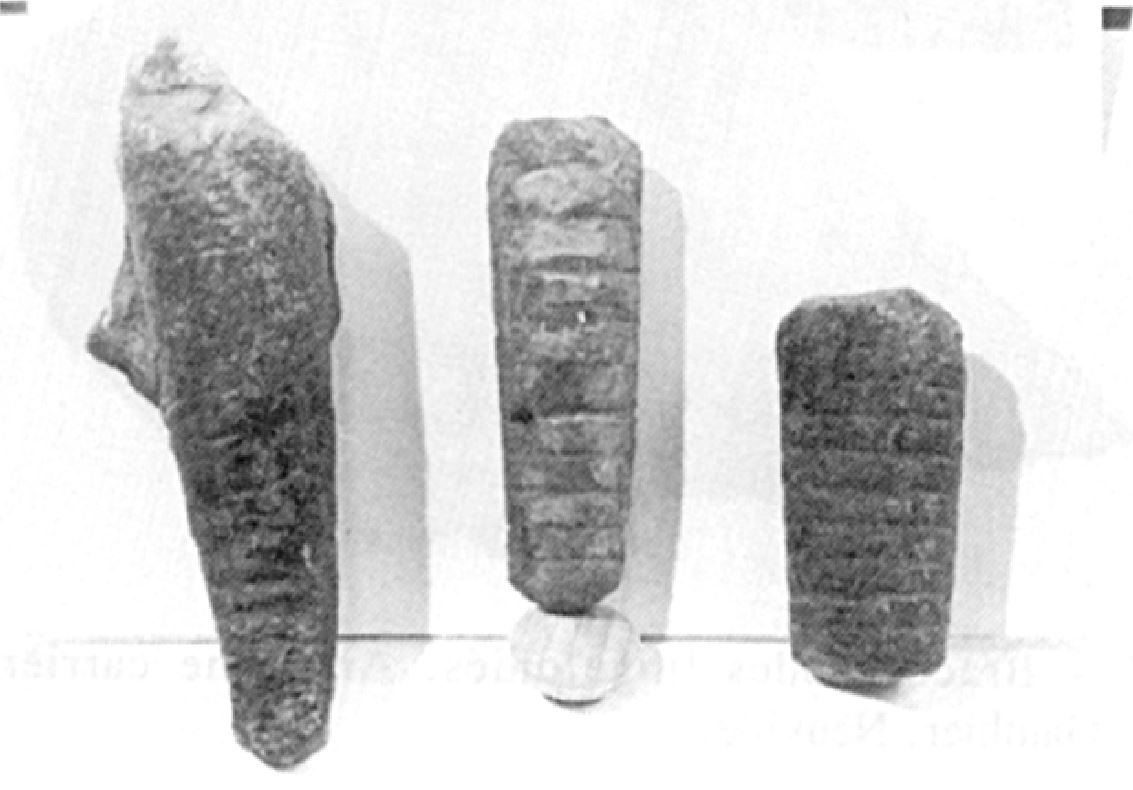
The fauna is numerous and very diverse (Clark and Globensky, 1973, 1975, 1976; Harland and Pickerill, 1982; Globensky, 1987). Brachiopods predominate, and bryozoa are characteristic and particularly abundant in lower beds. Trilobites and orthocone cephalopods are also visible. Parastrophina hemiplicata, Pasopora simulatrix, P. orientalis, Cryptolithus lorrenttensis and C. tessellatus are representative.
References
Publications Available Through SIGÉOM Examine
BILODEAU, C., BRUN, J. 2000a. GEOLOGIE 1/20 000, 21L12-200-0101 – SAINT-ÉDOUARD. In: MRNF. 2010. CARTE(S) GÉOLOGIQUE(S) DU SIGEOM – feuillet 21l. CG SIGEOM21L, 43 plans.
BILODEAU, C., BRUN, J. 2000b. GEOLOGIE 1/20 000, 21L12-200-0201 – PORTNEUF. In: MRNF. 2010. CARTE(S) GÉOLOGIQUE(S) DU SIGEOM – feuillet 21l. CG SIGEOM21L, 43 plans.
BILODEAU, C., BRUN, J. 2000c. GEOLOGIE 1/20 000, 21L12-200-0202 – DONNACONA. In: MRNF. 2010. CARTE(S) GÉOLOGIQUE(S) DU SIGEOM – feuillet 21l. CG SIGEOM21L, 43 plans.
BILODEAU, C., BRUN, J. 2001. GEOLOGIE 1/50 000, 21L13 – SAINT-RAYMOND. In: MRNF. 2010. CARTE(S) GÉOLOGIQUE(S) DU SIGEOM – feuillet 21l. CG SIGEOM21L, 43 plans.
BRUN, J. 1974. ETUDE PETROGRAPHIQUE DES FORMATIONS DU BLACK RIVER ET DU TRENTON DU QUEBEC. MRN. DP 248, 24 pages and 4 plans.
BRUN, J. 1975. ETUDE GEOLOGIQUE ET GEOCHIMIQUE DES FORMATIONS DU BLACK RIVER ET DU TRENTON DU QUEBEC. MRN. DP 296, 45 pages and 4 plans.
CLARK, T H., GLOBENSKY, Y. 1973. PORTNEUF AND PARTS OF SAINT-RAYMOND AND LYSTER MAPS ARES, PORTNEUF AND LOTBINIERE COUNTIES. MRN. RG 148(A), 112 pages and 1 plan.
CLARK, T H., GLOBENSKY, Y. 1973. REGION DE PORTNEUF ET PARTIES DE ST-RAYMOND ET DE LYSTER, COMTES DE PORTNEUF ET DE LOTBINIERE. MRN. RG 148, 117 pages and 1 plan.
CLARK, T H., GLOBENSKY, Y. 1975. REGION DE GRONDINES. MRN. RG 154, 171 pages and 1 plan.
CLARK, T H., GLOBENSKY, Y. 1976. REGION DE TROIS-RIVIERES. MRN. RG 164, 94 pages and 1 plan.
GLOBENSKY, Y. 1987. GEOLOGIE DES BASSES-TERRES DU SAINT-LAURENT. MRN. MM 85-02, 71 pages and 1 plan.
GLOBENSKY, Y. 1993. LEXIQUE STRATIGRAPHIQUE CANADIEN – VOLUME V-B – REGION DES APPALACHES, DES BASSES-TERRES DU SAINT-LAURENT ET DES ILES DE LA MADELEINE. MRN. DV 91-23, 336 pages.
HÉBERT, C., BILODEAU, C. 1999a. GEOLOGIE 1/20 000, 21M07-200-0202 – BAIE-SAINT-PAUL. In: MRNF. 2010. CARTE(S) GÉOLOGIQUE(S) DU SIGEOM – feuillet 21m. CG SIGEOM21M, 23 plans.
HÉBERT, C., BILODEAU, C. 1999b. GEOLOGIE 1/20 000, 21M09-200-0101 – SAINT-HILARION. In: MRNF. 2010. CARTE(S) GÉOLOGIQUE(S) DU SIGEOM – feuillet 21m. CG SIGEOM21M, 23 plans.
HÉBERT, C., BILODEAU, C. 1999c. GEOLOGIE 1/20 000, 21M09-200-0102 – SAINT-IRENEE. In: MRNF. 2010. CARTE(S) GÉOLOGIQUE(S) DU SIGEOM – feuillet 21m. CG SIGEOM21M, 23 plans.
HÉBERT, C., BILODEAU, C. 1999d. GEOLOGIE 1/20 000, 21M09-200-0201 – NOTRE-DAME-DES-MONTS. In: MRNF. 2010. CARTE(S) GÉOLOGIQUE(S) DU SIGEOM – feuillet 21m. CG SIGEOM21M, 23 plans.
HÉBERT, C., BILODEAU, C. 1999e. GEOLOGIE 1/20 000, 21M09-200-0202 – LA MALBAIE. In: MRNF. 2010. CARTE(S) GÉOLOGIQUE(S) DU SIGEOM – feuillet 21m. CG SIGEOM21M, 23 plans.
LACOSTE, P., HÉBERT, C., BILODEAU, C. 1999. GEOLOGIE 1/50 000, 21M08 – ILES AUX COUDRES. In: MRNF. 2010. CARTE(S) GÉOLOGIQUE(S) DU SIGEOM – feuillet 21m. CG SIGEOM21M, 23 plans.
MRNF 2009a. GEOLOGIE 1/50 000, 31I07 – TROIS-RIVIÈRES. In: MRNF. 2010. CARTE(S) GÉOLOGIQUE(S) DU SIGEOM – feuillet 31i. CG SIGEOM31M, 16 plans.
MRNF 2009b. GEOLOGIE 1/50 000, 31I09 – GRONDINES. In: MRNF. 2010. CARTE(S) GÉOLOGIQUE(S) DU SIGEOM – feuillet 31i. CG SIGEOM31M, 16 plans.
Other Publications
CLARK, T.H. 1959. Stratigraphy of the Trenton Group, St. Lawrence Lowlands, Quebec. Geological Association of Canada; proceedings 1959, pages 13–21.
GLOBENSKY, Y., JAUFFRED, J.C.N. 1971. Stratigraphic distribution of conodonts in the Middle Ordovician Neuville section of Quebec. Geological Association of Canada, proceedings; volume 23, pages 43–68.
HARLAND, T.L., PICKERILL, R.K. 1982. A review of Middle Ordovician sedimentation in the St. Lawrence Lowland, eastern Canada. Geological Journal; volume 17, pages 135–156. https://doi.org/10.1002/gj.3350170205