
Geology of the Opatica sub-province northeast of Matagami (Amisquioumisca Lake region)
Project for NTS sheets 32K01, 32K02, 32K07, 32K08, 32K09
François Leclerc and Emmanuel Caron-Côté
BG 2017-01
Published on


A new geological map of the Amisquioumisca Lake region (Opatica Subprovince) was produced at a scale of 1:50,000 following a survey conducted in the summer of 2016. The mapping of this area revealed four intrusions of mafic to ultramafic composition (Poncheville intrusive Suite) with characteristics similar to the Rocher Intrusion, known to host the Lac Rocher deposit (10.8 % Ni over 3.2 m, 2.34 % Ni and 1.15 % Cu over 14.5 m; Jones and Pitman, 1999). Two new showings show the characteristics of Mo-W mineralization associated with porphyry intrusions. Our work has also made it possible to better define the context for stratiform mineralization of exhalative origin hosted in the amphibolites, paragneisses and iron formations of the Rocher Complex.
Methodology
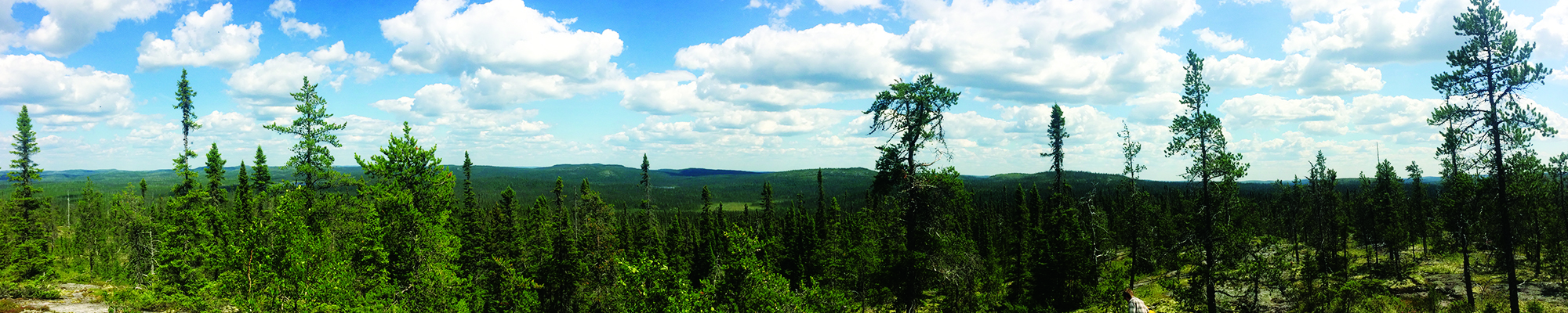
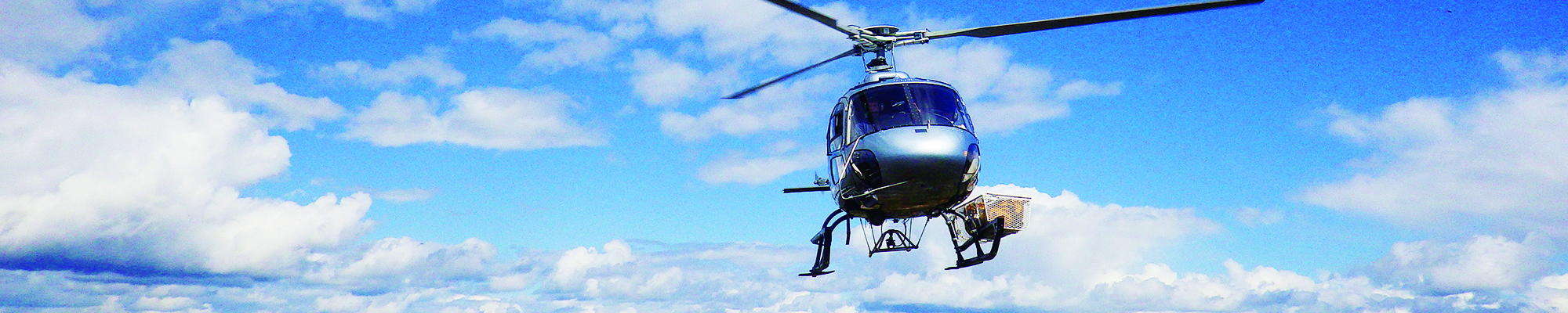
The area was mapped using the established method for surveys in forested areas served by a network of secondary roads. Geological mapping was carried out by a team of two geologists, three geologists in training and five students between June 10 and August 24, 2016.
Mapping of the study area allowed to produce and update the information presented in the table below:
| Elements | Number |
|---|---|
| Outcrops described (geofiches) | 1174 |
| Total lithogeochemical analyses | 244 |
| Lithogeochemical analyses of metals of economic interest | 54 |
| Geochronological analyses | 5 |
| Covered thin sections | 174 |
| Polished thin sections | 51 |
| Sodium cobaltinitrite stains | 121 |
| Record cards of the stratigraphic lexicon | 17 |
| Deposit record cards | 8 |
Previous work
The following table presents a list of work completed in the study area since 1935. It also includes the references cited in the report.
| Author(s) | Type of work | Contribution |
|---|---|---|
| Geoffroy et Koulomzine, 1935 | Mapping of the rivière Broadback area | First geological map and geophysical work in the study area. |
| Gaudet et Ingham, 1961; Ingham, 1961; 1962 | Magnetic ground survey and drilling | Identification of a nickel showing east of Rocher Lake by Osisko Lake Mines. |
| Mapping of the Frotet-Evans belt by the Ministère | Recognition of stratiform polymetallic mineralization in amphibolites, paragneisses and iron formations of the Rocher Complex. | |
| Franconi, 1971; Beaumier et Kirouac, 1996 | Surveys of lake and stream sediments by the Ministère | Geochemical anomaly maps. |
| Benn et al., 1992; Sawyer et Benn, 1993; Sawyer, 1998; Benn, 2006; Benn et Moyen, 2008 | Geological reconnaissance carried out along road cuts | Identification of the lithotectonic context at the level of the Opatica Subprovince. |
| Seismic surveys | Identification of the lithotectonic context at the level of the Opatica Subprovince. | |
| Davis et al., 1995 | U-Pb dating | Identification of the lithotectonic context at the level of the Opatica Subprovince. |
| Gosselin, 1996; Brisson et al., 1997a, 1997b, 1998a,1998b, 1998c; Morin, 1998a, 1998b, 1998c | Systematic mapping of the Frotet-Evans belt by the Ministère | Finalization of the geological mapping of the Rocher Lake area. |
| Detailed mapping, ground magnetic survey, drilling | Discovery of the Ni-Cu Lac Rocher deposit. | |
| Bandyayera et Morin, 1999; Bandyayera et Sharma, 2001 | Metallogenic study and U-Pb dating | Detailed studies of Ni-Cu mineralization in the Rocher Lake area. |
| Goutier, 2006 | Cartography, geological compilation | Geology of the Goéland Lake area (32F/15). |
| Dion et Lefebvre, 1998; Keating et D’Amours, 2010; D’Amours et Intissar, 2012 | Aeromagnetic surveys | The region is fully covered by aeromagnetic surveys. |
| Daoudene et al., 2014; 2016 | 40Ar/39Ar dating and thermochronological study | Comparison of the tectonometamorphic evolution of the Abitibi and Opatica subprovinces. |
| Verification of electromagnetic anomalies by SOQUEM | Discovery of new showings of stratiform polymetallic mineralization associated with amphibolites and paragneisses of the Rocher Complex. |
Lithostratigraphy
The study area is located in the southwestern part of the Opatica Subprovince, which is a Mesoarchean-Neoarchean volcano-plutonic and gneissic rocks assemblage of the southeastern Superior Province (Benn et al., 1992; Sawyer et Benn, 1993; Davis et al., 1995; Benn et Moyen, 2008; Percival et al., 2012). Consolidated units in the Amisquioumisca Lake region are divided into three assemblages based on a relative chronology of regional deformation:
- pre-kinematic to syn-kinematic units;
- late-kinematic to post-kinematic units;
- Paleoproterozoic dykes.
The relative chronology of the setting of these units is illustrated in this stratigraphic diagram, which takes into account overlapping relationships described in the field. These observations are supported by U-Pb geochronological data from eight samples taken in the area. This scheme is a very idealized section of the geology of the study area showing the overlapping relationships of the units as well as their relative positions. The size of the units shown in the diagram respects the areas mapped on the surface.
Pre-kinematic to syn-kinematic units
Supracrustal Rocks
The Rocher Complex (Brisson et al., 1998a), gathers the oldest rocks in the study area. It is composed of paragneiss (nAroc1) and amphibolites (nAroc2) in equal proportions, as well as a few decimetric extension lenses of iron formation (nAroc3) and small intrusions of nodular diorite (nAroc4).
Gneissic Rocks

The Rocher Complex is injected by foliated to gneissic tonalites and diorites of the Chensagi Suite (nAcng). This last unit, recognized throughout the Opatica Subprovince, corresponds to the « grey gneiss » of Sawyer and Benn (1993) and is one of the oldest and most voluminous in the region.
The La Bétulaie Complex (nAbtu) represents a new unit composed of migmatitic gneisses of tonalitic and dioritic composition. No overlapping relationship with foliated to gneissic rocks of the Chensagi Suite could be observed in the field. These two units could therefore be contemporary.
A nebulitic migmatite unit (M22), mapped by Ahmedali and Remick (1974) in the Soscumisca Lake area, outcrops in the southwestern region of the study area. We did not visit any outcrop of these migmatites that could be contemporaneous with those of the La Bétulaie Complex.
Intrusive Rocks
The Salamandre Intrusive Suite (Morin, 1998b) is composed of granodiorite (nAsam1), biotite tonalite (nAsam2a), banded hornblende tonalite (nAsam2c), diorite, and quartz diorite (nAsam2) that intersect rocks of the Chensagi Suite and Rocher Complex.
La Rocher-Quénonisca Intrusive Suite (Brisson et al., 1998b) includes several peridotite intrusions (nArok) 0.5 to 1 km in diameter, as well as the intrusions of Whitefish (nAwf) and de Rocher (nAlrc). The Whitefish Intrusion, composed of purple gabbro (nAwf1), is injected between tonalites of the Salamandre Intrusive Suite and paragneisses of the Rocher Complex. The Rocher Intrusion (nAlrc) forms a small circular intrusion that constitutes the host unit of the Lac Rocher Ni-Cu mineralization. It is composed of purple gabbro (nAlrc1), pyroxenite (nAlrc2), peridotite (nAlrc3) and plagioclase peridotite (nAlrc3a). This mafic-ultramafic intrusion cuts migmatitic gneisses of the La Bétulaie Complex.
The Poncheville intrusive Suite (nApcv) represents a new unit introduced here to designate four foliated intrusions composed of pyroxenite, diorite, purple gabbro, and quartz rich granitoids. These intrusions are injected into rocks of the Chensagi Suite and Salamandre Intrusive Suite.
Located at the edge between the Abitibi and Opatica subprovinces, the Ouescapis Pluton (nAoue; Ahmedali et Remick, 1974) consists of foliated to gneissic diorites. It cuts the gneisses of the Chensagi Suite and contains xenoliths of this unit. The northern part of the pluton is hosted in the nebulitic migmatite unit (M22).
The Nottaway Pluton (nAntw) is a new unit of biotite and magnetite granite. The foliated to gneissic granites intersect gneisses of the Chensagi Suite, the nebulitic migmatite unit (M22), the Ouescapis Pluton, and intermediate to felsic rocks of the Salamandre Intrusive Suite.
Late-kinematic to post-kinematic units
Intrusive Rocks
The Frédéric Intrusion (nAfrd) is a new unit corresponding to the informal unit « Aopa3 » defined in the Goéland Lake area by Goutier (2006). In the study area, it is composed mainly of diorite and quartz diorite and also includes some tonalite. This intrusion cuts gneisses of the Chensagi Suite.
The Pinède Grise Pluton (nApg) is a new unit composed of granite and minor monzonite and monzodiorite. It cuts gneisses of the Chensagi Suite.
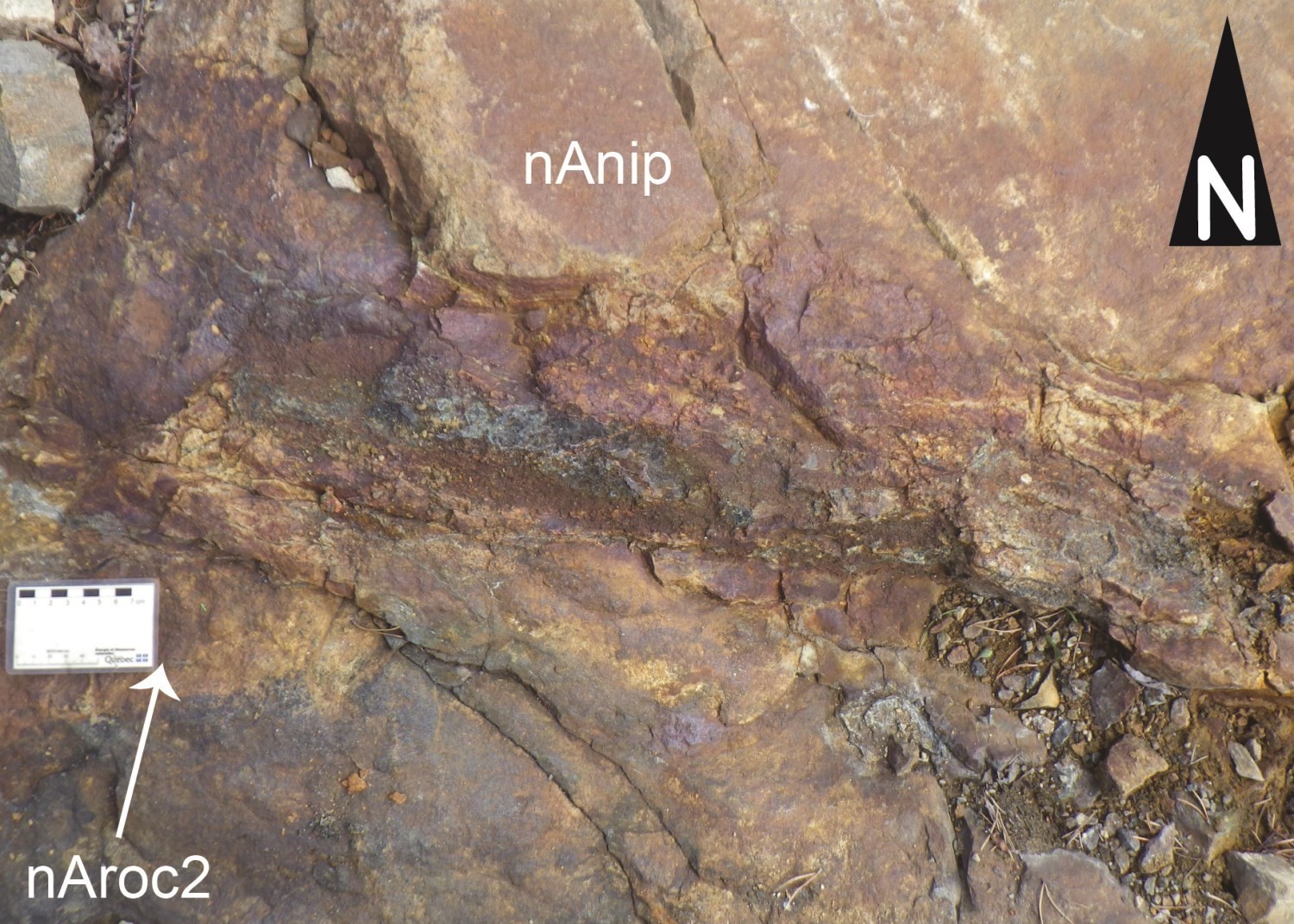
The Nipukatasi Massif (nAnip; Brisson et al., 1998b) is a granite intrusion associated with smaller amounts of monzonite and quartz monzonite. The massif cuts foliated to gneissic rocks of the Rocher Complex, Chensagi Suite and La Bétulaie Complex.
The Amisquioumisca Suite represents a new unit that includes a main intrusion composed of syenite, monzonite and quartz monzonite (nAamq1), as well as two smaller intrusions made of rocks of intermediate composition (nAamq2). The main intrusion cuts rocks of the Chensagi Suite and La Bétulaie Complex, as well as massive rocks of the Nipukatasi Massif and Pinède Grise Pluton. The two intrusions of intermediate composition cut rocks of the Chensagi Suite and also the main intrusion. It is thus the most recent Neoarchean intrusion in the study area.
Paleoproterozoic dykes
Three swarms of Paleoproterozoic dykes go through the study area.
The Senneterre Dykes combine NE-SW diabases that cut gneisses of the Chensagi Suite and granites of the Nottaway Pluton.
The Biscotasing Dykes are ENE-WSW oriented gabbro veins with a sub-ophitic microstructure. They cut the Senneterre Dykes south of Rocher Lake.
The Esprit Lake Dykes are NW-SE oriented diabases that cut both the Senneterre Dykes and de Biscotasing.
Structural geology
The Amisquioumisca Lake region is characterized by three Neoarchean ductile deformation events named D1, D2 and D3.
Deformation phase (D1)
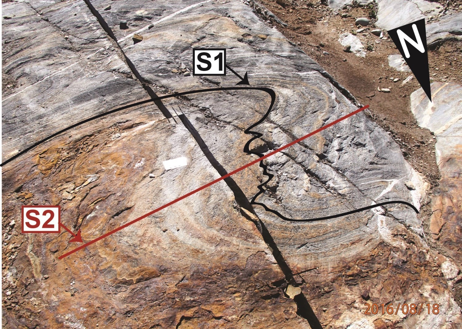
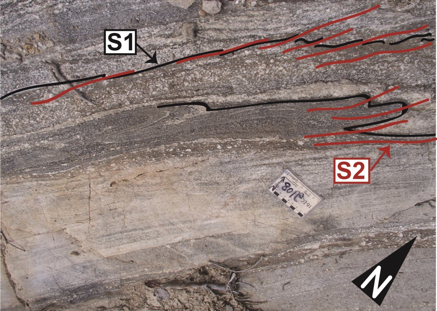
The first phase of deformation D1, observable at the scale of the outcrop, corresponds to a penetrative foliation or gneissosity (S1) associated with open to isoclinal P1 folds oriented NW-SE to N-S. These structural elements are particularly visible in the oldest units of the Rocher Complex, Chensagi Suite, La Bétulaie Complex and Salamandre Intrusive Suite. They are visible in the hinge areas of tight to isoclinal P2 folds, but are completely transposed into the flanks of the folds (Outcrops 16-FG-5274, 16-EC-2108 and 16-EC-2115). No regional fold nor any fault or shear zone associated with deformation D1 has been identified.
Deformation phase (D2)
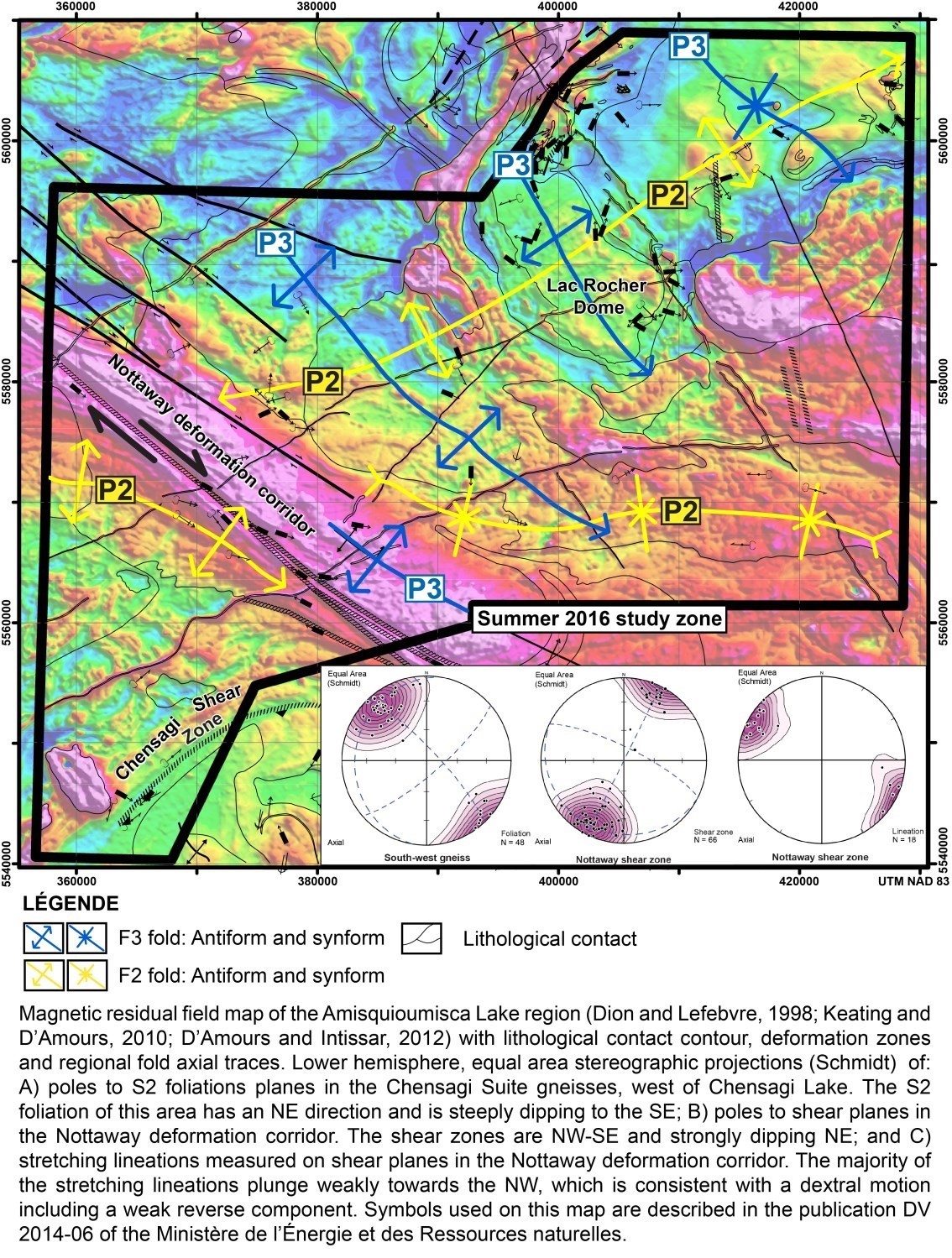
The main regional deformation episode D2 is manifested by a strongly dipping S2 foliation axial to regional isoclinal P2 folds oriented E-W to ENE-WSW (magnetic field map).
P2 Regional Folds
The study area is affected by three P2 folds of kilometric amplitude (magnetic field map). These double-dipping isoclinal folds have subvertical axial planes that are roughly E-W oriented but locally bend due to slippage movements characterizing the NW-SE major shear zones of Nottaway and Lucky Strike. The P2 anticline located in the northern part of the study area thus shows an orientation ENE-WSW compatible with a counter-clockwise rotation of the sector between these two shear zones. The sigmoidal shape of the two other fold axes in the southern part of the study area reveals drag folds compatible with dextral movement along the Nottaway Shear Zone.
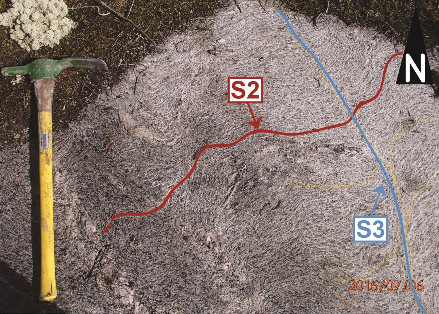
At the scale of the outcrop, the steeply dipping S2 foliation is axial to the isoclinal P2 folds and holds a moderate to subvertical dipping lineation (Stereogram A, magnetic field map). South-west of Amisquioumisca Lake, amphibolites of the Rocher Complex (Outcrop 16-FG-5274) are characterized by an S1 banding affected by tight to isoclinal P2 folds dipping weakly to moderately to the east (26°/082°). These P2 folds are associated with a S2 schistosity of E-W subvertical axial plane (099°/89°). To the southwest of Chensagi Lake, tonalitic to dioritic gneisses of the Chensagi Suite exhibit a S1 gneissic banding materialized by the alternation of coarsely grained quartzofeldpathic leucocratic bands and foliated melanocratic bands of dioritic composition. These bands are folded isoclinally (P2), and then transposed in the regional ENE – WSW S2 schistosity (Outcrop 16-EC-2108).
Chensagi Shear Zone
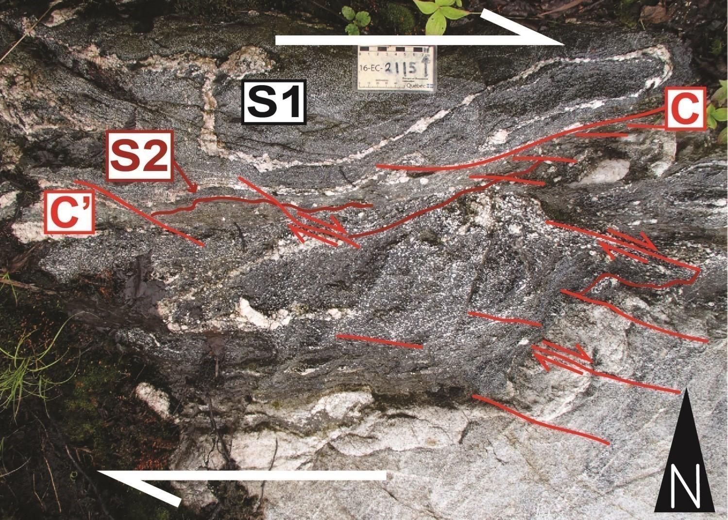
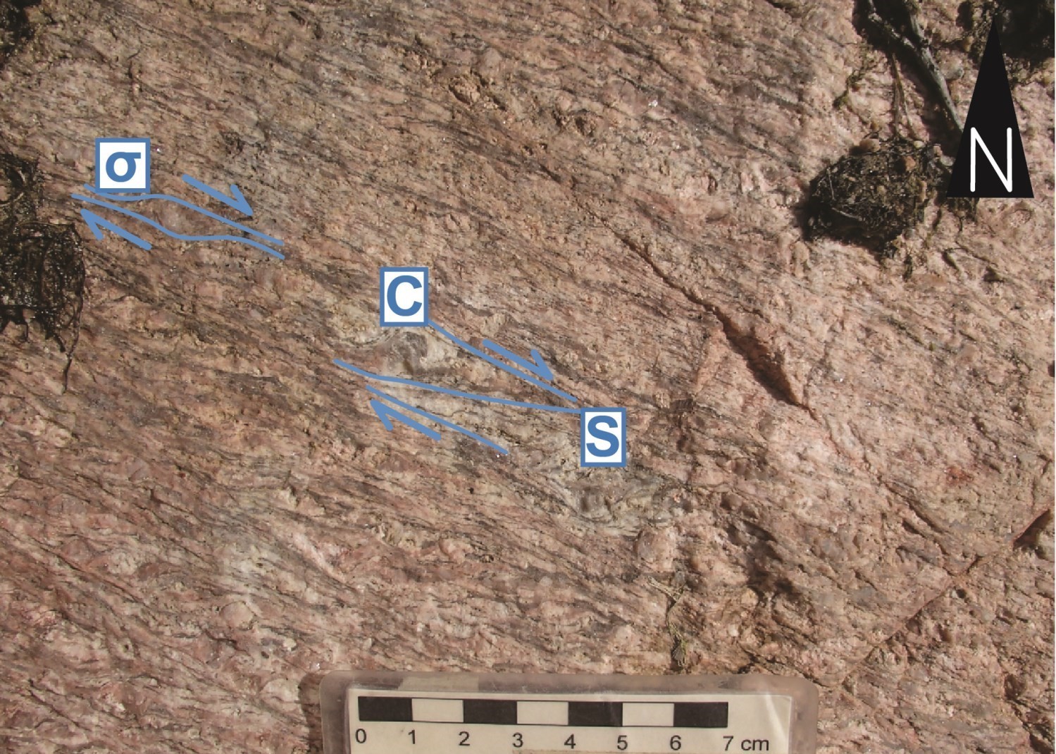
In the southwestern corner of the region, the intensification of the S2 schistosity defines a shear zone with inverse-dextral motion and SE dipping that we designate as the Chensagi Shear Zone (magnetic field map). Asymmetrical fabrics observed there (S-C fabrics and C’ shear bands) are also attributed to the D2 event. No known mineralization is associated with this shear zone.
Deformation phase (D3)
The deformation phase D3 results in a spaced S3 cleavage axial to NW-SE-oriented regional P3 folds in highly foliated diorites and tonalities of the Chensagi Suite, La Bétulaie Complex and Salamandre Intrusive Suite.
P3 Regional Folds
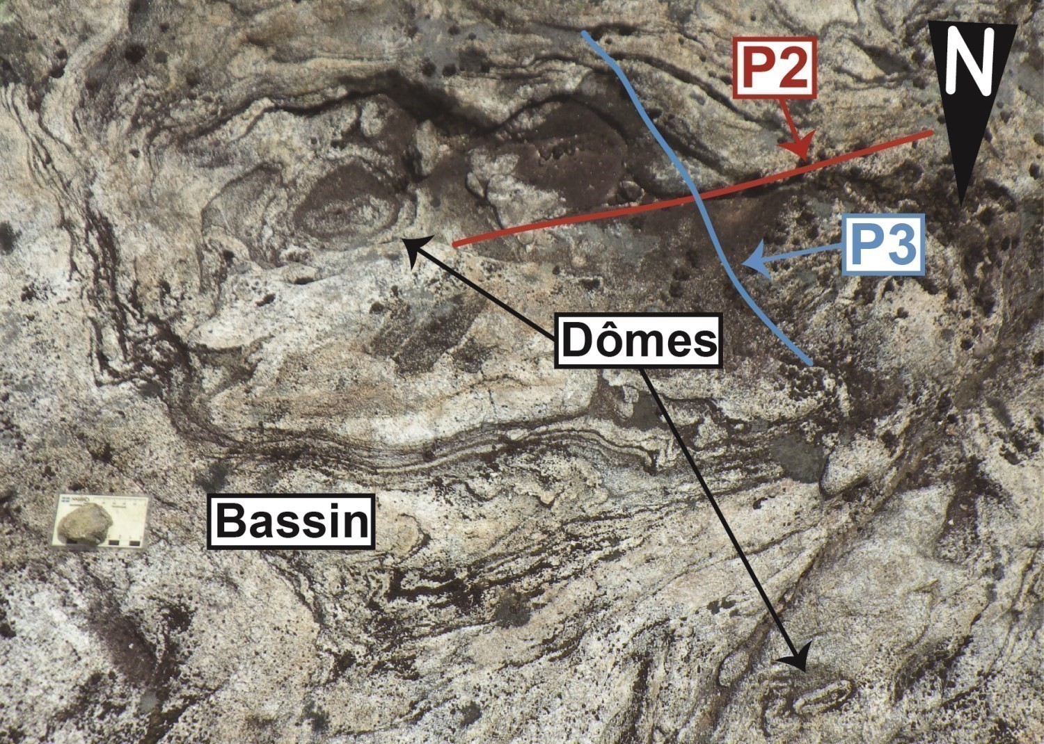
The study area contains four large regional P3 folds with axial traces oriented NW-SE. These folds are open with subvertical axial planes and fold axes dipping weakly towards the SE. The Lac Rocher dome in the eastern part of the study area (magnetic field map) results from the interaction of regional P2 and P3 antiforms and the intrusion of a diorite of the Salamandre Intrusive Suite into metavolcanites of the Rocher Complex. At the scale of the outcrop, diorites of the Salamandre Intrusive Suite show a S2 schistosity crenulated by a S3 NW-SE cleavage North of Amisquioumisca Lake, Type 1 and Type 2-fold interference patterns (Ramsay, 1967) between ENE-WSW axial-trace P2 folds and NW-SE axial trace P3 folds observed in migmatitic gneisses of the La Bétulaie Complexsuggest that migmatization was contemporaneous with the D3 deformation phase.

Nottaway Shear Zone
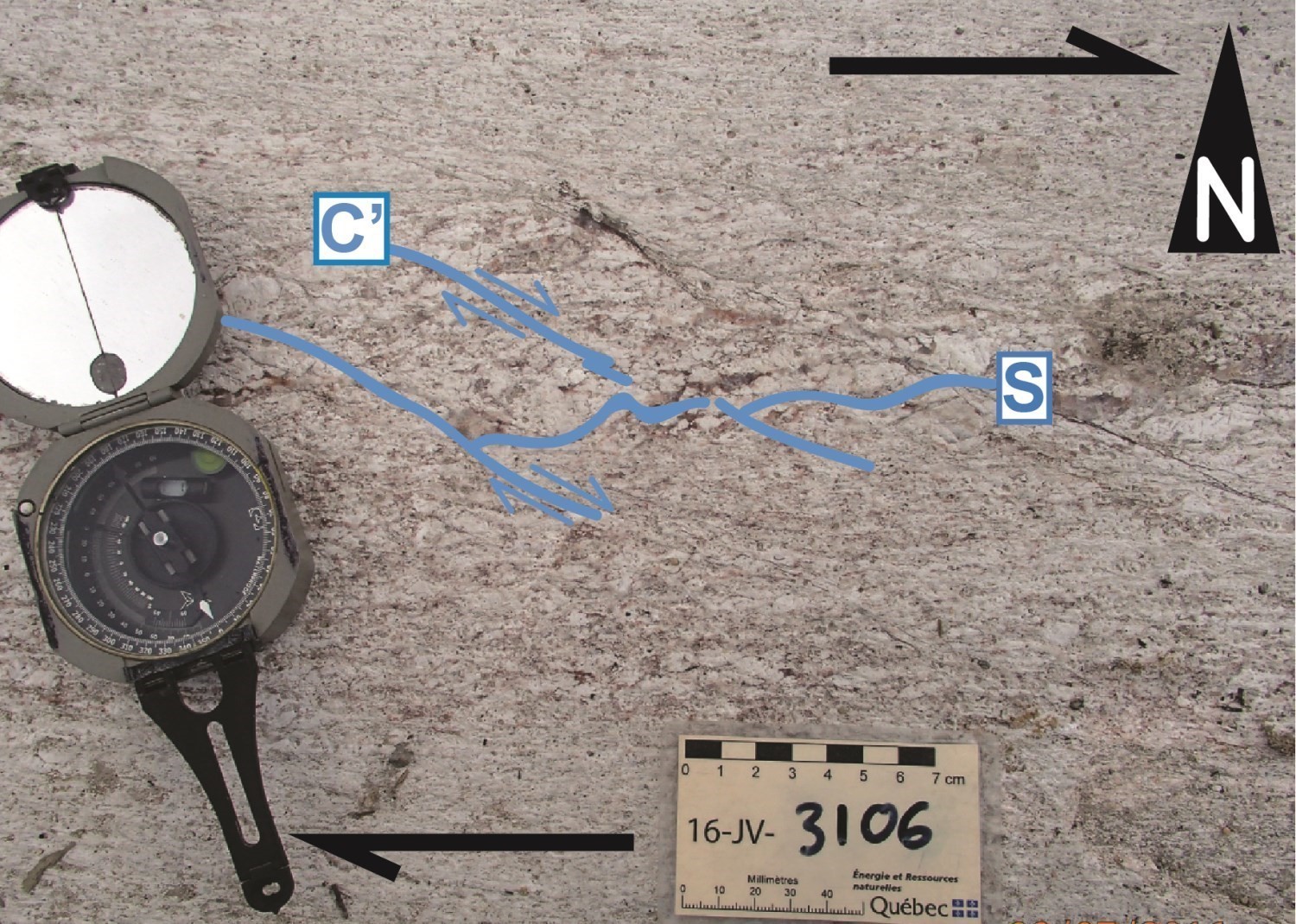
The D3 deformation phase is also associated with steep NW dipping faults and shear zones referred to as the Nottaway Shear Zone (Stereogram B; magnetic field map), a major structure that crosses the entire Opatica Subprovince and that extends towards the SE in the Abitibi Subprovince. In the study area, the lineaments that border the positive magnetic anomaly of the Nottaway Pluton granite make it possible to appreciate the width of the Nottaway deformation corridor, which reaches about ten kilometers in width. Near the shear zones, a mylonitic fabric shows kinematic indicators (omega and S-C-C’ shadows) that outline oblique-dextral movement (Outcrop 16-KG-4125 and Outcrop 16-JV-3106). Very low dipping lineations confirm the essentially strike-slip motion along this deformation corridor (stereogram C; magnetic field map). On a regional scale, the map of the residual total magnetic field shows the development of drag folds compatible with dextral oblique movement recognized in the field. These structures demonstrate dragging and transposition of the earlier D1 and D2 fabrics. Despite its imposing size, no mineralization has been identified so far within the Nottaway Shear Zone.
Metamorphism
In the study area, gneisses of tonalitic and dioritic composition from the Chensagi Suite (nAcng), La Bétulaie Complex (nAbtu) and the nebulitic structure unit (M22) show evidence of partial melting indicating that the rocks have reached at least upper amphibolite facies. For the other units, except the proterozoic dykes, the minerals observed in thin sections are rather compatible with lower amphibolite facies.
Economic geology
The Amisquioumisca Lake region shows prospective zones for three types of mineralization:
- Magmatic nickel-copper mineralization (± cobalt ± platinum group elements) associated with mafic to ultramafic intrusions;
- Stratiform mineralization of exhalative origin;
- Molybdenum-tungsten mineralization associated with porphyry intrusions.
The table of showings below presents the results of analyses for ten showings known in the sector, including two new showings discovered in the course of our work.
(E): selected sample; (R): channel; (F): drill
The table of lithogeochemical analyses of metals of economic interest gives the location, the description and the analysis results for 54 samples chosen in order to evaluate the economic potential of the region.
Ni-Cu-PGE mineralizations associated with ultramafic intrusions northeast of Matagami
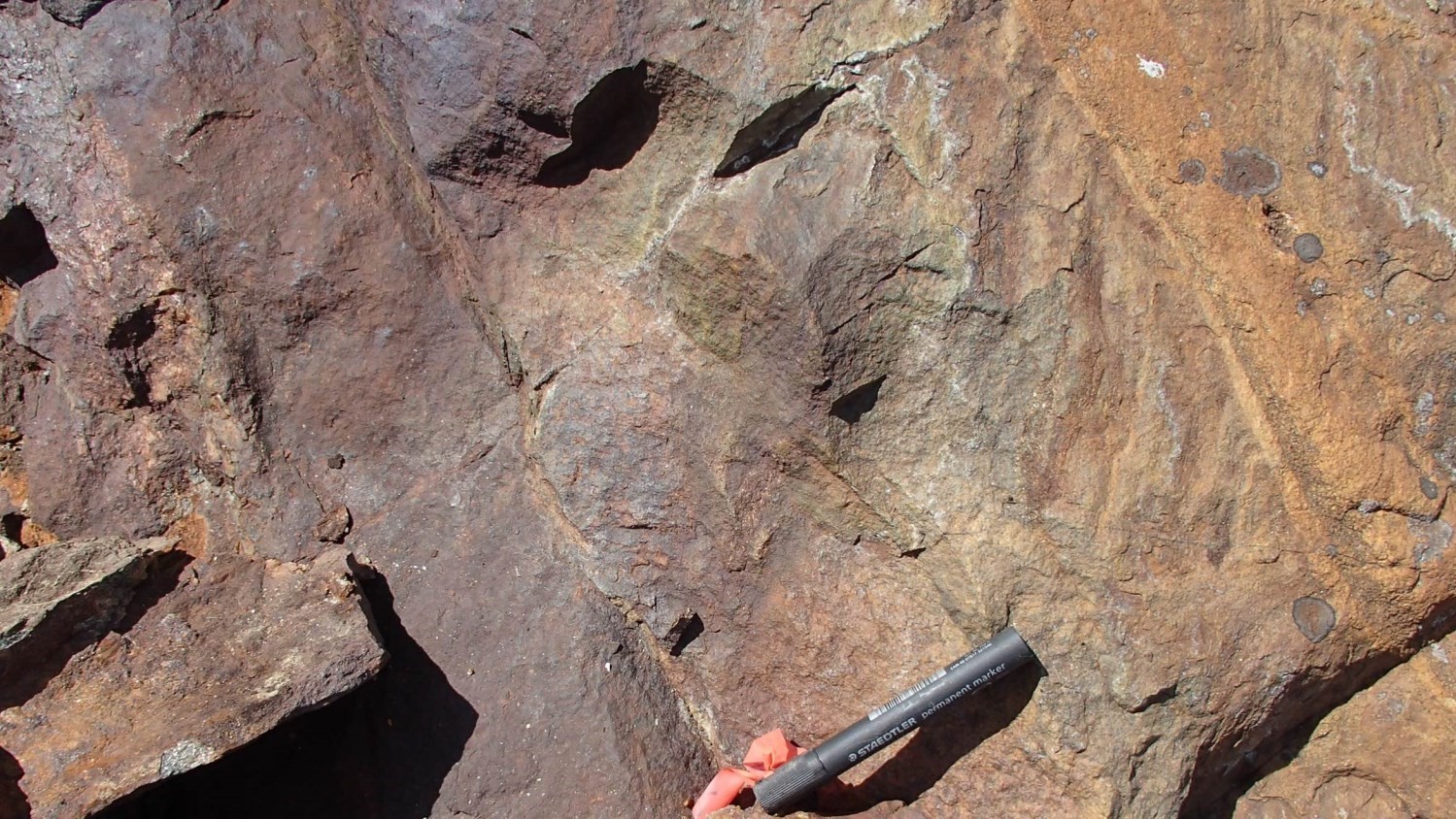
 Prospective areas for nickel-copper mineralization (± cobalt ± platinum group elements) are known north of Amisquioumisca Lake (location on the interactive map). The Lac Rocher deposit and the prospective Huskies and Wildcats zones are hosted in three small intrusions of essentially ultramafic composition (peridotite, pyroxenite and some gabbro). These intrusions of 0.5 to 1 km in diameter correspond to circular positive magnetic anomalies spaced about 10 km along an EW alignment on the magnetic field map (Dion et Lefebvre, 1998; Keating and d’Amours, 2010; D’Amours and Intissar, 2012). The Lac Rocher deposit characterized by disseminated, semi-massive and massive mineralization of pyrrhotite, pentlandite and chalcopyrite best illustrates it. The best content (10.8% Ni and 0.6 ppm Pt over 3.2 m) were obtained in a massive sulphide zone located at the base of the Rocher Intrusion (Rocher-Quénonisca Intrusive Suite; Jones and Pitman, 1999). The host unit of this intrusion, composed of tonalitic gneisses of the Chensagi Suite and metric paragneiss xenoliths of the Rocher Complex, may have played an important role in sulphide saturation (Bandyayera and Sharma, 2001). According to Bandyayera and Morin (1999), microstructural evidence suggests that the emplacement of the mineralization results from segregation of sulphides and fractional crystallization of a monosulphidic liquid.
New area to explore for Ni-Cu-PGE mineralization north-east of Matagami
Mapping of the study area allowed us to define new prospective zones for nickel-copper mineralization (± cobalt ± platinum group elements) (location on the interactive map). These areas of strong positive magnetic anomalies include four differentiated intrusions composed of pyroxenite, gabbronorite, purple gabbro, diorite and quartz-rich granitoid, which we assigned to the Poncheville intrusive Suite. These intrusions align on a NE-SW axis from the south of Rocher Lake to the south of Lac Poncheville and cut dioritic to tonalitic gneisses of the Chensagi Suite. As for intrusions of the Rocher-Quénonisca Intrusive Suite located west of the Rocher Lake, purple gabbro is the dominant facies of the Poncheville. Geochemical comparison of major elements from the Poncheville and Quénonisca rocks seems to demonstrate fractional crystallization evolution of a similar tholeiitic magma. Considering the magmatic Ni-Cu (± Co ± PGE) mineralization of the Lac Rocher deposit is located in lower pyroxenite and at the base of the median gabbroic unit of the Rocher Intrusion (Bandyayera and Sharma, 2001), Poncheville pyroxenites and melagabbros represent prospective areas to explore for this type of mineralization.
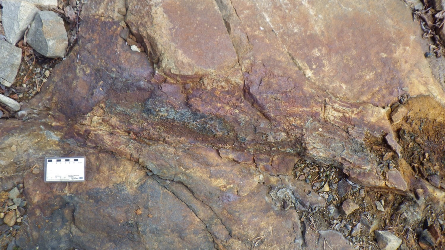
Prospective zone for stratiform mineralization of exhalative origin north-east of Matagami
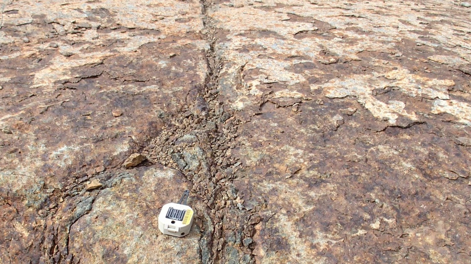
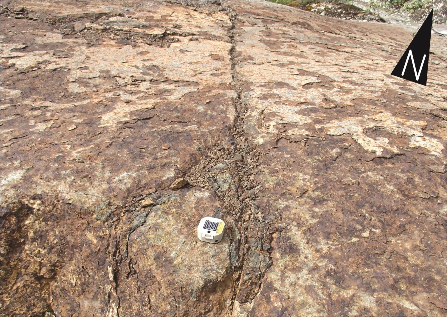
 Amphibolites, paragneisses and iron formations of the Rocher Complex represent prospective zones for exploration for stratiform mineralization of exhalative origin composed of pyrrhotite and pyrite accompanied by traces of chalcopyrite and sphalerite (location on the interactive map). The disseminated or semi-massive to massive lenses mineralization is transposed into the S1 foliation, and remobilized into close to tight P2 fold hinges (Outcrop 16-FG-5274). During mapping of Rocher Lake, Franconi (1974) noted that this mineralization was localized preferentially at the contact between amphibolitized basalts and mafic to intermediate volcaniclastic rocks or paragneisses. The Chensagi-Grille A and Julian-Ouest showings belong to this type of mineralization. The rheological contrast between xenoliths composed of amphibolites and paragneisses (Rocher Complex) and enclosing rocks composed of foliated to gneissic intrusive rocks (Chensagi Suite, La Bétulaie Complex, Nottaway Pluton) or massive intrusive rocks (Nipukatasi Massif) favored the development of a network of fractures and faults. These structures, commonly injected with syn-kynematic felsic intrusions, allowed remobilization of the disseminated stratiform mineralization (Outcrop 16-FL-1017). The JFO, Julian and Nottaway-Bloc Ouest showings show remobilized mineralization emplaced in this context. For the JFO showing, samples collected in fault zones show some gold content (Perreault et al., 2014).
New molybdenum-tungsten showing north-east of Matagami
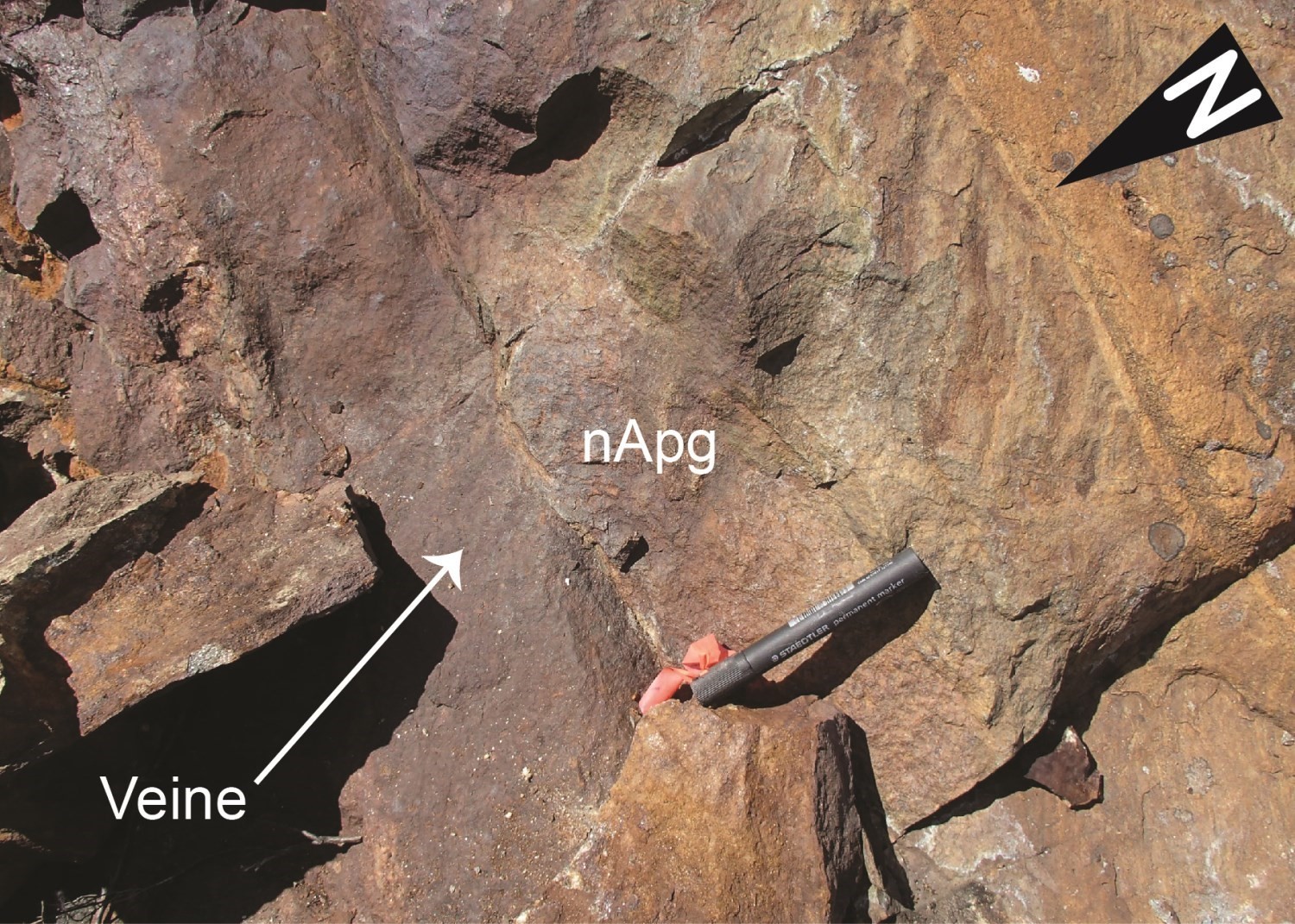 The Pinède Grise Pluton, host of the new Lac Moquachea showing, is a prospective area for molybdenum-tungsten mineralization associated with porphyry intrusions (location on the interactive map). X-ray diffraction analysis of samples from this showing allowed to confirm a tungsten mineralization composed of scheelite (crystals of 80 to 100 µm) and a smaller amount of wolframite (crystals of 10 to 50 µm). The outcrop also shows silver mineralization as veins or veinlets of disseminated to semi-massive sulphides cutting granite (Outcrop 16-EC-2229). Disseminated molybdenite was recognized nearby on an outcrop exposing monzonitic facies. Host rocks of the showing are massive, suggesting a late- to post-kinematic age. Geochemical analyses of granite and monzonite indicate that the intrusion is peraluminous. These characteristics are reminiscent of the tungsten vein deposit-type model developed in peraluminous anorogenic granites (Jébrak and Marcoux, 2008). The Pinède Grise Pluton is therefore a prospective unit for molybdenum-tungsten mineralization. Spatially dispersed scheelite, wolframite and molybdenite associated with quartz veins corresponds to the type 1a mineralization of the Bergslagen deposit in Sweden, which is the largest W and Mo resource in the Scandinavian countries (Hellingwerf and Baker, 1985; Sundblad et al., 1993). Granite of the Lac Moquachea showing also shows hematite-altered biotite bands that may correspond to Bergslagen deposit type-3 mineralization (biotite magnetite schists with quartz-hematite and quartz-pyrite veins).
This Geological Bulletin was made possible through the cooperation of many people who actively took part in the various stages of the project.
| Authors | François Leclerc, geo., Ph.D. francois.leclerc@mern.gouv.qc.ca Emmanuel Caron-Côté, geo. stag., M.Sc. emmanuel.caron-cote@mern.gouv.qc.ca |
| Organism | General direction of Géologie Québec, Ministère de l’Énergie et des Ressources naturelles, Government of Québec |
| Cooperation – Fieldwork | |
| Mapping | Karl Gibbs, geo. stag.; Francis Guay, geo. stag. and Julie Vallières, geo. Students: Thomas Debruyne, Maxym-Karl Hamel-Hébert, Julie Perreault, Karim Simard and Ronnie Sinclair Junior Trapper |
| Cook | Daniel Crépeau |
| Camp representative | Alexandre Leduc |
| Logistics | Marie-France Beaulieu, geo. stag., B.Sc. |
| Camp set-up | Stéphane Carignan, MERN supervisor and CIVILCO company team |
| Transportation | Wendake Hélicoptère Inc. company: Richard Brunet, pilot, Éric Lacasse, mechanic and Steve Bellefeuille, mechanic |
| Cooperation – Geological Bulletin (Bulletin géologiQUE) | |
| Consultation and discussion | Daniel Bandyayera, geo., Ph.D. Jean Goutier, geologist, M.Sc. |
| Coordination | Marie-Andrée Vézina, geo. |
| Editing | Claude Dion, ing., M.Sc. |
| Potential assessment | Hanafi Hammouche, geo., M.Sc. |
| Geochemistry | Fabien Solgadi, geo., Ph.D. |
| Geomatics | Karine Allard, Kathleen O’Brien and Julie Sauvageau |
| Geophysics | Siham Benhamed, geo. stag., M.Sc. Rachid Intissar, geo., M.Sc. |
| Web management | Caroline Thorn |
| Critical review | James Moorhead, geo, M.Sc. Patrice Roy, geo, M.Sc. |
| English translation | Céline Dupuis, geo, Ph.D. |
Références
Publications du gouvernement du Québec
Autres publications